Download Agreement, Release, and Acknowledgement of Risk:
You (the person requesting this file download) fully understand mountain climbing ("Activity") involves risks and dangers of serious bodily injury, including permanent disability, paralysis, and death ("Risks") and you fully accept and assume all such risks and all responsibility for losses, costs, and damages you incur as a result of your participation in this Activity.
You acknowledge that information in the file you have chosen to download may not be accurate and may contain errors. You agree to assume all risks when using this information and agree to release and discharge 14ers.com, 14ers Inc. and the author(s) of such information (collectively, the "Released Parties").
You hereby discharge the Released Parties from all damages, actions, claims and liabilities of any nature, specifically including, but not limited to, damages, actions, claims and liabilities arising from or related to the negligence of the Released Parties. You further agree to indemnify, hold harmless and defend 14ers.com, 14ers Inc. and each of the other Released Parties from and against any loss, damage, liability and expense, including costs and attorney fees, incurred by 14ers.com, 14ers Inc. or any of the other Released Parties as a result of you using information provided on the 14ers.com or 14ers Inc. websites.
You have read this agreement, fully understand its terms and intend it to be a complete and unconditional release of all liability to the greatest extent allowed by law and agree that if any portion of this agreement is held to be invalid the balance, notwithstanding, shall continue in full force and effect.
By clicking "OK" you agree to these terms. If you DO NOT agree, click "Cancel"...
Peaks: Mount Yale (14,196 ft)
Mascot (13,436 ft)
Trailhead: Denny Creek
Elevation Gain: 4,586 feet
Total Mileage: approx. 8 miles
5-2-08
Cody and I arrived at Denny Creek trailhead at 11:00 pm. Surprisingly the road was void of snow to the trailhead and the parking area was also clear of snow.
5-3-08
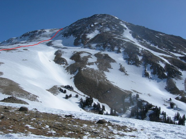
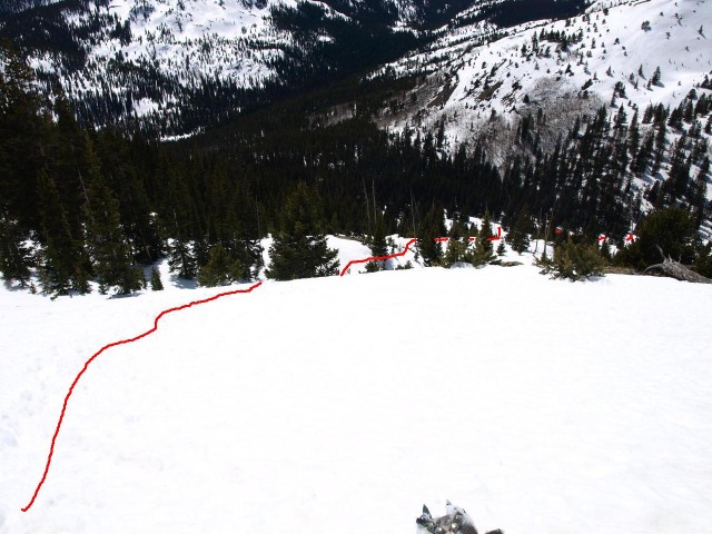
We got up around 5:00am ate breakfast, finished packing for the day's journey and hit the trail at about 6:00 am. The hard pack snow began at the trail register and progressively got deeper the further we went up the trail (2-4 ft). There was about 1/4-1/2 inch of fresh snow. At about a 1/2 mile before reaching the junction of Delaney Gulch and the North Fork drainage we went straight up the ridge to the east. Yale had just come into view when we began our ascent up the ridge.
(This is where we stopped heading up Delaney Gulch and headed up ridge to the east.)
After going up the ridge a 100 feet or so, the snow pack became very slick and steep (45-60 degrees). We cramponed up and finished ascending to the top of the ridge. The snow for the most part was good and solid going up the ridge, but did occasionally break through sinking in waste deep sugar. From here we followed the ridge top to the north and after about a 1/2 mile Mount Yale came into view again.
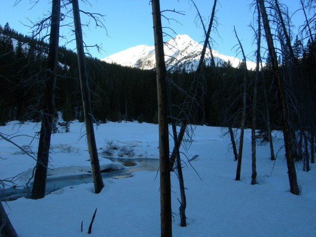
(Denny Creek and (North Fork drainages)
(Yale comming into view again)
(view into Delaney Gulch)
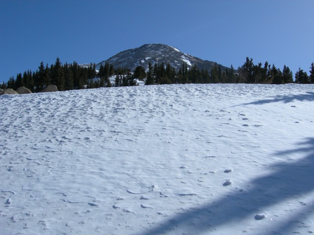
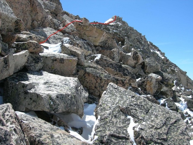
From the connecting ridge we ascended to the left side of the summit. At about 1,000 feet below the summit the steepness gradually increased to about 45-55 degrees and again became very slick. Once again crampons were essential to maintaining gription.
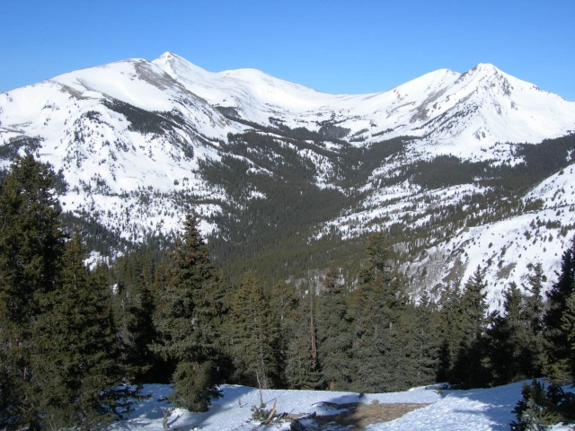
(Ascent route)
(ridge to false summit)
(ascent route)
I reached the summit at about 11:00 and enjoyed the view for the next hour and a half (elevation gain from trailhead 4,286 feet). About 30 minutes after reaching the summit another party (father and son from Grand Junction arrived at the top.) At 12:30 Cody reached the summit.
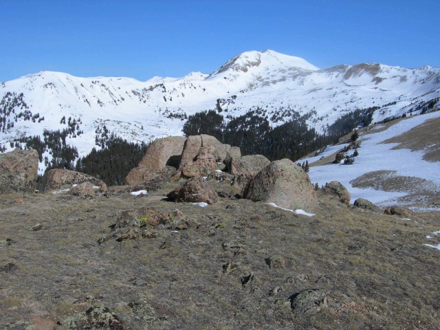
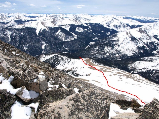
(view from summit to NW in North Cottonwood Creek drainage)
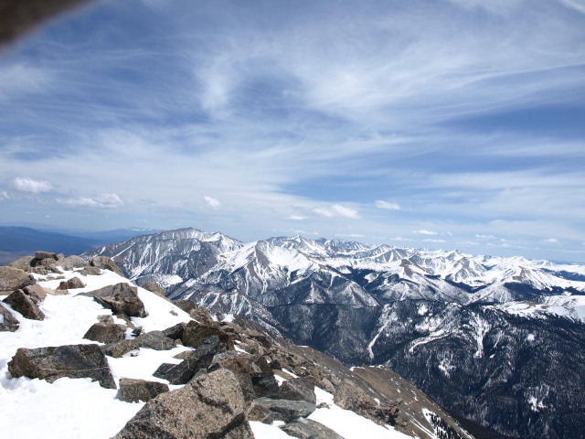
(summit view towards Mt. Princeton)
At 1:00 we began our descent to the saddle connecting to Mascot Peak. Much more rock was exposed on the SE side of the Yale, but there were a couple of good snow shoots to take advantage of to the saddle. Once at the saddle we ascended back up about 300 feet (give or take a little) to the summit of Mascot (elevation 13,435 feet).
From Mascot we went back down to the saddle and traversed around Yale (mixed rock and snow) to the ridge we initially ascended.
(route from Mascot back to ridge of ascent)
(view into Denny Gulch from ridgetop)
As we descended down into Delaney Gulch the snow pack became progressively softer from the heating sun, but still held us (most of the time).
(descent route into Delaney Gulch)
At about a ¼ mile before the trailhead the snow pack was no longer holding and the joys of post-holing began. We had snowshoes with us, but since we were so close we just trudged to the finish. At about 4:00 we made back to the trailhead.
Another great day in the high country, felt good to be back!!
Thumbnails for uploaded photos (click to open slideshow):
I ran into you down low while you and Cody (and myself) were trying to find the route. Didn‘t mean to lead you guys on a wild goose chase, I eventually found the route, found the turnoff, got lost soon after, bushwacked to treeline, found a sweet cornice, made it to the 13,900 foot saddle and called it a day from my ankles rubbed raw from my boots. I saw you haulin a** up the summit ridge, nice work and a great day. (Hurrendous ski though)
I tried hollaring for ya when we started up the steep ridge. Going straight up the ridge got us up on top pretty quick. Was surprised you hiked up that last steep stretch in your ski boots, wasn‘t that a bit slick? I watched you ski down from the saddle, looked like fun. I was wishing I had my snowboard!! Now I can put a face for ”Lordhelmut.”
The ski boots were good for kicking steps in, I had solid footing the whole way up and didn‘t feel crampons were necesary, but if I was wearing hiking boots, I‘d probably put them on like you guys did. The snow from 13,900 to the bottom of that relatively steep slope was just terrible crust, but once I got to treeline, it got much better and I got a few nice turns in, but the trip through the woods was a quagmire to say the least. I wanted to get up that ridge and summit but hiking on rock/boulder with alpine ski boots is unpleasant, simply put. Nevertheless, its always a pleasure finding other means of transportation on a descent than hoofing it out.
we did yale a day after you from denny creek TH, made the last minute decision to leave the skis behind. we didn't even have to break out the crampons up high, thanks to your (and lordhelmut's) bootpack. luckily, we managed to avoid postholing on the way down, as we returned to the car by about 1pm. nice job on getting mascot too!
Caution: The information contained in this report may not be accurate and should not be the only resource used in preparation for your climb. Failure to have the necessary experience, physical conditioning, supplies or equipment can result in injury or death. 14ers.com and the author(s) of this report provide no warranties, either express or implied, that the information provided is accurate or reliable. By using the information provided, you agree to indemnify and hold harmless 14ers.com and the report author(s) with respect to any claims and demands against them, including any attorney fees and expenses. Please read the 14ers.com Safety and Disclaimer pages for more information.
Please respect private property: 14ers.com supports the rights of private landowners to determine how and by whom their land will be used. In Colorado, it is your responsibility to determine if land is private and to obtain the appropriate permission before entering the property.