Download Agreement, Release, and Acknowledgement of Risk:
You (the person requesting this file download) fully understand mountain climbing ("Activity") involves risks and dangers of serious bodily injury, including permanent disability, paralysis, and death ("Risks") and you fully accept and assume all such risks and all responsibility for losses, costs, and damages you incur as a result of your participation in this Activity.
You acknowledge that information in the file you have chosen to download may not be accurate and may contain errors. You agree to assume all risks when using this information and agree to release and discharge 14ers.com, 14ers Inc. and the author(s) of such information (collectively, the "Released Parties").
You hereby discharge the Released Parties from all damages, actions, claims and liabilities of any nature, specifically including, but not limited to, damages, actions, claims and liabilities arising from or related to the negligence of the Released Parties. You further agree to indemnify, hold harmless and defend 14ers.com, 14ers Inc. and each of the other Released Parties from and against any loss, damage, liability and expense, including costs and attorney fees, incurred by 14ers.com, 14ers Inc. or any of the other Released Parties as a result of you using information provided on the 14ers.com or 14ers Inc. websites.
You have read this agreement, fully understand its terms and intend it to be a complete and unconditional release of all liability to the greatest extent allowed by law and agree that if any portion of this agreement is held to be invalid the balance, notwithstanding, shall continue in full force and effect.
By clicking "OK" you agree to these terms. If you DO NOT agree, click "Cancel"...
We left Glenwood Springs at 4:30 am sharp to try to hit the trail by 7:00 to 7:30. We missed or turn in Winfield and took a side trip to the Gunnison Spur trailhead. That little mistake cost us about an hour.
We found the correct turn and parked down the road a little ways from the gate.
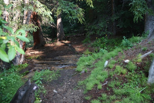
We left the car about 8:30 am and started up the trail. It is obvious from the trail that it is not as heavily traveled as many 14er trails.
After a short hike through the timbers the trail opens up to a beautiful valley.
This portion of the hike is very enjoyable with the exception of a couple of very soggy areas that will fill your boots if you are not careful.
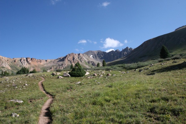
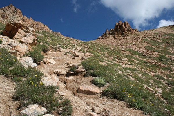
After these boggy areas you can see where the trail is taking you. I guess we new we were going to have to climb at some point during this one.
This first good climb is not as bad as it looks from below. Photo nearing the top.
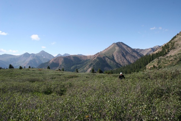
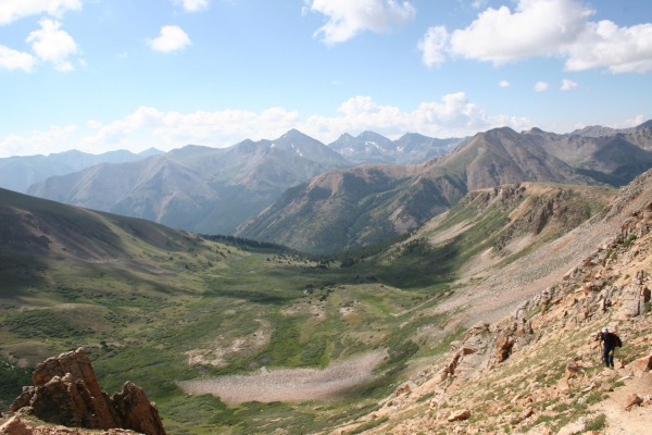
Awesome view of the valley below and the nice level hike across the bench makes it all worthwhile.
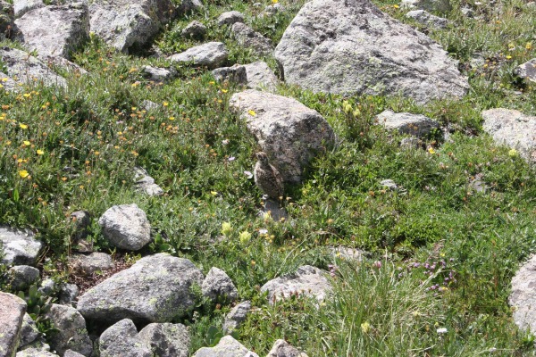
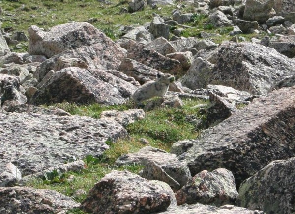
Saw the typical tundra wildlife. Marmots, Picas and Ptarmigan chicks.
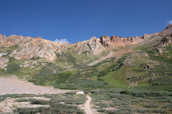
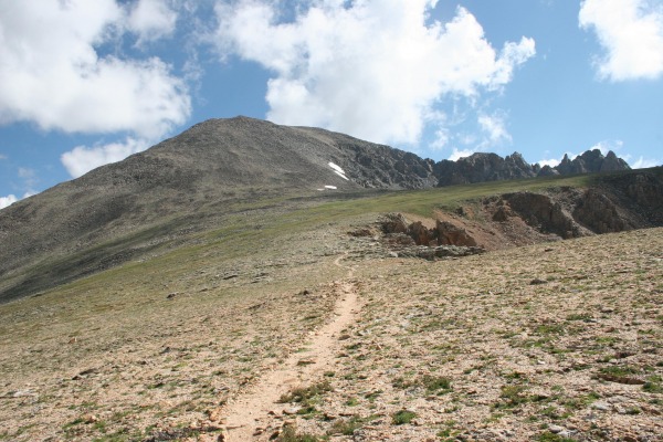
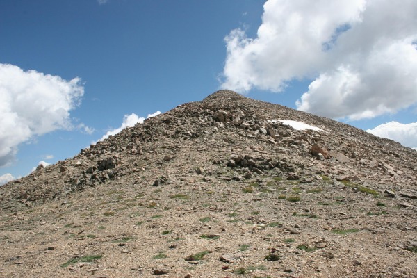
Once off of the bench it is sporadic trail with some rock hopping to the top of what would appear to be the summit if you didnt know better. After this false summit you get a view of another false summit.
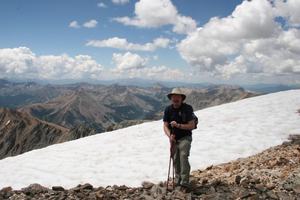
I summited around 11:45 Am which was quite a bit later than I had anticipated. To be honest this was a tougher hike than I thought it would be. This was my climbing partners first 14er and it turned out to be a little too much for the first one. He made it to about 13,700 and decided that the rate he was going he would not make it to the summit at a reasonable time.
There is still a very small amount of snow on the summit.
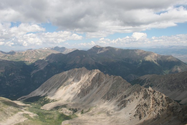
Great views of Mount Elbert and Mt. Massive.
All in all it was a very enjoyable day in the mountains. We only ran across 2 groups taking this route. 1 group of four (bobbyperu) and a group of 2. Saw 1 other group on the summit who had taken the Northwest ridge. We excepted much larger crowds. I think the weather report discouraged a lot of people. Very quiet day in the mountains.
If I had it to do over I would have taken it much slower on the way down. My knee was in pretty bad shape by the time we got back to the car at 2:40. 6 hours and 10 minute round trip with lots of picture taking and a few 5 to 10 minute brakes and 20 minutes on the summit. GPS trip computer read 8.01 miles. The rain started about 3:30 as we were getting on Hwy 24.
Thumbnails for uploaded photos (click to open slideshow):
Comments or Questions
Caution: The information contained in this report may not be accurate and should not be the only resource used in preparation for your climb. Failure to have the necessary experience, physical conditioning, supplies or equipment can result in injury or death. 14ers.com and the author(s) of this report provide no warranties, either express or implied, that the information provided is accurate or reliable. By using the information provided, you agree to indemnify and hold harmless 14ers.com and the report author(s) with respect to any claims and demands against them, including any attorney fees and expenses. Please read the 14ers.com Safety and Disclaimer pages for more information.
Please respect private property: 14ers.com supports the rights of private landowners to determine how and by whom their land will be used. In Colorado, it is your responsibility to determine if land is private and to obtain the appropriate permission before entering the property.