Download Agreement, Release, and Acknowledgement of Risk:
You (the person requesting this file download) fully understand mountain climbing ("Activity") involves risks and dangers of serious bodily injury, including permanent disability, paralysis, and death ("Risks") and you fully accept and assume all such risks and all responsibility for losses, costs, and damages you incur as a result of your participation in this Activity.
You acknowledge that information in the file you have chosen to download may not be accurate and may contain errors. You agree to assume all risks when using this information and agree to release and discharge 14ers.com, 14ers Inc. and the author(s) of such information (collectively, the "Released Parties").
You hereby discharge the Released Parties from all damages, actions, claims and liabilities of any nature, specifically including, but not limited to, damages, actions, claims and liabilities arising from or related to the negligence of the Released Parties. You further agree to indemnify, hold harmless and defend 14ers.com, 14ers Inc. and each of the other Released Parties from and against any loss, damage, liability and expense, including costs and attorney fees, incurred by 14ers.com, 14ers Inc. or any of the other Released Parties as a result of you using information provided on the 14ers.com or 14ers Inc. websites.
You have read this agreement, fully understand its terms and intend it to be a complete and unconditional release of all liability to the greatest extent allowed by law and agree that if any portion of this agreement is held to be invalid the balance, notwithstanding, shall continue in full force and effect.
By clicking "OK" you agree to these terms. If you DO NOT agree, click "Cancel"...
A beautiful day in sunny Colorado and a fun 14er type hike - life is great.
We found that, driving from Denver, it was about a half hour faster (1hr drive time) to get to Summit Lake via Bergen Park rather than catching 103 out of Idaho Springs.
The route is well marked. Just walk north past the restrooms at the lake and you'll see the trail to your left. The trail up Spalding shoulder is a bit steep, but the whole trip is easier than any 14er you'll do.
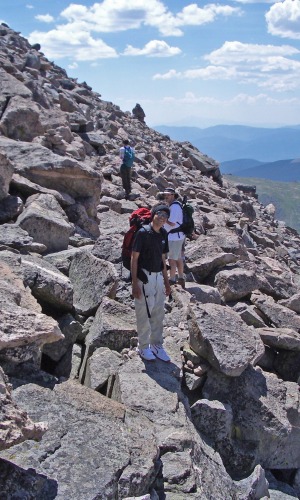
Some reports have mentioned scary ridge walks. With 3 kids, the youngest at age 11, we didn't find anything to worry us. This photo shows the trail when you get up on the "ridge". It would only be scary if you don't follow the well placed cairns and walk to the edge.
To add West Evans (14,256), you'll need to walk about 150' to the edge when you are below it. You're below it when you can first see the Mt. Evans peak and the last curve of the road.
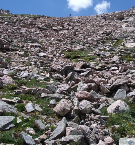
To descend via the North East route (highly recommended), go to the left side of the Peak Finder monument at the edge of the parking lot. The route is talus/scree but the trail is well marked. It's quite steep so you may wanted to lengthen your poles. And yes, poles are highly recommended. Here's a shot from below:
Thumbnails for uploaded photos (click to open slideshow):
Caution: The information contained in this report may not be accurate and should not be the only resource used in preparation for your climb. Failure to have the necessary experience, physical conditioning, supplies or equipment can result in injury or death. 14ers.com and the author(s) of this report provide no warranties, either express or implied, that the information provided is accurate or reliable. By using the information provided, you agree to indemnify and hold harmless 14ers.com and the report author(s) with respect to any claims and demands against them, including any attorney fees and expenses. Please read the 14ers.com Safety and Disclaimer pages for more information.
Please respect private property: 14ers.com supports the rights of private landowners to determine how and by whom their land will be used. In Colorado, it is your responsibility to determine if land is private and to obtain the appropriate permission before entering the property.
")
")

