Log In 
Report Type 
Mini
Peak(s)  Capitol Peak  -  14,138 feet
Snowmass Mountain  -  14,105 feet
Date Posted  09/12/2026
Modified  10/17/2026
Date Climbed   09/09/2026
Author  outrundeath
 Cap-Snow Traverse / Capitol to Snowmass   

Summary at the top: Elyon's Ridge

At a minimum, completing this traverse injury-free is more likely if you have already successfully completed the 4 other major 14er connecting traverses in CO and summited the 14ers they connect. With this level of skill and experience, it is more probable to do this route without problems (injury-free). But, there's always the unexpected...

Here, let's echo the words in the post of a previous Cap-Snow finisher. This traverse is a serious undertaking. You and you alone are responsible for your decisions. Make good ones.

Details:

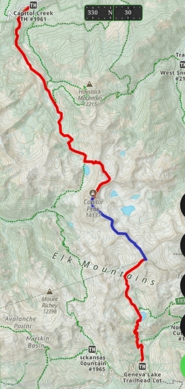
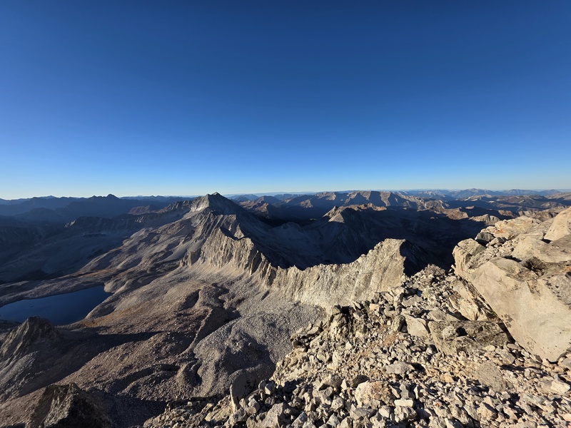
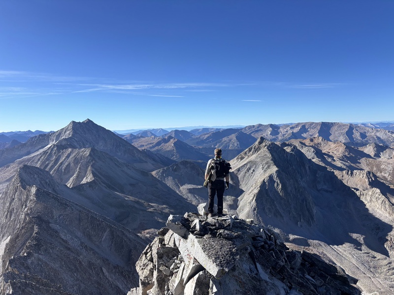
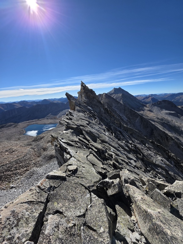
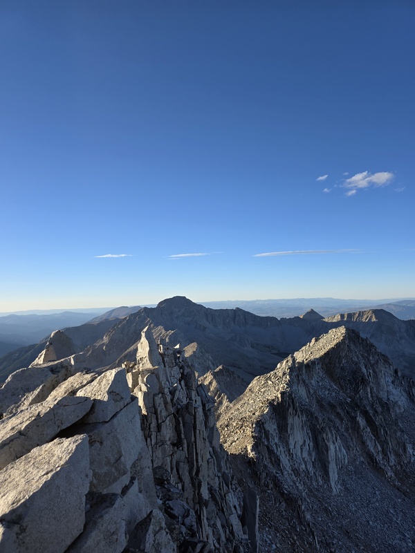
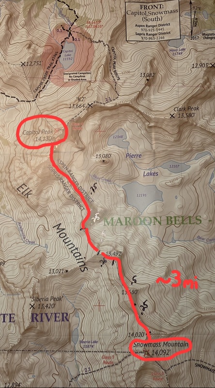
We completed the Cap-Snow traverse (formerly 'satan's ridge') going from Capitol Peak to Snowmass Mountain on Wed, 9 Sept. 2026. It took us ~10hrs from ~8am to ~6pm peak to peak.

These 3 factors took the most time:

1) Loose rock instability across nearly the entire distance of the traverse (making slow careful foot placement necessary for safe forward progress).

2) Notches between traverse ridge segments. Many of these each took longer to down-climb and then to climb back up to the next ridge segment than crossing the ridge segments themselves.

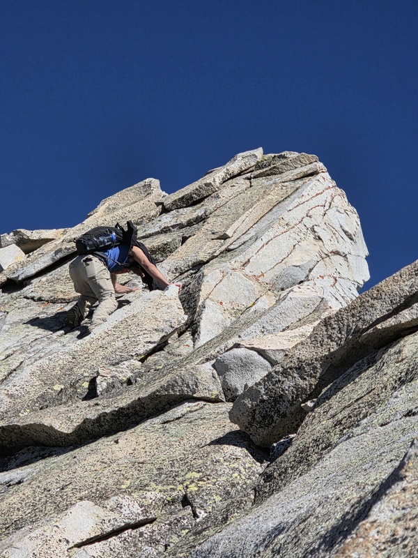
3) Technical portions we chose to solve and climb through instead of bypass (spoiler alert: these mostly occured at the last ridge segment before beginning the ascent to Snowmass). We did bypass (by down and then up-climbing) a final gendarme on the last ridge segment that was beyond our free-solo climbing ability (we brought very little climbing gear, some webbing and a couple of cordelettes, but chose lighter packs in favor of bypassing something not free-solo climbable by us). Had one good 5.7 free-solo that popped my adreneline a little up a follow-on ridge sement after a notch. My glasses came off 1/2 way up, so I was juggling finding holds while trying to save my shades. Would have sacrificed the shades if I had to ... didn't have to this time. Note: this 5.7 climb is not necessary to complete the traverse.

My pack weight, including the 4 liters of water that sustained me w/out needing to refill across the traverse, was 20.7lbs.

If I had it to do over again I would have brought more real food and less packaged bonk-nosh. Also, grateful to my buddy for the extra agua down the West slope of Snowmass. I was running low, not out, but getting there.

Our party consisted of 2 men, 23yrs and 46yrs old. Together, we prayed each peak. Nothing too complicated, The Lord's Prayer found in the book of Matthew Chapter 6. In this case, 2 are definitely better than 1.

Vehicle Logistics:

Two 4-wheel drive vehicles. We placed one vehicle at the Geneva Lake TH in Lead King Basin just outside of Marble, CO and then drove the 2nd vehicle to Capitol Creek TH.

Comms: Rocky Talkies

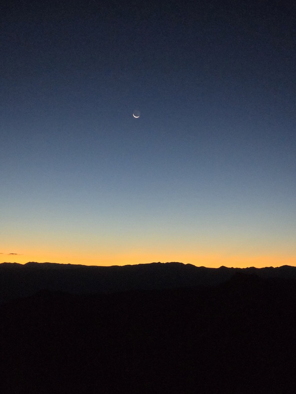
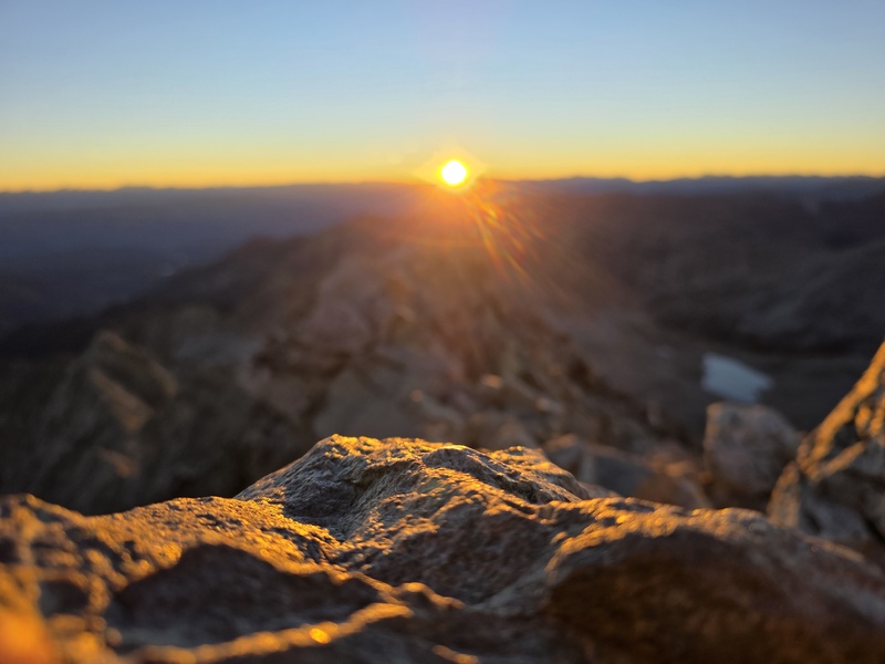
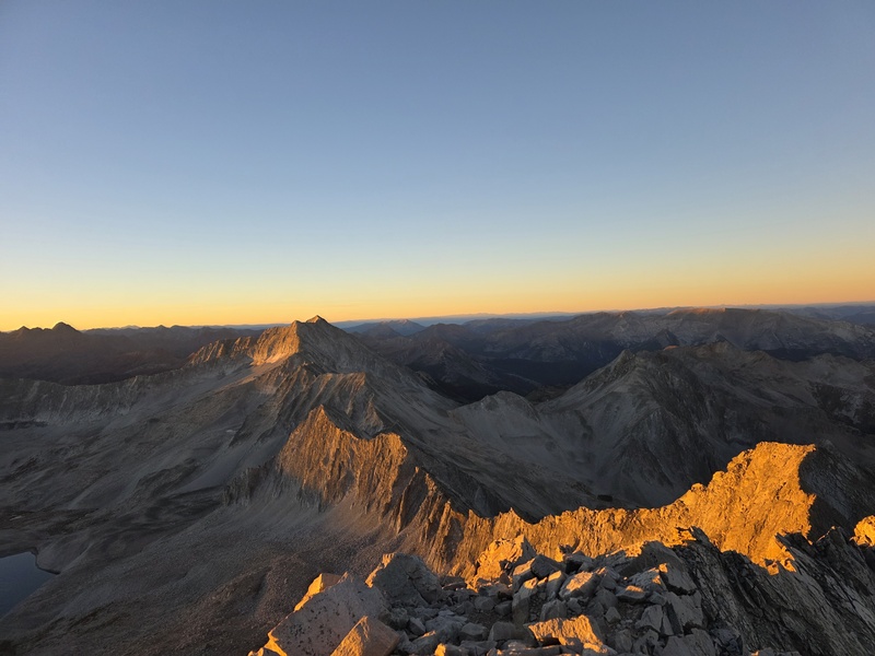
We started in the night/early morning, taking the ditch trail in to Capitol Peak and summitting the peak at sunrise to maximize the amount of daylight travel time on the traverse.

We traversed all ridge segments w/ zero injuries and created a .gpx file of our route that gave us the basic statistics of our traverse.

Distance Peak to Peak: 2.87mi

Avg Speed: 0.3mph

About 4hrs moving time & 6hrs stopped time

After summiting Snowmass Mt at ~6pm we down-hiked the West slope route and took the trail past Geneva lake back to the TH. This is about 4mi: ~2mi down to the creek in the valley; then ~2mi back to the TH. We completed the first 2 mi in waning sunlight, and the second 2mi on the trail w/ headlamps. I was physically exhausted at the base of Snowmass and running on fumes on the way back to the vehicle at the TH. My younger counterpart had some still left in his tank. He led the way back to the jeep.

From TH to TH the entire route took us ~24hrs. I took a few breaks going up the switchbacks from capitol lake to the saddle, and from the saddle to the peak. My hiking partner and I staggered our start times from Capitol Creek TH b/c we knew from previous hikes that he's faster than I am. We agreed to meet at the Capitol summit between 6am and 7am, so we could each plan our sleep, start time and pace separately on the initial longest leg.

Obviously, we aren't breaking any records or making any new discoveries on this traverse, just 2 average dudes successfully completing the traverse w/ minimal gear in a single day.

Hoping to remove fear from other future hikers and climbers, and the myth of daunting impossibility that seems to cloud the minds of those considering hiking this traverse.

Our Keys to Success

1) Body Condition: We had good physical conditioning.

2) Weather: We had perfect weather. We checked the Wx and planned accordingly.

--there is a bailout point into Pierre Lakes Basin at the low saddle a little before the 1/2 way point on the traverse ... when we crossed this saddle there was a white climbing rope anchored to the saddle that went over the edge down into the basin

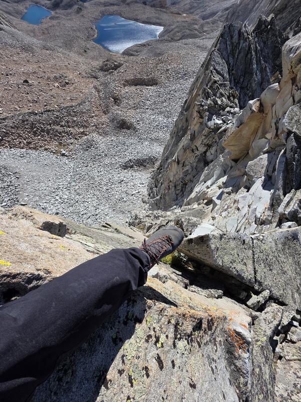
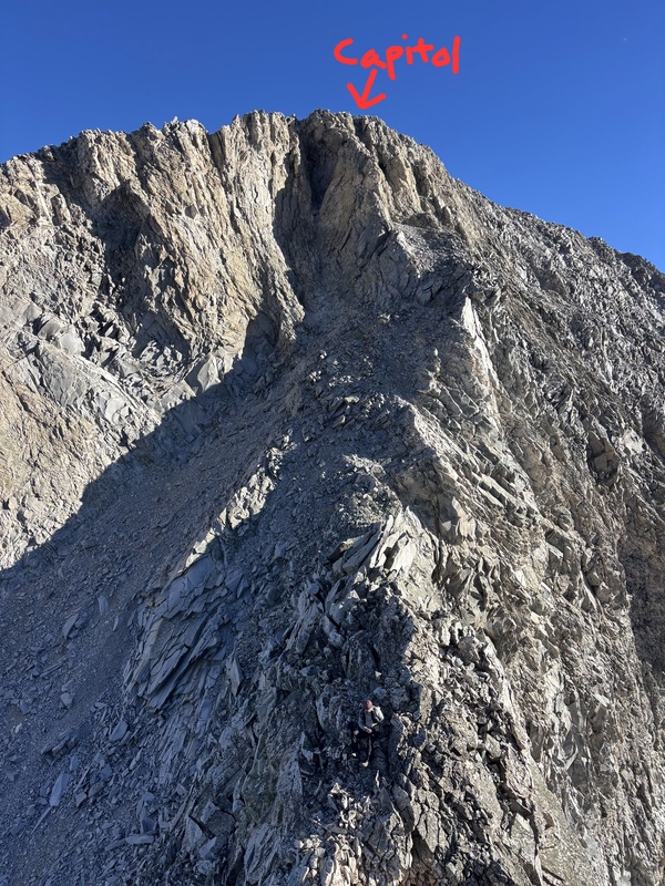
3) Technical Skills: We were able to do the ~5.5 - 5.6 initial down-climb at the start of the small ridge just off Capitol Peak to gain the start of the first ridge segment of the traverse.

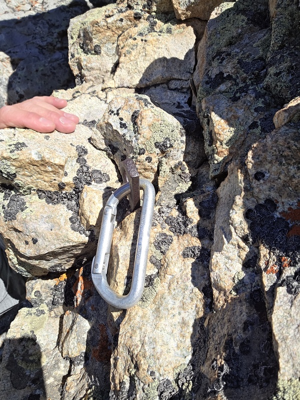
--in the pics below note the pic of the old peton w/ the newer 'black diamond' caribener attached: this is placed at the ~1/2 way point on the initial down-climb from Capitol Peak--we both free-soloed this down-climb (w/out using any gear). I got a little amped on the downclimb, but calmed down as I transitioned from L to R, finding good foot placement along the way.

--Imho, being capable of accomplishing this down-climb, is a key indicator that you possess what is necessary to complete the entire traverse.

4) Patience: We took it as slow as we needed to ensure no serious fall injuries. Unless you're FKT-ing in some aspect, no need to rush. SIS/SIF

5) Attitude: We Enjoyed overcoming the traverse between Capitol and Snowmass--Cap-Snow--unofficially referred to, and formerly known as satan's ridge (he doesn't have a claim to it anymore, we, along w/ many of those who have gone before us, have consistently and reliably re-dedicated it by action to its rightful owner upon completion). This ancient, narrow way is not as foreboding if you have the correct mindset.

Cheers

Respectfully,

outrundeath

may your hiking/climbing on El Elyon's ridge be filled w/ joy on El Elyon's Ridge

p.s. tried to upload the 24.3kb .gpx file to this report from my phone, couldn't get it uploaded, don't know why ... unlabeled error

Elyon's Ridge Elyons Ridge

not satans ridge not satan's ridge


Thumbnails for uploaded photos (click to open slideshow):
1 2 3 4 5 6 7 8 9 10 11 12 13 14


Comments or Questions
ballardwf04
User
sick
9/13/2026 2:49pm
Wicked work dude, glad to see “regular” ppl doing this. Curious, how did you prepare for this? What kind of mountain experience did you have prior?


outrundeath
User
healthy
9/14/2026 8:47am
holy operations took place on the peaks and the ridge that day ... it was 14er # 57 for me and #s 55 and 56 for my friend. It was traverse #5 for both of us.


Been_Jammin
User
mega send
9/14/2026 9:42am
well done :)


Mountain Ninja
User
excellent work!
9/15/2026 11:00am
Great planning and execution. I may never have the courage to attempt this route, so I enjoyed reading your stats, tips and thoughts!


outrundeath
User
You have it
9/23/2026 6:18am
Appreciated your comments. If you want it ... it's yours for the having ... your courage was made for more :)


opech
User
Awesome
9/25/2026 7:23pm
Hey, I’m looking set to do the traverse next summer. Was hoping whether you have more info to share so I can prepare especially logistics. Do you have an insta I can message you through if you’re happy to disclose more of your trip.


outrundeath
User
No meta
9/25/2026 11:19pm
No Meta, feel free to ask your questions here.

Trailhead(TH) info:

Lead King Basin
https://www.14ers.com/php14ers/trailhead.php?thparm=er06

Capitol Creek
https://www.14ers.com/php14ers/trailhead.php?thparm=er05


opech
User
Trailhead
9/26/2026 10:26am
I am most likely attempting solo so will only have one car. Lead King would make the shortest rt, but I don't think I can make it up the road (I barely made it to capitol creek this summer), I'd like to hear if you can compare the two roads. If I am to start from capitol creek would you know whether taking the west or east slopes down snowmass is better. It seems that taking west slopes and then hiking to capitol lake from lead king is a shorter but I know nothing about the trail and I don't want to be stranded there in the dark so please let me know if you know those trail conditions.


opech
User
Traverse conditions
9/26/2026 10:37am
For the actual traverse is there anything you avoided. I saw Matt Randall's video where he mentions that he avoided "satan's horns"; wanted to hear your take and if there is anything else to look out for. This summer I went down to check out where the downclimb off of cap and it seemed to me like there were two different gullys. Do you have any picture or info on how to identify where it is.


outrundeath
User
Snowmass West Slope Route
9/27/2026 11:45am
Snowmass West slope when tired seems very long, steep downhill, no single well-defined trail (trail-ish parts) seemingly never-ending boulderfield all the way to the valley, quite a challenge after completing the ridge. I've not done the standard route on the east slope so I cannot compare, but, the west slope is tiring after a long day. The nice gradual, dirt mostly downhill trail back to the lead king TH in the valley after the West slope is easy. I assume the most direct route back to Capitol Lake from the Snowmass West Slopes is via the West Snowmass Creek Trail (Trail #1963)...~4mi? ... but i don't know. I didn’t plan that route, so i don't know what its like .... seems like it might be steep though...maybe not good in the dark.


outrundeath
User
Capitol Cr. vs Lead King
9/26/2026 9:07pm
Capitol Cr. is a steady uphill, not very difficult 4-wheel drive road...lead king takes a minimum of about 45minutes (45min is a fast run) from the start of the 4wheel drive portion, its a long drive up to the crest, then switchbacks down into the valley to the
TH, the stock jeep rubicon i was in navigated the continuous camelback humps all the way down into the valley well, but i did scrape the undercarriage a few times. You cross at least a couple of creeks if I remember correctly. Lead King is a more difficult 4-Wheel-drive Rd than Capitol Creek by every metric that comes to my mind.


outrundeath
User
The Horns & downclimb
9/27/2026 6:03pm
We skipped the horns and N. Snowmass due to time and energy...sun was getting low in the sky. Avoid is a strong word, we avoided injury and death ... not kidding... after that, we did everything we were capable of, and wanted to do that we had time to do in our 1 day push...we maintained the ridge for as long as we were safely able...

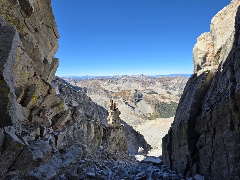
The downclimb we took seemed like the easiest 'line' we saw down to the traverse by a wide margin compared to any other option ... I've got some technical Mt climbing experience so seeing these 'lines' is a little more 2nd nature, but it should be pretty obvious on the mini-ridge just off the Capitol summit...ill check to see if I have any other pics of it.


outrundeath
User
Pic Added
9/27/2026 12:25am
Added downclimb to traverse from Capital Peak orientation pic...do not remember which line we took from this perspective (its easier to determine the correct route when standing at the top), and i did not take this pic, but I'm in it ... we think the route was the 'V' near the top middle of the pic


outrundeath
User
Directissima Normale
9/27/2026 6:57pm
Final Ridge Bypass Note:

Final note to better answer question:
If I were low on energy and or daylight going from Capitol to Snowmass, I would skip everything on the last ridge in the traverse after the 'Devil's Doorway' just before the ascent to Snowmass and then take the most direct route up to the peak of Snowmass Mt. before descending Snowmass and returning to a vehicle...

1) Go through the doorway, then go up to Snowmass avoiding the Gendarme Gauntlet, or 2) when you see the doorway, just go directly up to the Summit of Snowmass Mt. using the easiest direction of ascent from that point...

to bend & blend some alpinist terms using some code-swtching and juxtaposition:

Directissima Normale

My 2 cents for a time/energy saver modification at the end.


opech
User
Ridge
10/13/2026 7:43am
I know this kind of ruins the whole point of doing the ridge direct, but would you know whether it is possible to avoid the downclimb by just not summiting capitol and instead traversing over from the trail (up capitol) to the bottom of the downclimb. Also last summer I took climbing shoes up capitol when I was considering the traverse. Would you have an opinion on how useful they would be (am I better off just packing more water instead of shoes). And then final for the route finding. I assume the way is as simple as it can be of just sticking to the true ridge, and then only at the end kind of pick and choose what gendarmes to avoid?


outrundeath
User
5.6 Downclimb, Climbing Shoes, Routfinding
10/13/2026 9:27pm
Q: Avoiding Capitol Summit Downclimb
A: Unk, may be too steep on the Pierre Lakes Basin side, 1/2 way central saddle easiest upclimb to traverse . . . west side near summit is also steep . . . there might be a way ... you could find it :)
Q: Climbing shoes Y/N?
A: If you plan to climb through harder sections on Gendarme Gauntlet Y, If not approach shoes or hiking boots should suffice.
Q: Routfinding
A: Yes, Stick to the ridge, if you're skills do not allow you to safely climb through an obstacle generally downclimbing a little on the west-side reveals a path forward to bypass, and then upclimb to regain the ridge


   Not registered?


Caution: The information contained in this report may not be accurate and should not be the only resource used in preparation for your climb. Failure to have the necessary experience, physical conditioning, supplies or equipment can result in injury or death. 14ers.com and the author(s) of this report provide no warranties, either express or implied, that the information provided is accurate or reliable. By using the information provided, you agree to indemnify and hold harmless 14ers.com and the report author(s) with respect to any claims and demands against them, including any attorney fees and expenses. Please read the 14ers.com Safety and Disclaimer pages for more information.

Copyright: Route information, text, risk factors, maps, GPX files, charts, photos, 14ers.com-created map imagery, flythroughs, and other content provided in this route description are copyrighted by 14ers.com and may not be copied, reproduced, republished, distributed, modified, or used to create derivative works without prior written permission.

Please respect private property: 14ers.com supports the rights of private landowners to determine how and by whom their land will be used. In Colorado, it is your responsibility to determine if land is private and to obtain the appropriate permission before entering the property.