
| Report Type | Full |
| Peak(s) |
"West Eolus" - 13,733 feet |
| Date Posted | 09/07/2026 |
| Date Climbed | 09/02/2026 |
| Author | daway8 |
| West Eolus Recon |
|---|
|
As the title suggests, this was just a quick recon trip tagged onto the end of my main objective in the basin, so I didn't have time to make an actual summit bid, but I did manage to take a lot of pictures from different angles and with different lighting and very briefly get my hands on some rock. The conclusion at this stage is, if the rumors of there being a class 4 route (or maybe slightly easier) up this peak are true (and assuming the access for it hasn't crumbled away in the years since those solo ascents were reported) then it's going to take some boldness to flesh out a route on this crumbly rock. I'm neither 100% convinced that there is or isn't a class 4 (or maybe at least low 5th) way up this peak but I think it's worth some more exploration for those interested in such challenges. It's my hope that this report will put itself out of a job by helping be the last little extra push that someone needs to propel them to rediscovering a class 4 (or maybe low 5th) route up this peak, apart from the 5.7 one now documented. Included in this report will be:
DISCLAIMER: This is a steep, loose and dangerous peak. Although there are a couple people who did this peak a long time ago and faintly recall it seeming like class 4 or so, there have been attempts by very skilled climbers to flesh out such a class 4 route that have so far been unsuccessful. My brief recon gives some slight hope of still finding of class 4 route to the summit but PLEASE DO NOT ATTEMPT this route without solid class 5 climbing skills - at least low to mid 5th, since it's super easy to end up up on loose 5th class terrain and there's not yet conclusive proof that the rumored class 4 route is still intact, if that was ever an accurate ranking to begin with. This rock is NOT the wonderful Crestone Conglomerate that is a joy to scramble and explore - this is loose garbage that is just barely solid enough to maybe be worth the challenge of trying to confirm a class 4 route. If all you want to do is reach the summit, please bring ropes and a partner and do the established 5.7 route. Until another route is confirmed, searching for a rumored class 4 route up this loose peak is a high risk endeavor suited only for those who want the adventure of trying to flesh out a route that has never been documented but is possibly easier than the current known 5.7 route. So if that increasingly rare opportunity appeals to you - PROCEED AT YOUR OWN RISK! 
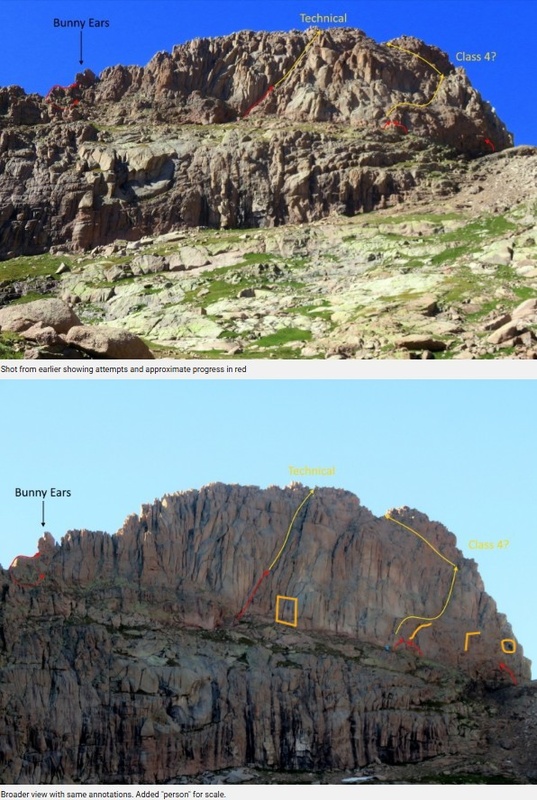
Backstory It was during all the Lidar shake-up a ways back that I first really started picking up on the buzz about West Eolus and the growing debate about whether or not it was a ranked 13er. Boggy B was the first to post trip reports to this site and he tossed out the tantalizing bait that many years ago a couple different people had said they had done this peak and felt that it was only class 3 or 4, yet when he went and made his first attempt to climb it, he was repeatedly shut down on route after route that he attempted, failing to find anything that seemed at all like class 4 or below, despite circling around the peak and trying many options. However he did provide an annotated image displaying a potential class 4 line to be explored in his excellent trip report Secrets of West Eolus and Other Stories. Soon after, he returned, but I was disappointed that he seems to have given up on fleshing out any potential class 4 route and instead just sent it straight up a 5.7 line in the middle with ropes, as recorded here. Then, more recently josephnephi and bdloftin77 borrowed some gear from Eric Gilbertson and permanently removed all ambiguity surrounding the classification of this peak by determining that its ranked status was conclusively inconclusive and that it was probably not ranked but likely could be since it had a prominence of 299.931ft (according to one set of data) yielding a 77.6% probability that it's unranked. You can read the full details with additional statistical analysis in A Mountain That Refuses Classification. Finally, Dobsons very recently confirmed, along with his climbing team, that the 5.7 route identified by Boggy B does indeed go and was ranked appropriately as you can read about in his report. So, while 5.7 is perhaps within my soloing limits - at least on good rock - it's just not nearly as enticing to me to go solo something that better climbers than I have roped up for and already fleshed out in detail. But the possibility that there could be a class 4 route hidden on that face but that you'd better have some low to mid 5th ability if you want to be the first one to flesh it out (the couple of people who had done it long ago don't seem to be fully certain of where exactly they went up...) well, let's just say that this kind of opportunity to flesh out a "new" route that is easier than the currently documented one - that's an increasingly rare opportunity for the highly documented Colorado 13ers and something that sounded like an exciting opportunity for me. However, first I needed to complete lap2 of Eolus and North Eolus (leaving me with just San Luis to finally wrap up lap2 for all 58 of Colorado's 14ers). I had decided to do that as a hike in from Purgatory and, not having a confirmed route between Eolus and West Eolus, I tagged the pair of 14ers and then dropped all the way down to camp before then regaining 2,500ft to get up to West Eolus. By this point, it was getting later in the day than I wanted, I was feeling the drain from all the hiking over the last couple days, and the clouds were building up more than I was comfortable with - by 6pm a big storm did in fact hit the basin. (If you're considering hiking in from Purgatory but want more details on that, feel free to check out the other recent trip report I did: Purgatory - Not Really That Bad After All) As such, the main thing I can offer for now is a collection of extra photos with a few annotations to help others (or maybe one day myself, if no one beats me to it) more quickly zero in on possible routes and also perhaps make it easier to describe any such route to others now that I've help annotate some landmarks that can be made out from close up and further back. The Approach A few quick notes on the approach. If this is your only objective in the basin then the logical place to start up is from somewhere just below 11k in the basin. There are some good campsites in the trees around 10,900ft and a spot or two shortly after as well. Shortly after you come out of the trees as the trail passes those campsites, you'll enter a large meadow and off to your left (as you hike towards Twin Lakes) you'll see a large black gash that water has carved out of the rock. You can leave the trail anywhere past that gash and begin your bushwhack uphill. I briefly tried to chart an optimal line to skirt between willows (most of which are small enough to not really block your travel) and various little mini rock walls, small clusters of pine trees, etc. However, it was soon apparent that there wasn't any optimal path and you just have to make a million micro route finding decisions, most of which won't really matter - just go uphill. Do be aware that you'll gain ~2,500ft in ~1.75mi so this does get steep enough to put some whoop on, but there's no actual "climbing" needed until you reach West Eolus. However, it's worth noting that a lot of this is steep grass, or occasional brief sections of steep dirt and so this could be quite unpleasant to descend in the rain (I made it down soon enough to not have to find out). 

Partway up, you might be tempted to go up the gully to the left, but you'll want to make a curve to the right to end up to the right of a prominent peak that juts up. 
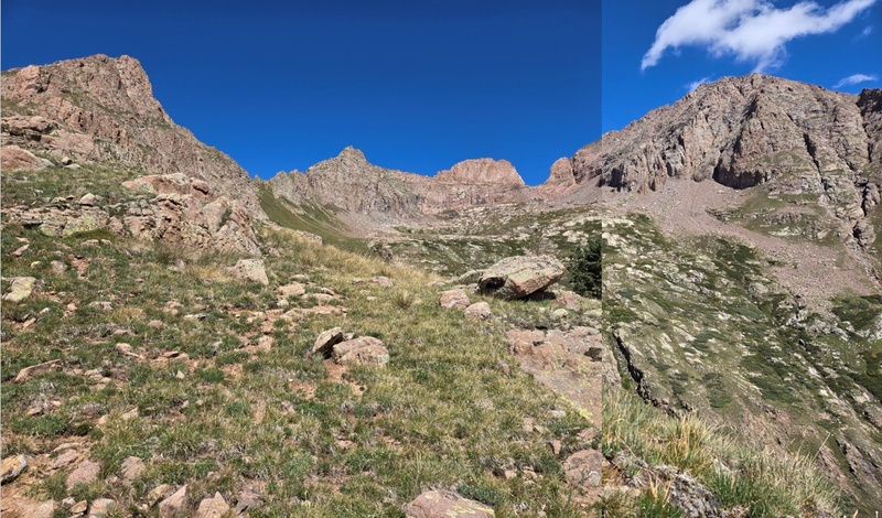
As you go up, you'll eventually reach a more or less flattish spot where you now see a bunch of peaks come into view to your right (view below) as West Eolus pops up ahead of you (two photos below). 

Soon after the flat spot you should be able to find some game/usage trails cutting across the tundra below the rock formations to the left and above messier terrain below to the right. 


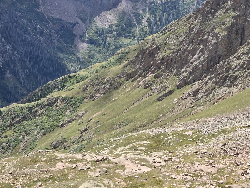
On your eventual exit, you'll want to look for the above faint Z and take either usage trail to where you can drop back down where you came up. Below left is another gully which looks ok from here but based on the map and other photos, would likely prove needlessly painful to descend, compared to backtracking. 
Eolus Connection So, part of the reason I ran out of time and energy to fully explore West Eolus was that my primary goal was to get lap2 of Eolus/North Eolus and, since looking at photos and topo maps left me extremely uncertain that I could safely connect the two, I just dropped all the way back down to camp and then came back up 2,500ft to West Eolus. Being able to drop directly from Eolus to West Eolus could make this radically shorter and easier - if there's a decent line. Somehow I overlooked the fact that bdloftin77 (Ben) had scaled up the West slopes of Eolus in order to get some stunning photos of West Eolus from above (see the previously linked report: A Mountain That Refuses Classification). Anyone wishing to do West Eolus who also plans to grab Eolus on the same trip may want to reach out to Ben for details of the connection - or perhaps he'll be kind enough to drop some details in the comments. As is, having not had details on a connection, I took multiple photos of the west slopes of Eolus to look for a possible way to connect the peaks directly. A direct connection from the saddle looks improbable - and would likely be steep, technical and loose. However, a little further down the slopes there does seem to be a possible ramp of sorts (annotated in one of the photos below). But I have no idea the rock quality or other obstacles between there and the summit of Eolus, or how difficult it would be to spot the ramp from above without gpx tracks to help guide you. But here are some photos for those who may want to explore that connection to make additional scouting of West Eolus more efficient for those also doing the 14ers in the basin. It would be fascinating to climb up to the hump just to the right of the saddle and see what West Eolus looks like from there, but that would likely take a whole lot of extra effort to get close enough and high enough to see the areas of most interest for a possible class 4 route (which would seem to be on the half closer to the saddle, if such a route indeed exists). 


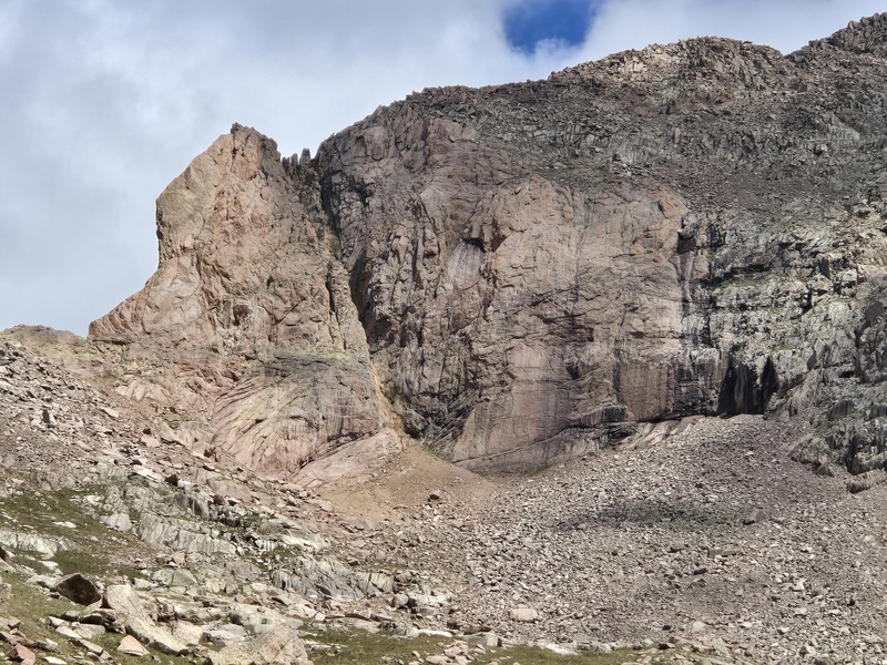
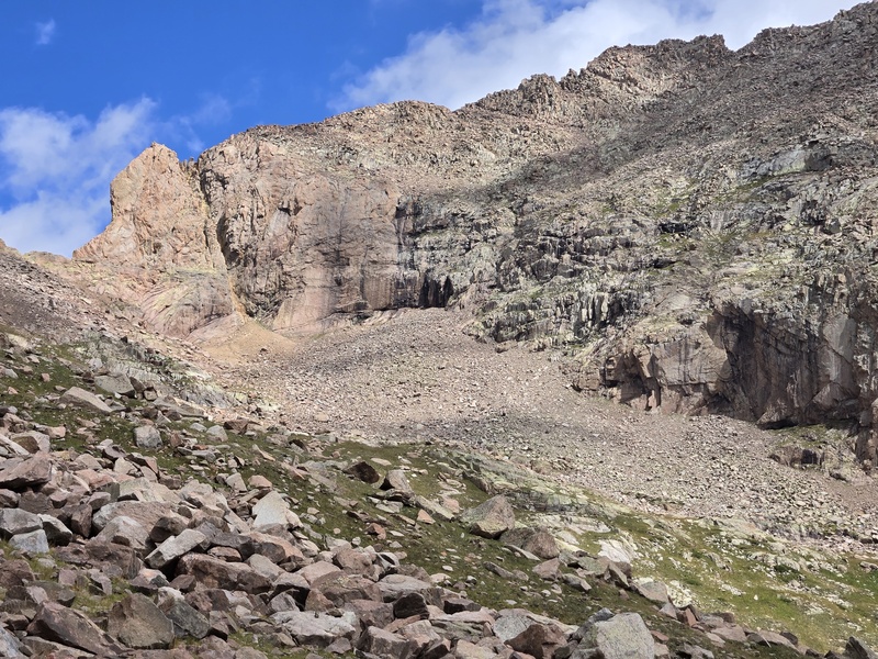
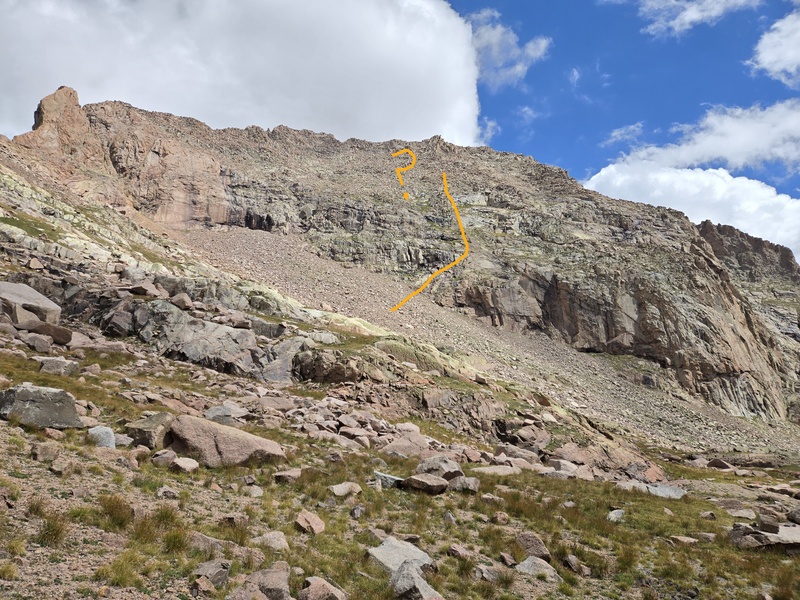
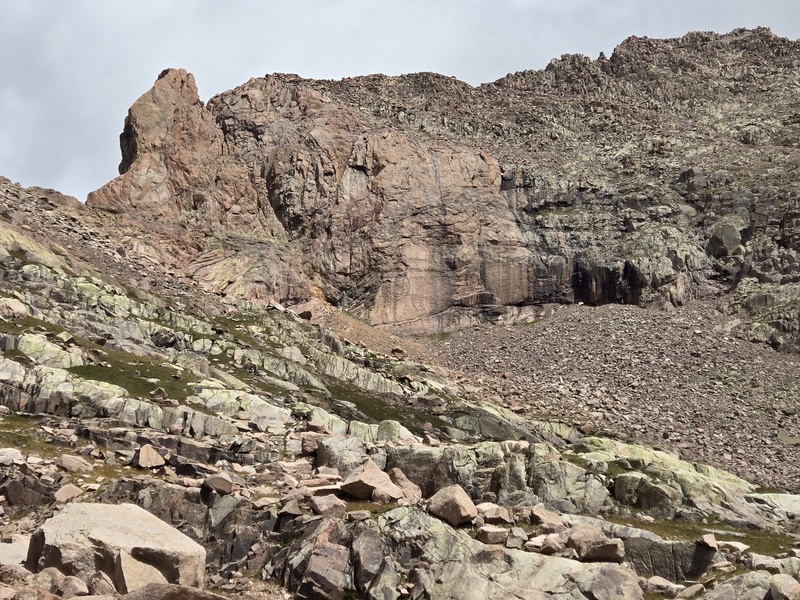
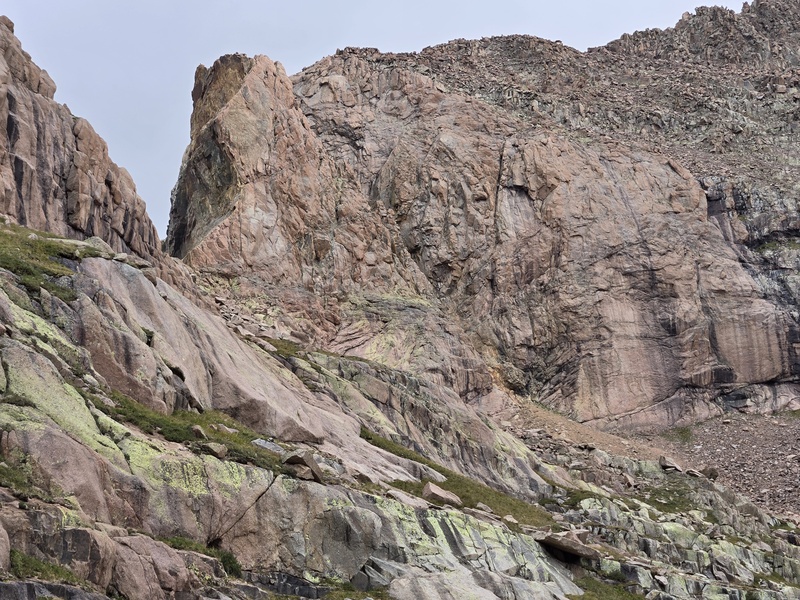
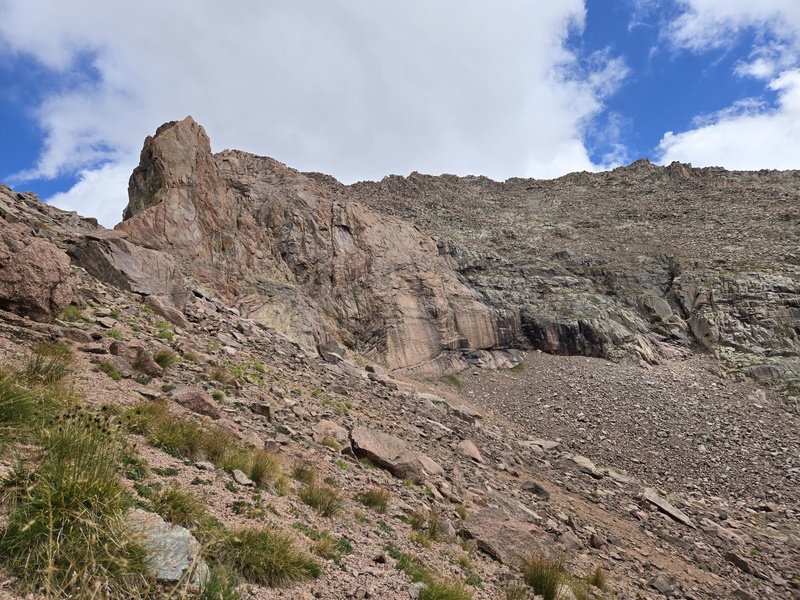
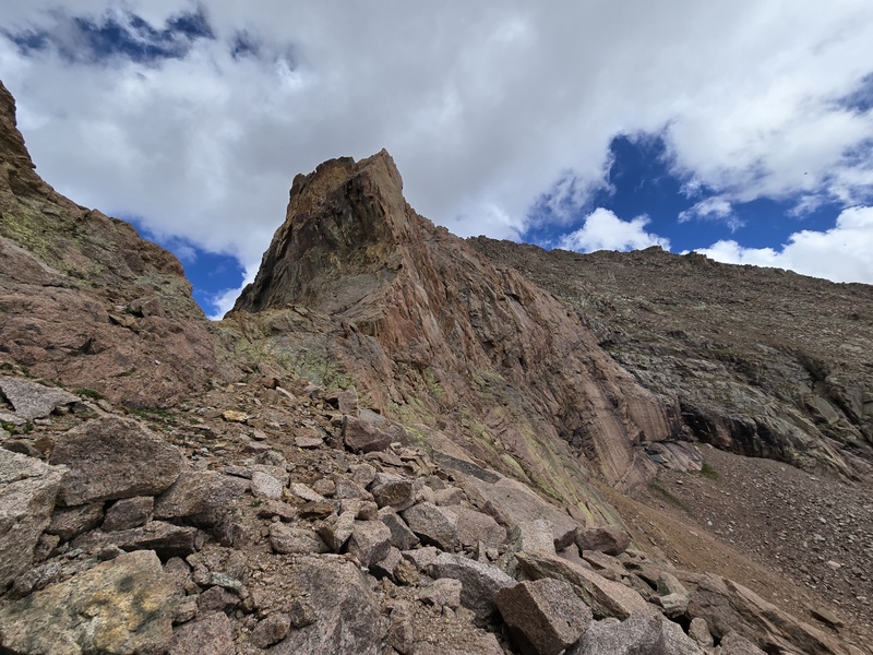
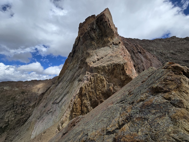
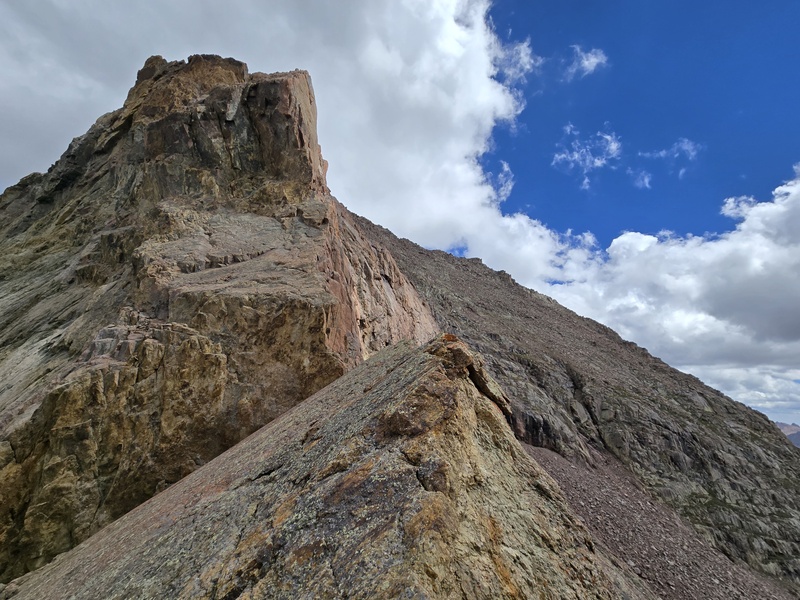
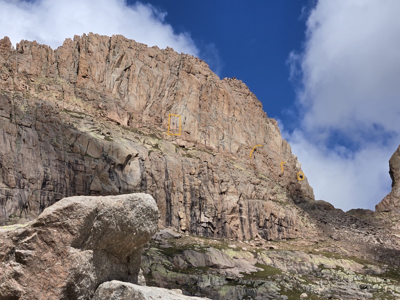
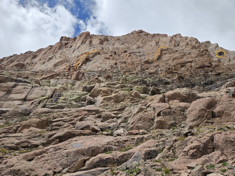
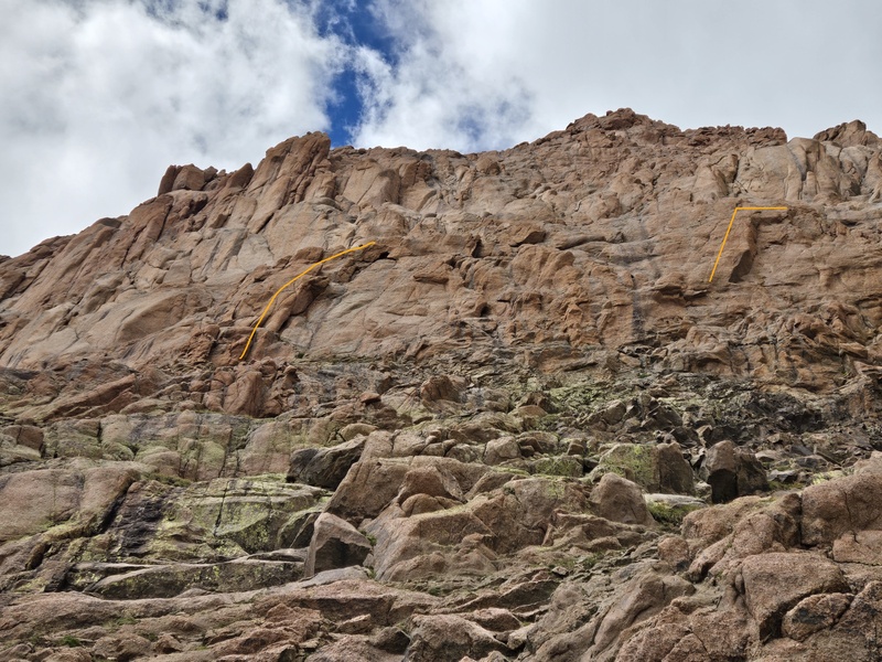
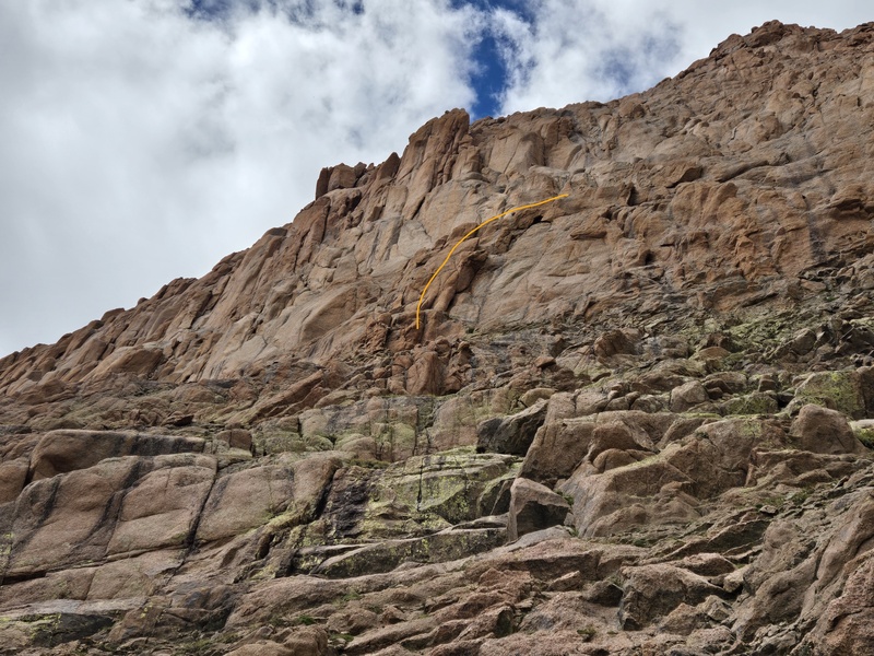
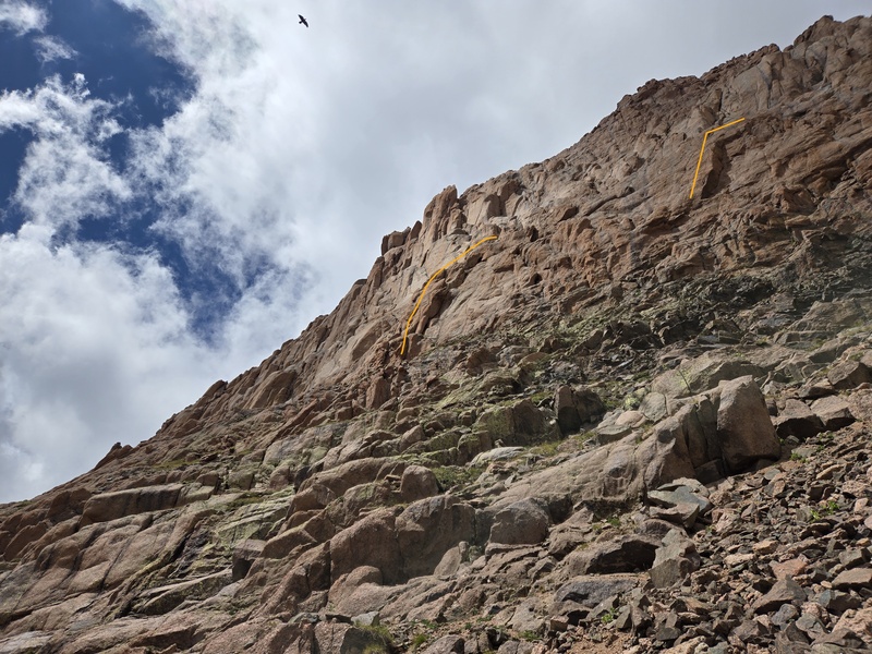
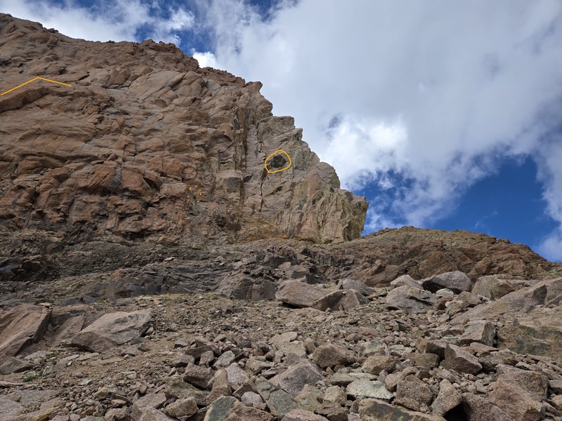
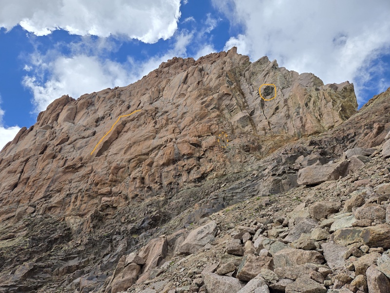
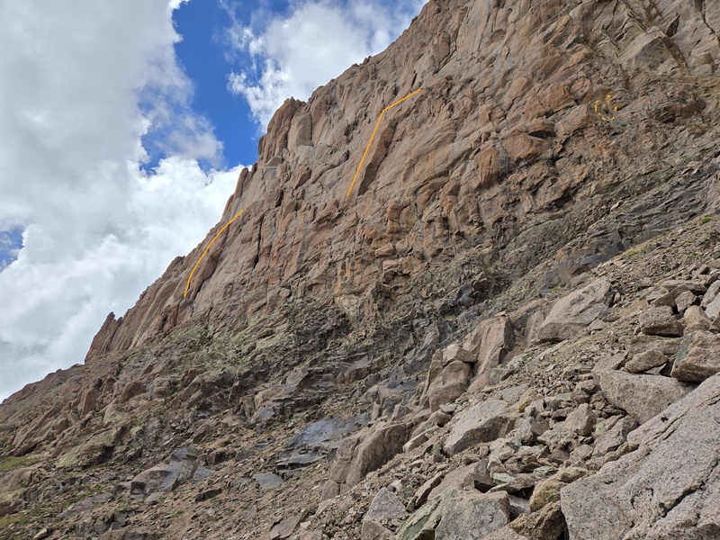
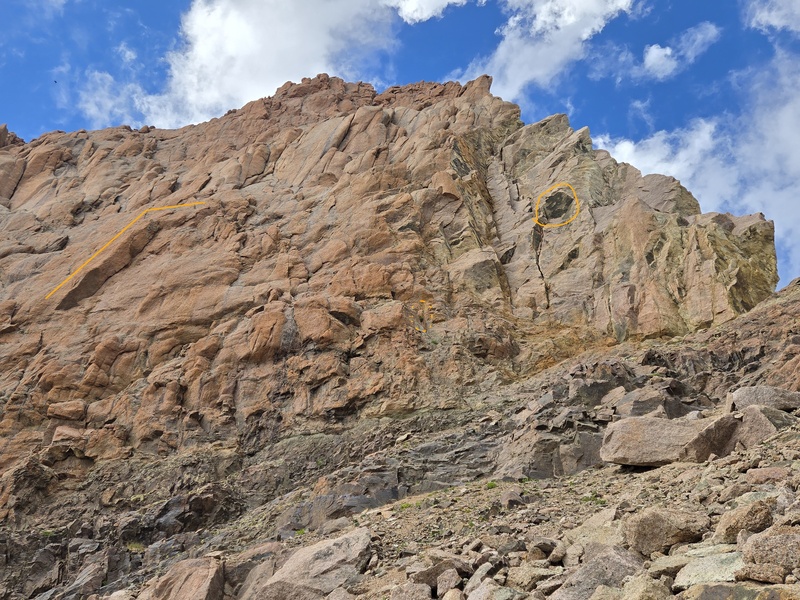
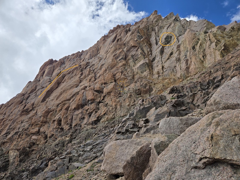
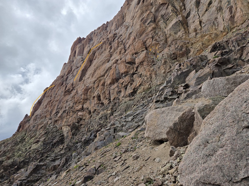
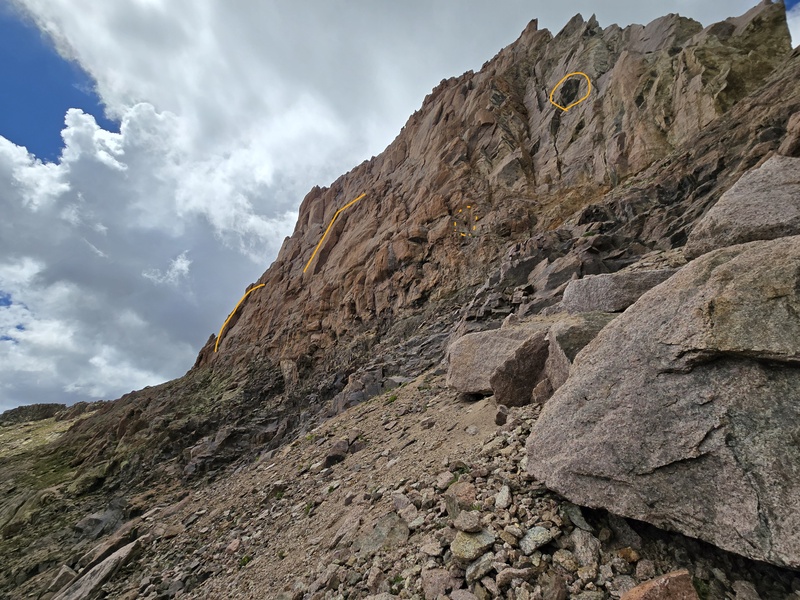
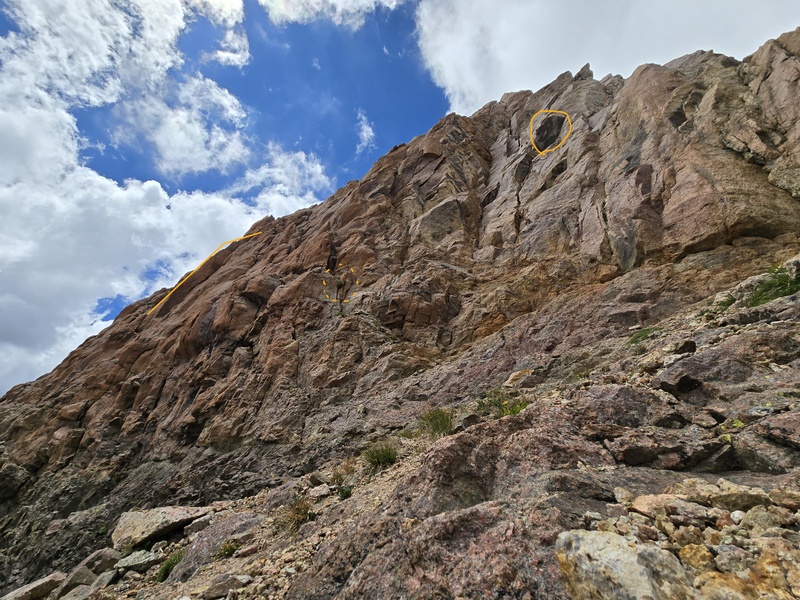
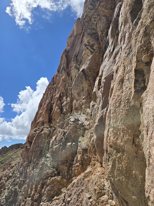
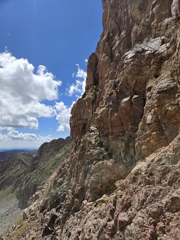
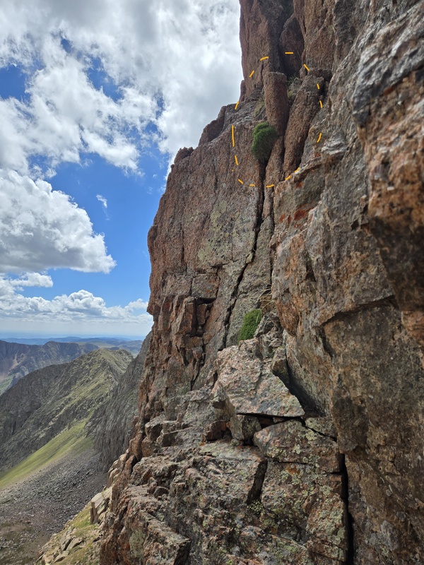
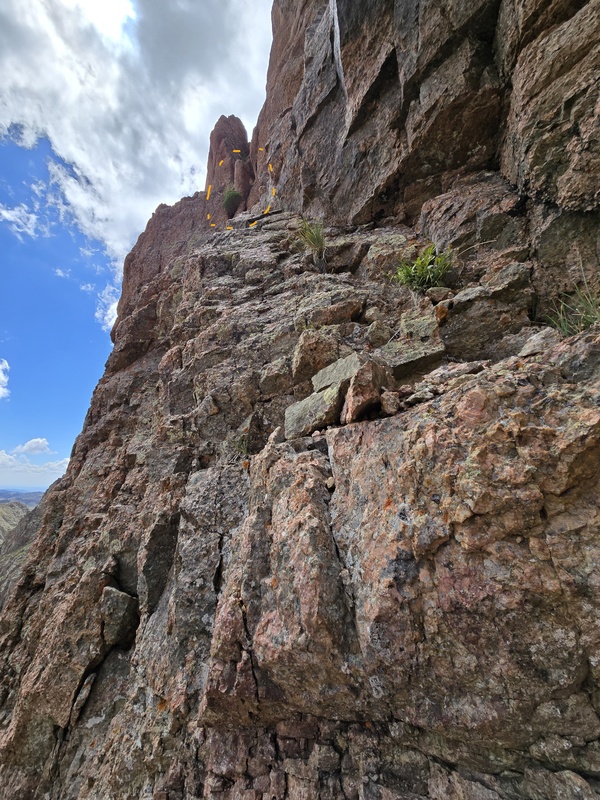
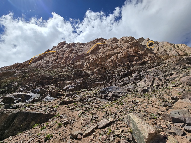
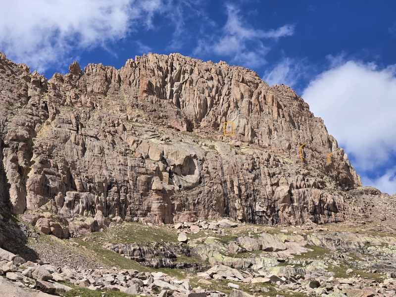
West Eolus So unfortunately the main thing I have to offer after this quick recon trip is just a bunch of extra photos, but I also took the time at home to study these in detail and pick out landmarks from which to more quickly and easily get my bearing on any potential return journey (or perhaps help speed up the analysis and ease the ability of describing the route for anyone who beats me to it - if indeed anyone else is crazy enough to try to scope out a class 4 route on this treacherous peak). There are 5 main features that I have identified and marked up very lightly in most of the photos in order to more quickly spot common features across images. Four of these features are marked in the very first photo of this report; 3 of them are marked in the photo below and each of them are then marked with the same type of symbols in following photos. The 5 main features on the SW face are:
I intentionally made these marks with faint, thin orange lines so as not to obscure too many details, while still allowing your eyes to snap quickly to the features repeated throughout the photos. I also shamelessly stole a couple snapshots from Boggy's report and annotated them with these same marks so people can easily tell what areas he already did some initial exploring on. 


The following images are ones I took, starting generally from near the middle of the right half of the SW Face, working over to the saddle and then working back along the SW Face a little closer, followed by some more macro shots. 


Concluding Thoughts It's fascinating how at some angles a class 4 route looks impossible, but from others (such as the snapshot from Boggy's first report) it seems almost certain that there must be such a route. As a funny point of comparison, I was recently doing the Adams Family Traverse and popped up on a ridge to see a towering monster of a cliff face that had a discernable trail at the bottom that then disappeared into what surely was an almost unclimbable madness of advanced 5th class mountaineering. Not yet having gotten my bearing, I opened a topo map on my phone and took a moment to glance around, get my bearings and try to identify what this impossibly imposing route was. After a brief moment of examination I thought: 'no, that's that right - I must be turned around...' So I took another closer look at the topo, turn around in circles to survey the surrounding ridges, lakes, etc and soon verify with absolute certainty exactly where I'm at at what I'm seeing. 'No way,' I think to myself, 'you've got to be kidding!' That impossible looking route that seemed so imposing from the particular angle I was viewing it from, was none other than the standard Difficult Class 2 route up Challenger Point!!! I share that little story simply to illustrate that what sometimes looks impossible from a distance, often turns out to be much easier once you get up close and find the right line. Time will hopefully tell if that is the case with West Eolus, but for now this peak continues to be shrouded in mystery with its ranked status still being within the bounds of statistical possibility and the existence of a route easier than 5.7 still being rumored but undocumented. My Times As usual, I'm no speed demon - and this was after hiking in from Purgatory the day before and doing Eolus/North Eolus the morning of, then dropping all the way back down to camp before starting this climb. 10:20am start from camp at ~10,900ft 11:34am reach scenic flat spot at ~11,984ft with view across the basin 1:44pm finally got up to the saddle at ~13,437ft (after taking a ton of photos on the approach) 4:16pm back on main trail 4:22pm back at camp a little before 6pm: major storm that had me worried finally arrives Thumbnails for uploaded photos (click to open slideshow): 












|
| Comments or Questions |
|---|
|
|
Caution: The information contained in this report may not be accurate and should not be the only resource used in preparation for your climb. Failure to have the necessary experience, physical conditioning, supplies or equipment can result in injury or death. 14ers.com and the author(s) of this report provide no warranties, either express or implied, that the information provided is accurate or reliable. By using the information provided, you agree to indemnify and hold harmless 14ers.com and the report author(s) with respect to any claims and demands against them, including any attorney fees and expenses. Please read the 14ers.com Safety and Disclaimer pages for more information.
Please respect private property: 14ers.com supports the rights of private landowners to determine how and by whom their land will be used. In Colorado, it is your responsibility to determine if land is private and to obtain the appropriate permission before entering the property.



 Download GPX file used in this map