Download Agreement, Release, and Acknowledgement of Risk:
You (the person requesting this file download) fully understand mountain climbing ("Activity") involves risks and dangers of serious bodily injury, including permanent disability, paralysis, and death ("Risks") and you fully accept and assume all such risks and all responsibility for losses, costs, and damages you incur as a result of your participation in this Activity.
You acknowledge that information in the file you have chosen to download may not be accurate and may contain errors. You agree to assume all risks when using this information and agree to release and discharge 14ers.com, 14ers Inc. and the author(s) of such information (collectively, the "Released Parties").
You hereby discharge the Released Parties from all damages, actions, claims and liabilities of any nature, specifically including, but not limited to, damages, actions, claims and liabilities arising from or related to the negligence of the Released Parties. You further agree to indemnify, hold harmless and defend 14ers.com, 14ers Inc. and each of the other Released Parties from and against any loss, damage, liability and expense, including costs and attorney fees, incurred by 14ers.com, 14ers Inc. or any of the other Released Parties as a result of you using information provided on the 14ers.com or 14ers Inc. websites.
You have read this agreement, fully understand its terms and intend it to be a complete and unconditional release of all liability to the greatest extent allowed by law and agree that if any portion of this agreement is held to be invalid the balance, notwithstanding, shall continue in full force and effect.
By clicking "OK" you agree to these terms. If you DO NOT agree, click "Cancel"...
A few weeks ago, I reached out to some folks who had recorded ascents of soft-ranked West Eolus to get an idea of what to expect. From a sample size of two, both had vague memories of the climb from years ago, but one said "class 3-4" and one said "class 3+." This was consensus enough for me to try to add it to a quick solo trip to Chicago Basin.
Context:
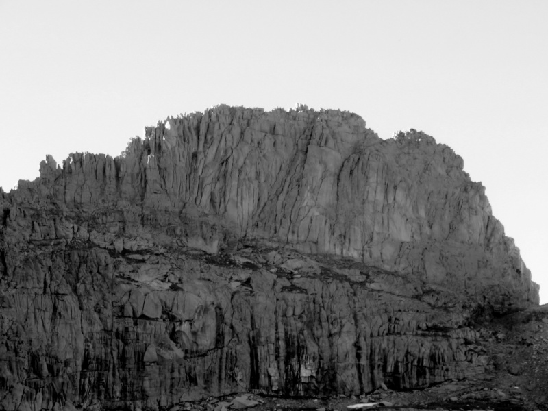
West Eolus
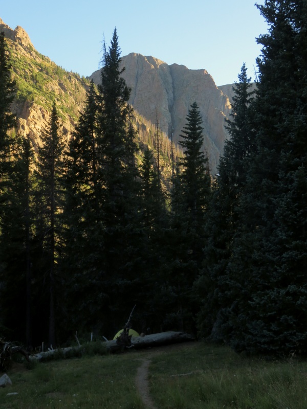
Thursday I took the train to Needleton and booked it out of the gate. At the signage a mile up, I ran into Noah from Albuquerque, who had hiked in from Purg the day before. We teamed up and at his brutal pace reached the campsites at 11,000' in two hours from the Needleton bridge. I set up my tent, found some water, and then headed north up the slopes west of the creek that drains the high basin beneath West Eolus.
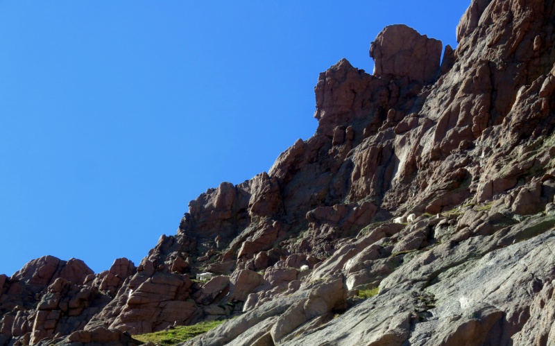
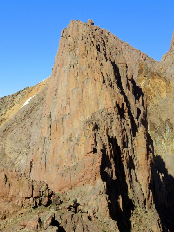
A decent goat trail led me up to the ridge, but I got suckered into steep willows trying to access the basin lower than I should have. Once in the basin, easy scenic walking led to the business. West Eolus sits prominently at the head of this drainage, a remarkable fin made up of decomposing garbage, with a gravel yield typical of area peaks. One previous ascensionist had said the route was on the east ridge, so I made for the eastern saddle separating the basin from New York Basin to the north. I watched some goats traverse from this saddle across a huge ledge beneath the south face as I approached.
Goats
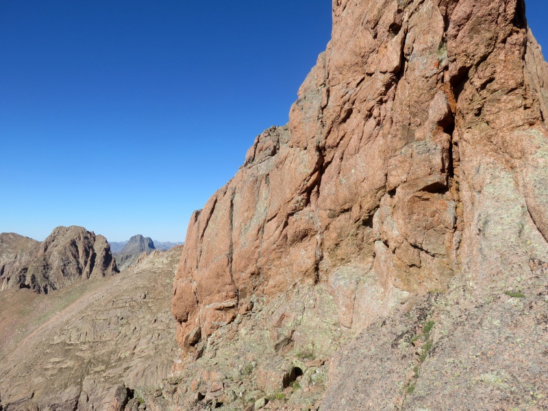
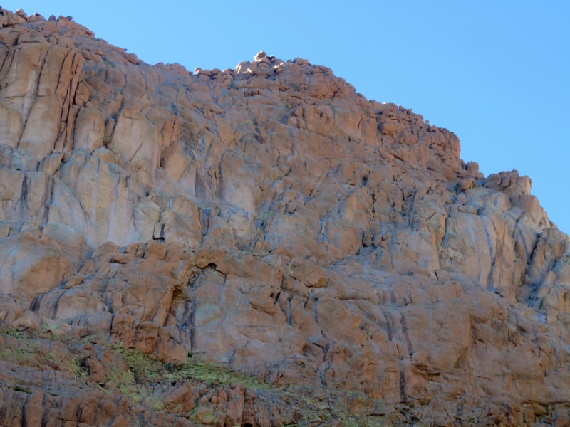
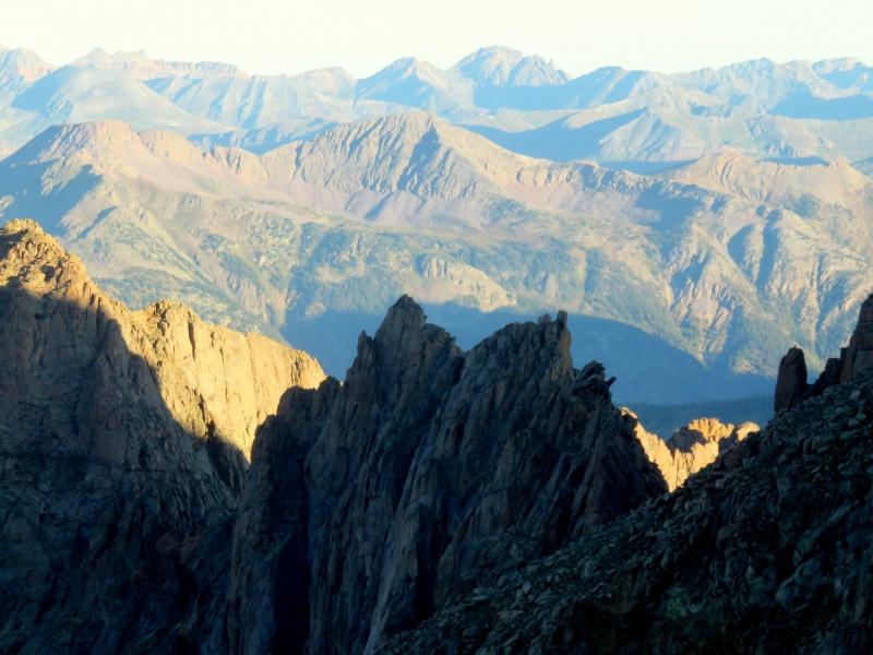
At the saddle it was immediately apparent that the east ridge proper doesn't go at a non-technical grade, and that the north face does not harbor scrambling routes. This information wasn't surprising given the appearance of this summit from any vantage point. I did see a crack system on the ridge that looked easy down low but terminated in 5.hard-looking towers.
East ridge and north face. Apologies for bad photo.
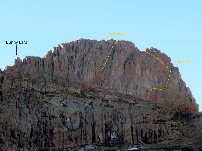
I started west across the big ledge, searching for weaknesses. Just around the corner on the southeast face, there appeared a system of right-facing flakes and ledges to access lower-angle terrain above, and so I started up. Loose, exposed 4th class turned ugly about 30 feet up, so I decided that wasn't it and tediously downclimbed.
Attempt 1 - Reached grass clump below big flake
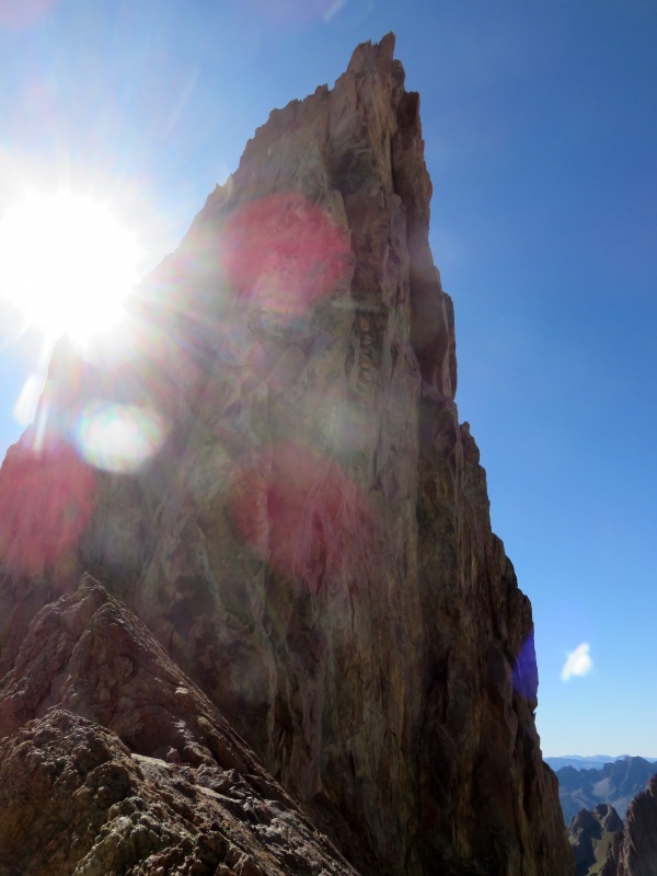
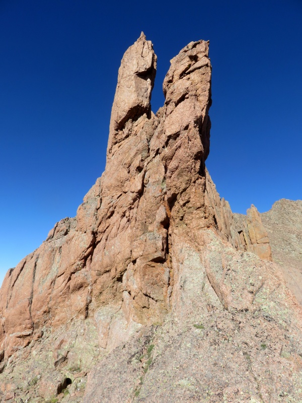
I then thought perhaps the west ridge proper, so I made across the ledge--more sloping and gravelly than broad and grassy, with a huge cliff below--climbed a short 3rd class gully to the western saddle, and started up the west ridge. Surprise bunny ears shut me down right away. I tried first to traverse around them to the north, then retraced my steps to the saddle and tried a lower bypass to the north. A slabby class 4+ face might have yielded but the prospect of downclimbing it stopped me from proceeding up that way.
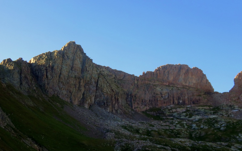
Disheartened, I traversed back to the western saddle. A cairn on nearby PT 13,596 caught my attention, and I hiked over to see if perhaps this was an honorary West Eolus with a register to shed some light on the situation. No register appeared, though the new perspective from this point illuminated the futility of my efforts on the west ridge.
West ridge from PT 13,596. Bunny ears near bottom. Gradual slope top right is part of Eolus and not connected to W Eolus.
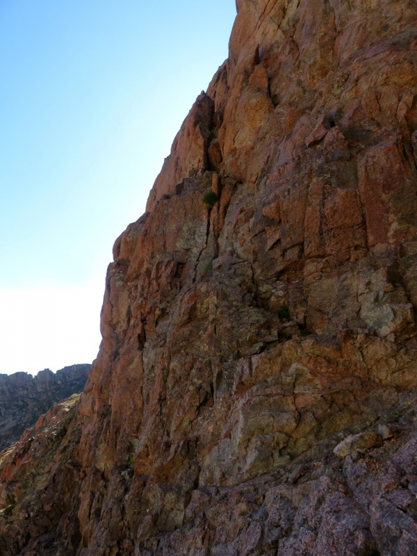
I returned to the western saddle, climbed down the gully, and started back east across the ledge. In the middle of the south face, I spotted a left-facing gully and chimney system that looked promising, and again started up. The climbing was reasonable, though the right side of the slot was comprised mainly of slabs and boulders resting tentatively against the face, any of which, if blown, would eliminate the slot, with a few unstable must-use boulders camming against them for good measure. But all good things come to an end, and a low-angle, 20-foot #6-looking offwidth crack put a stop to the fun. I estimate it goes at 5.6 with unknown but probably similar terrain above. I again downclimbed tediously to the ledge and continued east.
Attempt 4 - Went up chimney left of stacked slabs/boulders
As I approached the east side of the south face, I noticed a ledge and possible ramp leading to the upper southeast face. I started up this and didn't get far before an out-sloping gravel slab blocked progress. I could have mantled up in a few moves, but reversing this without reasonable holds would have been problematic, especially in the dark. These were probably the easiest moves I didn't make but would have been sketchy nonetheless.
I returned to the ledge and tried one more route to bypass the previous section but ended up at the same point. It was getting late, and I felt I had performed sufficient reconnaissance to determine I wasn't going to get up West Eolus without a rope. I can usually sniff out a non-technical route if there is one, especially a route so forgettable as to not leave a stamp on the memory of those who have climbed it. This makes me wonder whether I missed something obvious. Anyone?
UPDATE: Kylie and I returned with gear the next weekend and sent the south face.
Shot from earlier showing attempts and approximate progress in redBroader view with same annotations. Added "person" for scale.Closer view of potential southeast face route
I hiked back down the upper basin and this time hopped on a faint game trail to contour west out of the drainage and descend the adjoining ridge and slopes to my campsite, which I reached just before dusk.
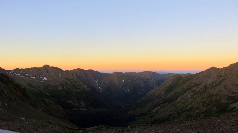
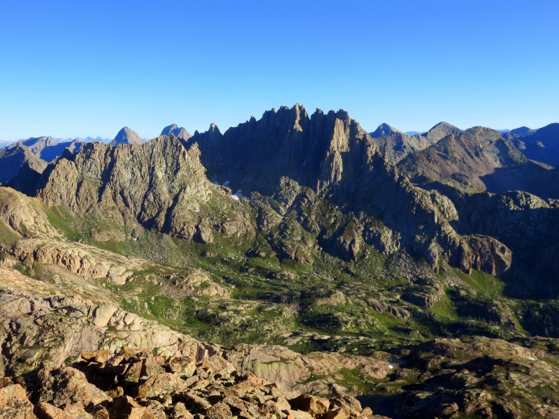
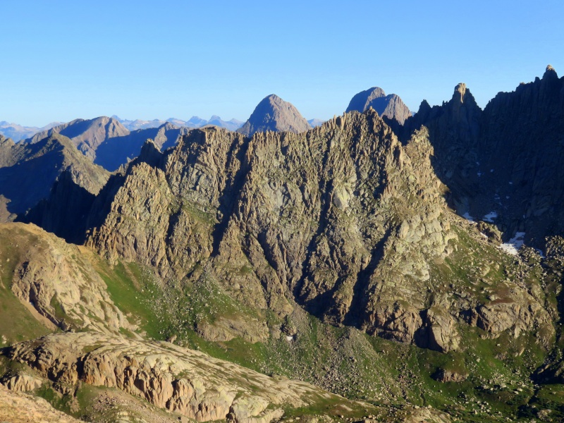
PT 13,596 and West EolusView towards Columbine PassSunlight, Windom, S Windom, JupiterView of South Windom and the access rampMt KennedyEighteen, Windom, S Windom, JupiterBold
Having decided to punt on West Eolus, I wanted to make the train out the next day, and my conservative estimates on how long it might take to complete South and East Windom, for which I had no beta, had me up at 5:30 am. Following the trail towards Twin Lakes, I began to see light beams flitting around in the darkness. I soon passed by a group of hikers who were figuring out the route where the trail crosses some slabs and is unobvious in the dark. I would be bushwhacking imminently and was worried I might lead them astray so I said something like "Hey I'm going to be leaving this trail in a bit. Don't follow me." It sounded pretty curt, so if that was you, sorry!
I departed the Twin Lakes trail at 11,700' and contoured east below Peak Eighteen, aiming for the high bench between Eighteen and Jupiter Mountain. Along the way there were some cliffs to navigate and significant willows to avoid, which I managed more or less successfully in the darkness. By seven o'clock I was looking up the broad north-facing ramp/gully I had planned to take up South Windom, which is situated in the middle of the ridge connecting Windom and Jupiter. After hiking up the 200-foot talus apron, I scrambled out to the right of the gully, following the path of least discomfort from there. On the whole it was forgettable, though the upper section holds a few massive boulders primed for the next catastrophic rockslide, and I had to take some care to prevent the talus beneath my feet from undermining the talus above my head.
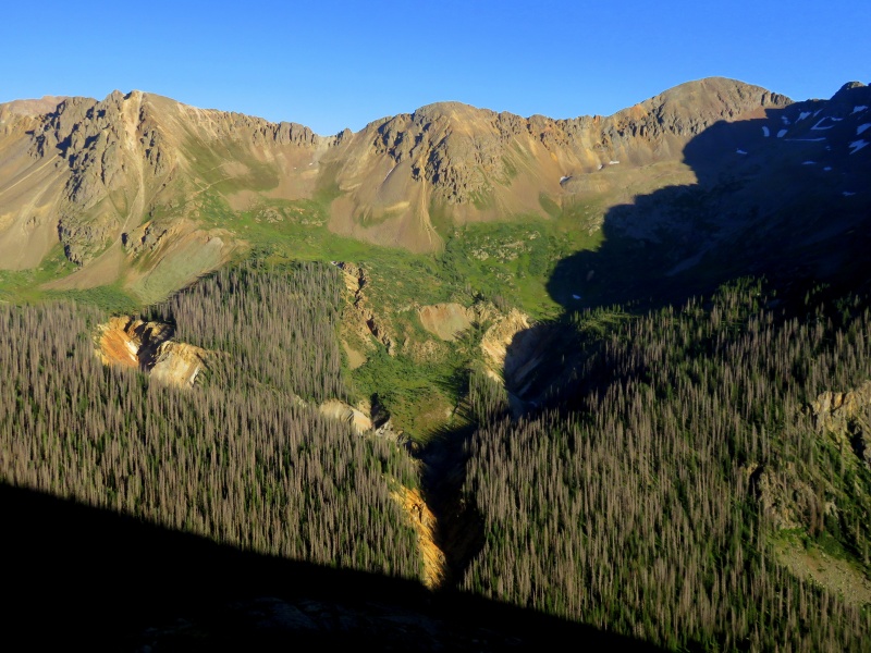
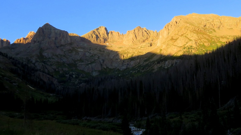
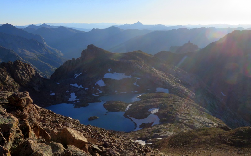
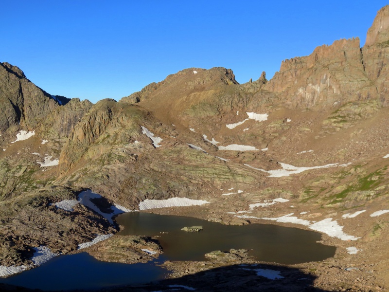
Chicago Basin at dawn
From the top of the gully it was a short jaunt north to the summit of South Windom, which since Sept. 2017 has apparently been of interest only to Mike Garratt and myself. (Incidentally, does anyone have contact info for Mr. Garratt?) Fantastic views all around and gentle terrain to East Windom lifted my spirits as I descended northeast towards the pretty lake at 13,100'. I rounded the west side of the lake and hiked east to the easy summit of soft-ranked East Windom. Ahead of schedule, I enjoyed the scenery for a while before heading back up and over South Windom, which I topped out the second time at 8:45.
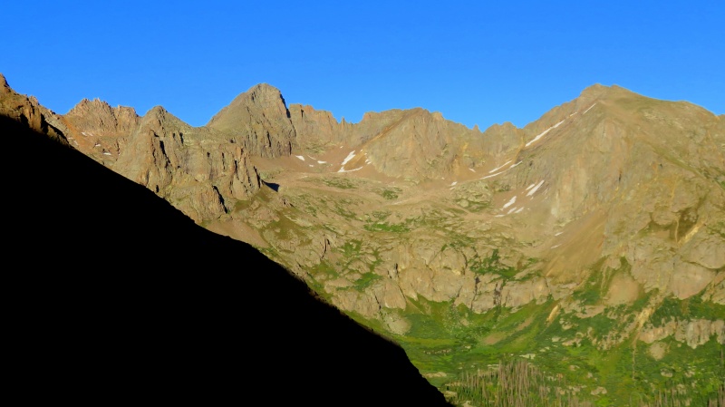
Windom from South WindomWindow over Needle RidgeEast Windom and Lake 13,100 from South WindomPeak Ten and Jagged Mtn from East WindomPeak Ten with Arrow, Vestal, Gray Needle, Noname Needle, etc.Lake 13,100 and South Windom from East WindomWeminuche burl. McCauley, Echo, Organ, Amherst, etc.
Following almost exactly the same route back to the Twin Lakes trail as I had taken earlier, I reached my campsite at 10:15, with plenty of time to eat, refill, and chat with a pair of bowhunters I'd met on the train. They wanted a sporting hunt, so I told them about the goats high on West Eolus and gave them the approach beta, and up they went. I lingered some more before hiking out to Needleton, where I soaked my legs in the frigid waters of the Animas and napped in the sunshine. Probably due to running a "second 8:45 train," the garbage train was quite late to arrive in Needleton at 4 pm. During the ever-agonizing ride back to Durango I daydreamed about the retirement of the D&SNG and installation of a bike path in place of the tracks.
Thumbnails for uploaded photos (click to open slideshow):
I applaud your willingness to venture into the un- or rarely explored. The obscure path less (or never...) taken. I can relate, big time.
OK, on your solicitation of ideas photo (with red/yellow lines), of course it's hard to say unless a viewer had a good handle on details, slope gradient, etc. E.g. that horizontal band near the base of the cliff, I can't tell if it's a ledge or just a shading of color caused by a rock layer. That aside, the one feature that popped to my eye is the crack system to the right of the central yellow line, it ends with the word "technical." It's been my experience that I need to greatly expand the actual crack size when I see something that far away, i.e. a very visible crack from that distance is a chimney, a hairline crack from a quarter mile off is probably a healthy offwidth, etc. If it's a chimney, might that line go? Or is the "technical" warning a show-stopper there as well, even though it looks like you explored the line to the left? All pure speculation, but fun armchair mountaineering on a Sunday morning!
@Darin - It was an accident of not doing them in any particular order. The lack of planning is evident in the fact that the remaining peaks are mostly up Ruby and Noname. Oops!
@TomPierce - I think that right-hand crack is more of a flaring corner than a chimney. And you're right, especially in this area, everything is way bigger than it looks from a distance. All the cracks looked insanely OW, and the gravel is really abrasive here. I do think the "technical" line will go, minimum 5.6. Kind of wish I'd gone with a partner, rope, and huge gear. On the other hand, this report jogged Mark Ott's memory, and he says he took my "class 4" route to the summit. Guess I've gone soft..
@Natalie - Same. We came over Grizzly and were totally gassed after Graylock. Yeah, Gray Needle looks like a tough nut--time to lose the ego and aid!
Caution: The information contained in this report may not be accurate and should not be the only resource used in preparation for your climb. Failure to have the necessary experience, physical conditioning, supplies or equipment can result in injury or death. 14ers.com and the author(s) of this report provide no warranties, either express or implied, that the information provided is accurate or reliable. By using the information provided, you agree to indemnify and hold harmless 14ers.com and the report author(s) with respect to any claims and demands against them, including any attorney fees and expenses. Please read the 14ers.com Safety and Disclaimer pages for more information.
Please respect private property: 14ers.com supports the rights of private landowners to determine how and by whom their land will be used. In Colorado, it is your responsibility to determine if land is private and to obtain the appropriate permission before entering the property.


")
")
")
")
")
")
")
")
")
")
")
")
")
")
")
")
")
")
")
")
")
")
")
")
")
")
")
")


