| Report Type | Full |
| Peak(s) |
Mt. Elbert - 14,438 feet Blanca Peak - 14,350 feet Uncompahgre Peak - 14,318 feet Mt. Lincoln - 14,293 feet Castle Peak - 14,274 feet Mt. Blue Sky - 14,268 feet Mt. Wilson - 14,256 feet All 58 14ers |
| Date Posted | 08/11/2025 |
| Modified | 10/21/2025 |
| Date Climbed | 06/16/2025 |
| Author | Cool Hand Luke |
| Tour de 14ers Bikepack - Summer 2025 | ||||||||||||||||||||||||||||||||||||||||||||||||||||||||||||||||||||||||||||||||||||||||||||||||||||||||||||||||||||||
|---|---|---|---|---|---|---|---|---|---|---|---|---|---|---|---|---|---|---|---|---|---|---|---|---|---|---|---|---|---|---|---|---|---|---|---|---|---|---|---|---|---|---|---|---|---|---|---|---|---|---|---|---|---|---|---|---|---|---|---|---|---|---|---|---|---|---|---|---|---|---|---|---|---|---|---|---|---|---|---|---|---|---|---|---|---|---|---|---|---|---|---|---|---|---|---|---|---|---|---|---|---|---|---|---|---|---|---|---|---|---|---|---|---|---|---|---|---|---|
|
This trip report gives details on my Tour de 14er bikepack trip on all 58 Colorado 14ers, which I completed from June 16 through July 24th, 2025 in 38 days and 11 hours. 2024 Attempt In 2024 I attempted the Tour de 14ers. I trained hard all winter season for skimo, knowing this would help me for the summer adventure. Every weekend I was out, and regularly putting in 25K vertical weeks. I continued to train hard in the spring mud season, hiking up and running down the local ski hills and riding my bike after work. All was set, and I began my trip June 20th, 2024. On the car ride over to Buena Vista I began to cough, and just felt weird. By the time evening hit, I was coughing a lot, and felt so bad I didn't want to eat. I had put so much time into the trip, that I decided I was going to give it a go, and hope that I could start feeling better and continue. The first day of the trip I climbed Belford, Oxford, Missouri and Huron, and began coughing up stuff on the descent. I was moving slow, and the altitude was really affecting me. That evening, I woke up gasping for air, and couldn't breath. Reflexes took over and I jumped up and began a violent coughing fit. Finally, I coughed something up and my airway was clear, and I could finally breath again. After my heartrate settled down, somehow I was able to fall asleep again, as if it were all a bad dream. The next morning, against better judgement, I climbed Harvard and Columbia. I still felt bad, but not as bad as the day before. Once I hit treeline, my pace started to slow again, and things went downhill while I stubbornly continued uphill. I summited Harvard, but completely fell apart on the traverse over to Columbia. I could take about 20 steps, then would have to stop and take several breaths. At the summit of Columbia I had to lie down, and realized I had not looked around me at the view once all day. On the descent I needed to lie down several times and rest, and finally came to terms that this was the end of the trip. 2025 Trip I planned on taking a summer off, and attempting Tour de 14ers in Summer 2026 and doing some recon trips over summer 2025. As early spring hit, the snow tapered off and most of Colorado was well below average average snowfall. My wife threw out the idea of trying the trip this summer, and after a moment of thinking about it, I said I appreciated the thought, but Culebra was probably completely booked, and I hadn't been training hard. I looked at Cielo Vista's website, and there was one spot available all summer, on the exact weekend I needed it. I quickly booked the spot, and began revising my trip plans to fit Summer 2025 Home for the Summer: My trusty 2022 Ritchey Ascent, named Goose, would be my home for the summer. I ran SRAM Eagle XO mountain bike gearing paired to SRAM Rival road bike shifters and a 28 ring up front. This bike performed flawlessly on the trip, and handled everything from rough 4x4 descents, to 100+ mile road days. The Ritchey was a dream build for me, and I just fell in love with the bike even more on this trip; it is just an amazing frame. More details on gear is at the end of the report. 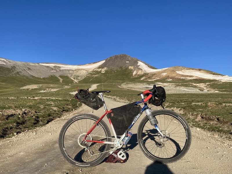
Mosquito/Ten Mile Ranges - Days 1 & 2 Day 1: Quandary, Decalibron and Bike to Sherman: Day 1 I started out in Breckenridge, due to the lower snow levels in the area. I stayed at a local hostel the night before starting the trip, since camping is not allowed at the trailhead, and woke up and biked to the trailhead early in the morning. Quandary went by really quickly, and I felt really good on the way up. I made it up in just over an hour and half, had a good snack on the summit, and returned to my bike. After biking over Hoosier pass, I turned up Kite Lake Road and began the long, hot climb up to the Decalibron trailhead. At the trailhead, the weather looked good, even thought it was around noon. I started up Democrat, and enjoyed the wide ridgeline ambles between peaks. After making it back to my bike, I had a fast descent into Fairplay, and began the rocky climb to the Sherman trailhead. Finding a campsite was a little difficult since 4 miles of the road up high are private property. I had to go to treeline just below the trailhead to find a spot to sleep for the night. 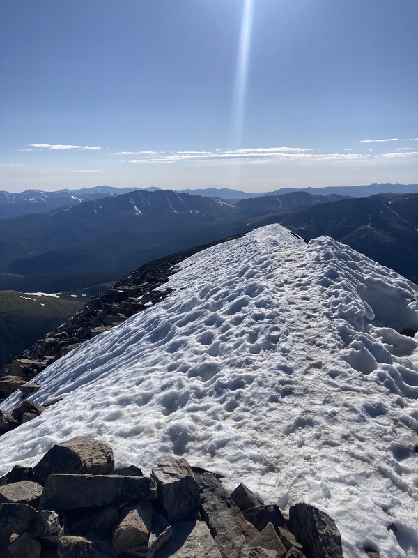
Day 2: Sherman with a Twist and Bike to Holy Cross- My plan for today was to hike my bike to the Sherman/Sheridan saddle, summit Sherman, then go down the trail on the Leadville side. This would save me 80ish miles of riding around through Salida and Buena Vista. I woke up before sunrise, and began hiking my bike up the road. The actual hike a bike to the Sherman saddle wasn't easy, but not as bad as I thought it would be. I made it to the top of Sherman, had a snack, then began the descent. I soon realized the descent was going to be more challenging than the ascent. I was able to ride a few sections, but it was 80-90% hike a bike through snow and rock fields. Not fun, but it saved me some time. After a quick resupply and Taco Bell break in Leadville, I was on my way to Holy Cross. The climb up Battle Mountain Pass was really hot, and I still had a long climb ahead to the Holy Cross trailhead. I shifted into my lowest gears, and began the grind up Tigiwon Road. The road was still closed to vehicles, which was nice for me, but after a few miles I hit a section where a crew was grading the road. This made the riding now loose dirt and rock, and I struggled to maintain traction. There were not any places for me to refill on water on the way up; I finally was able to get water at Half Moon campground, and camped there for the night. 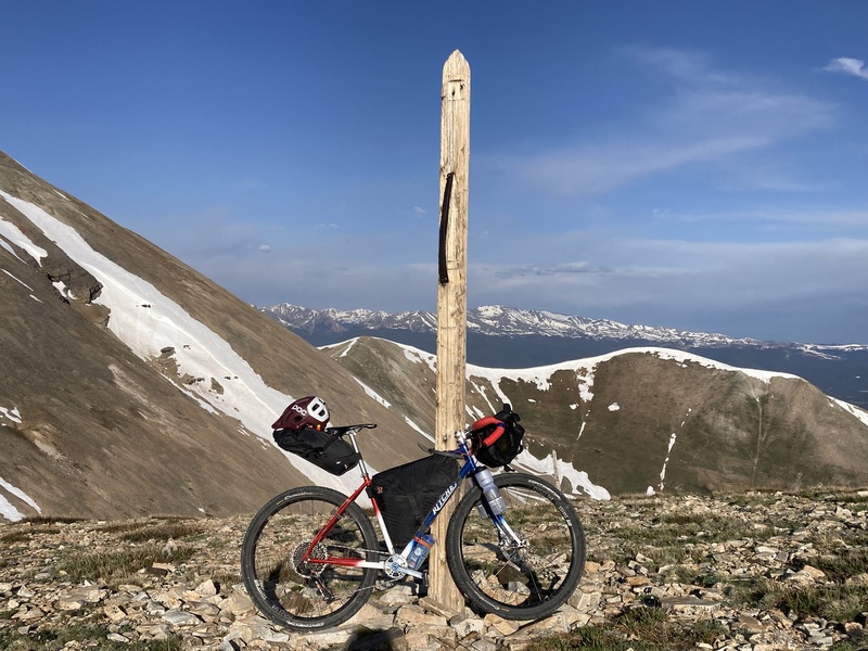
Sawatch Range: Days 3-9 Day 3: Holy Cross - I began the hike up Holy Cross early in the morning on day 3. I had never been up via Half Moon before, as I previously climbed the trail via Halo Ridge, and the terrain felt eerie in the early morning after realizing I was the only person around. There was still quite a bit of snow on the north side of Holy Cross, and I postholed and struggled to find the trail/reasonable way through from 11K until about 12.5K. The rest of the way to the summit was fun, and the views from the top were amazing. After making it back to my bike, the first few miles of the descent on the freshly graded road were tough. I had to stop a few times to squirt water on my brake calipers to cool them down, as there was no relief on the downhill to let them cool. The road climbs back to Leadville were once again hot and steep, and I had to stay on top of food to make sure I didn't bonk. At some point in the previous 3 days my bike had fallen on the derailleur, and I was having trouble shifting into my vital lowest gears. I did a makeshift adjustment on my b-screw, but had to hold my shifter in to stay in low gear. I pedaled fast to Leadville to see if I could make it to a bike shop to get a proper adjustment, and Leadvelo BiciCasa squeezed me in to help me out. Great service and help, highly recommend them. After the repair, I resupplied, ate some pizza, and made my way to the second Halfmoon trailhead of the day. 
Day 4: Massive and Elbert and Bike to Bel/Ox: I approached Massive from the North Massive Trailhead, and had climbed the route earlier in the summer as an altitude training day. In the few weeks since I had been here the snow had melted a lot. I've always really enjoyed Massive and the final ridge push to the summit. Once I returned to my bike and campsite, I made the short trek to the North Elbert Trailhead. It was really hot, and I realized I did not drink enough water on Massive. I tried to get some water down, knowing there likely would not be any places to refill on the way up and down Elbert. I had a tough time on Elbert in the heat, and could feel the general fatigue in my legs. I put my head down and did the best that I could, knowing there would be more days like this to come. After the peak, I did a quick resupply in Leadville and tried to get some calories in, and enjoyed the downhill sections to the turnoff to County Rd. 390. The road was not as washboarded as I remembered, and this was a welcome relief at the end of a hard day. Day 5: Missouri, Belford, Oxford and Huron: Big day, but I knew if I could do it really ill last year that this year should be easier. The hike up to Missouri was great, and I made really good time despite feeling worn down on Elbert the previous day. Once I gained the summit ridge on Missouri, I began to be blasted by wind. At first it was bearable, but it just kept picking up more and more. After summiting, I was beginning to have to brace with each gust so I wouldn't get knocked over. A big gust hit, and I saw my hat float helplessly over the ridge. At this point the wind was really cold, but I also felt like I couldn't get my shell out of my pack without risk of it being ripped away too. I quickly made my way back to the saddle, and enjoyed the wind break on the other side. I hoped to downclimb from the summit to Elkhead Pass, but that was completely out of the question with the wind. I began my unexpected descent of Missouri and hike up Elkhead Pass Trail. As I neared the summit of Oxford, the wind picked up again and almost blew me down several times. On one particularly strong gust, my sunglasses were ripped from my face, and I saw the arms explode on a rock. This was turning into quite an expensive day! In a sour mood, I walked across the summit of Belford and just kept going. My right shin was hurting a little bit, but I blocked it out and continued hiking. After reaching my bike, I stashed my camping gear to reduce weight for the ride up to the Huron trailhead. I reached the trailhead in the early afternoon, and already had close to 9K feet of climbing on my legs. I was tired and grumpy from the wind earlier, but knew the view from Huron would be worth the pain. On top, I enjoyed the view of the Apostles, and fortunately the wind had calmed. I knew I had lucked out again today with the weather, and began the descent. Near the trailhead I saw something dart into the bushes, and realized it was a young mountain lion. I looked around for mom and didn't find her, and kept frequent checks behind me until I reached the trailhead. Day 6: Buena Vista and Yale: The previous day beat me up with around 27 miles of hiking and almost 14K of elevation gain. My shin was hurting, and I was also beginning to feel the effects of being in a big calorie hole. I also realized on Huron that I needed to stop in town to find a hat and sunglass fix, and BV would be my best option for the next week. I had a big breakfast at Brown Dog, followed by more breakfast at City Market, and resupplied for the next few days. Late morning I was pedaling to Silver Creek trailhead to begin Yale. The first miles of trail were fast and I made decent time, but my shin was getting worse. I thought the route to the summit would be class two, but soon ran into some loose terrain that made my shin hurt more each time needed to stabilize. I finally made my way to the summit, but was looking for an easier way down to take some of the pain off my leg. I bushwhacked down a random basin and regained the ridge at a low point. I made it back to my bike, and finished the rest of the ride up to the Harvard/Cottonwood trailhead. Day 7: Harvard and Columbia and Bike to Princeton: After a night of rest my shin felt a little better in the morning, and I began the long approach to Harvard. I was familiar with the route from last year, and was already making much better time. Harvard was windy at the top, but I knew if I could drop down in the basin to traverse to Columbia I could get some relief. My shin started hurting on the ridgeline, and I had to take a break to elevate my leg and try to get the swelling down while I got in some much-needed food. Traverse went by easily and I ran into two more climbers. At the top of Columbia I had to elevate my leg again, and the loose descent really took its toll. I stopped in BV one last time to have some pizza at Elkhorn, recharge electronics, and call my wife. The ride to Princeton was hot, but uneventful. After I passed the camp, I started the long hike-a-bike to try to save some time the next day, and camped around 11K feet. 
Day 8: Princeton and Antero - Princeton was a peak I had only climbed once, and I remembered it was a rocky ascent. The hike up was nice, I ran into a few people, and had the summit to myself. At the top I had enough service to look at the details on the upcoming Antero climb, which I thought was 8-10 miles long, and realized I was in for another 16 miles. Ouch, this took away a few hours I was planning on, plus I had hoped to make the ride to Shavano afterwards. I tried to descend at a good pace, but my right shin continued to slow me down. I had a noticeable limp going on now, and wondered if I had a stress fracture. Each step was a dull pain, and descents left me unstable. I made it to my bike and began the screaming descent down Mt. Princeton Road. At one point my front tire hit sand and I was soon on the ground, but amazingly unscathed, but somewhat shaken at how easily I could have been hurt. 
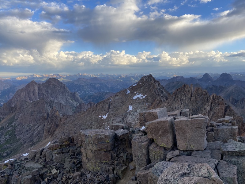
The ride to Mt. Antero was hilly and hot, and I made it to the trailhead a little past noon. Clouds were building, but did not look bad, so I decided to give it a try, and worst case I could make it to treeline and make a final decision. A decade had passed since I last climbed Antero, and I forgot that the entire approach is on a rocky 4x4 road. My shin was not happy, but at treeline the weather was holding so up I continued. While the hike was not fun, the views from the summit were great, and I was once again rewarded with solitude. It felt great to make it back to my bike and be off the 4x4 road. I began my bike to Shavano/Tab, and opted for a "shortcut" on the Colorado Trail. Turns out this was not a shortcut at all due to the rockiness of the trail, and I ended up having to camp somewhere enroute to the trailhead. Day 9: Shavano and Tabeguache: I was riding at first light to try to make up time so I could complete Shav/Tab and ride to Crestone to begin the Sangres. The Colorado Trail relented in rockiness for a few miles and I had hope, but soon the rocks reappeared. It also began to rain with lots of cloud cover, a bad sign for my plans for the day. I eventually made it to the CT/Shavano intersection and quickly got ready. The weather did not look good, but I decided I would try to make it to the saddle and make a decision. I was running low on food, and knew if I could not do the peaks today I would need to backtrack to resupply, and return. On the way up the clouds continued to build and began to get darker. I could hear thunder behind me, but the wind was pushing the clouds up the valley and away from me. I cautiously continued on, and ended up with yet another lucky break in the weather as patches of blue began to show through. I knew I had some limited time to safely summit before the weather returned, so I really dug deep. My shin still hurt, but was beginning to feel better than the previous few days. The views from the peaks were great, but I knew on the summit of Tabeguache that weather was building again and I needed to get down. I was surprised that people were still on the summit of Shavano and seemed unphased by the incoming weather. I rode into Poncha Springs, and knew making it to Crestone tonight would be out of the question. I resupplied on food, and stopped at Red Truck to get a pizza and recharge electronics (great pizza btw). With more energy after eating and having some water I began the climb up Poncha Pass, which was nice in the evening since it was cool and shaded. At the top of the pass the light began to fade, but I realized it was a lot of private property and really no where to camp. I checked my map and found some BLM land about two miles down the road, but when I reached the BLM land the wind was blowing hard and there was an incoming storm. I rode down a sie dirt road a little bit, found a ditch out of the wind, and set up my bivy for a well-earned rest. Day 10: Ride to Crestone and Hike up Cottonwood Creek: I woke up in the morning and felt weird. My nose was runny, my hands swollen, and I couldn't open my eyes all the way. I touched my face and it felt really puffy. I looked at myself on the screen on my phone, and realized I slept in a ditch of plants I was allergic to. Not much I could do except pack up and pedal. I stopped along the way to grab a solid breakfast and get some Benadryl in Villa Grove. At this point my stomach was becoming a bottomless pit. I continued to Crestone, and once again stopped to grab more town food while I could before a big day. I knew at this point that climbing peaks was out for the day, and today would be spent setting myself up for success tomorrow. I biked to Cottonwood Creek Trailhead, organized gear and stashed my bike, then began the mosquito-infested hike up to Cottonwood Lake. I set up camp at the base of Crestone Peak, and battled marmots for the next hour as I tried to eat my dinner and go to bed. Sangre de Cristo Range: Days 11-17 Day 11: Crestone Traverse, Humboldt, Kit Carson and Challenger: My alarm went off at 2:30 AM and I immediately ate a quick breakfast and downed a liter of water. A rough start to the day, but I knew it was what I had to do. I began my ascent up Crestone Peak's red gulley, and it was much more difficult to navigate in the dark. After a few reroutes, I was close to the summit, and also trying to figure out which point above was the actual summit. I made it to the top just in time to see the warmth and colors of the new day begin to show orange over the horizon. I was unsure if the traverse would go, as it was still late June, but decided to give it a go with the snow levels that I saw. The traverse was fun, but right before the fifth class bulge crux there was a big pile of snow, making it necessary to get my shoes wet right before smearing. The crux pitch to the summit was airy as ever, but wow, these peaks do not disappoint! 
I started the descent down to Broken Hand Pass, and tried to remember the correct route down. Originally I thought I would do the Crestones and Humboldt, return to my bike, and climb the Willow Creek 14ers the next day due to how my shin was feeling. I realized I was moving well today and feeling good, and climbing them all in one day was doable if this held up. On the way down Broken Hand I ran into an ER doctor that was climbing 13ers, and we hiked along together and talked. I realized this was my first extended in-person conversation since the trip began, and it was nice to talk to somebody. We parted ways at the junction to Humboldt, and I stocked up on water and began the ascent. Humboldt was fun, and I was feeling really good. I decided that I was going for Kit Carson and Challenger, and began the descent and making my way across Bear's Playground. 


I made my way towards Kit Carson, and enjoyed the perfect weather and views. I ran into another person on the way, and we surprised each other and talked about what we could expect on our routes forward. The final ascent up to Kit Carson was tedious scree, but I made it up and began my descent down to The Avenue. As I started to ascend the Avenue to the Challenger Saddle my mind wandered to making it back to my bike, and possibly getting more food in Crestone that evening. I kept hiking and stepped up on a rock with my left leg, but my right toe caught the rock as I was uplifting, and I immediately felt a tearing sensation in my right shin that put me on the ground and tears in my eyes. I got up, and was immediately limping. I tried to walk it off the best that I could, and got a little relief. I continued on to Challenger's summit, and elevated my leg while I took some time to regroup. I began the descent after some time, but soon realized I had taken the wrong path down and was off route in addition to reinjured. I tried to continue down on what I thought was a way to meet up with the trail, but the terrain got worse. My shin was really unstable at this point, and every step hurt. Eventually I decided the best route was to reascend to the ridge and regain the trail. The descent really hurt, and I was limping badly. The looseness of the trail made it even worse, and I would have sharp bursts of pain. The only way out of this was down, and I had to continue. It took me longer to descend Challenger than it took for me to complete the Crestones just earlier in the day, and once I found the first place to get water and camp I knew I was done for the day, and possibly the summer. Day 11: Back to Crestone and Bike to Culebra- I woke up in the morning and could definitely tell that my shin was injured, but it was not as bad in the morning as it was when I went to bed. My body was doing a great job of trying to mend itself and recover with what little sleep I could provide. I made my way down the trail to make it back to Crestone, and pondered what came next. My reservation for Culebra was the next day, meaning I would have to skip the Blanca/Lindsey group if I wanted to do all 58 peaks. I also knew I was in no shape to do several technical traverses around Blanca, and my summer could be over if I did have a stress fracture. I finally made it to Crestone after a long descent and road walk, and stopped to get some food. I started to look at Google Maps to plan out my new route to Culebra today. I thought it would be 60ish miles, but soon discovered it was 105 miles. I immediately regretted sleeping in, and knew I had to move. I needed to get back to my bike at Cottonwood Creek TH, which was 5 long and hot miles from town along asphalt and dirt roads. After finally reaching my bike, I began pedaling, knowing I needed to average 15 mph to make it to Culebra before dark. Luckily, biking did not hurt my shin, but as I turned south on 17 I began to battle a rough head wind that slowed me down. In Alamosa I knew I needed to resupply, so had to take precious time to get groceries, knowing I would likely miss store hours in Blanca and Ft. Garland due to the time I lost battling the headwind for 30+ miles. The ride was not pretty, but I made it to Culebra a little bit past 11 PM and immediately fell asleep. Day 12: Culebra: My alarm went off at 5:00 AM, in time for me to eat breakfast and try to hydrate before Carlos and his crew met us at the gate to begin Culebra. With recent ownership changes, Cielo Vista no longer allows bicycles on ranch property, and I knew this was a major bummer to my bikepack adventure. Carlos was really kind and professional, but also reassured me that they cannot allow bicycles due to ranch policies, which I knew was coming. He set me up with a car ride to the TH, and I soon began the hike up. My shin really hurt, and I knew that I would have to take a few days off after Culebra to see if I could recuperate. At the summit I met up with a guy named Erik, and we hiked down together and chatted about peaks, Denali and life in general. Erik was kind enough to give me a ride back down to my bike, as Carlos asked me to ask other hikers to get a ride back down to my bike. I rode back to San Luis, got some snacks and a coke at the convenience store, and booked a hotel in Fort Garland for a few days to see if I could get my shin in a spot where I could continue the trip. 
Days 13-14: Rest in Fort Garland: Fort Garland is not the first place in CO I would recommend for a vacation, but my hotel room had a bed, shower, and a few restaurants were nearby. I checked in and found out that due to a water issue, laundry was not available anywhere in town. After 12 days out with only river baths, I needed to wash clothes, so I had to do a bathtub wash. After cleaning up, I immediately got to watching TV, elevating my leg and icing with a vengeance. The next few days were all about giving myself the best shot to try to keep the trip going, and catching up on calories and rest. Ft. Garland's grocery store had closed down, leaving Dollar General as the only place to resupply. This made me think a lot about the access to fresh foods in rural and less affluent communities, and how often those with less face so many more struggles for access to necessities. Day 15: Bike to Lake Como/Blanca: I was cautious about how my shin would hold up, but felt well enough that I was willing to give it a try. Unfortunately my next peaks would be one of the most, if not the most, technical days of the entire trip. I packed up and began to cycle to Lake Como Road, knowing today would be spent camping up high and getting ready for a big day tomorrow. After turning onto Lake Como Road, the road immediately turned to sand about 1" deep. Not an issue for cars, but my bike tires were swimming, and it became easier just to walk my bike. I knew there have been several car break ins on the road, and I was worried about my bike, so I hiked up a few miles and found a hidden spot in some trees to lock up my bike. The hike up to Lake Como was uneventful, and I got ready for bed so I could get an early start in the morning. Day 16: Little Bear, Ellingwood, Blanca: I woke up at 1:30 AM, knowing this could be my biggest day of the entire trip. I hoped to link up Little Bear, Blanca, Ellingwood and Lindsey, but knew there were two technical traverses. I got mixed up in the morning on the route up Little Bear and missed the turnoff and wasted some time. Eventually I found the right turnoff, and luckily had the peak to myself with the early start. Water was running down the hourglass, and several sections were very slick. I had previously only climbed Little Bear with snow over a decade earlier, and soon realized how many rocks are sitting there waiting to fall. I hit the summit of Little Bear with a slight sigh of relief, and started the traverse to Blanca. As I began to descent a big step, I had trouble trusting weight on my right shin, and realized that a 5th class traverse was not going to be the test piece to see if my shin was ok. I accepted that I needed to descend the standard route, and upon reaching the trail began the long ascent to Ellingwood. It was a bummer, but I also knew I was continuing my trip versus ending it, and being safe. Ellingwood went well, and the weather was holding for the day. I began the traverse to Blanca, but already knew that Gash Ridge wasn't happening for me today either. My leg felt better, but descents were still a little stutter step with my right leg. I began the descent down Blanca, and the long hike out on Lake Como. I hate that road. 
I made it back to my bike, and began the long ride towards Gardner so that I could link up Mt. Lindsey separately. Once again, I hit a headwind on the way to Blanca, and just felt defeated. I found a field off the highway, and set up my bivy to get some rest. Day 17: Mt. Lindsey: The ride to Mt. Lindsey and back was going to add over 120 miles and some significant elevation gain to my trip, but hey, at least my trip was continuing. The initial ride went well, but as I got closer to Lindsey the road was really steep! I made it to the trailhead mid-afternoon and the weather looked good, so once again I decided to go for the summit and turn around if needed. Several people descending passed by, and around treeline I had the mountain to myself. The scrambling was really fun on the ridge, and I enjoyed the summit views. After making it down and back to my bike, I began the descent to my camping gear I had stashed lower to save weight on the climb. I opted to go to sleep early and try to wake up early the next day, knowing there was a lot of private property without camping soon after. Day 18: Ride Day to San Luis: I knew it was going to be a long day, with roughly 150 miles to San Luis by bike. I got started early, and by mid-morning I was passing through Blanca/Ft. Garland for the 4th time of the trip. I took a Taco Bell break in Alamosa ($13 for 2000+ calories) and Kristi Mountain Sports was kind enough to air up my bike tires. Monte Vista clicked by, and I decided to resupply in Del Norte, as it offered more options than Creede. It started to rain in Del Norte, so the grocery shop break was a nice way to wait out the storm. It started to rain on me again in South Fork later in the ride, so I stopped to get something for dinner so I could use the remaining daylight to ride. I eventually made it to Creede in the evening, and it continued to rain. I set up camp outside of town on my way to San Luis, and was happy to make it close to my next peak after crossing a lot of the state. Days 19-26: San Juan Range Day 19: San Luis and ride to Lake City: I started riding early in the morning a bit before first light to try to climb San Luis and make it to Uncompahgre and Wetterhorn to camp. It turns out that in the rain the night before I took a wrong turn and ended up in the right area, but the wrong mining road. I was able to correct the mistake, but it took some climbing on the bike and time. I made it to San Luis TH still early in the morning, and changed gear to get ready to hike. San Luis was a fun peak, and just felt remote, mostly because it is really remote. The weather was cloudy and moody, but did not feel like storms were eminent. I made it back to my camp spot a little after noon, packed up gear, and began the ride to Lake City. The climb was really hot, and there was more elevation gain than I expected. I was also feeling the effects of my long ride yesterday. Eventually I crested Slumgullion Pass, and began the descent into Lake City as the sun started to set. I found a decent camp spot in a park, and fell asleep fast. It was July 4th weekend, and I was ready to escape back into the mountains as soon as possible 
Day 20: Wetterhorn and Uncompahgre: This was a day that I had really been looking forward to, as these peaks are simply stunning. I woke up early and had a cold ride to the Wetterhorn Trailhead. I chose this peak first as it had less roundtrip mileage versus starting at Nellie Creek. My legs felt good on the hike up Wetterhorn - some days you're the hammer and some days you're the nail. The scrambling on Wetterhorn was fun, and I was rewarded with one of the best 14er views. 
I continued on to Uncompahgre after descending Wetterhorn, and the view just stayed amazing all day. I started to feel the fatigue of the past few days and the trip - I guess some hours you're the hammer and some hours the nail... I ran into two other climbers Nick and Jacqueline, that recognized me from Lake Como Road. We chatted and realized we were both climbing all the 14ers this summer, and would probably run into each other again based on plans. Unfortunately I couldn't spend much time on the summit of Uncompahgre, as I still had to ride as much of Engineer Pass as possible today, so I began my descent. I made it to about 12,200' on Engineer Pass that evening, and set up a high camp in one of the few flat(ish) spots off the road that I could find. 
Day 21: Sneffels: I slept in a little bit so that the upcoming descent off Engineer into Ouray would be warmer. I topped out on Engineer with alternating riding/hike-a-bike, and got ready for the bumpiness that was to come. Eventually I made it down to the highway, and began the road descent into Ouray. It felt criminal to pass the turn off to Camp Bird/Yankee Boy to descend more, but I needed food. After breakfast and a resupply in Ouray, I began the climb back to Camp Bird, and the long climb to Sneffels. I heard in Ouray that Imogene Pass was closed, which was my planned route to get to the Wilsons after Sneffels. This was a bummer, but I also thought it might be possible to get a bike through. After a few hours of biking, I was at the trailhead for Sneffels, and once again the weather was holding, so I decided to try a mid-afternoon ascent. Sneffels is a lot like Princeton, in that the peak looks so great from afar, but climbing it really isn't the most enjoyable ascent or descent. Redeeming quality for Sneffels is that the summit views are amazing, though. I took some time on top of the peak to enjoy the view after feeling like I snuck this one in. I realized after talking to some 4-wheelers that Imogene on the Telluride side was not plowed, and they showed me a few pictures. It was a tough call, but I decided that riding the road around through Ridgeway and Sawpit was going to be the guaranteed option to make it to the Wilsons, and the snow and slope looked like it would be a dangerous runout to try to hike a bike over. I started to pedal down Camp Bird Road, hoping I could make it back it Ouray in time to catch some food. I made it in time to get a pizza (common theme) and find a park to pitch my bivy in. 
Day 22: Ride Day to Wilson Group: Highway ride to the Wilson group, and while the shoulders were not always the widest, drivers here were really great. Views of the Dallas Divide almost made me forget that I was climbing. It started to rain on me when I made it to the Telluride Business Center, so I took a little break to regroup and get off the saddle. In the early afternoon I did the remaining miles, and turned off on 535/Duncan to make it to Kilpacker TH. I used the rest of the afternoon to hike up high into Navajo Lake Basin to get an early start the next morning Day 23: Wilson Peak, Mt. Wilson, El Diente and ride towards Purgatory: I woke up really early knowing this would be yet another big day. I started the ascent up Wilson Peak, and soon passed the familiar mine cart. After the saddle I started to traverse, but lost the trail, and had some trouble finding where it was. It seems like several of the cairns had been knocked down in the winter, and I couldn't find the ones far away in the dark. After wasting some time, I was on track and scrambling towards the summit. The scrambling reminded me of Mt. Lindsey, and was a lot of fun with solid rock. I saw a few climbers on the descent, and made my way over to Mt. Wilson and El Diente, which would then take me back to the Kilpacker Trailhead to save some miles. 
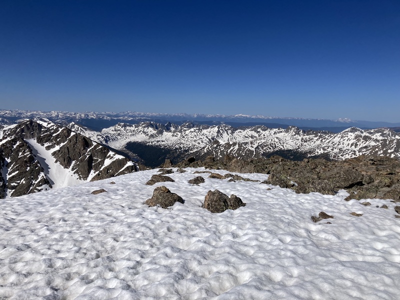
The hike up Mt. Wilson went fine, but at the top I had to get creative to get around a snow field. I also forgot how airy the summit of Mt. Wilson is! I kept thinking to myself, how is this a 4th class hike, then my question was answered in the last 100 feet to the top. Traverse over to El Diente went well, and ran into some other climbers. It looked like clouds were moving in, so I was trying to get down as soon as possible. I wish I could numb the memories of the descent off of El Diente - probably one of the worst descents along with Sneffels. Nothing more to be said other than put your head down and just keep moving. I made it back to my bike, and began the ride to make it as close to Chicago Basin as possible. 
Day 24: Chicago Basin Approach: I took Bolam Pass to Purgatory, hoping that I could get a resupply in Purgatory. I'm not really sure what would be faster- Bolam Pass or Ophir Pass, but Bolam was a nice ride. I made it to Purgatory, but most of the places were closed since the bike park was closed this year. There was a pizza place with garbage pizza, and a few college staff that gave me an eye roll when I asked to buy slices. After trying to get some food in, I made my way to Purgatory trailhead and began the trek to Needleton. The trail alternated between some ridable sections after the initial descent, then a lot of hike a bike, but it was nice to see the Animas again. Finally I made it to Needleton, locked my bike out of sight, and got my overnight gear together so I could hike into Chicago Basin to make the next day shorter. Day 25: Windom, Sunlight, Eolus and N. Eolus and Arrive in Silverton: Another early morning start. There was more snow in the San Juans this year than I expected based on the snow data, and especially Chicago Basin. In the upper basin I needed to cross several snow fields for Windom and Sunlight. On the way up to Windom right at sunrise there was thunder in the distance, sprinkles, and dark clouds. Not a great sign for the day ahead. I decided to keep going up, as the storm clouds were moving away from me. Fortunately this was the right call, but thunder that early definitely put me on the lookout. Windom Peak was a lot of fun, and I was greeted by one of the best sunrises of the trip: 
I descended a snowfield to get to Sunlight a little faster, and started a fun ascent up the peak. Scrambling at the top of the peak was fun, and I had great views of the surrounding Weimenuche. Next it was on to Eolus and N. Eolus peaks, complete with mountain goats. The rock on N. Eolus was the stuff of legend - so grippy and felt like you would walk up anything. Eolus was more loose and just not as good of rock quality. Hard to complain with the views, though. 
I started the descent off Eolus, and made it back to camp and hiked out of Chicago Basin. Such a beautiful place, but it is being loved to death. I made it back to my bike, took a river bath, did some river laundry, then took a nap. I then had a rather bumpy and tedious 11 mile bike ride ( not in Wilderness) , and arrived in Silverton. Unfortunately by this point in the night it seemed like everything in town was closed, and I was out of food. I rode by somewhere with the lights on, and the occupants gave a loud cheer. I realized it was a deli/bar, and stopped in to see if they had any food left. The owners, Chris and Meghan, were super kind, and did in fact have some sandwiches and chips left, and even poured me a beer on the house - calories are calories! If you're in Silverton, definitely recommend Dera Deli and Bar - local and clean ingredients and some really kind owners. By this point it was 11 PM - so I excused myself, rode a few miles out of town, and found somewhere to camp on the way to Cinnamon Pass. Day 26: Handies, Sunshine, Redcloud: I was bummed to miss the start of the Hardrock 100 since it was happening today and I was so close, but also knew I needed to keep moving on. I woke up to one of the coldest mornings I had on trail, and started the steep ride/hike up Cinnamon Pass. The climb went by faster than expected, and I realized I may be able to do all three peaks today. 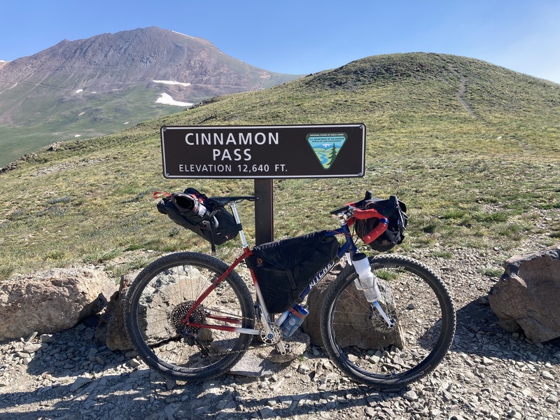
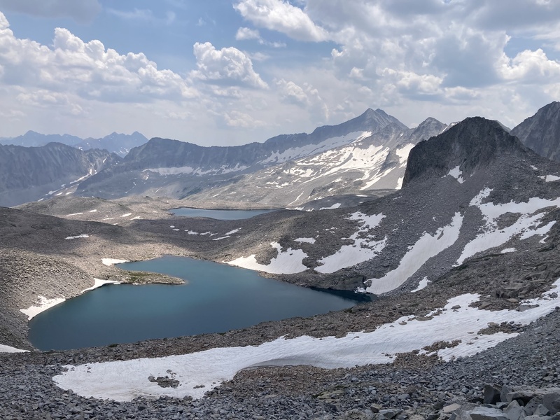
I descended to American Basin and started the climb to Handies. Amazing views and the best wildflowers of the trip. I was hoping to possibly see some of the Hardrock runners on Handies, but I was a bit early. I ate the last sandwich I had from Dera Deli on the summit, and knew I needed to make it to Lake City tonight to get more food. After a few miles I was at the Silvercreek TH for Redcloud and Sunshine, and it was significantly warmer. I started up the trail, and felt tired from the late night and big days. The weather was weird on the ascent, as one side was cloudy and dark, and the opposite side of the ridgeline was bluebird. 
The weather held, so all was good. At this point I was really hungry, but nothing I could do besides try to move faster and get to Lake City. I was hoping I could descend off of Sunshine back to the road, but I didn't see a great option, and knew my hunger was affecting my decision making, so I took the safe route back and retraced my steps to Redcloud. Back at my bike, I began the descent to Lake City, which was much longer than I expected- around 18-20 miles. Unfortunately the grocery store was closed, so I found a Mexican food restaurant and ordered enough food for a family, then made my way back to the park I had camped in previously. San Juan Range- Check. Day 27: Bike to Elk Range/Pearl Pass: This was another long ride day, around 100 miles, and involved a big climb up Pearl Pass at the end. I was really worn down after all of the San Juan passes and peaks, but could start to fathom the end of the journey. I made good time on the road to Gunnison, and stopped for lunch and a resupply. After that, I kept going on the road to Crested Butte, but faced a brutal head wind after Almont. I tried to tuck as much as I could, but it just zapped my energy. I turned onto Brush Creek Road, and was on much more familiar terrain from previous bikepacking adventures. The climb up Brush Creek went well, but eventually I hit terrain where I needed to hike my bike. Around 10-11K, the hike-a-bike was pretty intense over several scree fields - this was probably the roughest road I had to hike my bike up. I made it pretty close to the top of the pass when it got dark, but I couldn't pass up ( pun intended) a flat camp spot, and was soon asleep. Days 28-33: Elk Range Day 28: Castle and Conundrum: I woke up early the next morning, and finished the ascent of Pearl Pass, and descended to Montezuma Rd. I was on my home turf, and it felt great to be back. I locked my bike up, and started the hike up to the trailhead. The ascent up Castle was uneventful, but I could definitely feel all of the fatigue built up in my legs. I chatted with a few climbers on the summit about the Elk peaks, then continued on to Conundrum. On the return trip to Castle, my legs were just beat. While I enjoyed the ascent and familiarity of peaks close to home, I knew I needed to take some rest to safely finish the adventure. 

Day 29: Rest Day at Home: After the descent from Castle and Conundrum, I made it to Castle Creek road and began the familiar ride to Hwy 82 and the ride to my house. It was great to see my wife and dogs as I rolled up to our home! The next few days were full of rest, relaxation, and eating. It felt really weird to turn on a tap and have immediate access to water, and to take my dogs on an easy morning ramble. I knew a few days off would give me the rest that my body desperately needed to finish the trip strong. Day 30: Capitol and Snowmass: I woke up really early and began the ride to Snowmass Creek Trailhead. This allowed me to climb Capitol from Moon Lake, and cross Pierre Lakes Basin to link up Snowmass. After turning off the main trail and crossing West Snowmass Creek, the trail was easy to follow for a few miles, but then became really difficult to find, and I've done the trail several times. I lost the trail here and there as it petered out, and eventually just made my own way. I boulder hopped after the Daly saddle, and made my way below K2. I ran into a solo climber named Connor there that asked if he could join me up to the summit, and it was nice company chatting with him. We made our way up to the summit, and enjoyed the view. After the descent and return past K2, we said goodbye and I proceeded the descent into Pierre Lakes Basin. Such a beautiful place that I have been meaning to visit for years now. 

Unfortunately on the descent, and really on Capitol, something felt off and my shoes were not gripping the rock well. At home I had thrown out the shoes I had used all trip and switched to another shoe, and the rubber was just slipping off of the rock . Not the peaks you want that to be happening on. I had to proceed carefully through the boulder hop of Pierre without as much grip as I would like. Around the low point of Pierre Lakes a storm rolled in with lightning, so I took shelter and waited it out in a safe spot. After the storm passed, I decided that Heckert Pass gave me more bail options and less exposure than a shortcut by Satan's Ridge, so opted for this route since another round of storms later seemed possible. It was a lot more boulder hopping to Heckert and took more time than expected. After reaching Heckert, I descended and made my way towards Snowmass. The weather was still something I had to keep an eye on, but steady enough to keep going. Snowmass was actually more Mass than Snow this year, so there was a lot of boulder hopping that was tedious in shoes without great grip. I made it to the ridge, and there was some fun scrambling to the summit. Weather looked like it was rolling in around me, so I tried to move as fast as I could to summit and make it back to the lake. This was a big day, and it took longer than expected. I think footwear added some time, but general fatigue was a major factor at this point too. I knew there was the possibility I may not finish in daylight, so took some light insulated gear and emergency bivy incase I needed to sleep out. Around the log jam the light faded, and I decided to try to get some rest and finish the descent in the morning. Day 31: Pyramid Peak: I continued the descent after a 3 AM wakeup call, and made it back to my bike early in the morning. With the weird timing of getting out, I thought another peak today was out of the question, so rode back home to take a shower and eat. Around noon I looked at the weather and really liked what I was seeing, so decided to ride up to the Bells to see if Pyramid was an option. I locked my bike up at Maroon Lake parking lot, and started the ascent up to Pyramid. Unfortunately I went past the first water crossing without filling my bottles, and the other usual sources were dry ! It was hard to find water, but eventually found some in the amphitheater. Pyramid went really well, and was a fun scramble up to the summit. Views at the top were great, and I got a good look at the Bells for the following day. 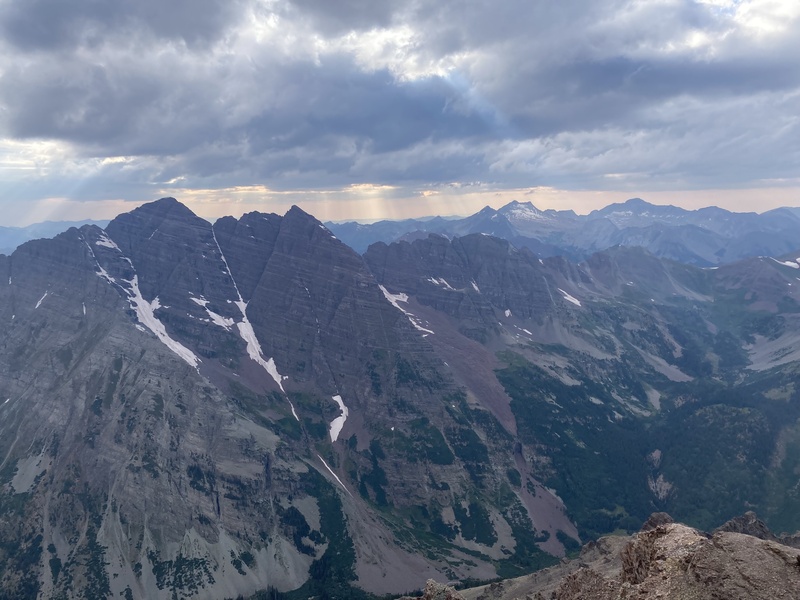
I had lucked out so many time on weather this trip that it seemed to be the norm. I started the descent off of Pyramid, knowing that it would be dark at some point past the amphitheater. It was a fun descent, and kinda weird to be on the peak with nobody else on it too. I made my way back to the main trail by headlamp, and turned towards Crater Lake, where I had a campsite reserved. Day 32: Da Bells: Another early wakeup call. After such a late day on Pyramid, I was surprised to feel so well heading up Maroon Peak. The weather was a little weird for so early in the morning, with more cloud cover than I would like. Based on the previous day, I thought it would burn off. Near the Maroon Peak saddle, it started to sprinkle harder, and the wind picked up. I already had my rain shell on, but also put on my rain pants. There was another group of 3 putting on rain gear and turning around. It was cold, and not the day I expected. I also did not want to have to turn around and have to resupply, and ride back up. I decided to try Maroon Peak, knowing I could turn around if needed, and also being familiar with the peak. I ran into another group a few hundred feet higher at the first gulley that were turning around. I kept going, but my hands were really cold grabbing handholds as the terrain turned to 3rd class. Slowly, the sprinkles turned to drizzle, the wind subsided, and then the drizzle stopped and it was just cold. As I neared the middle of the second gully, the sun tried to poke out, and the rock started to dry. I thought the traverse was out of the question, but Maroon was doable. As I got closer to the summit, the sun started to shine more, and the rock started to dry out even more. I thought that I could always go to the Bell Cord saddle and see if the first crux was dry. When I arrived at the Bell Cord, the weather was nice and the rock was dry, so I decided to do the traverse, knowing the crux areas were getting sunshine or more shielded from the rain. The traverse was fun, it felt so weird to have both Pyramid and the Bells to myself the past two days. I've done the traverse several times, but otherwise would have turned around at Maroon Peak given the weather and possible wet rock if it were my first attempt. I haven't done North in a few years, so the descent took some memory, and there were a lot of missing cairns for earlier in the season. Eventually I made it back to my campsite, and made it into town for a resupply , then began the ride over Independence Pass to La Plata. I made it to a campsite near La Plata well before dark, had dinner, then got to bed early. 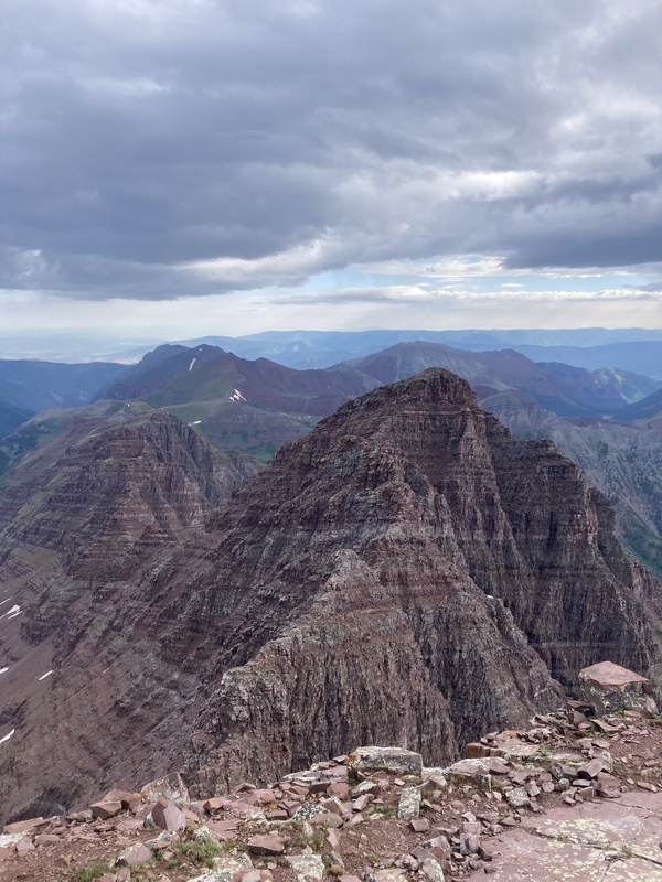

Day 33: La Plata and ride to Grays/Torreys: Another cold and drizzly morning, and I thought my weather luck may be running out. When I made it to the trailhead in the dark I was surprised to see so many cars- they seemed to be at least 1/2 a mile from the trailhead, but it was a Saturday. I rode up the road, then transitioned to hiking gear. Initial trail was easy and went pretty fast. Around treeline, it started to rain again and the wind picked up, enough so that I needed rain jacket and pants. It really wasn't an enjoyable hike to the summit given the crowd and the wind. I hit the summit, then immediately turned around and started the descent. It was a little past 10 AM when I got back to the trailhead, but I knew I had a big ride of around 90 miles to the backside of Grays and Torreys. I rode to Leadville and stopped for a pizza at High Mountain Pies, and really was feeling the calorie hole my body was in. After Leadville, it was a climb over Fremont Pass to catch the bike trail to Frisco, then on to Keystone and Little Peru Creek. I found a good camping spot in Little Peru Creek as the sun was setting that I couldn't pass up. Day 34: Grays and Torreys: Early morning wakeup, and a few miles in the dark on the bike. The goal today was to hike my bike to the top of Argentine Pass, summit Grays and Torreys over Mt. Edwards, and then ride to Evans and Bierstadt. I made it to the road closure, and it was hike-a-bike time. The ascent up Argentine Pass was narrow single track, but not too bad. At the top of the pass I locked my bike up more for appearances than actual security, then started the trek over to Grays and Torreys. Knowing it was a weekend and the crowds I encountered yesterday, it was nice to be on a more remote trail. Grays was fun, but there were some annoying groups up on Torreys that were obnoxiously loud. Eventually, I made it to my bike and started the descent down Argentine. 
The descent down Argentine was rough, and I had to hike a lot more than expected. My tires were pretty worn after a month out, and the road had enough side slope and loose dirt that I was more pointing and hoping versus steering. It relented a few times, but I almost yearned for the descents in the San Juans versus this stuff. Eventually, I made it down and started up towards Guanella Pass. Day 35: Blue Sky and Bierstadt: Another big day to do these two peaks, then ride to the Longs Peak trailhead after, so an early start. I reached the summit of Bierstadt around sunrise, and enjoyed the view. Next was the Sawtooth traverse, which I hadn't done in well over a decade. It was fun, but less on the ridge than I remembered. Finally, there was the hike over to Blue Sky. I forgot that Blue Sky road was closed this summer for construction, so it was a nice surprise and unique experience to have the summit to myself. I saw a group of mountain goats chasing each other up high, After a nice summit break, I returned and descended via Gomer's Gully. It was still fairly swampy at the lower points, but I was able to wash off in the creek where it meets the main trail. I made it back to my bike, and it was a fun and fast descent back to Georgetown. 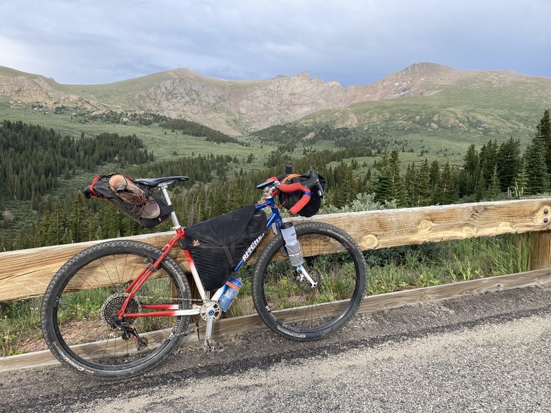
After lunch in Georgetown and classing up the picnic area with a gear dry out session, it was off to Longs Peak. My route sent me over Little Hamlin Gulch to Mammoth Gulch and Tolland, and if I had it to do over again I would take Peak to Peak from Idaho Springs. Many sections of the route were unrideable and hike-a-bike, and at this point in the trip it was a lot of unexpected to handle. There were some really pretty sections, but it seems like it did add time to the bike, and navigation was difficult. I finally made it to Longs around 11 PM, and settled in for a short. bivy sleep. My buddy Danny and his friend were climbing the Diamond the next day, and we hoped to be able to catch each other at the trailhead and say hello early the next morning. Day 36: Longs Peak : I woke up around 2:30 AM and had a some breakfast and got ready for the day. Danny and Anton rolled in around 3:30 AM, and we got to say hey while they were getting their gear finalized. I started the hike up Longs, and felt really good on the trail and made decent time for being out over a month. I made it to the keyhole, and started the scramble. It was windy at times, then warm, and eventually I was at the homestretch and had the summit to myself for a little while. Descent down was uneventful, and when I got to the TH Danny and Anton were there after a successful Diamond climb, and we got to catch up more and talk about life, bikes and adventures. Thanks for the donuts, guys! I got in some more food, and started my descent to Boulder to catch the Highway 36 bike path to Cherry Creek in Denver. In Boulder it was more food, and also a quick detour to get some fresh socks, as my feet were hurting with every pedal stroke. The Hwy 36 bike path was a nice, and quite the change from riding rural roads. I was in a weird spot timing wise that put me in downtown Denver around dark, but fortunately my cousins that live close by were happy to have me stay at their place. It was great to catch up with them and also get some rest after a long day. As a side note, later on my ride I found out that Cherry Creek State Park offers camping if anybody is doing Tour de 14er and needs somewhere to stay between Longs and Pikes. 

Day 37: Ride Day to Pikes: It is about 160 miles from Longs to Pikes, so I had to split it up into two separate days. Riding the bike paths was pretty fun through Denver, and something I don't get to experience normally. It was also such a huge contrast to what I had experienced for the past month plus. At Palmer Lakes I took Mt. Herman road, and this was a really cool shortcut to Woodland Park. Definitely one of the few shortcuts that was enjoyable and actually saved time on the trip. Dinner and resupply in Woodland Park, then a dreaded ride on Hwy. 24 to Divide. It was raining on my Hwy 24 ride, and it was rough with traffic. Had a few drivers and a motorcyclist go out of their way to be @$$holes, but there were also many others on the road that were kind. I made it to the turnoff for Crags, and started my final dirt road climb and bivy of the trip. Day 38: Pikes and bike to Breckenridge: Pikes was my first 14er, so it was full circle that it was my last 14er of this trip. I still had a big ride to Breckenridge at the end of the day, so I needed an early start well before sunrise. The hike was very quiet, and I had the peak to myself and caught sunrise above treeline. Upon reaching the summit, it was quite different than the last time I was up there! I enjoyed the views with some moody clouds over the plains, then began my descent. The view from the top was beautiful, and a fitting farewell to the trip. The rest of the ride back to my starting point at Quandary TH was uneventful, and not quite the sunrise sendoff I had earlier in the day. I feel so fortunate to have been able to do this trip, and it's something I will always carry with me. 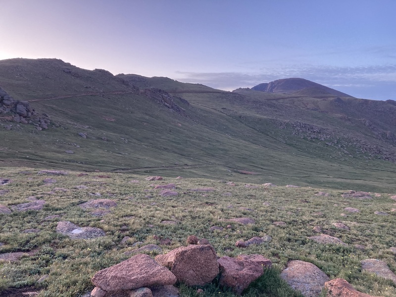

Gear List: (may be forgetting a few things)
Closing thoughts:
Thanks for reading, and let me know if you have any questions! Thank you's: My amazing wife for the support and making this trip possible, my friends and family for the support and words of encouragement, my cousins for hosting a smelly bike-packer short-notice, my dogs for eventually forgiving me after I returned (I bribed them with bones), the random hiker that gave me a generous spray of Off at Willow Lake, CFI for the amazing trail work, Aloha Cycles in Carbondale, CO and Dirt Service Center in Aspen for bike service, courteous drivers and all of those that help protect our public lands. Thumbnails for uploaded photos (click to open slideshow): ")
")
")
")
")
")
")
")
")
")
")
")
")
")
")
")
")
")
")
")
")
")
")
")
")
")
")
")
")
")
")
")
")
")
")
")
")
")
")
")
")
")
")
")
")
")
")
")
")
")
|
| Comments or Questions | ||||||||||||||||||
|---|---|---|---|---|---|---|---|---|---|---|---|---|---|---|---|---|---|---|
|
Caution: The information contained in this report may not be accurate and should not be the only resource used in preparation for your climb. Failure to have the necessary experience, physical conditioning, supplies or equipment can result in injury or death. 14ers.com and the author(s) of this report provide no warranties, either express or implied, that the information provided is accurate or reliable. By using the information provided, you agree to indemnify and hold harmless 14ers.com and the report author(s) with respect to any claims and demands against them, including any attorney fees and expenses. Please read the 14ers.com Safety and Disclaimer pages for more information.
Please respect private property: 14ers.com supports the rights of private landowners to determine how and by whom their land will be used. In Colorado, it is your responsibility to determine if land is private and to obtain the appropriate permission before entering the property.


