Download Agreement, Release, and Acknowledgement of Risk:
You (the person requesting this file download) fully understand mountain climbing ("Activity") involves risks and dangers of serious bodily injury, including permanent disability, paralysis, and death ("Risks") and you fully accept and assume all such risks and all responsibility for losses, costs, and damages you incur as a result of your participation in this Activity.
You acknowledge that information in the file you have chosen to download may not be accurate and may contain errors. You agree to assume all risks when using this information and agree to release and discharge 14ers.com, 14ers Inc. and the author(s) of such information (collectively, the "Released Parties").
You hereby discharge the Released Parties from all damages, actions, claims and liabilities of any nature, specifically including, but not limited to, damages, actions, claims and liabilities arising from or related to the negligence of the Released Parties. You further agree to indemnify, hold harmless and defend 14ers.com, 14ers Inc. and each of the other Released Parties from and against any loss, damage, liability and expense, including costs and attorney fees, incurred by 14ers.com, 14ers Inc. or any of the other Released Parties as a result of you using information provided on the 14ers.com or 14ers Inc. websites.
You have read this agreement, fully understand its terms and intend it to be a complete and unconditional release of all liability to the greatest extent allowed by law and agree that if any portion of this agreement is held to be invalid the balance, notwithstanding, shall continue in full force and effect.
By clicking "OK" you agree to these terms. If you DO NOT agree, click "Cancel"...
| Snowmass - East (sort of direct) |
|
Started on trail 6/6/2025. Weather was spotty with rain. According to the weather, we were going to have a great window of sunny skies the next day. It has been raining and snowing all week. Be sure to look up at the cliffs on the left side as you hike up the 9 miles to Snowmass Lake. The log jam wasn't as bad as everyone and every trip report made out to be. There are two options to cross. The first option is shorter with plenty of log options. We chose this option and used trekking poles to assist with balance. The second option was about twice as long and not as many log options for the cross. Remember that logs get very slippery when wet. We saw plenty of deer, marmots, and a rabbit on the way up to camp. About half a mile before Snowmass Lake there was spots of snow to hike in, but it really wasn't that bad. When we got to the lake, we were amazed by the backdrop of the scene in front of us. At the exit of Snowmass Lake where it turns into the creek, we noticed about 30 trout in the very shallow water. Most of them were about 2ft long. Found a good camp spot with no snow on the NE side of the lake.
Woke up at 3am on 6/7/2025 for out summit attempt. Weather was about 35 degrees. Right off the bat we were in the snow as we maneuvered the willows on the South side of the lake. Most of the snow was still firm, but there was still little post holing. Snowshoes would've helped, but weren't needed. Got to the boulder scramble on the West side of the lake. As noted in other reports, this rock is very loose. Since it had been raining and snowing all the week prior, the rock was even more loose than usual. Remember to not scramble above anybody. At the top of the boulders, we made our first steps onto the snowmass. With our gaiters, crampons, and ice axe, we ascended up towards the ridge. The snowmass is long and daunting. Around sunrise, we could already feel the snow softening up. I kept as the lead moving up toward the ridge. We went up one couloir to the left of the "official" direct approach. At this point it was about 8am and had to pay extra close attention to the snow conditions. As the snow grade steepens, be aware of wet slab avalanches. In our couloir, we made an apparent class 4 move up an 8ft slab and gained the ridge. We were immediately welcomed by exposure. One false move or slide, and you go down the back side of the ridge. Again, with there being a layer of fresh snow from the last week, there were no tracks to follow. We stayed as close to ridge proper as we could. Made a couple small traverses where the snow gave way. Be sure your footing and holds are secure before each move. Gained the summit at about 9am. Weather was about 30 degrees with wind gusts of 25mph. It was definitely chilly, but man WHAT A VIEW. We ate our summit snacks and took plenty of pics and made our decent. It was obviously easier going down because we had our own tracks to follow. We dropped down the same couloir we ascended up. With how slushy the snow is at this point, there was little glissading. Stayed on the snow as much as we could down toward the lake. Coming back through the willows was obviously worse than this morning as each step, we'd sink a couple feet. Once at camp, we took a quick nap, cleaned up and headed for the car. About a mile before the TH we encountered a bear. Be sure to bring bear spray. As always, the car was a welcoming site. Overall a solid trip with challenges that made the experience worth it.
My GPS Tracks on Google Maps (made from a .GPX file upload):
Thumbnails for uploaded photos (click to open slideshow):
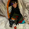
 Approaching camp at Snowmass Lake")
 Snowmass Lake")
 Moments before sunrise on the snowmass")
")
 Took a somewhat direct route")
 No prints in the snow to follow. Finding our own way on the ridge.")
 Summit")
")
")
|
Caution: The information contained in this report may not be accurate and should not be the only resource used in preparation for your climb. Failure to have the necessary experience, physical conditioning, supplies or equipment can result in injury or death. 14ers.com and the author(s) of this report provide no warranties, either express or implied, that the information provided is accurate or reliable. By using the information provided, you agree to indemnify and hold harmless 14ers.com and the report author(s) with respect to any claims and demands against them, including any attorney fees and expenses. Please read the 14ers.com Safety and Disclaimer pages for more information.
Please respect private property: 14ers.com supports the rights of private landowners to determine how and by whom their land will be used. In Colorado, it is your responsibility to determine if land is private and to obtain the appropriate permission before entering the property.
 Approaching camp at Snowmass Lake")
 Snowmass Lake")
 Moments before sunrise on the snowmass")
")
 Took a somewhat direct route")
 No prints in the snow to follow. Finding our own way on the ridge.")
 Summit")
")
")