Download Agreement, Release, and Acknowledgement of Risk:
You (the person requesting this file download) fully understand mountain climbing ("Activity") involves risks and dangers of serious bodily injury, including permanent disability, paralysis, and death ("Risks") and you fully accept and assume all such risks and all responsibility for losses, costs, and damages you incur as a result of your participation in this Activity.
You acknowledge that information in the file you have chosen to download may not be accurate and may contain errors. You agree to assume all risks when using this information and agree to release and discharge 14ers.com, 14ers Inc. and the author(s) of such information (collectively, the "Released Parties").
You hereby discharge the Released Parties from all damages, actions, claims and liabilities of any nature, specifically including, but not limited to, damages, actions, claims and liabilities arising from or related to the negligence of the Released Parties. You further agree to indemnify, hold harmless and defend 14ers.com, 14ers Inc. and each of the other Released Parties from and against any loss, damage, liability and expense, including costs and attorney fees, incurred by 14ers.com, 14ers Inc. or any of the other Released Parties as a result of you using information provided on the 14ers.com or 14ers Inc. websites.
You have read this agreement, fully understand its terms and intend it to be a complete and unconditional release of all liability to the greatest extent allowed by law and agree that if any portion of this agreement is held to be invalid the balance, notwithstanding, shall continue in full force and effect.
By clicking "OK" you agree to these terms. If you DO NOT agree, click "Cancel"...
We departed the Ruby Gulch Trailhead at ~5:30am. Road was clear and parking was plentiful!
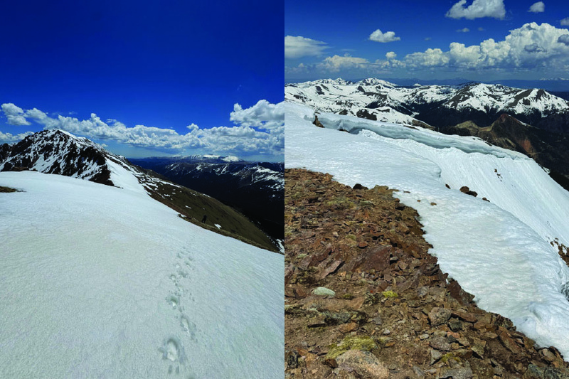
We started up the main trail. At about 0.70 miles, there is a slight 'wiggle' in the trail. Here, we turned left and started our ascent of Engelmann. This is a very steep climb with minimal trail, especially through the grassy area.
Engelmann Peak summit via northwest slopes is no joke. This is a solid ~1.5mi grind with a limited trail.
Next up: Robson Peak!!!
8: The route to Robeson Peak, easily the most straightforward summit of the day
It was a pretty simple walk up Robeson (~1mi) from Engelmann, the least difficult and stressful part of the day. Next up: Bard Peak!!!
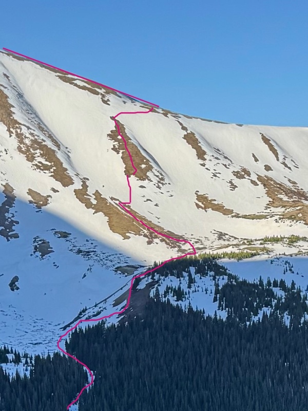
10: From Robeson summit, looking for a line to Bard Peak. We took some advice from helpful tracks to get started!
From Robeson to Bard, we stayed aways left of the ridge line, successfully avoiding steep snow on this ascent.
11: From Bard Peak, view of the sawtooth, Greys and Torreys, and Grizzly Peak
Bard Peak is a pretty strenuous ~1.5mi from Robeson but is SE facing so the snow was minimal.
12: In and out of snowshoes heading down Bard on the ridgeline to Parnassus
13: Back in snowshoes up the ridge to Parnassus, view looking back at Bard Peak and ahead to a nice cornice on Parnassus
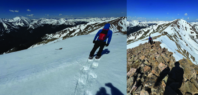
THE HARDEST 1.5mi of the day, an absolute grind up the ridge between Bard and Parnassus leads to the summit. We choose to veer a bit left of the ridge (not obvious in the GPX) to avoid snow.
14: Our descent route off of Parnassus Ridge
We had a bit of trouble finding the right line (obvious in the GPX) to descend the ridge. We know we wanted to be ahead of the low point and a ways away from the slides to the right (towards Woods Mtn). We crossed the first snow section with snowshoes and glissaded the second. After that, the remaining rout was fairly straightforward; avoid thickets and head toward the Ruby Gulch Trail.
15: And finally back on the Ruby Gulch trail, with a promising view of Red Mountain
My GPS Tracks on Google Maps (made from a .GPX file upload):
Thumbnails for uploaded photos (click to open slideshow):
Comments or Questions
Caution: The information contained in this report may not be accurate and should not be the only resource used in preparation for your climb. Failure to have the necessary experience, physical conditioning, supplies or equipment can result in injury or death. 14ers.com and the author(s) of this report provide no warranties, either express or implied, that the information provided is accurate or reliable. By using the information provided, you agree to indemnify and hold harmless 14ers.com and the report author(s) with respect to any claims and demands against them, including any attorney fees and expenses. Please read the 14ers.com Safety and Disclaimer pages for more information.
Please respect private property: 14ers.com supports the rights of private landowners to determine how and by whom their land will be used. In Colorado, it is your responsibility to determine if land is private and to obtain the appropriate permission before entering the property.


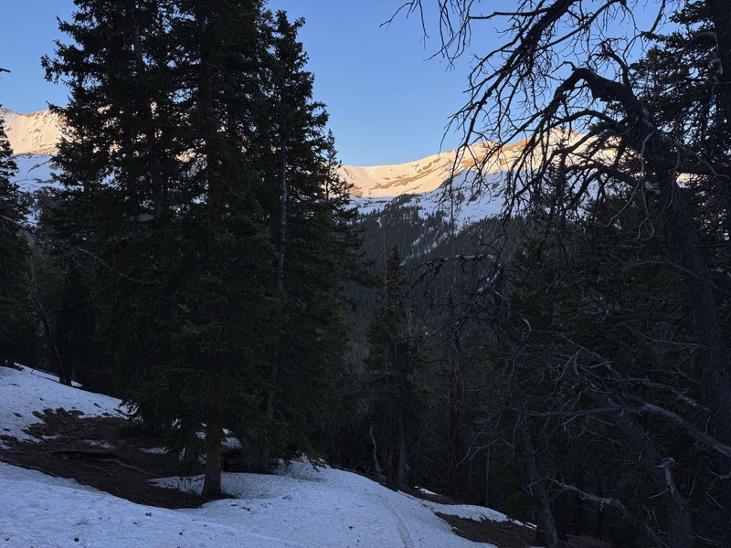

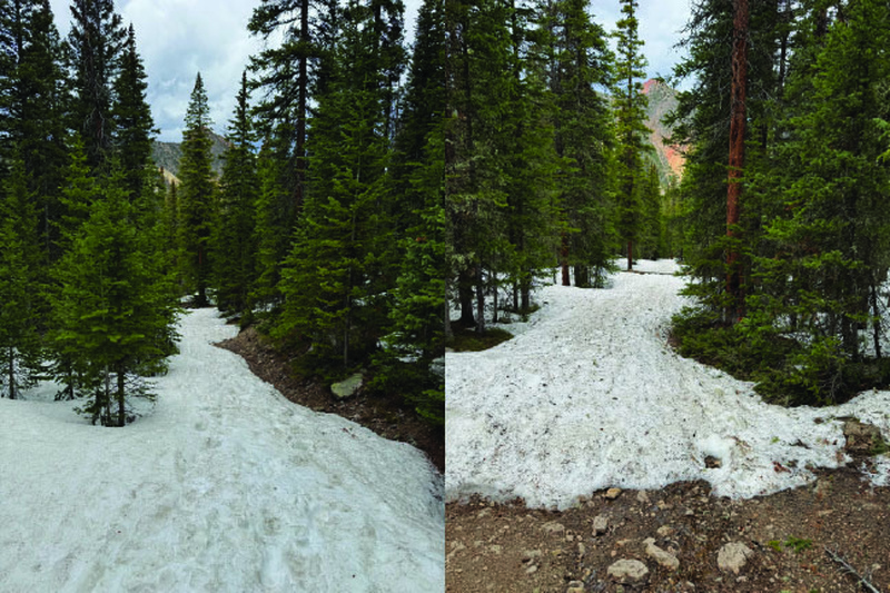
 2: There was a decent path to follow through the trees (with some good snow!)")
 3: Finally out of the trees on Engelmann and a real view Robson, Parnassus, and Woods and of the Bard - Parnassus saddle")
")
 5: At the end of the grass, find the pole in the rock to continue along a faint trail to the right of the false summit")
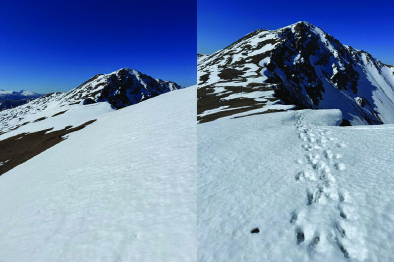
 10: From Robeson summit, looking for a line to Bard Peak. We took some advice from helpful tracks to get started!")
 12: In and out of snowshoes heading down Bard on the ridgeline to Parnassus")
 13: Back in snowshoes up the ridge to Parnassus, view looking back at Bard Peak and ahead to a nice cornice on Parnassus")
 15: And finally back on the Ruby Gulch trail, with a promising view of Red Mountain")
 1: Finally a view of the Parnassus - Woods saddle after gaining some elevation on Engelmann")
 14: Our descent route off of Parnassus Ridge")
 6: Up the chossy rocks from here!")
 7: On the summit of Engelmann Peak, nice view of Robson, Bard, and Parnassus ahead of us!")
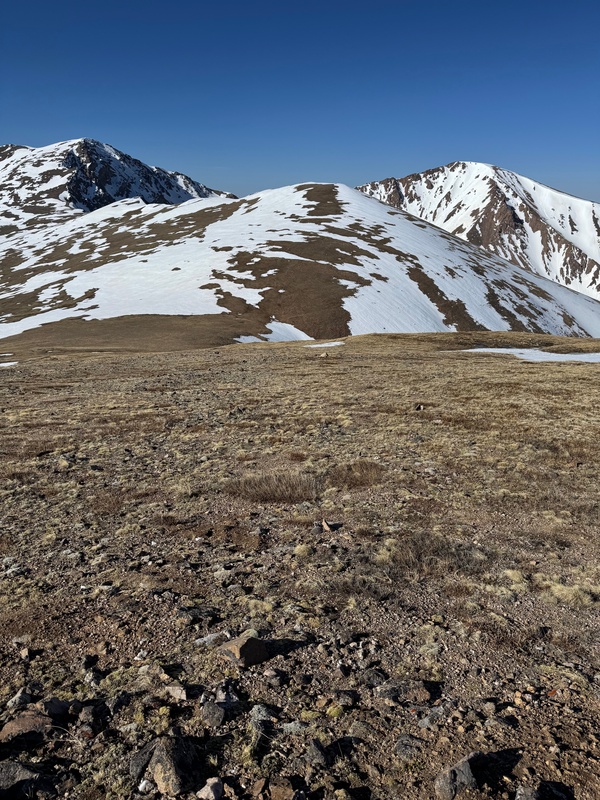
 8: The route to Robeson Peak, easily the most straightforward summit of the day")
")
 11: From Bard Peak, view of the sawtooth, Greys and Torreys, and Grizzly Peak")