Download Agreement, Release, and Acknowledgement of Risk:
You (the person requesting this file download) fully understand mountain climbing ("Activity") involves risks and dangers of serious bodily injury, including permanent disability, paralysis, and death ("Risks") and you fully accept and assume all such risks and all responsibility for losses, costs, and damages you incur as a result of your participation in this Activity.
You acknowledge that information in the file you have chosen to download may not be accurate and may contain errors. You agree to assume all risks when using this information and agree to release and discharge 14ers.com, 14ers Inc. and the author(s) of such information (collectively, the "Released Parties").
You hereby discharge the Released Parties from all damages, actions, claims and liabilities of any nature, specifically including, but not limited to, damages, actions, claims and liabilities arising from or related to the negligence of the Released Parties. You further agree to indemnify, hold harmless and defend 14ers.com, 14ers Inc. and each of the other Released Parties from and against any loss, damage, liability and expense, including costs and attorney fees, incurred by 14ers.com, 14ers Inc. or any of the other Released Parties as a result of you using information provided on the 14ers.com or 14ers Inc. websites.
You have read this agreement, fully understand its terms and intend it to be a complete and unconditional release of all liability to the greatest extent allowed by law and agree that if any portion of this agreement is held to be invalid the balance, notwithstanding, shall continue in full force and effect.
By clicking "OK" you agree to these terms. If you DO NOT agree, click "Cancel"...
Backstory 14ers.com has been a resource for me for almost 15 years. I grew up in Colorado Springs, and while my family loved to hike around locally, I didn't grow up in a mountaineering or climbing family. When I was 10, a new sandwich shop called "Which wich," first introduced me to this site. They were running a deal where you could earn a free sandwich for every 14er you climbed (if you took a picture with one of their bags on the top). They had a list of every peak on this little waiver, and I remember going home and googling each one. I was blown away by the pictures of Capitol Peak, Crestone Needle, Wetterhorn, etc... now aware that the Himalayas were right in my backyard. My mom realized this deal would be a perfect way to take us on trips and get some free food out of it! This sparked a long-standing love for Colorado's mountains. I became obsessed with this website, the trip reports, pictures, and any media I could digest about these peaks. I was glued to Gerry Roach's guidebook, and it became a necessity for me on any long car ride. Over the past few years, I've used the site mainly for the map feature, but recently, I've had more desire to add my own reports. This one is a couple of years late, but I figured better late than never.
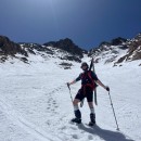
My first time up Capitol was in August of 2019. It was surreal to walk across the famed "Knife Edge" and dip in Capitol Lake. Later that fall, I finished the 14ers (besides Culebra) and began learning to rock climb outdoors after bouldering in a gym for 3 years or so. At first, it was just a fun "workout" to escape the monotony of competitive team sports, but I quickly fell in love with the movement of climbing. I learned to trad climb on a NOLS course, and by the spring of 2020, I was hoping to check out many of Colorado's classic alpine multi-pitch routes. I met a new partner, Matt Randall, and we began a strong climbing partnership. We checked out many routes together, including the Ellingwood arete on Crestone, the Prow on Kit, Petit Grepon, Zowie Tower, and eventually the Diamond on Longs. The 2 weekends that we weren't able to link up, we found different partners, and each led every pitch on the NW buttress of Capitol.
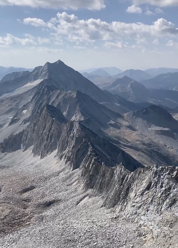
The NW buttress was one of the scrappier of all these routes, but it went well for both of our parties. We both enjoyed the route, finding it less daunting than the Mountain Project comments led us to believe. I remember sitting on the summit, dreaming of one day connecting Capitol and Snowmass. It was easily the most impressive connecting ridge on any of the 14ers, in my opinion. Matt texted me he had the same thoughts, and we started talking about making it happen together. We both did plenty of research, inspired by the big efforts and attempts up there. A key report was from Noah McKelvin, who climbed the ridgeline with 2 others back in 2010. This report can still be found on here! We read about the legendary Lou Dawson, who climbed the NW Buttress in Winter, as well as skied Capitol. Other routes had been put up on the North Face as well, including a winter mixed climb, which topped out near the Knife edge. It was clear there were many significant ascents off the beaten path... or knife edge. We didn't, however, find information of anyone climbing the North Face and connecting the traverse to Snowmass, an obvious and lofty objective.
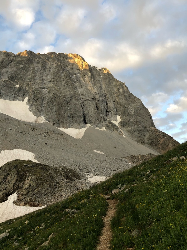
Approaching the NW Buttress, the line takes the right skyline in up to 13 pitches of climbing. Each party will climb it differently. On this day, we did it in 7, with a little bit of Simul Climbing and Soloing.
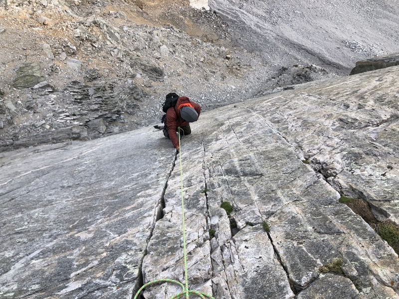
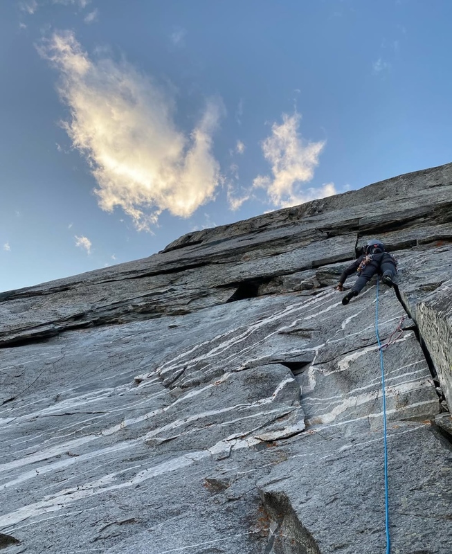
David Sandberg, coming through the crux pitch. This beautiful 5.9 crack throws all kinds of jams at you. Hardest part of the route right off the bat.
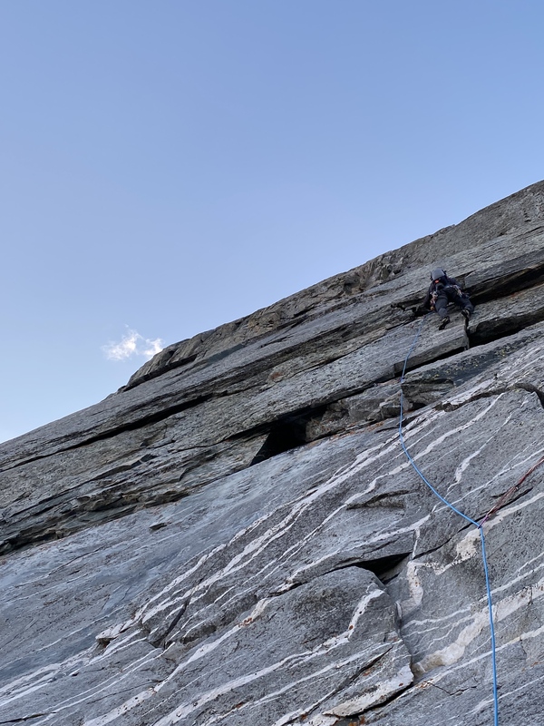
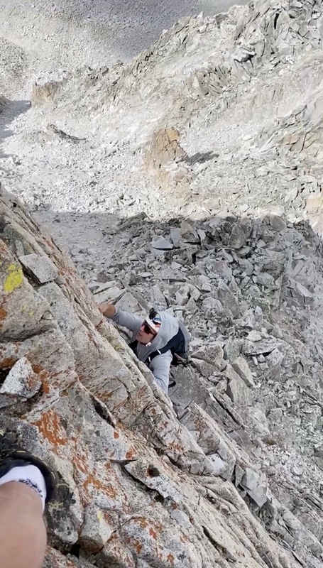
Midway up on the buttress, in the more scrambly section.
Dave wore a pair of his homemade boots from the summit back to the car... one of the wildest things I've seen!
The following summer, Matt reached out about potentially linking up the NW buttress and the traverse to Snowmass, A.K.A "Satan's Ridge." Matt and I both agreed it would be amazing to stay ridge direct, besides obviously contrived or unworthy sections of choss that could be avoided. I thought about it for a while, as it had quite a reputation and lacked information. After weighing everything in my head for a couple of days, I eventually told him I was game. We were able to get in a few outings of simul-climbing around Salt Lake, polishing up our communication, speed, and systems.
We met out in Aspen on Sept 10th, and I dropped my car off at the Snowmass Creek TH where we would end the next day. This route could be made better by leaving a car at Lead King Basin, but alas, we didn't have time for that. We drove over to Capitol Creek and tried to get some sleep.
The next morning, we set off from Capitol Creek at 3:45. Our gear consisted of a light rack (12 or so pieces), a 60-meter/8.0MM rope, harnesses, helmets, climbing shoes, Inreach, and snacks. I brought a liter and a half of water and refilled it at Snowmass Lake.
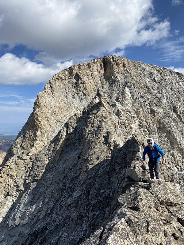
Matt took the first pitch, which would be a classic at any crag. Great pitch, but the freezing wind made everything feel a bit stiffer. Matt battled numb fingers and strong winds and led it clean, I followed it up the same. I led the second pitch, an in-your-face "5.8" move off of the belay, which led into a junky crack/chimney system. After we had these two pitches done, we put the rope away for the rest of the day. We agreed that if either of us had a sliver of doubt, we would bust it back out, but moving quickly on a day like this is imperative to your success. The middle section of the buttress is about 800 feet of 4th - 5.6, which heads up an ever-narrowing arete. This arete places you at the final headwall, 300 ft of 5.7, which is the final crux of the route and ends directly on the summit. The entire route is somewhere between 1500 - 2000 feet.
Matt on Pitch 1... Cold belay for me.
Higher up on Pitch 1
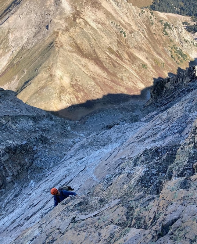
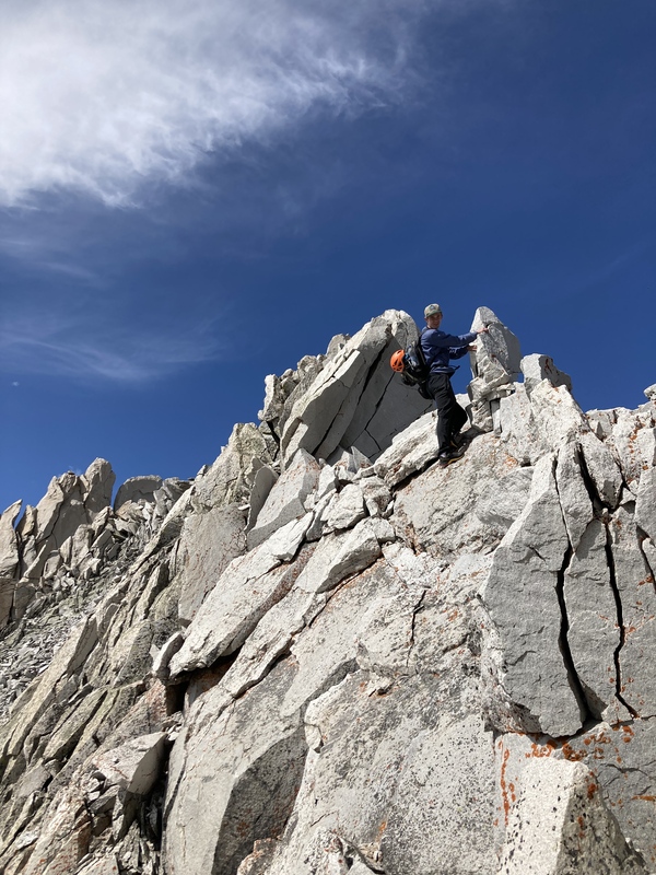
Soloing the upper headwall. Climbing through a steep bulge. Serious exposure!
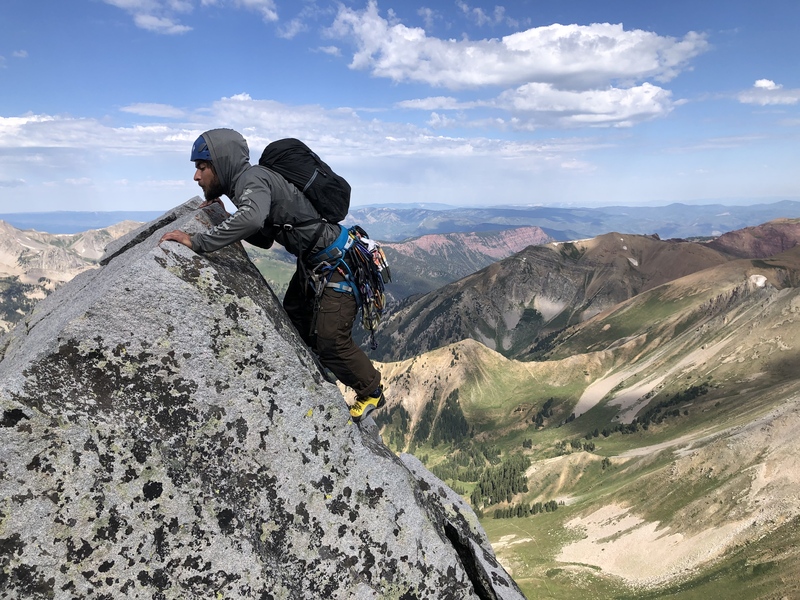
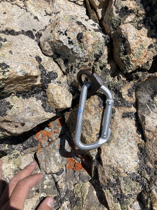
By 9:45, we were standing on the summit of Capitol. It took us 3 hours to the base of the route and 3 hours up the NW Buttress, which was as smooth as we could've hoped for. We were flowing, feeling certain that we wanted to continue onto the daunting ridgeline, calling to us like a siren. The initial drop off of Capitol is a precarious knife-edge, similar to the famous one on the standard route, but a bit more sustained/loose. This terminates at a small ledge, with an ensuing ~ 5.5/6 downclimb onto the ridge. There is an old piton in this spot, which looked solid but should probably be backed up if you are planning on rappeling and avoiding the downclimb.
A little bit of history. This piton is mentioned in the other trip reports on the ridge and was utilized by these parties.
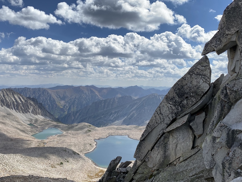
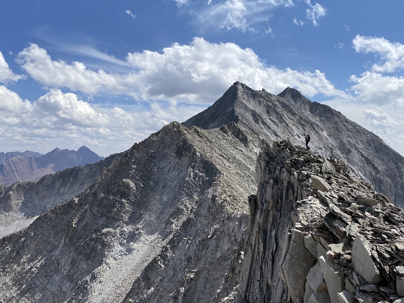
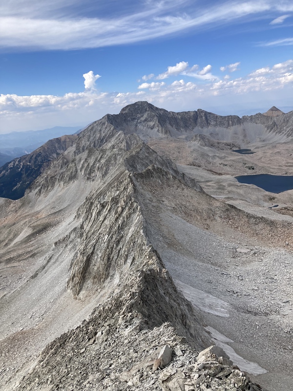
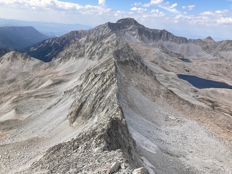
Exposed sections continue after the 5.5 downclimb, after a few more knife life ridges you will find yourself on a long class 3/4 section of slabs. This section of the ridge is the most relaxed and predictable. We were able to move quickly through here.
Looking ahead... a lot to go!
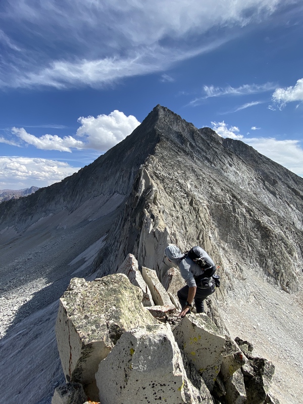
Looking back towards Cap. The downclimb is just left of the dark gash in the upper center of the photo. Matt grins during some of the most enjoyable exposure of the day.
Entering the slab section. Believe it or not Matt is actually in this picture (Low Center)
Beautiful heart formation. Teetering blocks everywhere. By the end of the day, our eyes were incredibly irritated from trundling so many rocks, and the dirt and dust that was blown back up at us.
Some of the quality stuff, beautiful traversing
One of many 5th class sections along the direct ridge. Testing every hold and foot.
Mini cruxes everywhere
Nearing the crux of the ridgeline.
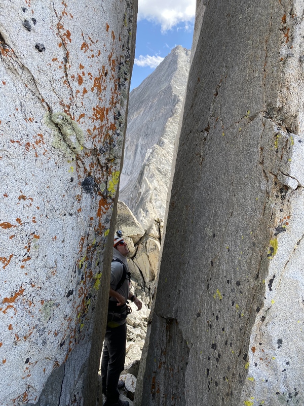
Looking through the feature known as "Satan's Doorway"
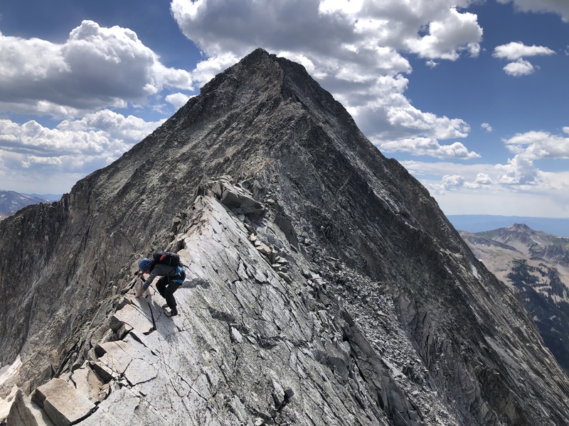
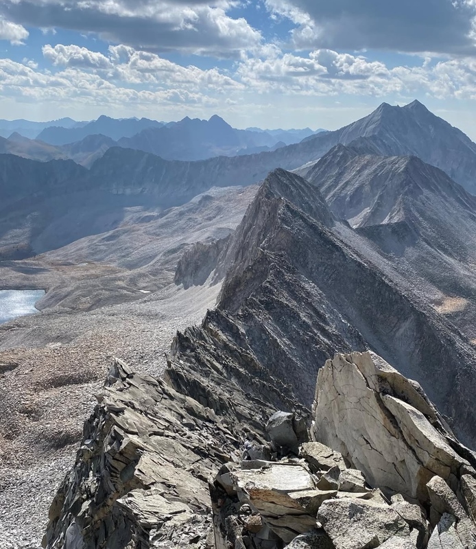
Navigating around or over "Satan's Horns" is the trickiest part of the day, no matter which route you choose, this section will challenge you. We traversed directly under the distinct horns, the only spot where we deviated off of the true ridgeline, on rather suspect 5.6/7. We just did not see the point in complicating such a good day trying to tack on these two 35 foot gendarmes. Traversing under them was sketchy enough, gotta have your head screwed on here. We tip-toed through this section and found ourselves under the stunning North ridge of North Snowmass.
Traversing the JUNK
Looking back at Cap and the day's work.
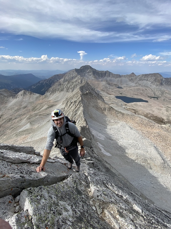
Solid and Quality scrambling on N Snowmass. This is one of the highlights of the traverse. Beautiful 5.5 slabs and movement take you to the summit.
One final look back !
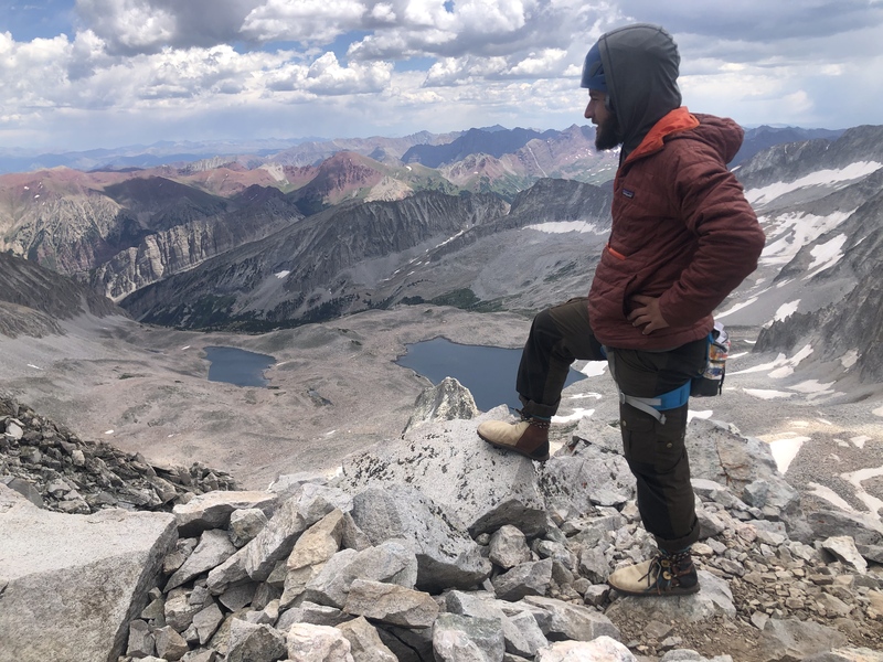
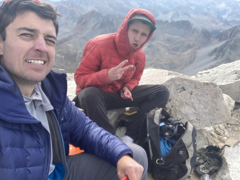
The true summit of Snowmass, 12 hours into the day. Now for a long descent down Snowmass Creek... yay...
We relaxed for a second, took a bit more time to pack our stuff up nicely, and started making our way back. All of the anticipation, planning, and energy put into making it happen had officially hit us, and the relief quickly turned into a fried/exhausted feeling. Once we hit the trail, we turned on our music and checked out for the long walk back. 17 hours and 45 minutes after setting off, we were hopping in my car and heading back to Capitol Creek.
It's now February 2025, and this is still one of my most cherished memories/days in the mountains. Colorado's high peaks will always have my heart. I hope this report helps others to dream, be creative, and go for it. While I don't encourage recklessness, I am not one to tell people what they can or cannot do. I was hesitant about writing this one for a bit, as I didn't want to glorify a dangerous, loose, and hyped ridge, but I tried my best to keep the hyperbole to a minimum. Don't be mistaken, as it is a very serious undertaking. At the end of the day, I want to share these stories and information, even if it only helps one other person. I've benefitted greatly from amazing trip reports and so much information from this community over the years!
23 Miles - 8600 ft gain - 17:45 - 9/11/2021
Thumbnails for uploaded photos (click to open slideshow):
Hey! I'm subscribed to Matt on YouTube! It's always fun to see what crazy stuff he's up to. Also, random history of the carabineer on the piton, but forum member oldschool Mike left it when he and a group did the ridge in 2010. He left a comment on Paul Davis' video on the ridge. Hopefully I'll do the buttress some day, but the ridge looks like a whole nother level of Colorado climbing. Once again, great report!
Thanks, dude! You know your stuff. Yep, I referenced that group in the report, their write-up helped us out a lot. I saw you're only 14! Keep getting after it, and you'll do whatever you set your mind to. Stay safe out there, and remember there's no rush!
Yup! I've learned my lesson about taking stuff slowly from various minor injuries, most notably some runner's knee that I'm just know fully recovered from after almost 2 months no mountains. Now I pay a lot of attention to form in exercises, and taking progression slowly in almost everything I do.
So rad to see a familiar name pop up - especially when that familiar name takes on such a remarkable feat. Congrats to you, Noah! I had no idea when we briefly worked together that you did this ridge. Truly impressive! Hope you're well! -Matthias
d_baker
Ahhh my bad, I just wasn’t as keen on them. Really enjoyed writing them but decided to delete after a day or two. I appreciate the nice words. I’ll keep them up in the future.
My name is Mike...I was on the initial traverse in 2010 with Steve G, Kiefer, Noah, and myself. That biner you saw hanging off the piton on the descent from the summit of Cap is mine....I mark all my gear with blue tape. It's been awesome to see you guys, as well as others, repeat this stunning ridge. It was the best day(s) I've ever had in the mtn's.
Mike,
Really cool to see the history of your traverse. Thanks for sharing, and inspiring others to dream big. I’m sure those memories are some of your most cherished as well. Cheers!
Caution: The information contained in this report may not be accurate and should not be the only resource used in preparation for your climb. Failure to have the necessary experience, physical conditioning, supplies or equipment can result in injury or death. 14ers.com and the author(s) of this report provide no warranties, either express or implied, that the information provided is accurate or reliable. By using the information provided, you agree to indemnify and hold harmless 14ers.com and the report author(s) with respect to any claims and demands against them, including any attorney fees and expenses. Please read the 14ers.com Safety and Disclaimer pages for more information.
Please respect private property: 14ers.com supports the rights of private landowners to determine how and by whom their land will be used. In Colorado, it is your responsibility to determine if land is private and to obtain the appropriate permission before entering the property.


")
")
")
")
")
")
")
")
")
")
")
")
")
")
")
")
")
")
")
")
")
")
")
")
")