| Report Type | Full |
| Peak(s) |
Maroon Peak - 14,163 feet |
| Date Posted | 10/20/2024 |
| Modified | 01/01/2025 |
| Date Climbed | 10/05/2024 |
| Author | JROSKA |
| Additional Members | JayTizzle |
| Maroon Peak - A Full Day Climb |
|---|
|
NOTE: This trip report involved a successful summit of Maroon Peak, and a GPX file was used. I have included that file here. The GPX on this trip report is not the one that we "created" (as that would involve getting lost and backtracking). Rather, it's the one that we used to stay on track and ultimately, a nice summit and a safe descent. It was very helpful. Remember a few things if you use this track: 1) Between 12,200 and 12,400 feet on the 2800 Feet of Suck, you might feel like you're losing the trail and climbing up rocks. We got confused here both on the ascent and descent. Don't be alarmed. Trust the GPX track. 2) On the 14ers.com route description, you'll read about two gullies below Point 13,753. This GPX track will keep you almost exclusively in Gully 1. 3) It's well documented that the area between the top of the uppermost gully (13,850 feet) and the summit, is the most challenging area on this peak in terms of route finding. Trust the GPX file in this section. We got a bit distracted by cairns here, and ended up nearly a full 200 feet below where we should have been. Follow the GPX route in this section, check it frequently, and you will be fine. Since summiting Tabeguache via West Ridge last August, I had stalled for more than a full year at 50 on the 14er checklist. It certainly wasn't from a lack of trying. In reviewing my goals for 2024, the intent was to get Snowmass, Sunlight / Windom, Maroon and El Diente. For whatever reason, (very similar to 2015), God wouldn't sign off on me even getting started on an approach, much less reach a 14er summit. Snowmass in June involved yet another issue at the log jam. In my "infinite wisdom and maturity", I proceeded to allow my frustration level with falling short on that peak for a 3rd time to interfere with training. Before I knew it, July was lost and I was out of shape. In August, with a Chicago Basin train reservation in my pocket, I pulled myself together and was ready to get Sunlight and Windom. After getting all the way out there and actually sitting on the train on the morning of the 26th, an announcement was made that a rockslide had rendered the tracks impassable. September brought two more fruitless plans as weather stopped attempts at Maroon and El Diente before they even got off the ground. In the spirit of "Lord willing", there was a fair amount of reflection as to whether I should consider moving on from the 14er pursuit and be content with 50. Scratching the El Diente trip was especially painful, as me and JT McGrath, probably my most trusted hiking partner, were literally on the way and stopped for lunch in Colorado Springs when we made the final call. As the snow piled up out there and the rain poured down in Denver later that night, I was resigned to the season ending in a shutout. The following day, JT sent me a text basically saying, "let's not give up on this season just yet". I halfheartedly agreed but it was September 22 and the mountains were now covered in fresh snow. Still, the long term weather forecast looked promising and I elected to sign on to the positive game plan. Fast forward to a few weeks later and Maroon Peak has been successfully summited, and I was able to avoid the 2024 shutout, and the beat will go on. JT and I made the trip on October 5. I figured that because Maroon is an iconic peak, and I haven't really done anything else this year, I might as well put up a trip report. I'm very happy with the summit because of the 8 I had left heading into this year, Maroon was probably the biggest hurdle to clear and it's done. As usual when I post a trip report, the objective is mainly to share a tale about just a regular guy climbing one of the more difficult 14ers and to hopefully encourage others to climb the peak, as well as convey the realities of the endeavor. There's going to be nothing in here about my superior route-finding skills (mainly because my route finding skills stink), my off the charts risk tolerance (I used guides for Capitol and Pyramid) or my incredible speed (18 hours from Maroon Lake to summit and back). Maroon Peak is definitely on of the most serious 14ers but it's a doable task, and it was exactly that for JT and I on that Saturday. It's the only peak that, for the most part, went right for me this year. Despite our best efforts, we were unable to secure a parking pass for Maroon Lake. The "3 day in advance" release of several parking passes, at least in this case, was a myth. No public shuttles were available either. We were able to execute Plan C, which was to get a private shuttle, through Blazing Adventures, from Aspen Highlands to Maroon Lake. 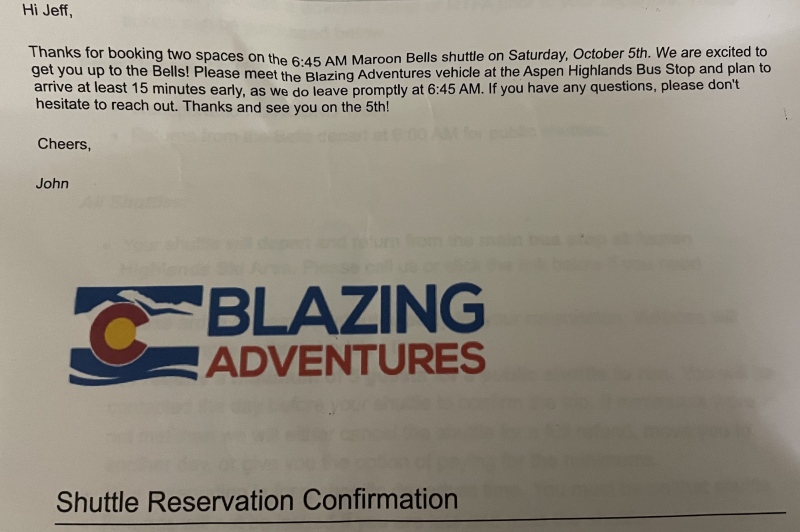
The shuttle was one way, and this detail would prove critical at the end of the trip. There would be no alpine start for this hike. 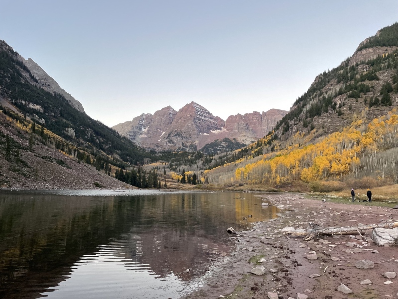
There would be no weather concerns on this fall day and we forged ahead. We reached Crater Lake in about 45 minutes. 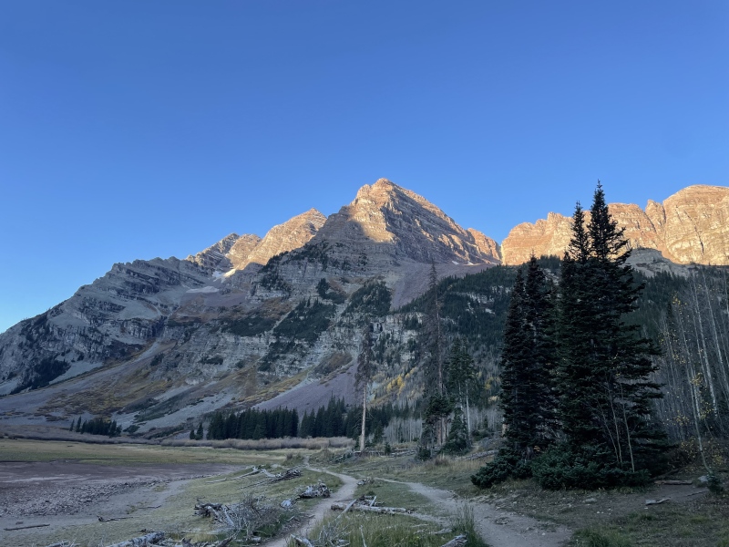
Sleep the night before a hike is always hit or miss for me but I had banked almost 5 hours and for the most part, I felt great. We started up the famed "2800 feet of suck" at 8:45. 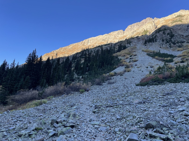
The heart was ready, but I knew that I wouldn't just march up this thing and at some point I'd get slow. My maximum day climb this year had been 3,300 feet and that was in May at a lower elevation (Barr Trail). We agreed on short, regular rest stops, with 2 or 3 longer breaks to break up this monumental task. 
For awhile, I caught myself thinking "this is it?". Falcon Peak in Morrison is my "go-to" for training and that's just under 2,000 feet of gain. Still under that mathematical limit, this still felt like a walk in the park. That would change, however. 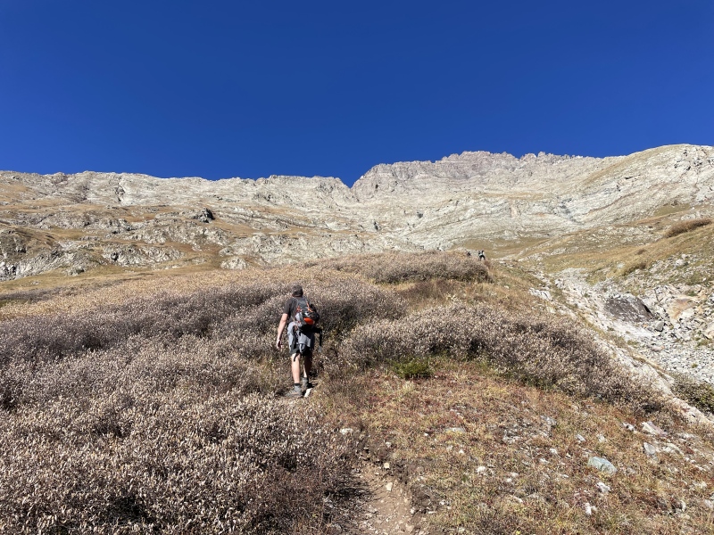
By 9:45, we were at about 11,500 feet. That's still 1 k per hour but that's the last time I'd see that pace for the day. I'll digress by pointing out again that we made this attempt on a perfect weather day, and that's why we made the trip. But for anyone reading this report and planning a Maroon ascent, I can't overstate enough, the need to be in better shape than I was for this. Had we been facing any type of monsoon issue, I wouldn't have been fast enough. Even with an earlier start. We'd have had to turn back at the ridge, period. In our case we literally had the entire day to work with, but that's a rare blessing. In most cases, you'll want to follow conventional wisdom with Maroon. Be in shape, and start early. 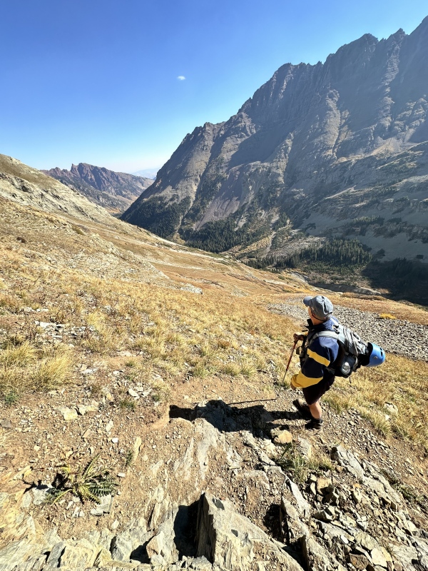
I notice an absence of pictures between 12k and the ridge. Neither of us made a single click for almost 2 hours. That's telling of our general mindset by this point of, "we just need to get through this somehow". At about 12:15, at last, we finally reached the lookout point at 13,200 feet. 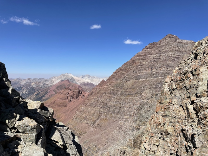
Both of us had really struggled to close from that little tundra hump at 12,900 to get to the ridge. That last 300 feet probably took us almost an hour and upon hitting the ridge, I wondered if my day was over. I'd ascended 3,600 feet, easily the biggest day of the year for me and that summit looked far away. There was a young lady named Katie there, waiting for her husband to return from the summit, and she provided words of encouragement for us both. JT and I lingered at that spot for almost 30 minutes, the first half of which, I felt like I was done. I asked JT if he could continue without me but even before the words came out, I felt really bad. I could instantly tell that he didn't want to attack this beast solo, and that any decision I made here would directly affect him. I felt a quick flash of guilt at quitting on a climbing partner at the worst possible time. It's a weakness for me and I've done it before, just telling a partner, "I'm finished". I was recently on the other side of this, and that helped me realize how that puts a hiking partner into a bind. Had I been solo I'd have called it a day. But I wasn't solo. I had committed to travelling out here with another person to summit Maroon as a team. With that in mind, I strapped the helmet on and said, let's go. We agreed that, at almost 1, time was starting to get short and darkness before we got back to this point wasn't an option. But we settled on a general plan of, step by step, watch the clock, see how it goes. 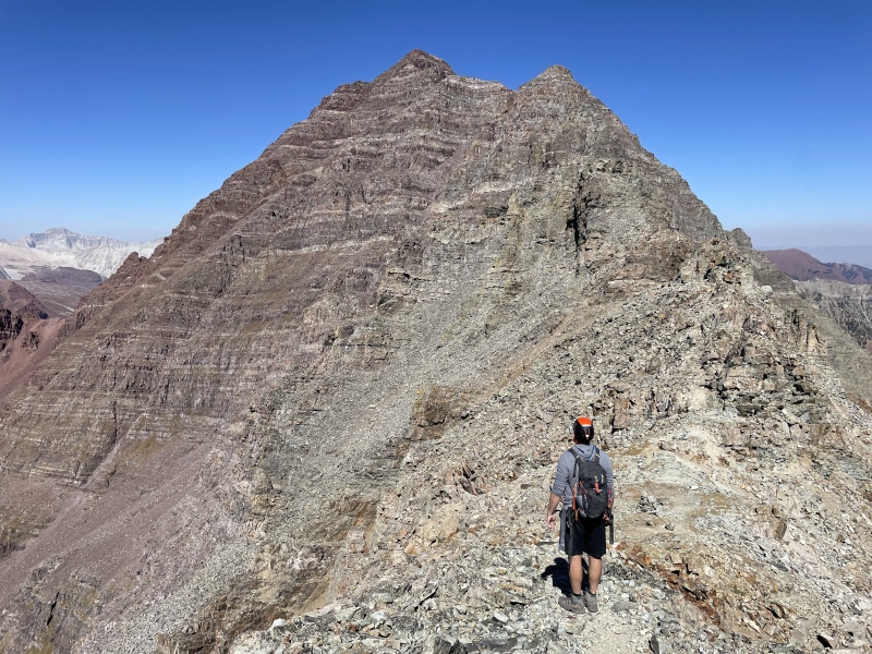
In what seemed like no time at all, we reached the chimney and the first Class 3 climbing of the day. 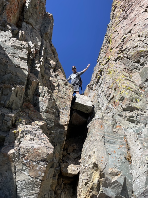
Just before that chimney ascent we encountered 3 cheerful guys descending, full of enthusiasm and energy. Just so happy to be out there on a blue bird day in the mountains. After their downclimb, their overall message to us was basically, "perfect weather, you've got this". I think I've said this in a previous TR, but those types of words of encouragement to a complete stranger can really affect someone's day. Just from conversing with these guys for a few minutes, for the first time, I felt an overwhelming sense of, "We are reaching this summit. It's going to happen". 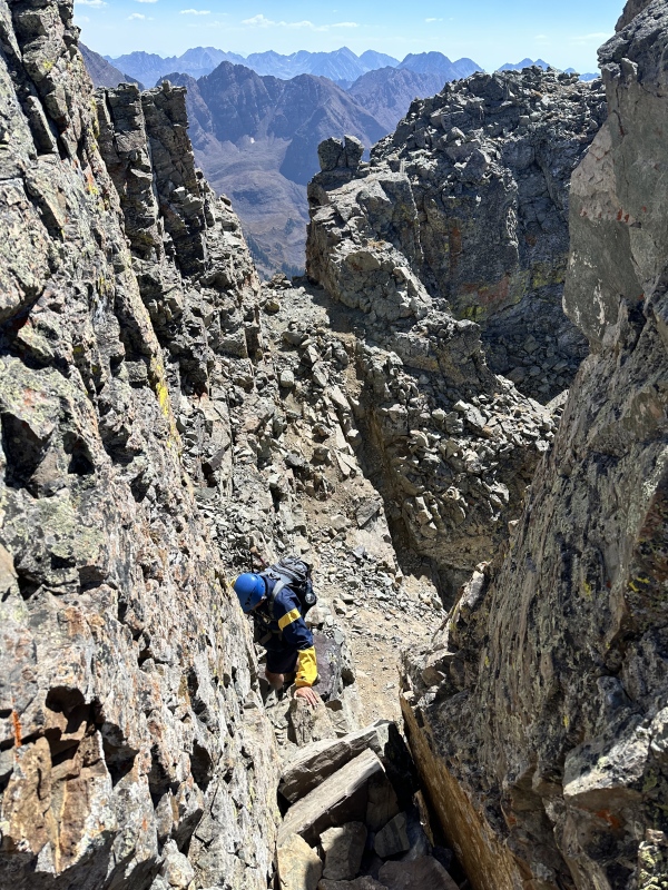
Prior to this climb, I had downloaded the GPX file of another hiking partner who had climbed Maroon with a guide. I suspected I'd need it and wow, did that ever turn out to be correct. I always study routes ahead of time and take notes, committing details to memory and even printing out pictures from 14ers.com but I detected myself in slight confusion as early as the entrance to Gully 1. JT saw it but I had no idea that we were there already. 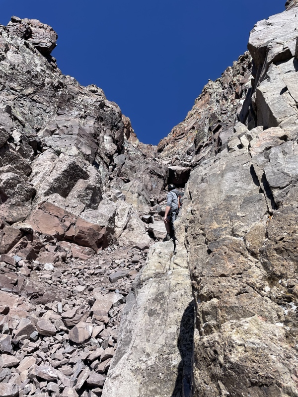
We had some trouble finding the exit point of Gully 1, so that's when we made a team decision to put me on permanent GPX duty with JT leading, with regular stops and constant communication for me to make sure we were on track. For the most part, it worked. We followed the track out of Gully 1 and realized that there was no Gully 2, other than to skirt the very top of it. That made sense because from above, Gully 2 looked like a loose pile of landfill trash. 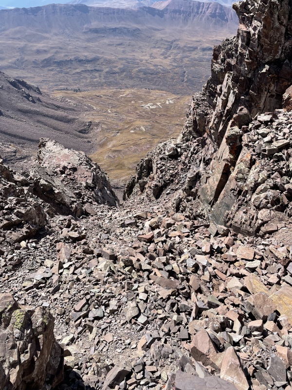
We reached the Robot Rock at 1:45. 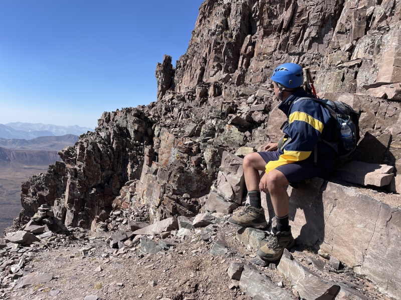
Then, we climbed and exited the upper gully at 2:15. 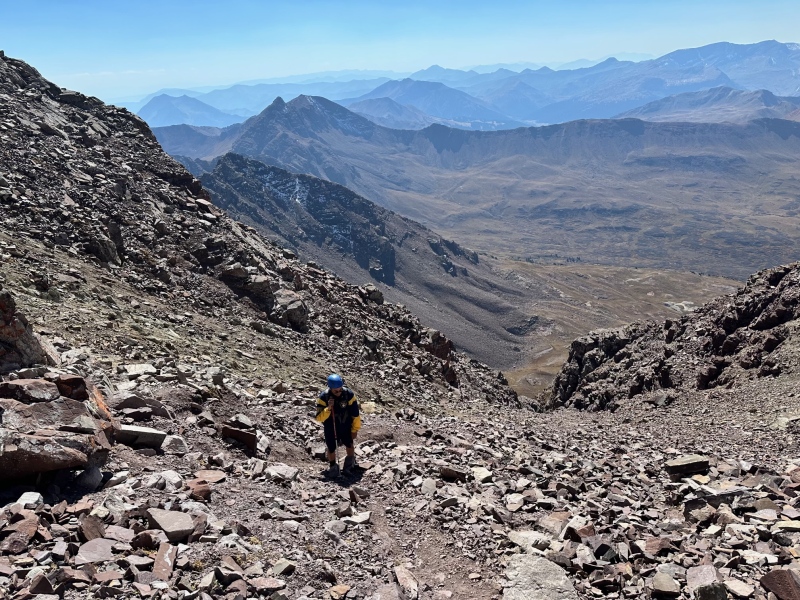
However, we wouldn't reach the summit for another full hour, and this is where the sheer volume and magnitude of the task at Maroon can really catch up with someone with average (at best) route finding skills like me. On so many of these types of peaks there's "fun climbing" followed by an upper gully that leads to the summit ridge and then, you're home free. Maroon isn't like that. Like Bill's route description says, there's still "150 feet of climbing on steep, complicated terrain below the summit", and this severely tested us. My memory is a bit foggy but we kept following cairns, being unsure of how to get to the summit ridge, backtracking, and verifying that we were far off the GPX route. We had increasing concerns about how late it was getting; at one point, we were more than 100 feet below where we were supposed to be, and had actually lost track of exactly where the summit was. 
We still had the GPX track and were able to carefully pick a line upward to it. I'm sure there's someone reading this, wondering, why does this guy keep talking about the GPX track. But for us, on this particular mountain, it really was that important. I don't believe we'd have ended up on rotten terrain, or hopelessly lost, but we definitely could have reached a quagmire in which we couldn't locate the summit, it was getting too late in the day, and we needed to turn back to avoid being stuck up there in the dark. Looking back on the trip, we were probably only 30 minutes away from needing to make tough decisions of that nature. 
The cairns in this upper section, while numerous, aren't useful. This part definitely calls for superior route finding skills (above and beyond spotting cairns). This is actually the first time I've ever been reduced to just ignoring them. They won't help you up here. We had a GPX track, a couple of cell phones, and a portable charger. We also had our two brains but given the fatigue setting in, the electronics were probably of more use in getting us to the summit by this point. 
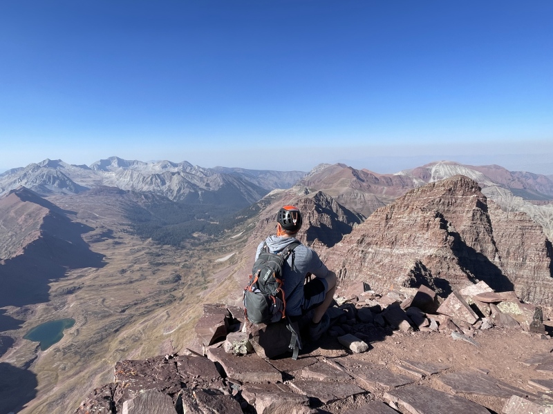
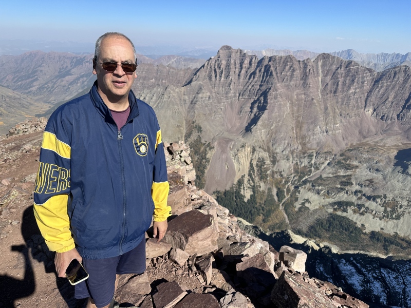
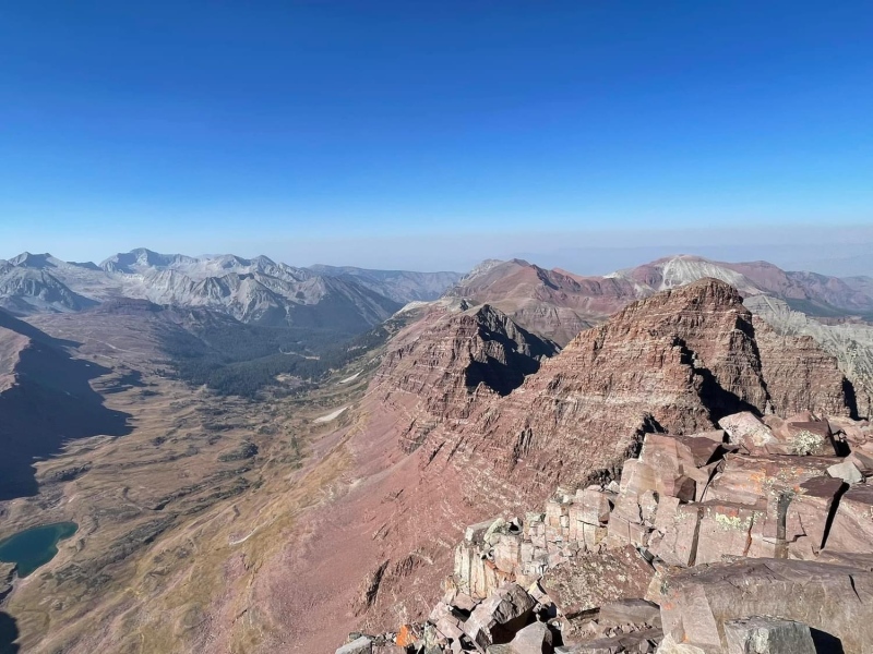

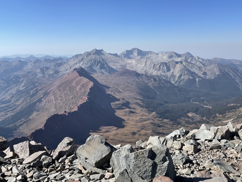
I loved the summit views from Maroon and the dramatic portraits of other Elk 14ers. Maroon seems to have a perfect central location for that. Obviously, we felt a sense of relief to reach the summit and still observe the sun far above the western horizon. We figured to be back to the ridge and well into the "suck" before the headlamps had to turn on. Still, any margin for error that previously existed was gone, and it had taken us 2.5 hours to summit from the ridge. After about 20 minutes it was time to head down and be prompt about it too. 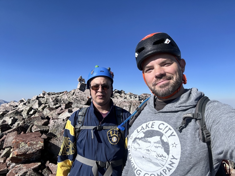
The descent back to the ridge was methodical and deliberate, generally with me leading the way and keeping us true to the GPX track. The area under the summit that had confounded us on the ascent went flawlessly. We had one slight issue in the upper gully in which we were tempted to exit early, but we found the Robot Rock. 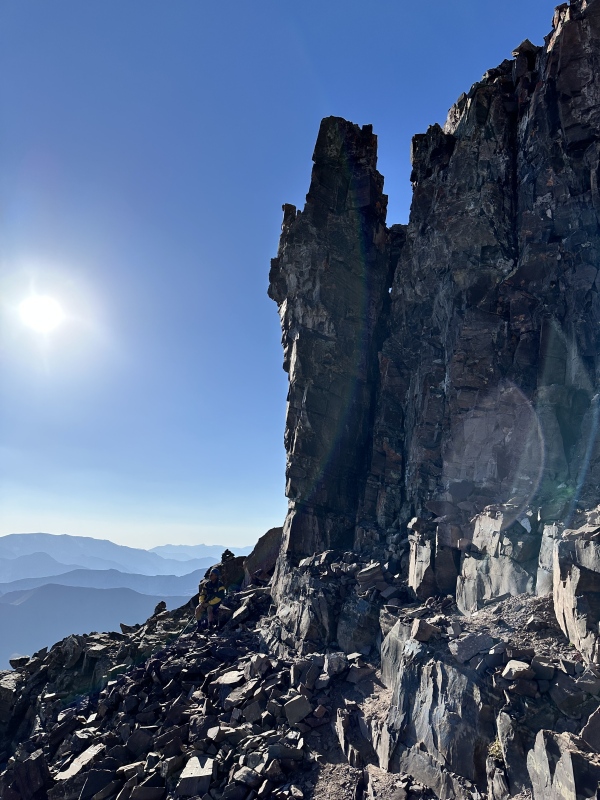
I recall a couple of other "slight" hiccups before and after Gully 1 but nothing that set us back more than a minute or two. Cairns are definitely more reliable in this section as opposed to higher up. We were very happy to complete the downclimb of the chimney before dark. 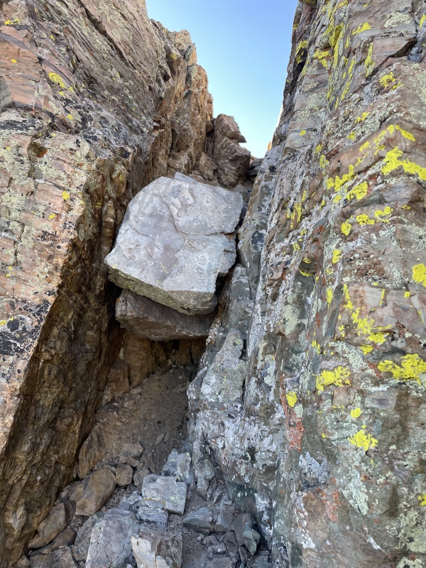
We reached the ridge at 13,200 feet at exactly 6:00. How incredibly satisfying to look back at this view, knowing the summit was reached, when 5 hours earlier there was so much doubt. 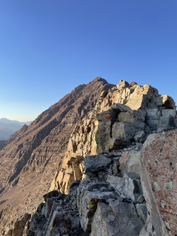
Now, the task was relatively simple. We needed to get as far down the hideous 2800 feet of gravel as we could, while we still had light. Neither of us doubted a safe descent anymore, but we also knew that any downward travel of this section in the dark, via headlamp, would not be looked back on with any type of fondness whatsoever. The goal was to minimize this as much as possible. We moved as fast as we could, but were still around 12,500 feet when daylight finally disappeared. Reminding ourselves with every step of how the summit was reached (to keep our spirits up), we would need to navigate the final 2,000 feet of this famed slope in the dark of night. 
I'm not really sure how to describe this part of the trip. We summited. And given the lack of a parking pass, we didn't have the option to start earlier than 7 AM. We took advantage of the weather and the dry conditions. So, in that sense, we did what we had to. But descending the bottom 2/3 of the "suck" in the dark was truly horrible. Even though we got through it, I can't possibly, truthfully, recommend that this is the ideal way to get Maroon. GPX helped but of course we couldn't see the route. Between the two of us, there were probably 35 backwards falls. There were multiple sections of the trail just above 12 k that seemed to end abruptly in a pile of rocks. Navigation between 11,600 and 12,400 was tedious and slow. I think there were a few portions in this area where we weren't even descending 50 feet in 10 minutes. It took us 4.5 hours to go from ridge to junction. That's a full hour longer than the ascent. Don't descend the 2,800 feet at Maroon in the dark. That's the moral. We did it but it was ugly. It's one thing to ascend that section in the dark but descending it is a different level. Absolutely no regrets on pushing for the summit, and it would have been a shame to turn back early on such a beautiful day. But stumbling down this thing in the dark was quite frustrating, and for anyone looking to climb Maroon, I'd strongly recommend not having this be part of your plan. We trudged to the junction at 10:30 and followed to Maroon Lake at 1 AM. Admittedly by this last stretch we were both slow due to the long day we were finishing up. Amazingly, two water bottles I had cached at the lake were still there, untouched. At that particular time, Maroon Lake was about as devoid of civilization as possible, so we elected to make fast tracks down to Aspen Highlands, where the car was parked. This plan was foiled almost immediately. JT and I disagree slightly on what exactly we saw about a mile into the walk, but with headlamp light, I observed a small black shape (about the size of a large dog) on the right side of the road, with another set of eyes in the trees on the opposite side. JT believes the figure on the road was a larger bear. Regardless, we agree that there was a dark animal, with a round head on the road less than 100 feet ahead of us. We were men of few words here as we pulled a 180 and reversed course back to Maroon Lake. I'd been up over 24 hours by this point and had just completed a day climb of Maroon Peakand still, I managed to set my own personal FKT for an ascent of 200 feet. Maybe a minute or two. Back at the lake by 2, and "marooned", so to speak, we improvised. We found a nice little hut with two bathrooms in it, between the overnight and the day use lots. Yes, we took shelter in an outhouse. 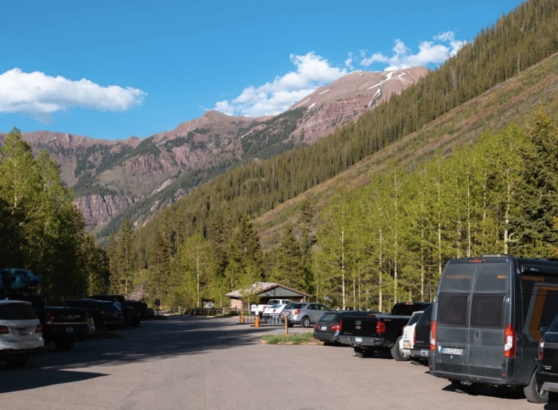
And we each even had our own stall! Seriously though, our options were limited. We had no camping gear, no car, it was probably 40 degrees and shuttles wouldn't start arriving for 5 hours. I suppose we could have built a small fire somewhere but the objective was mostly on trying to get some sleep, no matter how tortured the quality was. JT may have gotten an hour. I was more in the 15 minute range. As temperatures, and tempers, dropped further, we took turns roaming the day use lot approaching (bothering) new arrivals but that's a tough situation. Nobody arriving at 3-4 AM really wants to turn around and spend 30-45 minutes going back down to Aspen Highlands. I certainly wouldn't. Our only hope was to catch someone being dropped off by another party but we were unable to make that work. By about 6, we both knew that our only option (other than walking) would be a shuttle. Blazing Adventures, the one-way shuttle which had dropped us off 24 hours earlier, showed up just before 7. We were very thankful that they were willing to bring us back down to Aspen Highlands, to my car, thus ending our "post game" adventure. They made this trip possible and they got us out as well. This was an awesome trip. Absolutely spectacular. No, it was not perfect but no 14er summit trip has ever been perfect for me. There's always some type of trial or challenging situation and that's what makes every summit special. I never take anything for granted. It's never easy. Maroon ended up being my only 14er of 2024 when it looked like a shutout was imminent so I should keep complaints to a minimum. JT was the perfect hiking partner here, for the situation, refusing to close out the season when I was ready to start looking ahead. I couldn't have made this trip (much less the summit) without his positive energy. Even in my moment of weakness on the ridge, he was willing to let me sit there and sift through my doubt, and his enthusiasm to move forward made me want to do the same thing for him, and myself. Katie, the young lady waiting for her husband at the ridge, also helped by ignoring my pointless comments about "feeling old" and instead focused on our experience level. The three guys at the chimney got me fired up to close the deal. Mark (psa954hiker) deserves credit for providing me with his GPX file. My dad recently bought me a SPOT device to ease my mind. Blazing Adventures was great. And after, for whatever reason, after cancelling every other plan I made for this summer, God did allow this trip to materialize. I definitely needed a lot of help above my own efforts to summit Maroon Peak. 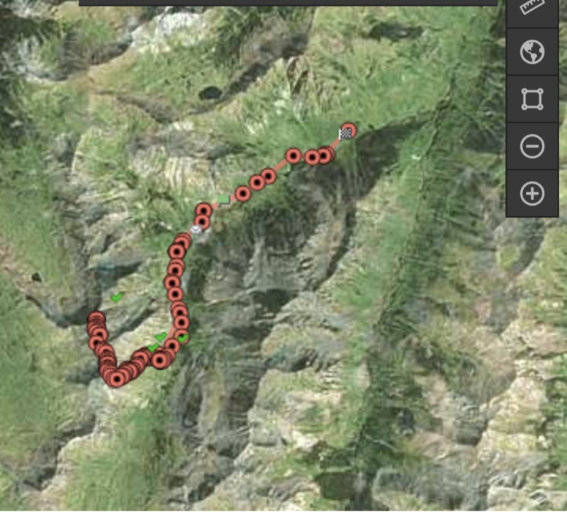
With 8 left (before this summer), had someone told me that I'd only get one 14er this year, but I could pick the mountain, Maroon would have been my choice. I'd tried it twice, both as a day trip and camping at Crater Lake and came up short both times. The nearly 5k feet of elevation gain. The 2800 feet of suck. The steepness, the length, the route-finding and the reservations. I was really starting to overthink Maroon. Plus, it was my only remaining peak named after my cat. 
I love how this season closed out and I'm looking forward to the future. I've gotten some clarity about continuing on with the 14er chase. I can still do these climbs, even the big days. It's just time to stop putting a clock and a deadline on the finisher. So how about the 18 hour day? For sure, that's something we addressed post-hike. Am I a year older than I was a year ago? Yes. Could JT and I have been in slightly better shape? Certainly. That's not what got us though. 3.5 hours up the dirt pile is an "it is what it is" thing for me. I could train from now until next June at the Incline and I still won't shave anything from that. We had trouble with the route from ridge to summit. That's an hour. Being slow and deliberate on the way down was another .5 hour. Descending the suck in the dark likely cost us a full 2 hours. And we slowed down past Crater Lake just due to the long day and fatigue. So, conditioning aside, 18 hours could have been shaved to 14 with more efficiency on the route and an earlier start, an option we didn't have. It's Maroon Peak. It's a beast. We did what we needed to in order to reach the summit, descended in the dark and dealt with the consequences, which weren't really that bad. As for Maroon Peak in general, sorry Will E, but it won't be ranked as my favorite. The infamous 2,800 foot approach, along with the route finding, and the sheer length of the route, weigh heavily against it. Maroon seemed to attack all of my weaknesses. That said, I loved almost everything above the ridge. The chimney was spectacular and that type of Class 3 climbing is what I enjoy the most in the mountains. I appreciate fun climbing without the intrusive thought of "how am I climbing down this". Gully 1 was surprisingly stable as we stayed near either edge and avoided the middle. Even as we strayed slightly off route below the summit, we never found ourselves on the loose, explosive rock of Elk legend. We always found safe climbing back to where we needed to be. Maroon Peak, for us, consisted of surprisingly stable rock. We worked hard for Maroon Peak and we fought for it. This one feels really good, and I'll always treasure the view from the top. 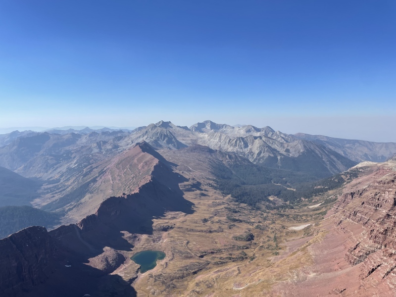
When all of the numbers are added up, with backtracking up high and the run back up Maroon Lake Road, this turned into about 5,400 feet of elevation gain - easily my biggest ever day climb. Despite doing next to nothing all summer and spending the previous year doubting that I could still do anything close to 5 k. Not overly efficient but the job did get done. That's a testament to how counterproductive negativity and overthinking can be. I really just needed to get up on a mountain and persevere. My next goal for this area is to revisit it in some future fall or winter, maybe without the crowds, now that I've completed the Maroon Lake 14ers. It would be nice to hang out at the lake for awhile and enjoy a view similar to the first time I experienced these two peaks in November 2015. 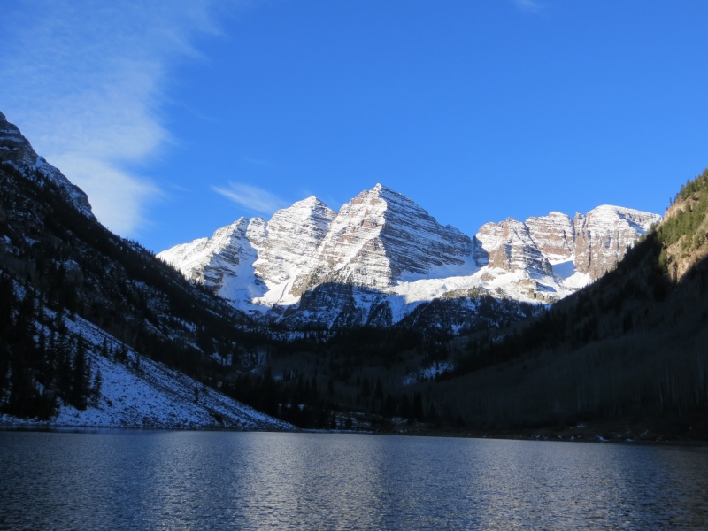
Thumbnails for uploaded photos (click to open slideshow): ")
")
")
")
")
")
")
")
")
")
")
")
")
")
")
")
")
")
")
")
")
")
")
")
")
")
")
")
")
")
")
")
")
|
| Comments or Questions | ||||||||||||||||||
|---|---|---|---|---|---|---|---|---|---|---|---|---|---|---|---|---|---|---|
|
Caution: The information contained in this report may not be accurate and should not be the only resource used in preparation for your climb. Failure to have the necessary experience, physical conditioning, supplies or equipment can result in injury or death. 14ers.com and the author(s) of this report provide no warranties, either express or implied, that the information provided is accurate or reliable. By using the information provided, you agree to indemnify and hold harmless 14ers.com and the report author(s) with respect to any claims and demands against them, including any attorney fees and expenses. Please read the 14ers.com Safety and Disclaimer pages for more information.
Please respect private property: 14ers.com supports the rights of private landowners to determine how and by whom their land will be used. In Colorado, it is your responsibility to determine if land is private and to obtain the appropriate permission before entering the property.


