Download Agreement, Release, and Acknowledgement of Risk:
You (the person requesting this file download) fully understand mountain climbing ("Activity") involves risks and dangers of serious bodily injury, including permanent disability, paralysis, and death ("Risks") and you fully accept and assume all such risks and all responsibility for losses, costs, and damages you incur as a result of your participation in this Activity.
You acknowledge that information in the file you have chosen to download may not be accurate and may contain errors. You agree to assume all risks when using this information and agree to release and discharge 14ers.com, 14ers Inc. and the author(s) of such information (collectively, the "Released Parties").
You hereby discharge the Released Parties from all damages, actions, claims and liabilities of any nature, specifically including, but not limited to, damages, actions, claims and liabilities arising from or related to the negligence of the Released Parties. You further agree to indemnify, hold harmless and defend 14ers.com, 14ers Inc. and each of the other Released Parties from and against any loss, damage, liability and expense, including costs and attorney fees, incurred by 14ers.com, 14ers Inc. or any of the other Released Parties as a result of you using information provided on the 14ers.com or 14ers Inc. websites.
You have read this agreement, fully understand its terms and intend it to be a complete and unconditional release of all liability to the greatest extent allowed by law and agree that if any portion of this agreement is held to be invalid the balance, notwithstanding, shall continue in full force and effect.
By clicking "OK" you agree to these terms. If you DO NOT agree, click "Cancel"...
When a new Lidar 13er was created out of a ridge line, the route up it didn't look particularly interesting - a choice between 2 very chossy gullies - but I noticed that this new creation was on the connecting ridge with Blanca and Ellingwood. And I've been meaning to do the Gash ridge for a long time. Shawn didn't need much convincing to do an airy scramble, and we were just waiting for a perfect weather window (the forecast for the day was 10% chance of rain after 3pm). We arrived at the Lily Lake TH the night before, and did an early start (for us) at about 5.30 am, still in the dark.
To save on weight, we decided not to bring climbing shoes or a rope/harness, but carried 15' of webbing. I wanted to have a handline in case I got sketched out and it worked out well for us.
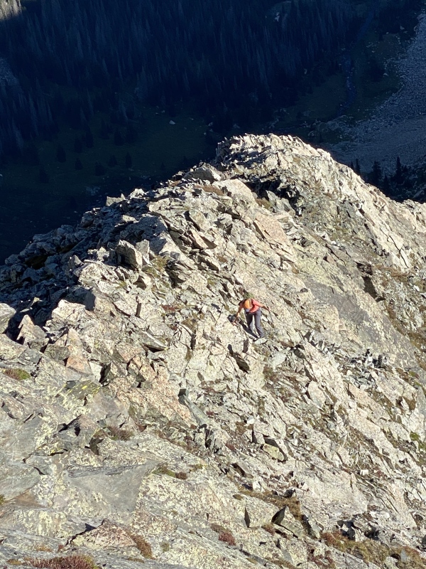
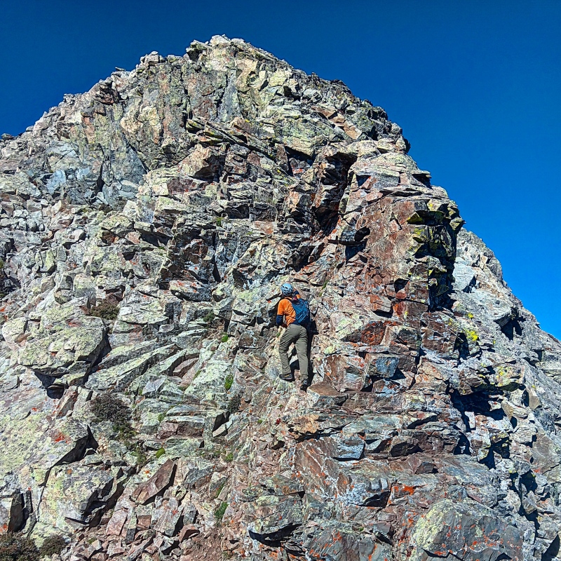
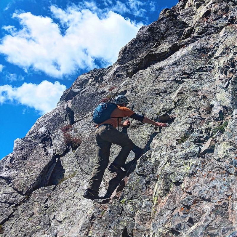
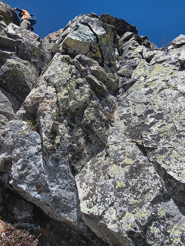
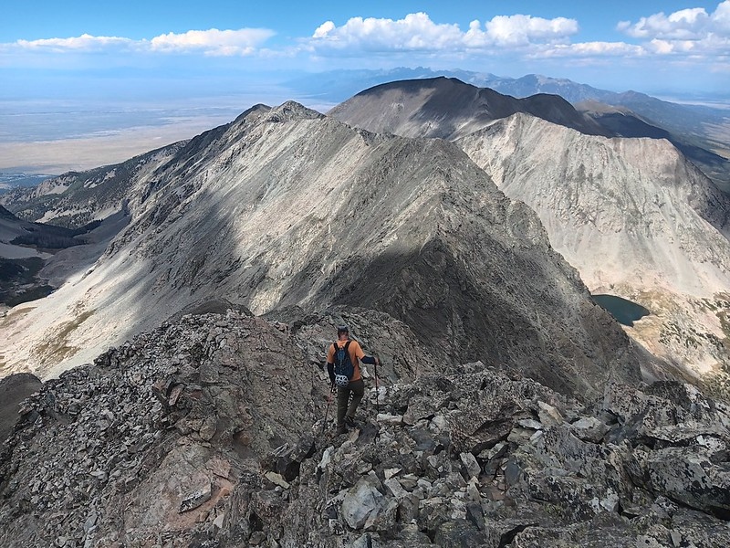
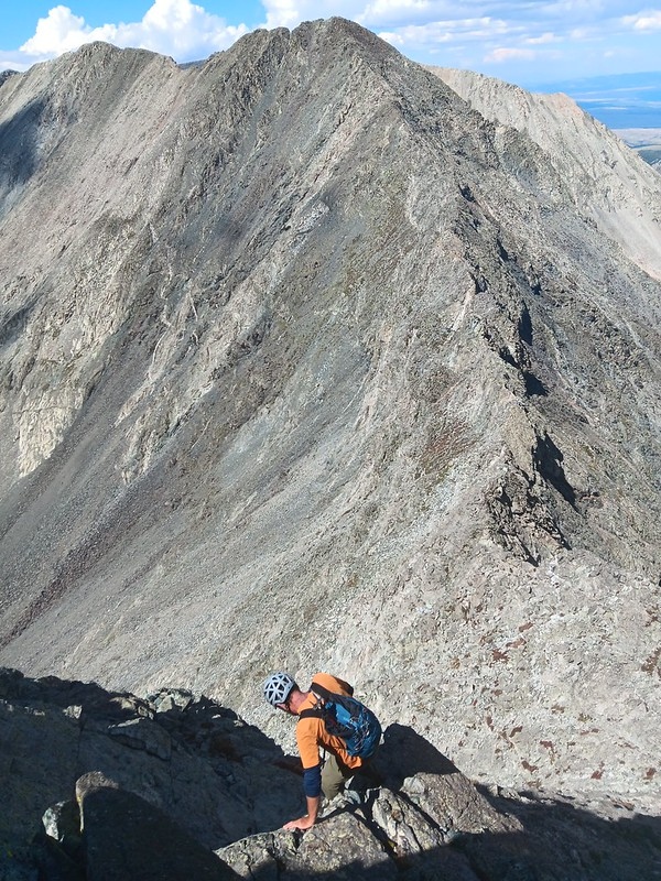
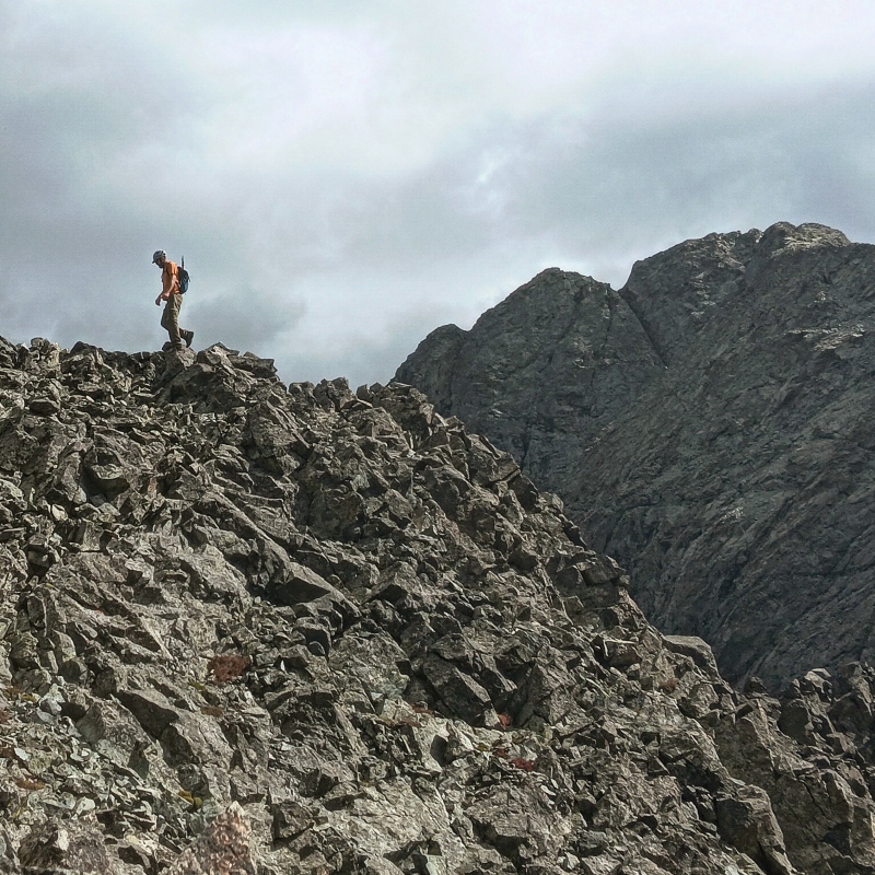
We followed the trail that I first took back in 2011 when we went looking for Mt Lindsey - essentially, Lynn and I did the scouting for the Gash ridge approach :) The scrambling commenced just 2 hours after leaving the trailhead, as we took the North ridge to Pt 13,380 as outlined in the excellent TR by Old Trad. From the start, I knew it's going to be a marathon, not a sprint, so I decided to employ the route finding techniques to save some energy, while Shawn was in his usual POMR mode and stuck to the ridge proper for the entirety of the loop. My strategy was to do the unavoidable cruxes, and utilize the reasonable shortcuts whenever possible to stay efficient and keep moving. Up to Pt 13,380 my strategy was to trail just below the ridge line on the left side, so for the most part it was class 3 terrain, but on couple of occasions, I had to stash the poles and do a couple class 4+ moves.
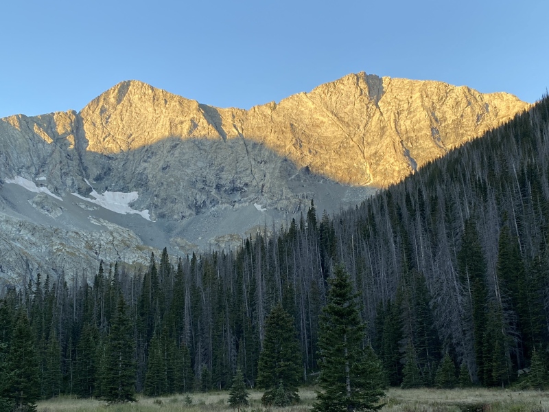
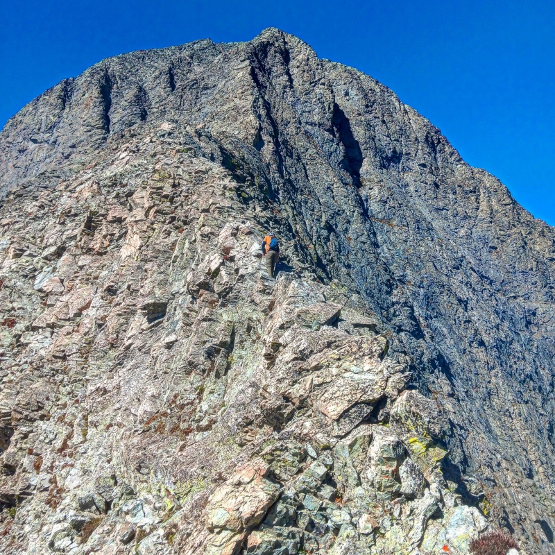
Morning light on Blanca (L) and Ellingwood Point (R)Heading up the North rib of Pt 13,380Starting up the ridgeScrambling on Gash ridgeLindsey in the backgroundShawn does an unnecessary downclimbExploring the ridge options - I went leftBaby Gash section of the ridgethe ridgeRidge scrambling
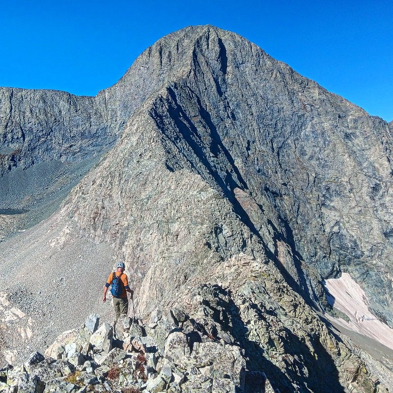
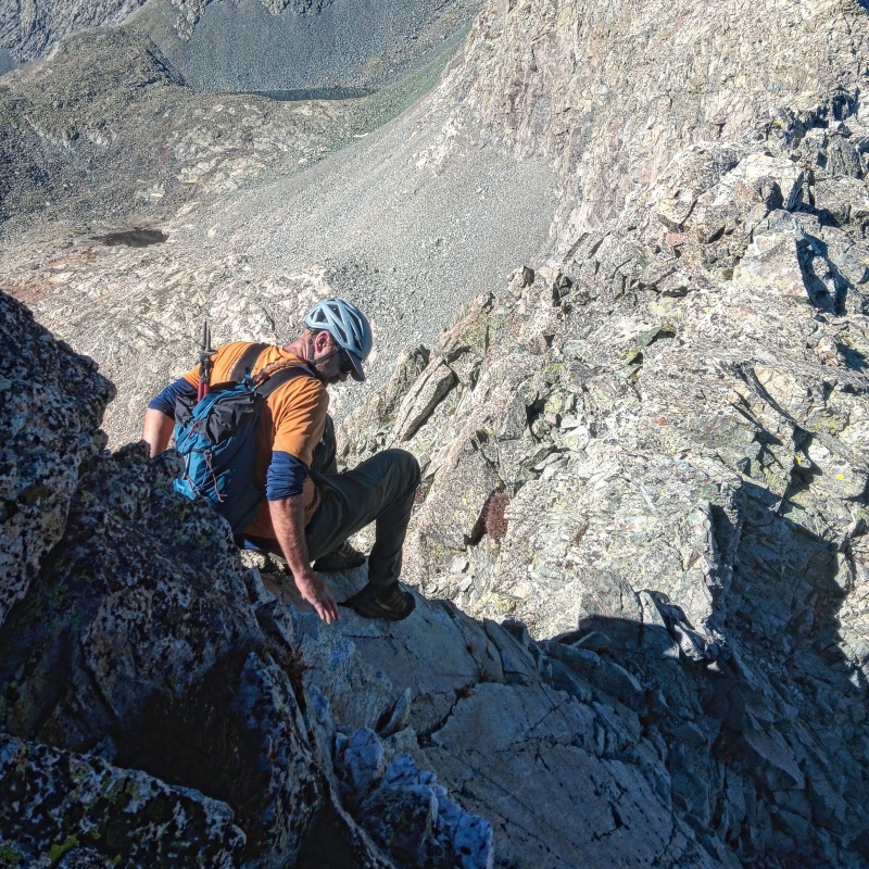
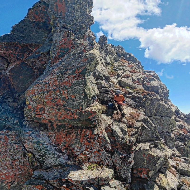
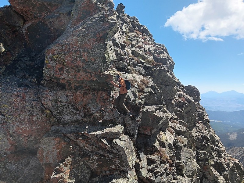
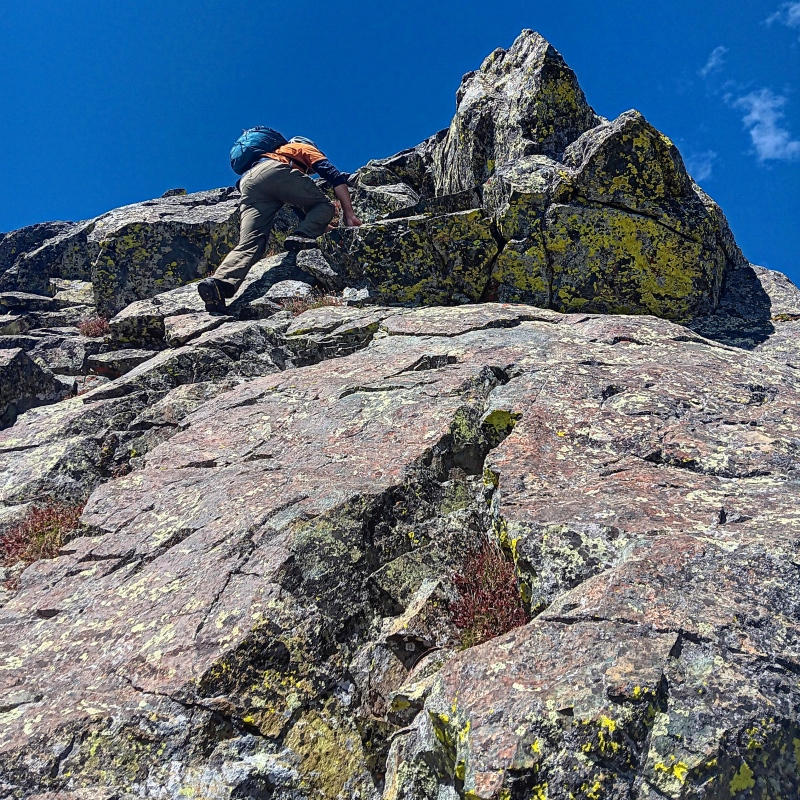
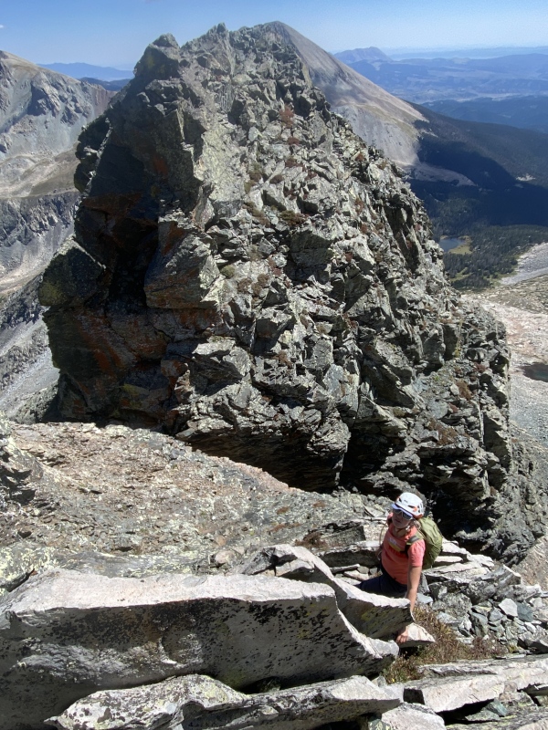
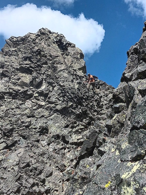
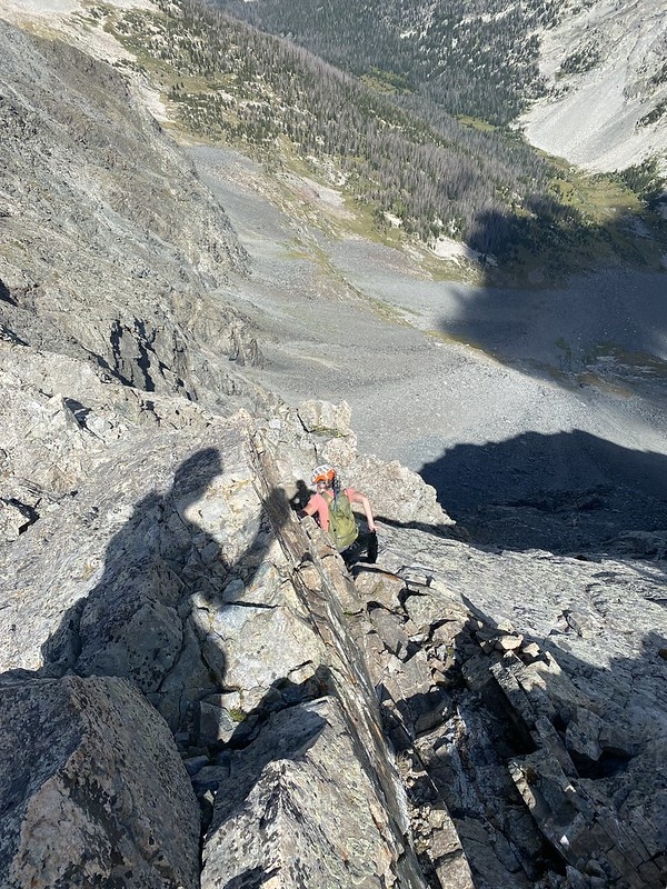
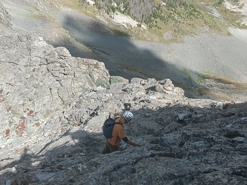
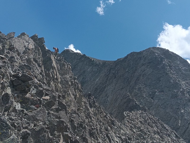
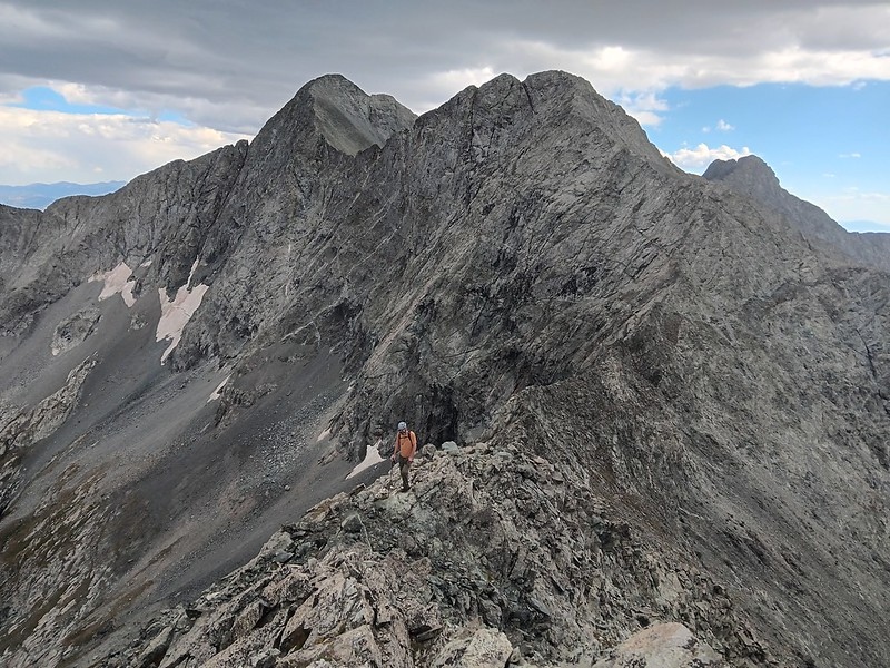
After Pt 13,380 I stayed on the left (sunny) side of the ridge utilizing small ledges when possible to bypass a few of ridge difficulties. Of course, in some cases the ridge obstacles were unavoidable. For the most part, the ridge difficulty was at a comfortable Class 3 level, punctuated by a few harder and more exposed sections, the most challenging being downclimb into the Gash and the climb out of it. I think for taller people it is probably easier, for me (at 5'3") it felt around 5.6. Shawn said if felt like Class 4 for him (at 6'3''). We brought about 15' of webbing and I was glad I had it for the downclimb. The ramp off the ridge on the left (sunny) side led to a solid looking anchor. I tied a webbing there and used it as a handline, which was just long enough, while Shawn later untied it and downclimbed facing out.
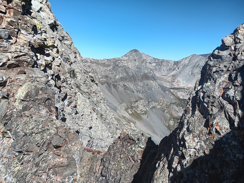
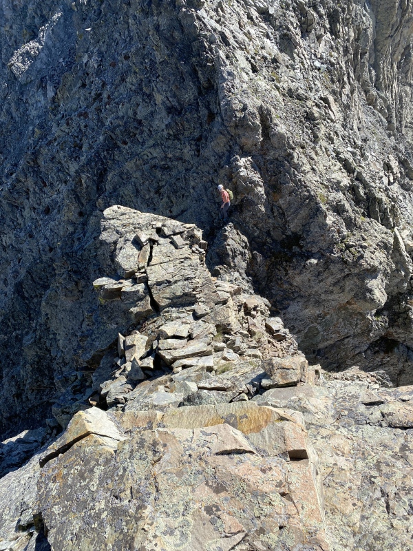
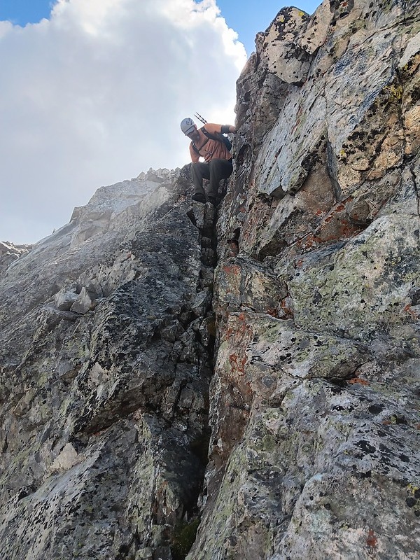
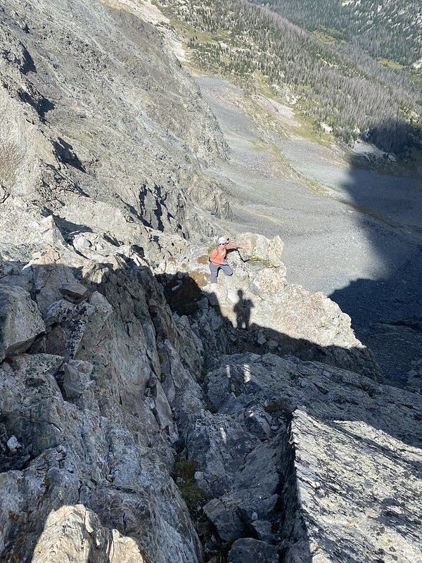
Shawn enjoying a snack break at the anchorShawn on the crux downclimbMe climbing out on the opposite side of the GashClass 4 scrambling on great holdsMore scramblingClimbing out of the GashScramblingAn old piton (used for rappelling?) is seen in the lower center
After the Gash
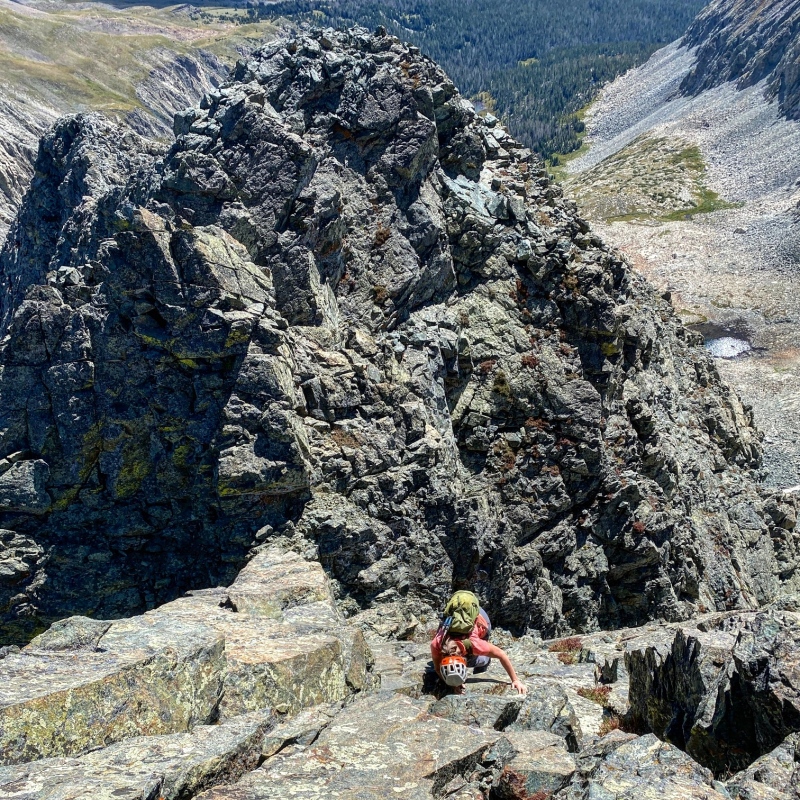
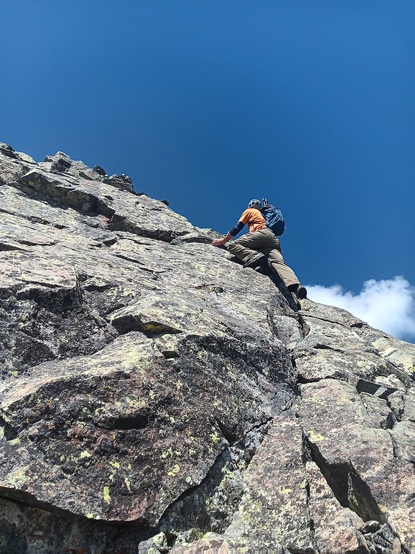
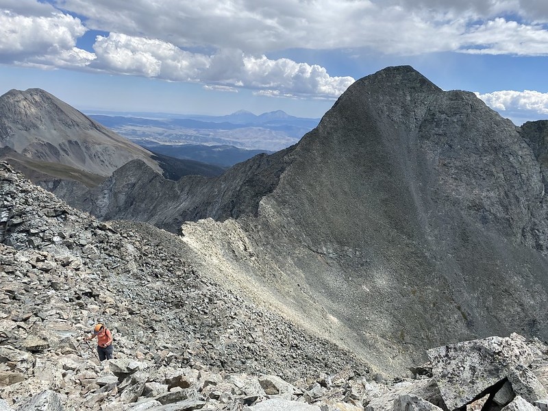
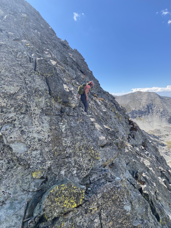
After dispatching the Gash, we arrived at the base of the "Slabs" that are described in other reports. Being in trailrunners, this section looked harder than what I was comfortable doing without climbing shoes, so I opted to traverse just 20-30 feet to the left to a much more comfortable class 3 terrain. I wanted to save some energy for the North ridge of Ellingwood Point, while Shawn continued to enjoy the harder scrambling.
Shawn launches into the steep upper slab sectionThis section is avoidable with a comfortable bypass to the left
We arrived at the solitary summit of Blanca just after noon, 4th time for me and first time for Shawn.
LB- Blanca traverse next time!
PART II - NORTH RIDGE ON ELLINGWOOD POINT
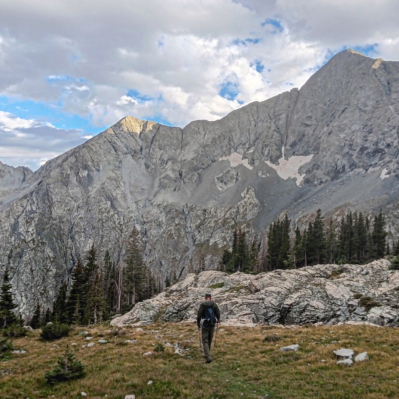
After a brief stay on the Blanca summit, we continued to the Ellingwood Point. The goal was to descend the North ridge and then traverse to the newly created Lidar 13er. I have done the standard (low) traverse between Blanca and Ellingwood before and was looking forward to a great 14er trail. Shawn ignored it for the most part and stayed high on the traverse. I thought it was too much work :) He still arrived to the summit of Ellingwood Point ahead of me.
Heading up Ellingwood PointShawn stayed high on the traverse2nd 14er of the day (my 4th time on Ellingwood Point)
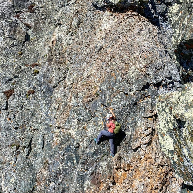
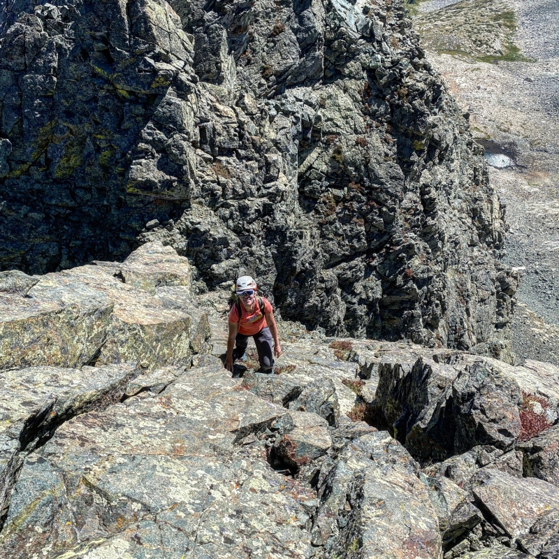
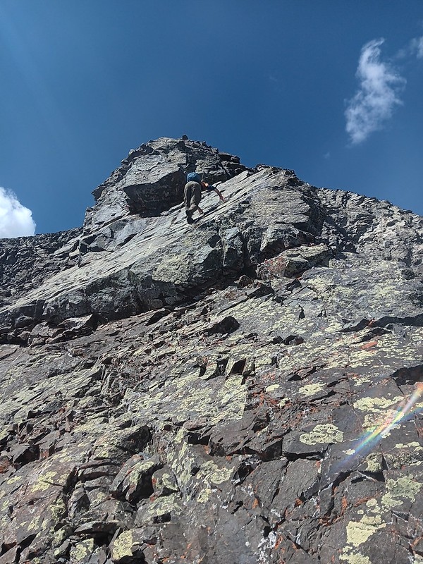
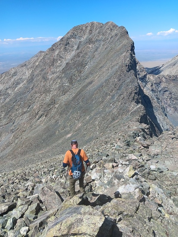
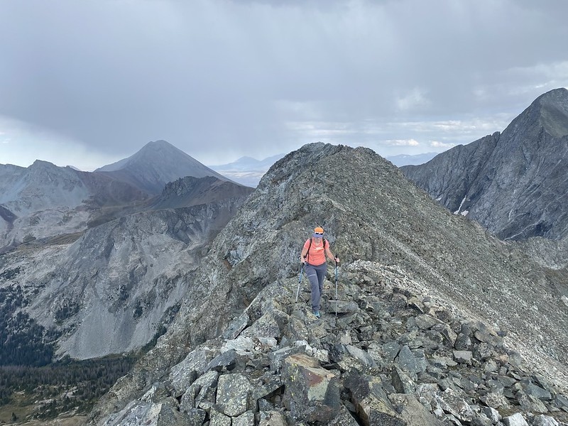
After a 40 minute summit break, we were ready to tackle the North ridge. There are different opinions about the North ridge, but we found it fairly straightforward and actually a bit easier and shorter than the Gash ridge. North ridge shares the start with the Zapata lake trail descent until 13,600 ft. The crux is the next 200 feet of the ridge and felt to me like Class 4 (maybe 5.0 depending on the line choice). I put a short route description on Mountain Project. At 13,600 feet, there will be a Class 4 chimney dropping to the right (NE) that we downclimbed. After that, we descended directly north on the spine of the ridge, downclimbing slabs with plenty of holds (Class 4-5.0 depending on the line, as many options are available).
Great views of the Sangres as we start the descent
I went first on the chimney downclimb in case I wanted a webbing handline from Shawn, but it wasn't needed.
Chimney class 4 downclimbShawn on the chimney downclimbShawn's viewShawn starting on the slabs below the chimneySlab descentLower slab downclimb
Past the slabs and around 13,400 ft, the ridge difficulties became optional. It was already past 3pm and we were scrambling for 8 hours, so I opted to skip the difficulties in order to stay efficient and keep moving, while Shawn stayed the ridge proper. He was starting to slow down though.
Shawn stays high on the ridge while I enjoyed the grassy ramp 40-50 feet below the ridge to save time and energy.Staying highShawn with the North ridge behind himNearing the 3rd summit of the day
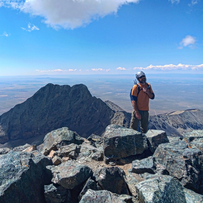
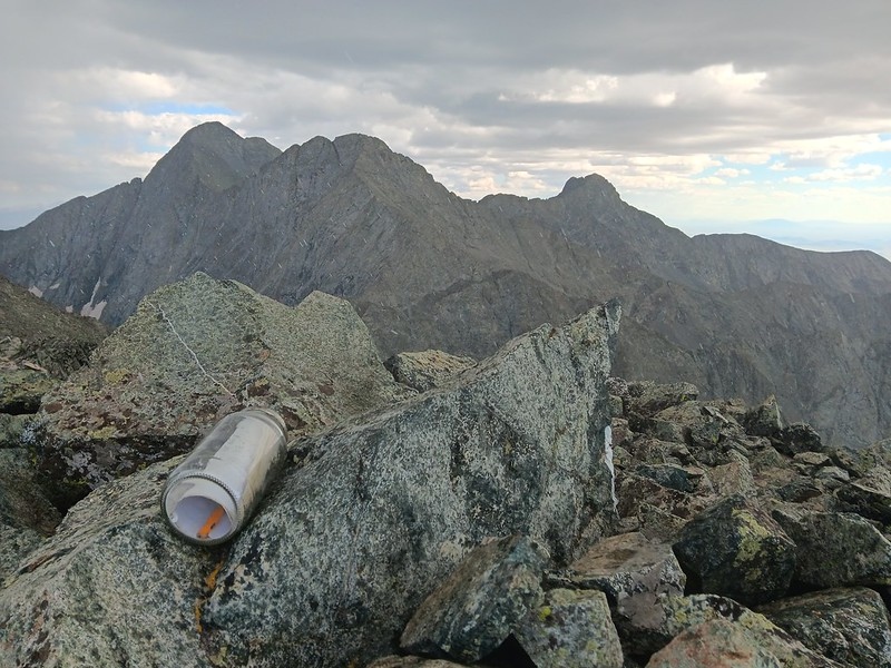
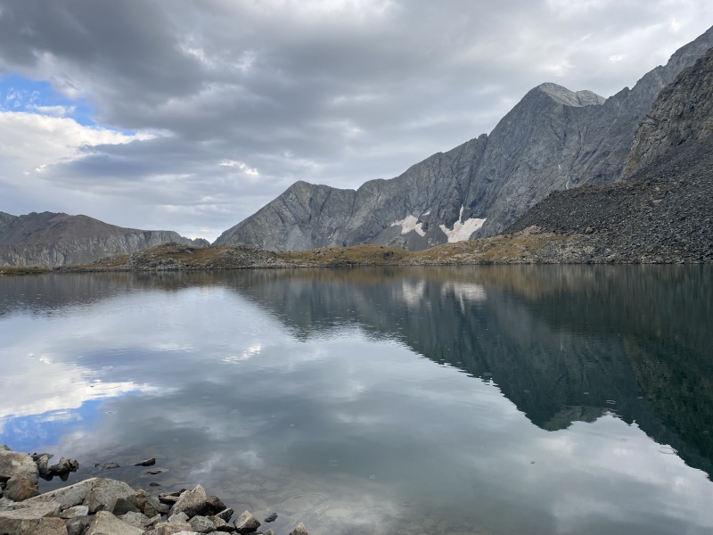
We finally reached the new Lidar 13er UN 13,656 11 hours after leaving the trailhead. The weather was deteriorating for some time, and it finally hailed on us on the summit, so the summit stay was brief (we also wanted to get back to the trailhead before darkness). The descent was as bad as anticipated with lots of loose rock (but not loose enough for scree skiing). We also ran out of water, so we stopped at the beautiful Lily Lake for a refill. Soon afterwards the weather cleared and we enjoyed a pleasant cruise back to the trailhead on a nice Lily Lake trail (only then I realized that the trail we took in the morning was not the proper Lily Lake trail).
This trip was definitely a highlight of the summer hiking season for me and the Gash ridge lived up to it's reputation. I didn't mind at all that the North ridge was slightly easier than expected and made for a great descent route back to the Huerfano River drainage. The following day, starting around 10 am, we did a grassy stroll to the summit of the nearby UN 13,557 and enjoyed the Sangres views one more time.
Lidar 13er summitPeaceful Lily Lake in light drizzleBack on trail
Our splits:
Lily Lake TH start - 5.30 am, base of North Ridge of Pt 13,380 - 7.15 am, leave Pt 13,380 - 9.50 am after a break, summit of Blanca - 12.15 am, summit of Ellingwood point -- 1.30 pm, left EP after 2pm, end of North ridge difficulties - 3pm, new Lidar 13er - 4.30 pm, Lily lake (filtered water) 6-6.30pm, TH - 8pm
My GPS Tracks on Google Maps (made from a .GPX file upload):
for taking the time to write this up, it's nice to see you writing full TR's again! This was a great day out and definitely one of the highlights of my summer as well. If you can continue to provide 14er routes like this I might tag along for a few more!
Full TR are way more time consuming to write, but they are nicer to look back on. I already know what we could do next - LB-Blanca traverse! Before you know it, you'll be a 14er peakbagger like the rest of us, because that's where it's at :)
This looks awesome! Gash is still on the To Do list, 5 hours (longer with bridge stuff?) just feels like a really long drive now haha. Thanks for writing it up!
It's kinda interesting that there are still new exciting routes to do on 14ers after all these years. 4 times on B&E for me and still haven't done the LB-Blanca traverse or SW ridge on Ellingwood. Perhaps the 5th time will be the ticket.
That link-up has been on the list for a while, but haven't managed to get to it yet! Your TR is just reinforcing that it looks like a seriously cool day! If you haven't done the West Ridge on LB yet (you probably have), we did that one this year and it was a blast. More like 5.0 than 5.4. Also, just heard of Wilm's Couloir, which looks ridiculously aesthetic, and a rib variation to the NW Face on LB that also looks awesome. It's crazy that there are so many cool routes in such a small area of the range.
My 3 summits of LB so far were SW ridge (not a fan of this route), then winter and spring ski descents via much more aesthetic Hourglass, but I haven't been back in 7 years, as 13ers occupied most of my time in the summers. LB-Blanca traverse is definitely on the to-do list.
Congrats on completing such an amazing route! Your TR and photos are absolutely awesome too. Seems you descended back to Lily Lake the same way that we did - it was a huge relief to arrive there after the extended effort.
Your report was extremely helpful in planning this adventure! The Gash is really something, huh?
Caution: The information contained in this report may not be accurate and should not be the only resource used in preparation for your climb. Failure to have the necessary experience, physical conditioning, supplies or equipment can result in injury or death. 14ers.com and the author(s) of this report provide no warranties, either express or implied, that the information provided is accurate or reliable. By using the information provided, you agree to indemnify and hold harmless 14ers.com and the report author(s) with respect to any claims and demands against them, including any attorney fees and expenses. Please read the 14ers.com Safety and Disclaimer pages for more information.
Please respect private property: 14ers.com supports the rights of private landowners to determine how and by whom their land will be used. In Colorado, it is your responsibility to determine if land is private and to obtain the appropriate permission before entering the property.


")
")
")
")
")
")
")
")
")
")
")
")
")
")
")
")
")
")
")
")
")
")
")
")
")
")
")
")
")
")
")
")
")
")
")
")
")
")
")