Download Agreement, Release, and Acknowledgement of Risk:
You (the person requesting this file download) fully understand mountain climbing ("Activity") involves risks and dangers of serious bodily injury, including permanent disability, paralysis, and death ("Risks") and you fully accept and assume all such risks and all responsibility for losses, costs, and damages you incur as a result of your participation in this Activity.
You acknowledge that information in the file you have chosen to download may not be accurate and may contain errors. You agree to assume all risks when using this information and agree to release and discharge 14ers.com, 14ers Inc. and the author(s) of such information (collectively, the "Released Parties").
You hereby discharge the Released Parties from all damages, actions, claims and liabilities of any nature, specifically including, but not limited to, damages, actions, claims and liabilities arising from or related to the negligence of the Released Parties. You further agree to indemnify, hold harmless and defend 14ers.com, 14ers Inc. and each of the other Released Parties from and against any loss, damage, liability and expense, including costs and attorney fees, incurred by 14ers.com, 14ers Inc. or any of the other Released Parties as a result of you using information provided on the 14ers.com or 14ers Inc. websites.
You have read this agreement, fully understand its terms and intend it to be a complete and unconditional release of all liability to the greatest extent allowed by law and agree that if any portion of this agreement is held to be invalid the balance, notwithstanding, shall continue in full force and effect.
By clicking "OK" you agree to these terms. If you DO NOT agree, click "Cancel"...
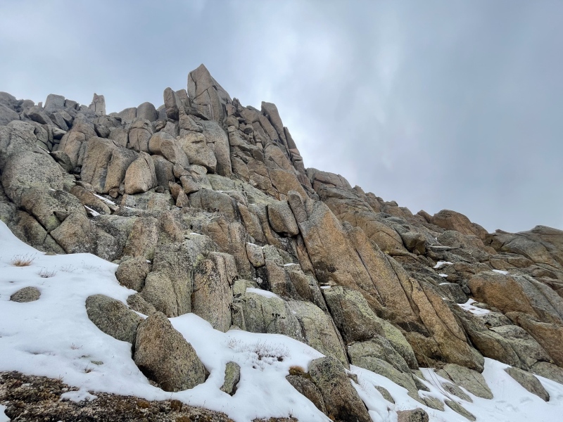
Locating the Gray Needle first climbed in 1953 was quite a project, introduced to me by Jim DiNapoli and Steve Gladbach in 2012 (Jim's report here). Notably, they identified the correct needle (which I'd since dubbed "The Bishop" based on their report) but sadly were not able to attempt it before they both passed away. Starting in 2018 I made several efforts with Kylie, culminating in a 2020 ascent with Grant Kleeves (my report here) of the point designated as Gray Needle by the USGS (BGN page here). In 2021, gore galore sparked a discussion (here) which eventually inspired further exploration by myself, Jonny Zaugg, and Amy (blazintoes) in 2022 and 2023 (my post here). Our failure to locate the 1953 route prompted Clint (Anima) and partner Elan to make an attempt on "The Bishop" in July 2024, on which they discovered the bolt ladder installed on the first ascent of Gray Needle 71 years prior (Clint's report here).
Much credit thus goes to Clint and Elan, whose efforts largely solved the mystery. The only thing left was to climb it to the summit. Though the FA route was alluring, I didn't like the prospects of aiding on 71-year-old bolts with no hangers, retrobolting or otherwise damaging the historic bolt ladder, or installing new hardware in parallel; much less schlepping any more gear than necessary. Instead I thought we should focus our efforts on a chimney on the north side, directly below the summit. Although photos kindly provided by Clint revealed it was probably quite wide, there still appeared to be usable cracks within its recesses.
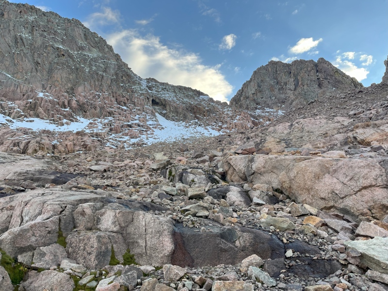
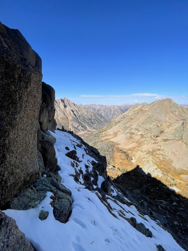
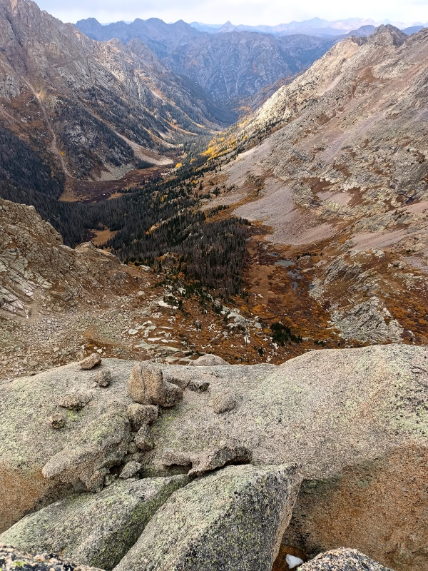
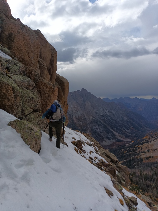
Having used various approaches to this area--Noname Creek, Vallecito to Sunlight Basin, Chicago Basin to upper Noname via Twin Thumbs Pass, Kodiak High Route to upper Noname via Jagged Pass, Lime Mesa to Upper Noname (aborted in Chicago Basin due to weather)--I've grown to dread the prospect of transporting climbing gear to the Jagged vicinity. On our 2023 trip we tried another approach: Chicago Basin to the Windom-Sunlight saddle and on down to camp at 12700' above the unnamed lake south of Sunlight Lake. This takes full advantage of the Chicago Basin trail, which goes quick to 13200'. From there the ascent to the saddle is only 500 feet, followed by 900 feet of descent to camp, in a brutal 3/4 mile of boulder-hopping and shifting talus. Yet this seems to be the least of evils currently known to me.
View of descent to camp from Windom-Sunlight saddle far right (Amy)
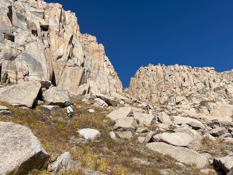
En route, Jonny tagged Peak Eleven and Twin Thumbs while Amy and I side-tripped Peak Eighteen. With a casual start the next morning, we rambled northward over rolling alpine meadows and huge granite slabs, dipping depressingly far below the elevation of our campsite before beginning the stiff climb to the notch that forms the Peak Ten-Noname Needle saddle. Originally I'd planned on descending the gully to the west, which runs into the ledge system leading to Noname Ridge; however, the deep, shaded gully was still holding a fair amount of late September's snow, so instead we scrambled up a short class 4-5.0 weakness to the north, then contoured northwest across steep grassy slopes until we reached the sandy gully providing access to Noname Needle from the lower ledges, to which we descended.
Climb to the Peak Ten sneak (Amy)
Weakness on north side of Peak Ten-Noname saddle, photo on descent (Jonny)
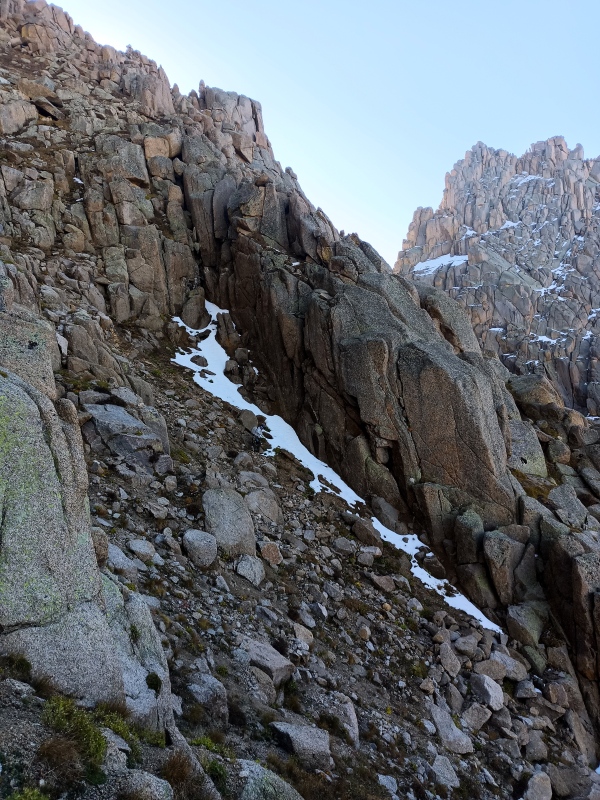
Easy traverse to Noname gully (Amy)
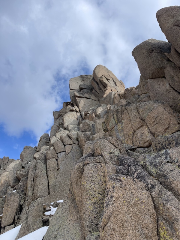
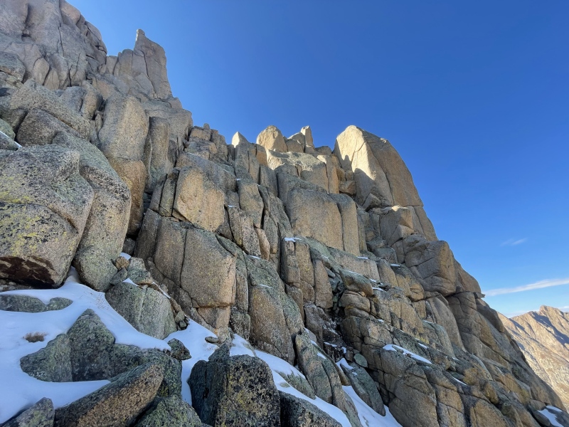
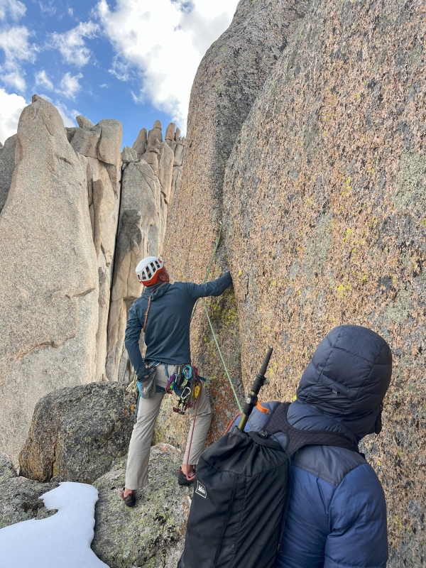
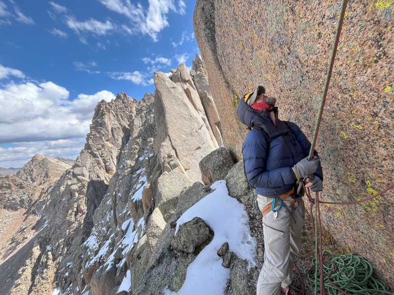
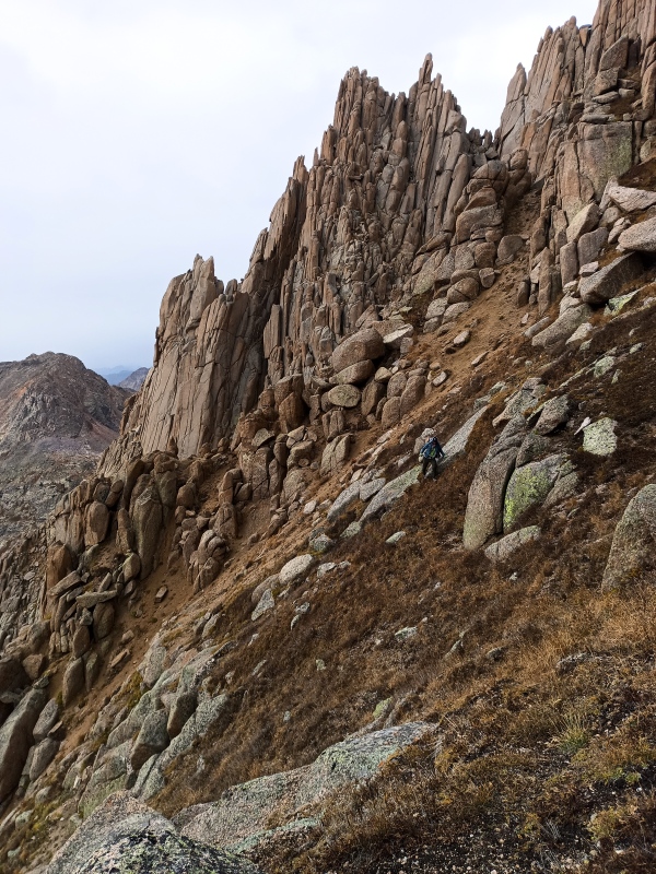
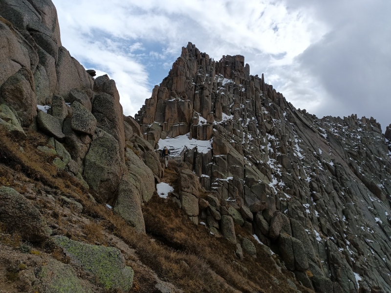
We traversed the sloping grassy terrace beneath the intimidating south face of Gray Needle, wrapping around to the north side of the peak, where the precipitous ledges were covered with snow. From here it appeared we could get close to the summit without roping up. We scrambled up blocky terrain eastward until we reached a point just below and east of the notch between Gray Needle and Needle #4. With dry shoes we'd have 3rd classed a bit farther, but here we roped up and traversed an outsloping block west around a corner to a gap in the ridge. We made another descending traverse on precarious ledges with a 4th class step down, passing the notch, to reach a comfortable stance by the north side chimney, directly beneath the summit.
Amy at bottom of Noname gully
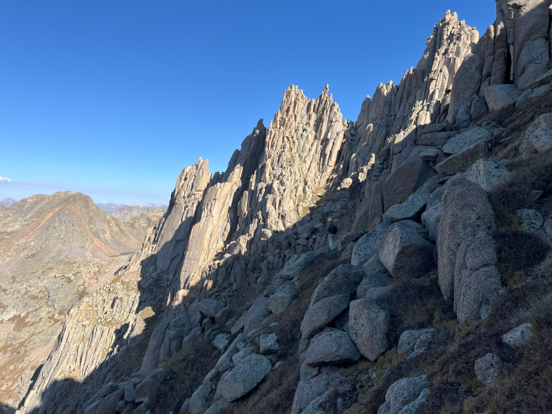
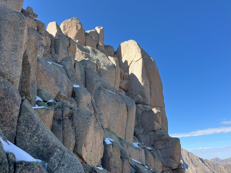
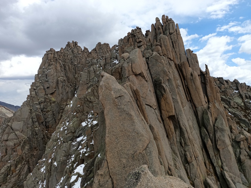
Gray Needle from Noname Balcony at the west end (Jonny)
North side ledges (Jonny)
Scrambling up, North Chimney below sunny slab (Jonny)
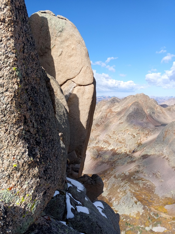
Closer look (Amy)
Final traverse to North Chimney
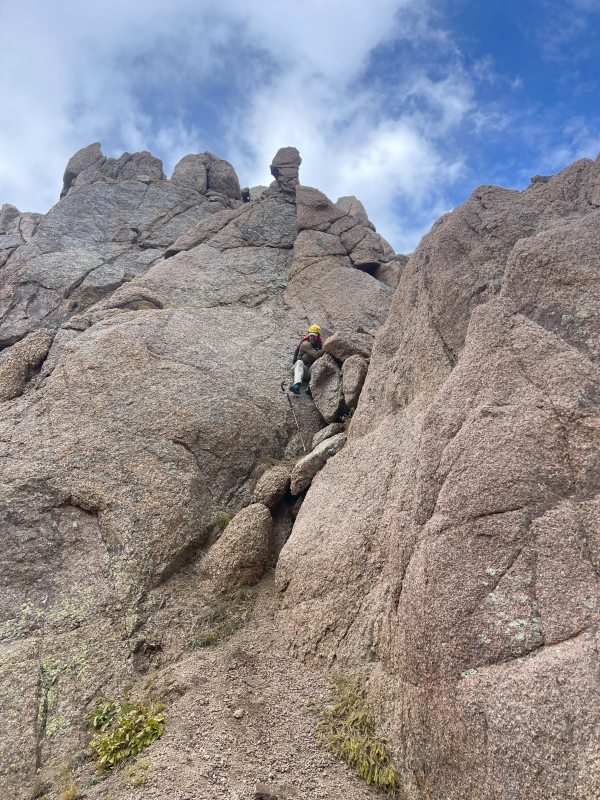
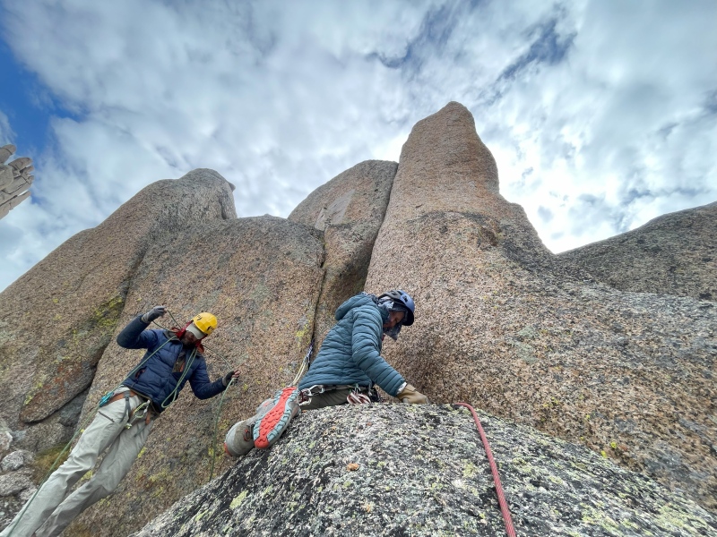
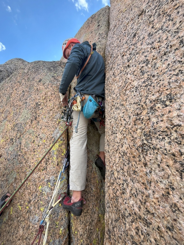
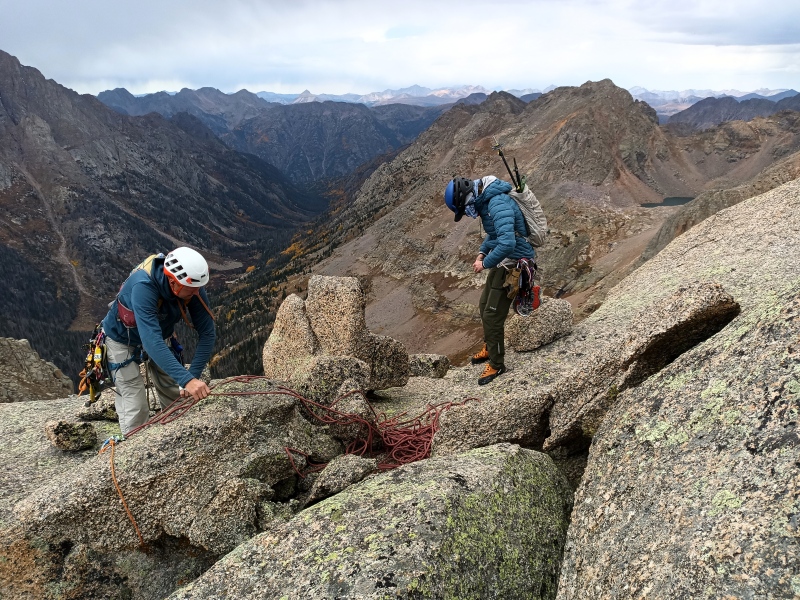
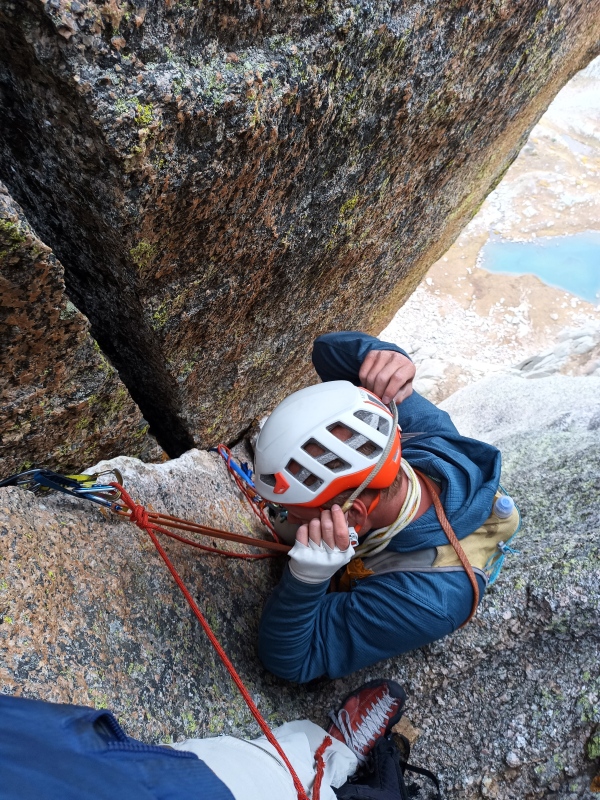
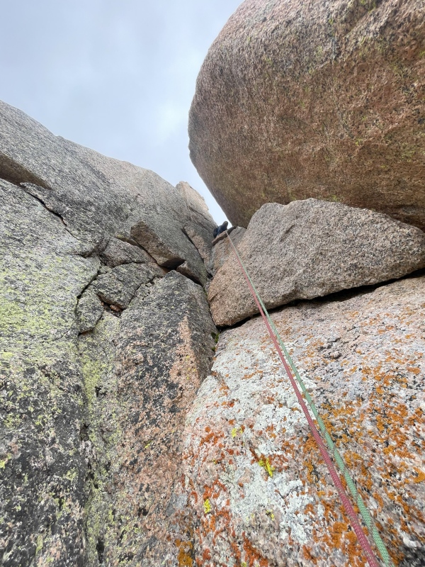
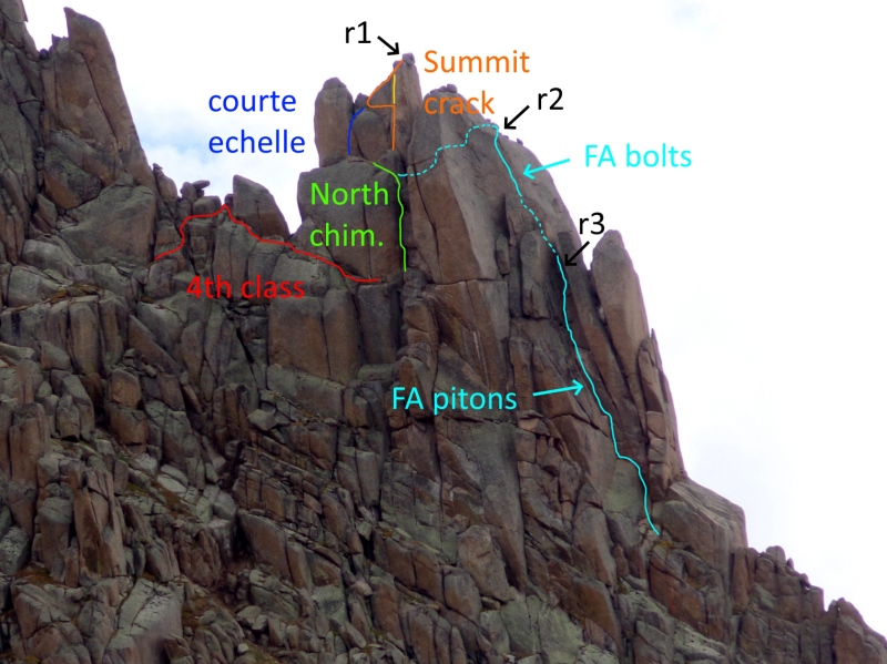
This chimney is 5 or 6 feet wide, on the whole afflicted with the worst case of razor-sharp, decomposing granite dandruff, with captive blocks forming two distinct overhangs, the first being more severe. The sides offer a fingers- to hands crack on the right and an offwidth (#4-#5) crack on left. With considerable effort, after ditching his pack, Jonny worked the offwidth through the overhangs to a ledge 30 feet up. Next I followed, preoccupied with the task of escorting my pack on the other rope, which was clipped to all the gear in the crack, and preventing its tearing open and dumping its contents into the abyss. I did enjoy a secure knee jam but otherwise French freed my way to the top. Jonny graded this pitch 5.9-5.9+.
Jonny leads North Chimney
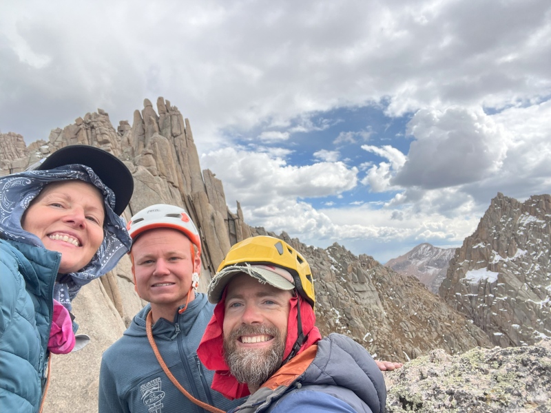
While Amy followed, I explored our ledge 20 feet below the summit. This is clearly the site of the courte echelle (shoulder stand) employed by the 1953 party; a platform 7 or 8 feet up would be quickly reached by such a maneuver. Hand cracks are found on both sides, with the left being shorter but slightly overhung, the right leading past the shallow end of the platform to the summit. Once Amy arrived at the ledge, Jonny launched upward, battling his way 15 feet up the righthand crack before stepping delicately left, then beached-whaled onto the vanishing end of the platform and scrambled up to set a belay on the summit capstone. Since he was now directly above, we opted to follow the crack entirely. While this pitch would go at 3rd class with a shoulder stand, Jonny graded his route 5.10b, above my pay grade, and I happily aided it out on the cams and second rope. Amy followed suit (let's assume she did significantly more actual climbing than me), and we three stood on top of Gray Needle, 71 years after its first ascent!
Courte echelle ledge (Jonny)
Jonny checks out left crack, most likely courte echelle (Amy)
Courte echelle ledge, not quite this overhung (Amy)
Jonny leads summit crack (Amy)
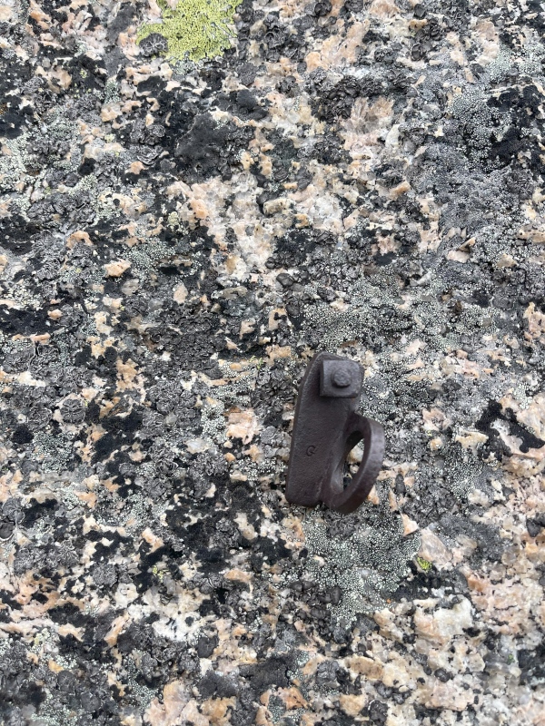
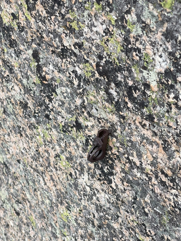
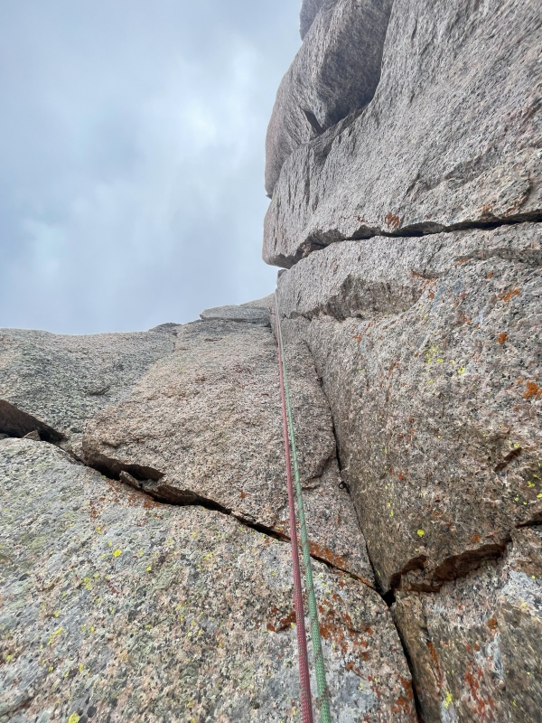
After enjoying the thrilling position, we rappelled off the capstone 20 feet back down to our packs on the ledge, then reversed the 50 foot (horizontal) descent described in the FA account by a belayed traverse west across the top of our chimney and up a 4th class corner, squeezing up through an awkward 5th class wedge to reach the relatively broad south shoulder of the slab we knew hosted the FA bolt ladder. From here the true summit is in your face, while the pinnacles up-ridge fade into the periphery. We rappelled off a slung boulder 30 feet, past the 1953 bolts--which repurposed sawed-off pitons as hangers--and the already-tattered anchor left by Clint and Elan in July, and like the FA party "wedged ourselves between two giant blocks on the sharp summit ridge." Here we installed a final anchor and rappelled 55m, down the narrow seam led by Barry Bishop all those years ago (it only just struck me how apropos a nickname "The Bishop" is for this needle), replete with 6 pitons that we counted, to the north side ledges.
Team on summit! (Amy)
View up ridge from summit
View down to bolted slab from summit
On south shoulder of bolted slab
Summit from top of bolted slab
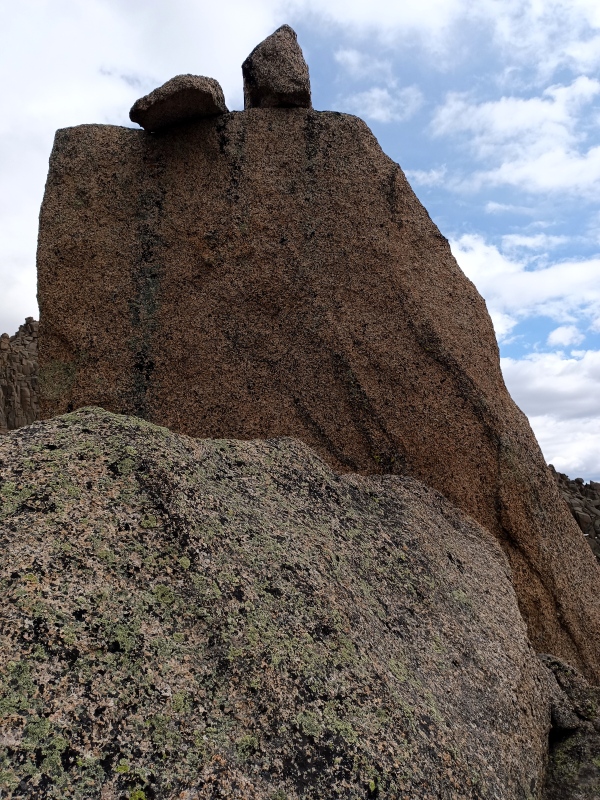
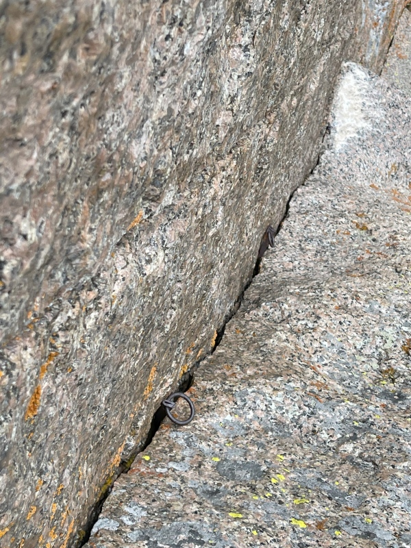
1953 bolt ladder (Amy)
Blade turned hanger (Jonny)
Angle turned hanger (Jonny)
Wedged between giant blocks at our final rappel anchor
Rappel down the FA "rotten chimney" (Jonny)
FA pitons (Jonny)
FA pitons (Jonny)
Final rappel (Jonny)
Amy descends north side ledge
Traverse back to Peak Ten sneak
Approaching Peak Ten sneak
Red=roped approach Green=N chimney, 5.9/+ Blue=Probable FA route Orange=Summit crack, 5.10b Yellow=Summit crack direct, likely 5.11 Cyan=FA route and our descent, dashed portions hidden by features Black=Our rappels, R1=20', R2=30', R3=55m to approach ledge (not shown)
Amy and Jonny tagged Peak Ten while I moseyed back to camp and made my dinner, puzzling over a huge balloon floating in the western sky. Upon my partners' return we joked it was a Chinaballoon, but turns out it likely was a surveillance balloon (like these). Nursing work commitments and missing family, I hiked out the next morning, while Amy and Jonny stayed to work on an undisclosed project before tagging Knife Point and Sunlight Spire on their way out the following day.
It feels great to finish this project, and to finally complete with certainty the officially named 13ers. I could hardly have wrangled a better team for this particular challenge, Amy and Jonny both being tough, strong climbers, willing partners, and good company to boot.
The attached GPX includes our entire approach track from 2023 (I didn't GPS much of this trip), which CalTopo clocks at 10.8 mi. and +5500/-1000 ft. It also includes a composite of paths taken to the base of Peak Ten and the final route up to the roped pitches of Gray Needle, from our campsite 2.5 mi. and +1500/-950 ft.
My GPS Tracks on Google Maps (made from a .GPX file upload):
Glad to see the project come to fruition for you! I didn't realize you'd been after the Gray Needle for six years. You mention: "it only just struck me how apropos a nickname 'The Bishop' is for this needle." When Gore Galore posted that trip report and I found out that Barry Bishop was on the first ascent, that was my first thought: "What a perfect name for one of the needles!" Quite the coincidence that the Bishop was the needle that Barry Bishop climbed. Looks like you had an A+ team too.
Still can't believe I didn't see those pitons back in july... especially with those big rings.
Yeah, you can actually see them from the balcony area if you know what you're looking for (and we had binoculars to confirm). Kylie and I traversed the north side ledge pretty much to its end years ago and we didn't see them either. You would have been right under them up on the west shoulder.
Thanks again for your part in this saga. You should go back and get it!
Marc said he really liked the TR and appreciated the chronological order and found it easy to understand. We're discussing the history now and looking at pictures. I cant wait for him to see the old pitons!
I missed seeing the ring pitons too Anima and I was on rappel!!!
Wish you were here to discuss because sometimes I get into the weeds and havent bothered to understand the differences between named and ranked, etc. sometimes it takes me a while to get hooked on climbs and/or lists. Mostly I enjoy the alpine with friends.
Very cool finding the history of the bolted route. State of the art pitons, anchors and hangers from 1953. Great report.
Congratulations completing your goal!!!
Time well spent in the beautiful, wild Weminuche. So nice to see the original gear at last, can't believe how close we were though I didn't want to go any higher that day! Great summit photo as usual @blazintoes
I'm in for the centennial @fepic1 you'll just have to help carry these kids up with us
Caution: The information contained in this report may not be accurate and should not be the only resource used in preparation for your climb. Failure to have the necessary experience, physical conditioning, supplies or equipment can result in injury or death. 14ers.com and the author(s) of this report provide no warranties, either express or implied, that the information provided is accurate or reliable. By using the information provided, you agree to indemnify and hold harmless 14ers.com and the report author(s) with respect to any claims and demands against them, including any attorney fees and expenses. Please read the 14ers.com Safety and Disclaimer pages for more information.
Please respect private property: 14ers.com supports the rights of private landowners to determine how and by whom their land will be used. In Colorado, it is your responsibility to determine if land is private and to obtain the appropriate permission before entering the property.

")
")
")
")
")
")
")
")
")
")
")
")
")
")
")
")
")
")
")
")
")
")
")
")
")
")
")
")
")
")
")
")
")
")


