| Report Type | Mini |
| Peak(s) |
Mt. Blue Sky - 14,268 feet Mt. Bierstadt - 14,066 feet |
| Date Posted | 08/13/2024 |
| Date Climbed | 08/13/2024 |
| Author | Ptorstadactyl |
| A LONG adventure across the Sawtooth |
|---|
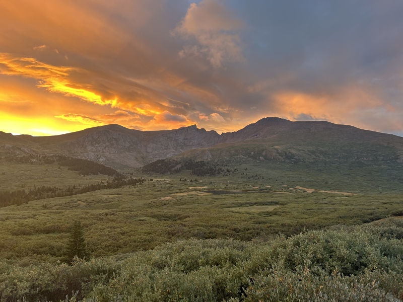
My friend and I started hiking from the Guanella pass trailhead at ~6:20 AM, intending to do the Bierstadt-Blue Sky combo via the Sawtooth. This was going to be his 13th and 14th 14ers climbed, and I had already done Bierstadt and Blue Sky on separate occasions, and have 20 under my belt. Having done Longs a few years back, I was ready to tackle this class 3 climb, but a little unsure about some things going in, so for others who may find themselves in a similar boat, this may be helpful. Climbing Bierstadt took just around 2 hours, a relative walk in the park. From there, the biggest surprise was just how steep the down climb to the saddle before the Sawtooth was. I should have known by looking at the elevation map, but do not be fooled, it is a steep, slow descent down a gully at first, and then a general rocky face, to get down to the saddle. It took us over an hour to get down to the saddle, only an 800 ft descent. This was with storm clouds moving in, so we had a good incentive to move fast, as well. Other groups seemed to take about the same time as well. This most certainly took longer than expected, so plan accordingly. 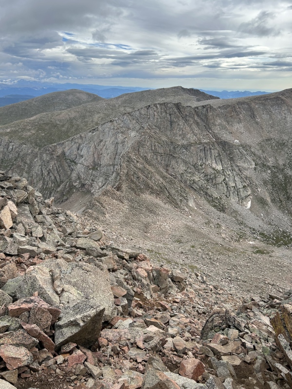
From there we took the straight shot route up the crux gendarme. It was not as steep as photos make it seem, although we were undoubtedly using our hands for almost every move. It followed a pattern of 2-4 moves, then a place to stand up and rest. This continued for about ten minutes, and then leveled off. At no point was I concerned about falling to my death, although a major slip would certainly hurt pretty bad. We took our time, talked through moves, and got through without any trouble. As far as the super exposed ledges went, I was pleasantly surprised. The photos on the website, as well as the ones we took, are a bit deceptive. For one, the ledge, which in some photos looks like only a 20 ft long jaunt before it's over (maybe that's just me?), is actually huge, more like 100s of feet before you reach the end (see picture with me for scale). This is helpful, because it also means that the ledge is wider than it first appears. What looked like a sketchy shimmy across a ledge barely wide enough for a person over a 500 foot cliff turned out to be a careful walk across a sidewalk- width- ish crescent of decently stable rock... over a 500 ft cliff. Be careful, of course, as falling is not an option, but don't be as daunted by the photos as they might first seem. 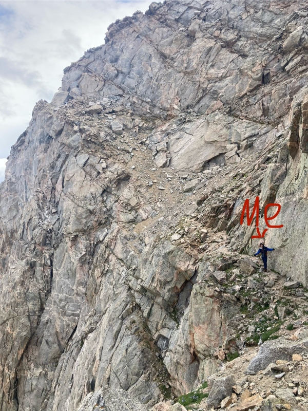
From there, the theme of the day continued to be that everything took longer than expected. For one, the slog to the top of Blue Sky from the Sawtooth is surprisingly far, with somewhat tricky route finding. Then, the gully to the north of the Sawtooth, which we descended down, took a little longer than I was expecting, by maybe 20-30% more time. Then again, I've never been a fast downclimber, preferring to push speed while going uphill. But by far the biggest time suck was the mile and a quarter of hiking through thick brambles in the valley, heading back to the main Bierstadt trail. Our shoes got super muddy, pants got super wet from the brambles, and our pace slowed to a snails pace in many places. Granted, the time wasn't much of an issue anymore, as we weren't trying to get off a summit before storms rolled in, but it was still a shocker. If you are planning on going up initially by this route, allocate more time. It will take a while. All in all, this was a great introductory class 3 route in my opinion. I would have been very nervous in some spots without my experience hiking a bunch of class 2s and Longs Peak, so definitely do not go without some decent experience. Would recommend for anyone looking to get into class 3 climbing after getting through a decent chunk of the easier peaks. Be prepared, bring warm gear, food, and water to be out hiking for longer than you think it will take. Thumbnails for uploaded photos (click to open slideshow): ")
")
")
|
| Comments or Questions | |||
|---|---|---|---|
|
Caution: The information contained in this report may not be accurate and should not be the only resource used in preparation for your climb. Failure to have the necessary experience, physical conditioning, supplies or equipment can result in injury or death. 14ers.com and the author(s) of this report provide no warranties, either express or implied, that the information provided is accurate or reliable. By using the information provided, you agree to indemnify and hold harmless 14ers.com and the report author(s) with respect to any claims and demands against them, including any attorney fees and expenses. Please read the 14ers.com Safety and Disclaimer pages for more information.
Please respect private property: 14ers.com supports the rights of private landowners to determine how and by whom their land will be used. In Colorado, it is your responsibility to determine if land is private and to obtain the appropriate permission before entering the property.

