Download Agreement, Release, and Acknowledgement of Risk:
You (the person requesting this file download) fully understand mountain climbing ("Activity") involves risks and dangers of serious bodily injury, including permanent disability, paralysis, and death ("Risks") and you fully accept and assume all such risks and all responsibility for losses, costs, and damages you incur as a result of your participation in this Activity.
You acknowledge that information in the file you have chosen to download may not be accurate and may contain errors. You agree to assume all risks when using this information and agree to release and discharge 14ers.com, 14ers Inc. and the author(s) of such information (collectively, the "Released Parties").
You hereby discharge the Released Parties from all damages, actions, claims and liabilities of any nature, specifically including, but not limited to, damages, actions, claims and liabilities arising from or related to the negligence of the Released Parties. You further agree to indemnify, hold harmless and defend 14ers.com, 14ers Inc. and each of the other Released Parties from and against any loss, damage, liability and expense, including costs and attorney fees, incurred by 14ers.com, 14ers Inc. or any of the other Released Parties as a result of you using information provided on the 14ers.com or 14ers Inc. websites.
You have read this agreement, fully understand its terms and intend it to be a complete and unconditional release of all liability to the greatest extent allowed by law and agree that if any portion of this agreement is held to be invalid the balance, notwithstanding, shall continue in full force and effect.
By clicking "OK" you agree to these terms. If you DO NOT agree, click "Cancel"...
Antero was the last peak I needed in the Sawatch range. The idea of hiking 15 miles round trip on a jeep road just didn't sound very fun and so I kept putting it off till last. Then I found the Little Browns Creek approach which is not shown on 14ers.com. Hopefully this will give some good info to those who want to try it themselves.
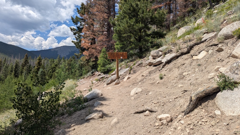
I got a later start than ideal and got to the Browns Creek Trailhead at about 6:15pm. I was shooting to complete about 4 miles and was in a bit of a battle with daylight and a small pop-up storm skirting by so I was redlining it for most of this section. There are two turns to be aware of. The first is about 1.3 miles in where you need to take a right at this sign:
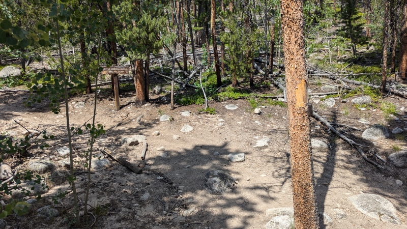
Another 0.3 miles later (1.6mi from the trailhead) is your second turn
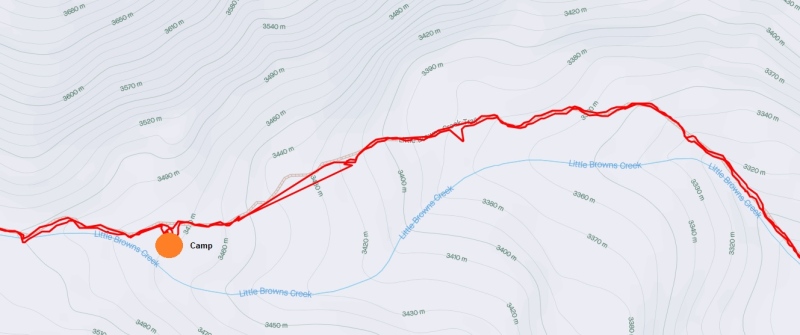
The trail is very easy to follow from here. The best campsite I found is about 4.2 miles from the trailhead. The trail gets some distance from the creek before getting really close again right around this spot.
This map shoes the trail (red) and stream (blue) and about where I setup camp for the night
I quickly got to work prepping camp for the night and getting things ready for the next day. Getting everything done just as the light disappeared for the night. I set my alarm for 5:30am and got to sleep.
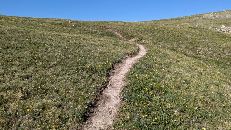
The Little Browns Creek Trail is well marked and very easy to follow. I had read previous reports that it abruptly ends at one point, or it kind of comes and goes. There must have been some work done since these posts because that's not the case anymore.
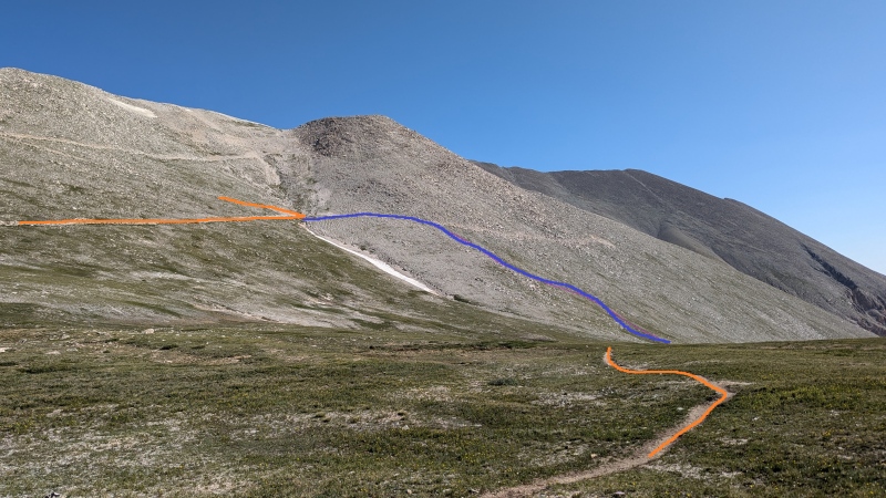
In my quest to reduce the amount of road hiking as much as possible I took a clearly visible side trail that shaved off a fair amount of distance and went for it. It was steep with very loose footing, I would very much not recommend anyone take this route. It's not overly dangerous, just not worth it IMO. You can see the shortcut in the gpx file. and in the picture below
The blue line is the approximate route of the shortcut, green is the route I would recommend sticking to.
From here it is easy enough to follow the standard route the rest of the way. You'll end up hiking on the road for about 1.5 miles total round trip which is pretty good for a loop that totals over 15mi. I stuck to the "standard" route back to the Browns Creek Trail on the way back. It is very easy to find with a sign at the entrance from the road.
A 4-runner had made it up the road to about 13,400'. Two other cars were parked at about 12,700' with tents setup so it is certainly possible to drive up pretty high if you have the right vehicle.
Total distance this route with the shortcut one was was 14.9 miles. If you stick to the standard trail it would be about 15.6mi. I liked this route a lot, and while it makes for a long day, the standard route does as well. I would take walking among trees, streams, waterfalls, and wildflowers over a jeep road any day.
This was peak 30/58 for me, and my last peak in the Sawatch range.
Photo drop:
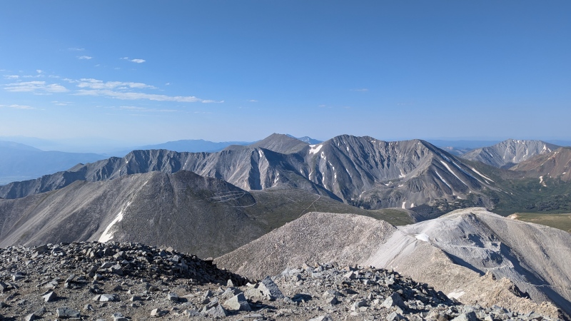
Shav & Tab from the Antero Summit
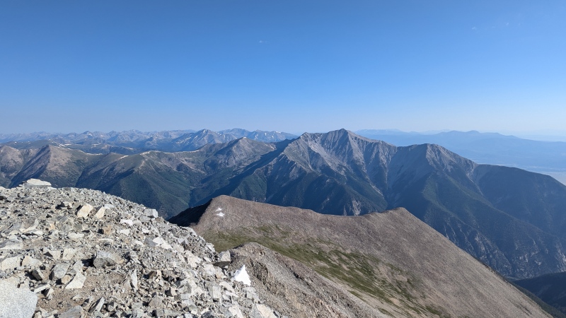
Mt. Princeton from the Antero summit
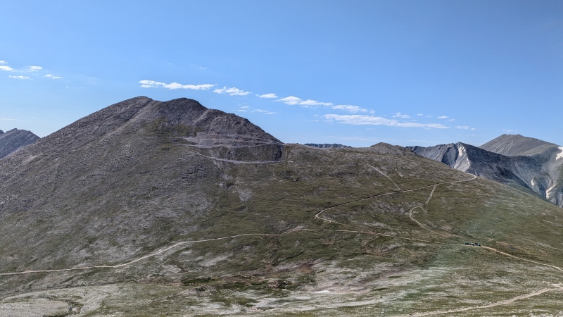
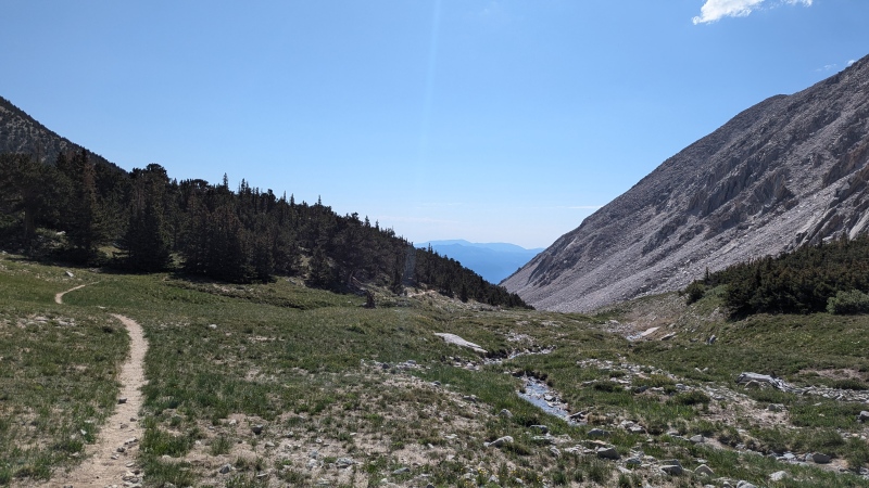
Photo from the upper road section looking south. The Browns Creek trail is below the road going off to the left. Entrance to the trail is near the couple of vehicles that can be seen parked in the distance
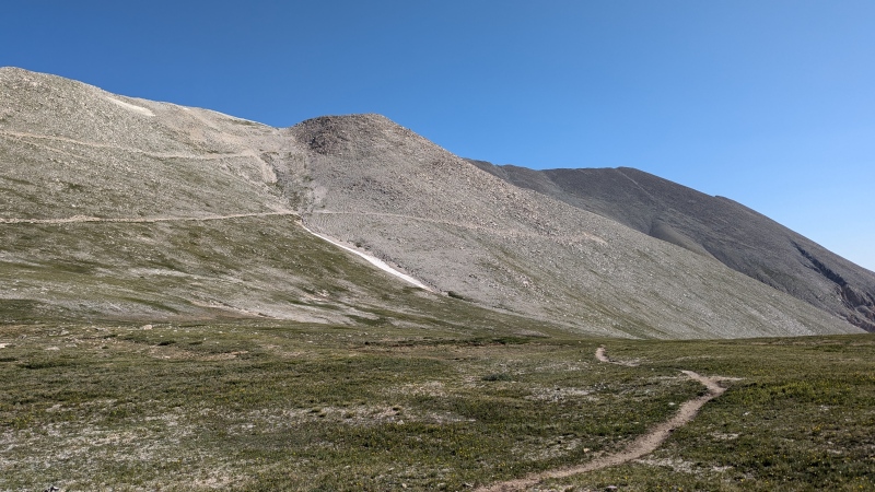
View back at the upper Antero road from the top of the Little Browns creek trail.
The Little Browns Creek Trail is very clear and easy to followLittle Browns Creek Trail on the way down as it's about to enter the trees
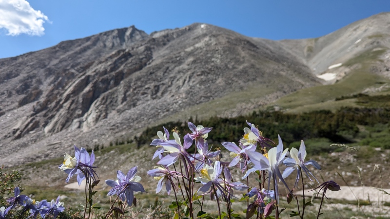
Wildflowers were all in full bloom in mid July.
My GPS Tracks on Google Maps (made from a .GPX file upload):
I think you got your route names mixed up here. This is the Little Browns Creek route, not the Browns Creek route, which is different. They are not the same route, as, for example, Gerry Roach's book illustrates. If you look closely at the image you posted of where the trail diverges from the creek and then comes close to it again, it says "Little Browns Creek" and not "Browns Creek". I also used the Little Browns Creek route to hike Antero and I agree it's a good one, peaceful and relatively secluded. The Browns Creek route instead comes up a different drainage, goes past Browns Lake, and has Shav and Tab to its south, rather than Mt. White.
Caution: The information contained in this report may not be accurate and should not be the only resource used in preparation for your climb. Failure to have the necessary experience, physical conditioning, supplies or equipment can result in injury or death. 14ers.com and the author(s) of this report provide no warranties, either express or implied, that the information provided is accurate or reliable. By using the information provided, you agree to indemnify and hold harmless 14ers.com and the report author(s) with respect to any claims and demands against them, including any attorney fees and expenses. Please read the 14ers.com Safety and Disclaimer pages for more information.
Please respect private property: 14ers.com supports the rights of private landowners to determine how and by whom their land will be used. In Colorado, it is your responsibility to determine if land is private and to obtain the appropriate permission before entering the property.
")
")
")
")
")
")
")
")
")
")
")
")
")
")
")

