| Report Type | Full |
| Peak(s) |
Jacque Peak - 13,212 feet |
| Date Posted | 07/10/2024 |
| Date Climbed | 07/10/2024 |
| Author | Peaks4Days |
| Jacque Peak Loop |
|---|
|
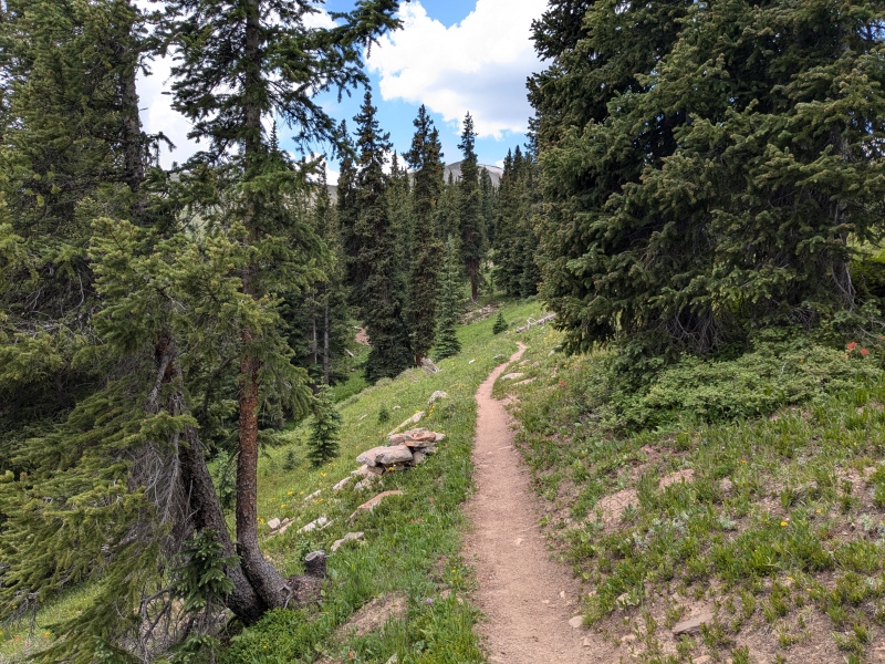
Jacques Peak Loop (Up Copper Mountain, down Colorado Trail) Stats: Getting There For this loop hike, I started and ended at the "Union Creek Parking Lot" at Copper Mountain. Fortunately, in the summer, this is free! However, there's no overnight parking, so you can't car camp there. Parking Lot to Union Mountain (Miles 0.0 - 4.9) I did this loop clockwise - going up Copper Mountain and coming down the Colorado Trail. This seemed the better option, because coming down the CT is much more scenic, and I like my good views at the end of the hike going downhill, not while I'm slogging up. 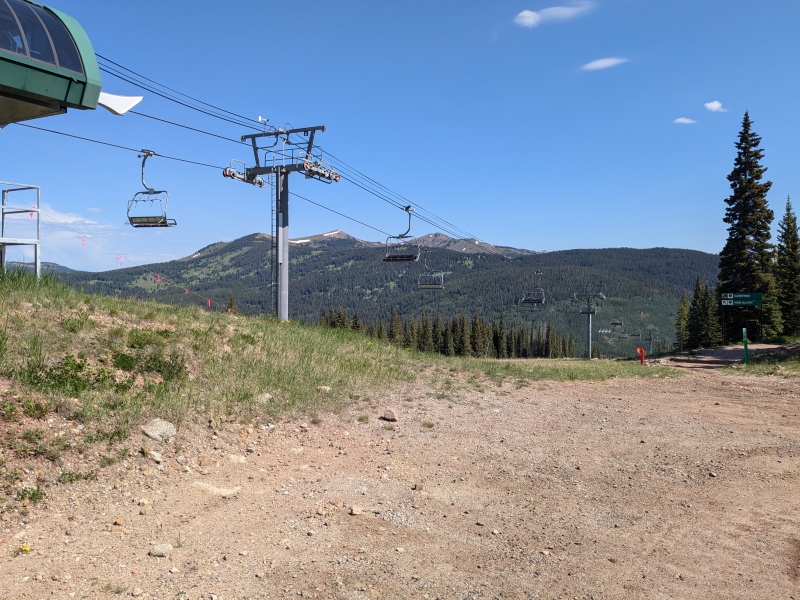
Going up the ski resort side meant following a service road that switchbacked across the slopes for just under 5 miles until reaching Union Mountain. WildWanderer did a great report detailing the directions leading to this point, so for brevity's sake, here's the link to her report: https://www.14ers.com/php14ers/tripreport.php?trip=22609#bottom Union Mountain to Jacque Peak (Miles 4.9 - 6.6) 
From the top of Union Mountain, the route over to Jacque was fairly obvious. The ridge went southwest, following some chute entrances down the eponymous "Union Bowl" of the resort. The terrain was tundra intermixed with same tippy, slab rocks, but nothing too out-of-the ordinary for 13ers. The last chute "Lallarookn" was 0.7 miles from the Union lift. 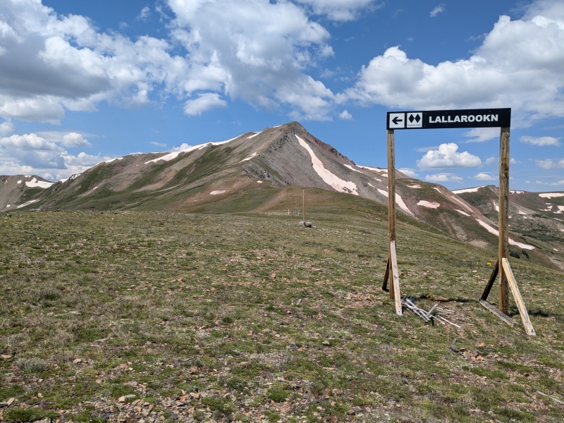
The route started getting serious about the gain to Jacque about 1.3 miles from the lift. All things considered though, the rock was fairly solid, making for a good push up to the summit. From the start of the slog, it was 900 ft. of gain in 0.5 miles to the summit. 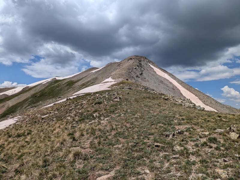
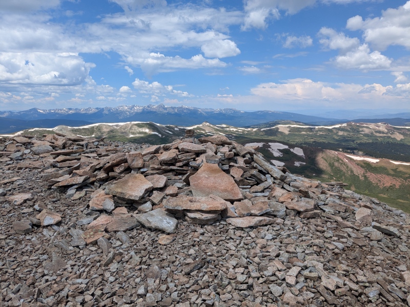
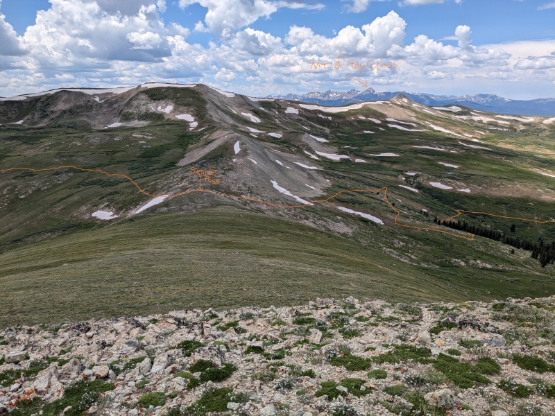
Jacque to Searle Pass (Miles 6.6 - 8.7) The loop continued down Jacque's West slope towards "Searle Pass," where it would join the Colorado Trail. Speaking of trail, this was all off-trail to Searle Pass, but with wide open views that made route-finding a breeze. Going down the West slope of was much nicer that the East slope. This side was less steep and was a mix of grass and comparatively manageable rocks. 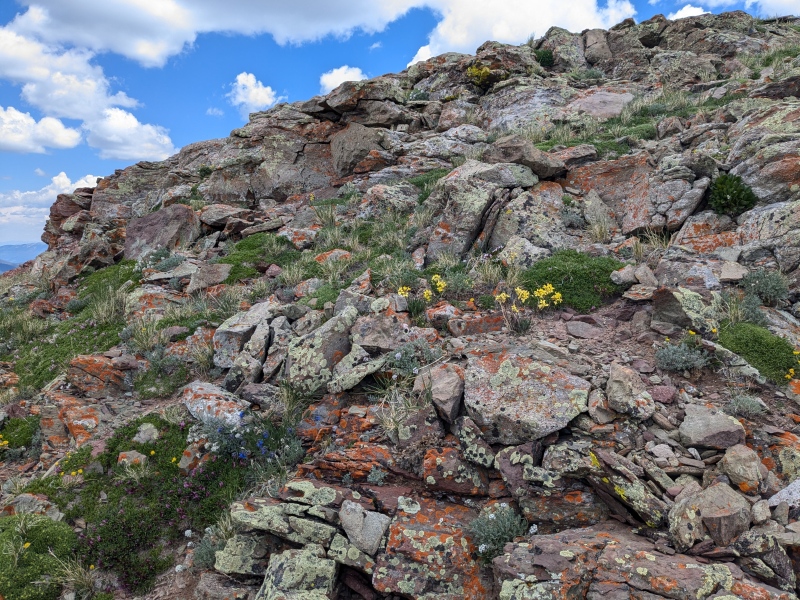
The West slope continued down for 0.7 miles, loosing about 500 ft. before coming to a small saddle. After the saddle, it was a small push up 175 ft for 0.3 miles. This was where the only route-finding above the treeline took place. Searle Pass was down to the West, but instead of going straight for it, I went another 0.5 miles on the ridge before banging a left. This prevented me from having to walk across the side-slope, and gave me a straight shot down instead. 

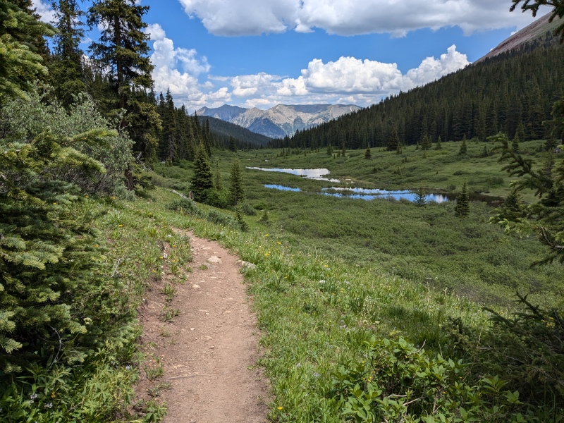
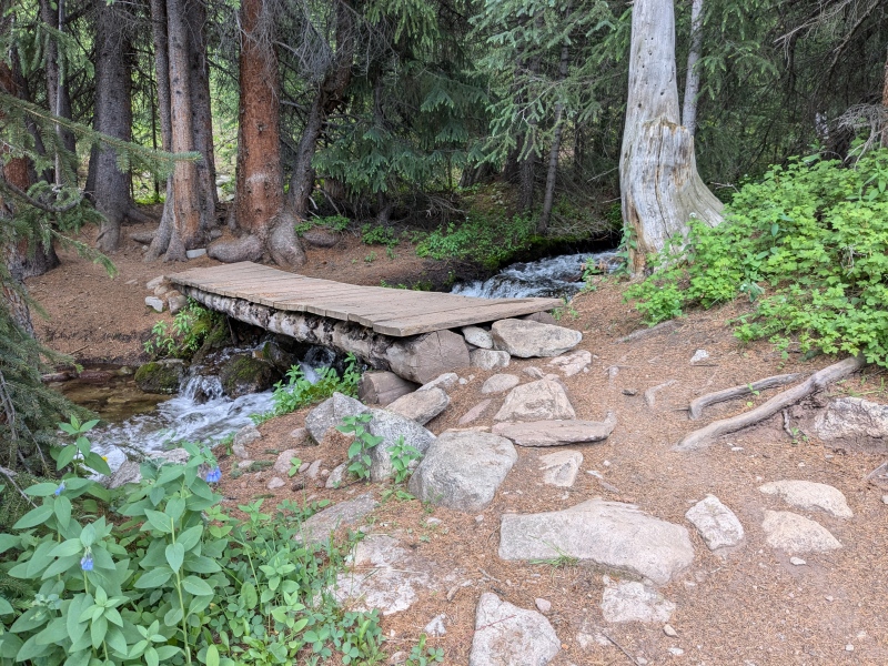
Searle Pass to Parking Lot (Miles 8.7 - 15.8) The rest of the way down on the Colorado Trail was beautiful. The bit above the treeline in particular offered stunning views of the area and had spectacular wildflowers this time of year (July 10). It was the longest stretch though, so I was ready to be done by the end of it. Speaking of which, I did take a slight shortcut at about a mile from the end. There was a small trail going down the "Lumberjack" ski run, which was a direct route to the road. This was opposed to continuing on the Colorado Trail, which looked like it would have been twice as long with a bunch of switchbacks to descend the same elevation. 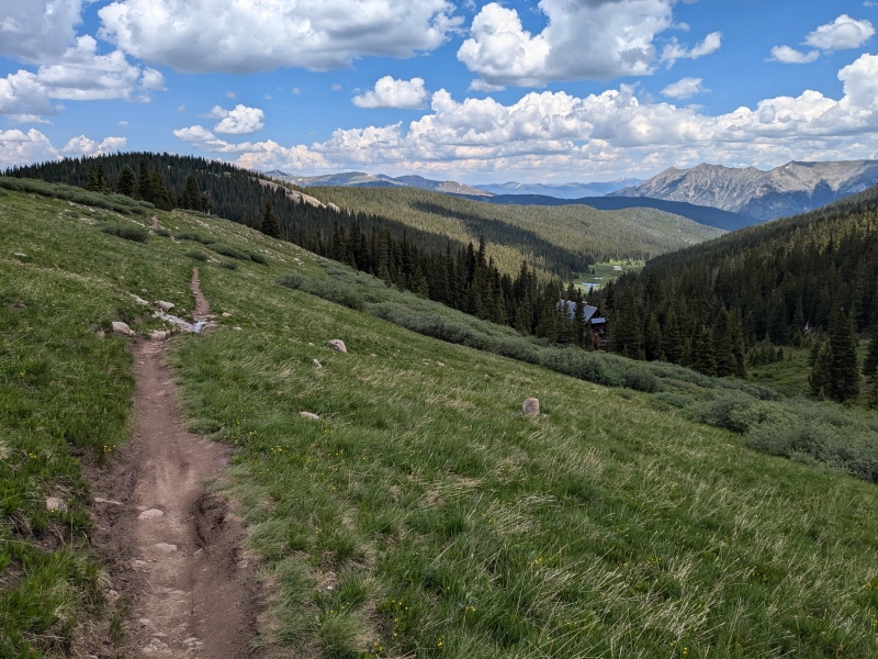
All said, a great route! Long route, but very easy as far as technicality goes. GPX posted below. Also, here's a link to my Strava of this: https://www.strava.com/activities/11857497991 Thumbnails for uploaded photos (click to open slideshow): ")
")
")
")
")
")
")
")
")
")
")
")
")
")
|
| Comments or Questions |
|---|
|
|
Caution: The information contained in this report may not be accurate and should not be the only resource used in preparation for your climb. Failure to have the necessary experience, physical conditioning, supplies or equipment can result in injury or death. 14ers.com and the author(s) of this report provide no warranties, either express or implied, that the information provided is accurate or reliable. By using the information provided, you agree to indemnify and hold harmless 14ers.com and the report author(s) with respect to any claims and demands against them, including any attorney fees and expenses. Please read the 14ers.com Safety and Disclaimer pages for more information.
Please respect private property: 14ers.com supports the rights of private landowners to determine how and by whom their land will be used. In Colorado, it is your responsibility to determine if land is private and to obtain the appropriate permission before entering the property.

