Download Agreement, Release, and Acknowledgement of Risk:
You (the person requesting this file download) fully understand mountain climbing ("Activity") involves risks and dangers of serious bodily injury, including permanent disability, paralysis, and death ("Risks") and you fully accept and assume all such risks and all responsibility for losses, costs, and damages you incur as a result of your participation in this Activity.
You acknowledge that information in the file you have chosen to download may not be accurate and may contain errors. You agree to assume all risks when using this information and agree to release and discharge 14ers.com, 14ers Inc. and the author(s) of such information (collectively, the "Released Parties").
You hereby discharge the Released Parties from all damages, actions, claims and liabilities of any nature, specifically including, but not limited to, damages, actions, claims and liabilities arising from or related to the negligence of the Released Parties. You further agree to indemnify, hold harmless and defend 14ers.com, 14ers Inc. and each of the other Released Parties from and against any loss, damage, liability and expense, including costs and attorney fees, incurred by 14ers.com, 14ers Inc. or any of the other Released Parties as a result of you using information provided on the 14ers.com or 14ers Inc. websites.
You have read this agreement, fully understand its terms and intend it to be a complete and unconditional release of all liability to the greatest extent allowed by law and agree that if any portion of this agreement is held to be invalid the balance, notwithstanding, shall continue in full force and effect.
By clicking "OK" you agree to these terms. If you DO NOT agree, click "Cancel"...
I already wrote up a TR on skiing Babcock but that was really more of a recon for a bigger day. Since last winter I'd been plotting a route to ski all the La Plata 13ers in one push. But you can draw a bunch of squiggles in Caltopo and Google Earth that look promising only to get shut down by impassable cliffs in realtime. And having only spent limited time back there I knew it would be a roll of the dice fluidly connecting them all.
Susannah and I had some back and forth on meeting time the night prior. Initially I agreed to meeting at the winter TH of La Plata Canyon at 3a but after studying the map and accounting for a snowmobile ride I renegged to 2:30a. Oof. Completely zombified I pulled up just after Susannah and loaded my gear onto her sled. Interestingly, the winter gate was in fact open and there was no snow in sight on the road. At this point, one of us should've suggested driving a vehicle. Instead, we were just too asleep still and pot committed to change plans. We charged down the dirt road on the sled at over 30 mph only encountering a few patches of snow over a mile into the ride. If the sled wasn't a beater before it was now.
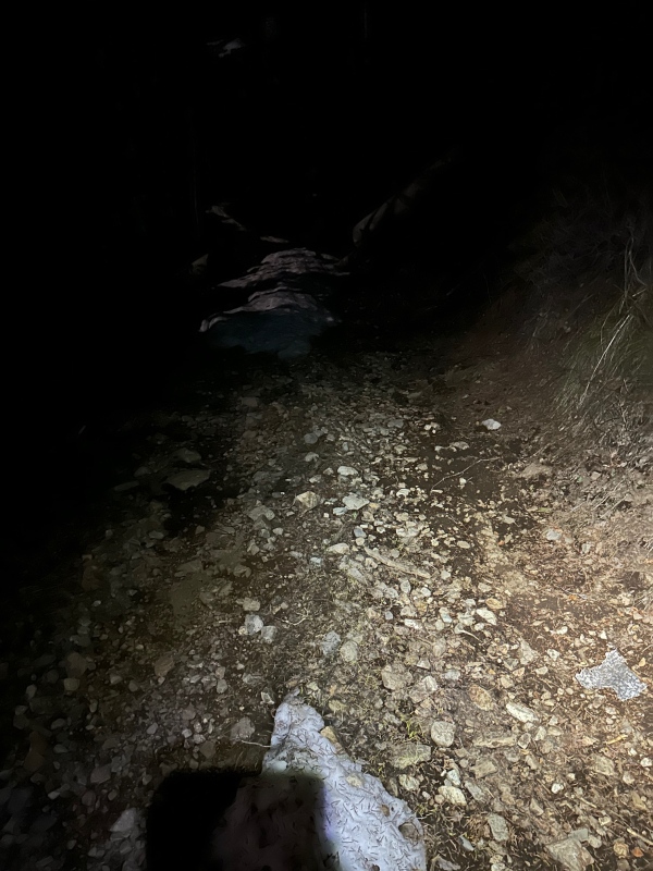
We unloaded and started "skinning" at just after 3. There actually wasn't any skinning for another couple miles and 2000ft, as the creeks were at full flow and the trails below 11k were almost completely melted out. The dark slog ended near treeline as we entered upper Boren Creek. We had been here a couple weeks earlier with more snow and later in the day with more light. That helped us navigate directly to the base of the south couloirs of Babcock.
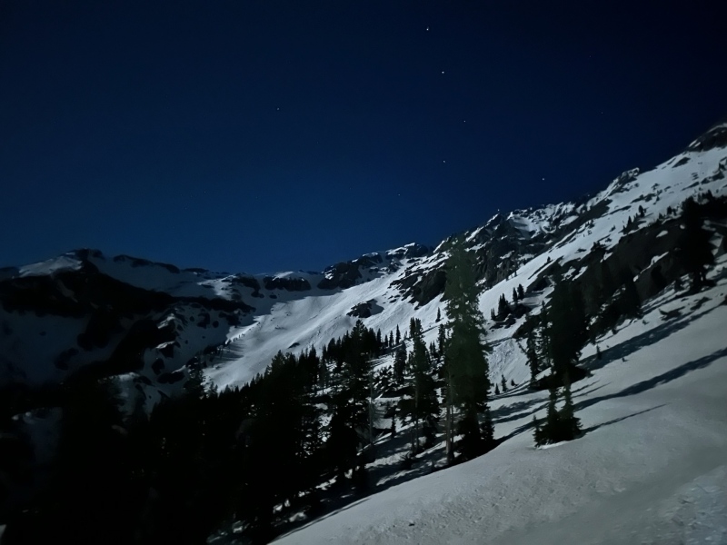
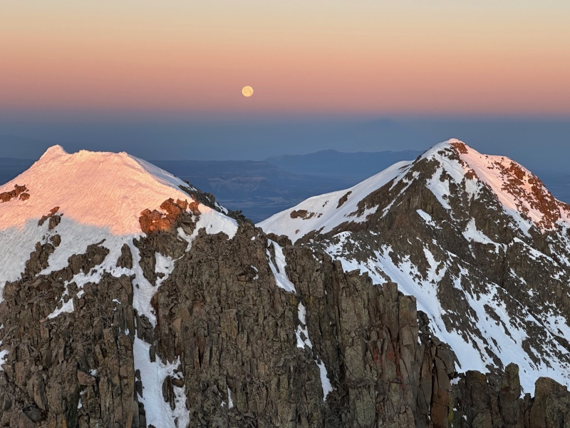
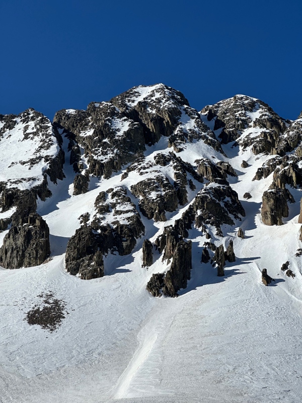
First few miles of Boren CkUpper Boren Ck on a full moon night
BABCOCK
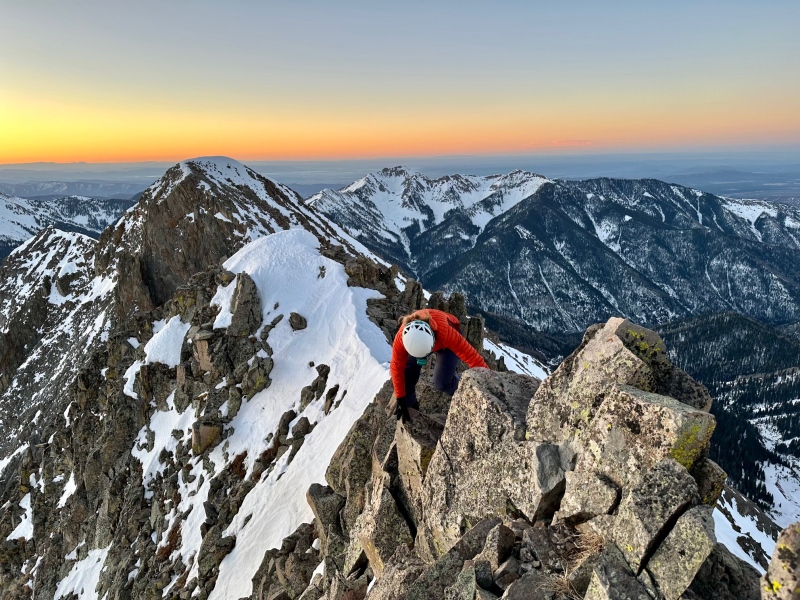
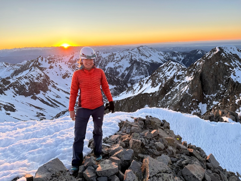
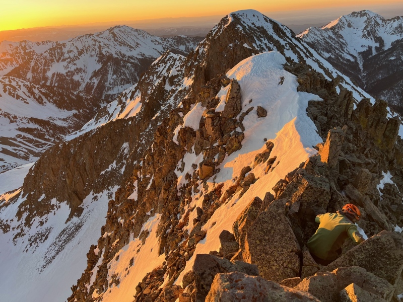
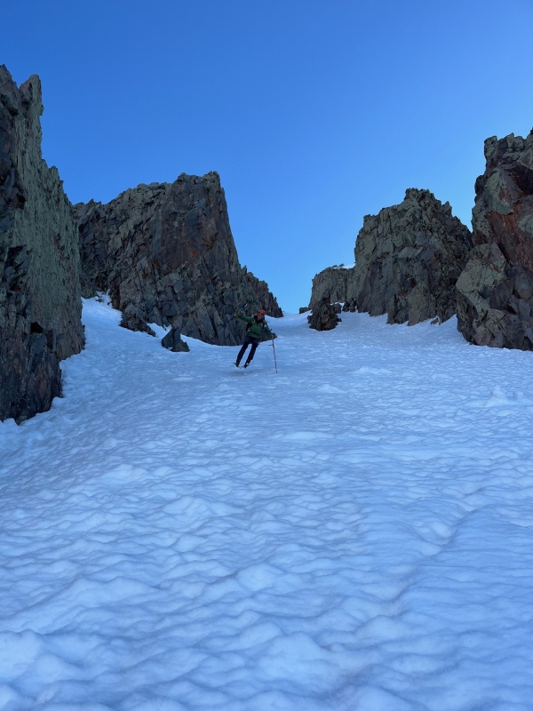
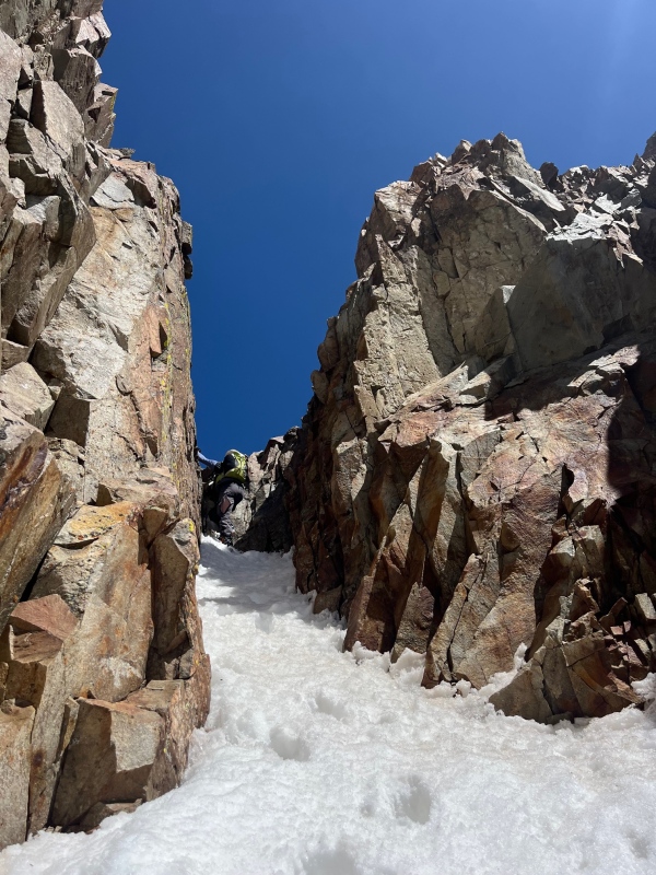
In our last visit we didn't summit but there would be none of that poor style on this go round. This time we went up the looker's right couloir of middle Babcock. In the predawn ink we traded out our ski boots for trail runners and scrambled up the eastern side, summiting right at dawn. The summit climb and subsequent sunrise left us breathless in that double entendre kind of way. We took it in for a few minutes before returning to our gear and starting down the same southern couloir we had climbed. The forecast soft freeze was in fact a hard freeze and the golden hour light did nothing to soften it. We embraced over 1000 feet of teeth chattering skull tingling turns atop refrozen suncups before throwing the skis back on our packs and beginning the climb up to spiller just as the snow was softening on that more eastern aspect.
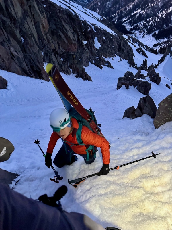
Susannah near the top of the couloirScrambling up BabcockMoonset over western Babcock and SpillerBabcock's summit ridgeSunrise on BabcockDescendingJump turning on refrozen chunder
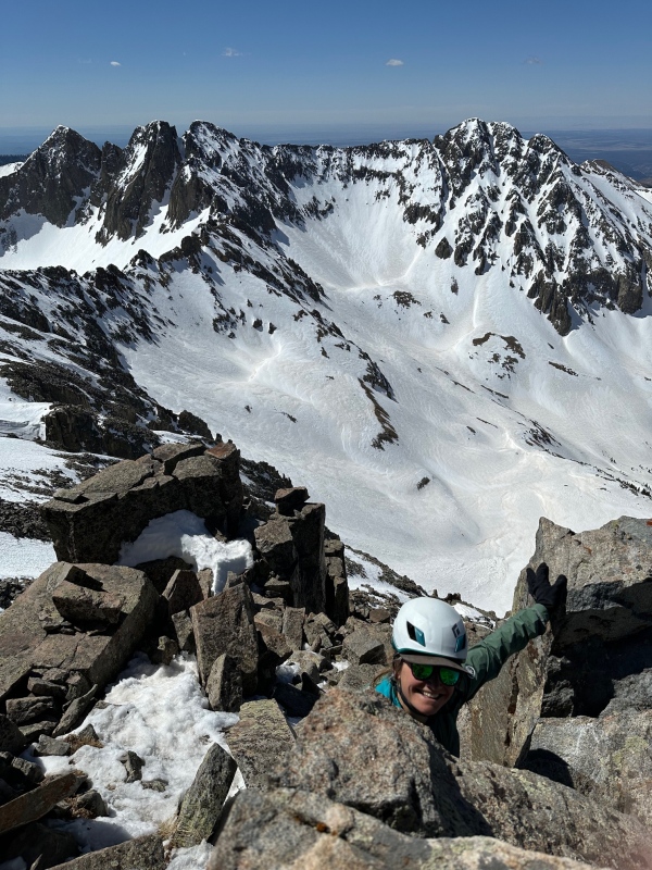
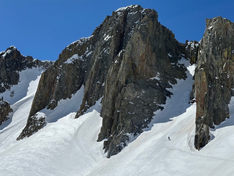
SPILLER
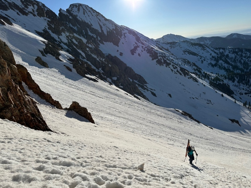
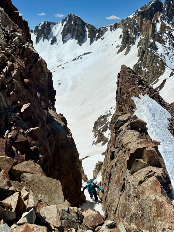
The warmth of a new day gave us a little pep in our step. We bootpacked up to the saddle between Spiller and Gibbs and scrambled up to Spiller's summit -ski boots on- covering the 1200 ft in just over an hour. Just shy of the top is the entrance to Spiller's north couloir. It is gorgeous: fall line, steep, big walls, 1000ft, did I mention north facing? It was completely bulletproof. Susannah entered the lower angled entrance and took a couple jump turns before it rolled over to ~45 degrees. Her confidence was shattered and she proceeded to start slowly side slipping for the next several hundred feet. Memorable in a way we were not hoping for. I followed behind making cautious jump turns. Susannah told me later she imagined me careening toward her like a bowling ball. Instead I caught up to her a few hundred feet down the line and cautiously passed. Eventually we found the sun and some slightly more edgeable snow leading us to the bottom of Owen Basin.
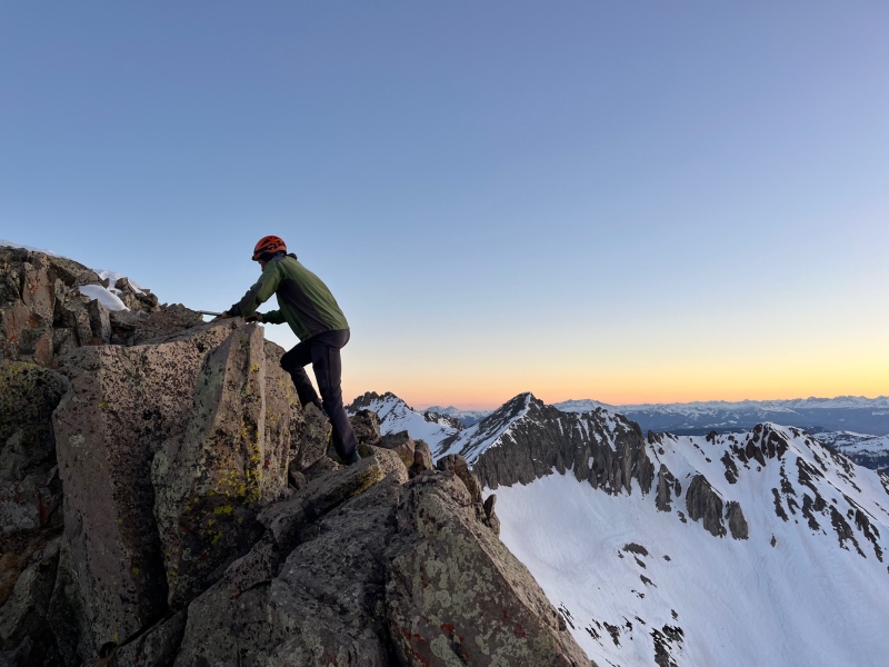
Ascending SpillerSpiller's south ridgeSusannah entering Spiller's north couloirLooking back on the north couloir of Spiller from Owen BasinSkins back on, Spiller in the background
MOSS & LAVENDER
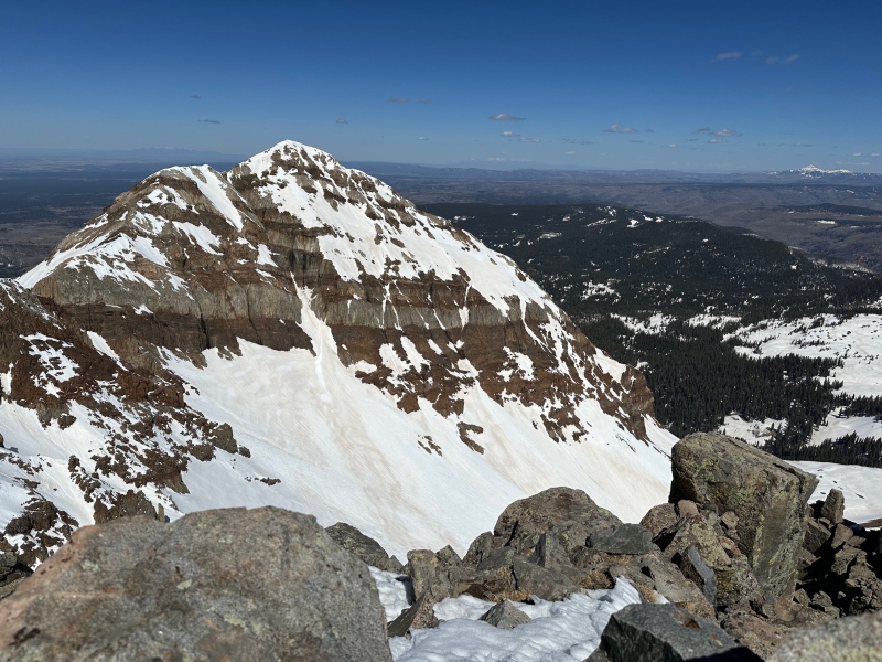
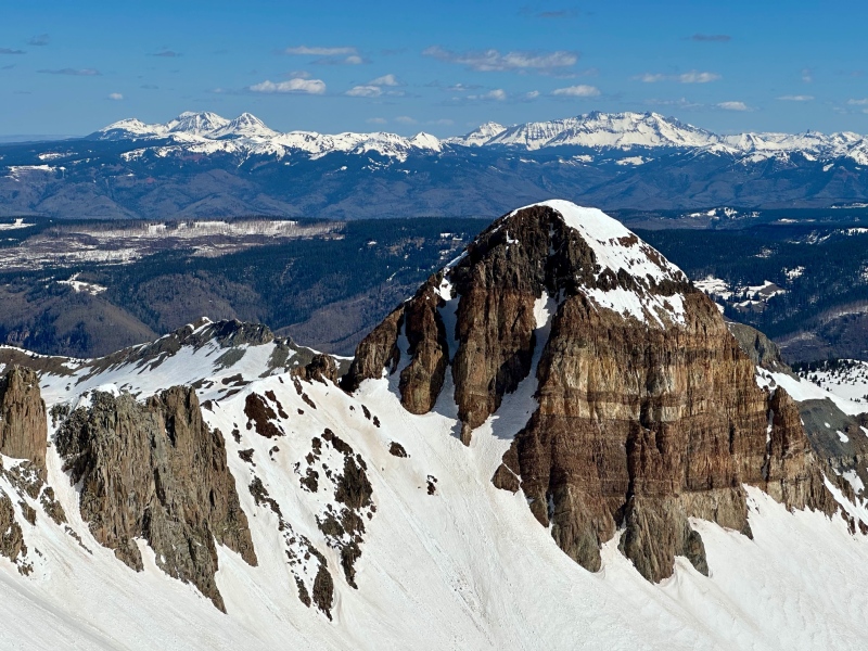
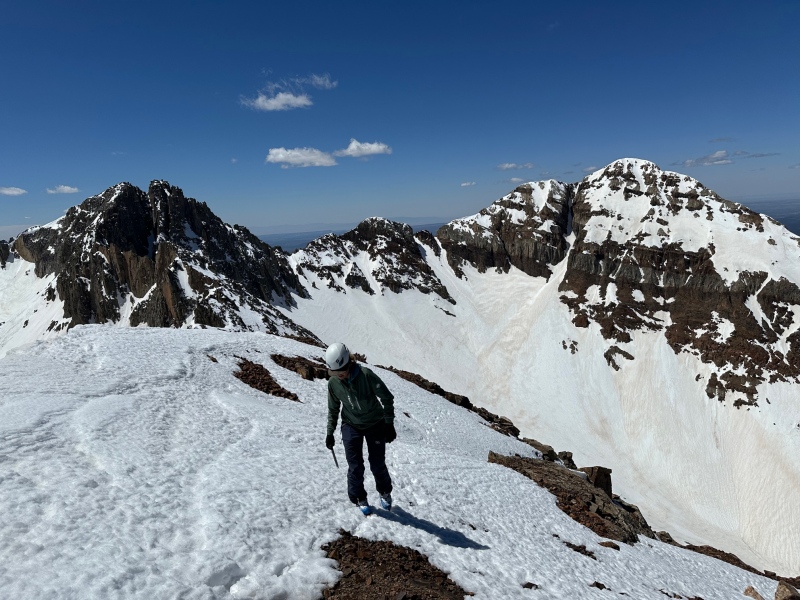
We transitioned back to skins and discussed our options for bagging all 6 mountains. It was after 9a and we had to be back to the snowmobile by 2p (not because of avalanche conditions but because I had to pickup my daughter from the bus). At this point we realized we might have to sacrifice a couple of of our objectives. We identified a couloir leading directly to the saddle between Moss and Lavender and started climbing. Both of us were feeling good so we ascended the 1000 feet to the saddle in about 45 mins . We kept our crampons on and hustled up Moss and then hopped over to Lavender summiting ~11. Even though Hesperus looked enticingly close from Lavender the practical side of me realized I'd be leaving my daughter hanging if we went for it. We retraced our steps to the saddle and discussed our options.
Lavender's summitSusannah descending LavenderHesperus from the summit of LavenderSusannah skiing into Bear Creek from the Moss-Lavender saddle
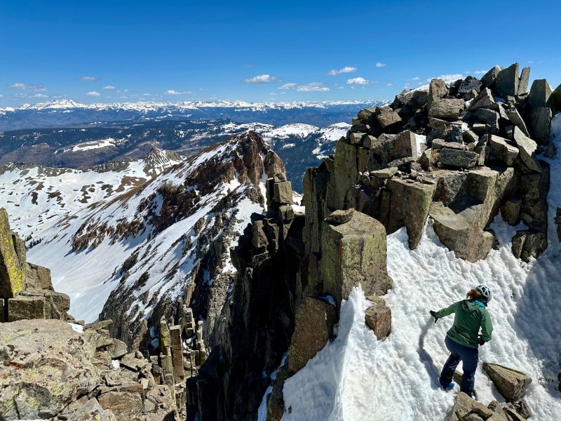
CENTENNIAL
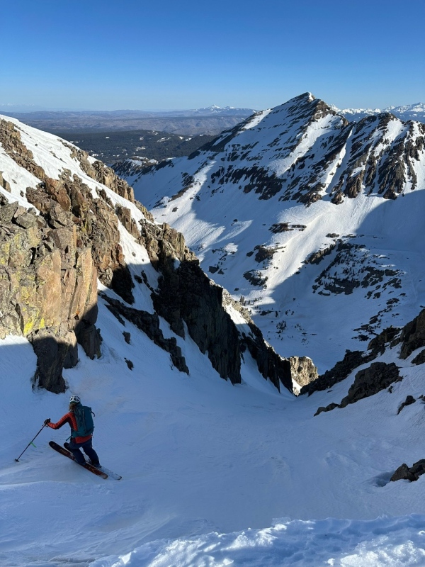
Earlier we noticed a corniced entrance to a broad couloir coming off the NE side of the Moss-Lavender saddle. Upon closer inspection we realized we could navigate the edge of the cornice for a descent into the Bear Creek drainage and the south side of Centennial. So we hastily ate "lunch" of some more protein bars and decided to give Centennial an attempt. We transitioned back to skis for the third time on the day and jumped in to the shady short couloir. The 300 foot upper section probably had the best snow on the day. Upon hitting the open apron, the sun affected snow had fully softened but was still supportable. We carried our speed and traversed from the base of the couloir paralleling the Lavender-Centennial ridge making it over to the the south side of Centennial in less than 10 mins from the saddle.
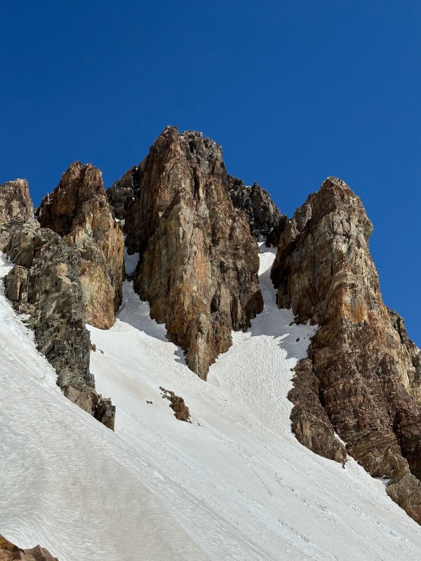
The south side of Centennial and the 3 couloirs. We climbed the left one.
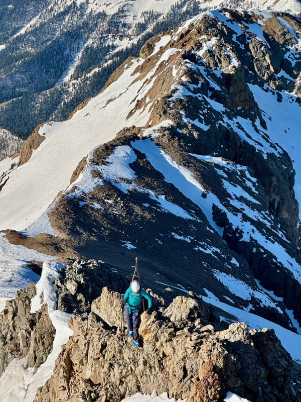
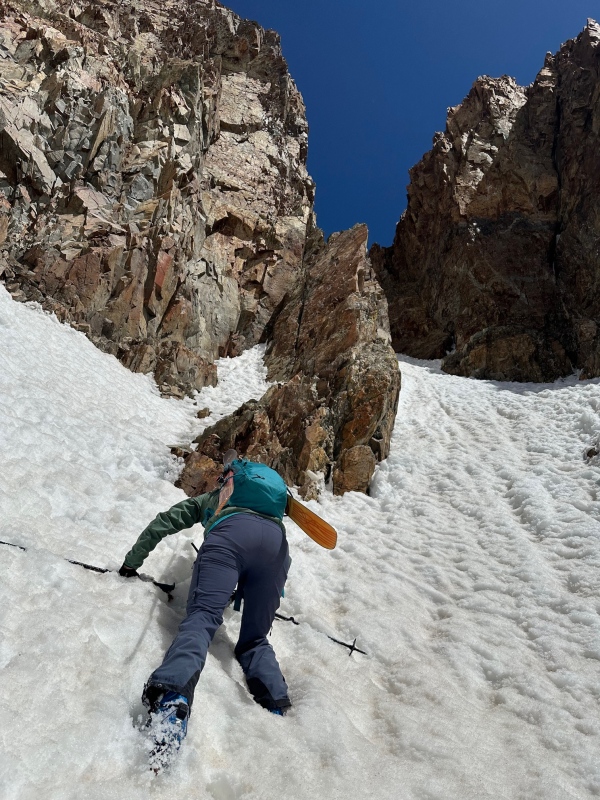
The south side of Centennial has 3 distinct couloirs and I challenge you to find beta on any of them anywhere on the internet. From the saddle it looked like the middle would go but upon closer inspection it had an ice flow atop a chock block. The lookers right one was also icy but the lookers left one had a workable pitch to it. We abandoned our skis at the entrance and started up the 60 degree slope using our axes for the first time on the day. The soft snow made the ascent feel secure. After a couple hundred feet the couloir ended abruptly at an 8 foot vertical wall. We shimmied our way up the corner dihedral and topped out on... another snowfield. It was less steep than the couloir and had thinner coverage with a westerly aspect. We ascended it and topped out at a notch looking into a tangle of tippy boulders, overhanging cliff faces and sketchy ledges. This veritable jungle gym of despair was where the middle couloir would have topped out. We backed off the notch and found a chimney leading to thin snow veiling a scree field. As this snowfield eased we realized we were on the summit of Centennial a little after noon just like that.
The chock is faintly visible in the middle gully.Susannah ascending. Shortly after this we ditched skis and pulled out axes to ascend the right side of this photo.Me climbing the top wall.Looking down into the couloir.Centennial's summit ridge with Hesperus behind. Notice the nice looking east facing couloir down from the south ridge.
EGRESS
We retraced our steps and skied down from Centennial toward the Moss-Diorite ridge. Susannah identified a weakness in the ridge that was only a few hundred feet overhead making for a short skin. I started feeling confident that we could make it back to the snowmobile before 2 as we descended into Tomahawk. There were several points lower down along the mining road where we had to go skis on skis off but I knew we could skate ski quickly along the floor of La Plata Canyon. That was right up until the point when we encountered a massive dirt road scraping plow peeling off the last remaining inches of snow on the road. WHY!? Is jeeping that popular?? This thing had scraped clear the entirety of the road forward of that point. Suddenly I was resigned to the fact that I'd be walking instead of skiing out. With it being past 1p and us having over 2.5 miles to go I was a little panicked. I started running in ski boots with Susannah reluctantly trying to keep up. Sweating profusely, dehydrated and exhausted we got back to the sled about 215. Susannah hammered the throttle kicking up rocks on the bone dry road as we passed multiple vehicles going in the opposite direction. I got back to my car at 230 and miraculously I made it to the bus stop at 3 just as the bus was pulling up. Pleasant weather, stellar company, marginal snow and miserable road conditions making for a memorable day in the La Platas.
My GPS Tracks on Google Maps (made from a .GPX file upload):
Sometimes you ski for the snow, sometimes for the route -- I've had some of my best days doing both. Congrats on a creative link-up in a less-traveled part of the state.
Cool you skied the VW face on Spiller. As I recall getting to Hesperus (at the end) is just brutal because the good scrambling is over before you even start on that mind-numbing excursion. Really dig your route on Centennial, too--those couloirs look like the ticket to link it with the others and avoid traversing around the west side. Nothing like ripping out on a rock sled at the end of the day. Huge effort to have done by early PM!
Thanks guys. But calling the Spiller descent a ski would be generous. It was a controlled fall.
Caution: The information contained in this report may not be accurate and should not be the only resource used in preparation for your climb. Failure to have the necessary experience, physical conditioning, supplies or equipment can result in injury or death. 14ers.com and the author(s) of this report provide no warranties, either express or implied, that the information provided is accurate or reliable. By using the information provided, you agree to indemnify and hold harmless 14ers.com and the report author(s) with respect to any claims and demands against them, including any attorney fees and expenses. Please read the 14ers.com Safety and Disclaimer pages for more information.
Please respect private property: 14ers.com supports the rights of private landowners to determine how and by whom their land will be used. In Colorado, it is your responsibility to determine if land is private and to obtain the appropriate permission before entering the property.

")
")
")
")
")
")
")
")
")
")
")
")
")
")
")
")
")
")
")
")
")
")
")
")
")
")
")


