Download Agreement, Release, and Acknowledgement of Risk:
You (the person requesting this file download) fully understand mountain climbing ("Activity") involves risks and dangers of serious bodily injury, including permanent disability, paralysis, and death ("Risks") and you fully accept and assume all such risks and all responsibility for losses, costs, and damages you incur as a result of your participation in this Activity.
You acknowledge that information in the file you have chosen to download may not be accurate and may contain errors. You agree to assume all risks when using this information and agree to release and discharge 14ers.com, 14ers Inc. and the author(s) of such information (collectively, the "Released Parties").
You hereby discharge the Released Parties from all damages, actions, claims and liabilities of any nature, specifically including, but not limited to, damages, actions, claims and liabilities arising from or related to the negligence of the Released Parties. You further agree to indemnify, hold harmless and defend 14ers.com, 14ers Inc. and each of the other Released Parties from and against any loss, damage, liability and expense, including costs and attorney fees, incurred by 14ers.com, 14ers Inc. or any of the other Released Parties as a result of you using information provided on the 14ers.com or 14ers Inc. websites.
You have read this agreement, fully understand its terms and intend it to be a complete and unconditional release of all liability to the greatest extent allowed by law and agree that if any portion of this agreement is held to be invalid the balance, notwithstanding, shall continue in full force and effect.
By clicking "OK" you agree to these terms. If you DO NOT agree, click "Cancel"...
In the summer of 2023 I first ventured into Boren Creek and Tomahawk Basin on separate trips to visit some of the La Plata 13ers. I was amazed by how much snow remained in August and September respectively in both the south and north couloirs draped upon Babcock and knew I had to come back in the spring.
The problem with the La Plata 13ers is they're tucked into the back of a narrow box canyon choked with snow well into June. A light 4wd is sufficient once the snow has melted to access the far trailheads but in winter and spring, you're either skinning the flat road for 4+ miles or taking a snowmobile - and the locked gate further enforces this. Upon a person's first visit to La Plata Canyon in the winter, the first thing you notice -besides the frigid inversion spilling out of the canyon- is the row of snowmobiles lined up along the road just inside the gate. There are more than a few cabins and houses inside the canyon that require winter access. But interestingly, many a rusted out, beat to shit snowmobile is parked there all winter long exclusively for accessing the far trailheads. Just my luck, my partner Susannah impulsively purchased a used sled on the cheap from one of the many snowmobile tour outfits for that express purpose.
After seeing our kids off to school, we met at the mouth of La Plata Canyon at the winter closure and she introduced me to her ride. I was expecting a trail sled but beyond that, it was also a 4 stroke. There would be no powder turns with this tank. I hopped on the back and we cruised along at 30mph making it up to the Boren Creek trailhead in 10 min. Sure beats an hour or more of hoofing a flat road.
The unobstructed sun quickly warmed things up as we started skinning but it stayed below freezing making for a quick approach to the end of the old mining road and to the bottom of the Babcock-Spiller cirque at treeline.
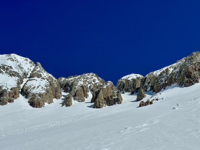
Looking up from Babcock's south apron
We made our first kick turn at the bottom of Babcock about 1.5 hours in. The frozen surface was beginning to transition from refrozen crust to soft, somewhat saturated snow in the direct morning sun. The edgable snow allowed for a smooth, skins on ascent. We were surprised to see and hear a lot of loose wet slide activity flaking off the mountain at 12000ft shortly before 1100.
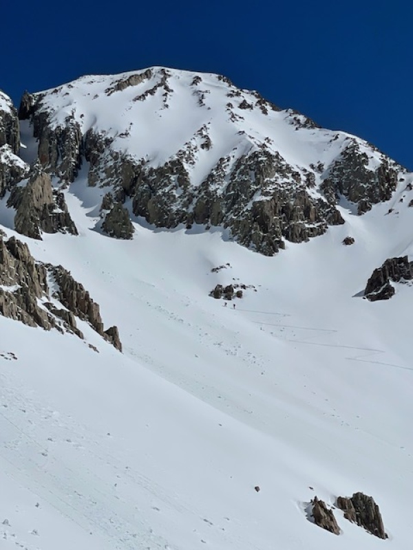
Skinning up the apron (taken from some friends near the Spiller saddle)
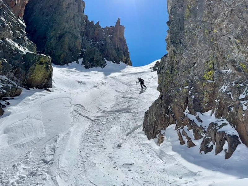
Favoring deeper snow with a slightly more western tilt, we made it to the bottom of the crescent shaped south couloir at 1120. Both of us were nervous about the increasing wet slide activity but the non-surface snow still supported our weight in crampons and the western side of the couloir remained shaded. The deeper wet snow under the noonday sun slowed our progress in the couloir as we had balling on our crampons.
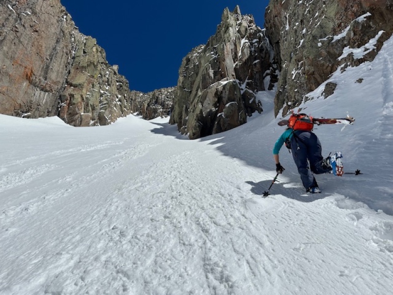
Ascending the crescent couloir on the south side
3hrs and 10 minutes into our tour we reached the saddle between the middle and west summits of Babcock at 1220 and the top of both the south and north couloirs. We decided not to faff with summiting in the interest of time, as we had both summited Babcock before.
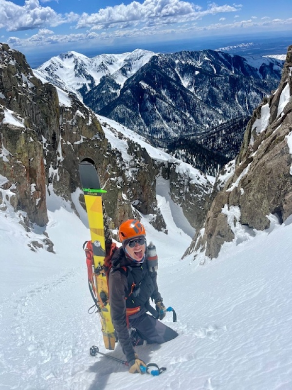
Near the Middle-West saddle
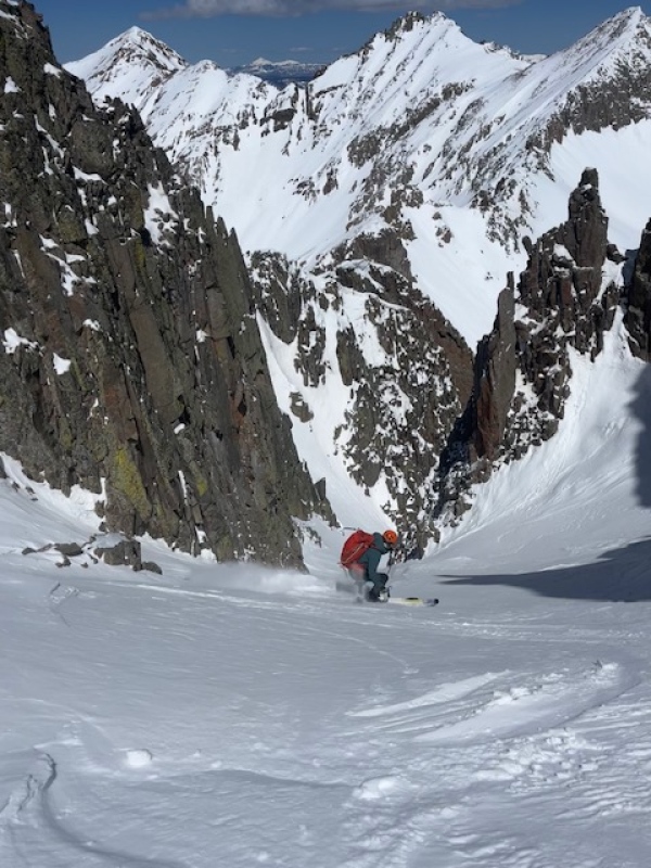
After some snacking and pinching ourselves over the windless banger of a day, we decided that we would descend the cold snow in the north couloir and ski out through Tomahawk Basin. Looping it felt more aesthetic anyway. We still did not know if we'd find chalky windboard as a result of recent wind events or soft snow. The top of the couloir doglegged into the wider, longer bottom half from north to NE. We both felt good about the avy forecast but I skied conservatively in the uppermost wind affected portion. Only a couple hundred feet down I was on a flat table staring into the rest of the line. It was fat and sheltered with cold snow. I waited for Susannah to catch up and dropped in. After briefly testing the snow it became clear it was nearly perfect conditions. I skied the 1000 ft to the bottom with reckless abandon.
Chalky, edgeable entranceSusannah dropping in
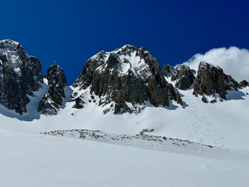
We admired our squiqqles then coasted through surfy firm but saturated snow to the road out of Tomahawk and back to the canyon floor. A couple miles of wet skating along the canyon road led us back to the sled just before 1330.
My GPS Tracks on Google Maps (made from a .GPX file upload):
Had the same thought, even before climbing Babcock last summer, but have no sled (sad face). Apparently there's a line off Spiller too. And I bet Hesperus skies well too. Also, there is a great coulie off Moss that I came up (class 4 at the top, so may need a rope to drop in that one, there's a blurb on that line on MP). I have CR with topo.
Appreciate the info Nat. Id like to get up there for more of them this spring.
Caution: The information contained in this report may not be accurate and should not be the only resource used in preparation for your climb. Failure to have the necessary experience, physical conditioning, supplies or equipment can result in injury or death. 14ers.com and the author(s) of this report provide no warranties, either express or implied, that the information provided is accurate or reliable. By using the information provided, you agree to indemnify and hold harmless 14ers.com and the report author(s) with respect to any claims and demands against them, including any attorney fees and expenses. Please read the 14ers.com Safety and Disclaimer pages for more information.
Please respect private property: 14ers.com supports the rights of private landowners to determine how and by whom their land will be used. In Colorado, it is your responsibility to determine if land is private and to obtain the appropriate permission before entering the property.


")
")
")
")
")
")
")
")
")
")

