Download Agreement, Release, and Acknowledgement of Risk:
You (the person requesting this file download) fully understand mountain climbing ("Activity") involves risks and dangers of serious bodily injury, including permanent disability, paralysis, and death ("Risks") and you fully accept and assume all such risks and all responsibility for losses, costs, and damages you incur as a result of your participation in this Activity.
You acknowledge that information in the file you have chosen to download may not be accurate and may contain errors. You agree to assume all risks when using this information and agree to release and discharge 14ers.com, 14ers Inc. and the author(s) of such information (collectively, the "Released Parties").
You hereby discharge the Released Parties from all damages, actions, claims and liabilities of any nature, specifically including, but not limited to, damages, actions, claims and liabilities arising from or related to the negligence of the Released Parties. You further agree to indemnify, hold harmless and defend 14ers.com, 14ers Inc. and each of the other Released Parties from and against any loss, damage, liability and expense, including costs and attorney fees, incurred by 14ers.com, 14ers Inc. or any of the other Released Parties as a result of you using information provided on the 14ers.com or 14ers Inc. websites.
You have read this agreement, fully understand its terms and intend it to be a complete and unconditional release of all liability to the greatest extent allowed by law and agree that if any portion of this agreement is held to be invalid the balance, notwithstanding, shall continue in full force and effect.
By clicking "OK" you agree to these terms. If you DO NOT agree, click "Cancel"...
"V 10" has a reputation that precedes it. Various high praise includes "exceedingly loose rock (think Elk Range, only worse)," "extreme care was needed. Did I mention that the rock was loose?," "I chose my way up and regretted it after the first ten feet," "some of the sketchier class 3 scrambling I have done in the San Juans," "one slip and I would be launched off 200-400 foot cliffs," and "[a] shocking garbagefest." Sounds amazing, doesn't it? "V 10" is a teetering pile of barely held together dinner plates, the type of ancient dinosaur shit mound turned into a mountain that's miraculously glued together with bubblegum and prayers. Its nearby parent, granitic Grizzly Peak, is a far sight better and is more reminiscent of the Weminuche than the San Miguel which it anchors. The duo is a bit odd together but most people attempt to combine the two, usually via terrible and sketchy sounding scrambling between them.
I'd already done Grizzly once with Whiley and we'd turned around trying to reach "V 10" due to the grueling willow bashing up Cascade Creek. This gave me an opportunity to return later and try "V 10" on snow to cover up the miserable dinner plate approach. Along for the ride were Amy "blazintoes," Michael "Boggy B," and Vera. No fancy pseudonym there. That's literally their name. Vera and I had never climbed with either Amy or Michael at this point, so we were stoked to get after it with some of our heroes. Michael suggested we also add on Grizzly via its north couloir since Amy and Vera both needed it. Deal. Sold. More snow climbing? Count me in.
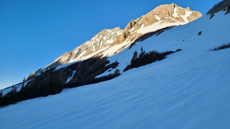
We knew that the approaches Michael and I had taken before - from Bolam Pass and Cascade Creek, respectively - would be very long with snow, so approaching from the Bandora Mine trail that departs from the 4WD section of the South Mineral Creek Road beyond the South Mineral campground would be best. We were able to park about a mile and a half from the start of the trail. Walking the snowy road the rest of the way to trail would be easy. We met up at 3am and were on the move about 15 minutes later. The trail would take us to Hope Pass, separating "V 9" and Point 13,302 (this peak is often mistakenly called "V 8"), and from there we'd depart the trail and pass through a ragged gash Michael noted on "V 9"'s west ridge.
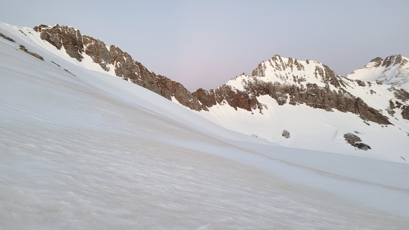
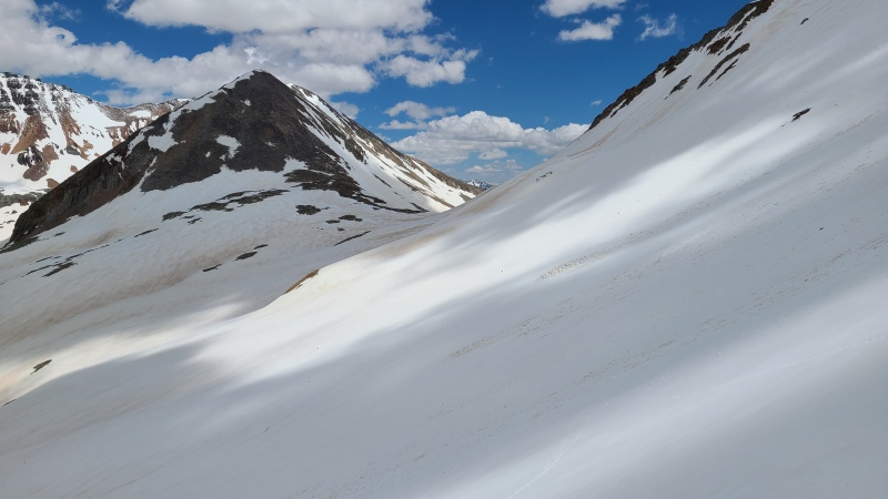
Rolling Mountain on the approach to Hope Pass."V 9" from just below Hope Pass. "V 9" would be a fine candidate for a snow climb since it's typical San Miguel choss.The low spot on "V 9"'s west ridge we'd go over. The peak on mid-right is unranked and unnamed, San Miguel Peak is on the far right.
We dropped a little bit on the other side of the pass and began contouring towards the low point in the ridge, which took us about 20 minutes to reach and 10 to climb.
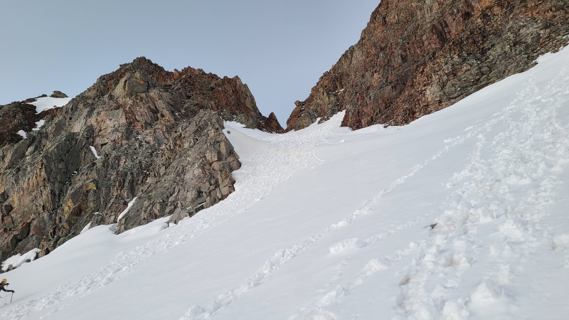
The gash from below.
In the middle of the gash. It's not terribly steep, somewhere in the 30-degree range.Pilot Knob, Vermilion Peak, and Point 13,302.Nice skies over Hope Pass a few minutes before 6am.
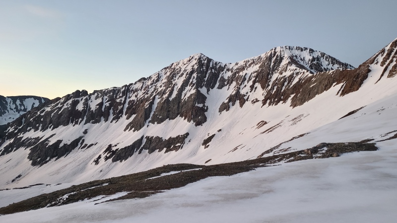
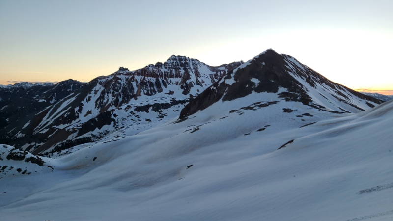
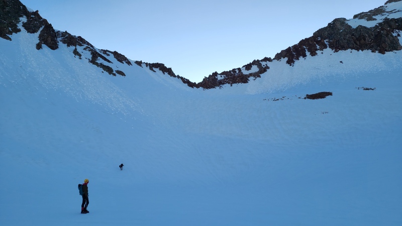
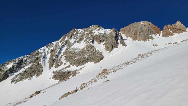
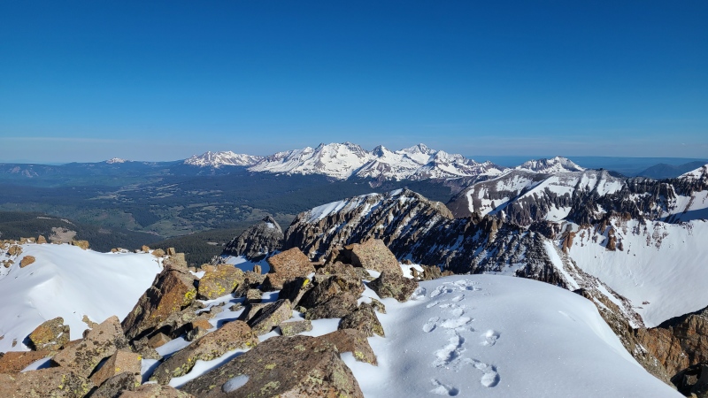
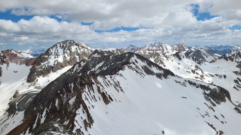
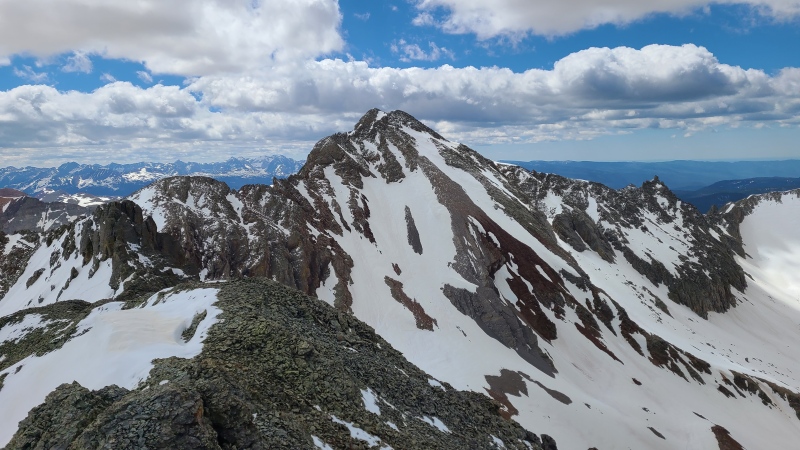
At the top of the ridge cleft we were granted spectacular views of Grizzly and "V 10". We had our work cut out for us as there would be a significant drop in elevation to reach Grizzly a long distance away, another big drop to reach "V 10", and then a final big drop and climb to get back.
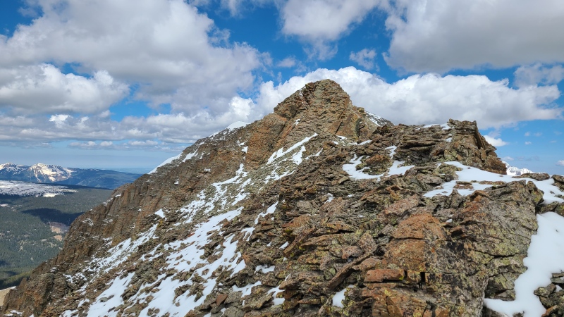
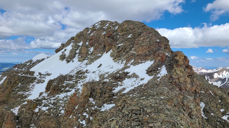
Grizzly on the left, "V 10" is the long ridge-like peak in center right. The actual summit of "V 10" is the ridge's rightmost point.
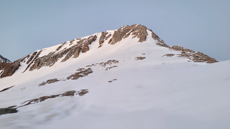
Snow coverage on both peaks was excellent. I'd been a little concerned that "V 10" would be melted and we'd be forced to climb the steep trash on its north face but a couple of continuous snow tongues meant we'd be able to stay on snow for the steepest climbing to the ridge.
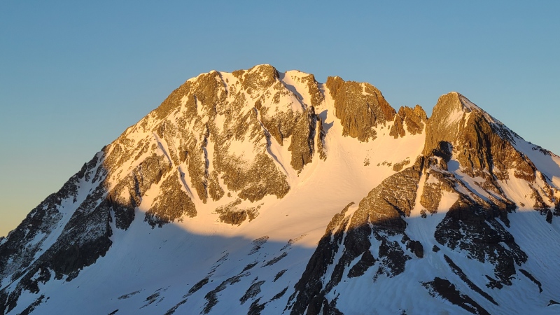
Grizzly Peak with north couloir to the summit obvious."V 10". It's every bit as steep as it looks.
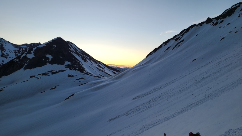
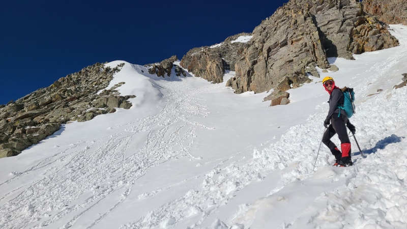
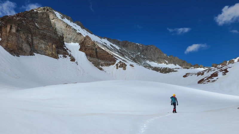
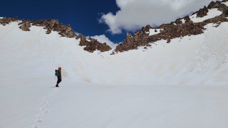
We dropped down into the shaded basin and made our way towards an angling snow ramp below the large, pointed tower between our two peaks. This ramp would be the key to accessing the north sides of both peaks.
Michael and Amy with the notch we climbed through in center.Chill snow ramp with just a short section of dry rock en route to Grizzly.
The ramp proved to be expeditious to the bowl below Grizzly, offering an ascending traverse on Moderate Snow. Before we knew it we were under Grizzly's impressive north face.
Grizzly north face.Amy and Vera coming up the ramp.
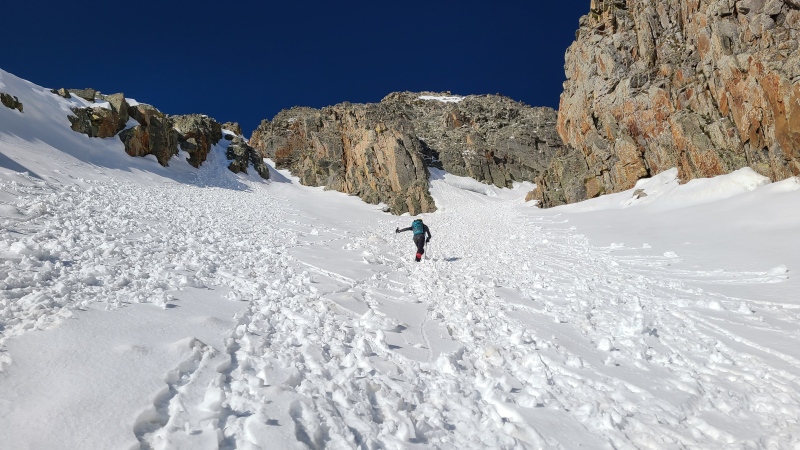
When we were directly under the face we had to make a decision on which of the many couloirs to climb. The most obvious route was to just climb the main couloir, but Michael and I were interested in checking out the central couloir below the summit, which looked like it doglegged climber's right behind some towers to join the main couloir. If it terminated in a rock wall we'd just climb back down and go up the other way.
Instead of going up the obvious fat couloir on the right we went up the one just below the summit thinking we could sneak behind the towers.
We could tell from a distance that the couloir didn't start off particularly steep.
Starting up the central couloir.The dogleg is quite the recluse!
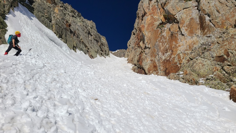
What we couldn't tell was how steep the dogleg was. It took us until we were practically at the bottom of it before we could tell what it was like - even less steep than what we'd climbed up to reach it!
The dogleg looking great.
We sauntered across the dogleg and into the main couloir, which was a straight shot to the summit from where we were.
Oh yeah!
We climbed the remaining three or four hundred feet on perfect snow, topping out with nary a cloud nor a lick of wind.
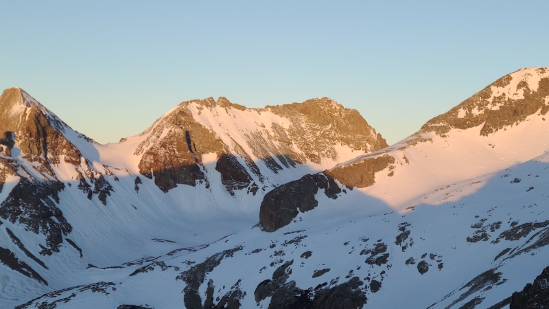
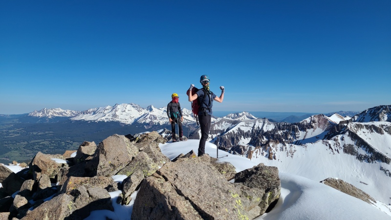
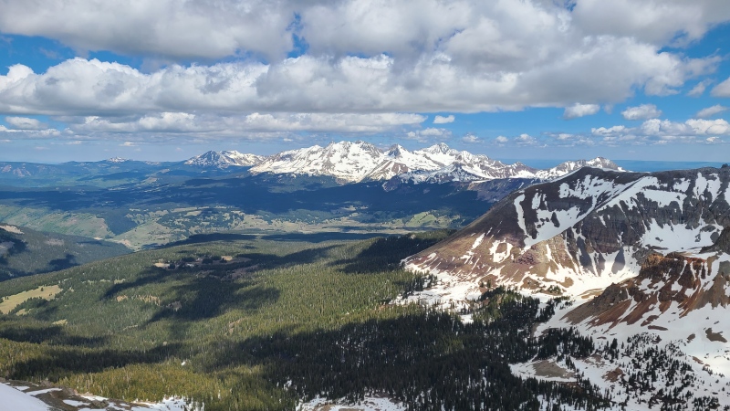
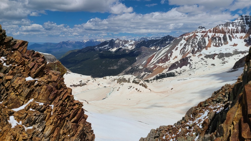
Michael and Amy on the summit. Looking strong! Wilson massif on the left, Lone Cone, Dolores, and Middle on far left.Weminuche and far reaches of the San Juan.Vermilion group. The Vermillion Dollar couloir is faintly visible in the middle of the face.Wilsons and Dolores Peak group. The snowy peak far in the distance on the left is 12,137-foot Groundhog Mountain.
Since we were already over five hours into our day, with the more difficult peak to go, we didn't wait on the summit long. Amy, Michael and I began down while Vera transitioned to skis. We all stayed in the main couloir this time since it was a lot more direct and saved a bit of time. Vera caught us partway down the couloir and skied far ahead across the ramp. They'd meet us below "V 10".
Upper couloir. Not particularly steep.Lower couloir. The dogleg pops out near the outcrop on the right side of the couloir.
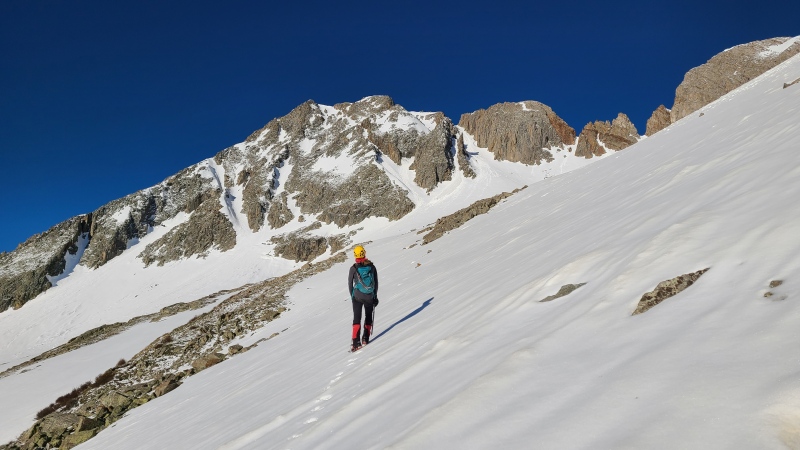
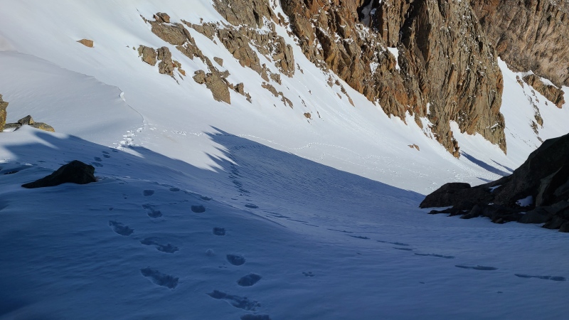
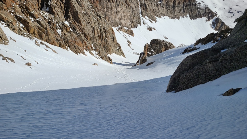
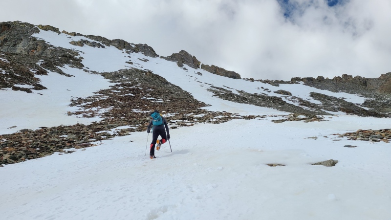
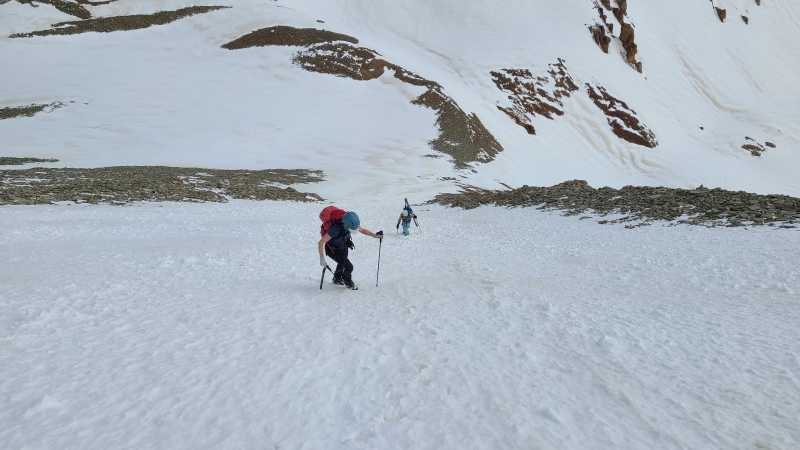
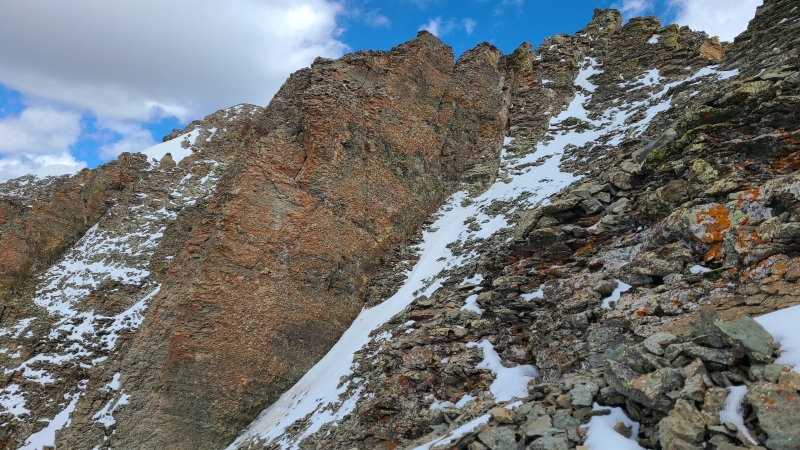
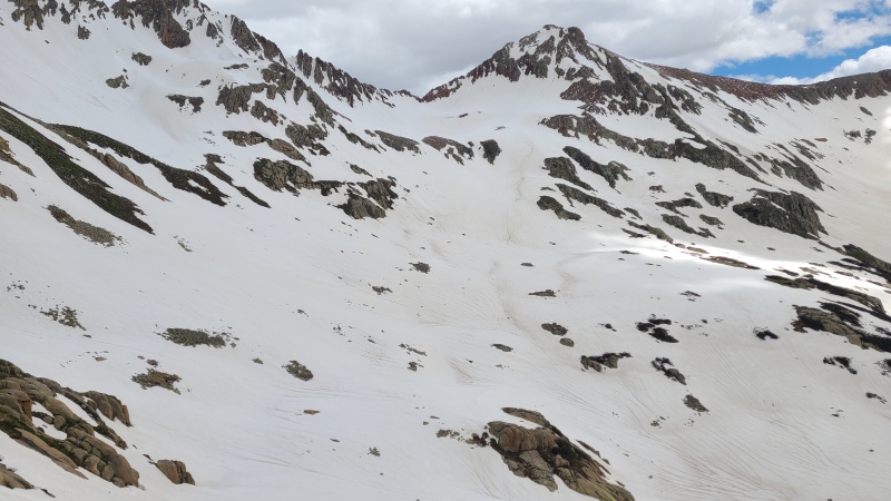
Re-crossing the ramp went quickly and we curved west around cliffs towards "V 10". We followed some rolling terrain en route to the upper basin. The snow covered up what was surely nasty San Miguel scree and talus.
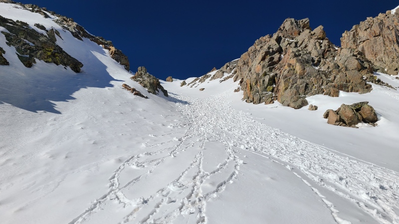
Nearing "V 10"'s north face.
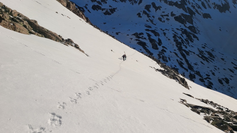
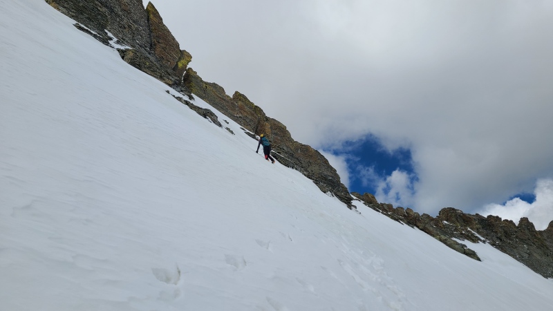
The two snow tongues on the face were basically identical in pitch and length, so we climbed up the western tongue to save ourselves a bit of steep traversing at the top.
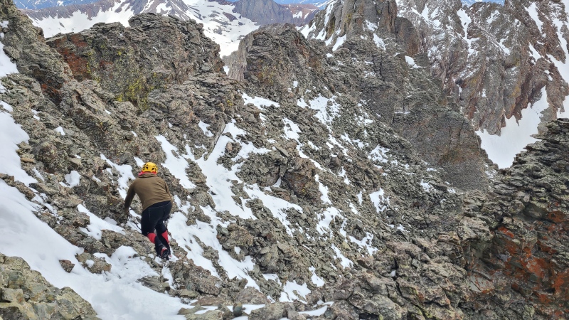
The face looks a lot less steep from below, but it's somewhere around 50 at the top. We aimed for the tall, narrow gap (which reminds me of a diastema, or a tooth gap) between the two largest blocks of rock on the ridge.
My stoke over the snow covering the terrible rock was redoubled as we climbed up. "V 10" lived up to its reputation. What a pile of crap!
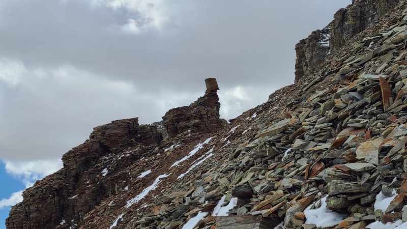
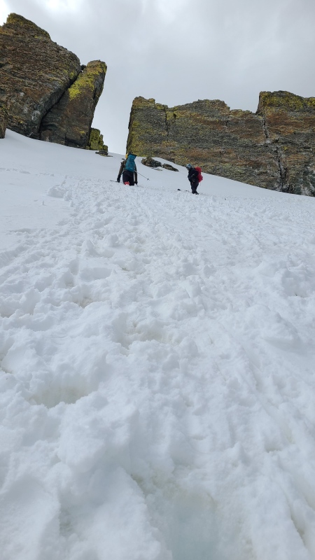
A neat rock formation along the ridge. Imagine how "good" the "scrambling" is on this kind of garbage.Amy and Vera switchbacking up to the ridge.
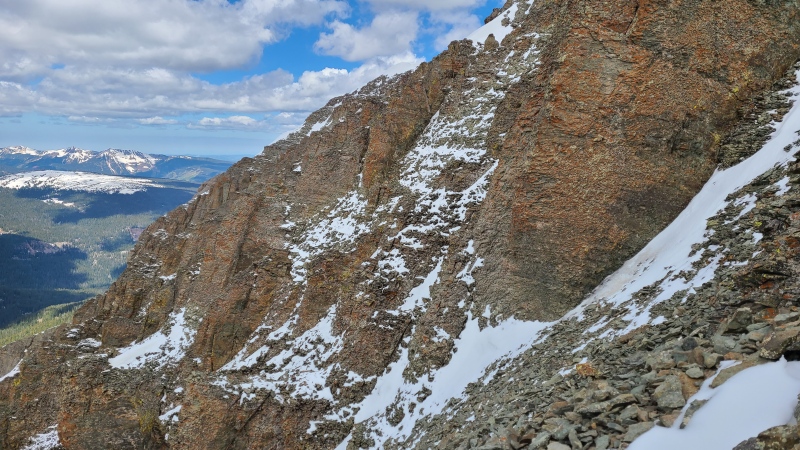
The face is about 500 feet tall and would surely be a slip'n'slide nightmare when dry. We climbed straight up to the ridge and were still a little east of our gap, so Michael kicked steps horizontally across the face, then up to the gap.
Moving towards the little sliver of sky by the yellow-topped rectangular block on the left.Beginning the traverse where we reached unclimbable rock on the ridge crest.
The short traverse across the face was the steepest snow of the day and didn't require a second axe but was much more comfortable with the second. From the notch in the ridge we got sobering views of the south side of "V 10". Teetering indeed!
The ridge from the notch. The horizon is skewed slightly up to the left, so this actually makes it look less steep.
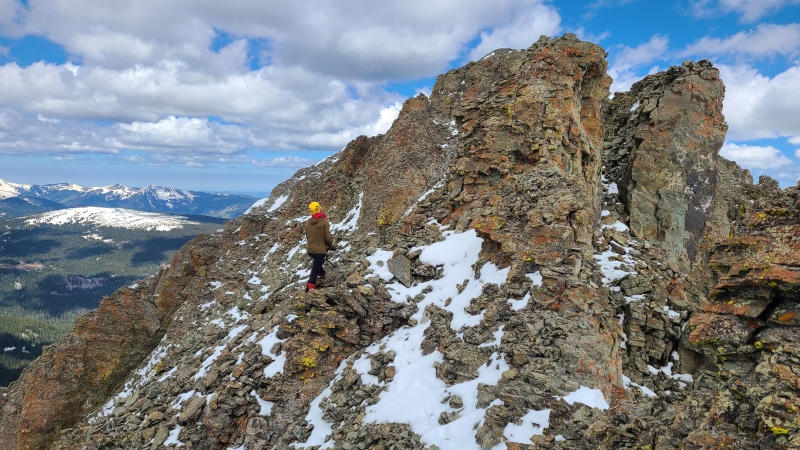
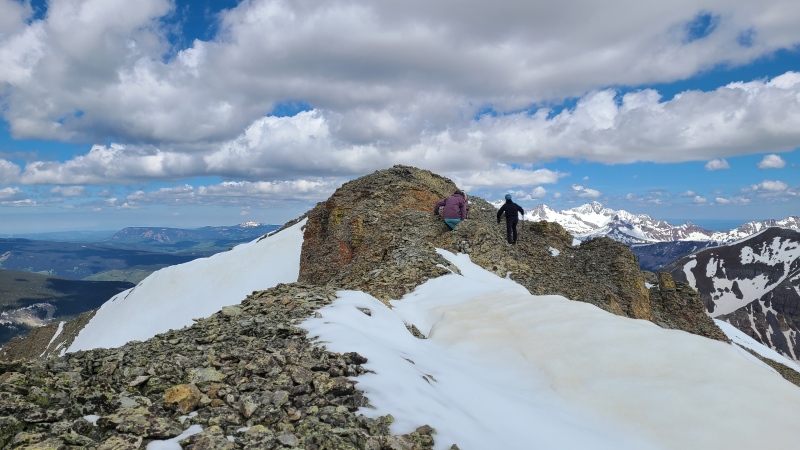
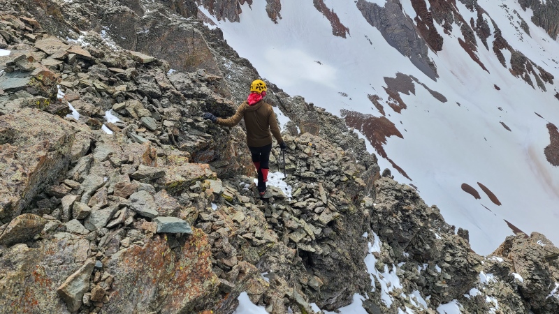
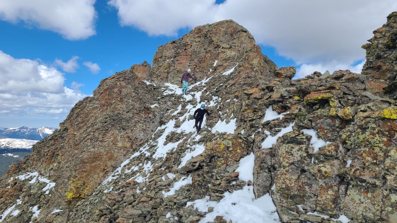
We left our packs at the notch so we weren't encumbered by the extra weight, took off our crampons, and began scrambling up the ridge. The scrambling was sustained Class 2+ with plenty of Class 3 thrown in, plus snow-covered poor rock that required testing of all the holds, and heady exposure. Even though the rock was junky and largely stacked haphazardly on top of itself I was pleasantly surprised by how bad it wasn't. I was expecting corn flake rock that disintegrated at the touch. This was bad but not that bad. For the most part the safest scrambling was right along the ridge crest. Moving a few feet on either side would have put us on slopes that were unlikely to support much more weight without dislodging the rock we'd be standing on.
Two main difficulties arose as we scrambled towards the summit. The first was a steep rib that blocked further progress along the south side of the ridge below the crest. We'd scrambled over one rib then taken a ledge to this point and scrambled steeply back to the ridge to bypass this rib.
The rib blocking easy progress. We scrambled up the righthand slope, and while it looks like a horror show it was both easier and more stable than it looks.No way around this rib, and nothing beyond it worth getting to anyway.
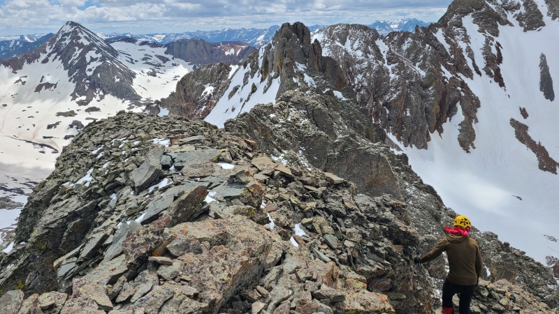
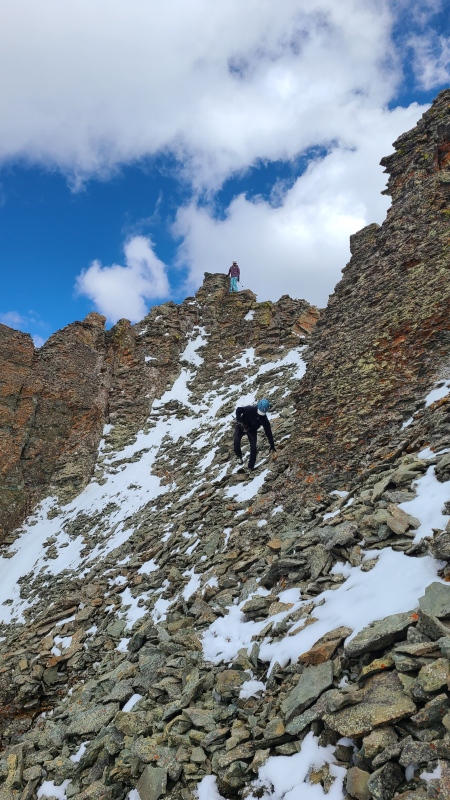
From here we encountered easier scrambling towards the summit block.
Some of the easier terrain between the rib and summit block (not visible). Care is obviously required when not much is attached to the mountain.
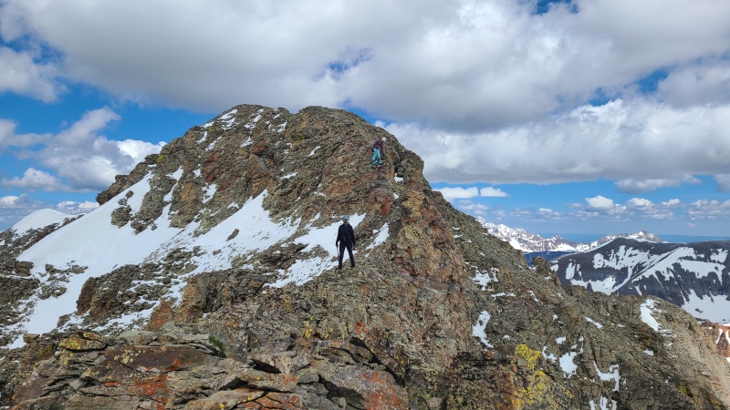
The second main difficulty was the summit block itself, which was 20 or 25 feet of steep Class 3. There was really only one option up the block on ridge direct. The rest was vertical choss.
Summit block.
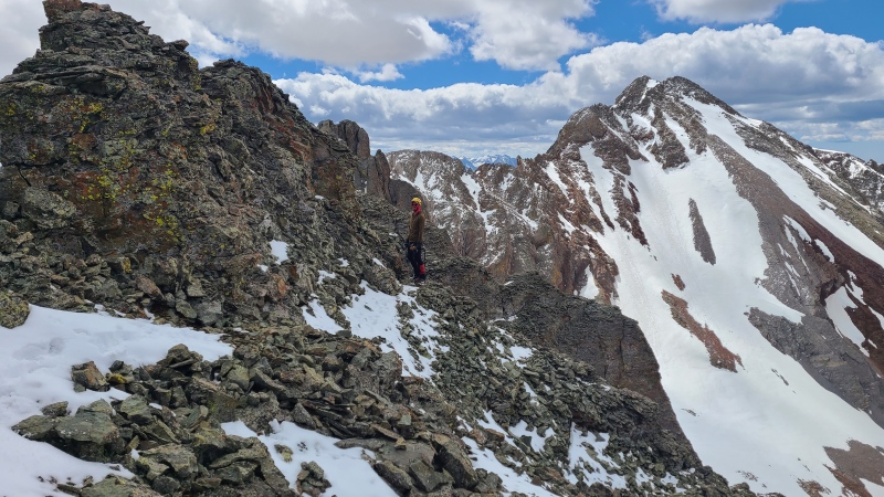
Once atop the scramble we had a short walk to the true summit. Difficulty here relented significantly - the only real walking portion since the gap between north and south faces - to Class 2 with a tiny bit of Class 2+.
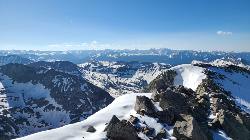
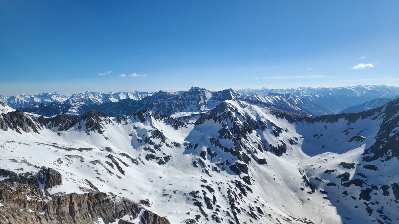
Last bit to the summit, and a nice reprieve from the difficulties getting here. The high point is hidden behind this little hump."Lake Point" far left, San Miguel Peak, Pilot Knob in center, Vermilion Peak and Fuller Peak. Fortunately the thing in center foreground isn't anything.Wilsons.Grizzly's western side, which people sometimes scramble to combine the two peaks. The scramble between them sounds less than fun, shall we say.
It was about 10:30am when we reached "V 10" so we again didn't delay getting down. The involved scramble and snow softening were on our minds.
Michael beginning down.Oddly, this picture from the summit shows best just how steep the snow to the ridge is.Bye bye, "V 10"! See ya never!
The scramble back down to the rib was pretty cool. I hadn't realized how narrow the ledges we'd climbed up actually were until I was looking down on them.
See our tracks through the snow?Traversing ledges away from the summit.Ten trillion chips off the old block.
Down climbing this junk required extra care, especially footwork, to make sure the rocks wouldn't skitter out from under us. Cartoon banana peels are funny, real life banana peels that send you hurtling to your death not so much.
Mind your toesies! While junky this isn't as ridiculous as it looks.
Once down the slope it was an easy walk back to the ridge break, where Michael, Amy and I down climbed the top couple hundred feet facing in. Vera, in typical badass Vera fashion, skied 500 feet of 30 to 50 degree snow in about nine seconds.
Beautiful rock, more beautiful snow to cover up the rotting trash that decided
From the flats below the face we began the long trek back to "V 9"'s west ridge. No, we hadn't forgotten about the drop and even bigger gain we had to make before getting there.
The snow was still in great shape for easy travel.Hot take looking at this photo: I actually thought "V 9" was a lot worse than "V 10".Lake Hope, which is served by what trail? Oh yeah, the Hope Lake trail. That's not confusing or anything.Hope Pass in early afternoon light. Not quite as charming as it is when under sunlit skies.
The rest of the hike back to our cars from "V 9"'s ridge was easy, and gratefully almost all downhill. We were all bushed after this duo, but man was I glad to have done "V 10" on snow. "V 10" was my second to last San Miguel ranked thirteener and it's hard to imagine how miserable it would have been in dry conditions. I can't recommend it enough with snow, should that skill be in your wheelhouse. Grizzly was a great addition to the day - thanks for suggesting it, Michael - and we were all able to hunt in amazing and capable company with each other, which is always a pleasure.
Statistics
Climbers: Ben Feinstein (myself), Amy G-S., Michael D., Vera U. Trailhead: Ophir Pass Road
Total distance: 15.11 miles Total elevation gain: 6,750 feet Total time: 11:50:30 Peaks: Two ranked thirteeners
Grizzly Peak, 13,753'
"V 10", 13,480'
Splits:
Starting Location
Ending Location
Via Time (h:mm:ss)
Cumulative Time (h:mm:ss)
Rest Time (m:ss)
FS 585
Grizzly Peak
5:13:07
5:13:07
0:00
Grizzly Peak
"V 10"
2:08:17
7:21:24
0:00
"V 10"
FS 585
4:29:06
11:50:30
Trip End
My GPS Tracks on Google Maps (made from a .GPX file upload):
If I remember correctly Michael was the one who suggested this approach, perhaps he can chime in. I think this is probably easier though, even if it might be a little longer - route finding is probably easier with how much road there is, and there's no below treeline shenanigans whatsoever on this, whereas Hope Lake trail has a good chunk below treeline.
Email from Amy, 6/14/23: "Ben wants to climb V10 from Mineral Ck."
Me: "V10 via Mineral Creek to the V9-V8 saddle to the San Miguel-V9 saddle? Why that way instead of Poverty Gulch (Hope Lake)?"
Anyway I think we then worked out that snow conditions on the E/S facing approach from S Mineral would be better than postholing up the timbered N facing trail and slopes of Hope Lake. This also led to the discovery of a new (to me) ice climb on the hike out. Much win!
Good work on the TR, Ben, and thanks to the crew for having me! A memorable day.
Thanks for the fact check, Michael, I had clearly forgotten. :lol: I still don't remember all the details (I've had this TR complete for at least a year and just never published it) but my initial assessment was to go over the ridge south of Rolling where terrain was least steep. That was my plan if done dry, anyway. Perhaps it was you who suggested going over the "V 9" saddle, and overall this approach beats below treeline mucking about on the Hope Lake trail, both better options with snow being part of the equation.
...than when Randy and I climbed V10 on 8/22/2019 as my tri finisher. When we were climbing the loose rock to V 10's east ridge, I remember thinking that the loose rock seemed to go on forever. Still, it was nowhere near as bad as V 3!
"V 3" is also much better with snow - quite enjoyable as a matter of fact, I would know! The San Miguel in general are improved by a good coat of snow. My hope is those brave souls who tackle "V 10" will read this, agree, and save themselves the trouble by doing it as a snow climb.
Guys, guys, this is America, you can just buy nice guns!
Caution: The information contained in this report may not be accurate and should not be the only resource used in preparation for your climb. Failure to have the necessary experience, physical conditioning, supplies or equipment can result in injury or death. 14ers.com and the author(s) of this report provide no warranties, either express or implied, that the information provided is accurate or reliable. By using the information provided, you agree to indemnify and hold harmless 14ers.com and the report author(s) with respect to any claims and demands against them, including any attorney fees and expenses. Please read the 14ers.com Safety and Disclaimer pages for more information.
Please respect private property: 14ers.com supports the rights of private landowners to determine how and by whom their land will be used. In Colorado, it is your responsibility to determine if land is private and to obtain the appropriate permission before entering the property.


")
")
")
")
")
")
")
")
")
")
")
")
")
")
")
")
")
")
")
")
")
")
")
")
")
")
")
")
")
")
")
")
")
")
")
")
")
")
")
")
")
")
")
")
")
")
")
")
")
")
")
")


