Download Agreement, Release, and Acknowledgement of Risk:
You (the person requesting this file download) fully understand mountain climbing ("Activity") involves risks and dangers of serious bodily injury, including permanent disability, paralysis, and death ("Risks") and you fully accept and assume all such risks and all responsibility for losses, costs, and damages you incur as a result of your participation in this Activity.
You acknowledge that information in the file you have chosen to download may not be accurate and may contain errors. You agree to assume all risks when using this information and agree to release and discharge 14ers.com, 14ers Inc. and the author(s) of such information (collectively, the "Released Parties").
You hereby discharge the Released Parties from all damages, actions, claims and liabilities of any nature, specifically including, but not limited to, damages, actions, claims and liabilities arising from or related to the negligence of the Released Parties. You further agree to indemnify, hold harmless and defend 14ers.com, 14ers Inc. and each of the other Released Parties from and against any loss, damage, liability and expense, including costs and attorney fees, incurred by 14ers.com, 14ers Inc. or any of the other Released Parties as a result of you using information provided on the 14ers.com or 14ers Inc. websites.
You have read this agreement, fully understand its terms and intend it to be a complete and unconditional release of all liability to the greatest extent allowed by law and agree that if any portion of this agreement is held to be invalid the balance, notwithstanding, shall continue in full force and effect.
By clicking "OK" you agree to these terms. If you DO NOT agree, click "Cancel"...
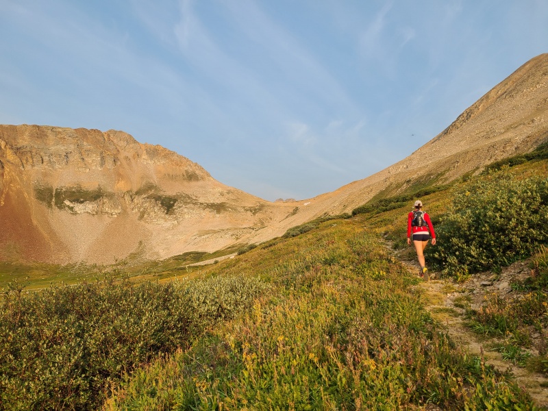
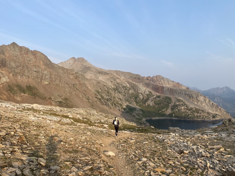
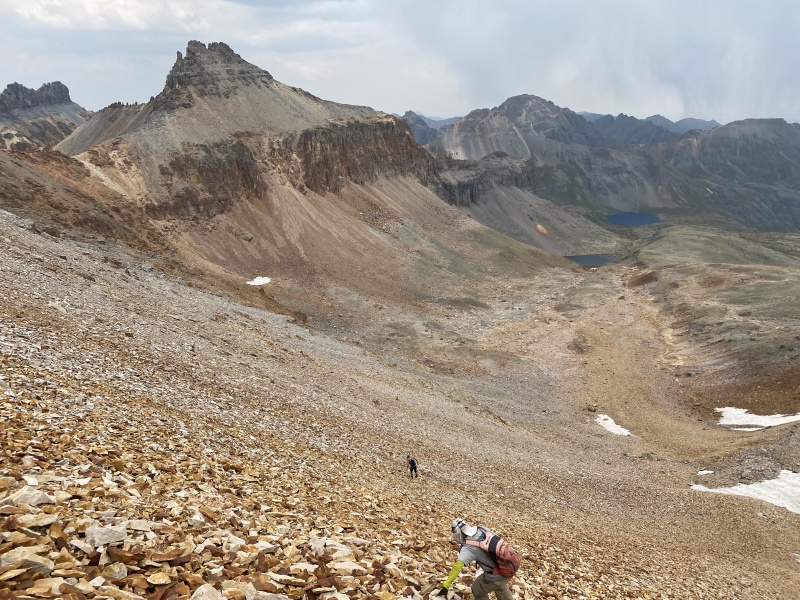
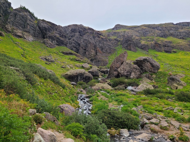
The more I climb in the San Miguel sub-range of the San Juan Mountains the more I like it. Sure, the peaks are crumbling at an alarming rate and the scrambling can be downright gruesome, but the area is wild, beautiful, and exhilarating. We found some measure of all of those on our peak bagging frenzy today, with a big half-loop in the vicinity of Vermilion Peak. We started from the Bandora Mine off Forest Service Road 585, which is the road to South Mineral Creek campground and the Rico-Silverton trailhead at its distal end. There's an old spur road here that's blocked off, and we parked nearby and hiked up the road, which eventually became a trail, en route to Hope Pass. The initial section of this hike was easy and contained the only vegetation we'd see for hours.
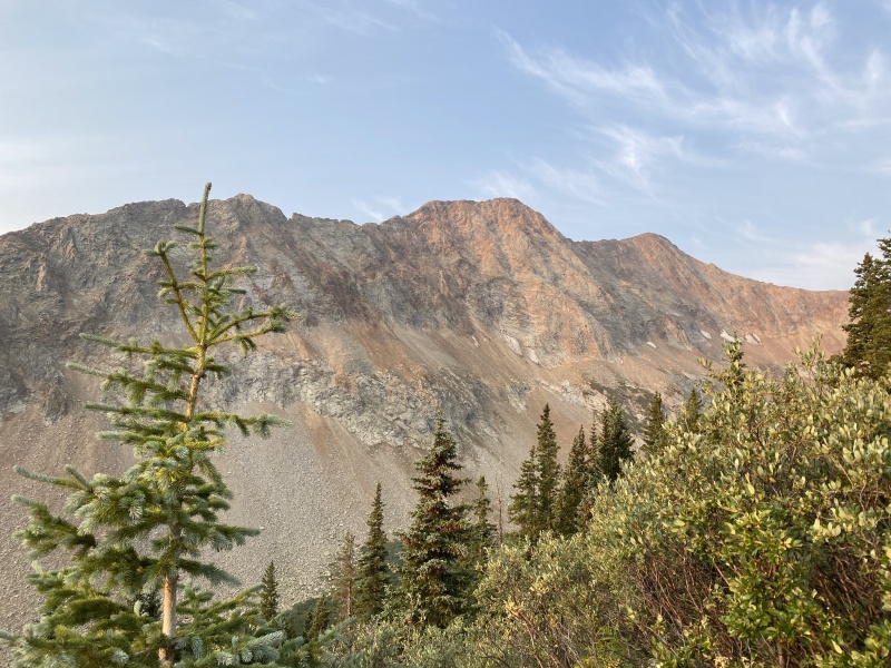
Just about the only lush and charming thing we came across for the next seven hours.Rolling Mountain. Photo: Marisa W.Hope Pass.
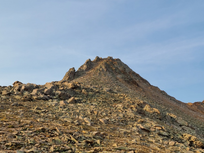
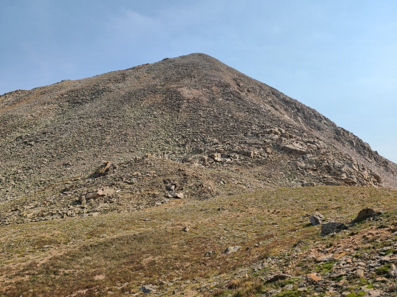
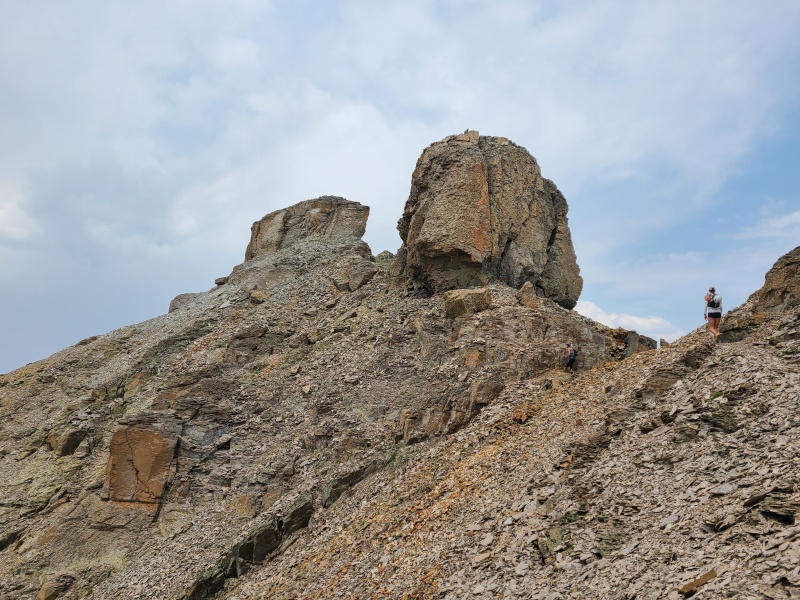
Our first objective was "V 9", a loose pile of rubble and scree just begging to totally collapse.
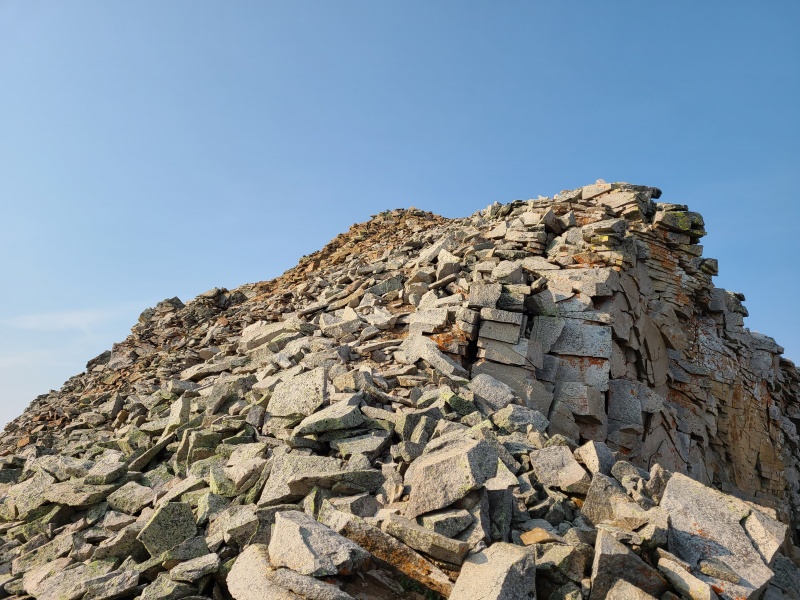
"V 9", which sure doesn't look like much.
When we reached the pass Whiley went to go retrieve her phone, which had slipped down into a crack in a rock far enough that she needed special tools to get it out.
Whiley off to get her phone. Photo: Marisa W.
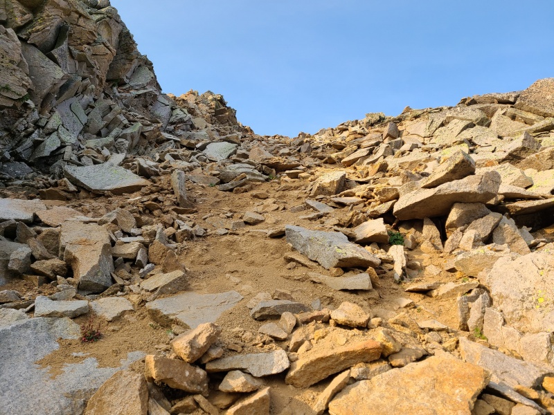
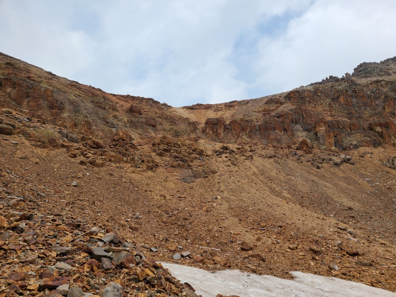
Marisa tentatively began up "V 9" with me and turned around in the initial gully, opting to wait for Whiley so they could do the peak together. The gully to access the ridge was a total pile of crap and was honestly about the best part of the peak, which says a lot. The talus and boulders in the gully, all of which was shifty, sat atop a layer of fine scree that provided little traction, and the gully was steep. Though it went at roughly Class 2+ it was extremely unpleasant and precarious.
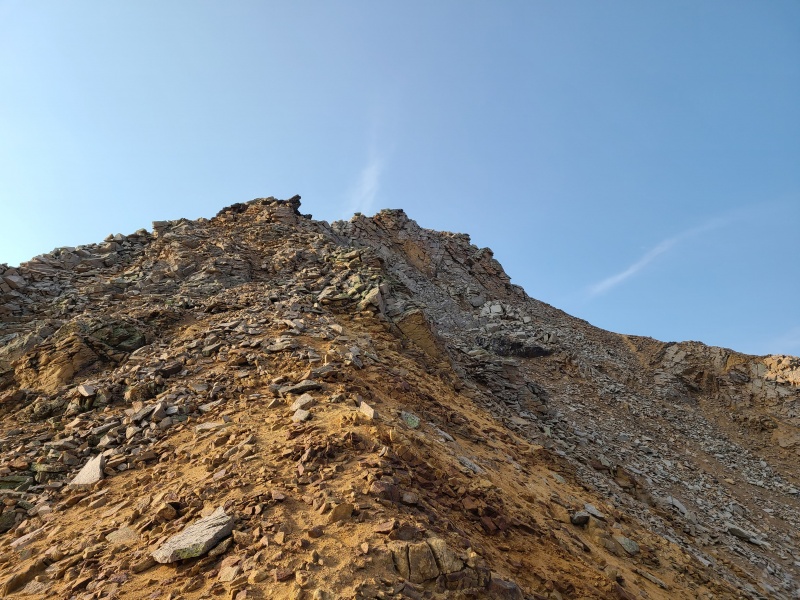
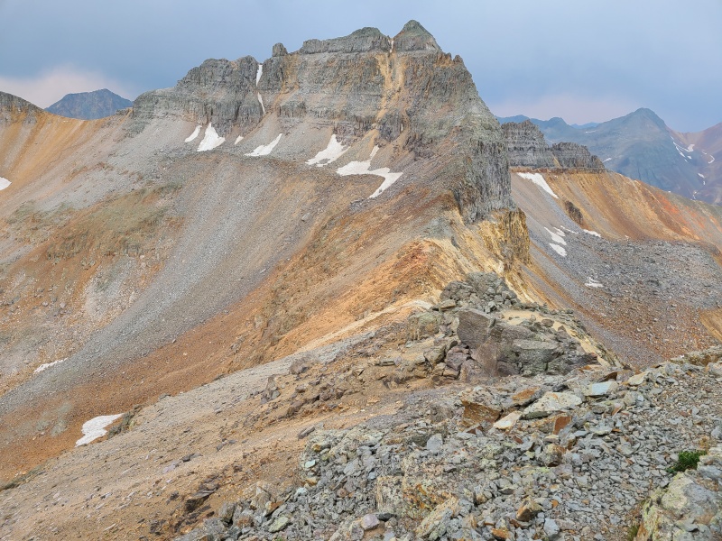
"V 9" from just above Hope Pass. The line goes right up that moderate looking gully.Turns out, the gully is god awful.
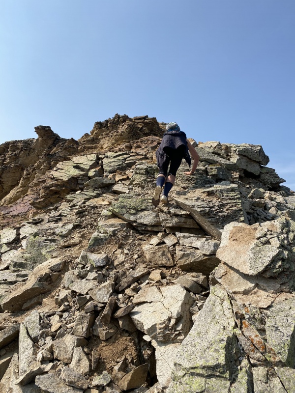
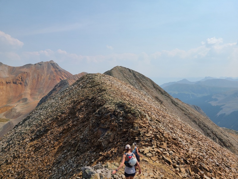
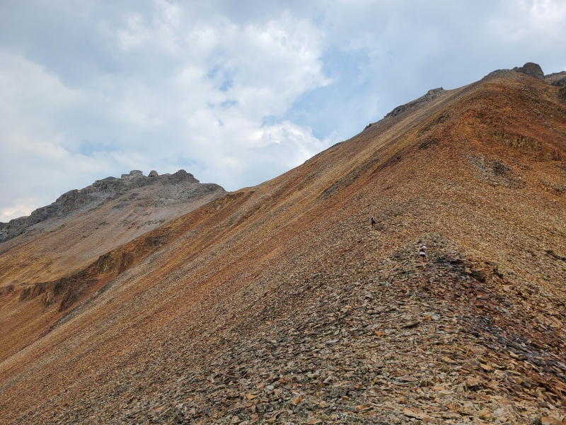
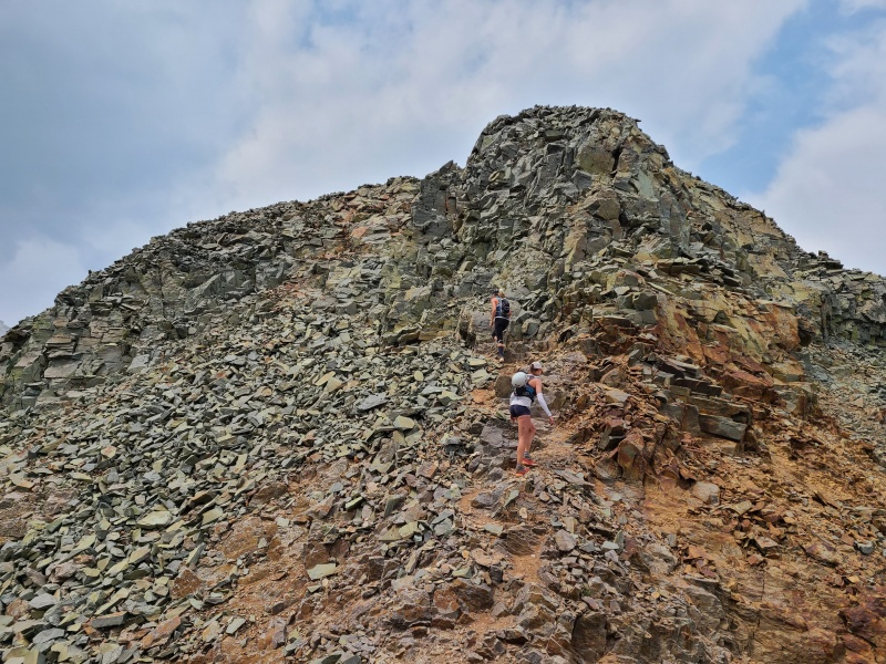
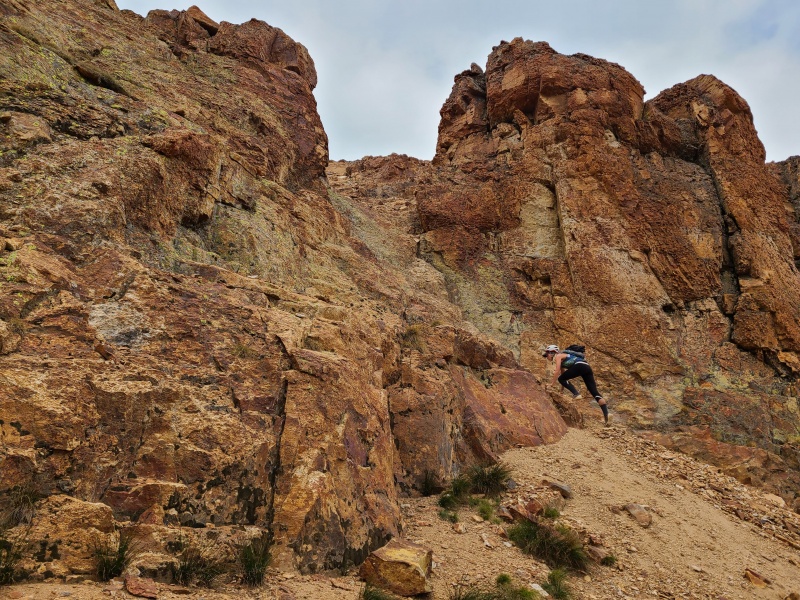
I continued on solo, and navigated the ridge as it narrowed and exposure grew. Staying on or within just a couple of feet of the ridge crest was usually the best bet as scrambling occasionally increased in difficulty to loose Class 3.
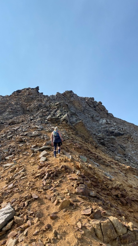
Typical nasty garbage on the ridge. What looks solid is suspect, what looks suspect is by definition untrustworthy.Whiley on the ridge. Be careful! Photo: Marisa W.vomit emoji
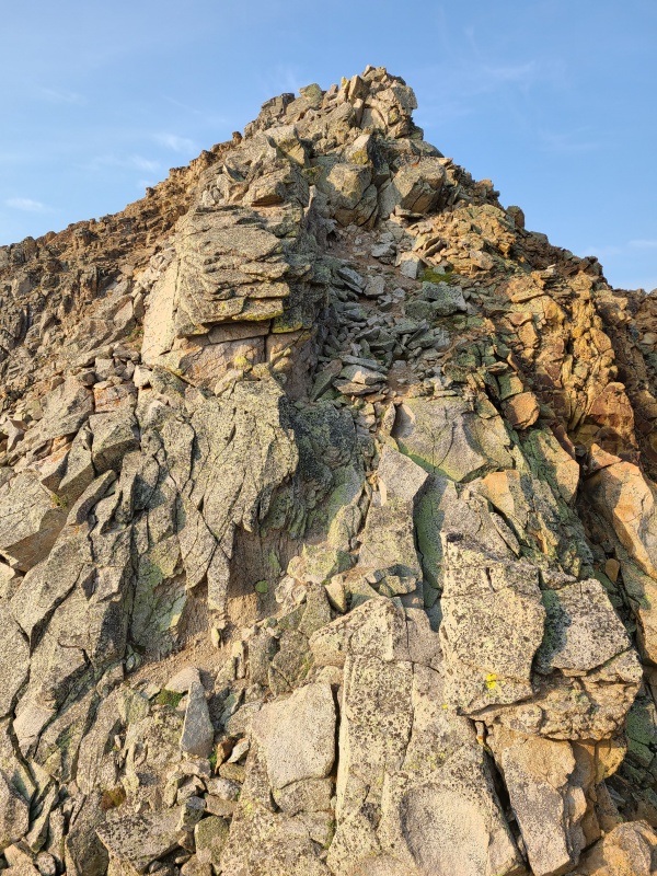
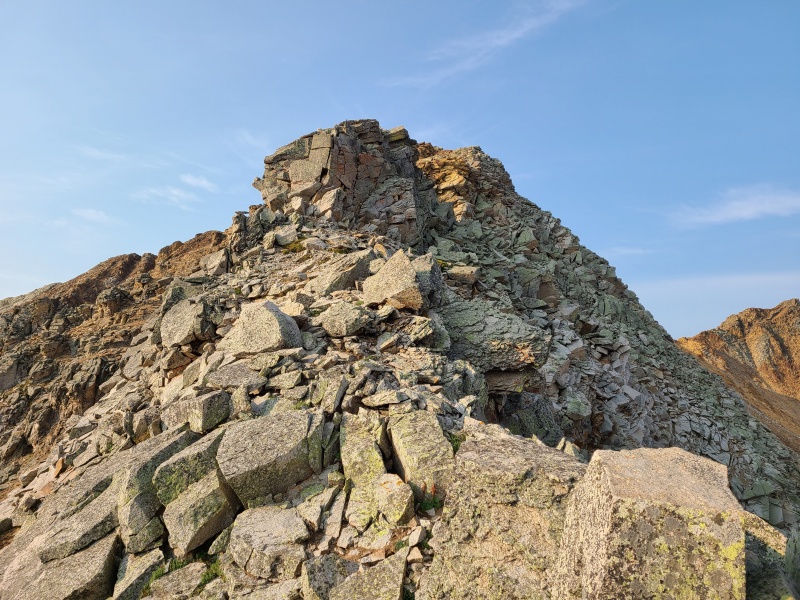
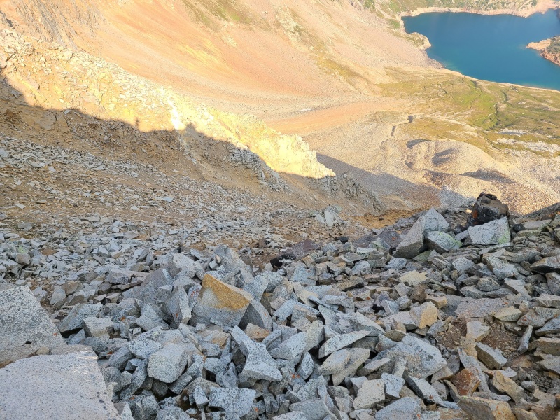
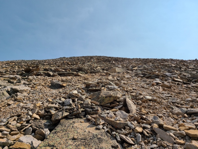
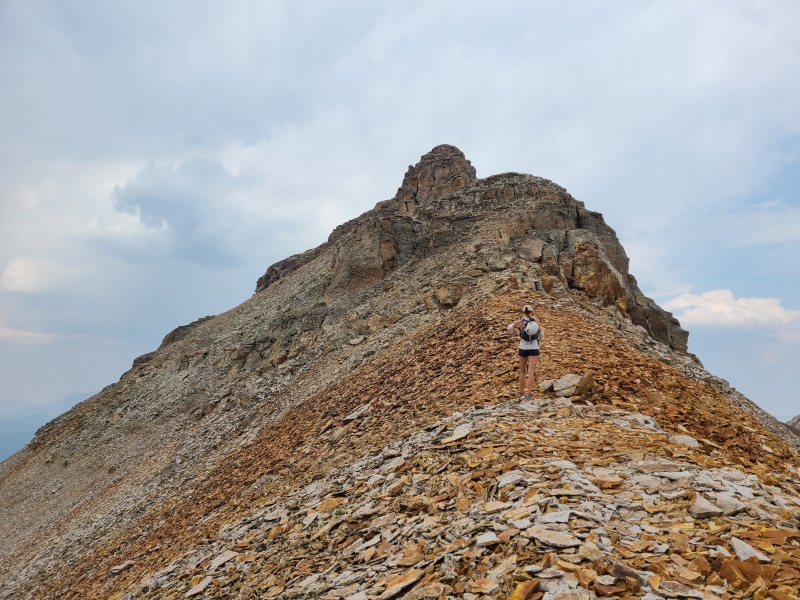
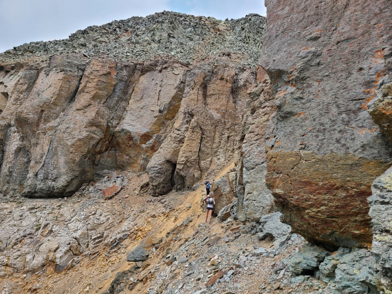
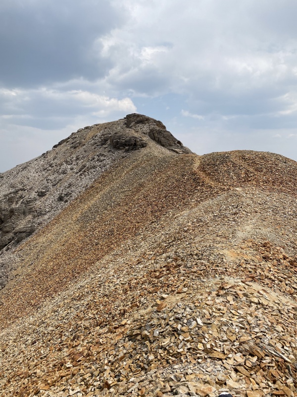
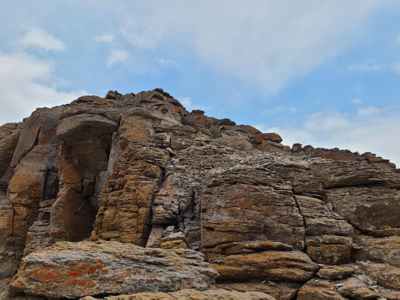
Most of the ridge consisted of this blasted apart type of rock stacked haphazardly atop itself in unusual ways. A few hundred horizontal feet from the summit things deteriorated further into friable red rock and sand. At this point the rock was basically just dinner plates glued together by gravity and nothing more, piles of said dinner plates loosely strewn about, or simply rock that would crumble at the touch. This final bit to the summit was the worst of "V 9" and, in my opinion, the worst of any of these six peaks. A single gendarme lay plopped into the middle of the ridge, and was most easily bypassed to climber's left.
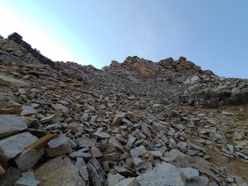
Upper ridge with summit in view. Going over the gendarme wasn't an option due to how loose it was, so we went around it on the left side, which was exposed.What's down and to the left. It's extremely loose sand-like scree, and the talus floats right on top of it.
At this point the summit lay within grasp, but wouldn't give itself up quite so easily. The summit was guarded by a steep scramble so wildly loose that I attacked it a few times head on and backed down in fear each time. I wasn't sure if anything was actually attached to anything and just couldn't justify putting my body weight on anything, since at the minimum everything at least shifted and clacked around when I did. I had to find a different way.
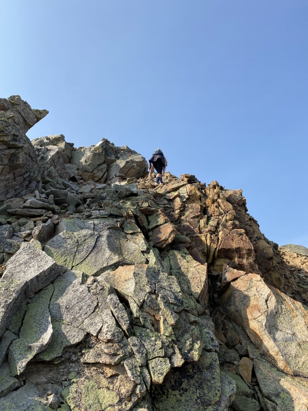
Upper summit ridge.Same spot with Whiley on it for scale. Photo: Marisa W.
After searching fruitlessly for a direct option, I skirted right around the corner on the sandy scree, then traversed a little ways until I found a more stable talus gully to ascend. The exposure was heady and the rock loose, but it wasn't doubly exposed like the ridge crest, and it wasn't as unpredictable.
Slightly less crappy gully I went up.Whiley tackling the junk head on. Photo: Marisa W.
Once back on the ridge there was only a little bit of Class 2+ to the summit.
Summit of "V 9".Ridge to Rolling Mountain.North towards Point 13,300 D, Beattie (both foreground), Golden Horn, Vermilion, and Fuller.Horrendous choss west towards San Miguel Peak with the Wilson massif hidden in the haze.
I really hadn't liked my climb up "V 9" so I wasted no time in reversing my route down the ridge to the gully and then back to the ridge again.
Down the talus gully. It's honestly the only part of "V 9" that's not as bad as it looks.Back to the ridge, looking to climber's right around the corner to the gully. Yep, this traverse actually works despite looking like an utter death trap.The traverse around the gendarme.
Along the way I ran into Whiley and Marisa as they ascended; Whiley had retrieved her phone from the crack (with a whoop and a holler that I heard from far up the ridge on my ascent) and was now helping Marisa up. Whiley had soloed "V 9" a couple of weeks earlier so this was old hat for her. I waited at Hope Pass for them to return.
Final descent off "V 9" with Point 13,300 D dead ahead. Photo: Marisa W.
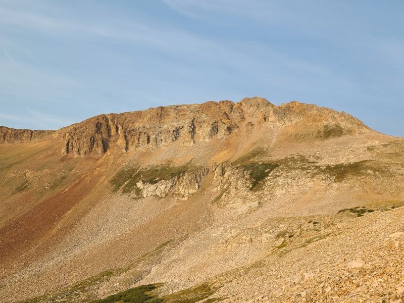
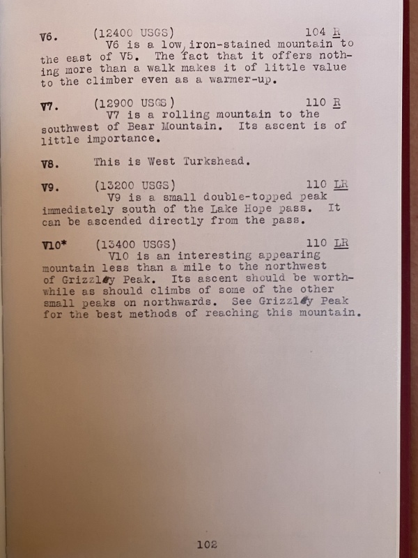
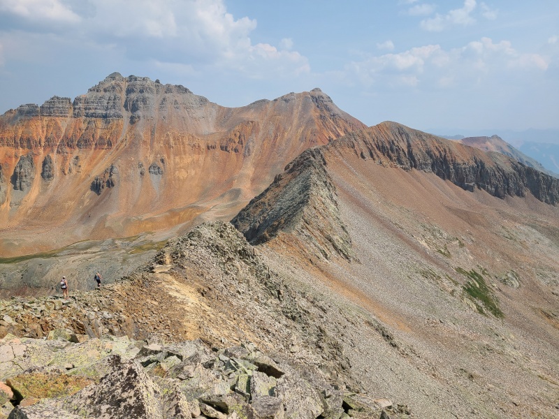
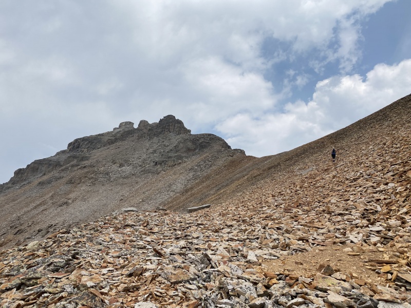
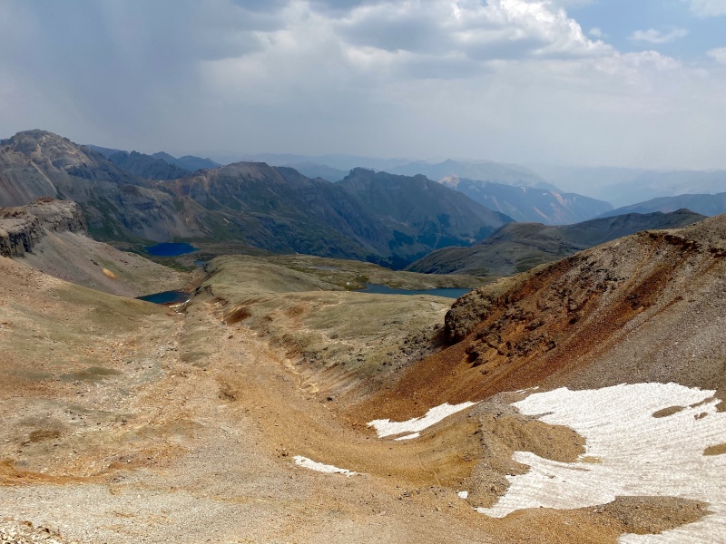
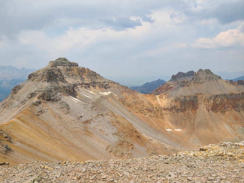
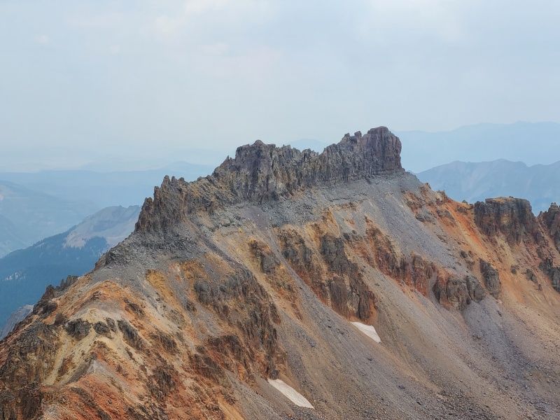
When they reached the pass we continued north up the south slopes of Point 13,300 D, another gigantic San Miguel pile of garbage, but this time the scrambling was a consistent Class 2+ and honestly not all that loose, at least when compared to neighboring "V 9". Side note: other trip reports say that 13,300 D is "V 8". This is not the case. "V 8" is an alternative name for 12er "West Turkshead Peak". I believe this nomenclature was first formally used in legendary climber Dwight Lavender's The San Juan Mountaineers’ Climber’s Guide to Southwestern Colorado.
Looking up 13,300 D's south slopes.Unpleasant but a walk in the park compared to "V 9"The San Juan Mountaineers’ Climber’s Guide to Southwestern Colorado, page 102. Thanks to Sarah Lavender Smith for letting Whiley have access to a copy.
All in all it took us almost an hour to tiptoe our way up 13,300 D's south slopes, owing to the crummy nature of the rock, but it was a relief for all three of us that it was so straightforward.
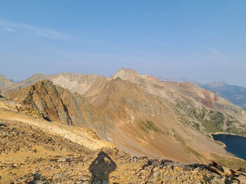
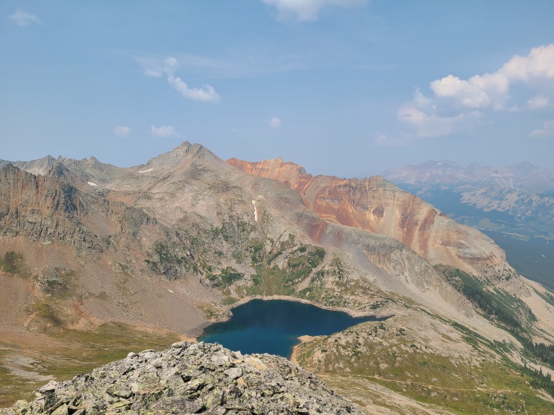
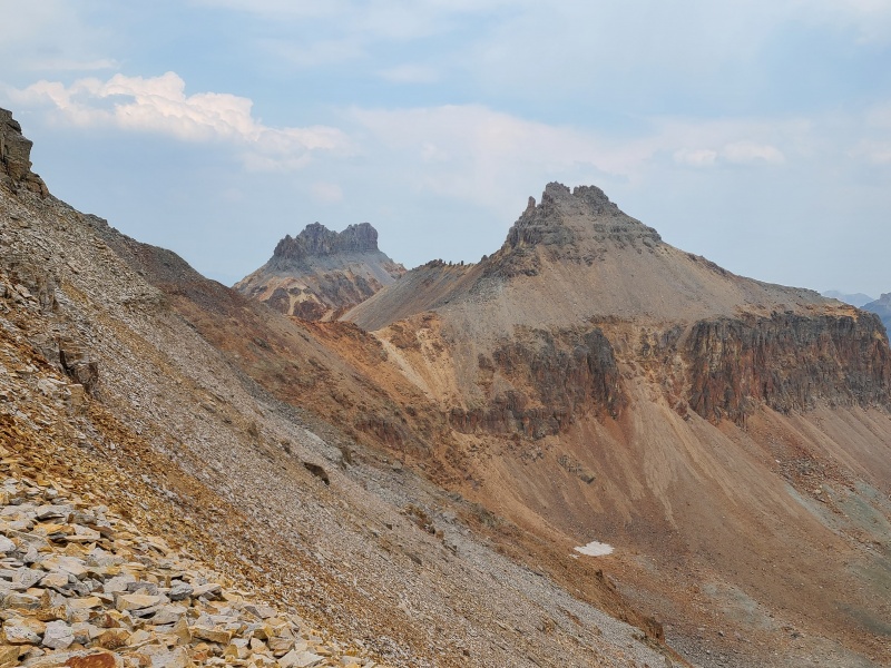
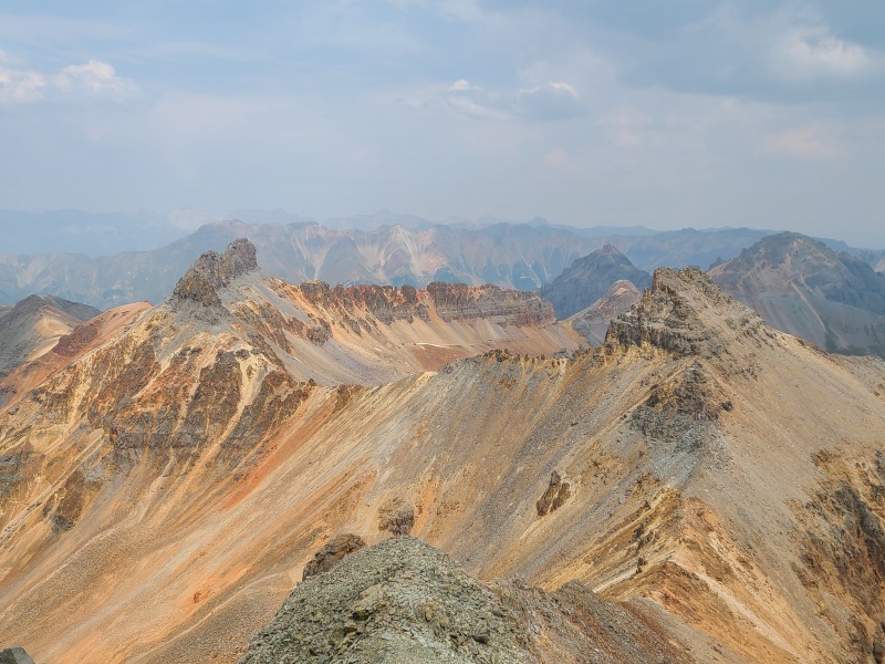
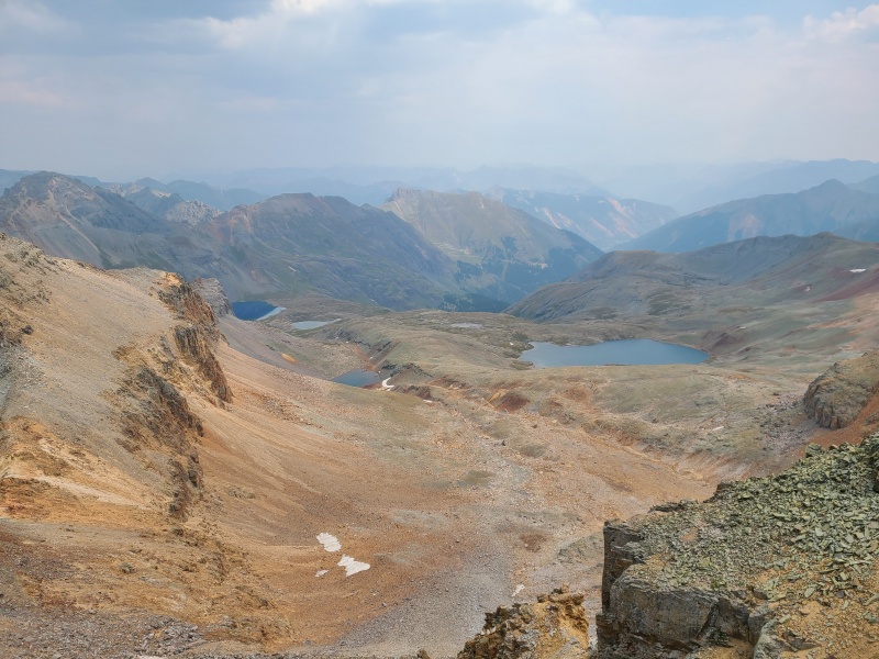
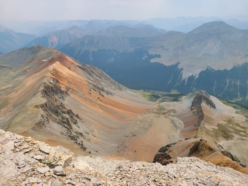
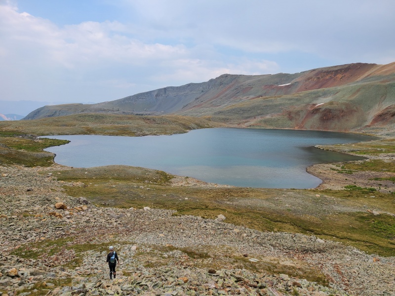
Lake Hope, San Miguel Peak, "Lake Point' (red), Wilson massif from 13,300 D.
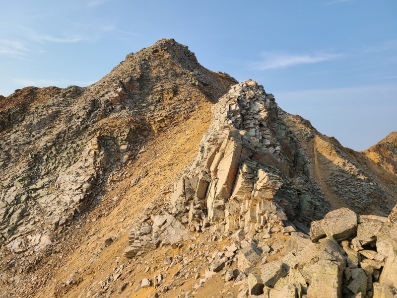
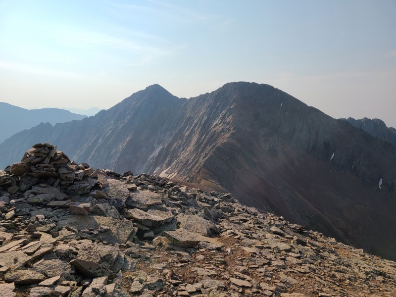
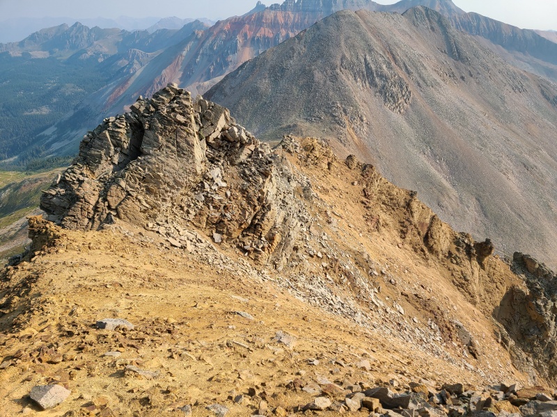
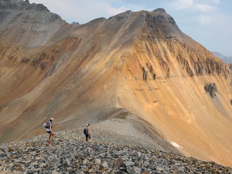
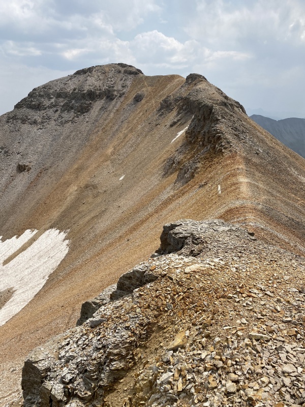
The chossfest didn't abate still, oh no. It continued for pretty much the entire rest of the day with exception of the deproach. We continued on towards Beattie Peak along a dinner plated ridge.
Beattie Peak is actually the smaller-appearing bump second from left.
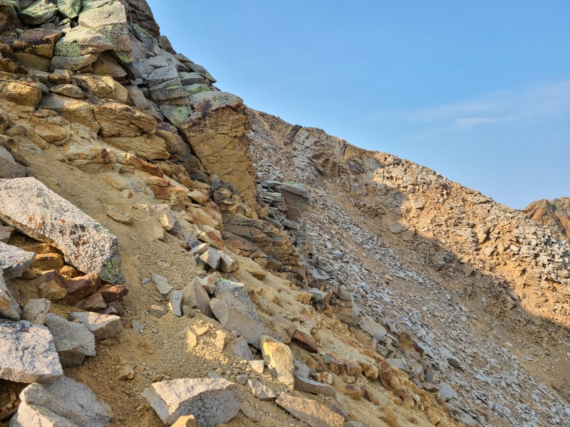
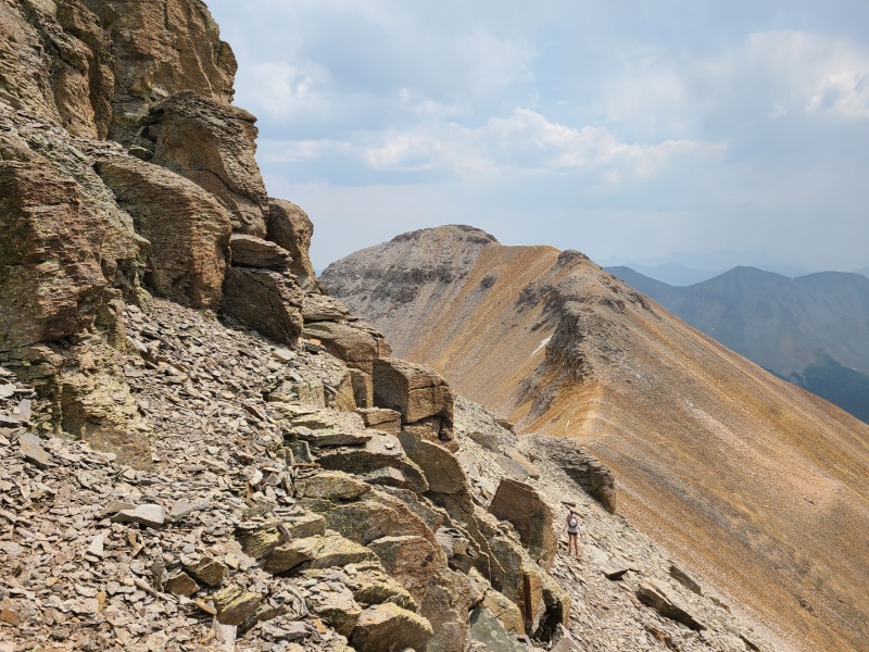
The ridge walk to Beattie was, as expected, quite loose, but it wasn't as exposed as "V 9" nor covered in sand. There were a few sections of Class 2+ and some Class 3 thrown in for good measure down some short and rotting cliffs and dihedrals, but the vast majority of the ridge went at a chill Class 2.
The meat of the ridge to Beattie. The little knob in the middle of it is where most of the scrambling took place.
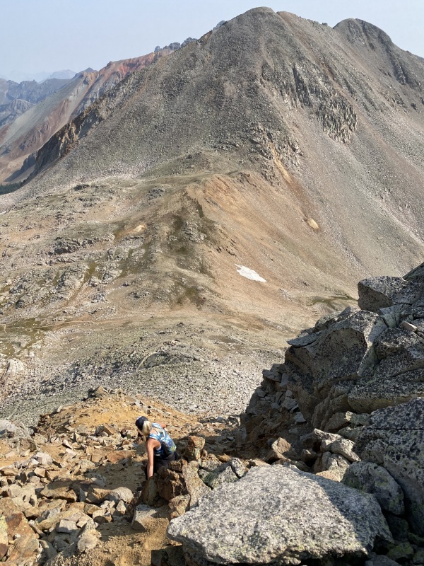
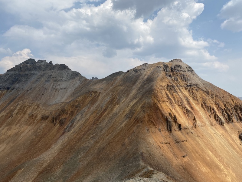
Beattie wasn't much on its own and we still had three peaks to go, with some clouds building overhead, so we scooted on towards Vermilion Peak and Fuller Peak. The descent off Beattie to the saddle was relatively pleasant on fair sized and stable talus. The saddle we went to could also be accessed from the Hope Lake trail, where an unofficial trail veers off and heads up to the saddle between Vermilion and Fuller.
The trail is faintly visible from the saddle.Vermilion and Fuller looking foreboding. Photo: Marisa W.
The trail eased the ascent that would otherwise be on insidiously loose red chip rock at a somewhat high angle.
Red cascade.Pilot Knob and Golden Horn are some of Colorado's most impressive peaks.Getting higher on Vermilion. Photo: Marisa W.
At the Vermilion/Fuller saddle we continued on to the former first, in case the threat of rain became more aggressive. Vermilion's standard route comes up from Ice Lake Basin and meets at the saddle, and from thereon the route up Vermilion is beat in.
Start of the ridge up Vermilion.Funky rock formations along the ridge.
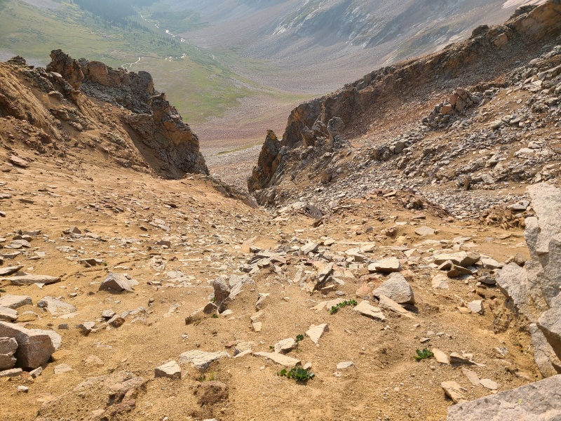
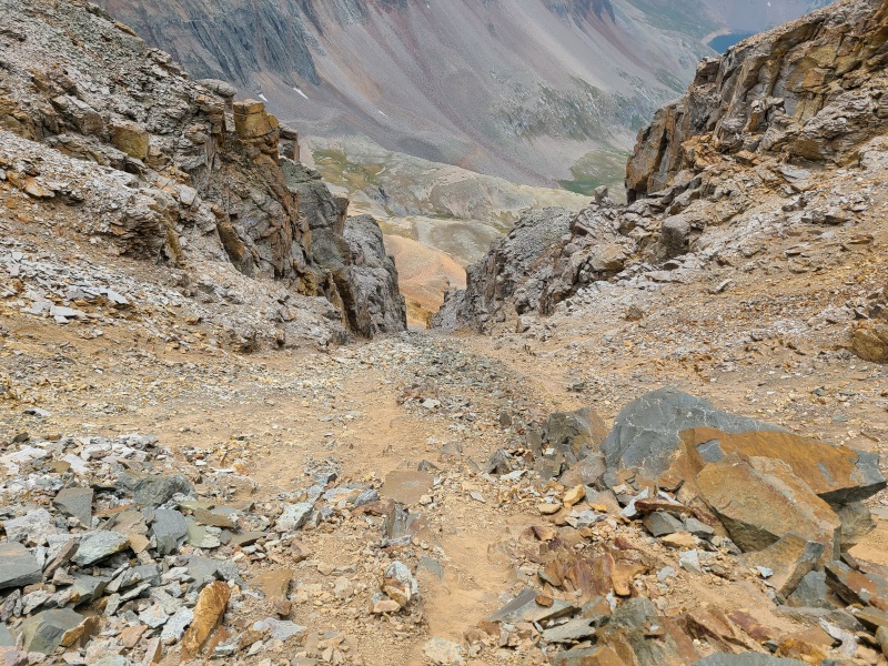
The trail slowly gained elevation until it hugged a wall over a steep, loose gully of death. This was the crux. We had to ascend the gully, but it was made up of red sand and completely untrustworthy rock.
Trail along the cliffs to the gully.Down the gully. Yikes.
Scrambling the gully wasn't actually as bad as expected, but still took concentration and checking of absolutely everything we touched, both hand and footholds. The sand was basically impossible to climb so we stuck to crappy rock on the right side of the gully.
Well that is a pile.Carefully ascending the gully. Photo: Whiley H.
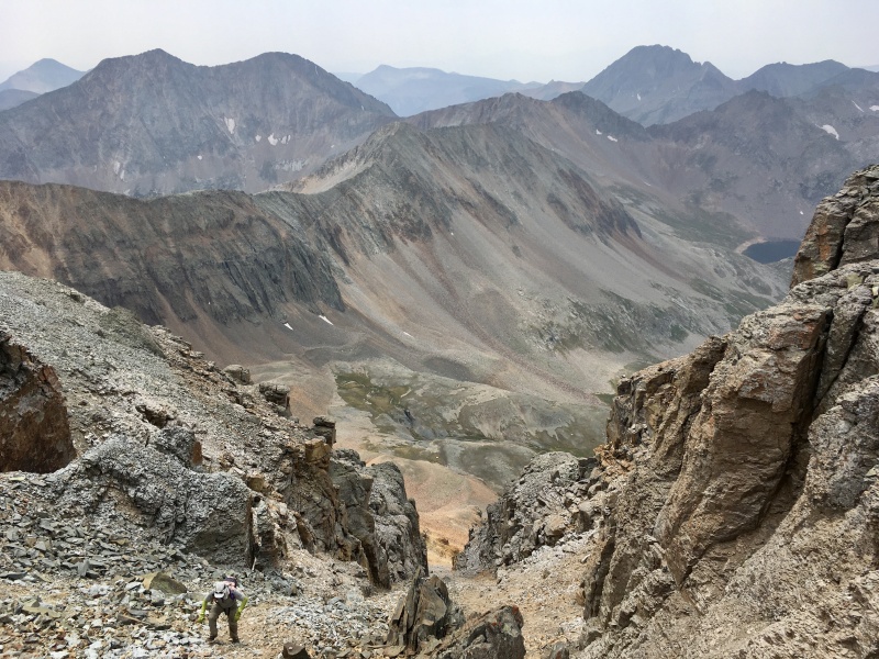
The gully was about 100 feet in length and consistent in the Class 2+ to Class 3 range. At the top of the gully the trail resumed and the difficulty eased. We made quick time to the summit.
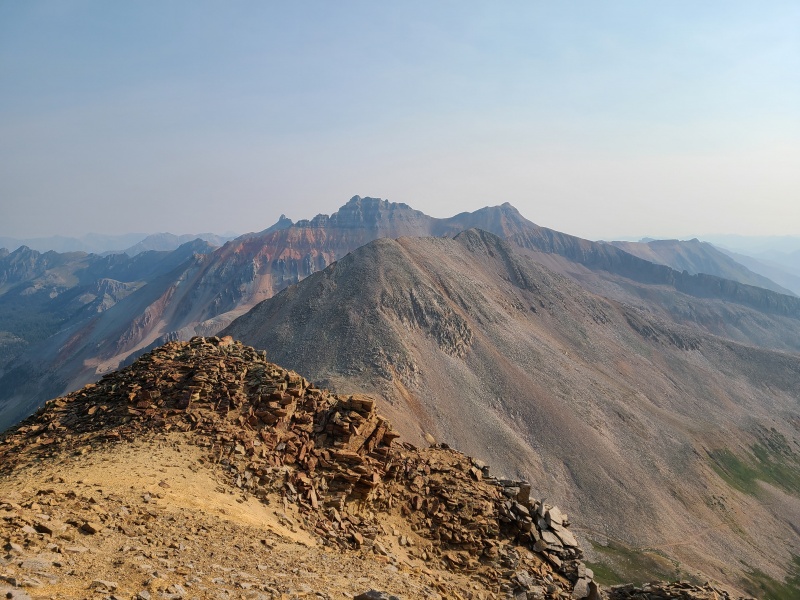
Last remaining hiking to the summit. Again, not as bad as it looks.Pilot Knob and Golden Horn from Vermilion's summit.
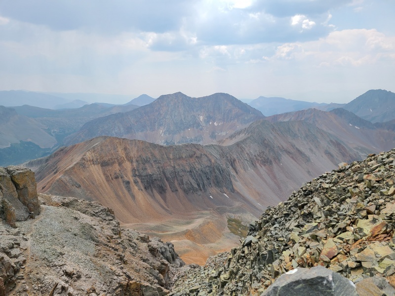
Rolling Mountain (background), and Beattie, 13,300 D, and "V 9" in the foreground.Fuller Peak.Ice Lake Basin.
Weather was still holding so we made a hasty retreat off the summit and down the gully, which we mostly butt scooted, trying to keep three or four points of contact at all times. Traversing back to the saddle with Fuller was quick in reverse, and Fuller held no surprises of its own, being a Class 2 walkup on the ubiquitous red San Miguel rock.
Route up Fuller.Ice Lake and an unnamed lake on the right, and Fuller Lake from the saddle. Photo: Marisa W.Photo: Marisa W.Fuller, easy and obvious. Photo: Marisa W.I love you. Photo: Whiley H.East towards South Mineral Creek. Rock glaciers are everywhere in the San Miguel.
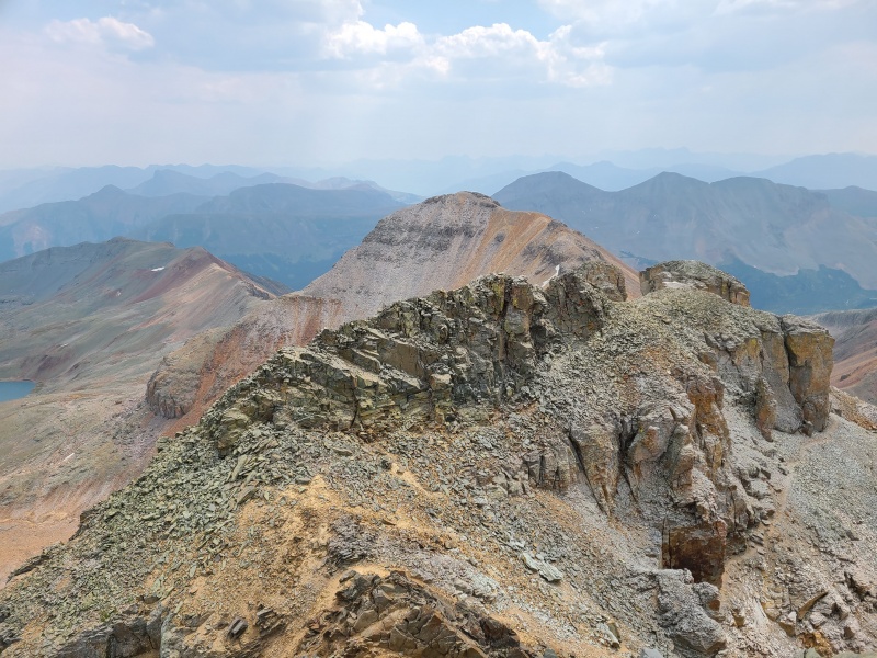
Vermilion, Pilot Knob, and Golden Horn. The trail to the saddle is visible, as is a scree ledge bypass to Golden Horn below Vermilion, as well as the standard red gully route to the Vermilion/Golden Horn saddle.
Fuller, being the one unranked peak of the day, wasn't particularly exciting, plus Marisa had to get back to Colorado Springs, so we quickly headed down towards Ice Lake Basin. The trail down from the saddle was great initially but quickly faded into the awful talus and dinner plates below. Eventually we stopped searching for trail segments and just went straight down.
An ugly descent. Photo: Marisa W.
At this point Whiley and I still wanted Golden Horn and thought we could squeeze it in before rain arrived, so we parted ways with Marisa and headed towards what looked like a rather improbable set of cliffs, slabs, and gullies to access Golden Horn.
Entrance ledges and gullies to the Vermilion/Golden Horn saddle. Miraculously, this only goes at Class 2+.
There's plenty of cruddy rock decomposing and showering all of the ledges and slabs on the ascent to the saddle, and a fair amount of route finding, but we kept it at Class 2+ somehow. Our route was exposed and somewhat convoluted but avoided several sections of obviously more difficult scrambling. It was important that we remembered our route up, as trying to reverse it would be a pain.
Some of the scrambling up to the saddle.Golden Horn towering above from the saddle.
Above the saddle difficulty relented and rock quality increased marginally. Most of the remaining elevation to the summit was boilerplate Class 2 talus, but there was a small amount of Class 2+ scrambling on blocky steps near the summit. What looked like an utterly ridiculous peak from all other angles was surprisingly easy!
Final steps to the summit.Vermilion and the terrain down to the saddle.Pilot Knob. Beautiful, intimidating, and wholly San Miguel in nature.
Whiley and I had raced up Golden Horn in less than half an hour from the basin, so great was our desire to get it before we got rained on. We tagged the summit, I took two photos, and we sped back down, taking care on the more exposed sections of the descent, which took us about 25 minutes. Back in the basin we were able to turn the RPMs down a bit and get back into pure hike mode. We hiked down a sizeable rock glacier until we were near Fuller Lake, which is where vegetation finally returned.
Fuller Lake.
With the return of life came the return of tourists. Despite the dark skies there were people absolutely everywhere. This was my first visit to Ice Lake Basin and while I had heard the stories of crowds I wasn't ready for the reality of it. It was a downright zoo up there! We traipsed past Fuller Lake before picking up the main trail through the area and taking it past Ice Lake and then down to South Mineral trailhead, passing innumerable people.
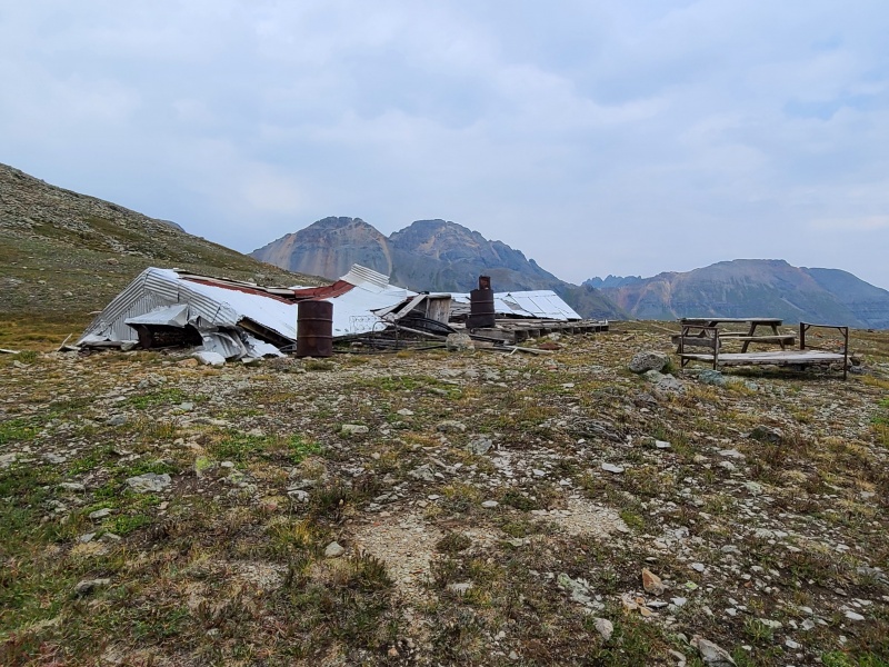
Old debris at the picnic area. This has been heavily vandalized, ripped apart, even burnt for campfires. Please don't damage it further.
On our way down it rained lightly, not enough to make hiking an issue, but we were glad to be off the rotting red peaks above. Such horrors were quickly forgotten as we hiked down the gorgeous trail. I can see why this is such a popular area for outdoor enthusiasts of all types.
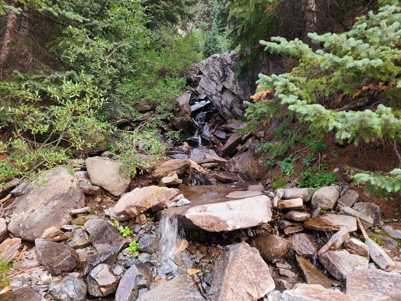
A wee waterfall en route to the trailhead.
When we arrived back at the trailhead we picked up my van and drove back to Bandora Mine to pick up Whiley's truck, then returned again to Silverton. We had been "on" all day and slept well that night. We'd tackled some of the San Juan's more wild peaks, and Whiley and I loved Golden Horn in particular. Both it and Vermilion are sentinel peaks. Though they give themselves up a little easier than you'd think they're spectacular and worth climbing despite their pathological rot. We can't wait to get back to the San Miguel!
Statistics
Climbers: Ben Feinstein (myself), Whiley H., Marisa W. (all except Golden Horn) Trailheads: Bandora Mine (start), South Mineral (finish) Total distance: 14.54 miles Total elevation gain: 6,036 feet Total time: 10:09:20 Peaks: Five ranked thirteeners, one unranked thirteener
"V 9", 13,260'
Point 13,300 D
Beattie Peak, 13,342'
Vermillion Peak, 13,894'
Fuller Peak, 13,761' (unranked)
Golden Horn, 13,780'
Splits:
Starting Location
Ending Location
Via Time (h:mm:ss)
Cumulative Time (h:mm:ss)
Rest Time (m:ss)
Bandora Mine
"V 9"
2:23:00
2:23:00
2:43
"V 9"
Hope Pass
0:53:14
3:18:57
34:38
Hope Pass
Point 13,300 D
0:54:23
4:47:58
4:38
Point 13,300 D
Beattie Peak
032:35
5:25:11
0:00
Beattie Peak
Vermillion Peak
0:46:19
6:11:30
0:00
Vermillion Peak
Fuller Peak
0:35:46
6:47:17
0:00
Fuller Peak
Golden Horn
0:58:13
7:45:30
0:00
Golden Horn
South Mineral Creek Trailhead
2:23:50
10:09:20
Trip End
My GPS Tracks on Google Maps (made from a .GPX file upload):
Happy New Year Ben,
To many more climbs and adventures!. I love that area... keep coming back year after year.I was there just a week after they opened it because of the fire and it already was a zoo... of people, dogs... and poop... It breaks my heart. Take care. Teresa
@Darin: no, but now I have a new weapon with which to annoy Marisa. :lol: I've got a coworker who's name is Shirley and you bet your behind I make sure to make the Airplane joke all the time.
@Teresa: happy new year to you as well! I am saddened by the damage people cause to Ice Lakes and other heavily trafficked areas as well. They're so beautiful and yet there will always be some who treat it as disposable and indestructible. Human nature, I suppose.
I had the opportunity to visit Ice Lakes during the closure - most of the area wasn't actually in the closure area, which I don't think most people knew. Whiley and I approached from another drainage, staying out of the closure which was mostly around the South Mineral side - and it was unbelievably nice not to have the crowds. We met a lone soul on the summit of Pilot Knob and passed a single tent with the occupant(s) nowhere to be found. Other than that it was almost like being in a pristine wilderness. Truly magical without the crowds. I bet it's something else with snow cover too!
I did what you guys did today with the exception of V9, and if it was worse than 13,300 I'm doubly glad I skipped that one. I think I may have taken a slightly different line, but damn. I was scared the whole way up; not that I'd lose my footing, but that the whole slope would slide and take me with it!
Other than that it was a great day; I had the text of your TR printed out and it was helpful. Thanks!
Caution: The information contained in this report may not be accurate and should not be the only resource used in preparation for your climb. Failure to have the necessary experience, physical conditioning, supplies or equipment can result in injury or death. 14ers.com and the author(s) of this report provide no warranties, either express or implied, that the information provided is accurate or reliable. By using the information provided, you agree to indemnify and hold harmless 14ers.com and the report author(s) with respect to any claims and demands against them, including any attorney fees and expenses. Please read the 14ers.com Safety and Disclaimer pages for more information.
Please respect private property: 14ers.com supports the rights of private landowners to determine how and by whom their land will be used. In Colorado, it is your responsibility to determine if land is private and to obtain the appropriate permission before entering the property.


")
")
")
")
")
")
")
")
")
")
")
")
")
")
")
")
")
")
")
")
")
")
")
")
")
")
")
")
")
")
")
")
")
")
")
")
")
")
")
")
")
")
")
")
")
")
")
")
")
")
")
")
")
")
")
")
")
")
")
")
")
")
")


