| Report Type | Full |
| Peak(s) |
Paiute Peak - 13,094 feet Mt. Audubon - 13,217 feet |
| Date Posted | 09/04/2023 |
| Modified | 09/05/2023 |
| Date Climbed | 09/02/2023 |
| Author | tylerhohs |
| Additional Members | Dmagalha |
| Paiute + Audubon CW traverse |
|---|
|
Indian Peaks Wilderness 13ers Paiute Peak -> Mount Audubon traverse Trip Summary:
Long time lurker, first time poster here. Been living in CO for 3+ years now and have gained much valuable information from this site so figure it's about time I pay it forward and share my own trip report. First time exploring Indian Peaks Wilderness and it did not disappoint. My buddy Dan and I devised a plan to bag Paiute Peak and Mount Audubon, and after researching some of the beta out there we elected to do the loop route clockwise as we read of the class 2-ish gully option from upper blue lake to get to Paiute, and it sounded like it would be more appealing to ascend that and descend back down the Mt. Audubon trail instead of vice versa. I included a GPX file of our route - my GPS didn't lock until about one mile in up at Mitchell Lake so there is about one mile of trail hiking missing at the front end. We set out at 7:15AM at the Mitchell Lake TH. Parking permits are a must at this time of year, Mitchell Lake is a smaller lot where permits are more competitive than the larger Brainard lot, but the latter will require you to add a little under of a mile of additional hiking each way. The trail up to Blue Lake was very scenic and well maintained, and we made good time up charging up to Blue Lake in about an hour. Along the way you pass Mitchell Lake and several other smaller lakes. 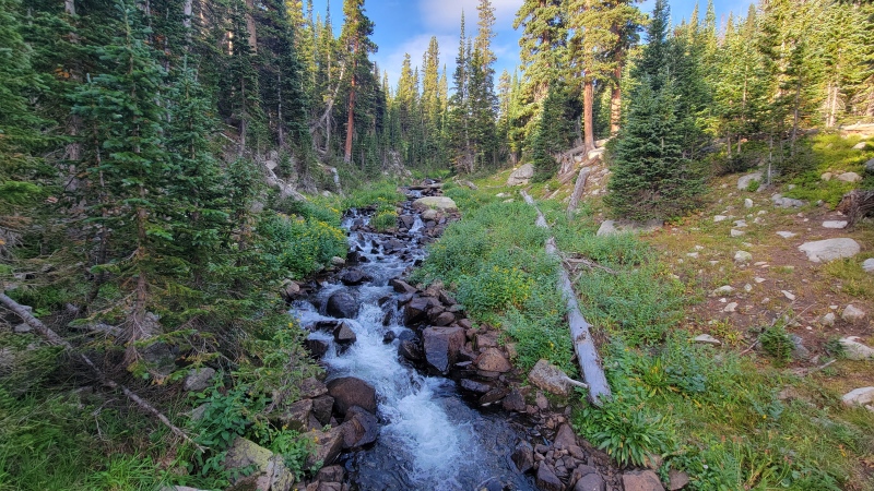
From Blue Lake, the trail traverses around the NE side of the lake and becomes slightly more faint as you make your way around the lake 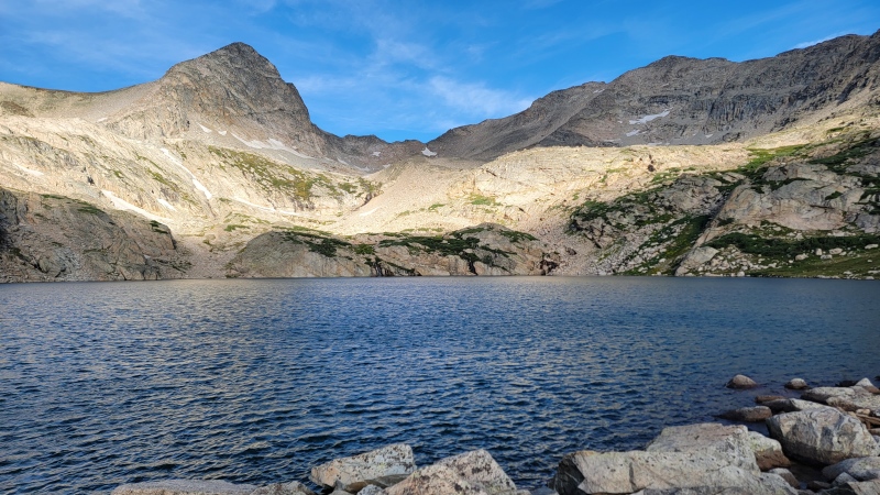
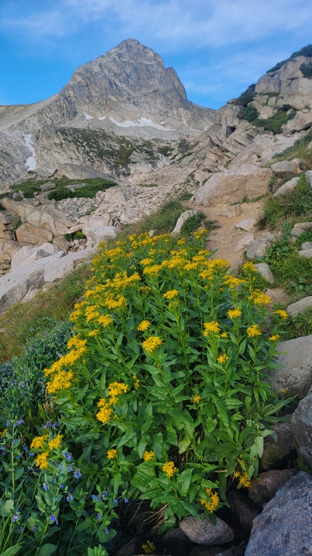
Even thought it's early September, wildflower season has been good to us this year with all the moisture we had in spring and summer 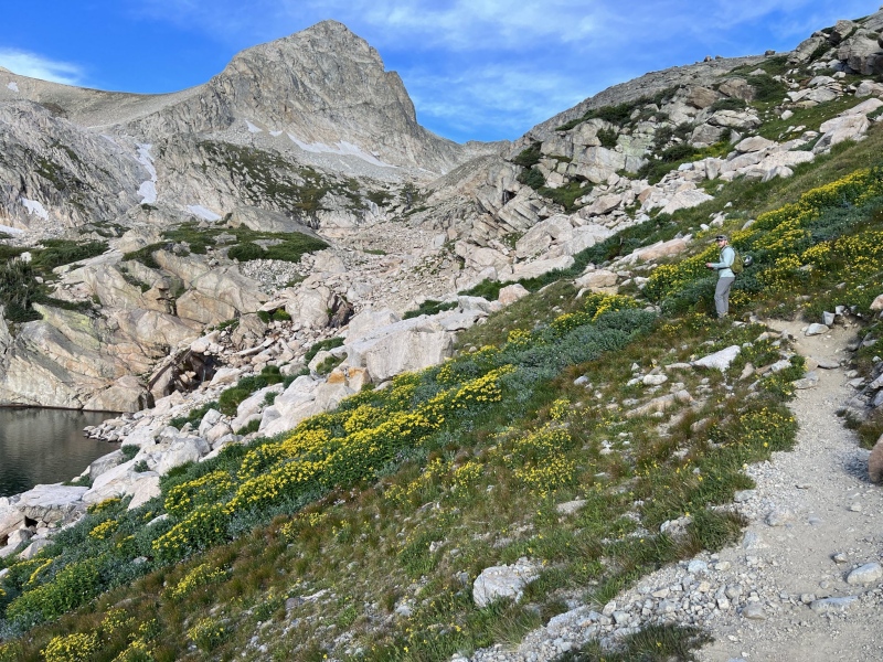
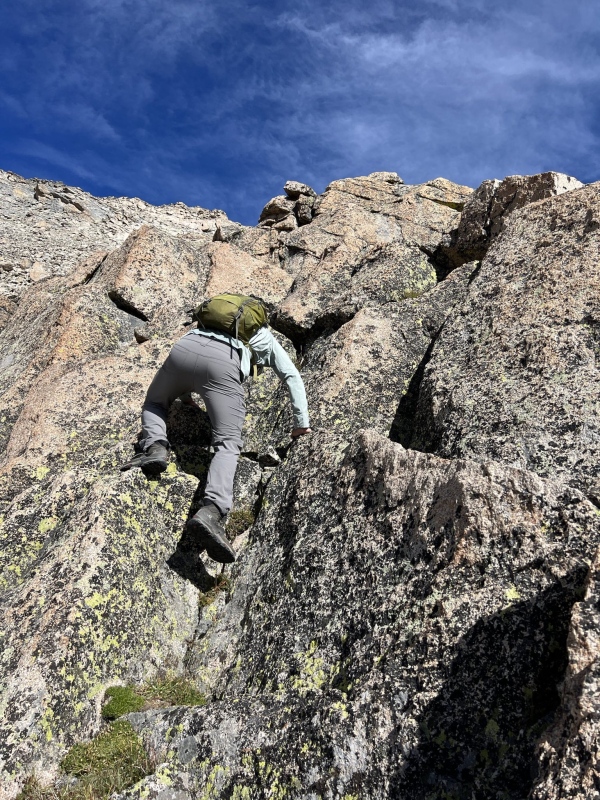
From Blue Lake we made our way up to 'Little Blue Lake' or the smaller higher elevation lake above the proper Blue Lake. At this point there was more or less no trail remaining and the routefinding and scrambling fun started. We generally trended NW from Blue Lake staying below a cliff band to the right of us until the slope angle eased where we could climb up it. 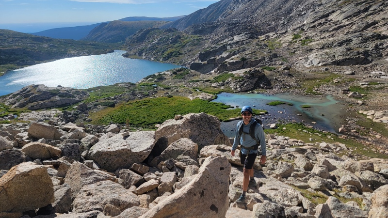
Once we got to Little Blue Lake, we took a short breather for a snack, to enjoy the views and to scope out the class 2 gully route up Paiute Pk. I had also read in a previous trip report that there was some optional class 3 rock to the climbers right of the gully that could be used to ascend as well. I forgot to grab a photo of the gully but from Little Blue Lake it's fairly obvious as the path of least resistance up to Paiute. We identified the previously described class 3 rock option and decided that looked like a lot of fun and went for it - it was fun climbing on mostly stable rock, sustained class 2 with class 3 moves here and there. Stay just climber's right of the gully and you can avoid all of the loose terrain in the gully and scramble up mostly solid rock, just don't veer too far right as there were some cliff bands to avoid down to the Little Blue Lake basin. In the map photo below, you can see our route compared to the gully. 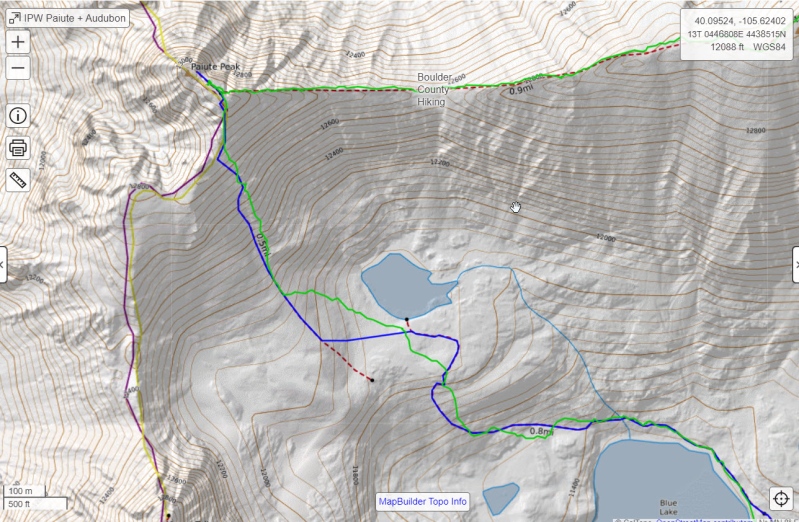
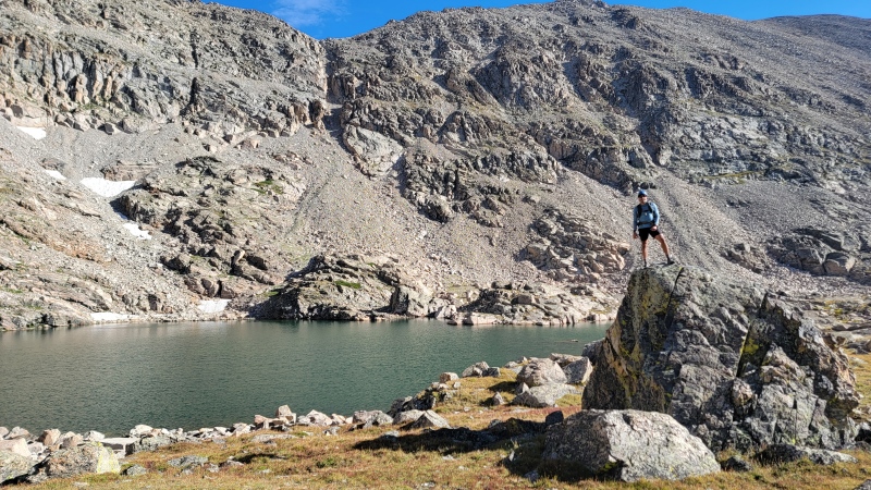
The climb from Little Blue to the summit of Paiute took about an hour. As you gain elevation, the views of Mount Toll and the Blue Lakes basin do not disappoint. 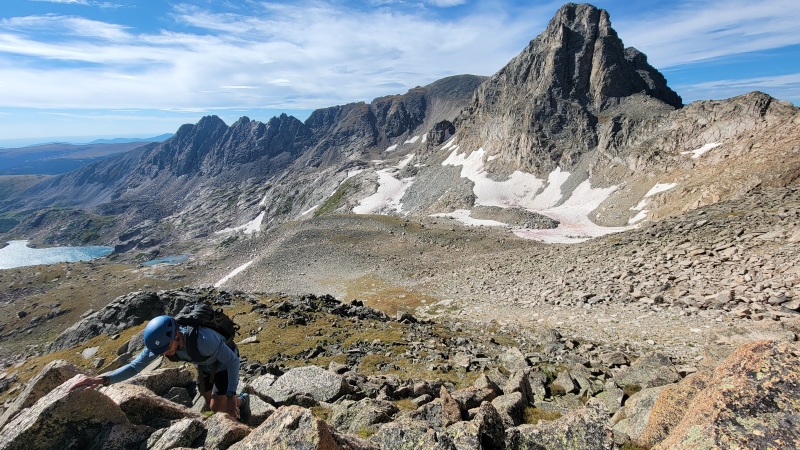
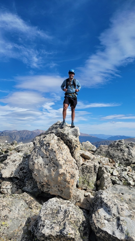
Once we topped out at Paiute, we took a break to take in the views and scope out the ridge traverse ahead of us. 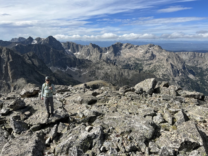
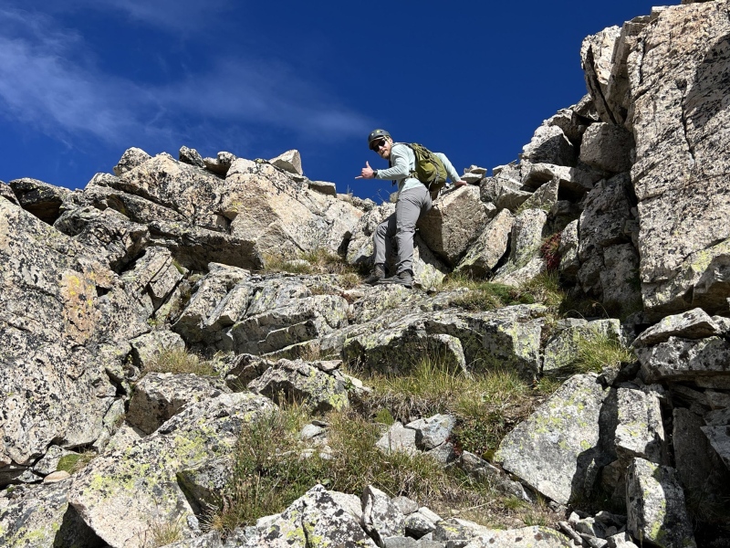
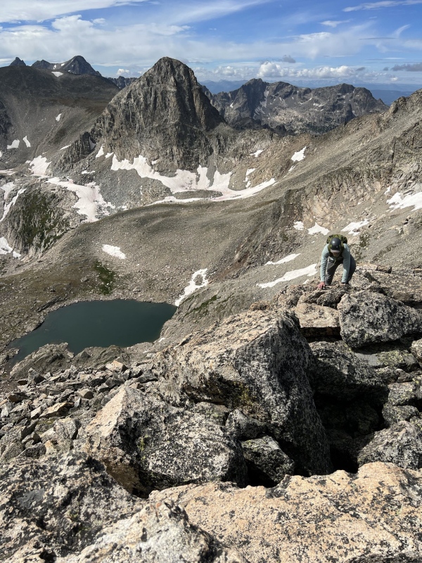
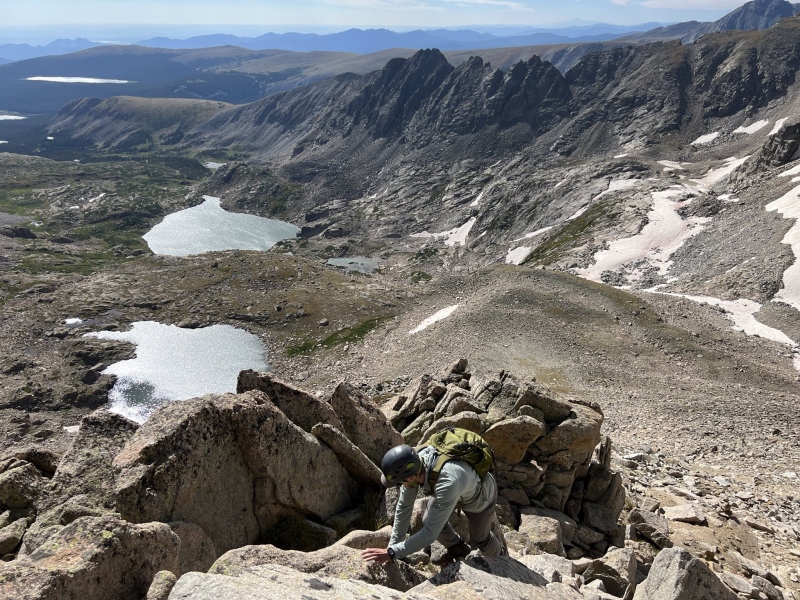
After the short break to recharge, we set off down the Paiute -> Audubon ridge. Routefinding was straightforward, for the most part just follow the ridge proper, there are occasional sections where exposure to the north side (i.e. left side when going from Paiute to Audubon) was easily avoided by skirting south slightly below the ridge crest. The 14ers.com route description does a great job at explaining this ridge. 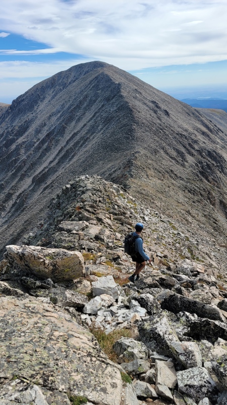
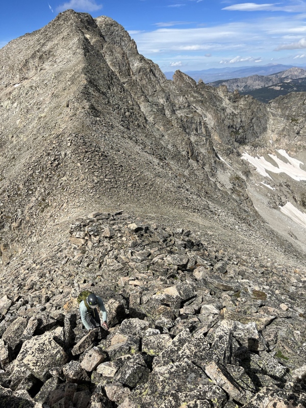
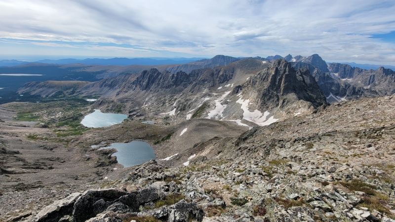
The ridge scramble was thoroughly enjoyable, and we completed it in just over an hour. We moved at a steady but comfortable pace. Once at the summit of Audubon, we gathered ourselves once again and took some time to take in the high alpine views. Notably, from the summit of Audubon the views of Rocky Mountain National Park to the N were pretty incredible. We were lucky enough to have both summits to ourselves on this day. 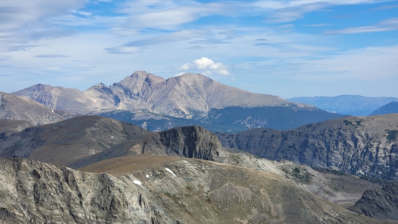
After enjoying the summit of Audubon for a bit, we set off down the talus field working towards the Mt. Audubon trail. Once you pick up the trail it's a rocky affair back to the car but we were able to shut off our brains and make decent time to make it back home to our families before dinner. Audubon summit back to car took about 1.5 hours. Overall an incredible day in the alpine in our beautiful state. I'll be back to the IPW for more exploring - on the way down Dan and I were discussing how Audubon's E slopes would be a fun ski objective, in the last couple of years the two of us have been building our confidence in the backcountry in the winter. Thumbnails for uploaded photos (click to open slideshow): ")
")
")
")
")
")
")
")
")
")
")
")
")
")
")
")
")
")
")
")
|
| Comments or Questions |
|---|
|
|
Caution: The information contained in this report may not be accurate and should not be the only resource used in preparation for your climb. Failure to have the necessary experience, physical conditioning, supplies or equipment can result in injury or death. 14ers.com and the author(s) of this report provide no warranties, either express or implied, that the information provided is accurate or reliable. By using the information provided, you agree to indemnify and hold harmless 14ers.com and the report author(s) with respect to any claims and demands against them, including any attorney fees and expenses. Please read the 14ers.com Safety and Disclaimer pages for more information.
Please respect private property: 14ers.com supports the rights of private landowners to determine how and by whom their land will be used. In Colorado, it is your responsibility to determine if land is private and to obtain the appropriate permission before entering the property.

