| Report Type | Full |
| Peak(s) |
Mt. Blue Sky - 14,268 feet |
| Date Posted | 09/02/2023 |
| Modified | 03/11/2025 |
| Date Climbed | 08/13/2023 |
| Author | NonStandardRoutt |
| Into Thick Air on Mt Blue Sky |
|---|
|
Trying to find a good way to start out my first trip report.. I guess a bit of background on me. I’m a flatlander (Chicago) in pretty good shape and hadn't really made my way onto big mountains until about two years ago when I hiked Quandary as my first 14er. The next summer I hiked Bierstadt and I have been hooked ever since. As much as I watch the 50 Project, scour 14ers.com or obsess over the mountains in general I’d like to say I know more than I do; and after my latest high alpine endeavor I’ve found that what I think I know about being in the mountains is irrelevant when I am actually in these situations and can’t rely on experts. On the morning of August 13th I set out from Steamboat Springs for Mt. Evan’s. via the Summit Lake trailhead which made for a sizeable drive. Weather for the day looked fairly solid, with a high chance of clouds but a pretty low chance for any showers, storms or wind. I had my parking pass and all roads seemed to be open. My drives in the early morning hours had been far more desolate than I expected wildlife wise. Luckily I came prepared with some solid tunes and podcast options, and the early morning glow of the Milky Way followed by the first hints of light on the high peaks was invigorating and set the day’s tone. Today was going to be great! But I was informed upon arriving at the access gate to Mt. Evan’s road that it would be closed until further notice. Nice. I could’ve sworn I did my homework and there weren’t any scheduled closures. But here we were. So there went my day I thought. Surely afternoon storms would move in and yet another chance to hike a 14er would go by the wayside. I thought listening to Justin Timberlake’s “What Goes Around Comes Around” would somehow get me up past a closure that had been signed since Silverthorne… no such luck. So I pivoted plans and brought my girlfriend out to brunch and shopping in Denver. After dropping her at DIA for her flight and heading back west on 70 I saw that my guardian angel JT had worked in cohorts with C-DOT to open the road back to Summit Lake! GAME ON! While I was just stoked to have made my way up there, I couldn’t help but wonder if I had yet again drove out of my way just to be turned around again. This time by weather. Upon arriving at Summit Lake around 2:30pm I found myself surrounded by clouds. 
As a flatlander who hasn’t spent much time in the mountains besides skiing, where you’re generally safe on the weather front, this was certainly a new experience. After waiting 20 minutes I decided that if I was going to give it a go it had to be now, and with a slight break in the clouds I began my ascent towards Mt. Spaulding. I think a big reason why I wanted to write this trip report is it was my first time truly assessing risk and trying to mitigate objective hazard in the mountains. What I will say is I have no clue whether I made the “right” choices or not, but I felt I made decisions that were both rooted in what I had observed that day and what the weather forecast had called for as well as my own personal risk tolerance. 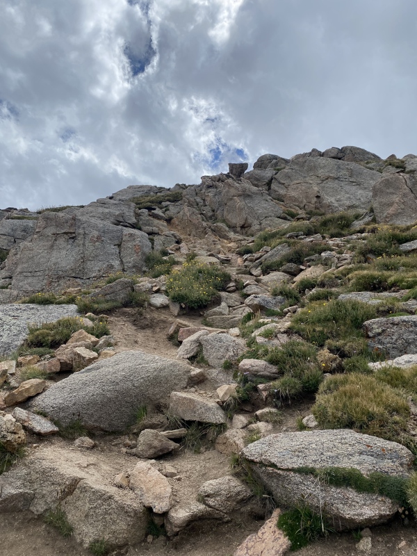
More than halfway up Spaulding and wow, could the sun really be coming out? It did, and left me with one of the coolest inversions I have ever seen. A sea of white clouds lay just a few thousand feet below me, in every direction as far as the eye could see. 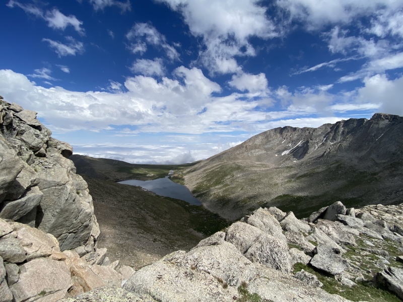


Higher level clouds lingered intermittently above, but none looked particularly ominous or seemed to bring the threat of precipitation. I was making good time and had reached the Summit of Mt. Spaulding in about 35 minutes and was just thoroughly enjoying the 180 the day was seemingly taking on all fronts. Good thing I did too because no more than 5 minutes after leaving the saddle between Spaulding and Evan’s I was watching a thin veil of clouds appear from below the ridgeline and begin to sneak upward all around me. 
It quickly got to the point where the clouds that were enveloping the Sawtooth and Mt. Bierstadt to the west had begun to totally sock in the ridgeline up to the top of Evan’s. 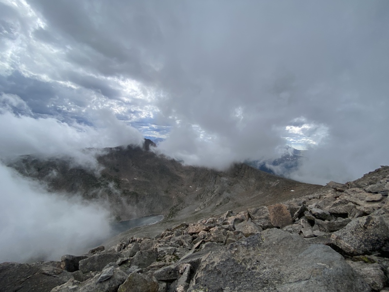
While I had been taking account of the weather and its impacts the entire way up, this was the first time I felt as if I had any sort of decision making to do. Just over halfway up and should I push forward or call it quits? Would turning around now really make any sort of positive impact on my safety, or perceived safety? Or just leave me disappointed and wondering ‘what if’. No way. Or at least that was what I told myself. I think a bit of summit fever was on hand here, as I wanted to avoid turning around at all costs… After all I had left Steamboat at 4am, and I had turned around the week prior 300 vertical feet below the top of Mt. Sherman because of my girlfriends splitting headache… unfortunate for the both of us but her particularly as she had enjoyed her time up her first 14er until the issue stopped us in our tracks. Point of the matter, I was extra motivated to make my way up, so I pushed on. This nixed my plan to go up to West Evan’s but it was a small price to pay, and I guess it also helped me more clearly define my risk tolerance while in these situations. By the time I was on the cairned boulder hopping route to the summit the ridge was 100% in the clouds, with visibility ranging from 15-25 yards. Winds weren’t much of a factor which certainly contributed to my confidence in moving forward. 
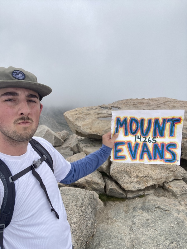
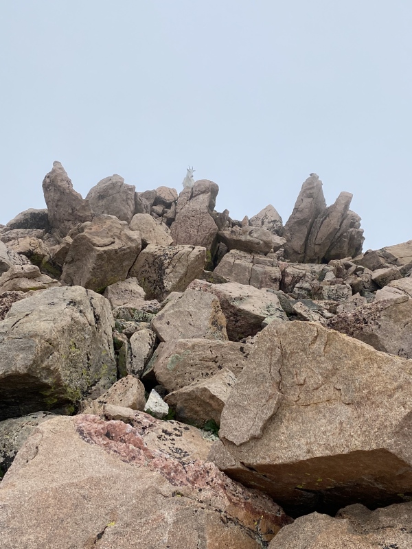
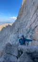
I made my way up to the top and spent about 5-10 minutes socializing and taking pictures with the few people that had stuck around with their vehicles on the summit. I was up to the summit in just over 1.5 hours from my car, and I think I forgot to mention that I didn’t pass a single person on my way up until the final stretch! What a treat in the front Range! After coming back down from the switch backs near the summit I was quickly alone yet again. Merely a few hundred yards from a parking lot and road yet the absence of people combined with conditions that struck me as almost supernatural lent itself to an amazingly “wild” sensation and overall experience. Running into a lone mountain goat also aided to the mystique! I found “route-finding” very manageable. I guess this was my first true test of having to be aware of direction without an obvious trail or normal visibility. While the weather conditions did complicate things to an extent, for the most part the cairns were obvious and with my good natural sense of direction I had no issue following the horseshoe shaped ridgeline all the way down to Summit Lake. Sorry for my lack of photos in this zone as I was hellbent on moving fast and staying safe. 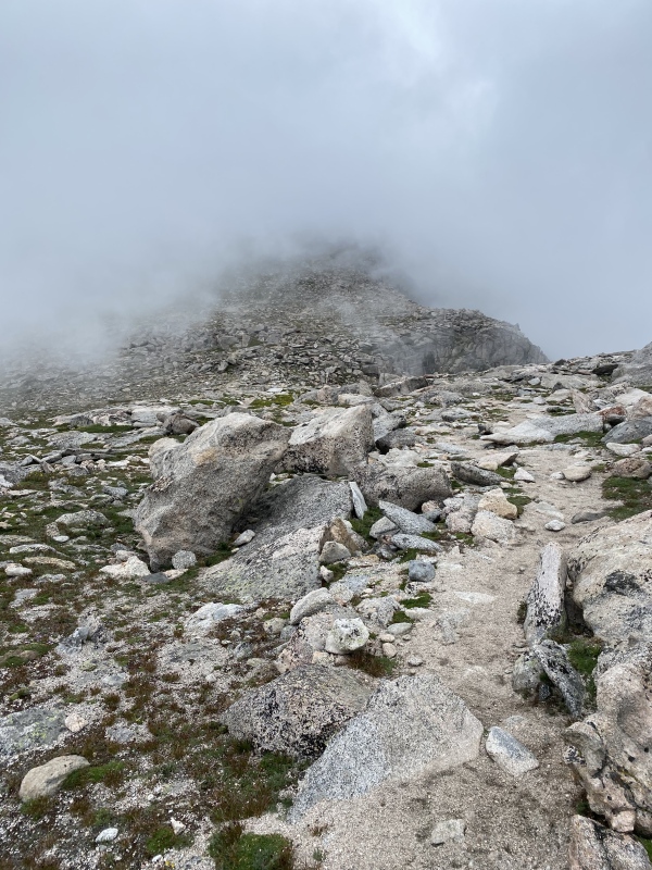
An hour later I was making my way up once again to Mt. Spaulding, and I quickly felt any energy that was left in my legs disappear. The price of moving far faster than I normally would’ve had caught up with me, and with it a word of advice: BONKING does happen! It’s not just a funny word to say. And it’s not just a normal tired after a long hike either. Like, I couldn’t move more than a dozen steps without having to stop to catch my breath but mostly to allow my legs stop screaming for rest. I had never experienced anything like it. I think the best way to avoid this is to find a comfortable pace for yourself, take your breaks as needed, and a healthy dose of water and snacks. In this situation I think I was so focused on being fast and staying aware of what was going on around me, that I didn’t do nearly enough refueling for how fast I was going, let alone my normal pace. Input=Output. A very simple and true mountain function. I quickly realized what was happening and stopped to inhale a few honey stinger bars, a bunch of water and a couple Advil. This was exactly what the doctor ordered as a few minutes later I was feeling ready to finish off the hike, and successfully made it down to my car 30ish minutes later. My moving time was just over 3 hours with a total time of about 3:20 minutes round trip. All in all, a wildly fun and successful day that seemingly arose from the ashes of my initial failed attempt. 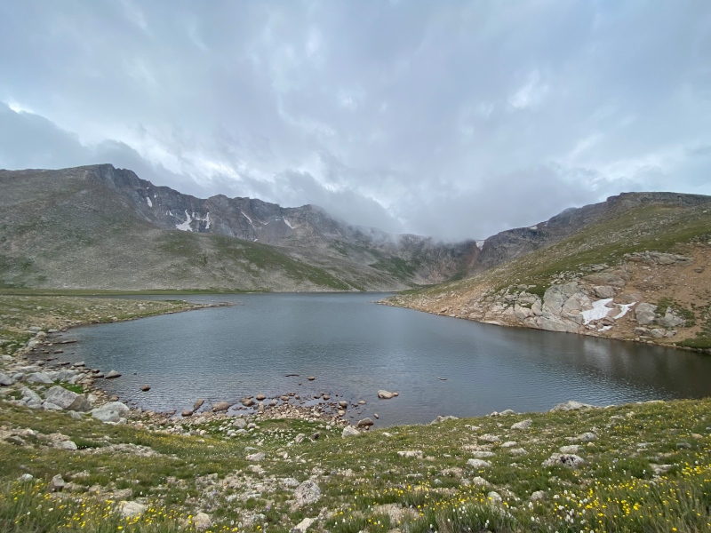
I feel like I continue to learn a ton about myself and the mountains every time I go out, and this ramble was no different. I hope some of the information included above is beneficial, and if anyone actually reads all of this and has suggestions for future trip reports I would also be open to that! Cheers! Thumbnails for uploaded photos (click to open slideshow): ")
")
")
")
")
")
")
")
")
")
")
")
")
")
")
")
|
| Comments or Questions | ||||||
|---|---|---|---|---|---|---|
|
Caution: The information contained in this report may not be accurate and should not be the only resource used in preparation for your climb. Failure to have the necessary experience, physical conditioning, supplies or equipment can result in injury or death. 14ers.com and the author(s) of this report provide no warranties, either express or implied, that the information provided is accurate or reliable. By using the information provided, you agree to indemnify and hold harmless 14ers.com and the report author(s) with respect to any claims and demands against them, including any attorney fees and expenses. Please read the 14ers.com Safety and Disclaimer pages for more information.
Please respect private property: 14ers.com supports the rights of private landowners to determine how and by whom their land will be used. In Colorado, it is your responsibility to determine if land is private and to obtain the appropriate permission before entering the property.