| Report Type | Full |
| Peak(s) |
Babcock Peak - 13,161 feet |
| Date Posted | 08/20/2023 |
| Date Climbed | 08/05/2023 |
| Author | Mtnman200 |
| Additional Members | RandyMack |
| Don*t Quit Your Daydream |
|---|
|
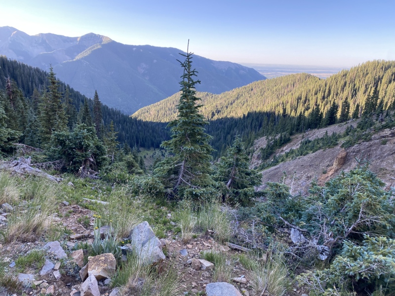
After reading the excellent trip report by Mike (Chicago Transplant) Rodenak, I've been dreaming of visiting Babcock Peak. On the descent from Babcock's summit, Mike identified what he thought would be a better ascent route. My goal with this trip report is to update Mike's trip report to include current road conditions and Mike's suggested ascent/descent route. Friday, August 4, 2023. Randy and I left Colorado Springs at 12:30 PM MDT and drove via Walsenburg, Alamosa, and Durango to Hesperus, where we headed north on the paved County Road 124 for four miles. Another four miles of gravel road suitable for passenger cars brought us to La Plata City campground (primitive). When we arrived at 6:40 PM, all but two of the nine sites were taken. Someone claimed the final campsite at 7:15 PM, so keep that in mind if you arrive on a Friday. Saturday, August 5, 2023. We drove about 3/4 mile to the Boren Creek road. Having read the description of a narrow road with sharp rocks, limited pullouts, and a downed tree across the road, we chose to park and hike the road. However, we discovered that the downed tree is gone, the rocks were less sharp than expected, and we could have driven to the 8th switchback on the road (about 10,800'). Above the 8th switchback, the road was blocked by large rocks that had come down the hill. Don't drive past this switchback unless you want to back down the road. Randy and I continued hiking up the road to about 11,200' and then headed north toward Babcock Peak. 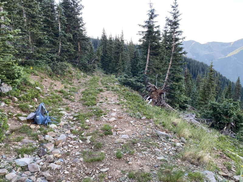
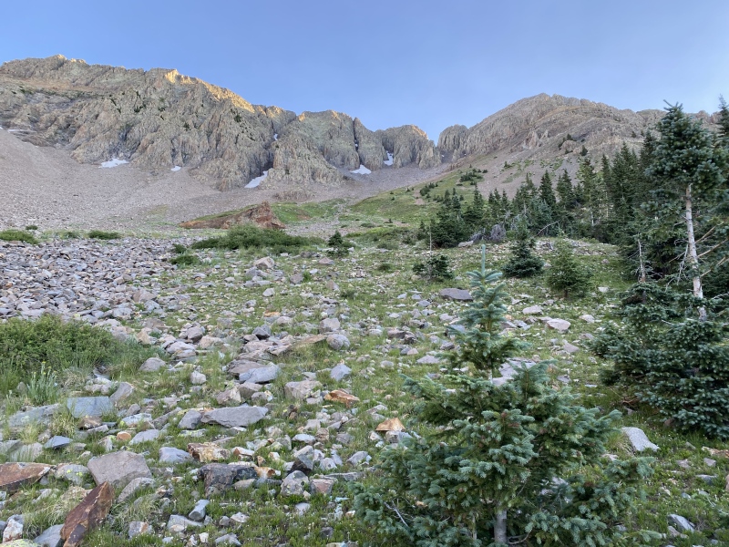
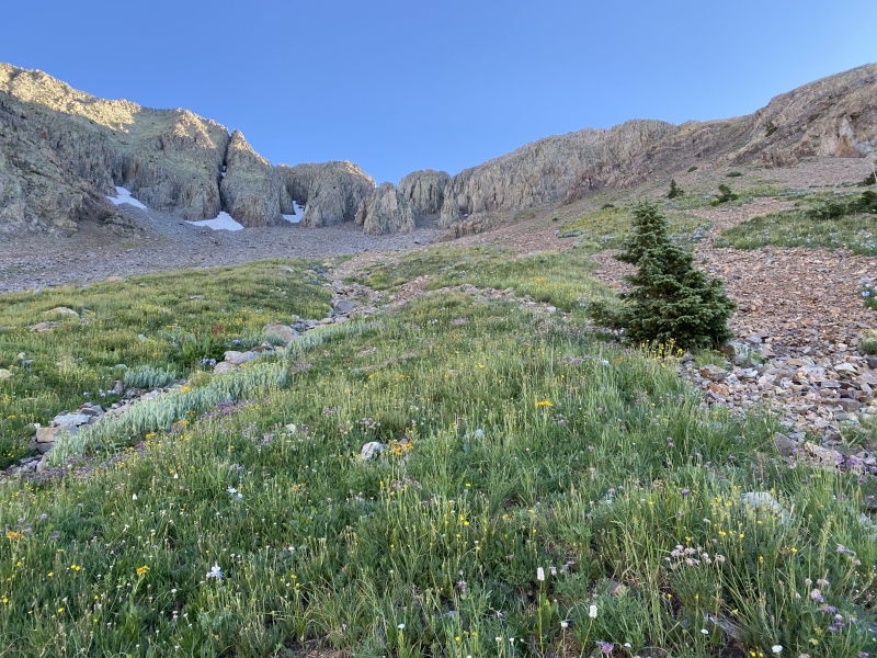
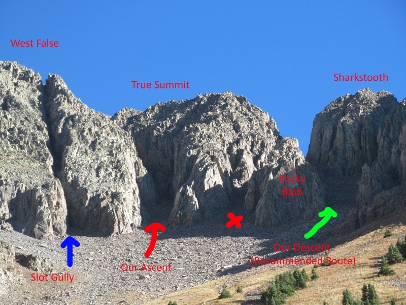
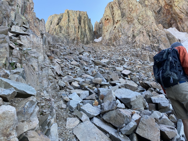
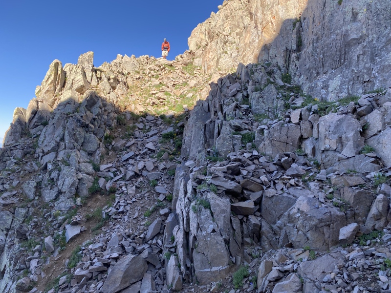
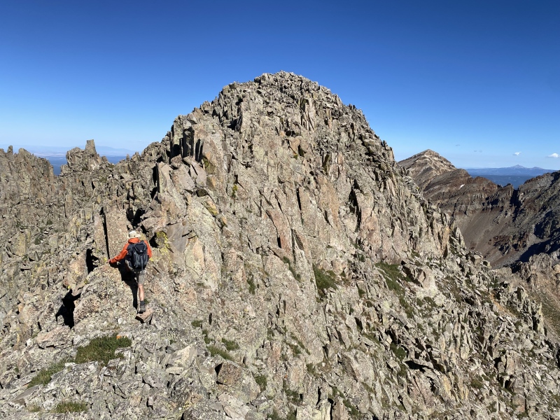
If you follow the path of least resistance, you should be able to keep the ascent to Class 3. Pay attention to your route so you can find the top of the ramp on your descent. 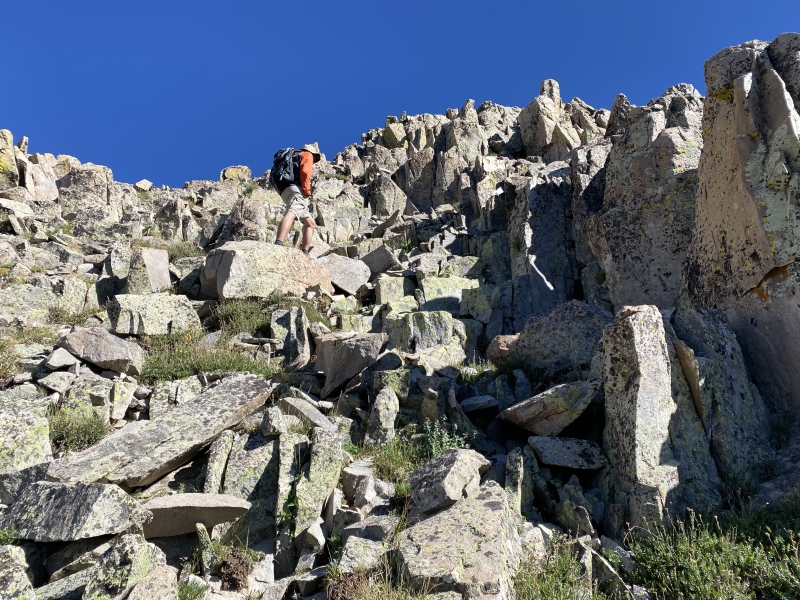
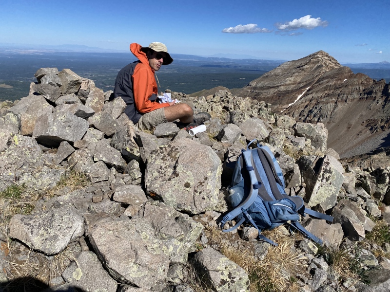
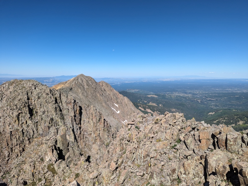
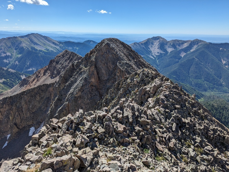
Randy and I spent about 45 minutes enjoying the views from Babcock's summit before heading down. We had no trouble returning via our ascent route. This was a very fun climb and is high on my "repeat" list. Thanks to Mike for the valuable beta, and I hope you don't mind that I borrowed your photo. Thumbnails for uploaded photos (click to open slideshow): ")
")
")
")
")
")
")
")
")
")
")
")
")
")
|
| Comments or Questions |
|---|
|
|
Caution: The information contained in this report may not be accurate and should not be the only resource used in preparation for your climb. Failure to have the necessary experience, physical conditioning, supplies or equipment can result in injury or death. 14ers.com and the author(s) of this report provide no warranties, either express or implied, that the information provided is accurate or reliable. By using the information provided, you agree to indemnify and hold harmless 14ers.com and the report author(s) with respect to any claims and demands against them, including any attorney fees and expenses. Please read the 14ers.com Safety and Disclaimer pages for more information.
Please respect private property: 14ers.com supports the rights of private landowners to determine how and by whom their land will be used. In Colorado, it is your responsibility to determine if land is private and to obtain the appropriate permission before entering the property.

