Download Agreement, Release, and Acknowledgement of Risk:
You (the person requesting this file download) fully understand mountain climbing ("Activity") involves risks and dangers of serious bodily injury, including permanent disability, paralysis, and death ("Risks") and you fully accept and assume all such risks and all responsibility for losses, costs, and damages you incur as a result of your participation in this Activity.
You acknowledge that information in the file you have chosen to download may not be accurate and may contain errors. You agree to assume all risks when using this information and agree to release and discharge 14ers.com, 14ers Inc. and the author(s) of such information (collectively, the "Released Parties").
You hereby discharge the Released Parties from all damages, actions, claims and liabilities of any nature, specifically including, but not limited to, damages, actions, claims and liabilities arising from or related to the negligence of the Released Parties. You further agree to indemnify, hold harmless and defend 14ers.com, 14ers Inc. and each of the other Released Parties from and against any loss, damage, liability and expense, including costs and attorney fees, incurred by 14ers.com, 14ers Inc. or any of the other Released Parties as a result of you using information provided on the 14ers.com or 14ers Inc. websites.
You have read this agreement, fully understand its terms and intend it to be a complete and unconditional release of all liability to the greatest extent allowed by law and agree that if any portion of this agreement is held to be invalid the balance, notwithstanding, shall continue in full force and effect.
By clicking "OK" you agree to these terms. If you DO NOT agree, click "Cancel"...
Wow, this was a quite a character-building hike. It wasn't some crazy harrowing experience or anything, but a couple of mistakes on my part made this hike far more difficult than expected.
I'm hoping to finish the 14ers this summer, and to keep all my future mountain plans on track, I'm planning on finishing the Sawatch 14ers by the end of June, and I had hopes of tagging both Harvard and Columbia today. Spoiler alert: I'll be coming back for Columbia later this week.
There's obviously been quite a bit of precipitation in the high country this June, but so far it hasn't been too difficult to find clear mornings to climb some peaks. For today, mountain forecast was calling for a snow/rain shower to begin around 10-11am, so my plan was to do a proper alpine start, hike Harvard, do the traverse, and be back down into the basin by around 11. Earlier this week on Antero, the trail was getting pretty close to summer conditions, and I made great time for myself, so I assumed I could do the same here. This was the first mistake: assuming that it would still be summer-y despite all the precipitation lately.
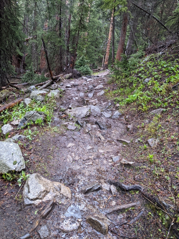
Nonetheless, I made a very rainy drive out to the trailhead the night before, and got a few hours of sleep in the car. My alarm went off at 1:45am, and I was moving by 2:05. I know this is quite early, but I was intent on beating the weather. The night before, I checked how much moon there was going to be, and it was almost nothing, meaning that it was going to be a dark morning. I made quick work of the first few trail miles, and the snow quickly took hold on the trail. There was an awkward mix of swampy, soaked trail segments, interspersed with deep, post hole prone snowdrifts. Following previous footprints became tricky from time to time (especially in the dark) as the trail meandered through the trees. The footprints from previous hikers snaked back and forth to avoid the increasingly large puddles.
Here comes the biggest mistake of the day. At some point, I checked my route line on OnX (the mapping app I use), to find that I was approximately half a mile from the Columbia turn off; the turn was due north/northwest from my location. I continued following the bootpack/trench, as it changed direction from what I believed was northwest to north. I checked OnX about 10 minutes later, and my location hadn't moved much. Maybe the GPS was having trouble with the surrounding valley or something. The trail turned slightly to what I thought was northeast. I thought to myself, "whatever, probably avoiding another stream." I continued walking, while thinking to myself that it was weird how much I was descending into Horn Fork Basin. 10 minutes of post holing later, I checked OnX, and to my dismay, it showed that I was almost a mile from the Columbia turn! What's going on? My altimeter said that I had descended nearly 300 feet since the last time I checked. I grabbed the Garmin to see if it had different ideas about my location, but it refused to turn on. I busted out the trusty compass even though I was certain that I had been walking due north this whole time. To my great dismay, the compass revealed that I was walking directly southeast! That meant that while following one of the trenches in darkness, I had somehow followed a stray path, which connected back to the main trench going the other direction, and I had failed to notice. I found this extremely disconcerting as I generally have a good sense of direction. Frustrated with this mistake, I made a complete 180, and continued in the correct direction.
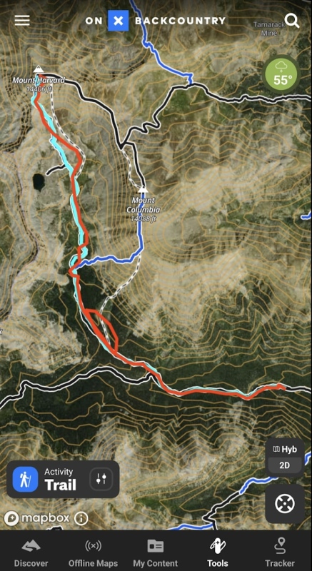
To illustrate this, the map below shows my intended route, and my best guess of the where I actually went. The cyan line is the intended route (slightly covered at the start) and the red line is where I believe I went.
Note the giant red loop
After correcting this mistake, I ascended into Horn Fork Basin as intended. I picked an egregious route to traverse the basin, involving a significant amount of snowy bushwhacking.
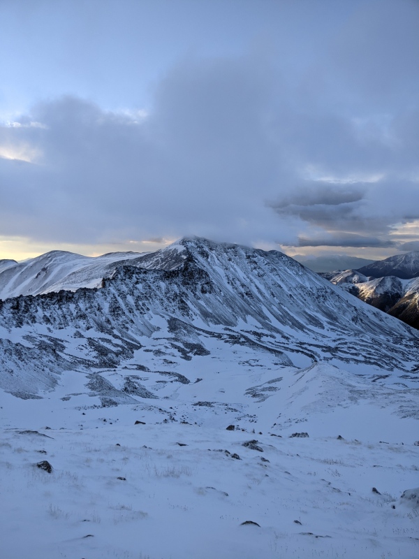
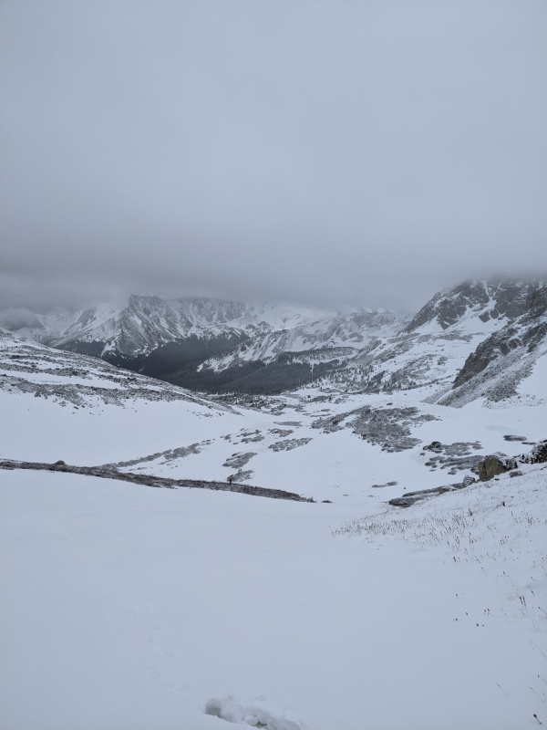
The biggest surprise of the day was that the conditions in the basin above were very reminiscent of winter. Not the late spring conditions that you'd expect this time of year, but proper winter. There was new snow accumulation of 2-6 inches depending on the spot, with a handful of slopes even developing small thin windslabs on the surface.
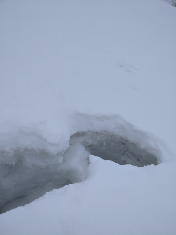
To illustrate the state of the snowpack, here is what I'd like to call a post-hole-snow-pit®. In the post hole, you can see that there's a base of wet, consolidated spring/summer snow, along with new, windswept accumulation on top.
Great times
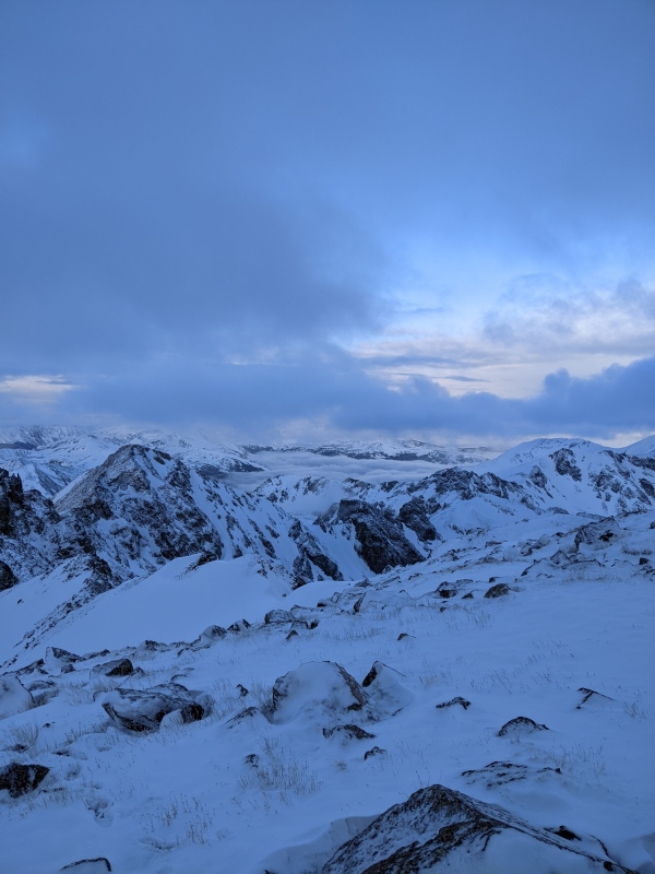
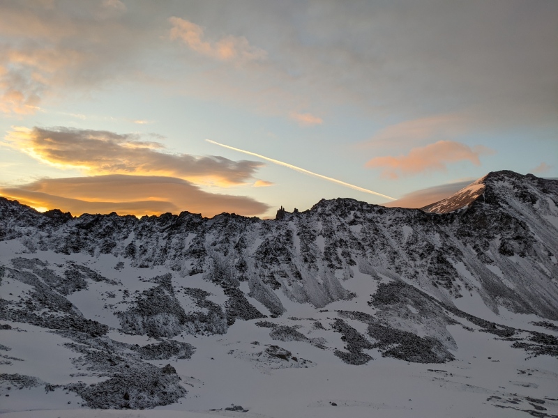
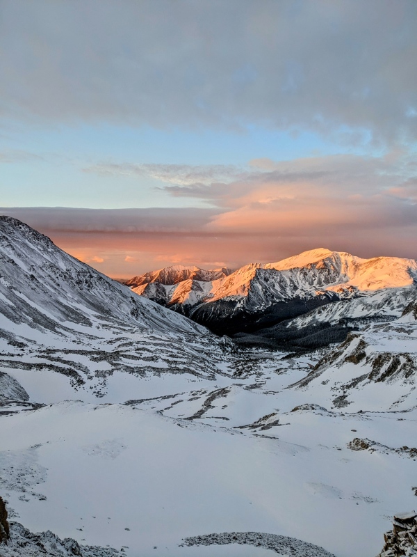
All those route mishaps ended up costing me upwards of an hour. After that was sorted out though, I began to make slow, but steady progress up the basin. I was greeted by a stunning blue hour and dawn:
ColumbiaLooking southwestCloud inversions to the westWhat I think is the "rabbit" at dawnDawnLooking south down the basin
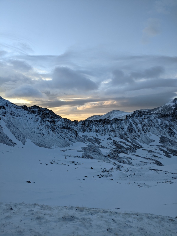
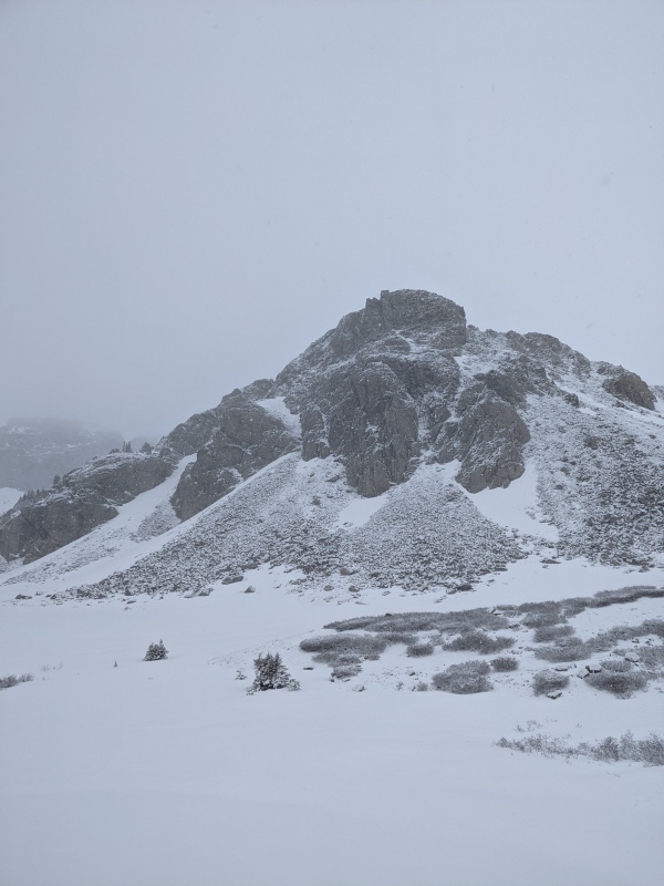
I continued up the ridge in the basin, nearing Harvard's ridge. Perhaps only 15 minutes after taking this photo, around 6am, clouds rolled in, bringing bad visibility, a light breeze, and a dusting of snow. I figured that I'd cautiously see if Harvard would still work out, but I was certain at this point that Columbia was out for the day, considering that the snow arrived 4 hours early.
Aside from having significantly warmer temperatures and less wind, this part was pretty reminiscent of winter.
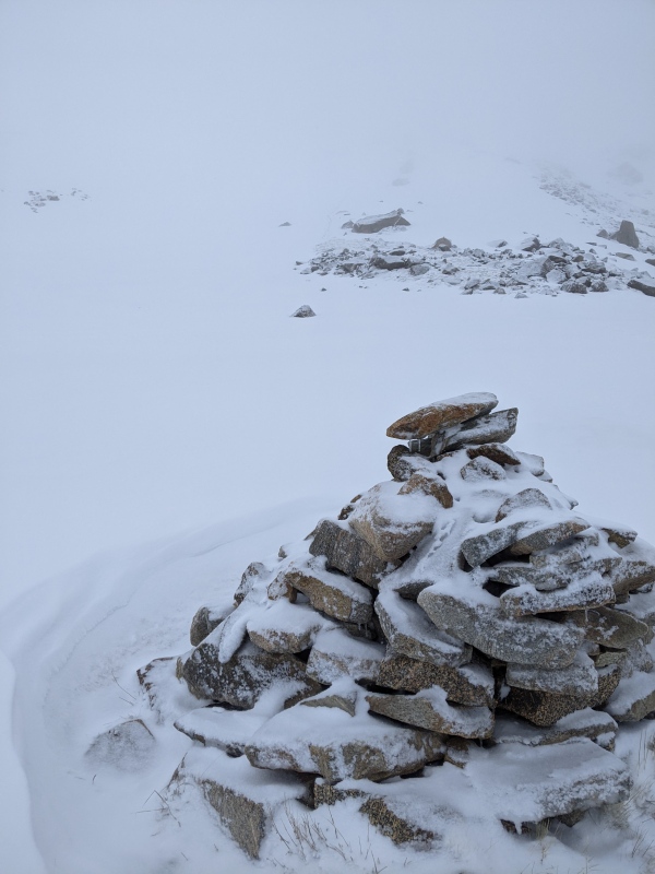
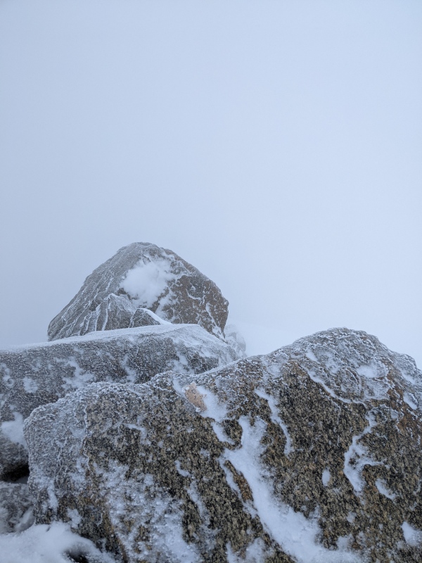
A big cairn around 13.3k, taken on descent
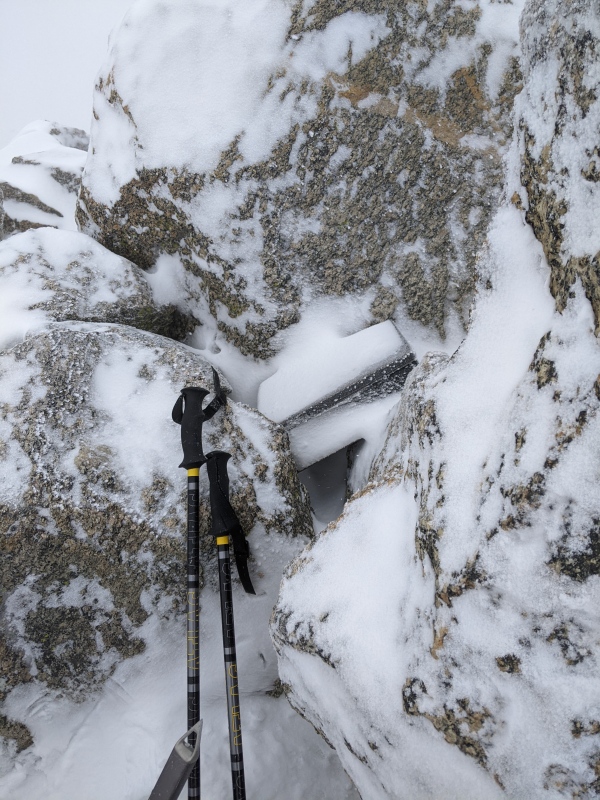
There was quite a big of windswept alpine ice on everything, not dissimilar from the stuff you might see on Culebra in winter. I had just brought microspikes; I certainly wouldn't have declined crampons here, but it wasn't a deal-breaker.
One of the icy post hole crossings on the summit ridge
I followed a lower-angle route on the summit ridge that traversed over to a col just east of the summit (see red line on map). Some boulder-hopping led to the top without many issues.
A snowy summit registerNice views at the top
I only lingered long enough to change my layers because, although unlikely seeming, I wasn't thrilled about these clouds suddenly deciding that they had the capacity for lightning. I just followed my footprints back the way I came, which was made challenging by the flat light.
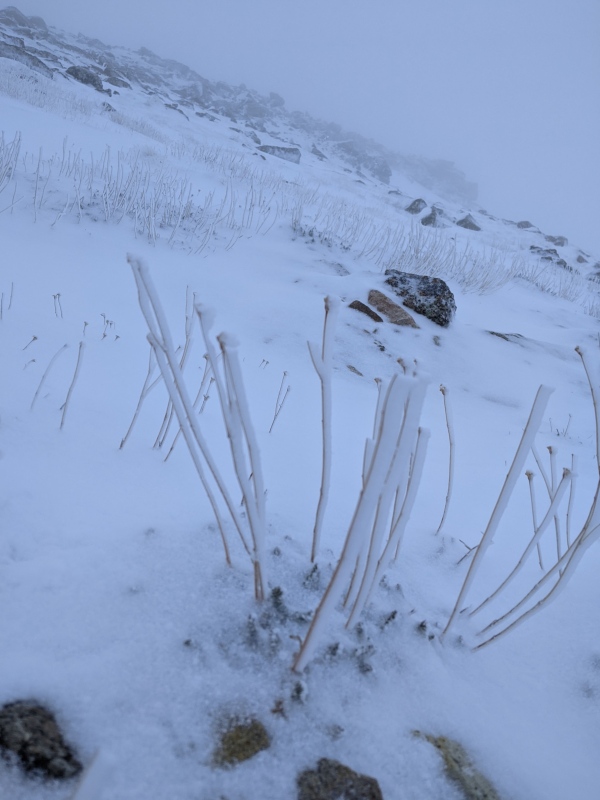
The ice on this plant is pretty cool
The cloud had descended quite a bit since my ascent, and it was snowing a decent amount.
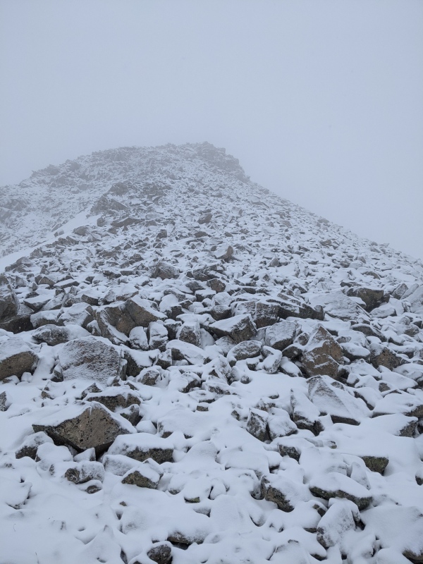
Talus on the basin ridge
Basin on the descentAnother mound in the basin
I picked a bit of better route on the way out that stayed on the east side of the basin for longer, avoiding the bushwhacking. I was eventually able to intersect a trench for the standard route of Columbia.
About to leave the basin
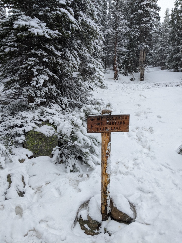
Much to my delight, I saw this sign that I hadn't found at all on the way in. My guess is that I was probably only 50 or so feet to the side, but there was no way of knowing since it was so dark on the way up.
Junction
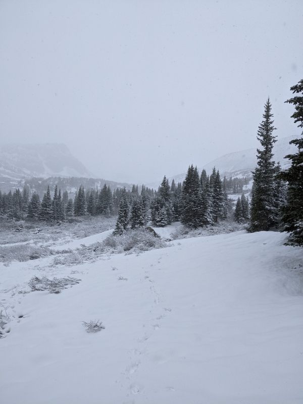
I had a much easier time with route finding on the way out, largely because I could see the trail segments here and there. I was likely very close on the ascent, but not quite on it. Aside from that, the remainder consisted of straightforward miles back to the car. The snow switched to rain at lower altitudes.
The unusual Colorado lushness
While overall there weren't that many issues associated with my misfires on this hike, I still have a few takeaways that I'm going to apply in the future, in the interests on making hikes more fun and straightforward:
-Conditions can change significantly, even over only a few days. Antero was mostly dry a few days ago, but this is quite different; I'm not going to assume the same conditions in the future. It's been quite the snow year :) We're only a couple days from calendar summer, but it's still pretty wintery up there.
-In the future, I'll probably avoid hiking on days where precipitation is forecasted to start this early in the day
-I'm going to try to make a habit of glancing at a compass frequently, even if I'm confident in the direction of travel. It'll probably help to avoid these backtracking issues.
Thanks for reading :)
Thumbnails for uploaded photos (click to open slideshow):
Glad to see you still got Harvard. I too, have become turned around / off track on those super dark nights. Seeing the compass turn in a direction you don't anticipate is always sobering. Unexpected winter conditions are some of my favorites, as you said, they offer character-building experiences. It's always good to be careful with the weather tho. I've had many enjoyable experiences on 13ers where it has snowed over the foot while I was climbing, and other less enjoyable experiences where lightning has struck so close to me that my ears rang. The weather forecast is usually wrong in terms of the extent of precipitation (way more or way less) so I usually try to go and see what conditions are like. More times than not, climbs have worked out that way, but of course, more caution is warranted.
Nice write up. I have decided there are two kinds of people. Those who believe they have a natural sense of direction and those who have learned otherwise.
Good job finishing Harvard. I have been up there twice thinking I would do that traverse and each time getting only one or the other peak for this or that reason.
Made an attempt on the 15th only to turn around 3.5 miles in. The snow drifts through the forest just below treeline was a bit rough with post holing quite a bit and it got swampy in spots. I had the gear but felt I just didnt have the stoke at that point and felt fatigued so I turned back. Thanks for sharing this. Might make another attempt this Tuesday.
and Columbia will always be there, glad you safely got one summit. Saturday morning we were also up in the high country skiing the Whales Tail on Whale Peak. The line was super easy but the storm was unlike anything I have seen in June (in the Rockies at least) and we soon found ourselves skiing knee-deep powder. Its June 17!
Good luck getting Columbia and be safe on the rest of those 14ers this year!
Best of wishes, Camden.
Caution: The information contained in this report may not be accurate and should not be the only resource used in preparation for your climb. Failure to have the necessary experience, physical conditioning, supplies or equipment can result in injury or death. 14ers.com and the author(s) of this report provide no warranties, either express or implied, that the information provided is accurate or reliable. By using the information provided, you agree to indemnify and hold harmless 14ers.com and the report author(s) with respect to any claims and demands against them, including any attorney fees and expenses. Please read the 14ers.com Safety and Disclaimer pages for more information.
Please respect private property: 14ers.com supports the rights of private landowners to determine how and by whom their land will be used. In Colorado, it is your responsibility to determine if land is private and to obtain the appropriate permission before entering the property.


")
")
")
")
")
")
")
")
")
")
")
")
")
")
")
")
")
")
")


