| Report Type | Full |
| Peak(s) |
White Rock Mountain - 13,523 feet White Benchmark - 13,411 feet |
| Date Posted | 06/12/2023 |
| Modified | 04/24/2024 |
| Date Climbed | 06/05/2023 |
| Author | Camden7 |
| White Rock to White BM | ||||||||||||||||||||||||||||||||
|---|---|---|---|---|---|---|---|---|---|---|---|---|---|---|---|---|---|---|---|---|---|---|---|---|---|---|---|---|---|---|---|---|
|
Sorry for the delayed write-up everyone. I would say I was busy and had important things to do, but not the case. I was just being lazy as can be. After a long day on Sunday climbing the Rustler Gulch 13ers, we were really slow to rise when the alarm struck at 3:50 on Monday morning. Despite still needing to fill camelbacks and organize our packs, we managed to get on the trail by 4:30 after choking down a few bites of cereal. Quick Facts: Climbers: Camden Lyon (Myself) and Tory Lyon (My Dad) Trailhead: Upper Judd Falls Trailhead (4wd access) 9,835 feet Distance: 10.1 miles Vertical Gain: 4,458 feet Total Time: 9:45 Peaks: 2 Ranked 13ers
Splits:
Having descended the Copper Creek Trail the previous afternoon, it was both a blessing and a curse to know each rock and bend. The near full moon once again limited the need for headlamps. We quickly rolled past Judd Falls, and after 40 minutes we had reached the Copper Creek crossing, exactly 2 miles from the TH. A log surely exists upstream, but we did not find it the previous afternoon, so just carried sandals to here and made the 5:15 am river ford. It was a little chilly on the feet, but we warmed up alright. 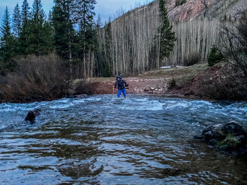
The trail beyond here was still covered in 2-3 foot deep snow, that had most certainly not frozen overnight. This section has its share of post-holing. 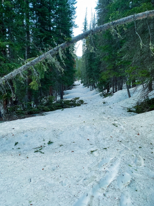
We left the trail at 10,550 feet, 3.4 miles in. The point where we left the trail was immediately before the trail crosses back to the west side of the creek. Our target was the small basin on the west side of WRM, that was north of Queen Basin, but south of the broken ramparts descending from the northern sub-summit of WRM. We climbed up through the forest alongside (south of) a small avalanche path, and after a few minutes, broke out into the slide path. Having finally found freeze-line, we popped on crampons at 10,650. 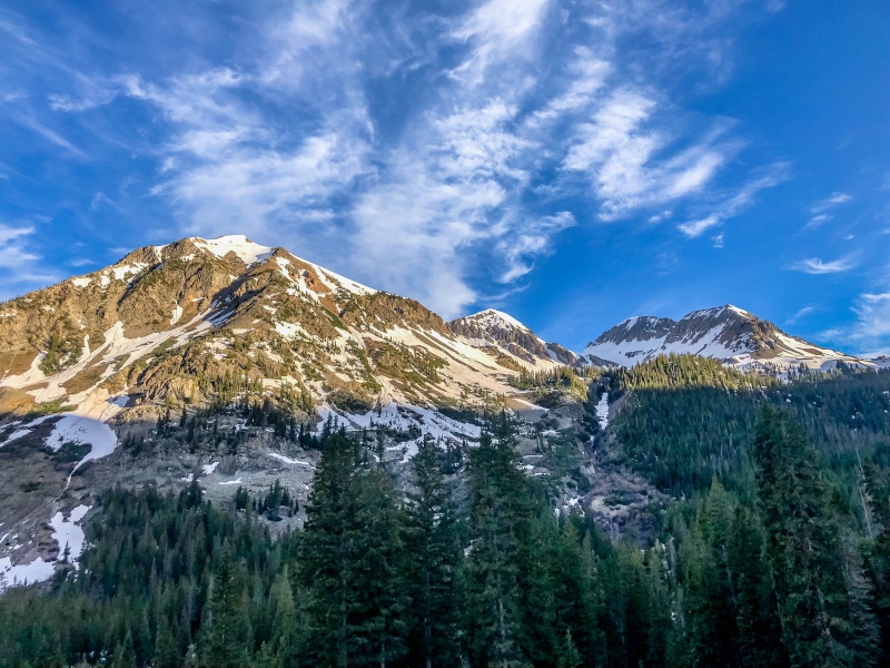
Excepting a few post holes where the snow was shallow and brittle near rocks, the snow was in great shape and would have allowed for great progress... were we not exhausted from the previous day's efforts. 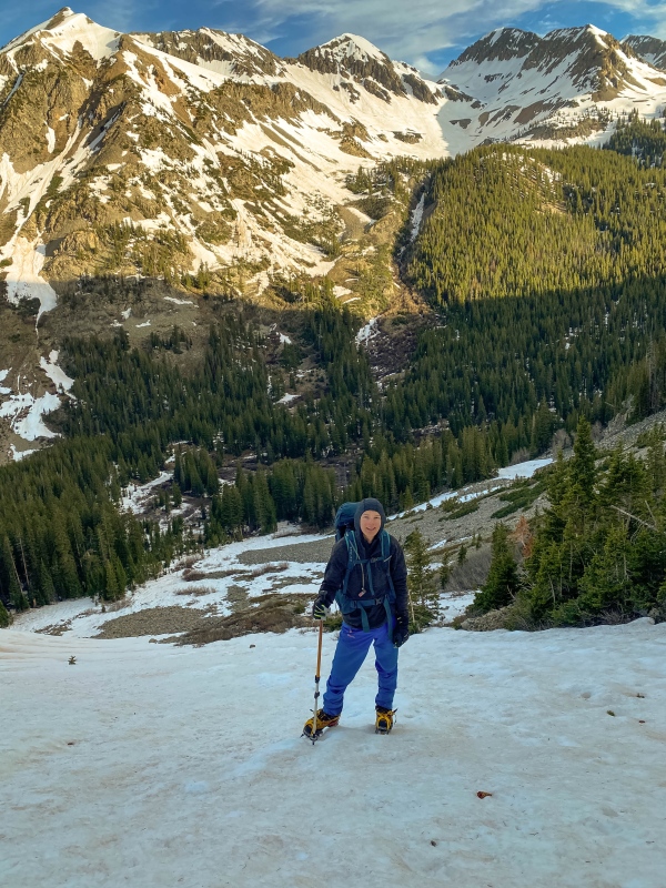
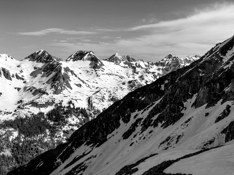
At about 11,200 feet, the angle of the hillside relents and a charming basin is entered. WRM towers high to the east, and its broken north and west ridges embrace the basin. Beautiful rolling moraines look up at bristling cathedrals and bishops on the dramatic west ridge, while sweeping views open up at your back. Few basins are more lovely or lonely. Until a little tiny bi-plane from Aspen came torpedoing through Copper Gulch. Very impressive piloting. 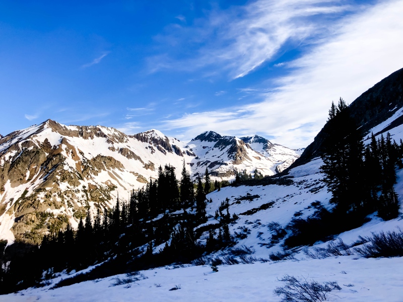
Above 11,800, the basin steepens into a high rocky headwall. A low angle ramp curves around to the left, while a number of more expedient couloirs tackle it directly. Most of them were split by rock bands or dry at the top, but the rightmost and largest was very inviting. 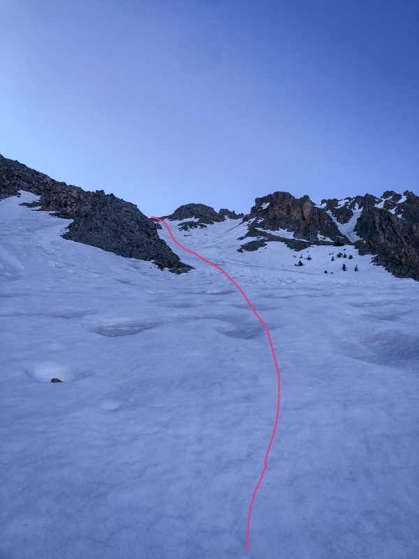
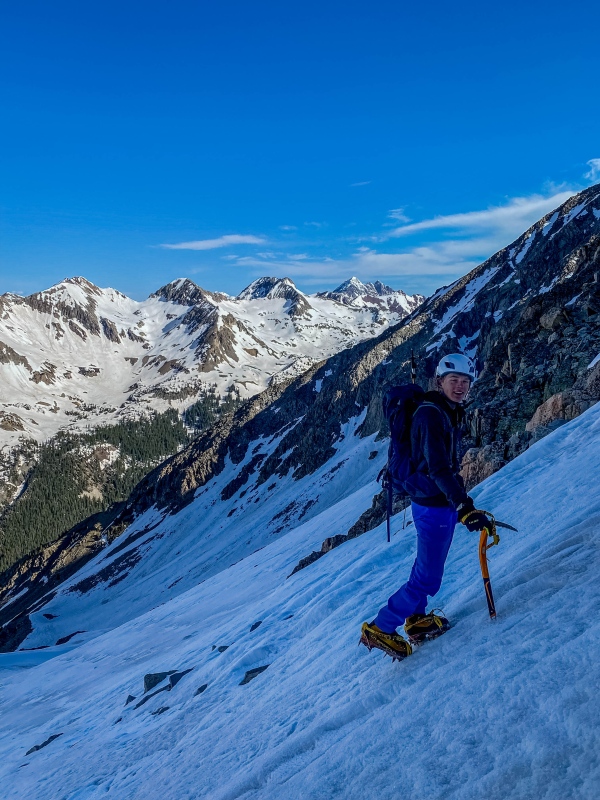
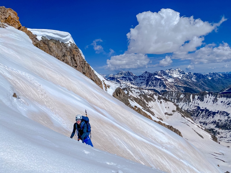
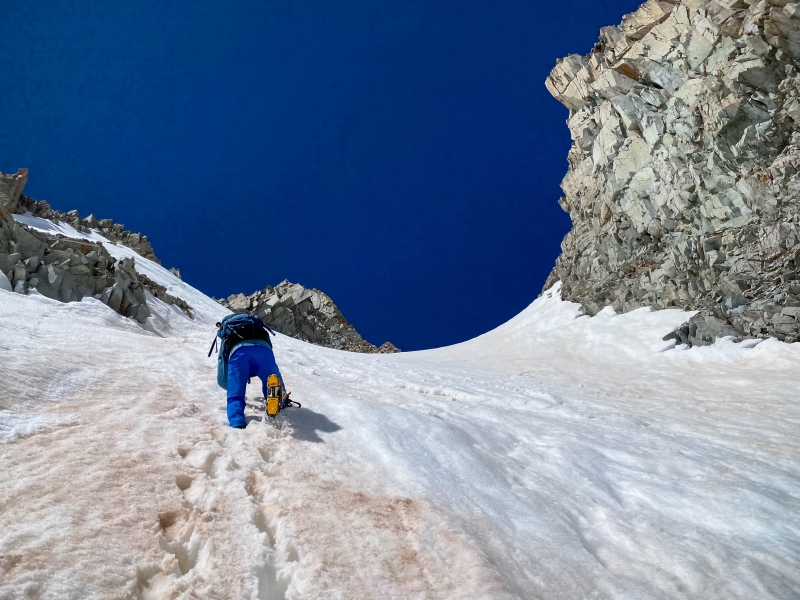
We zipped up the couloir, taking the left branch (the right goes to the west ridge). Most of it was very forgiving, but the upper portions probably exceeded 45°. Still very friendly compared to the previous day's exploits. A few short moves of class 2+ on loose rock returned us to snow, on a tiny bench at 12,600. 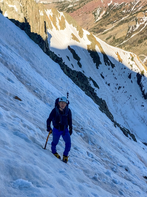
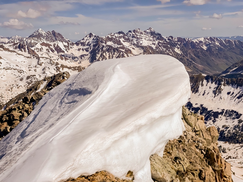
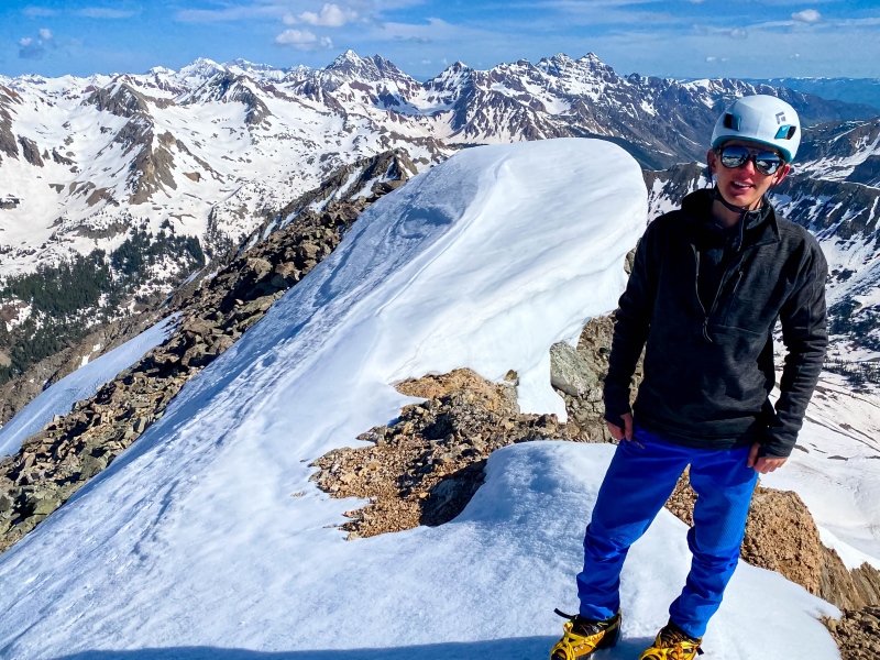
This lovely bench offered a great place for some food and water, and was adorned with spectacular views. The west facing snow above treeline was icy-hard, perfect for crampons. because of the soaring west ridge and the western aspect, we were protected by the sun, and didn't have to sunscreen until the summit. From the bench at 12,600, a handful of shallow gullies held snow, but only one was continuous to the ridge. As a matter of chance, that gully led directly into the summit, so despite its rather boring 45° angle, it felt somewhat aesthetic, especially with the perfectly frozen snow and unbeatable backdrop. 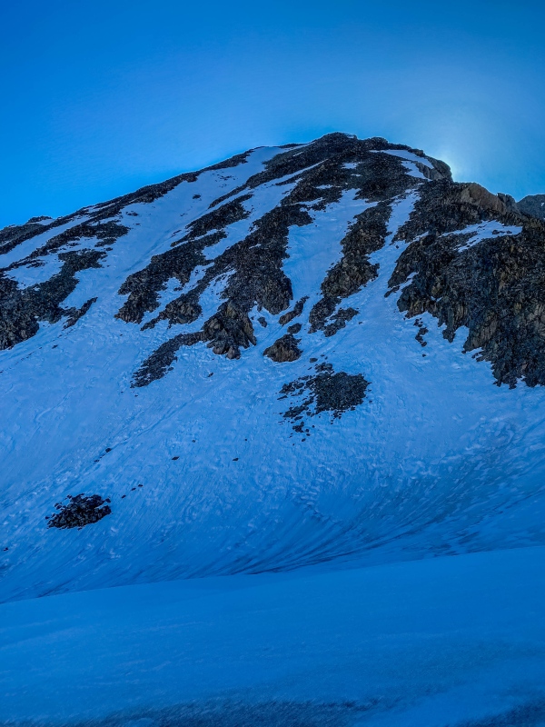
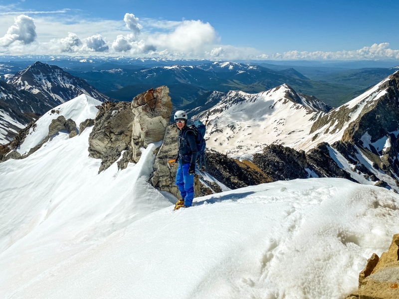
The snow was mostly perfect, but as we neared the summit it became a bit brittle in places. The couloir hit the north ridge about 8 feet from the summit, and a few steps later we were on top of my 118th ranked CO 13er (171 with 14ers included). The summit of White Rock Mountain was one of my favorites, with commanding views of the Elks, Swatch, and San Juans. We could even see the La Salles more than 130 miles away. It took us exactly 4 hours 30 minutes to get here, despite moving very, very slow. This is compared to 6 hours 55 minutes up Precarious Peak the previous day, where we were moving much faster. Some mountains are easier than others. 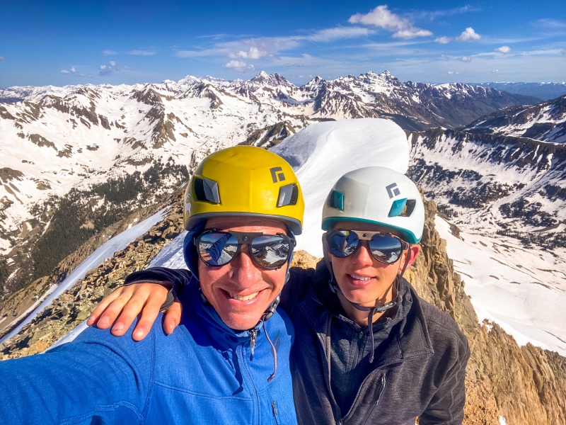
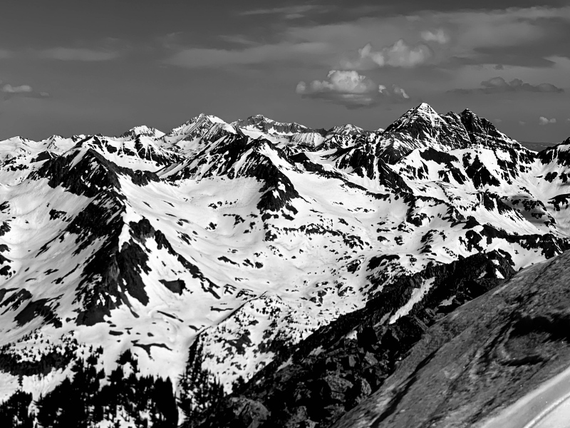
The views of Castle and Cathedral were impressive. After more than 35 minutes relaxing up top, we began to examine the traverse to White BM, and were somewhat dismayed. 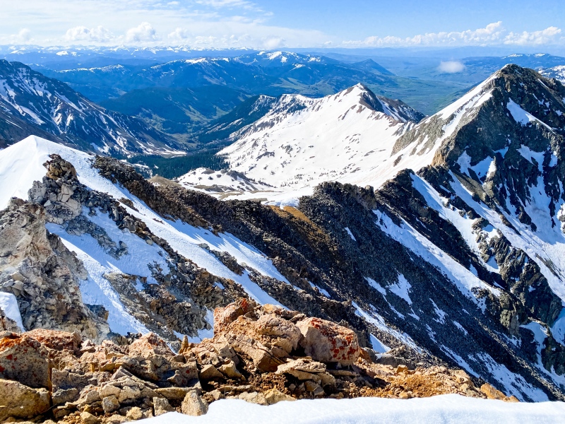
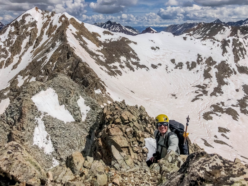
As it turns out, the crux of the entire traverse is descending the first 100 feet to the southeast. The ridge is adorned with a number of crumbling gendarmes, overhanging on the south side. To the north it should be easy to skirt them, but 1-2 foot deep unconsolidated/sun hammered slush over 3rd class rock above a giant cliff guarded it pretty well. We began with a 20 feet down climb directly off of the summit. It wasn't bad, but being loose 3rd class it was awkward in crampons. Luckily exposure was nonexistent. From there, we ended up skirting the first gendarme right against the rock on the north side, then down climbed about 40 feet of steep slush to where we could traverse across a snow-filled couloir and climb back to the ridge. 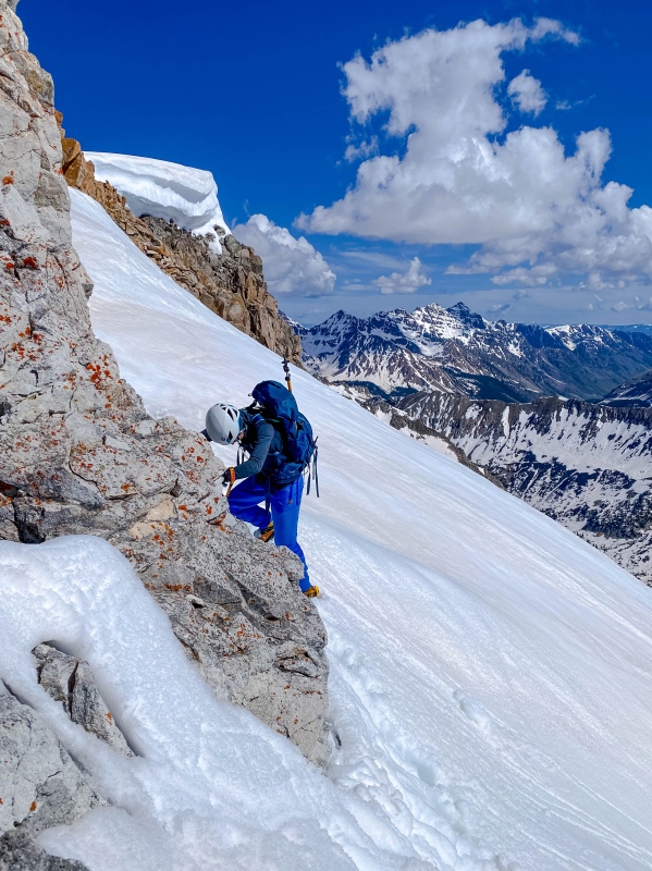
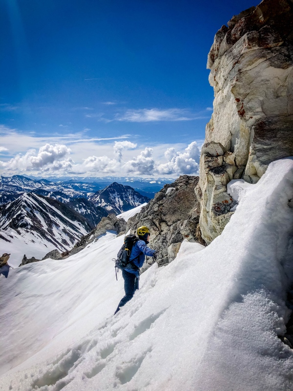
After climbing 30 feet back to the ridge, we crossed to the south side for some sketchy class 3 traversing over hopelessly loose rock, then down climbed a 20 foot snow choked chimney. Nothing exceeded class 3, but this section was frustratingly time-consuming. 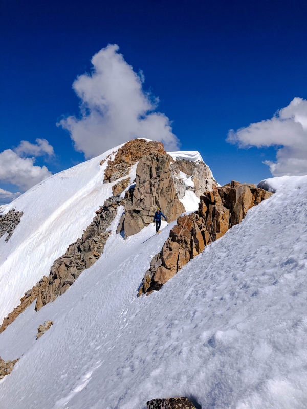
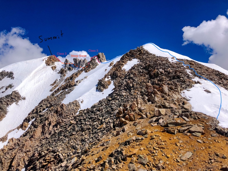
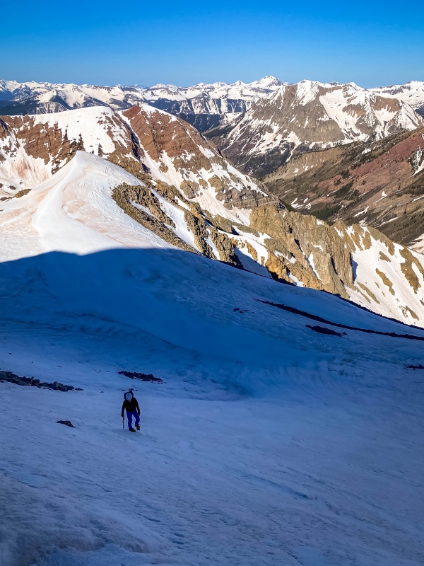
From the snowy point beyond the gendarmes, the ridge splits into the east and south ridges, both festooned with pinnacles and gargoyles. The descent south from here is easy down to a small red saddle, but soon rotten teeth forced us left onto snow. What followed was a 0.5 mile traverse across 45-55° snow. The snow was annoyingly slushy, and were we less comfortable on snow this portion could have easily mired us for hours. Interestingly, I think it would be even worse once melted out, with endless fields of teetering class 2+/3 blocks 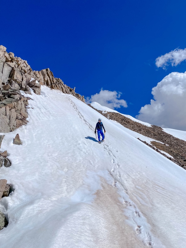
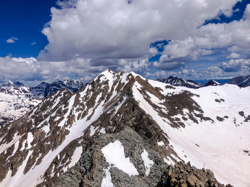
Most of the way across the snow traverse, we crossed under the lowest point in the ridge, with our elevation at about 12,940. From here, the view of White BM is sobering, to say the least. 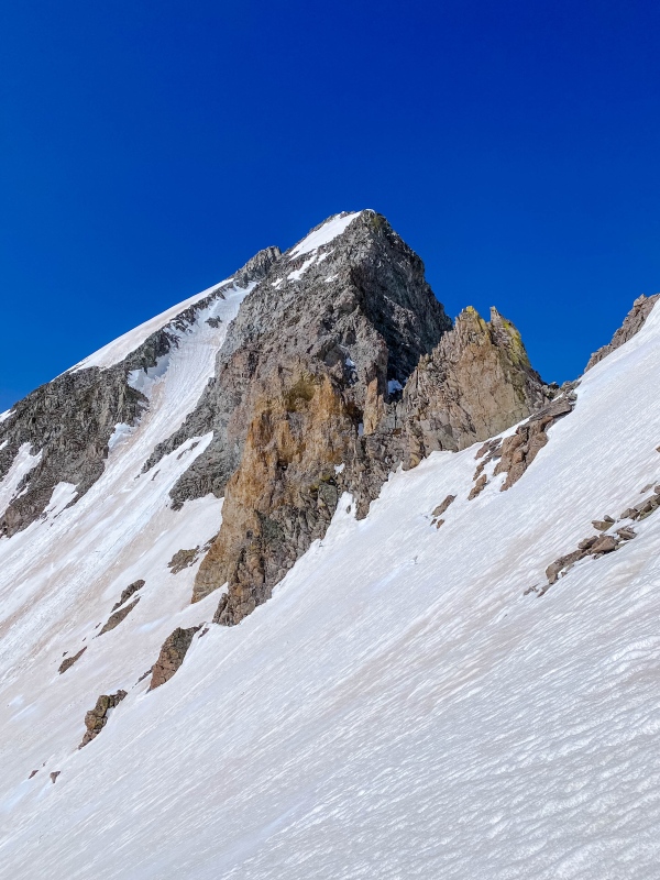
We finished the traverse and prepared to climb the steep couloir breaking through WBM's fearsome ramparts. The lower part of the couloir was cruiser 50° snow, but the upper part got a little trickier. The snow was crazy soft and the entire thing threatened by rockfall, especially so late in the day. I lead up it in such a hurry to escape objective danger that we didn't stop even momentarily until the ridge. Thankfully no cornice guarded the top. 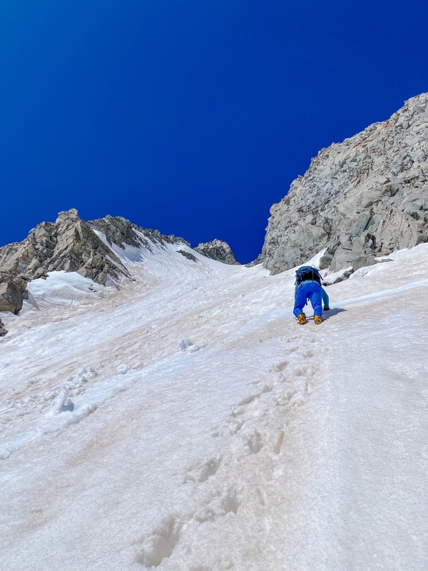
The top 150 feet were certainly engaging, at least 55-60° and wicked slippery with unsupportive corn. Just as the angle finally began to relent, we realized that following the couloir to the ridge would leave us stranded in a deep notch with overhanging talus between us and the summit, so I traversed left across some very steep snow and wallowed up slush coated rock and a couple mixed moves to pull over a small crown onto a rock rib on the east side of the ridge. 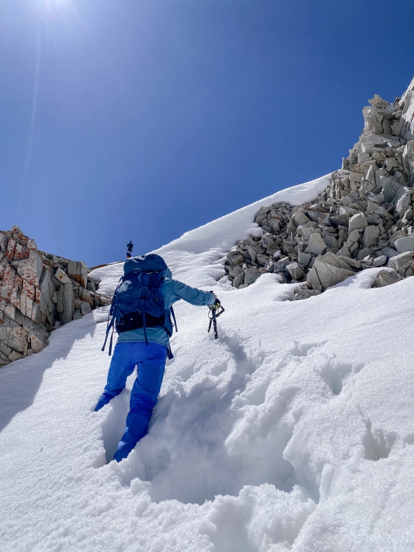
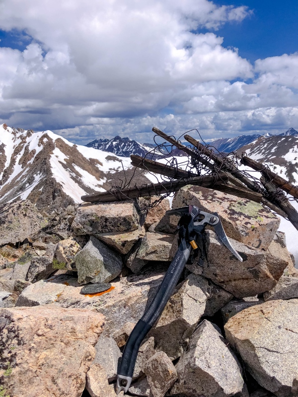
During the summer, I would imagine this is 4th class suck. I want to say that as much as I may be complaining about the snow conditions, this was an incredible route, and I loved every step of it. The traverse was interesting and beautiful, and the couloir aesthetic and improbable. Upon topping the rock rib, we popped off crampons and put them away for the weekend. About 100 feet of super loose but pretty easy class 3 ledges gained the ridge directly above the notch created by our couloir. From here the route to the summit was short-lived but sublime. A nice snow arete then some moves of stable but once again mild class 3 (this time more exposed) lead to a rocky knob, then some class 2 along the narrow ridge crest lead directly to the benchmark, and the summit register was wedged under a rock several boulders further south. 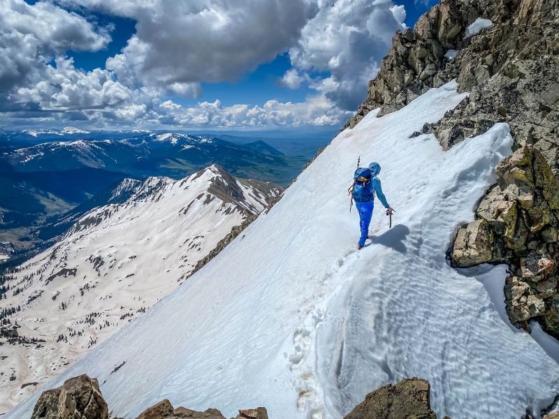
We reached the summit of WBM at around 11:20, just under 7 hours into the day. The traverse took us about an hour and a half once we finally got going off of WRM. It was a brilliant traverse and I cannot highly enough recommend this route, especially on a day with a better freeze, less sun, earlier start = firmer snow. We checked the register and confirmed that we were the first ascent of the year on each of the weekends 5 13ers. 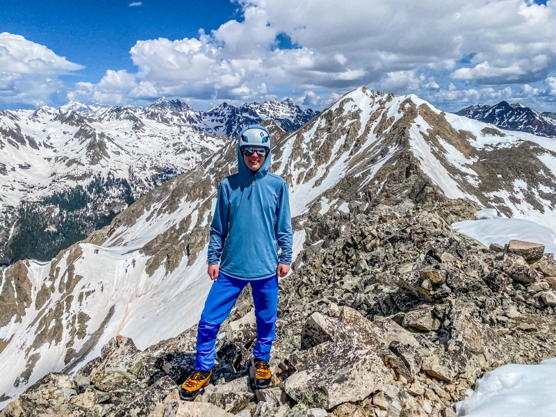

White BM was my 119th CO 13er, and a great on to carry the honor. After sunscreen and a snack and more than a little bit of lounging, we reluctantly started down. The southwest ridge begins with class 2 boulders. it appears rough ahead, and it is tempting to drop west on the inviting talus. DON'T! These gullies cliff out. Continue on the ridge, bypassing the few gendarmes with class 2 on the south side of the ridge. Upon reaching a golden colored saddle, we scree skied a hundred feet down the couloir on the north side of the ridge, then plunge stepped down into Queen Basin. 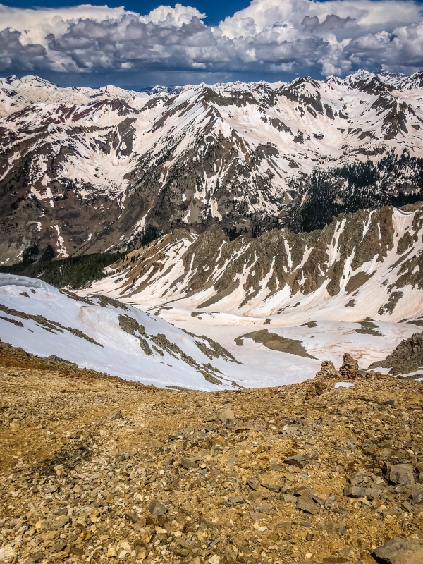
Within 10 minutes of leaving the summit we hit 12,500. Plunge stepping and a short glissade made short work of the 900 vertical. 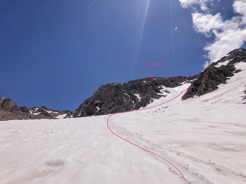
We continued down upper Queen basin, miraculously not post-holing. 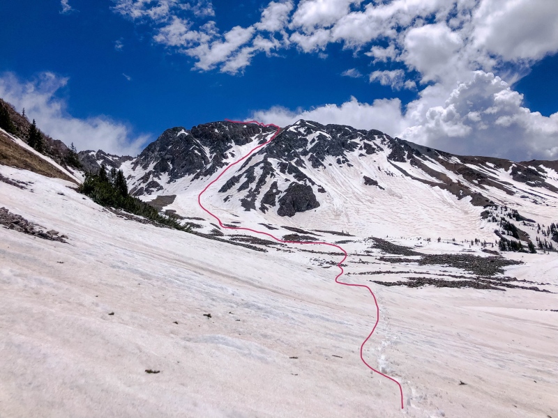
From around 11,700 we began wrapping right (north) and traversed through the trees to catch an avalanche path dropping down from WRM's west ridge to the trail. This kept us from having to negotiate the cliffs and dense trees others have reported in Queen Basin. This descent worked incredibly well, and as google earth had revealed, the avy chute was expedient and hassle free, with no bushwhacking, post-holing, or other unpleasantries. After reaching the trail, we zoomed out, with energy enough to tolerate the post holing on the south side of the creek. After a refreshing river ford, we passed a couple Texan tourists near Judd Falls. Apparently a kid from Texas had fallen 300 feet into the river a couple days earlier and somehow survived. We got back the the trailhead decisively less tired than the previous day and complained loudly about the 11 Texas license plates at the trailhead (along with one from Florida, and just a single other Greenie). After some chips and Salsa we hit the Secret Stash and enjoyed a record setting, stop-free 3 hour and 25 minute drive home, where we were greeted with homemade New Mexican style green chile pozole.Yum! Overall, these were two really great peaks, definitely my favorites of the weekend, probably so far this year. They are worth a trip! Thanks for reading and be safe out there everyone! Happy to answer any questions on route or conditions. Thumbnails for uploaded photos (click to open slideshow): ")
")
")
")
")
")
")
")
")
")
")
")
")
")
")
")
")
")
")
")
")
")
")
")
")
")
")
")
")
")
")
")
")
")
")
")
")
|
| Comments or Questions | |||
|---|---|---|---|
|
Caution: The information contained in this report may not be accurate and should not be the only resource used in preparation for your climb. Failure to have the necessary experience, physical conditioning, supplies or equipment can result in injury or death. 14ers.com and the author(s) of this report provide no warranties, either express or implied, that the information provided is accurate or reliable. By using the information provided, you agree to indemnify and hold harmless 14ers.com and the report author(s) with respect to any claims and demands against them, including any attorney fees and expenses. Please read the 14ers.com Safety and Disclaimer pages for more information.
Please respect private property: 14ers.com supports the rights of private landowners to determine how and by whom their land will be used. In Colorado, it is your responsibility to determine if land is private and to obtain the appropriate permission before entering the property.


