| Report Type | Full |
| Peak(s) |
Precarious Peak - 13,378 feet "Golden Tops" - 13,262 feet "Cassi Peak" - 13,242 feet |
| Date Posted | 06/07/2023 |
| Date Climbed | 06/04/2023 |
| Author | Camden7 |
| Rustler Gulch 13ers | ||||||||||||||||||||||||||||||||||||
|---|---|---|---|---|---|---|---|---|---|---|---|---|---|---|---|---|---|---|---|---|---|---|---|---|---|---|---|---|---|---|---|---|---|---|---|---|
|
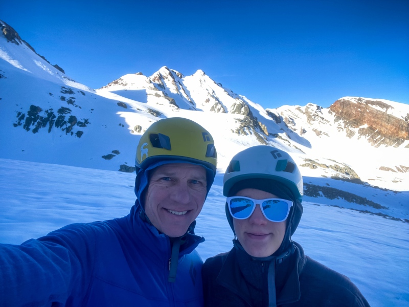
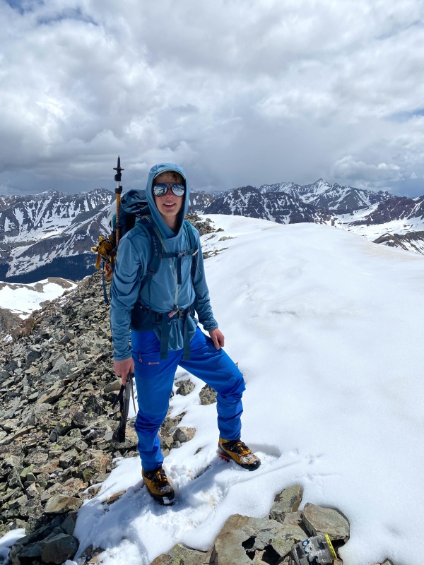
After a four consecutive weekends of day-tripping around the front range, schedules and weather finally allowed for a trip further afield. With the massive snowpack lingering in the Elks, we placed our sights on some couloirs above CB. I packed up the van while Dad was at work on Friday and Saturday morning, and we were wheels up out of Golden by 2 pm. Dad was exhausted from a busy week at work, so I drove. There was hardly a car to be seen on US 285, and soon we found ourselves atop Cottonwood Pass. In places the snow banks were still higher than the van, just a glimpse of what was to come in the Elks. The views of Taylor Park and the northern Collegiates were outstanding, and storm clouds made the drive a scenic tour. The numerous campgrounds along the Taylor River were just beginning to open for the summer, but the hordes of Texans had not yet flocked to the cool alpine air and deep forests of Taylor Canyon, so the drive was relaxing and easy. As we crested the hill on Jacks Cabin Road, the West Elks and Ruby Range roared into view, a staggering reminder of just how much more snow the Elks hold than the Front Range and Sawatch. We rolled quickly through CB, Mount CB, and Gothic, arriving at the Lower Judd Falls trailhead just after 6. Before June 15 you are allowed to sleep in your car/van. We readied our packs, cooked up some quick stirfry, and hit the pillows by 8:30. We had decided to leave approach shoes, micro spikes, and snowshoes behind, doing the whole day in GTX Cubes and praying for a solid freeze to limit post-holes. The alarm blared at 2:55, and by 3:30 we were off. Quick Facts: Climbers: Camden Lyon (Myself) and Tory Lyon (My Dad) Trailhead: Lower Judd Falls Trailhead (2wd access) 9,595 feet Distance: 14.5 miles Vertical Gain: 5,463 feet Total Time: 13:23 Peaks: 3 Ranked 13ers
Splits: This is my first time doing this this way, and I don't have stopped time, so relaxing on summits, eating lunch, etc. is just lumped into the times.
We began walking into the silvery night at 3:32, clicking on our headlamps when the full moon set behind gothic mountain and cast the valley into blackness. Above us, Mt. Bellview's snow-covered ramparts reflected the moonlight, leaving the darkness incomplete. We zipped up the muddy road 0.92 miles to a place where willows line both sides of the road, and the reflective closure sign over the bridge returned our headlamps' light. We knew we could not cross that bridge, for once we did we would be on the wrong side of the East River, which at its current size would be downright perilous to ford in the dark. For once my poking around on Google Earth had bore fruit, and I knew a cattle trail followed the east side of the river. We turned our headlamps to high-beam, prepared to hunt for the trail. It was behind the very first willow I checked. It's fun to get lucky. The cattle trail is well beaten in and easy to follow, but with the unprecedented levels of spring runoff, the creeks were swollen, the meadows flooded, and the trail slimy with mud. Almost exactly 1 mile and 150 vertical feet on the cattle trail brings you into the 401 Trail. There was one bog that we had to climb up the hillside to avoid, and two very sizable creek crossings among countless smaller ones, but even at roaring flood state none required a ford. Once on the 401 trail, we followed it 0.1 miles to the road. The 401 trail is important to find because it has a bridge over Rustler Creek, which would otherwise require a ford. We then followed the road 0.82 miles and 491 feet up the the gate and summer trailhead. It took us about one hour to get here (2.9 miles, ~600 vertical feet). The trail starts out pretty easy (it does follow an old road after all) and was dry, but by 10,250 (0.4 miles up the trail) we were on mostly snow, and would be for the next 11 hours. Around 10,380 the left side of the creek becomes nothing but a mess of beaver ponds, willows, and and certain misery. The road crosses to the east side of Rustler Creek, but because everything was under snow it wasn't clear where the road was, so we didn't initially realize it crossed. Finding ourselves in the deepening quagmire we hurried to the creek and eventually found a place to cross, where it choked down at an abandoned beaver dam. We had to jump from a snowy bank 5+ feet over 3 foot deep whitewater onto another snowy bank that may or may not hold our weight. With climbing packs it felt like quite the gamble, but we made it work. Maybe following the road allows easier crossing, but it seems unlikely. The creek was huge. We followed the road another half mile, before it once again crosses the creek. This crossing was smaller and had a rickety logjam of sorts, but was challenging nonetheless, and required an 8 foot down climb off a snowbank to access. Good fun in the dark. 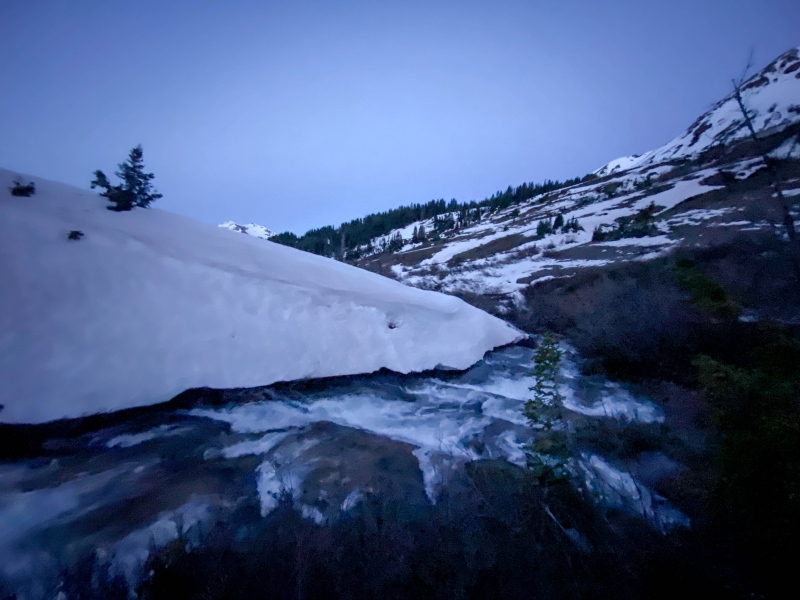
Beyond the second crossing the road climbs more steeply, gaining 400 feet as the valley serves sharply to the east. there is a washout and small creek to cross at at 10,800. At 10,880 the road breaks from the trees for the last time And you have an open view of all the summits ringing Rustler Gulch. A sole dry patch of ground harbored a couple glacier lilies and dawn broken in this area. 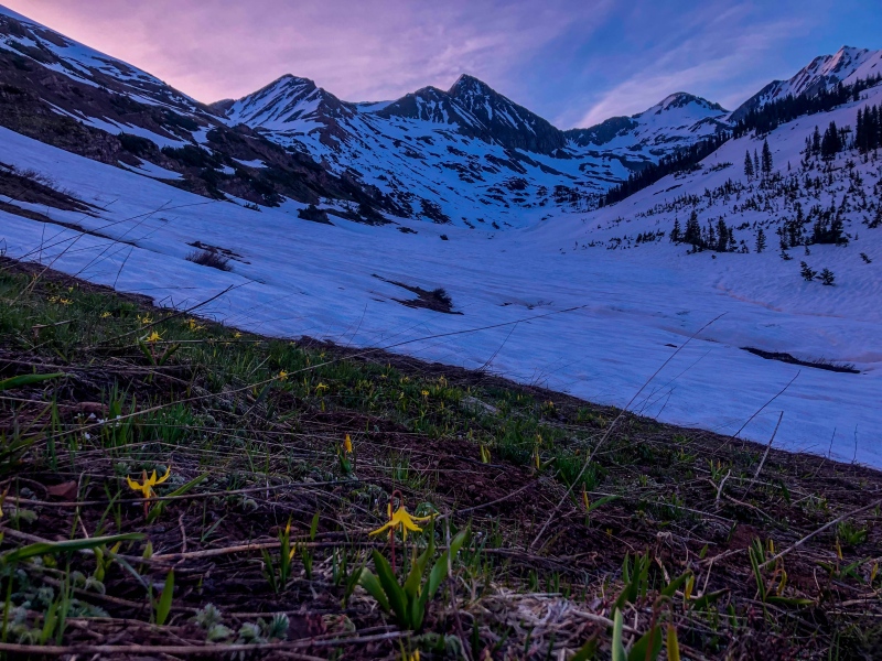
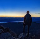
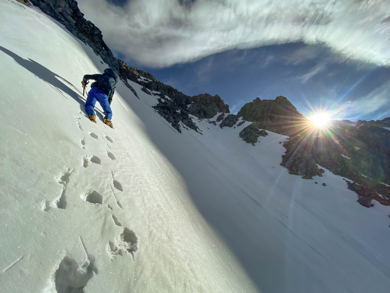
As we climbed through the upper basin first light hit the peaks. 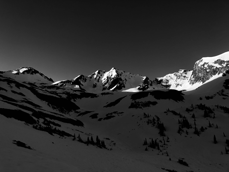
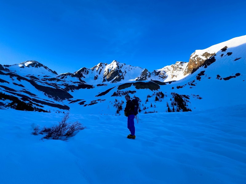
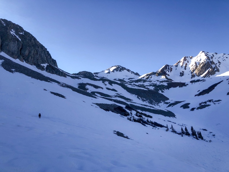
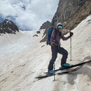
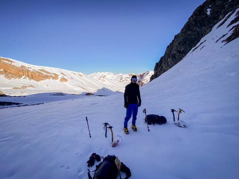
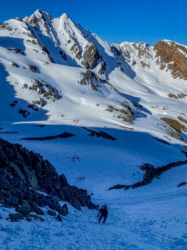
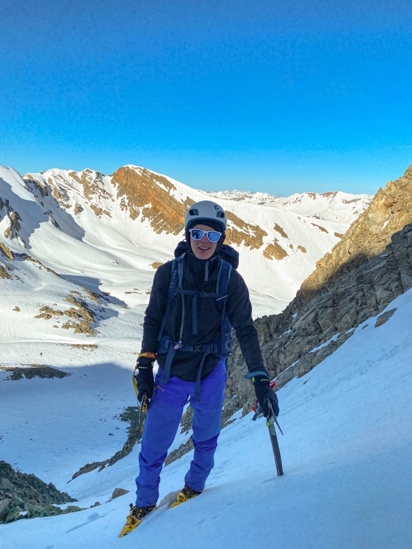
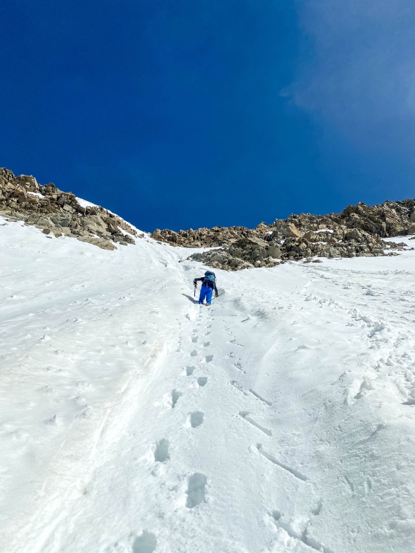
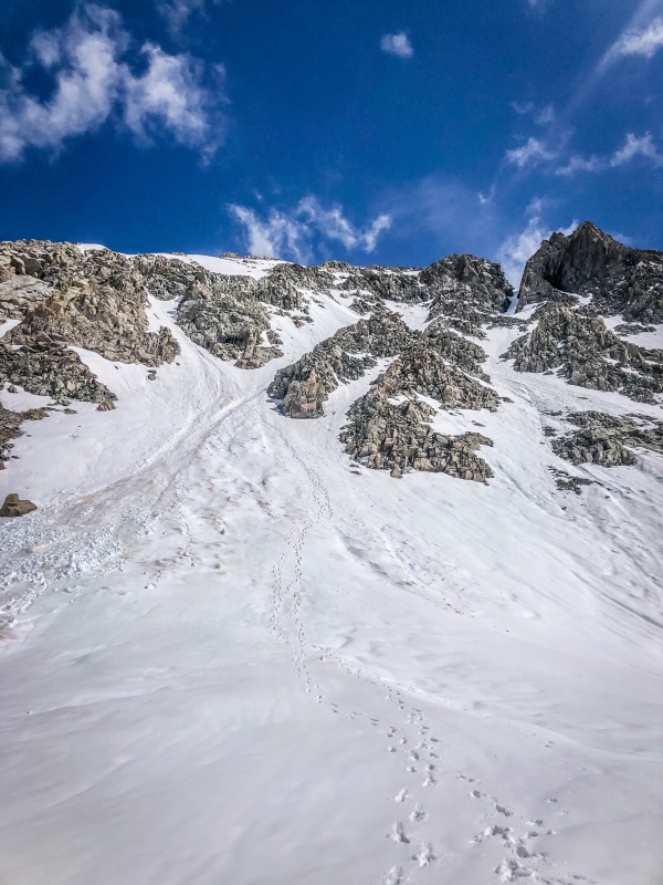
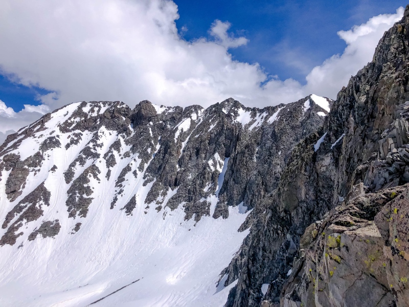
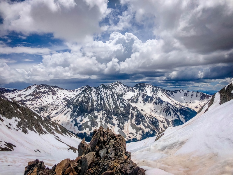
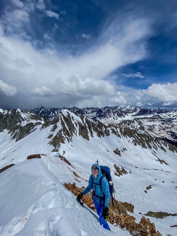
Above 11,000 feet, the route through the basin is of little importance. If there was less snow it might have mattered more where we went, but with still 40-60 inch snowpack at those elevations, willows, creeks, tundra, and boulders all behaved the same. We tended to stay on the left (north) side of the gulch, but anything would work. A shallow basin at 11,500 holds a few final trees, before the rock glacier rears up and guards the upper basin. Ascending this 800 foot high headwall brings you to a spectacular spot at the base of Precarious' south face and its rugged connecting ridge with Cassi, along with astonishing views down valley towards the Bellviews and once you get a little higher, further out to Treasure, Treasury, and Owen. The Ruby Range still looks like it should in March. It is about 4.2 miles from the summer trailhead to here, so 7.1 miles from Judd Falls TH. 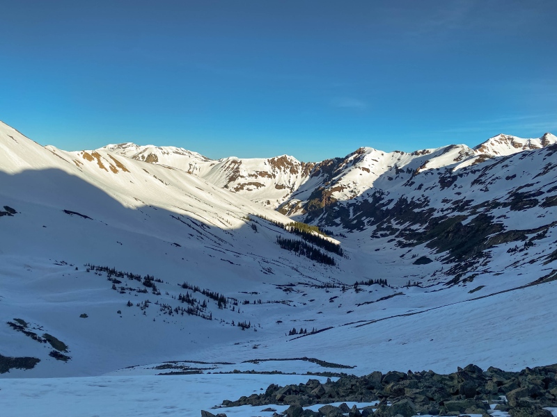
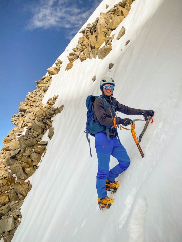
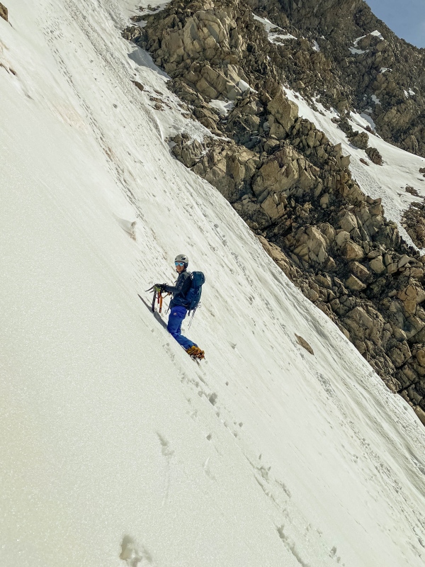
The couloir starts out very friendly, with 400 feet of fairly low angle snow (40-45 at the base, steepening to about 50 but then relenting again). It was initially pretty unconsolidated, but after the first 150 feet we were able to get into a nice icy runnel that was super nice climbing. The angle relents to about 40 degrees for about 50 feet, and there are some good rests atop rock outcroppings from 12,750 to 12,800. 
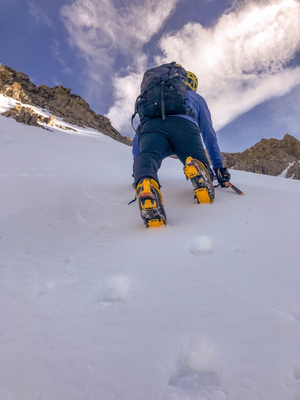
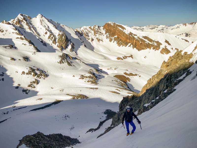
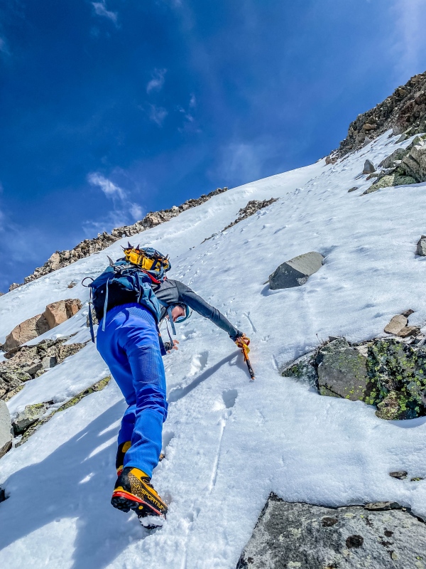
From 12,800 to 12,900, the snow steepens to at least 50-55°. We climbed then traversed off of an unconsolidated snow arete on the way up. Descending we found better snow on the gulley to the looker's right. 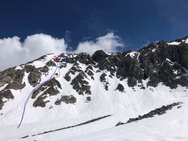
At 12,900, the couloir narrows substantially and a rock wall blocks upwards progress. The snow steepens to a fearsome 60°. Eventually the couloir dead ends. A 60°+ traverse left then over a vertical cornice and small bergshrund would keep you on snow, but it was grossly unconsolidated and we quickly backed off 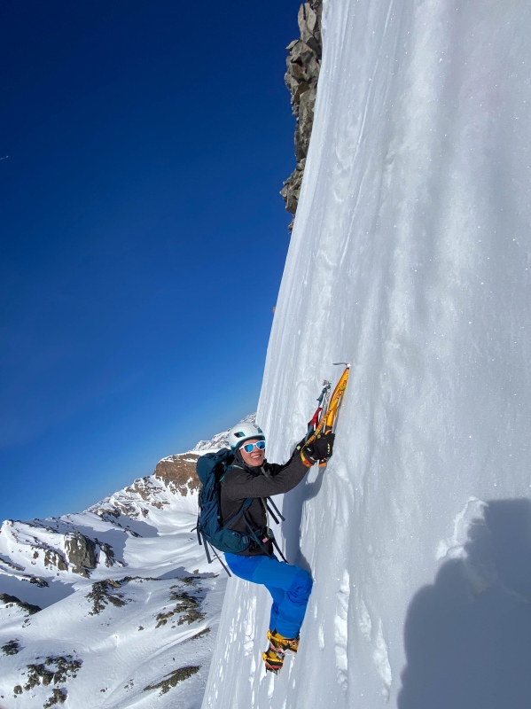
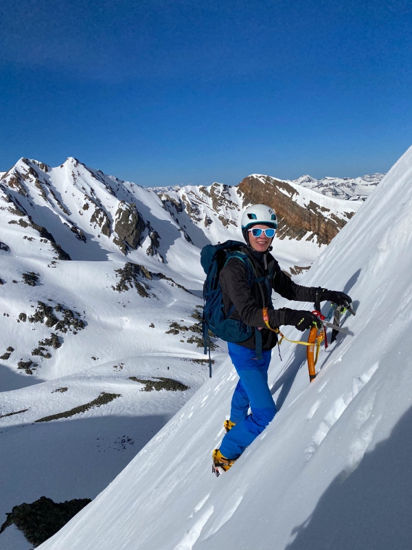
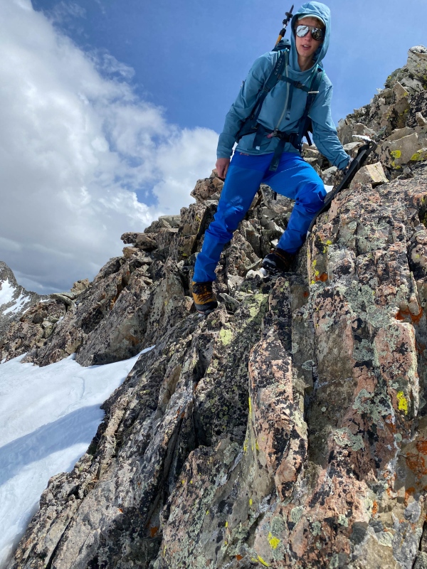
After backing off the snow line, I lead up through some mixed terrain to a moat where we could take of crampons and transition onto rock. 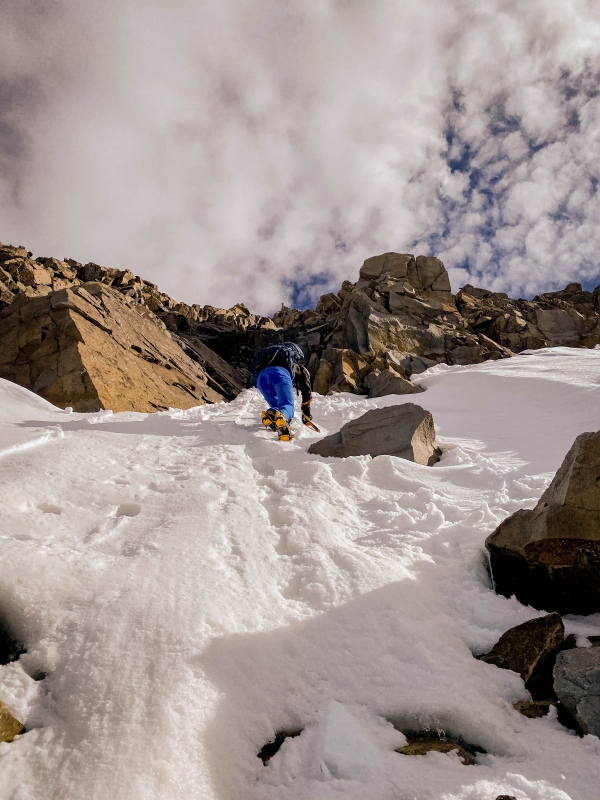
I traversed right from the above pic, took off crampons in the moat, then climbed a ten foot 4th class wall to gain easier ledges. The exposure was wild and the rock quality was suspect. Each hold was like a 10% hold, so even with 4 holds it seemed more likely than a coin toss that everything would just snap off and I would tumble 800 feet. We were NOT excited to climb back down it. From there, 100 feet of cautious 3rd class scrambling broke through the cliff band. Another 100 feet of precarious class 2+ boulders lead to the summit. 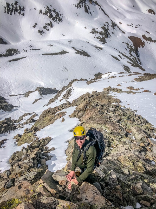
Eventually we hit the summit ridge and stumbled past teetering blocks and terrifying cornices to the summit. 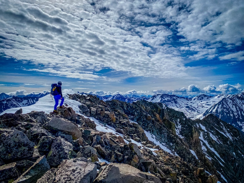
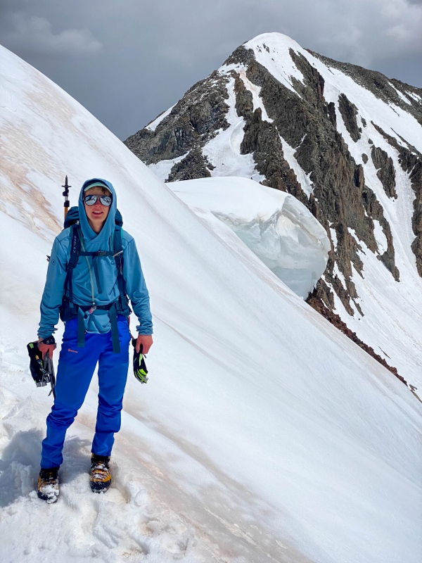
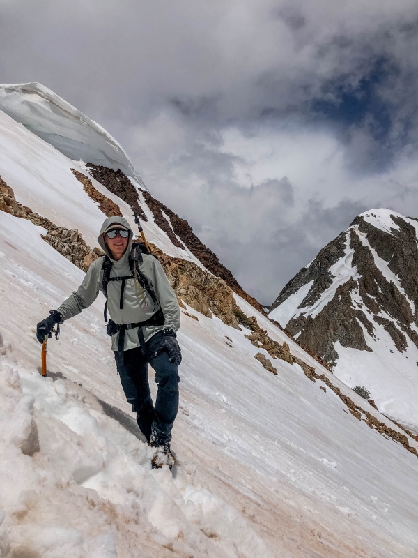
I have to say, I was pleasantly surprised by the difficulty of Precarious Peak. I am generally pretty comfortable on 60° snow, but this was a hard snow climb. The rock transitions were sketchy, the conditions were inconsistent. Actually really hard to get up and down the thing. I know the Southwest Couloir is probably easier than the Direct South Face, but it was too direct and proud a line to pass up. I genuinely feel that this may be the hardest 13er I have done without a rope. A 30m rappel would have made life a whole lot easier. 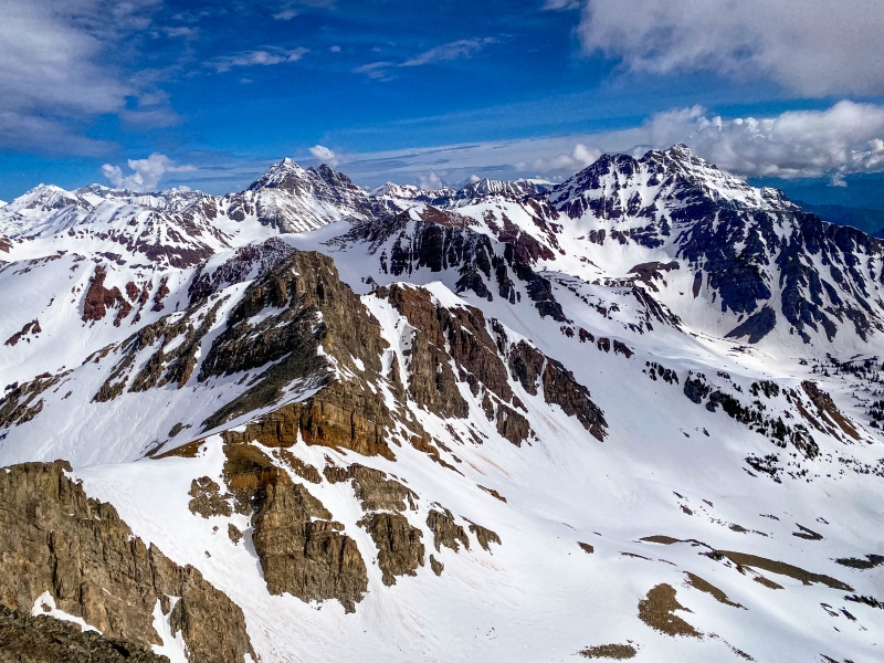
The descent was actually easier, as worried as we were. By staying further skier's right we were able to down climb a shorter rock section, that although probably 4th class and certainly wildly exposed, had better rock and a nicer platform for putting crampons back on. 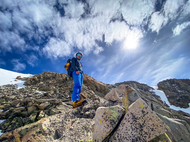
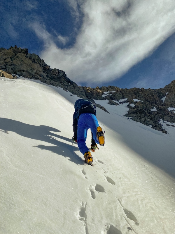
After a quick snack break and holstering tools, we set off towards Cassi Peak, and soon found the northwest facing snowfields to be hopelessly unconsolidated with thigh to waist deep post holing. Big suck. So much work. 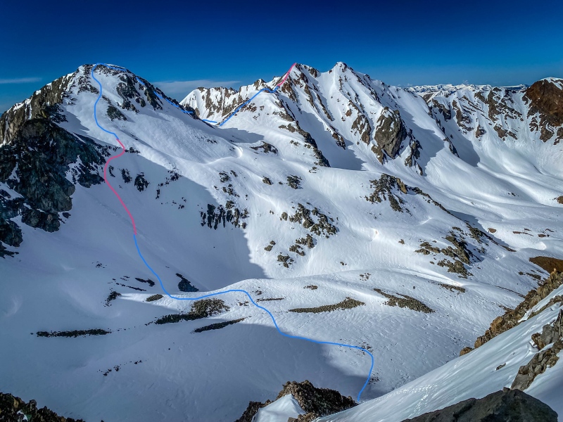
We looped high around the basin and ascended the leftmost gully through the lower rock band. It maxed out at 50°. Above 12,800 the angle relented but the post-holing worsened. When the post-holing got too annoying, I joined the north ridge and climbed somewhat exposed easy 3rd class, despite there being loads of easier terrain to my right. 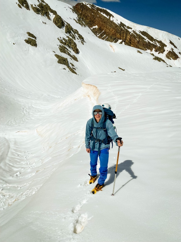
At this point we became concerned about weather, so after a good snack and water break we continued on our way. We fear the descent southwest off of Cassi would be impassible, but west of the ridge crest it was easy class three down climbs (on yucky rock) with sections of mellow snow. 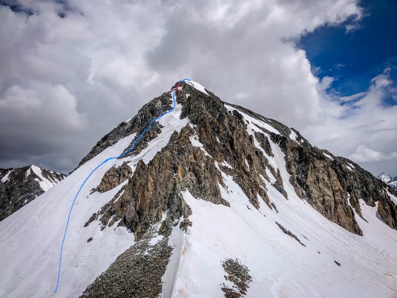
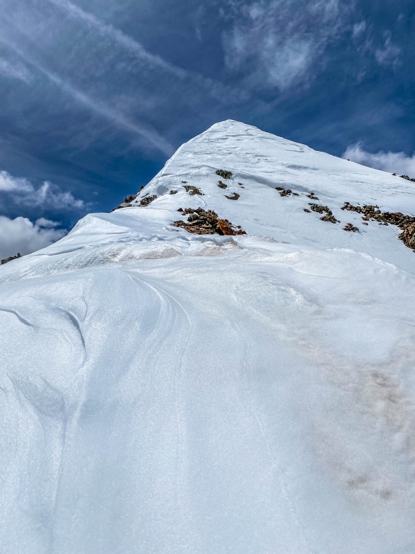
Somewhere I had gotten the idea that Golden Tops would be super quick and easy from its 12,800 saddle with Cassi. Wrong again. The combination of terrible rock, huge cornices, and unconsolidated powder on the ridge left us frustrated, and with time pressure from building thunderstorms to the west, north east, and south, we almost orphaned this one, but the weather and cornices held, and we managed to find the summit (kind of). There was so much snow piled up on top of the thing that we probably climbed at least 10 feet higher than the summer summit. 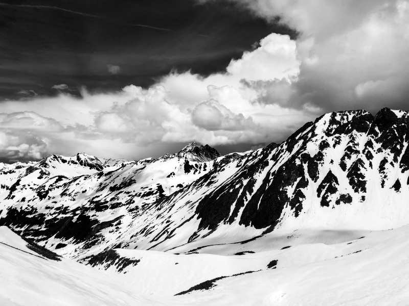
The ridge started with alternating 40° snow and steep class 2 to a false summit, followed by a pleasant low angle snow arete, before the upper mountain got really bitchy with a smoothie of exposed choss and sloughing powder. It was really unpleasant. 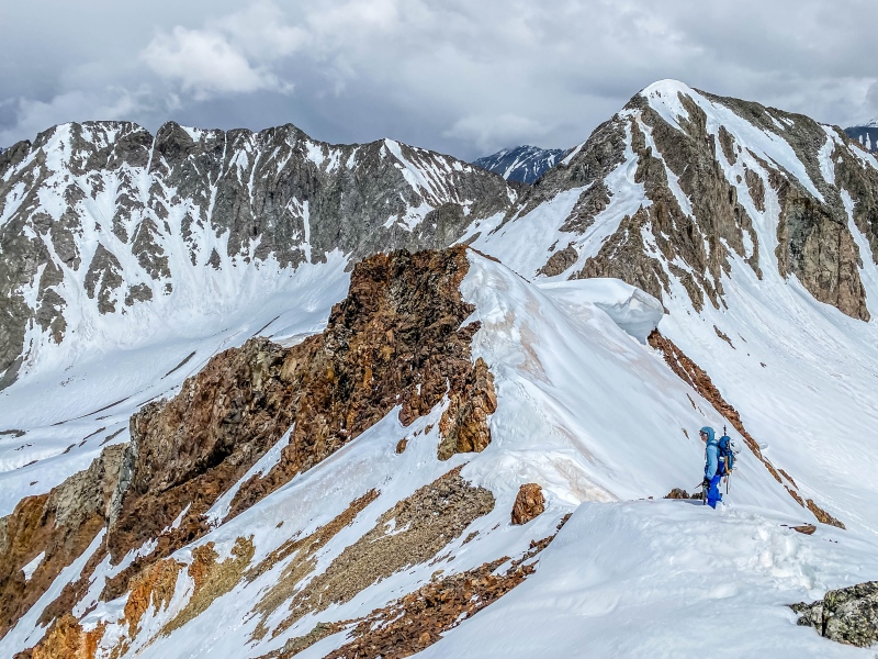
We traversed onto the east face and climbed 3rd class marbles above a cliff, occasionally crossing patches of unadhered slush. We only triggered one major rock/mud/slush slide. I don't quite know how there is still a mountain there with such shitty rock. 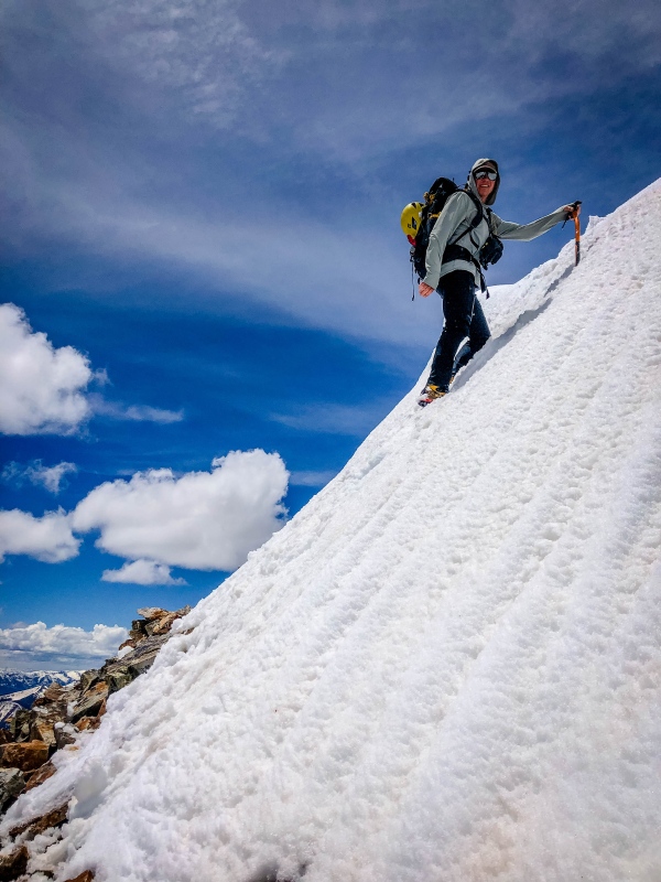
We down climbed a 45° east facing couloir off of the ridge, going one at a time as the face was sloughing and snowballing with tremendous wet-slide threat. Most other options would have put us under a cornice so we figured this was the safest of the options. 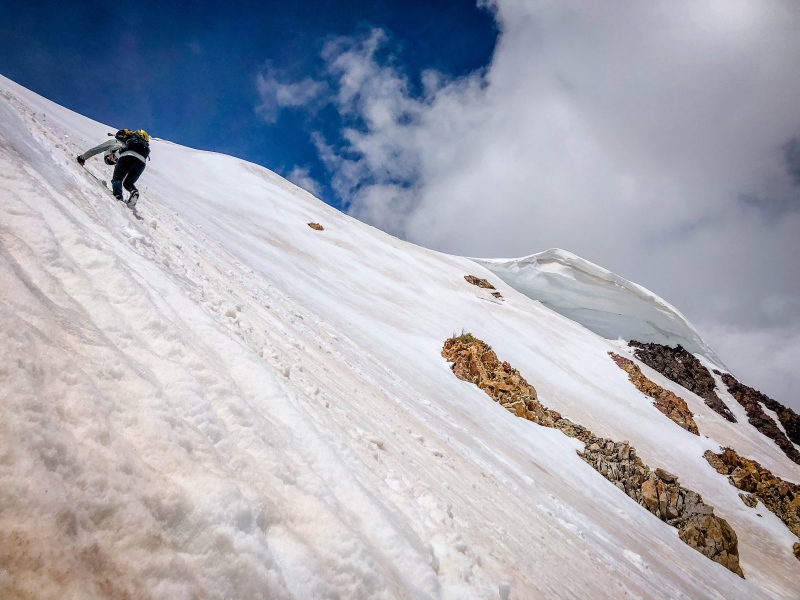
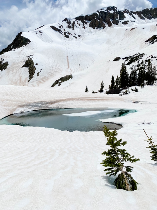
We dropped quickly down the snowy basin to the bench at 11,500 harboring 4 pretty tarns. 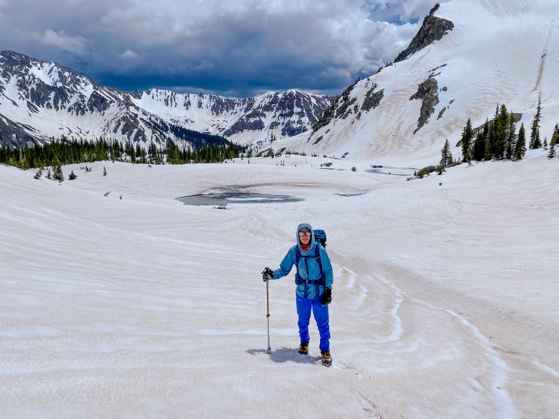
there is an old road that drops down to the copper creek Trail from here, but it would have us do an extra two creek crossings, both of which would have likely called for a ford, so we instead cut due south through the forest until we could drop southeast down an avalanche chute to catch the trail. 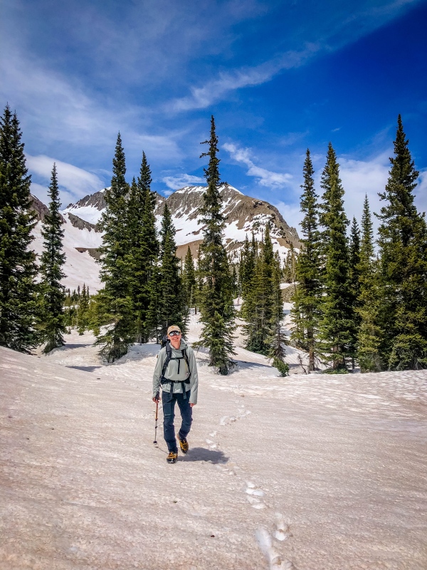
The first crossing of Copper Creek came up almost immediately, and would require a ford in normal shoes, but GTX Cubes are built different. 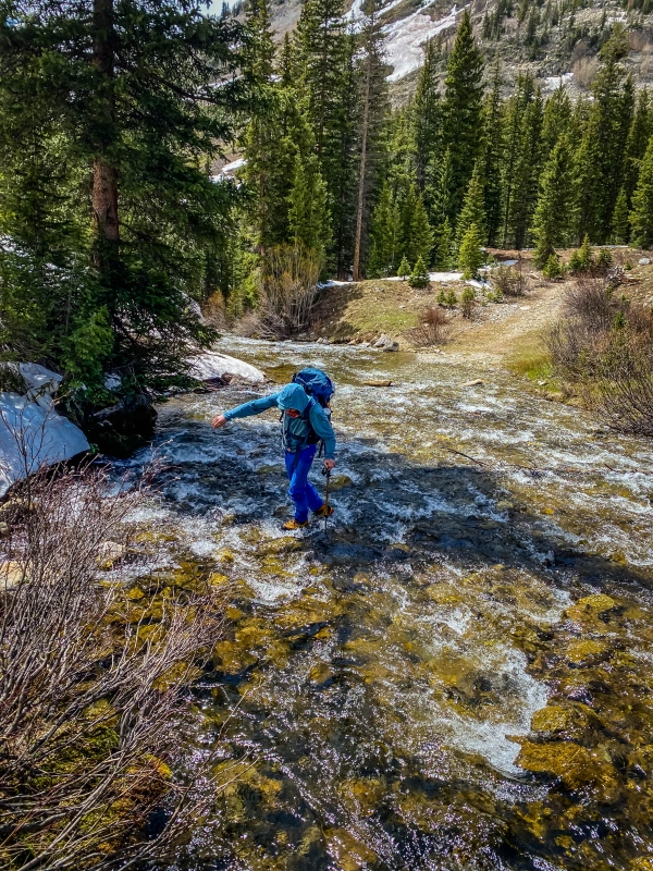
Once on the south (ie north facing) side of the creek, we enjoyed a pleasant 1.4 miles of horrid postholing before reaching the second river crossing. This one called for a ford, even in the GTX Cubes 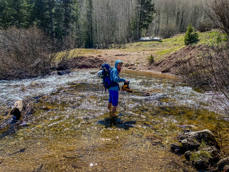
Overall, it was a great day, with challenging routes, incredible views, and great luck with the weather. It was the right call to leave approach shoes and snowshoes behind, but it didn't come without cost. I would recommend these peaks, but if you only have one day in the area, do White Rock Mountain and White Benchmark instead, as they have a shorter approach, better consolidated snow, and a super awesome traverse. 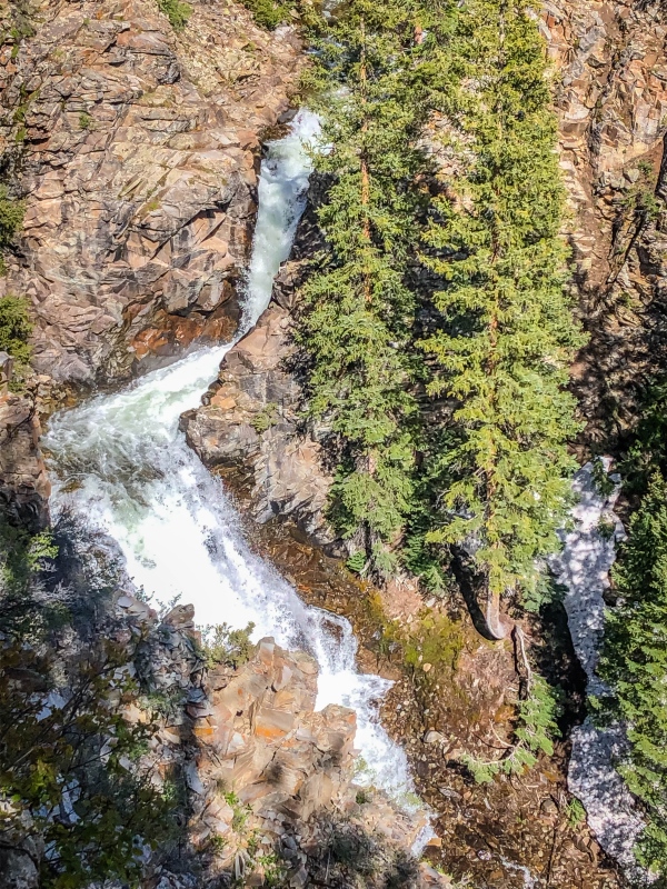
We rolled the last 2.5 miles back from the river ford pretty quickly, took an hour long nap, at some chips and salsa and ramen, repacked our packs, set out gear to dry, and went to bed at 8, hoping to get a good night's sleep before WRM and WBM on Monday. Thumbnails for uploaded photos (click to open slideshow): ")
")
")
")
")
")
")
")
")
")
")
")
")
")
")
")
")
")
")
")
")
")
")
")
")
")
")
")
")
")
")
")
")
")
")
")
")
")
")
")
")
")
")
")
")
")
")
")
")
")
|
| Comments or Questions | |||||||||
|---|---|---|---|---|---|---|---|---|---|
|
Caution: The information contained in this report may not be accurate and should not be the only resource used in preparation for your climb. Failure to have the necessary experience, physical conditioning, supplies or equipment can result in injury or death. 14ers.com and the author(s) of this report provide no warranties, either express or implied, that the information provided is accurate or reliable. By using the information provided, you agree to indemnify and hold harmless 14ers.com and the report author(s) with respect to any claims and demands against them, including any attorney fees and expenses. Please read the 14ers.com Safety and Disclaimer pages for more information.
Please respect private property: 14ers.com supports the rights of private landowners to determine how and by whom their land will be used. In Colorado, it is your responsibility to determine if land is private and to obtain the appropriate permission before entering the property.