| Report Type | Full |
| Peak(s) |
"Crestolita" - 13,264 feet Broken Hand Peak - 13,575 feet |
| Date Posted | 04/17/2024 |
| Date Climbed | 05/06/2023 |
| Author | supranihilest |
| Additional Members | Reg0928 |
| Crest of Spring | ||||||||||||||||||||
|---|---|---|---|---|---|---|---|---|---|---|---|---|---|---|---|---|---|---|---|---|
|
"Crestolita" is an oft overlooked thirteener just south of the Crestones. While it's easy to understand why, with two of Colorado's finest fourteeners nearby, and bicentennial thirteeners to the east and south, it's unfortunate that this is the case. "Crestolia" contains some good scrambling and snow climbing, including the north central couloir - the subject of this trip report. The easiest route is the Class 2 south face from Cottonwood Creek (the approach is harder than the climb of the peak) but that wasn't what I was looking for. I hadn't done any winter climbing at all and had only done three thirteeners, two of which were repeats, in the past six months and was itching to get a nice snow climb to kickstart the rest of the season. Derek "Furthermore" Wolfe's report on "Crestolita", which I'd read years earlier, inspired me to climb the north couloir, though I mixed up which couloir of "Crestolita"'s many northern couloirs was which by the time I made my climb. His route climbs a narrow, curving line below the summit, whereas my route climbs a more northeastern line to a saddle along the summit ridge before a short walk and final scramble to the summit. Due to the obviousness of my route I though that was the north couloir. For the sake of this report I'll call it the north central couloir so it doesn't get confused with Derek's route. Photos will make this more apparent, especially photo #5. I reached out to Ross, who lives in Crestone, and we made plans to meet at the lower South Colony Lakes trailhead and drive as far as we could before snow stopped us. Ross made it to the Rainbow trailhead and we decided to start there. We had boots on the ground just before 5:20am. The early part of the route is of course not particularly exciting, since we had to walk the road for several miles, and we took the Humboldt cutoff to the lakes instead of staying on the closed road past the upper trailhead since it was more direct. The views expanded even before we'd reached the lake. It was good to see Crestone Needle in its fine white coat of snow. 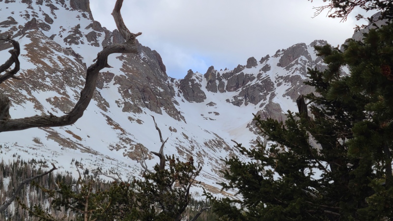
Once we reached the lakes we made out way more or less in a straight line to Broken Hand Pass. Oh how I love how easy snow makes things! We crossed over the eastern end of the frozen southeastern lake and approached the pass, leaving our snowshoes behind as the pass steepened enough to warrant crampons. 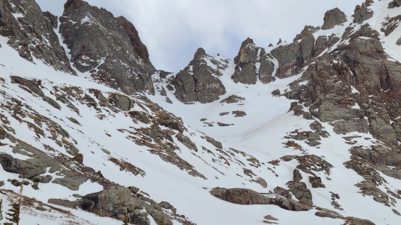
The snow climbing up the pass was in great shape. Firm and supportive to where we weren't sinking and exhausting ourselves, but soft enough to kick great steps for security. At this point in the season we had no reason to worry about avalanches. I was curious about taking the righthand chute up Broken Hand Pass, seeing as it was all snow, but it would take us slightly higher and further from our objective, so we just took the normal way up the pass. The right chute might make for a fun variation if Crestone Needle was the objective instead. As it were, the normal route up the pass was so snowy we didn't have to do any scrambling if we didn't want to. 
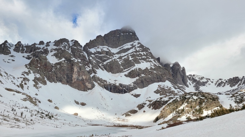
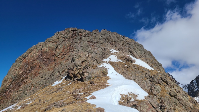
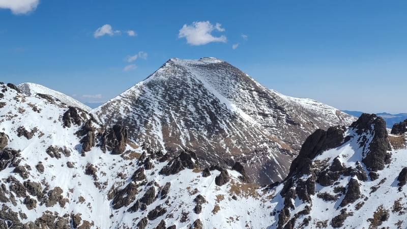
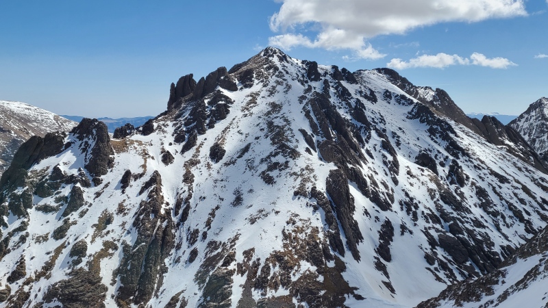
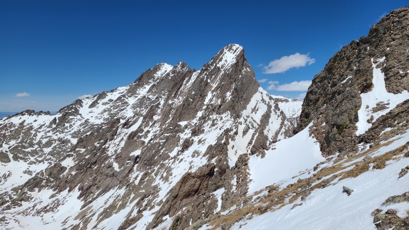
Being able to simply walk up Broken Hand Pass was a nice change of pace from the usual meh scrambling, and we were rewarded with a full frontal of "Crestolita" when we reached the pass. 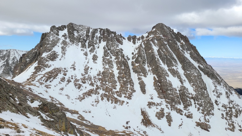
From here it's clear why I thought the north central couloir was the north couloir from Dereks' report - it pretty much begs the viewer to climb it. We'd have continuous snow to the saddle, and it looked nice and steep, exactly what I was looking for. We weren't sure exactly what the short bit from saddle to summit consisted of but we knew there'd be ways up as easy as Class 2, so we weren't too occupied with the thought. We also had an intimidating view of Crestone Needle from the pass, which actually looked like it'd be in perfect shape for a snow climb of its own. A group of skiers ahead of us was already heading up to the Needle. 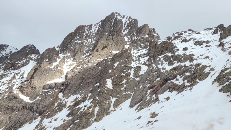
Since the snow was good so far, and we would be making a loop back to the pass after adding Broken Hand Peak, we left our snowshoes at the pass. The southern side of Broken Hand Pass had a nice covering of supportive snow so we plodded down and over to the bottom of the couloir. 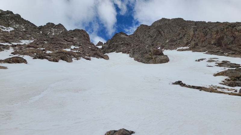
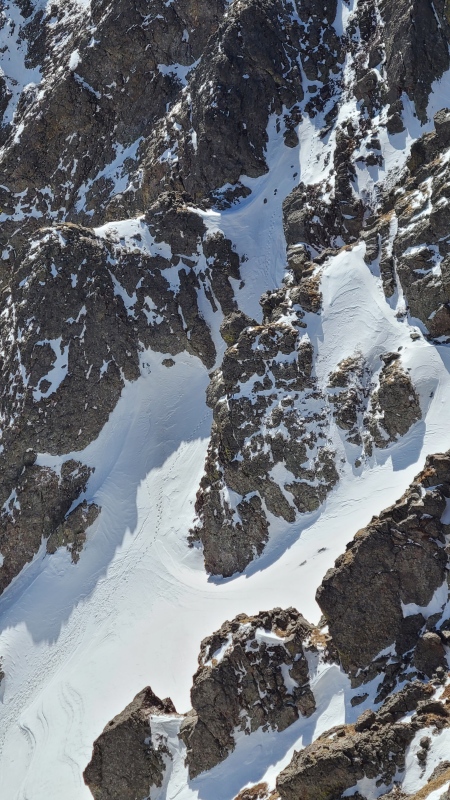
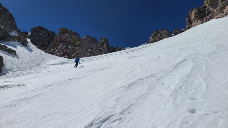
We quickly got into our crampons and got our axes out. When we were ready I took the lead up the couloir, which was in perfect condition. Easy, creamy step kicking, immediately starting off pleasantly steep, and of course nobody else to break our immersion. There weren't even any previous tracks up the couloir. I wasn't sure whether to be surprised or not, but probably the latter. Oft overlooked, indeed. The bottom half of the couloir was incredibly straightforward: climb up and enjoy. The walls narrowed maybe a hundred feet off the valley floor, which felt nice and cozy. At their narrowest, at the top before the couloir again widened out, we were able to see a set of rocks that blocked us from continuing straight up the couloir. 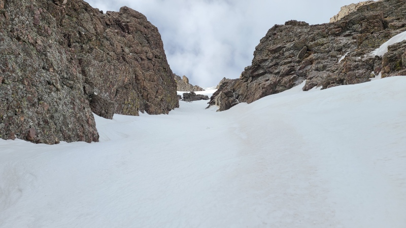
The rocks weren't a real problem, just something to dodge on one side or the other. The snow was a little steeper here but that just increased the fun factor because duh, steeper snow > not steeper snow. Bypassing the rocks on the right was easiest. We could have gone left too but it was simply a little off course. 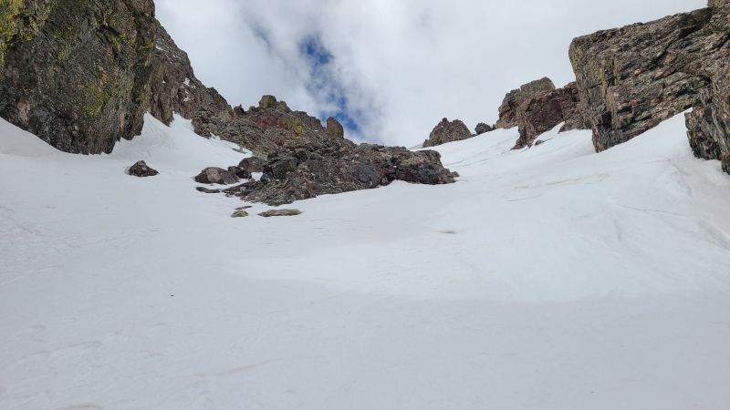
Directly overhead from the rocks was a large, curving snow drift. Climbing up the drift was the only part of the day that gave either of us any pause, as the snow suddenly became much harder and more dense. Instead of the easy step kicking up to this point I crabwalked to get the full length and extra points of my crampon in the snow. It wasn't steep enough to necessitate front pointing but it was close, and thus excellent. Before long we could see up different branches of the couloir. The right and center branches were most direct but both had huge cornices hanging over them. The left branch would force us into some steep, snowy scrambling, but we wouldn't be threatened by a cornice so hard left we went under the drift and then up again into the confines of the left branch. 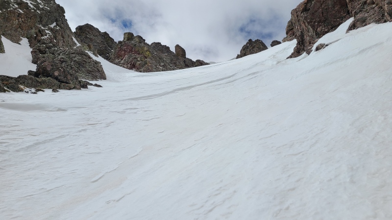
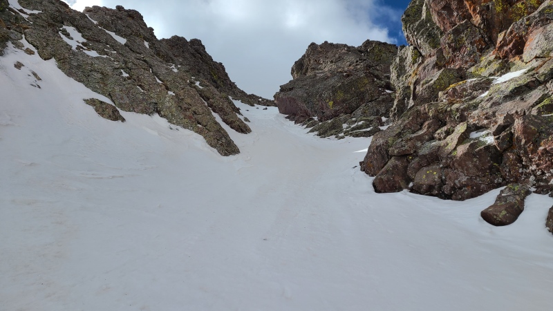
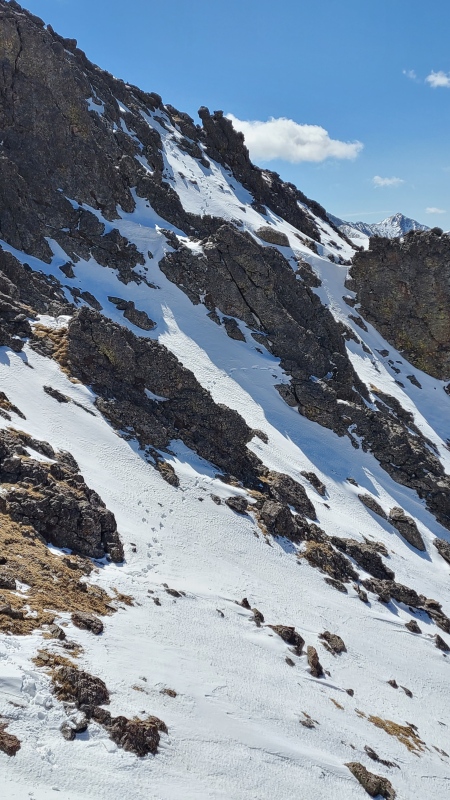
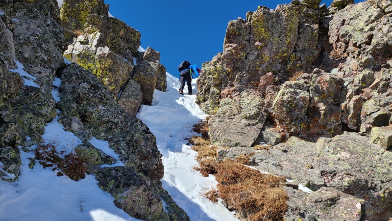
We had a little bit more snow to snake up before entering the narrowest tube in the couloir, where the scrambling was. The scrambling took some attention due to the steepness so I didn't take any photos while we were in the guts of it (see photos 22, 23, and 26-28 for various pictures of it taken later) and I had to hack a little tunnel for us through the exhilarating, nearly vertical top out. This was easily the steepest snow of the day, and using our hands on the rock here was roughly Class 2+. Once on top the difficulties immediately ceased. Ross made his way up behind me and we surveyed our next moves across the ridge to the summit. 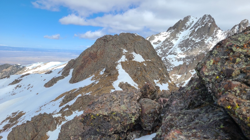
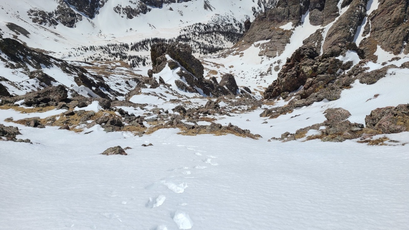
We didn't have much work on our hands from here. A short drop down the south face with some steep but easy snow and scrambling got us to the tundra below the summit block, which looked harder the closer we got. 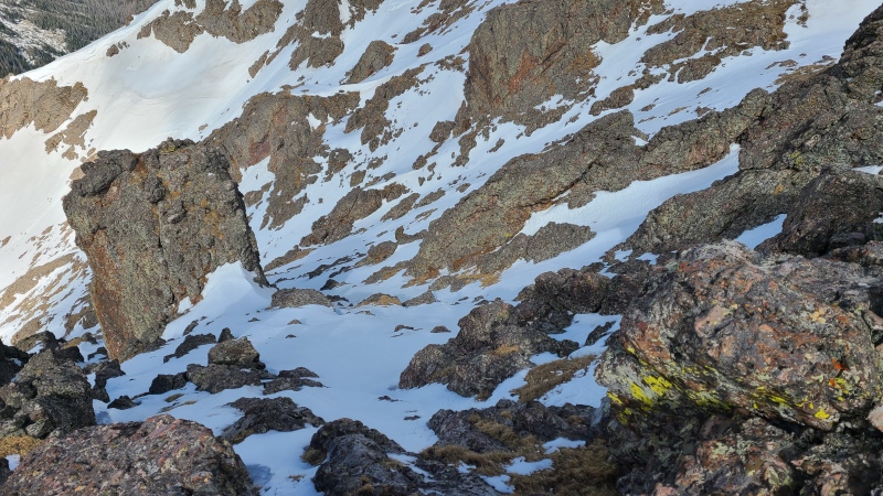
I made one half-hearted attempt at climbing straight up the block but didn't much like the scramble. Don't get me wrong, the rock was typical, wonderfully solid Crestone Conglomerate, but the combination of smooth cobbles, crampons, and gloves wasn't ideal. I peeked around the corner to the north and an easier scramble was immediately apparent, albeit with greater exposure, so we took the northern route instead. 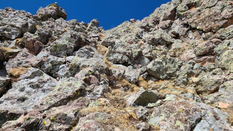
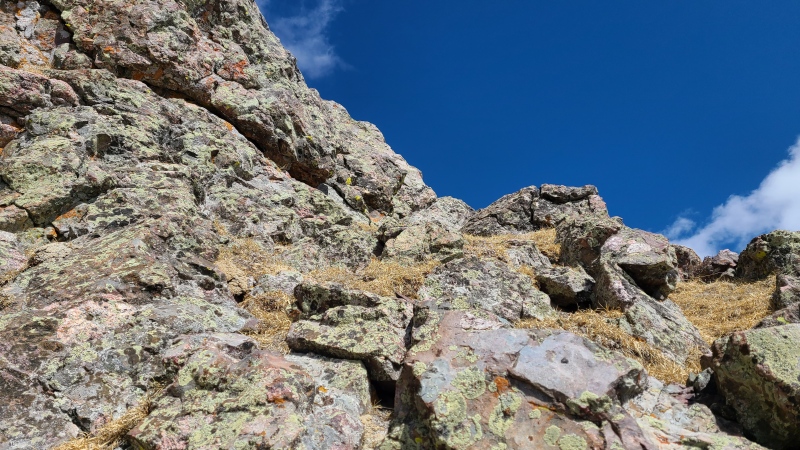
After maybe 50 vertical feet of fine scrambling we made the summit. Crestone views were simply breathtaking. 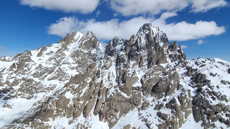
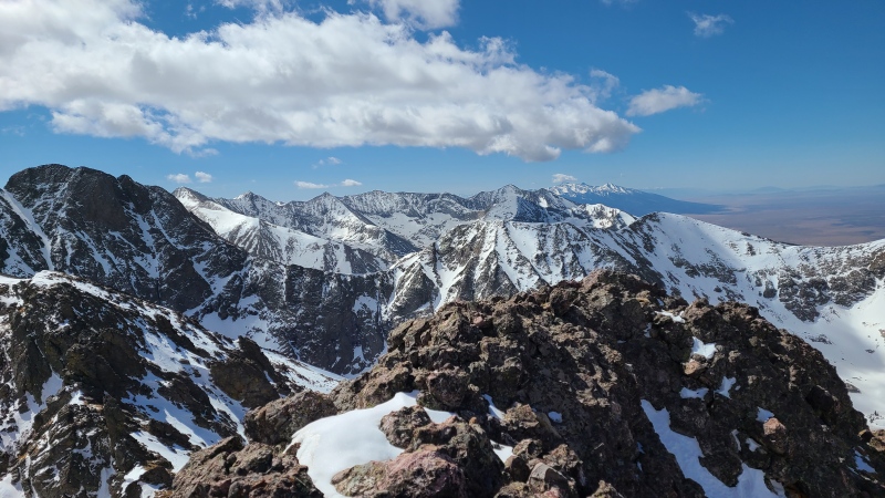
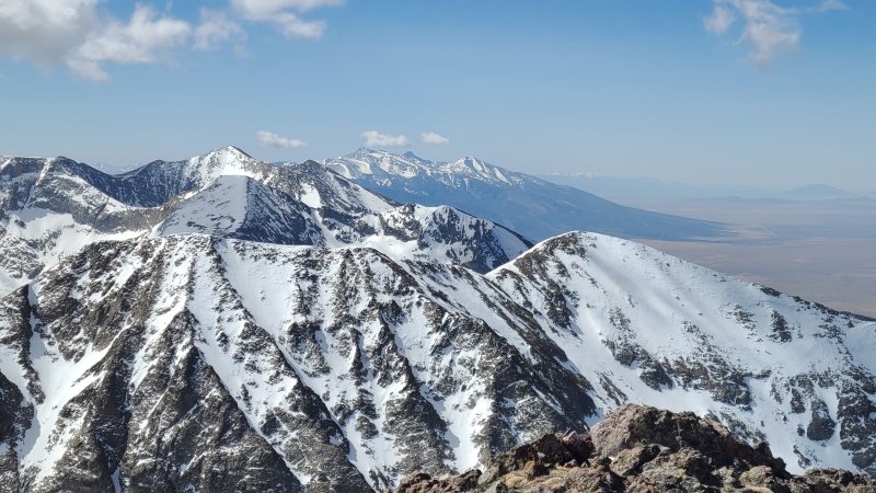
From the summit we were able to survey the upper portion of the north central couloir. It didn't quite feel as wild as it looked, but nonetheless we were impressed with ourselves. Ross wasn't much of a snow climber so climbing a line like this together with him was awesome. 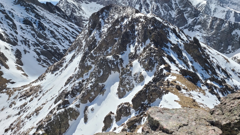
We spent a few minutes on top before climbing down a short section of snow to the south, then traversed back east towards the top of the couloir. 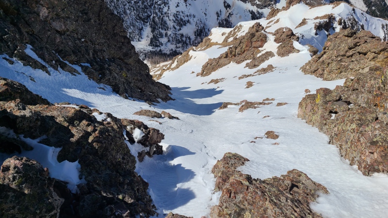
Getting back into the couloir was a little tricky, since we had to face in down climbing from flat ground to nearly vertical snow, but the very steep stuff was over quickly and we could face downhill again. 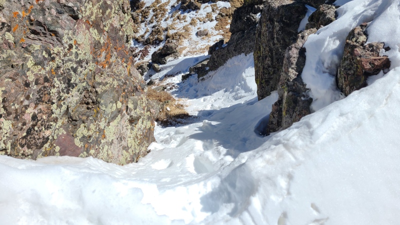
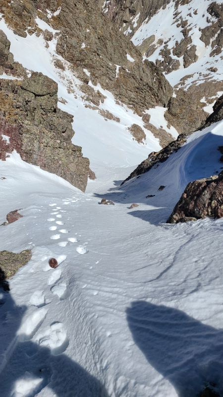
Reversing our track down into the main couloir was a piece of cake aside from having to not kick rocks on each other. 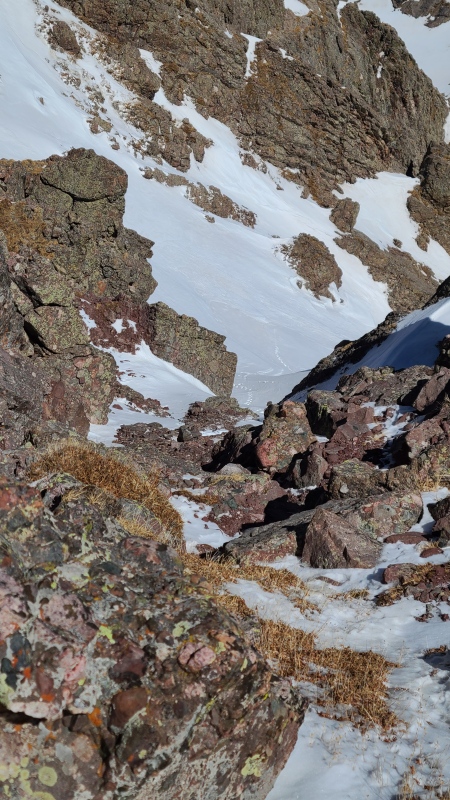
The short traverse through rock hard snow below the drift gave Ross a little bit of pause but he dispatched it quickly and without complaint. 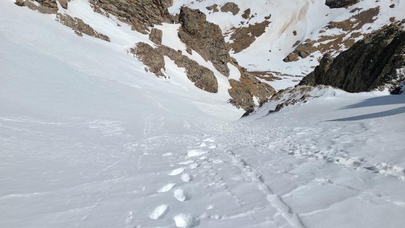
Now all we had to do was a simple task of walking down the couloir. The snow was still great, and despite the angle of the couloir we were able to plunge step from top to bottom in just a few minutes. 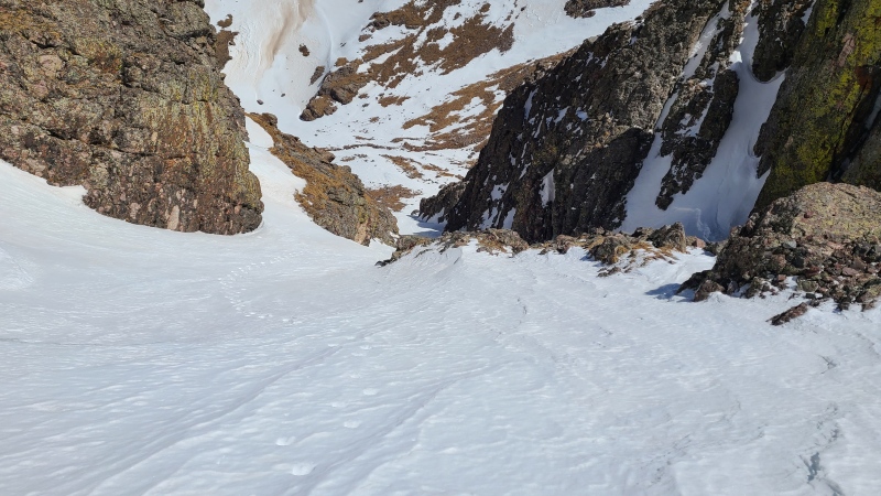
Next up: Broken Hand Peak. Unfortunately this one's got a real cool name and is pretty much a dud as far as climbing goes, because there isn't any. It's just a slog. 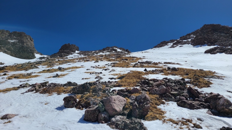
We were well into our day by now and tired. Ross had already done Broken Hand before and was gracious in repeating it with me. As with many thirteeners the primary difficulty on Broken Hand is simply slogging up the thing. Why couldn't there be another bomb couloir to climb? Yeesh! We ground out the vert up Broken Hand, made a short traverse around some rocks, and reached the summit. 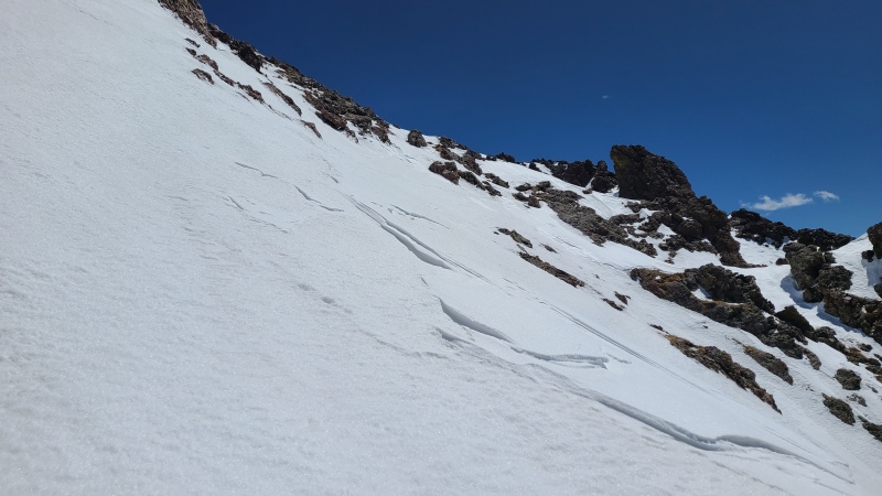
The views from Broken Hand also weren't that great as there were some large rocks coming up from Broken Hand Pass that blocked a good chunk of the views. We were able to get better views from below the summit so we rested up, began down, and took our photos a little below the summit. 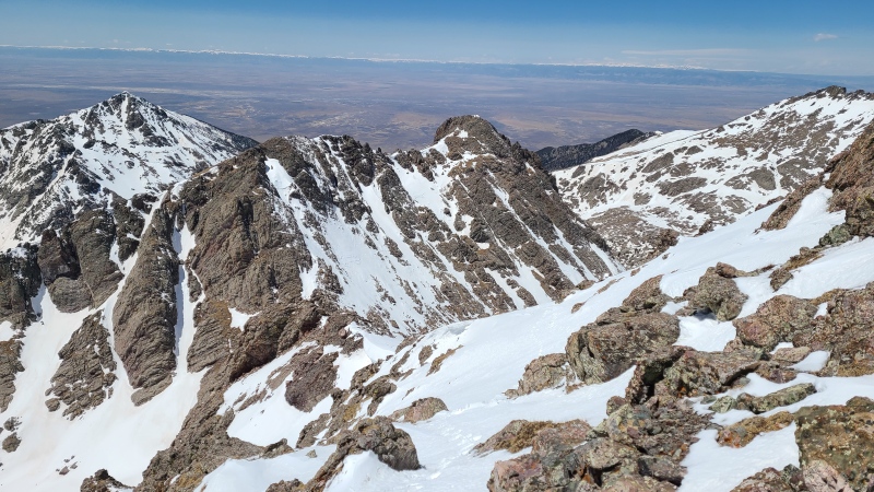
Instead of continuing all the way down into the valley before reascending to the pass we simply took a descending traverse roughly in the direction of the pass. There was some minor scrambling en route but for the most part the descent back to the pass was just more hiking. 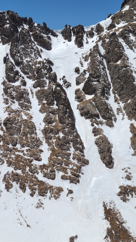
We picked up our snowshoes at the pass and ran into the skiers from earlier in the day. They'd made it a good way up the Needle but had gotten too late of a start and the snow got too soft for them to summit. The rest of our hike back to Ross' truck was uneventful, though the lower we got the worse the snow got. Eventually we were postholing to the ground in slush, despite our snowshoes, and utterly soaked from the knee down. Getting back and putting on dry footwear was the second best part of the day after the couloir, of course. 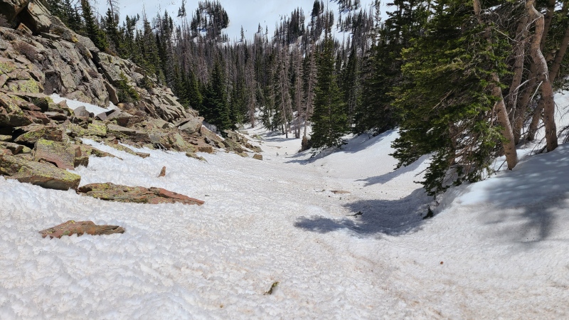
While I can't speak to the quality of the summer scrambling on "Crestolita" - though I hear it's pretty good - I can vouch for the quality of the north central couloir. It's a great early season starter, another Sangre climb that makes the range a fitting early or late season idea when other ranges might be out of condition. Having a great partner in Ross was awesome too. Thanks for trusting me on this little adventure, and for driving. We rode the crest of spring to the fullest on "Crestolita", yeehaw! StatisticsClimbers: Ben Feinstein (myself), Ross G. (for Gangsta) Total distance: 12.42 miles
Splits:
Thumbnails for uploaded photos (click to open slideshow): ")
")
")
")
")
")
")
")
")
")
")
")
")
")
")
")
")
")
")
")
")
")
")
")
")
")
")
")
")
")
")
")
")
")
")
")
")
")
")
")
|
| Comments or Questions | |||||||||||||||
|---|---|---|---|---|---|---|---|---|---|---|---|---|---|---|---|
|
Caution: The information contained in this report may not be accurate and should not be the only resource used in preparation for your climb. Failure to have the necessary experience, physical conditioning, supplies or equipment can result in injury or death. 14ers.com and the author(s) of this report provide no warranties, either express or implied, that the information provided is accurate or reliable. By using the information provided, you agree to indemnify and hold harmless 14ers.com and the report author(s) with respect to any claims and demands against them, including any attorney fees and expenses. Please read the 14ers.com Safety and Disclaimer pages for more information.
Please respect private property: 14ers.com supports the rights of private landowners to determine how and by whom their land will be used. In Colorado, it is your responsibility to determine if land is private and to obtain the appropriate permission before entering the property.


