Download Agreement, Release, and Acknowledgement of Risk:
You (the person requesting this file download) fully understand mountain climbing ("Activity") involves risks and dangers of serious bodily injury, including permanent disability, paralysis, and death ("Risks") and you fully accept and assume all such risks and all responsibility for losses, costs, and damages you incur as a result of your participation in this Activity.
You acknowledge that information in the file you have chosen to download may not be accurate and may contain errors. You agree to assume all risks when using this information and agree to release and discharge 14ers.com, 14ers Inc. and the author(s) of such information (collectively, the "Released Parties").
You hereby discharge the Released Parties from all damages, actions, claims and liabilities of any nature, specifically including, but not limited to, damages, actions, claims and liabilities arising from or related to the negligence of the Released Parties. You further agree to indemnify, hold harmless and defend 14ers.com, 14ers Inc. and each of the other Released Parties from and against any loss, damage, liability and expense, including costs and attorney fees, incurred by 14ers.com, 14ers Inc. or any of the other Released Parties as a result of you using information provided on the 14ers.com or 14ers Inc. websites.
You have read this agreement, fully understand its terms and intend it to be a complete and unconditional release of all liability to the greatest extent allowed by law and agree that if any portion of this agreement is held to be invalid the balance, notwithstanding, shall continue in full force and effect.
By clicking "OK" you agree to these terms. If you DO NOT agree, click "Cancel"...
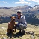
I have spent a lot of time around Fairplay, Como, Alma, Hartsel. From this area, no matter where you are you can always look around and locate Silverheels. I finally decided to climb it and use the Southern approach as described by E_A_Marcus_949 The gate to Beaver Creek road was open when I did this but the 4WD road is closed - it looks to be permanently closed based on the fence that is there. So I parked at the stream crossing. Total round trip was 9.2 miles and 3337ft of elevation. This is a picture of MT Silverheels on the drive up on Beaver Creek:
I wasn't sure how much snow I'd encounter but being on the South side it wasn't very much.
The trail (road) is easy to follow up through the trees. There is that left turn at about .9 miles. This is where you would park if the road was open. Other than that the trail is easy to follow.
View looking back on the trail at 1.1 milesLooking up the trail at 1.1 miles. It is steep and loose here but not for long.Just leaving the trees at about 2.0 miles. You can see the summit from here and the 12,200ft hump ahead.
Looking back at the tree line at 2.0 miles. Buffalo Peaks off in the distance.Nearing 12,200ft bump about 2.2 miles. Trail is still good here but I lost it as soon as I reached the bump.
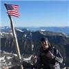
Looking back from near top of 12,200 bump. I found a trail for a little while.On top of 12,200 ft bump at 2.5 miles. You can see the wind shelter on the left. 13,000 ridge ahead on the right and summit in the middle.Nearing the edge of the 13,000 ridge at 3.6 miles.On top! I could not find the marker. I am sure it was covered with snow and wasn't really interested in digging!Summit looking Northward. Torrey's and Gray's on the left.Looking Eastward. I think that is Como down there.Looking South from the Summit. You can just see the 12,200 bump and Fairplay off in the distance. The 13,000 ridge is not visible from here.Southeast from the Summit. Little Baldy directly below and Pike's Peak way off center-right. Is there anywhere in Colorado that you cannot see Pike's?On the way back down. Now you can see the 13000 ridge and the 12,200 bump.After passing 12200 bump looking West toward Bross, Lincoln and Democrat,After passing 12,200 bump looking Northwest at Hoosiers and Quandary.Nearing the treeline on the way down. I found the trail again.Trail down into trees.
The entire hike took me 5 hours - 3 hours to the summit and 2 hours back down. I lost the trail right about the base of the 12,200 bump and then found it on and off again throughout the hike. The trail isn't really necessary after the tree line as you can see where you want to go and it is mostly tundra until the very top. Then there is some ankle deep snow and stable talus. On the way up I went over the top of the ridges. On the way back I went around - to the right for both. I think going around is easier even though there was some talus. The top ridge has a lower ridge to the right just below the top - it is mostly tundra. From the summit try to descend just enough to get on this ridge - aim right. My GPX shows the difference between up and down. Also it was hunting season and I did see several hunters below the tree line. Make sure you wear an orange vest and leave your antler hat at home :-).
My GPS Tracks on Google Maps (made from a .GPX file upload):
I thoroughly enjoyed this route last month. It was the first full week of bow season and 2nd day of muzzle loader season for big game when I hiked, but I didn't see another soul for the entirety of my or the trek. A few folks at their base camps. Looks like your GPS was pretty close to my track, plus a little snow for you.
Followed this route 10/15 and a hunter had shot a big bull elk...fell just off the trail above treeline, before the first bump. Very active area for hunting! And a fun route.
Is called Arnold Peak, the peak directly to the east on the SE ridge of Silverheels is Palmer Peak. Arnold Palmer is not too bad a day from Beaver Creek.
Hey great report! Was thinking of doing this route soon(ish). Was wondering if you had an idea of if the gate for Beaver Creek Road is still open or where to find such info? Thank you!
Tommy Burke- I called the South Park Ranger District today and they said that it is still open to get to the starting point you reached. Hoping this holds true in the next couple days. Thanks again!
doesn't close until Jan 1 each year and stays closed until June 15.
Caution: The information contained in this report may not be accurate and should not be the only resource used in preparation for your climb. Failure to have the necessary experience, physical conditioning, supplies or equipment can result in injury or death. 14ers.com and the author(s) of this report provide no warranties, either express or implied, that the information provided is accurate or reliable. By using the information provided, you agree to indemnify and hold harmless 14ers.com and the report author(s) with respect to any claims and demands against them, including any attorney fees and expenses. Please read the 14ers.com Safety and Disclaimer pages for more information.
Please respect private property: 14ers.com supports the rights of private landowners to determine how and by whom their land will be used. In Colorado, it is your responsibility to determine if land is private and to obtain the appropriate permission before entering the property.