Download Agreement, Release, and Acknowledgement of Risk:
You (the person requesting this file download) fully understand mountain climbing ("Activity") involves risks and dangers of serious bodily injury, including permanent disability, paralysis, and death ("Risks") and you fully accept and assume all such risks and all responsibility for losses, costs, and damages you incur as a result of your participation in this Activity.
You acknowledge that information in the file you have chosen to download may not be accurate and may contain errors. You agree to assume all risks when using this information and agree to release and discharge 14ers.com, 14ers Inc. and the author(s) of such information (collectively, the "Released Parties").
You hereby discharge the Released Parties from all damages, actions, claims and liabilities of any nature, specifically including, but not limited to, damages, actions, claims and liabilities arising from or related to the negligence of the Released Parties. You further agree to indemnify, hold harmless and defend 14ers.com, 14ers Inc. and each of the other Released Parties from and against any loss, damage, liability and expense, including costs and attorney fees, incurred by 14ers.com, 14ers Inc. or any of the other Released Parties as a result of you using information provided on the 14ers.com or 14ers Inc. websites.
You have read this agreement, fully understand its terms and intend it to be a complete and unconditional release of all liability to the greatest extent allowed by law and agree that if any portion of this agreement is held to be invalid the balance, notwithstanding, shall continue in full force and effect.
By clicking "OK" you agree to these terms. If you DO NOT agree, click "Cancel"...
When deciding which route to do on Mt. Silverheels, the route from Hoosier pass comes to mind as it's on the .com. However, we decided to do the Roach *classic* South Ridge from Beaver Creek outside of Fairplay after talking with some friends and reading other trip reports (thanks JQDivide!).
If I can find the history of the mountain or of her name, I really enjoy knowing about it. I knew this mountain was named after a lady but not her whole story. James Dziezynski provided a great intro and description of how the mountain got her name (here). Essentially, she was a dance-hall girl who wore silver heels and had a good-natured heart. With all the rampant illness that broke out in this area, most people left. However, she stayed to comfort folks. Her legend remained and the mountain was named in her honor.
This route is fairly straight-forward, however there isn't an over-abundance of information out there for it, so hopefully this report will help some others out. I thought about making a legit route for it on the .com but figured this may be better and more descriptive. I did add the Beaver Creek TH to the .com though for future reference and anyone searching for it.
From Beaver Creek TH - 10,740', 9mi RT, 3400' gain - where we started From 4WD parking TH - 11,180', 7mi RT, 2950' gain - only if you can cross the creek in your car.
Honestly, the extra mile on the road wasn't bad. It was a good warm-up with minimal elevation gain to get you ready for the day.
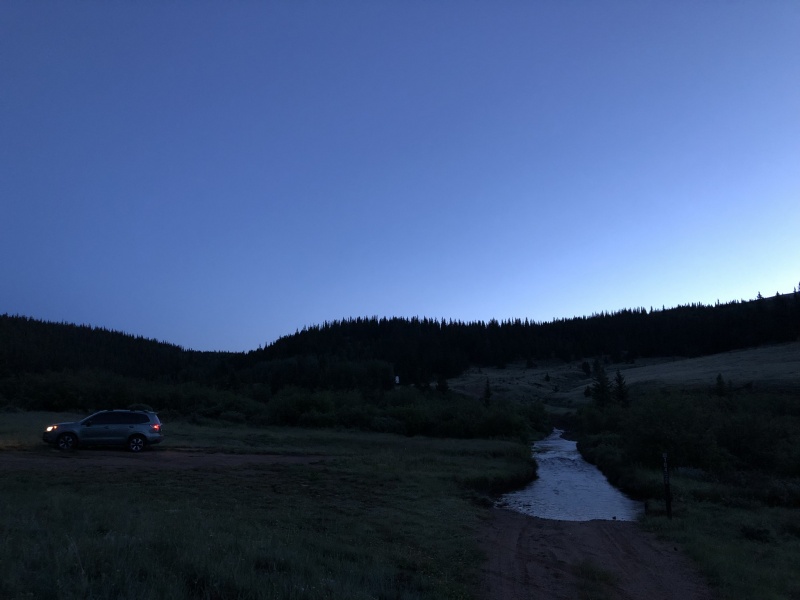
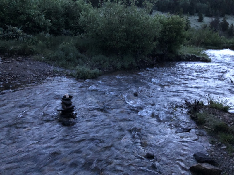
Large parking area if you can't cross the creek - taken around 5:30amAnother view of the creek midday. The only car we saw on the other side of it was a lifted 1990s-era 4Runner.
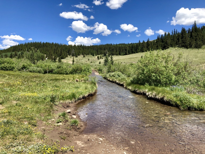
Once you make it to Beaver Creek you get the joy of starting your morning with a brisk barefooted ford across the creek. There are some narrower areas, as noted by a mid-creek cairn. The crossing does feel great after the hike - just a bit chilly pre-6am.
Where we crossed. No higher than mid-calf.
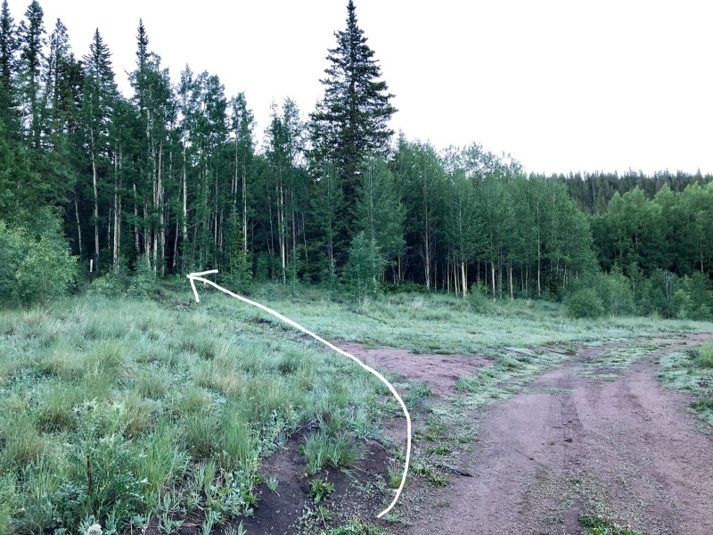
After the creek crossing it's an easy walk up the road to the junction of FS184. There is an area to park here if you cross the creek. Once hiking, though, do not continue on FS659 - turn left onto FS184 (no vehicular access). It's about 11,180', where the road starts to turn - don't follow the road unless you want a non-Silverheels adventure.
Veer here toward FS184 to continue to the hike.
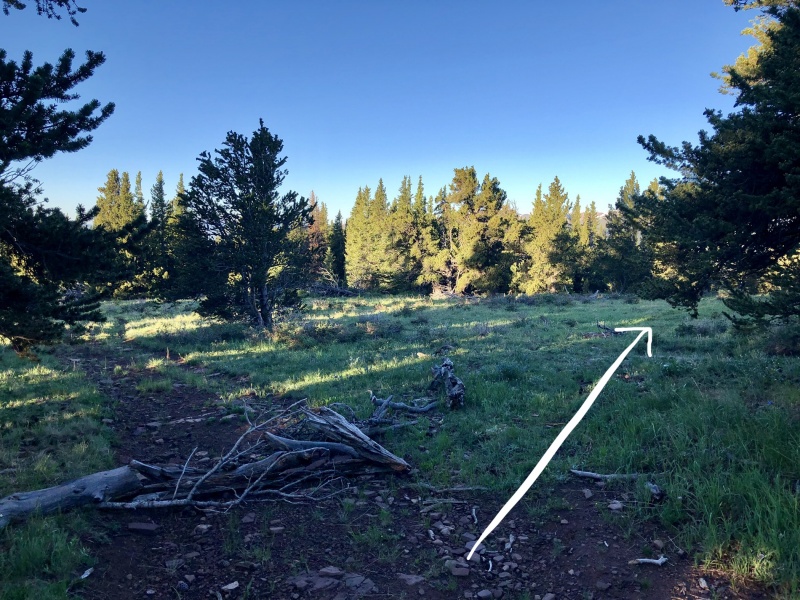
Continue hiking into FS184 for a while - about 1.1mi N/NE. This road will intersect another one, near treeline/before cool bristle-cone pine forest. Make note of this junction. You do not want to go the wrong way and coming back, it's easy to turn down the wrong road. People have built up a makeshift barrier, however, still be diligent about it. See pic below - veer right. On your descent there is another junction, which we didn't notice on our way up FS184, however, we did veer the wrong way on it. If you come to another junction on your descent back to the TH, go left, not right (unfortunately I didn't take a photo of this).
Where FS184 intersects another - on the descent veer right.
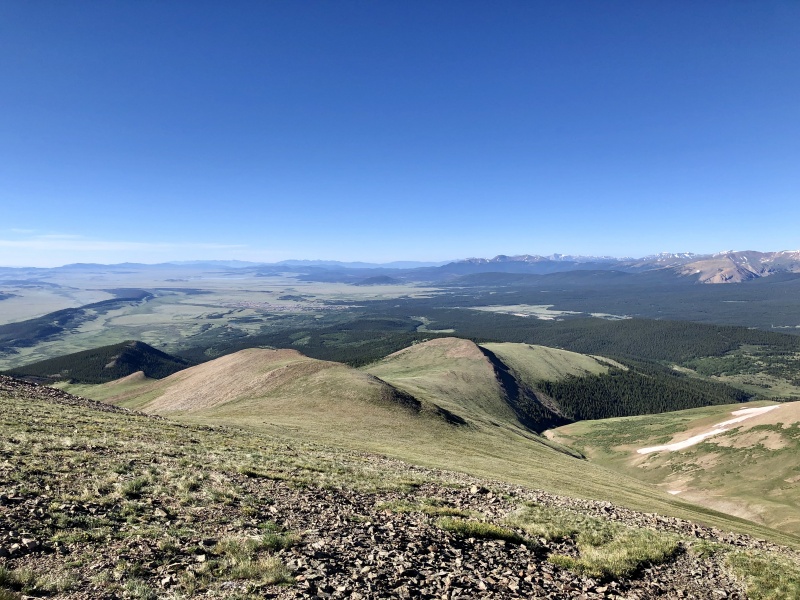
You'll keep hiking up the road, twisting through treeline into bristle-cone pines - they're really cool, make sure to admire them! Also make sure to turn around on your hike up the road - especially in the early-morning light. There are some fabulous views!
Once you're out of treeline, you'll see the first "bump" of the climb - Point 12,220'.
View from the road of the first "bump" - Point 12,200'
You'll leave the road around 12,000' and climb up and over this point. There is a rock windbreak at the far end. It's not necessary to go here, however, we found this was the simplest route up the face Point 12,200' and gave us optimal views of the remaining route (and of Mt. Silverheels herself!).
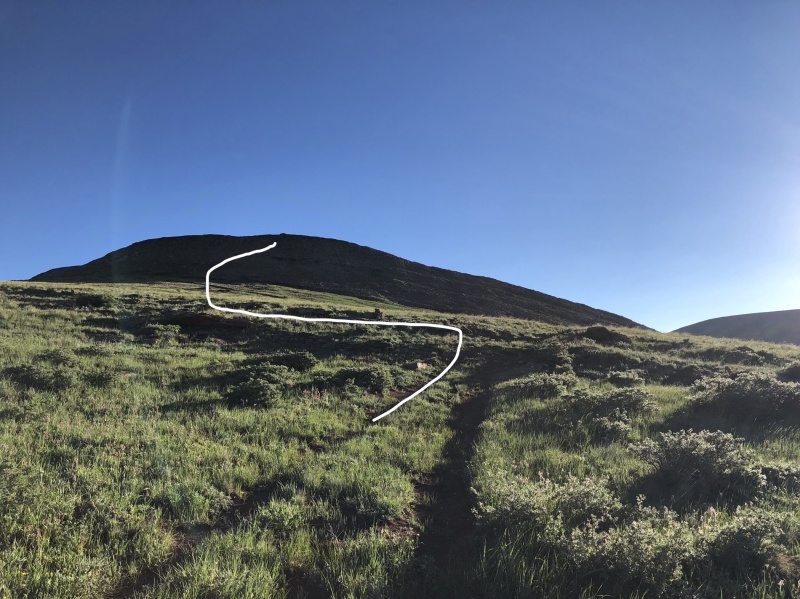
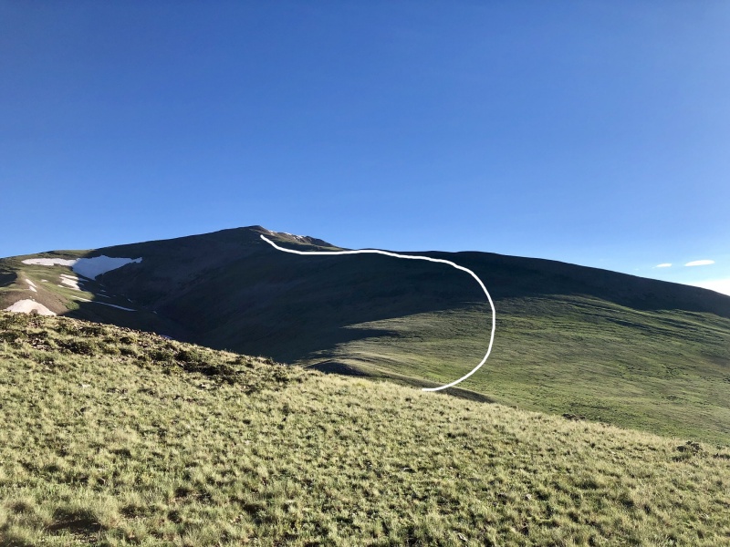
Once you summit Point 12,200', you can see your remaining hike up to Silverheels. The distance is greater than it looks though! You'll want to descent off this Point and hike about 1 mile north up some grassy slopes to small Point 13,004'. There are a few bumps along the ridge to this 13,000' point. We ended up going up the talus slopes and across the ridge. One the way down from Silverheels, we skirted around the point and side-slope hiked. If you do this going up, angle up to the 13,000' saddle. There are sections of occasional trail this way. Don't rely on it though as it comes and goes - just keep an eye on your route. This is a 13er afterall - route-finding and adventure is the name of the game here.
View of the remaining route from Point 12,200'. White line goes between the ridge and slope-skirting. We went across the ridge ascending and side-slope descending.Looking back at Silverheels, the yellow highlight is an approximate area of where trail segments are along the slope of the 13,000' saddle/bump.
The photo below shows the route from the 13,000' saddle of what you've done so far. Next, you will descend slightly off of the 13,000' saddle before your final ascent up the ridge/side of Silverheels. It's about 0.8 miles still to the summit from here. Everything looks farther than it is, but try not to be deceived. It's a gorgeous hike in a grassy area - not much talus and rock-hopping.
Atop 13,000' looking at the 12,200' bump.
Keep angling up toward Silverheels. You can go ridge proper or up the face of the mountain. We did a little of both. The wildflowers and views were astounding! There were a few cairns but for the most part, angle toward the summit. No false summits here - what you see is what you get.
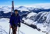
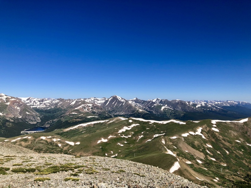
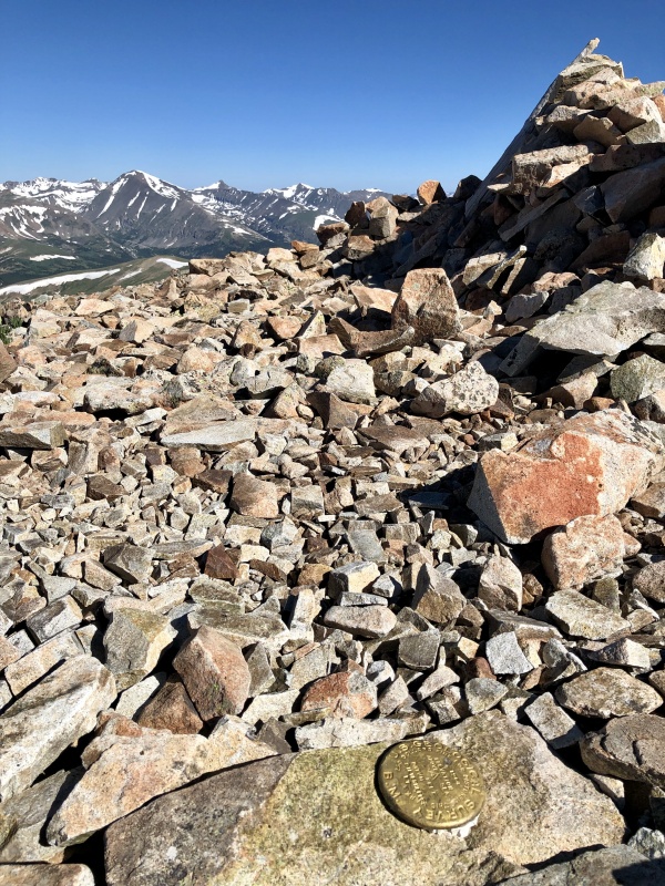
When you summit, there is a marker and wonderful views of the Front Range. There is a large wind shelter on this sizable summit as well. Enjoy your solitude while looking at Quandary and what is likely heaps of people. You'll descend the way you came. Make sure to keep an eye on those two forks in the road as mentioned earlier in the post.
Summit view of Quandary and surrounding mountains.Summit marker with wind shelter to the right and Quandary in the background.
This is a wonderful climb. I would label it as a class 2 since there is route finding, however, the terrain itself is not too difficult - some talus and rocks but mostly grassy slopes and road.
My GPS Tracks on Google Maps (made from a .GPX file upload):
Comments relevant for future hikers 8/10/2019 9:37pm
I did this route a few years ago, following Roach's guidance. Finding the Beaver Creek trailhead from Fairplay was a challenge (a maze of newer gravel roads in the area...Lat/long coordinates may be helpful).
I took my chances with a rental vehicle across the long creek crossing and was able to drive right up to FS184 (cheating!). Above 12000', my track was farther west, missing the sub peaks. I found mostly grass or solid rock, with two tougher talus slopes which slowed me down. Unsure which would be the faster or safer way.
I had this hike to myself, found 2 people at the summit that arrived by an even stranger route. The summit view is very nice and this would typically be a lonelier, big day.
The hulk of Silverheels is viewed for many miles driving north on US 285 through South Park. Smile if you've been there!
Google Maps indicates the GPS coordinate for where this GPX started is
39.270758, -106.015512
Caution: The information contained in this report may not be accurate and should not be the only resource used in preparation for your climb. Failure to have the necessary experience, physical conditioning, supplies or equipment can result in injury or death. 14ers.com and the author(s) of this report provide no warranties, either express or implied, that the information provided is accurate or reliable. By using the information provided, you agree to indemnify and hold harmless 14ers.com and the report author(s) with respect to any claims and demands against them, including any attorney fees and expenses. Please read the 14ers.com Safety and Disclaimer pages for more information.
Please respect private property: 14ers.com supports the rights of private landowners to determine how and by whom their land will be used. In Colorado, it is your responsibility to determine if land is private and to obtain the appropriate permission before entering the property.

")
")
")
")
")
")
")
")
")
")
")