| Report Type | Full |
| Peak(s) |
La Plata Peak - 14,344 feet |
| Date Posted | 10/09/2022 |
| Modified | 10/21/2022 |
| Date Climbed | 09/24/2022 |
| Author | dogdunnit |
| A Cloudless Day on La Plata (Southwest Ridge) |
|---|
|
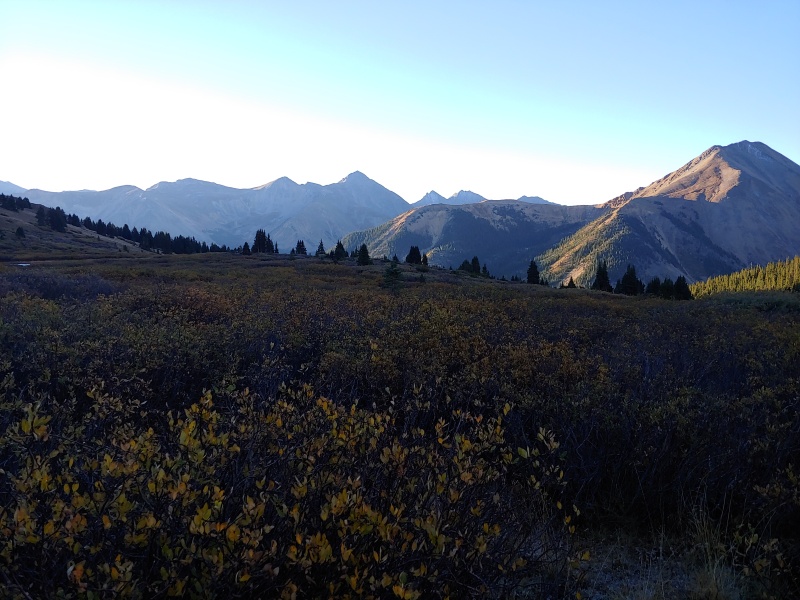
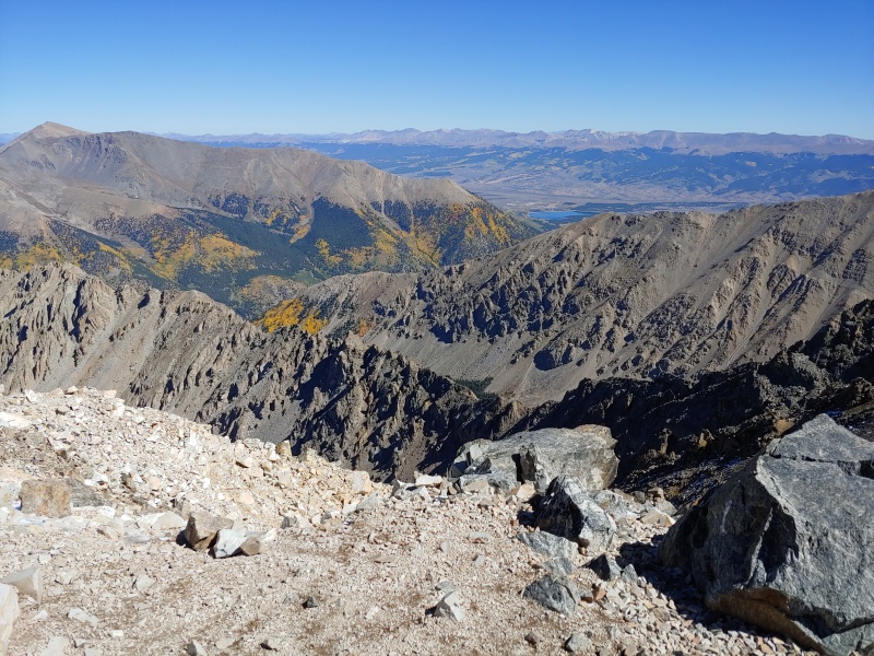
La Plata had been on my list for a couple years now. Being from New Hampshire, having an opportunity to climb a 14'er is unfortunately somewhat limited. But after climbing Elbert as my first 14'er two years ago (which was awesome!), La Plata was on the list. Turns out it would be 14'er #3, and my wife (Kris), son (Michael), and I made the time for it this fall. After planning an extended weekend in Buena Vista, my wife and I arrived early into town on Thursday. Having read about the 'rough' 4WD road heading up to the trailhead, we decided to take a dry run to see what we were getting into with this. There had been significant rainfall the past few days which also left me somewhat unsure about the two stream crossings that I was aware of on the road. So even though it seemed like a time sink (just under an hour off US 24), out we went. In the end, ya, the road is rough, but as many others have stated, better with 4WD vehicle (we had a Suburban) and high clearance you need. Turns out the stream crossings ended up being minimal too. So it appeared rather uneventful. Saturday AM we set out from Buena Vista at 5AM. I will say I was actually very glad to have driven the 4WD road in the daylight as I suspect my perspective would have been different if I was travelling it in the dark that morning for the first time. It was still dark when we hit the trail at 6:15. From the parking area, you pick up the trail after about .1 miles. The South La Plata trail sign was missing, but there is an info board next to the metal gate referenced by others. The trail is directly off to your left. We got to the basin just as the sun was coming up. I had read a lot of reports of how beautiful this valley is, and quite honestly those reports were the reason in selecting this route over the standard route. Well I have to add, no matter how many pictures you look at, absolutely nothing compares to seeing this in person. Simply beautiful. I took a lot of pics, determined to capture it. But nope... Still it just doesn't compare to being there. We loved this. 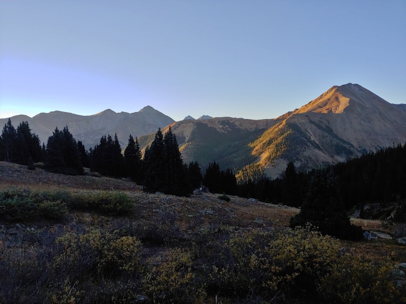


As we began our climb out of the basin, we were finally in the morning sun. The temperature this morning was ~30, so the trail thru the willows was frozen. 'Course this also meant that, what would otherwise be the loose scree climbing up to the southwest ridge, was also frozen. And there were no complaints there. 

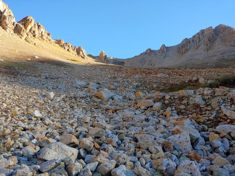
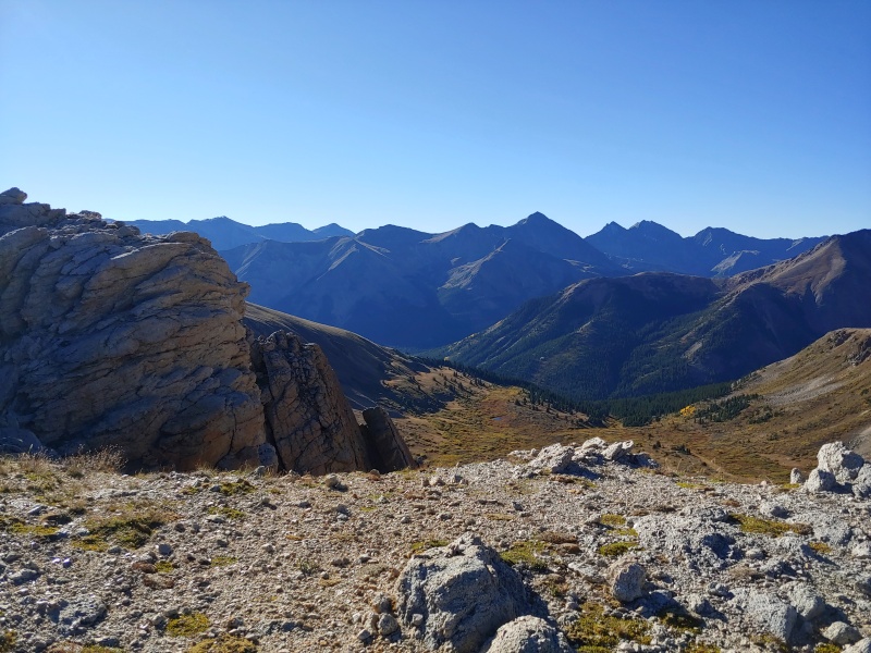
Once on top of the ridge, we were next off toward the large boulder field leading up to the first false summit. And we also somehow managed to get ourselves about 400' or so east of where the semblance of a trail exists up the rocky slope. I suspect it was due largely to lack of attention resulting from the several overlooks into the basin that continued to provide fantastic vista's, but who knows. 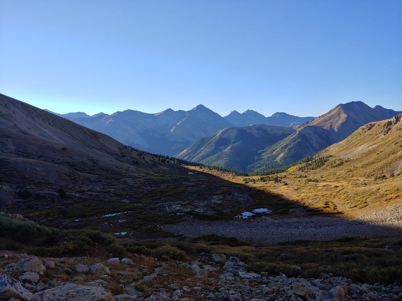

Michael our 24yo son had no issues rock hopping (part mountain goat??) but for 59yo dad and a bit younger mom (don't tell Kris I said that), this was more of a challenge. We were quite a ways up the boulder field before fully realizing our mistake. Kris and I decided to make an effort to regain the 'trail' and worked our way west to do so. In hindsight, I think continuing up would have been the right choice, as all we did was just make this section longer. It took ~2hrs to reach the first false summit where Mike was (somewhat) patiently waiting for us. 
The sight of the boulder field extending to the second false summit wasn't the most welcoming. I can't (won't) say how many times, from home, I had looked over this route. How had I missed that??? Argh... And so now came more of a mental challenge. Kris became frustrated and I felt mentally unprepared. For a moment, I had the fleeting thought that I wasn't sure on this one. But with some simple self encouragement, we continued on. With still not much for a defined trail, we reached the 2nd false summit. At this point, we could see the true summit a short distance away. Hard to explain, and maybe it is just me, but I love that feeling when you know you are going to summit! 
We summitted at ~11:30. Such a fantastic day. It was completely cloudless and the views from the summit were spectacular. I remember from the summit of Elbert, the smoke that year made even picking out 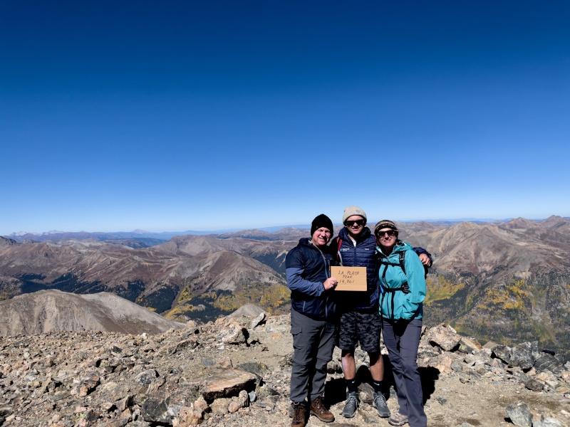


We enjoyed what has now become our traditional drink of homemade blueberry wine on the summit (brought from NH). And after many pics and a snack, decided after about an hour, that it was time to head down. 
Route finding was much easier descending. And traversing the the boulder field was actually uneventful. As expected, the section of trail heading from the ridge down into the basin was now thawed, but relative to a half mile or so of rock hopping, was somewhat slow going but still far easier than expected. I had read so much of folks lamenting the loose scree, but for us, the extent of the boulder field was the lesser favorite. As we had been in complete sunshine since the sun came up, it felt a bit odd, though welcomed, once we were back at the tree line and had some shade from the trees. We got back to the truck at 3:30. Does anybody else have a let down after completing a 14'er hike? Like Elbert, looked forward to this one for such a long while. And now it is in the books. Well, on to setting the heart on another! Thumbnails for uploaded photos (click to open slideshow): ")
")
")
")
")
")
")
")
")
")
")
")
")
")
")
")
")
")
")
")
")
")
")
")
|
| Comments or Questions |
|---|
|
|
Caution: The information contained in this report may not be accurate and should not be the only resource used in preparation for your climb. Failure to have the necessary experience, physical conditioning, supplies or equipment can result in injury or death. 14ers.com and the author(s) of this report provide no warranties, either express or implied, that the information provided is accurate or reliable. By using the information provided, you agree to indemnify and hold harmless 14ers.com and the report author(s) with respect to any claims and demands against them, including any attorney fees and expenses. Please read the 14ers.com Safety and Disclaimer pages for more information.
Please respect private property: 14ers.com supports the rights of private landowners to determine how and by whom their land will be used. In Colorado, it is your responsibility to determine if land is private and to obtain the appropriate permission before entering the property.

