Download Agreement, Release, and Acknowledgement of Risk:
You (the person requesting this file download) fully understand mountain climbing ("Activity") involves risks and dangers of serious bodily injury, including permanent disability, paralysis, and death ("Risks") and you fully accept and assume all such risks and all responsibility for losses, costs, and damages you incur as a result of your participation in this Activity.
You acknowledge that information in the file you have chosen to download may not be accurate and may contain errors. You agree to assume all risks when using this information and agree to release and discharge 14ers.com, 14ers Inc. and the author(s) of such information (collectively, the "Released Parties").
You hereby discharge the Released Parties from all damages, actions, claims and liabilities of any nature, specifically including, but not limited to, damages, actions, claims and liabilities arising from or related to the negligence of the Released Parties. You further agree to indemnify, hold harmless and defend 14ers.com, 14ers Inc. and each of the other Released Parties from and against any loss, damage, liability and expense, including costs and attorney fees, incurred by 14ers.com, 14ers Inc. or any of the other Released Parties as a result of you using information provided on the 14ers.com or 14ers Inc. websites.
You have read this agreement, fully understand its terms and intend it to be a complete and unconditional release of all liability to the greatest extent allowed by law and agree that if any portion of this agreement is held to be invalid the balance, notwithstanding, shall continue in full force and effect.
By clicking "OK" you agree to these terms. If you DO NOT agree, click "Cancel"...
"That’s what she said." ~ Michael Scott, Regional Manager, Dunder Mifflin Paper Company
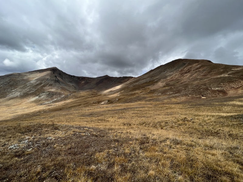
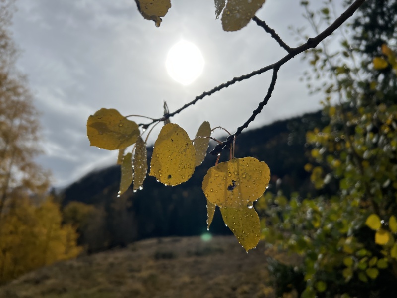
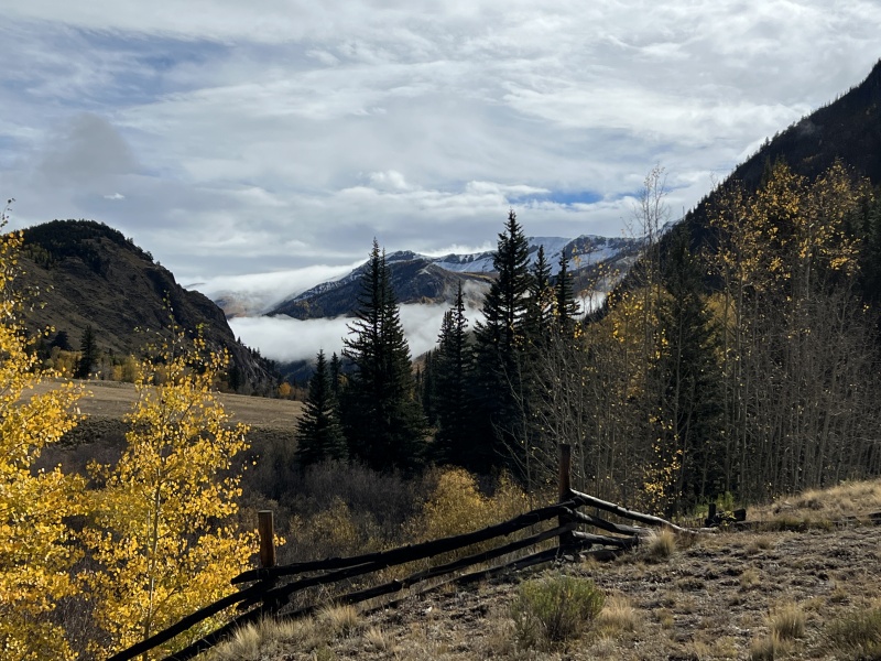
From the Mill Creek Bridge on Friday morningLooking down the passTourist photo
We were iffy on the attending the 2022 Fall Gathering because of the forecast. I know several people bailed. But you don’t know if you don’t go. And this year’s weather forecasts have been iffy at best.
We decide to go, and to get there Thursday night to take advantage of Friday morning’s good weather window. We arrived at Mill Creek Campground around midnight. But did we get up at 4:30 a.m. like those that went for Sunshine and Redcloud… nope. We stayed in bed until 7:30.
Got up. Made coffee. Cooked a real breakfast. Set up a bit of camp. And then decided to head up to Cinnamon Pass.
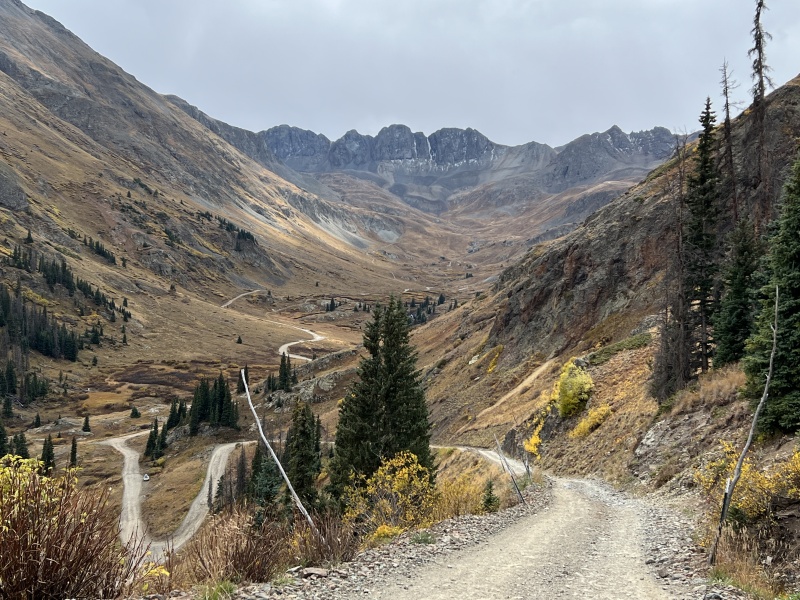
Side bar: CR 30 is in awful shape. It is the worst I have seen it in 20-plus years. Getting a 2wd vehicle to the Grizzly Gulch TH used to be the norm. I would not take a regular 2wd up that road anymore. It is rough, rocky and washed out / repaired in spots. Between the heavy rains and OHV traffic this summer, the road is no longer an easy cruise. Even 4wd vehicles will be driving slower, so add anywhere from 15-30 minutes to your trip. You will want a 4x4 to get to the top of the pass, some of the switchbacks are all rock. I spoke with a sheriff deputy on top the of the pass, and he said the road has gotten worse since this spring. Not sure what it will be like once the snow melts for the 2023 summer.
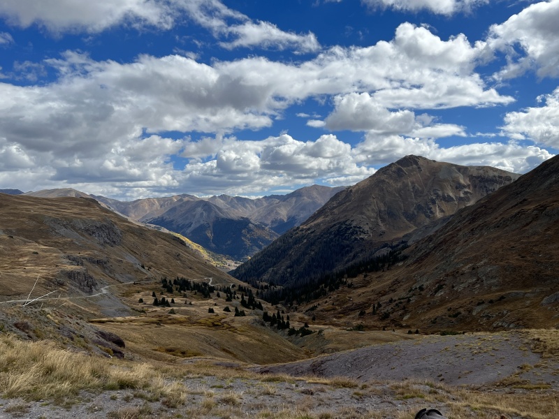
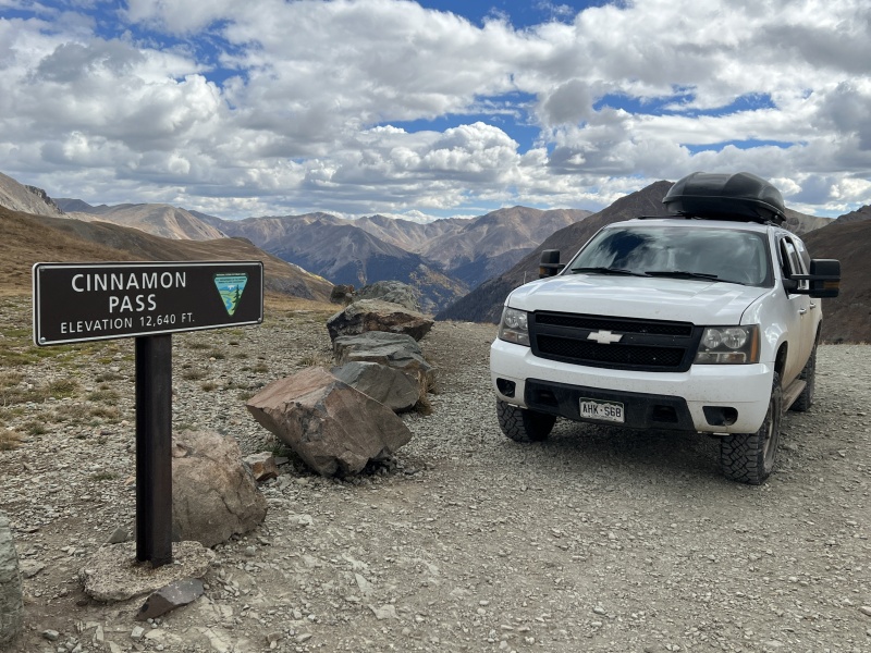
Well, obviously, it took longer to reach Cinnamon Pass than we thought it would. Got our obligatory tourist vehicle / sign photo. Then we parked out of the way at the top and started hiking at the leisurely 11:30 a.m. So much for taking advantage of the morning forecast.
The goal for the day was to hike Wood Mountain. The second goal, was to see how the weather looked when we got to the top.
The pass is at 12,600 and change. Wood is at 13,660. We were looking at 1,000 feet of gain. Not a big day by any means.
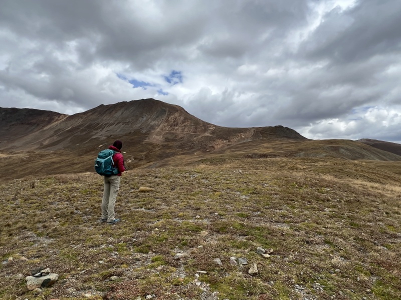
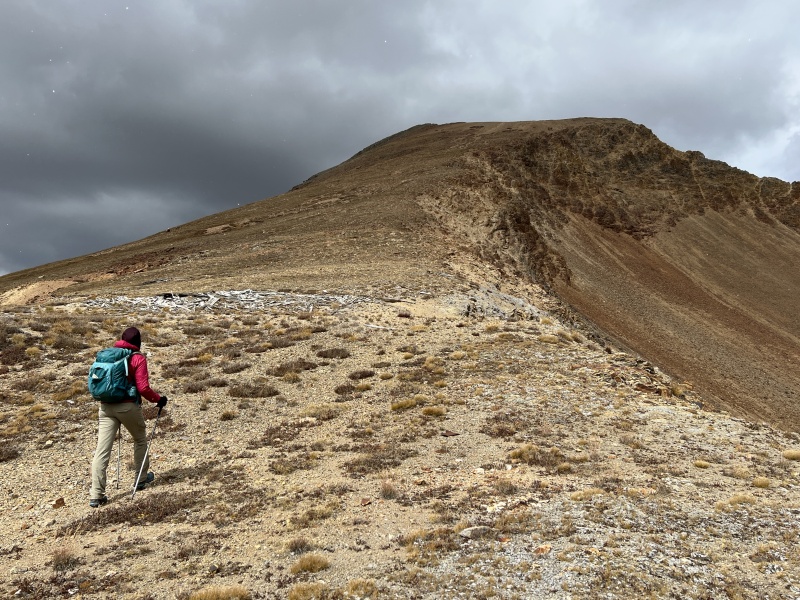
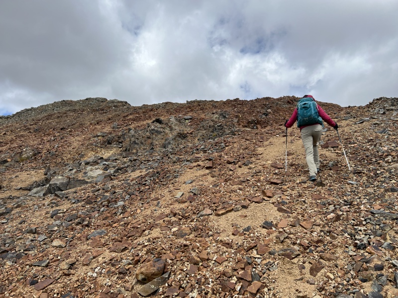
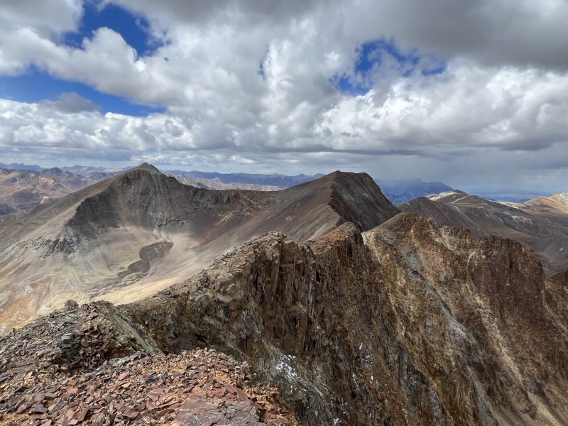
Heading to the right shoulderWe went up on the far right of the photoOn the ridge
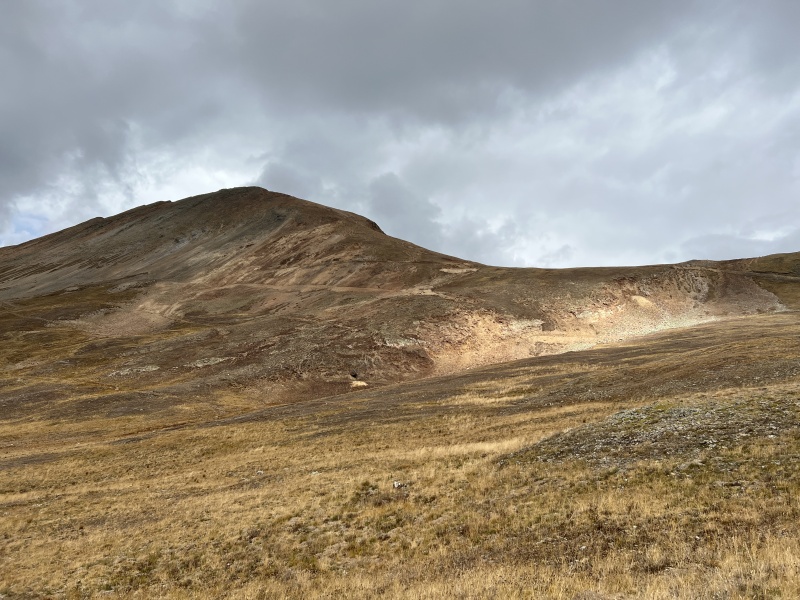
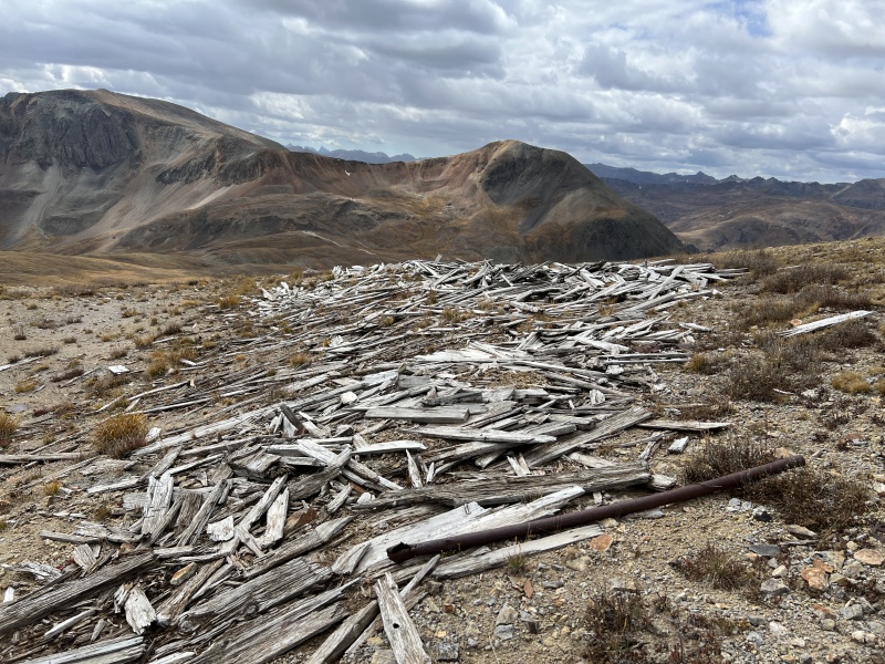
Cleveland GulchNear 13,100Flat remainsJust a walk up the peak
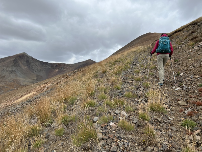
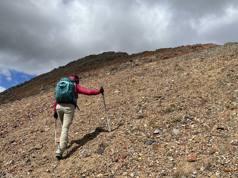
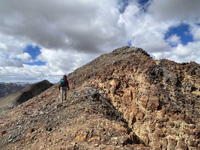
Loose gravel and dirtSummit comes into viewGetting close
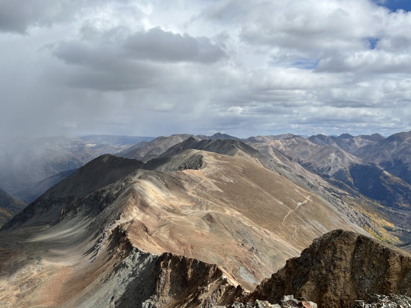
The summitSummit
We started out and just went up and over the bump across the street, behind the pass sign. We should have hiked down the road on the Silverton side about 100 yards to an old mining road. It is very obvious once you see it… just can’t see it from the parking lot.
Anyway, we headed toward the right shoulder of Wood to gain the lower ridge, which of course is an old mining road. On the ridge near 13,000. Followed it up to a flattened cabin or mining structure near 13,100. We got hit with some grapple a couple times, but nothing to worry about.
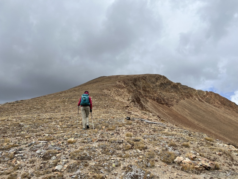
From the structure, it’s pretty much a straight ridge walk. Not much of a trail. Near 13,300 it becomes a loose gravel and dirt mixture. Not good for traction on the way up, but it made for a quick and easy descent. The top 50 feet became rocky, but still easy Class 2. Then the summit.
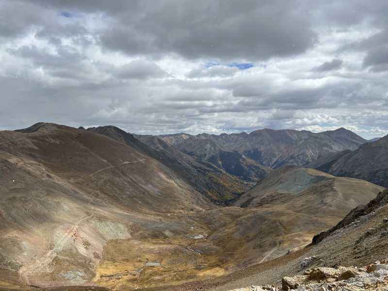
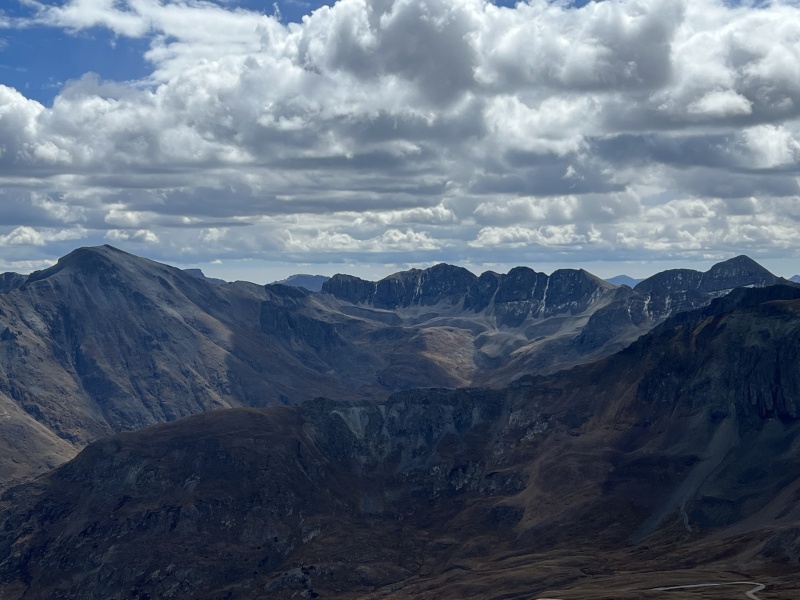
We spent about 10 minutes on the top. Watched a snow squall in the Henson Creek drainage that blocked out Uncompahgre. Thought about heading over to 13,708 and Animas Forks, but only thought about it.
We got out. Saw some peaks. Enjoyed the short hike. And decided to call it a lazy day. We were back to the Suburban in a total of 1 hour and 40 minutes. (about 2.5 miles)
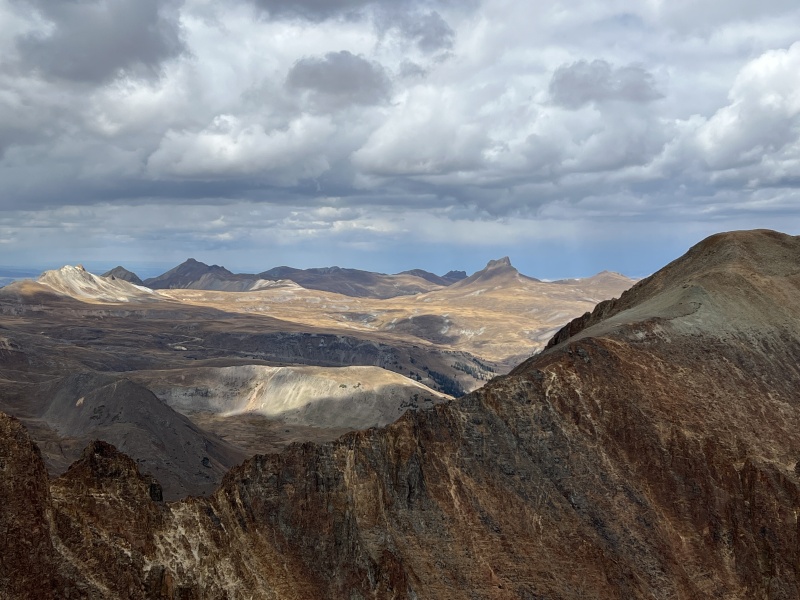
Wild Horse looks cool from everywhereAnimas and 13,708Was cool to watch the small storm
American Basin
Now, I know some would cringe at leaving some orphaned peaks on this hike. But the remaining peaks can be grabbed without having to resummit Wood. There is a trail, I assume an old mining trail or road, that bypasses the peak to the saddle with 13,708. You can see this on some of the GPX tracks or route maps people post. And hey, this is a great area to visit. So, why not come back.
I took some photos for a few people hanging out at the Cinnamon Pass sign, and spoke to the deputy before heading down. Once again, a very slow go.
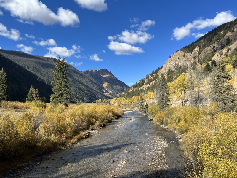
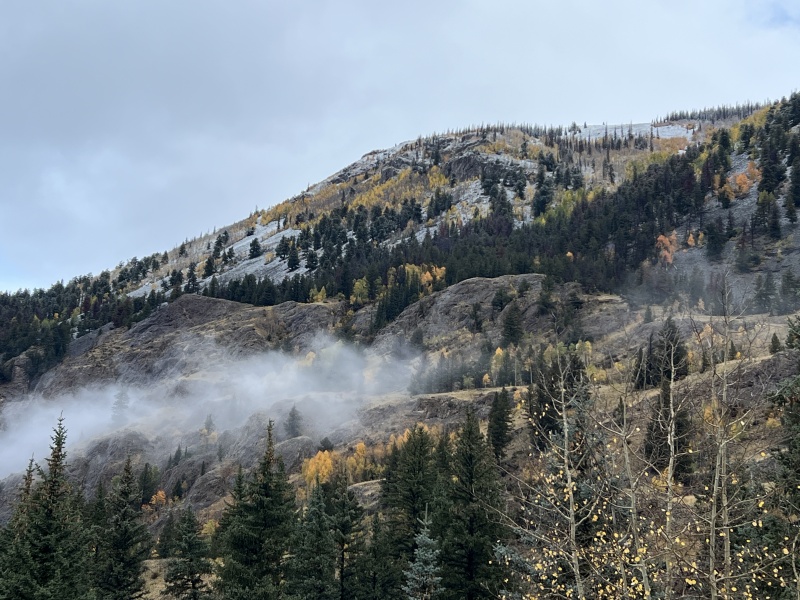
But the aspens were in prime color, so a beautiful drive.
If you are looking for another Cinnamon Pass Quicky, try Cinnamon Peak, 1.6 miles, 600 feet of gain. Up and down, with plenty of time for photos and snacks in 1.5 hours.
We stayed lazy, like a lot of people did this weekend. But others did grab some peaks. We had tentative plans for the Carson area, but that didn’t happen. On Saturday, we went for a short hike on Camp Trail (near and across the road from Williams Creek Campground.) It goes up behind the Camp Ozark / Camp Redcloud property and up to the Continental Divide. We did another 1,000 feet of gain in about 2.5 miles through some very nice aspen groves. Simply an enjoyable hike. Highly recommend it. We didn’t hit the top, but that’s ok.
Hung out at the campfire a bit on Saturday night. Sunday morning brought some great views with fresh snow. Everyone packed up and was gone. A good Gathering, but not large. Was good to see some familiar faces and meet some new people.
American Basin
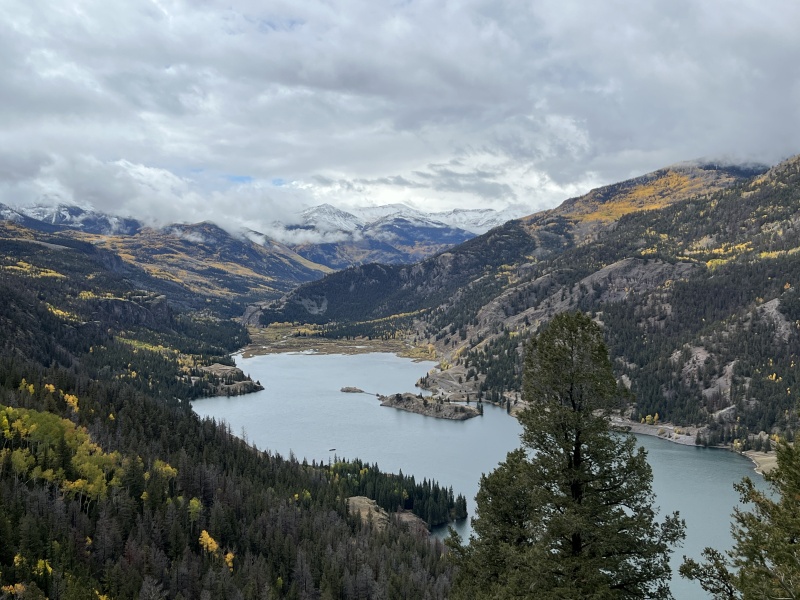
From camp, the route up SunshineAt campat campView from campLake San Cristobal on Sunday morningFrom Mill Creek Bridge on Sunday morning
Thumbnails for uploaded photos (click to open slideshow):
Joel, I was with a group on Jeeps dong the Alpine Loop on Saturday and definitely Cinnamon Pass was very different than your photos. It got quite a bit of snow. But still, such a great place! Beautiful photos!. Thank you.
I'm seeing a lot of clouds in your photos; glad the weather (mostly) cooperated with you.
Caution: The information contained in this report may not be accurate and should not be the only resource used in preparation for your climb. Failure to have the necessary experience, physical conditioning, supplies or equipment can result in injury or death. 14ers.com and the author(s) of this report provide no warranties, either express or implied, that the information provided is accurate or reliable. By using the information provided, you agree to indemnify and hold harmless 14ers.com and the report author(s) with respect to any claims and demands against them, including any attorney fees and expenses. Please read the 14ers.com Safety and Disclaimer pages for more information.
Please respect private property: 14ers.com supports the rights of private landowners to determine how and by whom their land will be used. In Colorado, it is your responsibility to determine if land is private and to obtain the appropriate permission before entering the property.


")
")
")
")
")
")
")
")
")
")
")
")
")
")
")
")
")
")
")
")
")
")
")
")
")
")
")
")
")
")
")
")
")
")
")
")