Download Agreement, Release, and Acknowledgement of Risk:
You (the person requesting this file download) fully understand mountain climbing ("Activity") involves risks and dangers of serious bodily injury, including permanent disability, paralysis, and death ("Risks") and you fully accept and assume all such risks and all responsibility for losses, costs, and damages you incur as a result of your participation in this Activity.
You acknowledge that information in the file you have chosen to download may not be accurate and may contain errors. You agree to assume all risks when using this information and agree to release and discharge 14ers.com, 14ers Inc. and the author(s) of such information (collectively, the "Released Parties").
You hereby discharge the Released Parties from all damages, actions, claims and liabilities of any nature, specifically including, but not limited to, damages, actions, claims and liabilities arising from or related to the negligence of the Released Parties. You further agree to indemnify, hold harmless and defend 14ers.com, 14ers Inc. and each of the other Released Parties from and against any loss, damage, liability and expense, including costs and attorney fees, incurred by 14ers.com, 14ers Inc. or any of the other Released Parties as a result of you using information provided on the 14ers.com or 14ers Inc. websites.
You have read this agreement, fully understand its terms and intend it to be a complete and unconditional release of all liability to the greatest extent allowed by law and agree that if any portion of this agreement is held to be invalid the balance, notwithstanding, shall continue in full force and effect.
By clicking "OK" you agree to these terms. If you DO NOT agree, click "Cancel"...
A Last-Minute Decision: Harvard-to-Columbia Non-Technical Ridge Traverse
Sign me up for exciting Class 3 and easy Class 4, especially for sustained lengths. That usually means avoiding the Sawatches. But the Harvard-Columbia Traverse along the ridge, with a handful of gully circumvents, offers a tasty and surprisingly enjoyable (though in retrospect) adventure. In retrospect, I say, because I wish I studied the route beyond making a Strava track based on the heatmap to better ascertain what is fun solid Class 3/4 versus loose sandy gully. This is in part a cautionary tale, because first, I traversed too many loose sandy gullies, which present conceivable dangers of large boulders becoming dislodged (hence I often breathlessly zig-zagged), and second spotty Strava tracks can lead to the blind leading the blind. Having said that, I, being solo, fully expected to either backtrack or descend to the main traverse; however I never felt the need to.
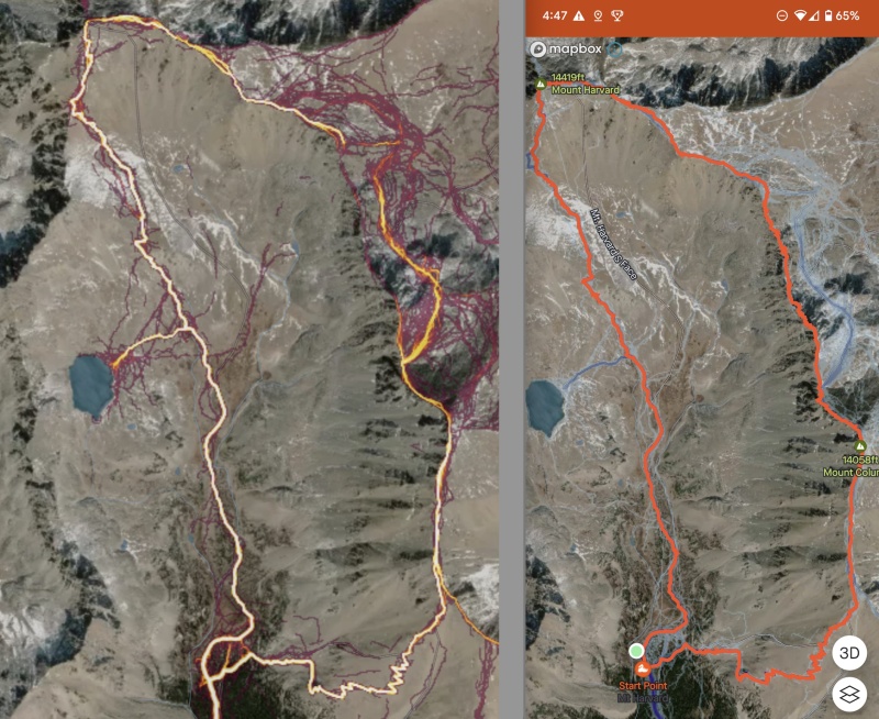
Here is my finished track (right) that follows very closely the spotty Strava track along the ridge. My downloaded track kept me on course, but I used reasonable judgement to not follow it exactly. I went clockwise.
I took a 30-hour midweek break day to drive out from the Front Range to enjoy peak fall colors (mostly along the drive) under close-to-ideal conditions before the freeze-thaw cycle ushers in shoulder season.
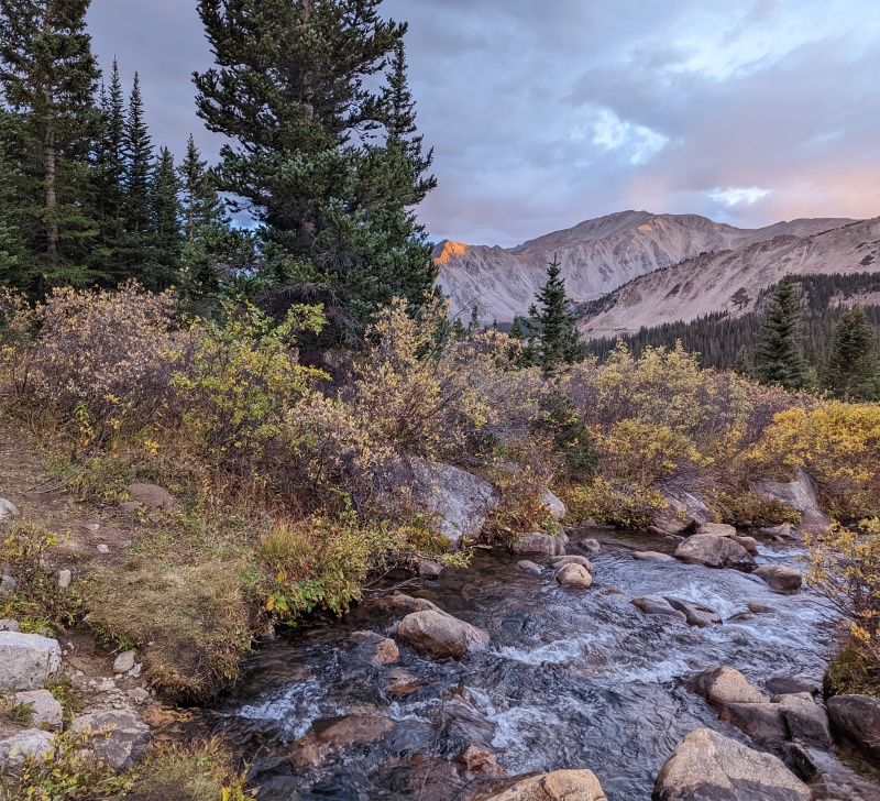
Up to N. Cottonwood Creek Trailhead.
Achieved setting up camp before sunset.
Sunset on Mt. Yale.
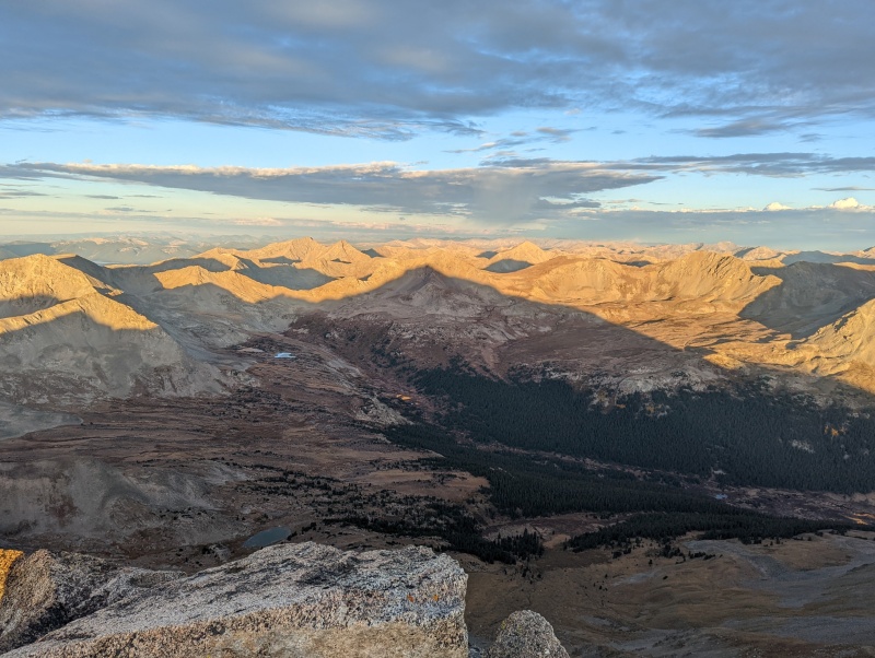
Harvard casts a long shadow.
Summited at about 7:30 am.
I mostly stayed on the east side due to my ignorance, thus missing a knife edge (apparently from other reports).
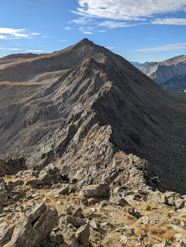
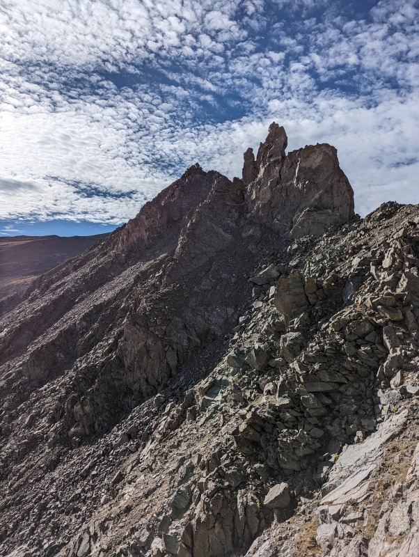
The highly eroded ridge looking toward Columbia.
The downclimb of the first portion of the ridge was continuously knee-buckling. Confidence dropped, but my endurance remained, so I continued. At one point, I felt not necessarily cliffed-out, but an exposed hard Class 4 descent lay before me, hence I back-tracked and found myself slogging across the loose gullies in no mood to take photos.
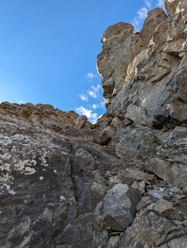
Soon spirits brightened as "The Rabbits" appeared along with more solid rock.
Better rock in sight.
Now things changed for the better, and the apprehension faded away.
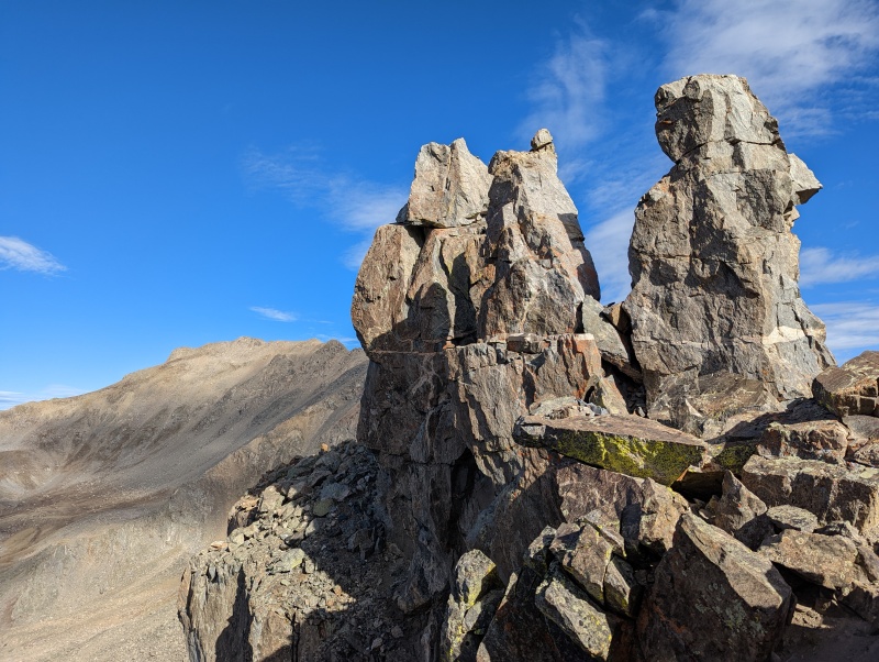
Rabbits above.Looking back.
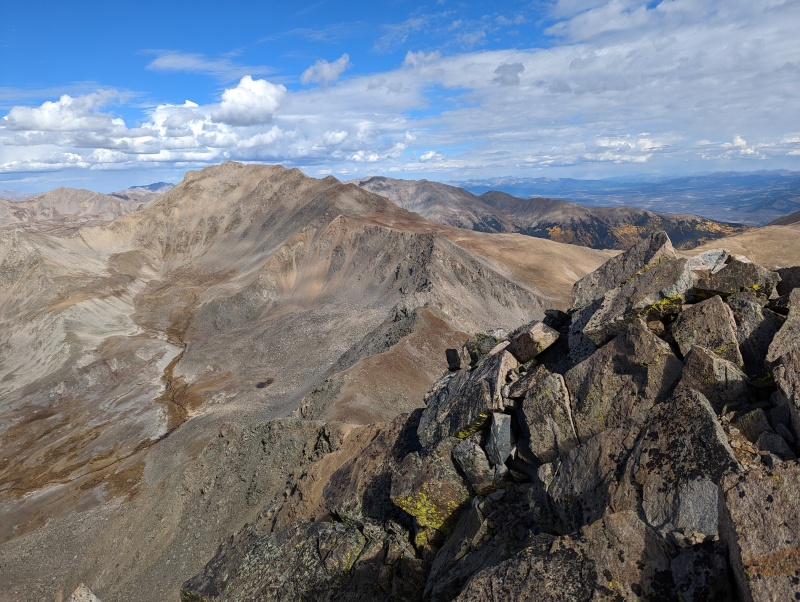
On top of Columbia after a torrid climb up the final 500 feet.
The Horn Fork Basin is quite barren.
I had visions of doing a marathon-length Antero, Tabeguash, Shavano circuit. Good thing I chose otherwise, because I'm both not in shape, and I would have probably encountered rain. Heard some thunder in the direction of Princeton.
Princeton drenched.
I wrote this report to say that if you enjoy adventurous scrambling but not technical climbing, the Harvard-Columbia ridge traverse is quite nice in ideal conditions. If I had it to do over again, I would do it with a buddy and study before hand. Most importantly, be aware of potential loose boulders!
Times- the traverse took 3 hours. I started at 5:05 am, and got to Columbia at 10:30, finishing the loop is 7:30.
My GPS Tracks on Google Maps (made from a .GPX file upload):
But this motivates me to carry an SLR with me, instead of my Pixel 6.
Caution: The information contained in this report may not be accurate and should not be the only resource used in preparation for your climb. Failure to have the necessary experience, physical conditioning, supplies or equipment can result in injury or death. 14ers.com and the author(s) of this report provide no warranties, either express or implied, that the information provided is accurate or reliable. By using the information provided, you agree to indemnify and hold harmless 14ers.com and the report author(s) with respect to any claims and demands against them, including any attorney fees and expenses. Please read the 14ers.com Safety and Disclaimer pages for more information.
Please respect private property: 14ers.com supports the rights of private landowners to determine how and by whom their land will be used. In Colorado, it is your responsibility to determine if land is private and to obtain the appropriate permission before entering the property.


")
")
")
")
")
")
")
")
")
")


