| Report Type | Full |
| Peak(s) |
Mt. Princeton - 14,200 feet |
| Date Posted | 02/06/2023 |
| Modified | 02/25/2023 |
| Date Climbed | 07/29/2022 |
| Author | ECF55 |
| Mt Princeton...From the Bottom! |
|---|
|
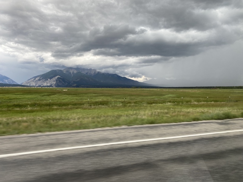
Mt Princeton From the Bottom - East Slopes Trail (Lower 2WD Trailhead) 29 July 2019 (Friday) Hike Times: 6:04am - 1:33pm MDT (7h 29min hike duration) Distance/Elevation: 13.46 miles / 5,594 ft (MapMyRun estimates) Mountain Conditions: Full summer conditions. Weather Conditions: Dry but with very active Monsoon conditions. Moderate temperatures. Partly cloudy in the morning and trending increasingly cloudy by mid-day. Downpours in the late afternoon. Crowds: Poplar. Encountered at least twenty hikers on the trail. Mt Princeton is a very impressive peak to behold. It rises abruptly out of the Arkansas Valley and towers over its immediate Sawatch neighbors due to the deep stream incisions immediately north and south of the massif. Roach calls it a singular mountain and a true monarch, and he recalls how the mountain stares you smack in the face for many miles as you descend into the valley and you cannot ignore its gaze. I think he's absolutely right. 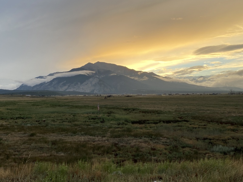
I first encountered Princeton in 2019 as we stopped for the night at the hot springs on our way back to Denver. I couldn't believe how close the mountain was to the pools, and similarly how the it just loomed over us. I knew I had to hike it some day. [Unfortunately for East Coasters like myself, "some day" turned out to be three years later. SARS-CoV-2 is for the birds.] In the run-up to the hike, I got it in my head that I needed to do Princeton from the bottom to maximize the challenge of summiting that beautiful mountain (hat tip to mnsebourn's "The Princeton Slog" for the seed kernel). Thoughts on whether it was worth it are at the bottom. [Note also that there are essentially no water sources on this hike, so take more than you think you will need because it's a pretty big day.] Mt Princeton Trip Report I got a very late start. Pre-hike jitters and noisy neighbors. Something went wrong with my alarm. Given the huge monsoon signal of the 2022 season, I feared that I had screwed up my big 14er hike for the season. Fortunately, I didn't have far to go from the hot springs, and after a quick 5 minute drive to the Lower 2WD Trailhead, I was on the "trail". 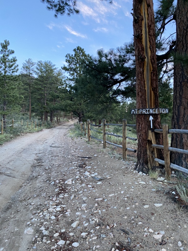
The Princeton approach is an odd one, consisting of a moderate gradient 4x4 mountain road that takes you slightly more than half way up the mountain. The road was generally single lane and rocky with some ruts and no room to pass, but it looked eminently navigable with a 4WD high clearance vehicle. The road acts as a service connector to the radio towers and also the Bristlecone Park Chalet at its terminus. 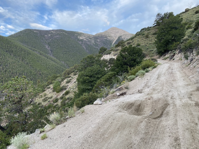
Hiking on this access road is generally boring and not particularly stressing, especially compared to some of the comically steep trails that I had just explored in the San Juans. These road miles can go really quickly, however. I knocked out the first three miles up to the Radio Towers in just under one hour (2000 ft, 19 minute miles) and the full 4.5 mile access road approach in 1h 40min (2900ft, 22 minute miles). I'm sure this full approach translated to less gas in the tank for my final summit push, but I have to say that I still felt strong and energetic once I hit the actual trail. As mentioned on this site, the actual trail finally peels off the 4x4 access road at about 11,800'. There is a nice granite staircase that curves off to the right. It's hard to miss. 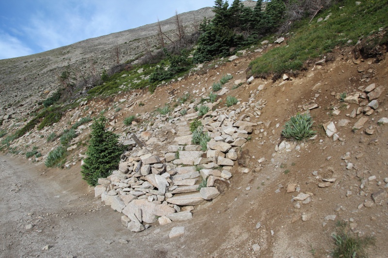
The next half mile of the hike is the most pleasant of the day where you get to hike on ACTUAL DIRT TRAIL! It was a great improvement over the access road. 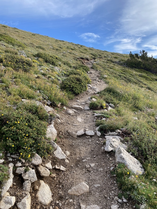
The dirt trail takes you around the base of Tigger, and before you know it, Princeton's east face comes into full view. There's still a substantial amount of elevation remaining, but you are well on your way. 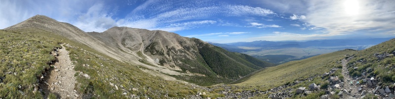
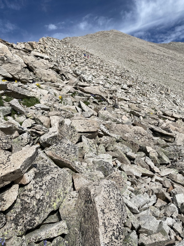
The trail works its way across the northern slope of Tigger Peak. This slope is fairly steep (it has avalanche risk in the winter) and is basically a giant talus field the whole way around. The rock is uniform granite of the Princeton Batholith; it's generally competent stone and fractures into cobble-to-boulder sized talus that litters the entire mountainside. Navigating the trail is a little tedious, but the rocks were pretty stable and slippage was not a huge problem (even if my overall pace dramatically slowed). 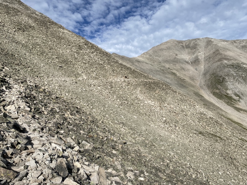
Eventually, the trail works its way towards the saddle between Tigger and Princeton. A switchbacking connector trail on hiker's left provides the easiest option to gain the ridge. There was minimal route-finding required in these summer conditions. 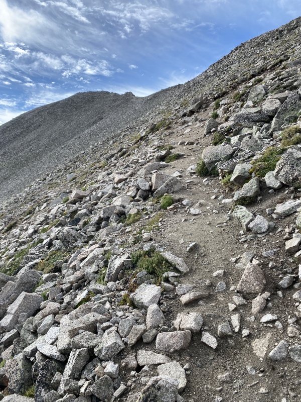
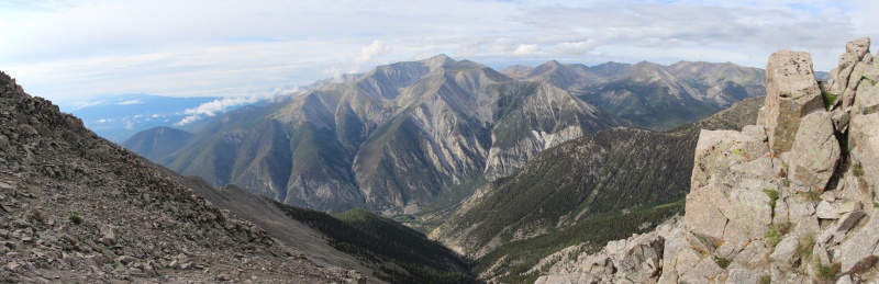
As you approach the ridge, it is important to stress that the entire hike up until this point has been largely in the Princeton east slopes amphitheater. There are two ridgelines that radiate from the peak and they essentially block all line-of-sight views to neighboring mountain peaks. While there are great views of Princeton, it's a gigantic wall of rock above an endless sea of talus and you have been looking at it for quite some time. Then, suddenly, without warning, you reach the ridge and before your eyes an entire new mountain landscape materializes, with Antero completely dominating the view like a hulking ship just beyond your reach. It was stunning and exhilarating. I let out an audible gasp at the beauty. The view is basically the ultimate reveal, the extreme exercise in delayed gratification. 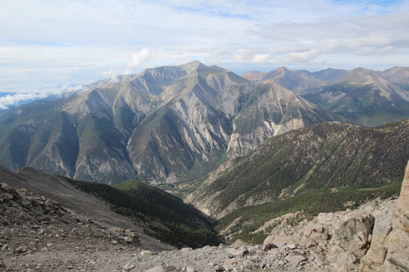
The remainder of the hike followed the ridgeline to the summit of Princeton. It's less than a mile, but you still need to gain another ~1200 ft. The terrain was typical of Princeton: fractured (but generally stable) granite rocks all the way to the summit. You have to work your way around a few obstacles, but the trail was easily manageable. The final several hundred feet of the hike steepens noticeably, but nothing exceeds Class 2 scrambles. 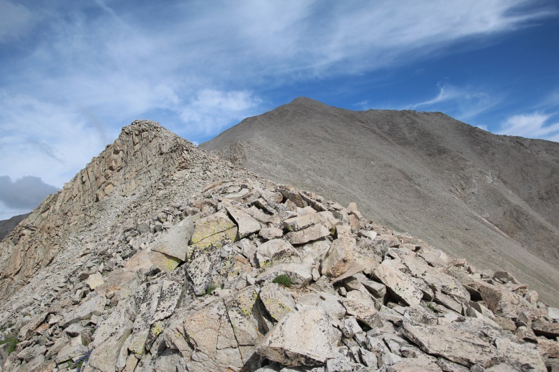
By the time that I reached the summit (~10:30am), the clouds were starting to roll in. Forecasts were predicting storms by 1-2pm, so I didn't linger very long. I was fortunate to get a few peeks through the clouds, but I'm sure the full view is much more enjoyable than what I experienced. 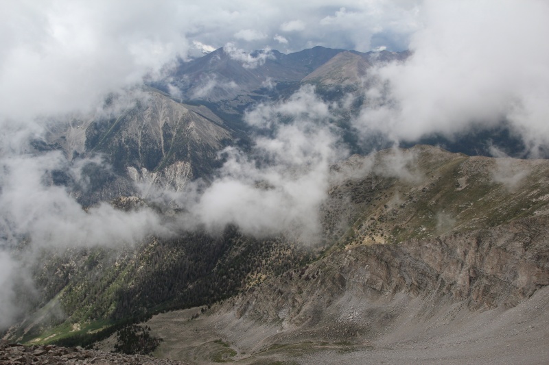
The return trip was uneventful, but my pace was limited on the talus given the uneven rocky terrain. Definitely long and moderately sloggy... The 4x4 access road on the way down was fast and boring. I was running late, so I double-timed it to the bottom in ~1h 15min (~17 minute miles). Princeton was my fastest pace of any high elevation peak hike, for sure. (Also of note: East Slopes is not really comparable to typical Colorado hikes due to its highly engineered access road that makes up over half of the hike.) 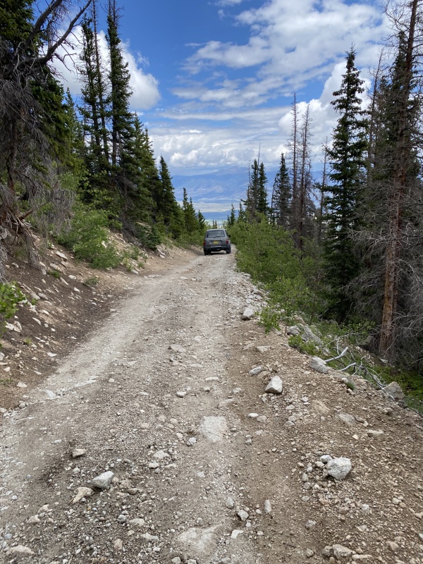
So is Princeton "From the Bottom" worth the effort? For me, the answer was yes, but not without qualifications. It's somehow simultaneously essential and superfluous. Princeton "From the Bottom" is a long, boring approach linked to an extended, tedious, talus-scrambling finish. Views on approach are fine but underwhelming. Princeton's eastern ridges tend to block all line-of-sight views to neighboring mountains, and Tigger initially blocks direct views to Princeton proper. Princeton itself does not really come into view until you finally round Tigger, and you still can't see its neighboring peaks until you clear the ridge. But WOW, does that view of Antero impress. If you consider the amount of time that hiking from the bottom adds to your day (versus driving to the radio towers), it's not as much as you might expect. I spent about 105 minutes hiking up to and down from the radio towers. If you assume 15-20 minutes of travel time each way in a car, then the net "cost" is a little more than an hour to add six miles and 2000ft elevation to your day. Who wouldn't want to bang out a 13 mile hike with over 5000 feet of elevation in a modest amount of time? The counter-arguments are valid. Engineers have done enormous amounts for work to dramatically decrease the difficulty of the approach. You are literally driving to the mountains to walk an additional six miles on an engineered surface! The views on the approach aren't worth the effort. Et cetera. Just bag the peak from the upper trailhead and move on. Others would mention that if you really want to hike Princeton from the bottom, then you should go non-standard and try the Grouse Canyon from the southwest. That route has it all, include route-finding, remoteness, Class 3 obstacles on ridges, and it climbs a similar height in about half the distance. Obviously, a huge day and probably not one to be done alone. Me, I settled for Princeton East Slopes "From the Bottom". It was the right thing for me at the time. And the next time I drive down US 24 near Buena Vista, I can look over at that Sawatch monarch and say, "You're damn right, I hiked that from the bottom!" Princeton vs. Yale or Elbert My list of Colorado 14ers is pretty short, but this was an easy one. If you have to chose your first Collegiate, start with Yale over Princeton. It's a much more balanced and enjoyable hike, and its summit talus section gives you a taste without overdoing it. If you need a Sawatch 5000 foot day, I would recommend Elbert SE Ridge [Black Cloud trailhead] heartily over Princeton. Elbert SE Ridge has the views all along the way to get you through that big day. Princeton is one of those peaks that's better to look at than to spend time on, unfortunately. But I'm glad I did it. Get out there! Thumbnails for uploaded photos (click to open slideshow): ")
")
")
")
")
")
")
")
")
")
")
")
")
")
")
")
")
")
")
")
")
")
")
")
")
")
")
|
| Comments or Questions | ||||||
|---|---|---|---|---|---|---|
|
Caution: The information contained in this report may not be accurate and should not be the only resource used in preparation for your climb. Failure to have the necessary experience, physical conditioning, supplies or equipment can result in injury or death. 14ers.com and the author(s) of this report provide no warranties, either express or implied, that the information provided is accurate or reliable. By using the information provided, you agree to indemnify and hold harmless 14ers.com and the report author(s) with respect to any claims and demands against them, including any attorney fees and expenses. Please read the 14ers.com Safety and Disclaimer pages for more information.
Please respect private property: 14ers.com supports the rights of private landowners to determine how and by whom their land will be used. In Colorado, it is your responsibility to determine if land is private and to obtain the appropriate permission before entering the property.

