Download Agreement, Release, and Acknowledgement of Risk:
You (the person requesting this file download) fully understand mountain climbing ("Activity") involves risks and dangers of serious bodily injury, including permanent disability, paralysis, and death ("Risks") and you fully accept and assume all such risks and all responsibility for losses, costs, and damages you incur as a result of your participation in this Activity.
You acknowledge that information in the file you have chosen to download may not be accurate and may contain errors. You agree to assume all risks when using this information and agree to release and discharge 14ers.com, 14ers Inc. and the author(s) of such information (collectively, the "Released Parties").
You hereby discharge the Released Parties from all damages, actions, claims and liabilities of any nature, specifically including, but not limited to, damages, actions, claims and liabilities arising from or related to the negligence of the Released Parties. You further agree to indemnify, hold harmless and defend 14ers.com, 14ers Inc. and each of the other Released Parties from and against any loss, damage, liability and expense, including costs and attorney fees, incurred by 14ers.com, 14ers Inc. or any of the other Released Parties as a result of you using information provided on the 14ers.com or 14ers Inc. websites.
You have read this agreement, fully understand its terms and intend it to be a complete and unconditional release of all liability to the greatest extent allowed by law and agree that if any portion of this agreement is held to be invalid the balance, notwithstanding, shall continue in full force and effect.
By clicking "OK" you agree to these terms. If you DO NOT agree, click "Cancel"...
Southwest Ridge via Grouse Canyon... Princeton's back door.
Mount Princeton: Southwest Ridge via Grouse Canyon
Miles: 6.6
Elevation gain: 5,097ft.
Note to reader: I am new to this web site and have never done a trip report before. I have also never before edited photos with Photoshop so please bear with me as I work this out. Any suggestion you might have on how to improve future reports will be considered. PM me with comments. Thanks.
I spent the week of the 4th of July avoiding the crowds I knew would be in the mountains, by the 9th I was a little stir crazy. I needed some peace of mind. Mount Princeton has been on my list of things to do for a month now so I decided to go for it. Preferring to climb less traveled routes the Southwest Ridge via Grouse Canyon had to be my choice.
I arrived at the unmarked Grouse Canyon trailhead at about 5:15am and was on the trail by 5:45am. From the small parking area at the trailhead I hiked northwest up the 4WD road for almost 0.2 mile to where old fallen trees near overhead power lines made it impassable to motor vehicles. The roadbed faded out into a winding well cairned path that quickly moved more westerly and uphill to the top of a small rise. At the top of this rise the trail turned abruptly right (north) and I followed it down to where it met Grouse Creek.
Following the east side of the creek closely the slightly overgrown path made it's way up the ever-narrowing canyon. As rock outcroppings rose to form the canyon walls, first to the right and then to the left, the trail became steeper as I climbed deeper into the canyon. Abruptly the shear canyon wall to the left came to an end at a place Lou Dawson describes as a rocky gate. Here at 9,800ft. the trail takes a hard right and I climbed uphill into an aspen grove.
About 80 yds. up the hill the trail turns sharply to the left as it crosses over a large fallen tree. Beyond this point the trail continues to gently climb north through Grouse Canyon paralleling the creek below to the left. I followed this trail though the aspen forest, after just a little over 0.3-mile I came out into a small clearing. Looking to my left I could see that I had passed a fork in the Creek and had moved into a smaller side drainage to the east of the maim drainage of Grouse Creek. There was a noticeably smaller stream in this drainage and I was now moving in more north-northeasterly direction.
I continued up the trail through the clearing entering into another stand of aspen, after a short distance the trail dropped down 15 ft. to the left into the overgrown streambed. Here at my feet I could see the source of the stream, a fair size spring emerging from the under growth. The trail made a hard right hand tune uphill into a dry gulch. I had now come a little over 0.6miles form the end of the 4WD road, and 0.8 mile from my vehicle.
A short distance (about 25 yds.) up from the spring as the under growth clears there is an unnecessary switchback up to the right and out of the bottom of this steep sided gulch. I mistakenly took this side trail only to find that it rejoined the well-worn trail in the bottom of this drainage. I walked up this drainage observing several cairns along the way marking an already well-defined trail and wondered why someone had taken the time to build them. The forest on either side of the gulch thinned as I progressed and I sited a few elk on the hillside.
About 0.4 mile above the spring I came to a large boulder in the gully with a cairn on top of it, the elevation here is about 11,000ft. Beyond this point I could see a large talus field up to my right. I continued to move up the drainage skirting around the base of the talus field to its end where the path jogged to the left and then continued on up the drainage. About 0.5 mile up from lower end of the talus field I came to the last group of trees in the gulch at 11.900ft.
Upon reaching the last group of trees in the gulch I traversed to left and climbed up and out of the drainage towards the last group of trees on the top of the rib to the north of me, about 0.1mile. The views from this point (about 12,200ft.) were the best yet. To the north I could see the entire upper basin of Grouse Creek, to the southwest I could see across lower end of Grouse Creek down into Chalk Creek. My view to the east was dominated be Princeton's southwest ridge from point 13,971 at its north end to the heard of goats on its southern most flanks. I lingered here a while studying my route to the top of the ridge and enjoying the view.
I followed the crest of this rib as it climbed in a sweeping easterly ark towards the ridge. As I drew closer to the ridge it became clear to me that west face of the upper part of the ridge was covered with loose scree thus making it more difficult to take the ridge via a direct approach. I traversed to the right and took the ridge at about the 13,000ft. point at 8:45 am. I had covered another 0.3 mile. The views from here improved again dramatically. Form this vantage point I caught my first glimpse of Princeton to the northeast. To the east I could now see down into Cascade Canyon, to the south I could see Antero's northern flanks. Being just a little excited about the next part of the climb I moved on quickly.
The first 230 yds. of the ridge was an easy class 2 climb. Along the way I got a good view of the next section. I could see that to stay on the top of the ridge I would have to do a short exposed class three pitch, I also had the option of taking a class 2+ lower line around the right side of the ridge. I decided to do both. First I moved toward the lower line, it proved to be a fractured but relatively solid and well sloped rock face. This line ended 140 yds. ahead at a 10 ft. drop off into loose scree filled gully. This gully ran the length of the slope and ended at a small notch in the ridge. Not wanting to have to dog paddle up the loose scree in the gully I decided take a short class 3 pitch up to the top of the ridge where I crossed over to the other side and made my way on solid rock safely down into the notch. The elevation here was roughly 13,300ft. On my return trip through this section I took the ridge all the way to the lower class 3 pitch and down climbed it. In the end this section proved the most interesting climbing on the whole trip.
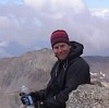
From the notch it was an easy 0.5-mile class 2 climb to the top of Point 13,971. From here I had a good view of the 0.5-mile connecting east-west ridge that ran between Point 13,971 and the summit of Mount Princeton. I climbed down to the connecting ridge and made my way to the top of Princeton, another easy class 2 section. I summated at 10:15 am.
I spent about an hour on the summit eating and visiting with other climbers. The views this particular morning were hazy from the wild fires to the west nonetheless I enjoyed them. All to soon the building clouds told me it was time to move on.
I spent great deal of time on my return trip taking photos and making notes for this report. Unfortunately the goats had moved on and the elk were being shy, I guess I should not have taken their presence or granted earlier. I arriver back at my vehicle at 3:50 pm.
In summation I will say that I got exactly what I was looking for. Peace of mind. Other than the occasional downed tree(s) the trail was easy going and other than the few I met on the summit I had the route all to myself. Another GOOD day in the Colorado high country!
Thumbnails for uploaded photos (click to open slideshow):
thank you SO very much, pictures especially. this route is on my winter list and you just saved me a day on recon this fall! got any other pics around treeline? thanks again
Princeton SW Ridge via Grouse Canyon 7/14/2008 12:49pm
I can vouch for the accuracy of this trip report. Four of us followed this route with frequent references to the printed TR. The descriptions and photographs made route finding easy. We made only one short accidental off route excursion.
The described 3rd class pitch is not difficult and I would recommend it over the scree. Further up the south west ridge, there are places where a slip would not be a good thing, and at points we found ourselves, chest to the rock, hands searching for grips, traversing above small snow fields with no safe run outs. For me, those were the most interesting sections on the ridge. The scenery is fantastic after you pass the talus field at the top of the dry gulch. We did a car shuttle, leaving one on Mt. Princeton Rd. near the radio towers. We came down by the standard trail. That route is 6.2 miles from Grouse Canyon to the Radio Towers and 4,897 elevation gain.
We saw no one until we reached the summit.
Back in July of 2010 I went with a group of friends and we went off trail badly. It was my first 14er attempted and we only made it to about 13000 before we turned back. Good Job though. I think I am going to try this route again some time hopefully.
Will definitely agree with the above recommendations of this route over the standard. On a recent ”Tour de Princeton” with my friend Judy we had no problems following this route up. The crux area has ample holds. The exposure off 13,971 was exhilarating. The standard route heading back to the radio towers road was the least fun part of our route. Big shout outs to the following:
Judy - Big kudos on your 1st Class 3!
Celeste - Nice chatting with you on the summit - Keep climbing!
Morgan - Thanks again for the ride from Frontier Ranch... we were done!
Caution: The information contained in this report may not be accurate and should not be the only resource used in preparation for your climb. Failure to have the necessary experience, physical conditioning, supplies or equipment can result in injury or death. 14ers.com and the author(s) of this report provide no warranties, either express or implied, that the information provided is accurate or reliable. By using the information provided, you agree to indemnify and hold harmless 14ers.com and the report author(s) with respect to any claims and demands against them, including any attorney fees and expenses. Please read the 14ers.com Safety and Disclaimer pages for more information.
Please respect private property: 14ers.com supports the rights of private landowners to determine how and by whom their land will be used. In Colorado, it is your responsibility to determine if land is private and to obtain the appropriate permission before entering the property.