| Report Type | Full |
| Peak(s) |
Maroon Peak - 14,163 feet North Maroon Peak - 14,022 feet |
| Date Posted | 09/08/2022 |
| Date Climbed | 08/29/2022 |
| Author | 123tqb |
| A Great Traverse! |
|---|
|
A Great Traverse!
Earlier in the summer Peter offered up a reservation for parking at Maroon Lake, a chance I couldn't pass up considering it was on a Monday (a.k.a. my Saturday since I got M/T off of work). I knew it'd be my chance to attempt the Bells Traverse before moving to Europe a few months later, so I took my time trying to find partners and mentally prepare for what would be the most technically-difficult unroped route I'd ever done. Evan was the only person to take up the offer due to the school year starting, which I was especially glad to hear considering he had already done (most of) the NE Ridge on North Maroon and would know (most of) the downclimb. We decided to camp near Aspen the night before and very easily found an open dispersed site in the Lincoln Creek area. I got the chance to test out my new 35-degree summer sleeping bag under the stars, leading to a bit of shivering in the near-freezing, humid air that night, but overall not too bad. Waking up at 4:00 had never been easier! We weren't sure how to confirm our reservation with the station unmanned, so we left our reservation number and Peter's name on the dash to prevent the need for a parking ticket. We set off on the trail, and ten minutes later were headed in the complete opposite direction from where we should have been going. Turns out we missed the very-obvious signage and kept going around Maroon Lake. Oops! We backtracked quickly and got on the trail to Crater Lake not long after. About an hour later we found ourselves in a very similar situation, missing the turnoff to start up the Green Slope. Oops again! We decided to head straight up the slope, meeting the approach trail on our way. We chalked up our navigational errors to the productive conversation we'd been having, making a mental note to turn on our routefinding brains once we made it to the actual ridge. 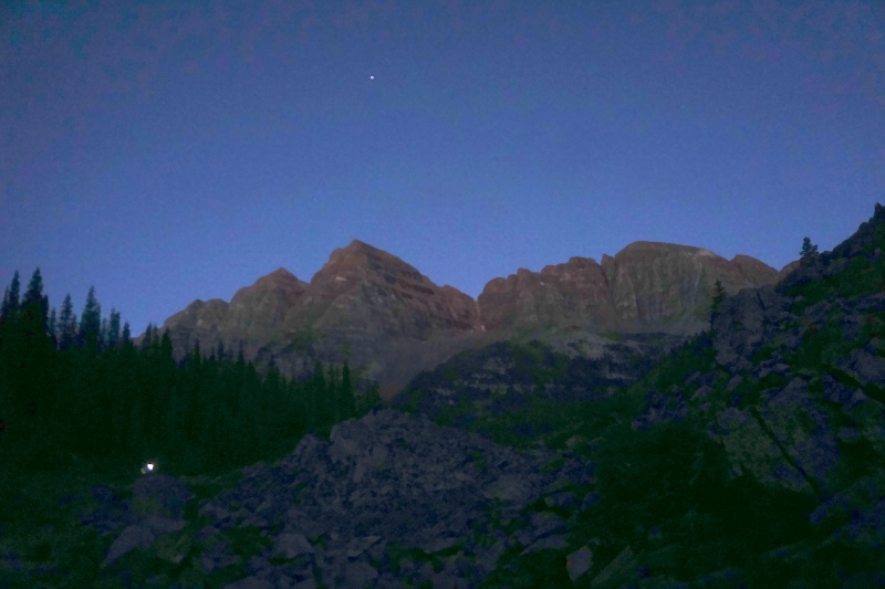
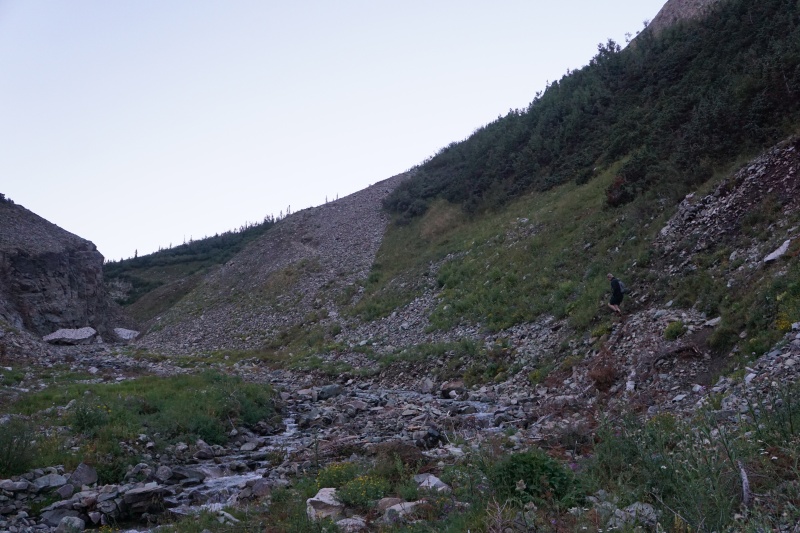
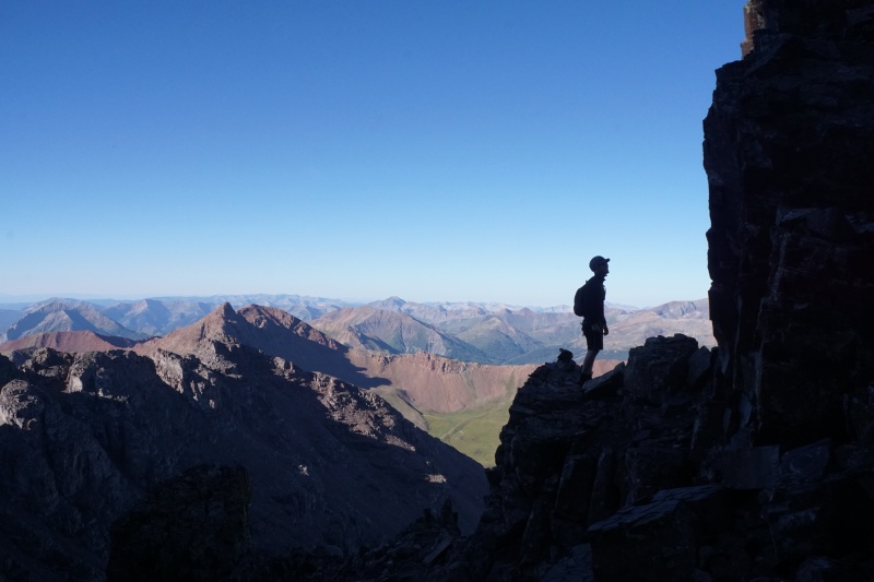
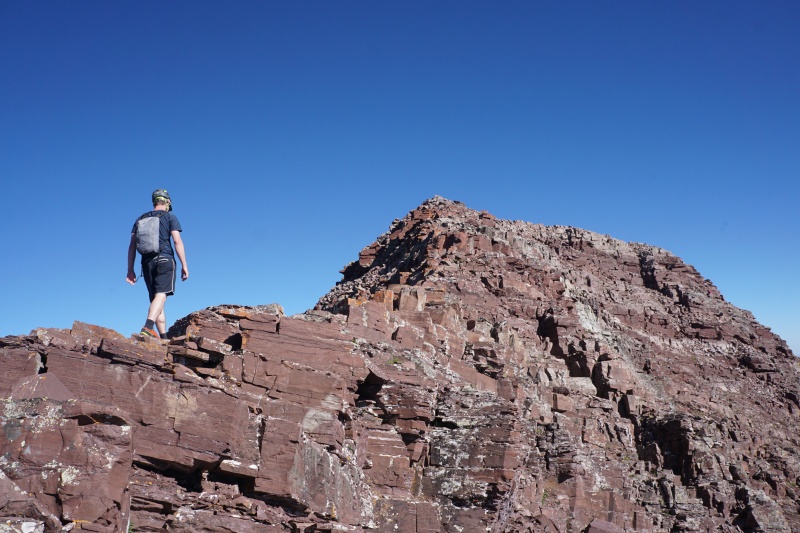
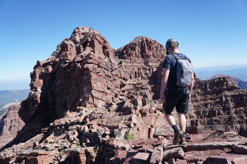
Despite our slowed-down pace up the Green Slope, we knew that once the actual scrambling began we'd be moving much faster. The slope did take a while, and we weren't afraid to take good, long breaks. Before long, however, we'd made it to the notch on the south ridge. While Evan pulled out some tasty cheese I took some grainy photos towards Capitol and Snowmass. We discussed how we really needed to start paying attention now, and couldn't get sidetracked by conversation again! The scrambling was about to begin! 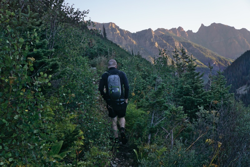
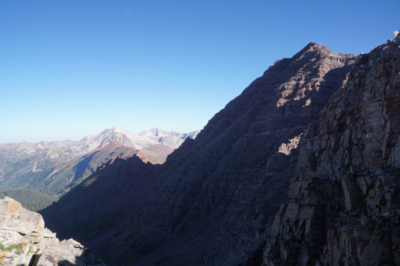
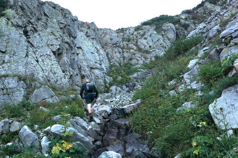
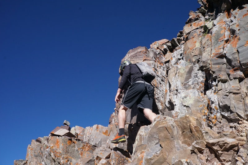
Before we knew it we were at the first tricky bit, which went by in the blink of an eye. Not long after came the loose gullies. We watched the group ahead of us ascend the left option (labeled Gully #2 in the route description). We followed, opting for the climber's left side on solid rock. I could definitely see why it would be dangerous to be below another party in this section, even hearing some random rockfall the second we were safely on the ledges! We dipped left a tad too early, following false cairns, forcing us to make a few exposed Class 3 moves on less-traveled terrain. If I were to do it again I'd go further up the gully, but in the end I can't be too upset because nothing seemed unnecessarily dangerous or difficult. We were back on-route pretty quickly. 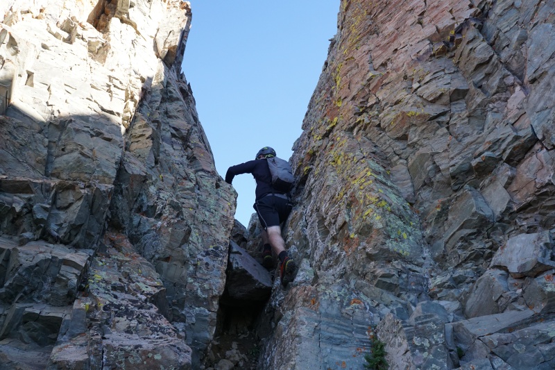
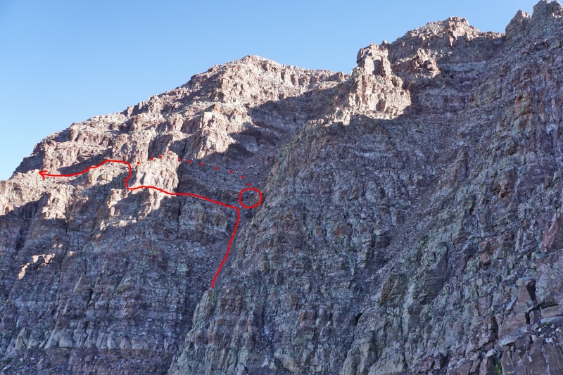
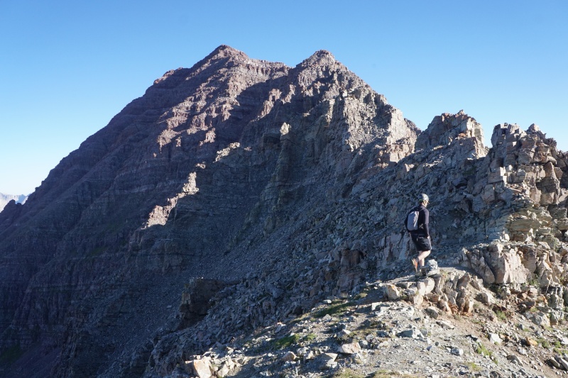
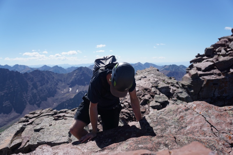
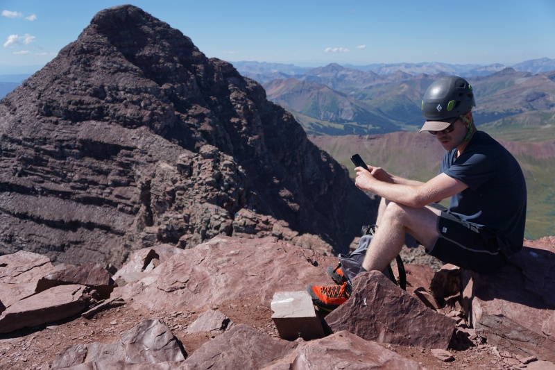
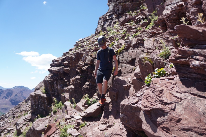
Everything went very smoothly, all the way through the next loose gully. The gully to ourselves, we made it to the notch and continued climber's left. Above here the route was a bit more tricky to find, but we weren't too concerned. We cut back onto the ridge a little early, but again encountered nothing above Class 3. We ducked behind a gendarme-of-sorts along the ridge before we found cairns again, and moved quickly all the way to the summit. In review, the route up South Maroon was more solid than I'd thought, had not-too-bad routefinding, and went WAY faster than I'd expected! We were standing at the highest point of the day at 9:30 with nothing but clear skies and fun ahead! 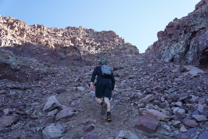
The route so far had been easier than expected, and hopes were high. Sure, the gullies on the way up were fairly loose, but in my personal opinion the looseness was overstated. We spent some time on the summit, refueling, re-hydrating, and talking to the other two groups who had just done the ascent. Then Evan and I talked over the difficulties ahead and set off downhill. 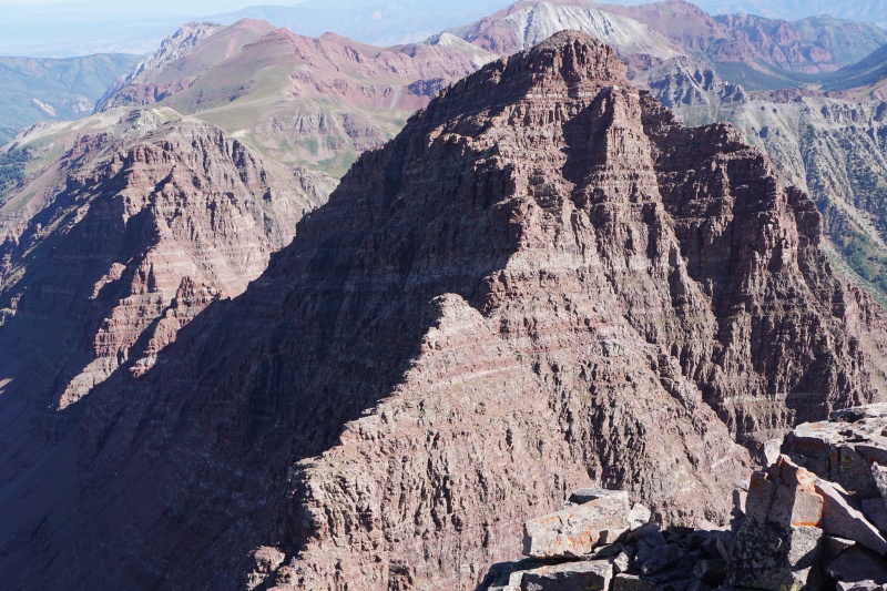
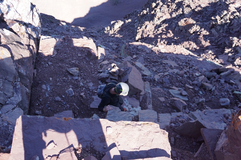
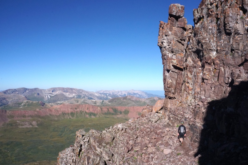
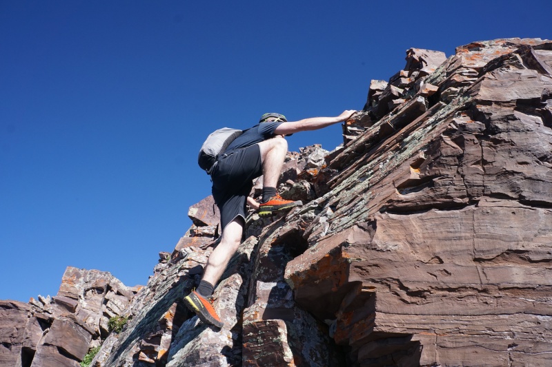
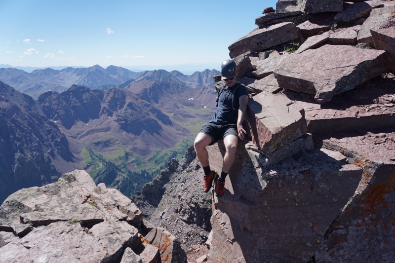
The downclimbs of the cliff bands on the north face of Maroon went by without trouble, all the way to Bell Cord Couloir. Across the couloir we could see a group of three with ropes, we (correctly) guessed it was a guide and two clients. I felt that the wall leading out of the couloir was only Class 3, at least the way we did it by going around to climber's left. First difficulty, done. 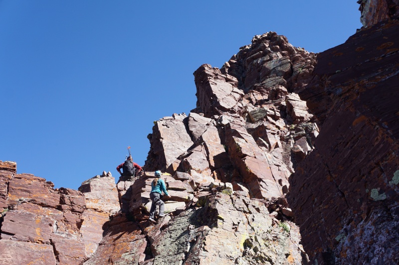
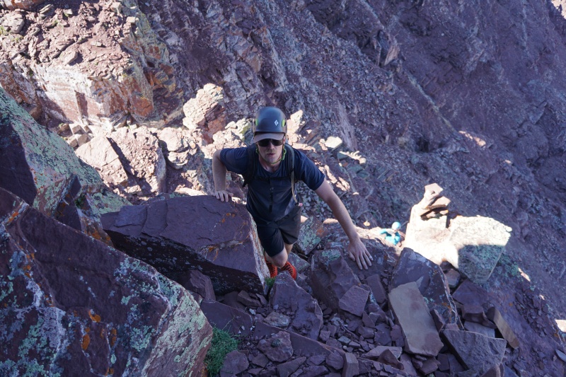
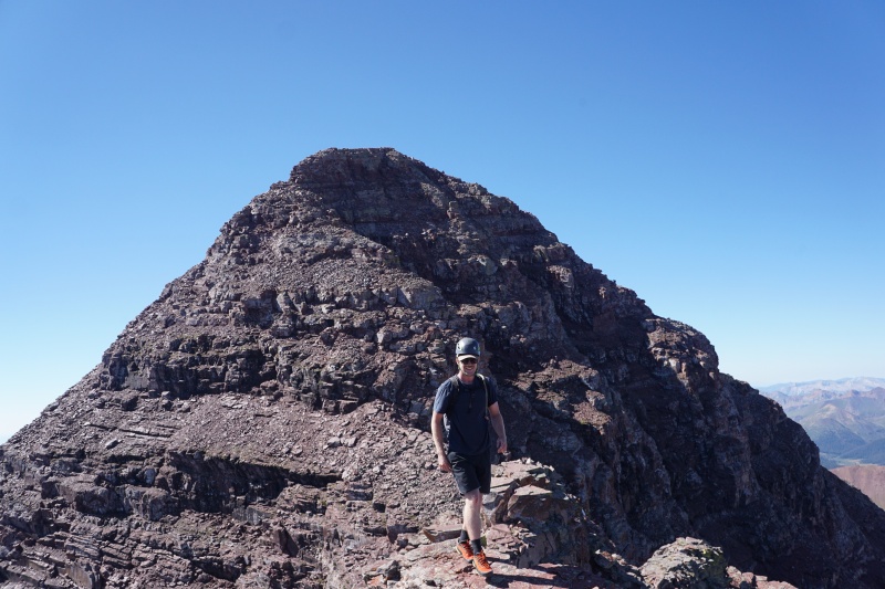
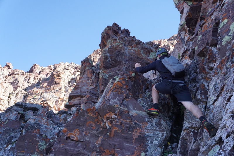
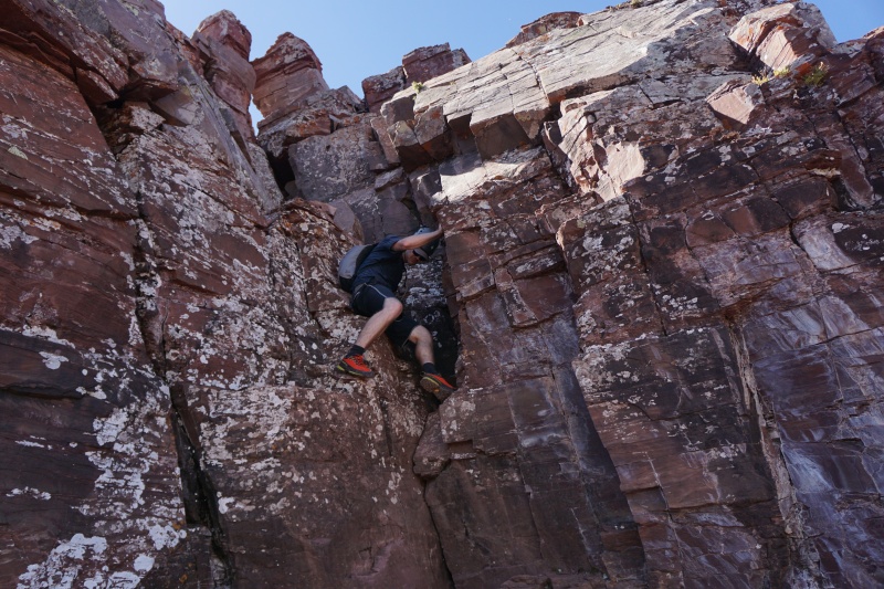
Arriving at the next difficulty we passed the group of three, who were beginning to rope up for the Class 5.2 section ahead. It was a juggy cruise up solid rock, couldn't complain! Very soon we were at the third, and most technical (5.4 to us), difficulty. Evan chose the chimney option while I stuck to a face to its left. Again before we knew it, all the difficulties were past us, and we only had Class 4 ridge ahead! We were both genuinely surprised at how quickly it all went by, and at 11:15 we were on the summit of North Maroon. 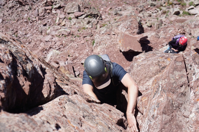
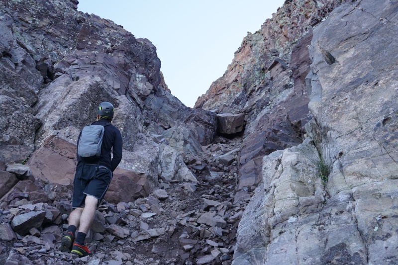
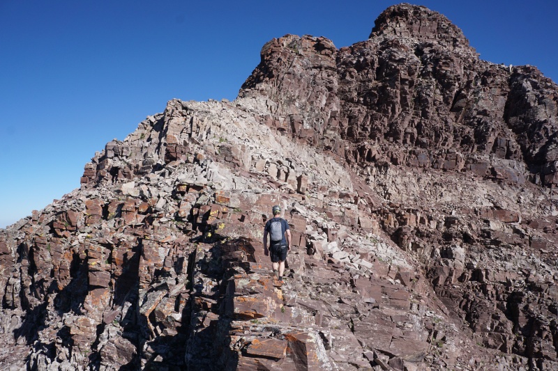
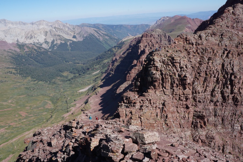
We sat and chatted with the other groups on the summit of North Maroon for a good few minutes while we rested up for the descent. Evan had already done this part of the route before (minus the actual summit pitch, due to weather reasons), so we felt confident in our abilities to finish up the downclimb without any errors. It was at this point that I began to notice how much pain my toes were in, since I was borrowing a pair of shoes for the day that fit a bit too small. I was pretty ready to be done with the climb, all the "cool parts" already behind us. We trudged on downhill, knowing that sooner or later it'd be over. We talked about the climb, Pyramid Peak, other climbs we had planned, and a thousand other things while my pain got worse and worse. But eventually, we did make it. Warm parking lot beer never tasted so good! 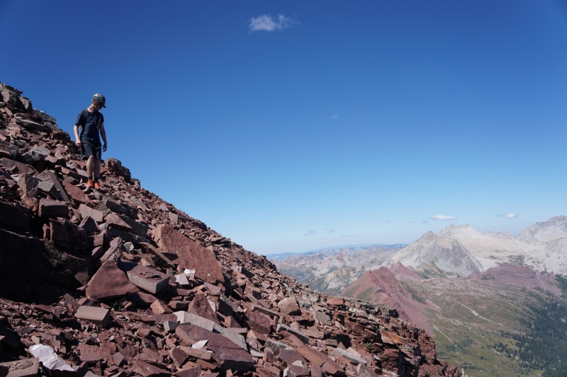
Thumbnails for uploaded photos (click to open slideshow): ")
")
")
")
")
")
")
")
")
")
")
")
")
")
")
")
")
")
")
")
")
")
")
")
")
")
")
")
")
")
")
")
|
| Comments or Questions | ||||||
|---|---|---|---|---|---|---|
|
Caution: The information contained in this report may not be accurate and should not be the only resource used in preparation for your climb. Failure to have the necessary experience, physical conditioning, supplies or equipment can result in injury or death. 14ers.com and the author(s) of this report provide no warranties, either express or implied, that the information provided is accurate or reliable. By using the information provided, you agree to indemnify and hold harmless 14ers.com and the report author(s) with respect to any claims and demands against them, including any attorney fees and expenses. Please read the 14ers.com Safety and Disclaimer pages for more information.
Please respect private property: 14ers.com supports the rights of private landowners to determine how and by whom their land will be used. In Colorado, it is your responsibility to determine if land is private and to obtain the appropriate permission before entering the property.


