Download Agreement, Release, and Acknowledgement of Risk:
You (the person requesting this file download) fully understand mountain climbing ("Activity") involves risks and dangers of serious bodily injury, including permanent disability, paralysis, and death ("Risks") and you fully accept and assume all such risks and all responsibility for losses, costs, and damages you incur as a result of your participation in this Activity.
You acknowledge that information in the file you have chosen to download may not be accurate and may contain errors. You agree to assume all risks when using this information and agree to release and discharge 14ers.com, 14ers Inc. and the author(s) of such information (collectively, the "Released Parties").
You hereby discharge the Released Parties from all damages, actions, claims and liabilities of any nature, specifically including, but not limited to, damages, actions, claims and liabilities arising from or related to the negligence of the Released Parties. You further agree to indemnify, hold harmless and defend 14ers.com, 14ers Inc. and each of the other Released Parties from and against any loss, damage, liability and expense, including costs and attorney fees, incurred by 14ers.com, 14ers Inc. or any of the other Released Parties as a result of you using information provided on the 14ers.com or 14ers Inc. websites.
You have read this agreement, fully understand its terms and intend it to be a complete and unconditional release of all liability to the greatest extent allowed by law and agree that if any portion of this agreement is held to be invalid the balance, notwithstanding, shall continue in full force and effect.
By clicking "OK" you agree to these terms. If you DO NOT agree, click "Cancel"...
Sunday, August 14, 2022. Having completed the 13ers in the Huerfano River area of the Sangre de Cristos, the next goal for Randy and me was Eagle Peak (13,205'), our northernmost unclimbed 13er in the Sangres. There are a variety of ways to approach Eagle Peak which depend at least in part on how tolerant you and your vehicle are of driving over bowling ball-sized rocks.
The first three miles of County Road 198 are suitable for any passenger vehicle. One possible approach to Eagle Peak is to turn south onto Forest Road 337 and bushwhack from the Duckett Creek (aka South Brush Creek) trailhead. A big downside is that this trailhead is at only 8540'.
Continuing west on Forest Road 198 past Rainbow Trail Camp requires a high-clearance vehicle. At latitude 38.2617 and longitude -105.6996 at 9800', leaving FR 198 and bushwhacking SSW eventually will get you onto Eagle Peak's long, gentle north ridge.
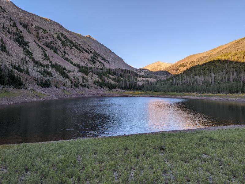
A third starting point is Rainbow Lake (elevation: approximately 10,340'). Our initial plan was to drive to a campsite at Rainbow Lake, but after a couple of miles of slow, bone-rattling travel we stopped at a lower campsite after realizing that we could walk the road as fast as we were driving it.
From Rainbow Lake, you can take the hard way to reach Eagle Peak's north ridge (like we did), or you can take the easy way. Details to follow. (Hint: you'll want to take the easy way.)
Monday, August 15, 2022.
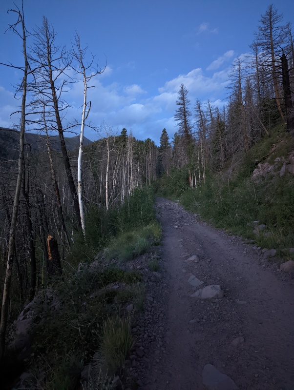
Randy and I started hiking up FR 198 toward Rainbow Lake. At times, the road wasn't particularly rough and made us question our decision to park where we did. Those questions quickly dissipated when we reached the inevitable rough sections.
FR 198 looks relatively tame here, but don't let that fool you. Much rougher sections await.
From a designated campsite on FR 198 just NW of Rainbow Lake, we walked east past the north side of Rainbow Lake and then looked for a way up the hillside to the ridge east of Rainbow Lake. It was steep and not particularly pleasant.
When we descended from Eagle Peak, we discovered that our ascent route was the hard way. We also discovered the easy way, which I'll describe later so you can avoid the hard way and take the easy way instead.
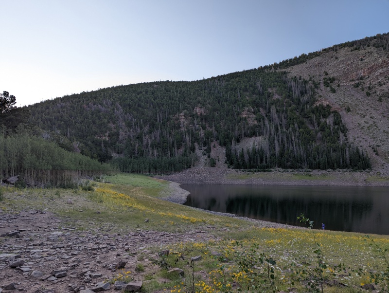
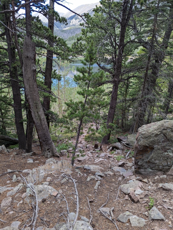
The north end of Rainbow Lake, with the north ridge of Eagle Peak rising to the east of the lake
Looking south from just north of Rainbow Lake
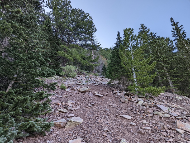
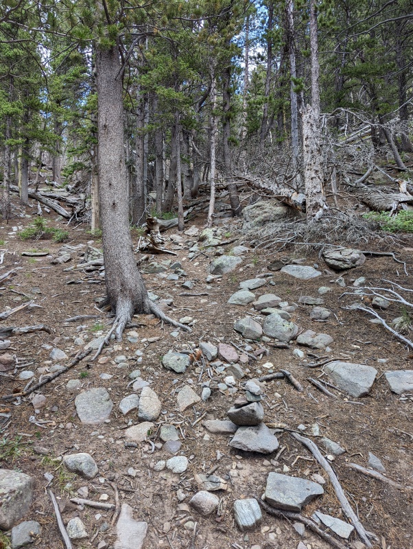
When we climbed onto the north ridge of Eagle Peak, we were surprised to find what appeared to be a constructed trail
The trail ended at treeline, but you don't need a trail above treeline anyway
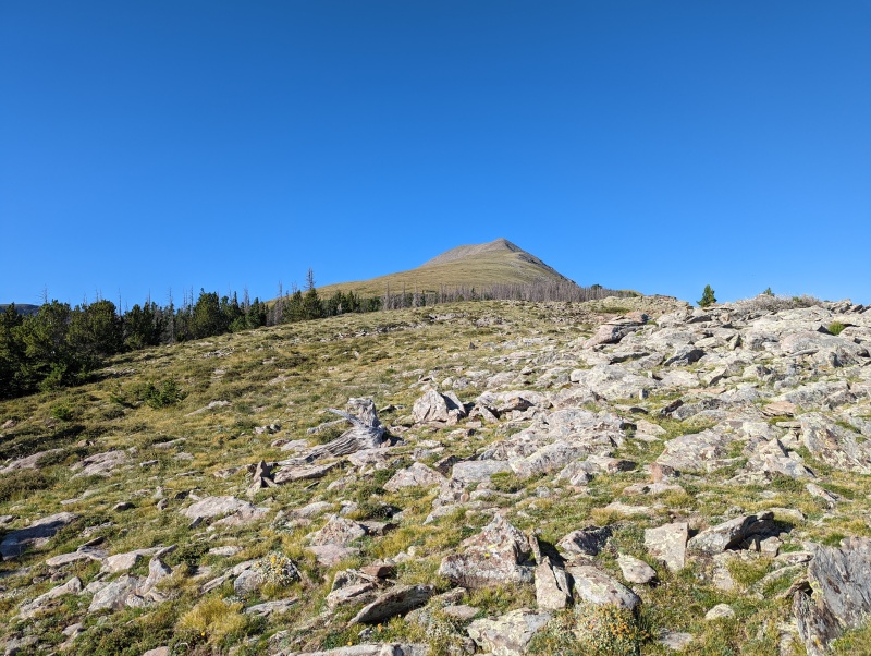
Looking down the north ridge of Eagle Peak from just above treeline. Above the trees, it's hard to get lost
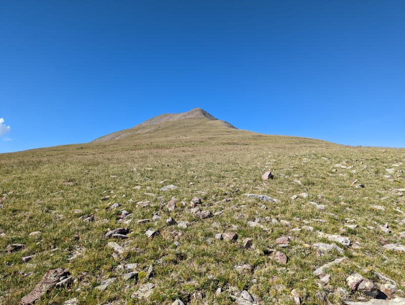
It's an easy hike south up the tundra toward Eagle Peak
A steady climb brought us to the summit of Eagle Peak, where we found an increasingly rare Colorado Mountain Club summit register.
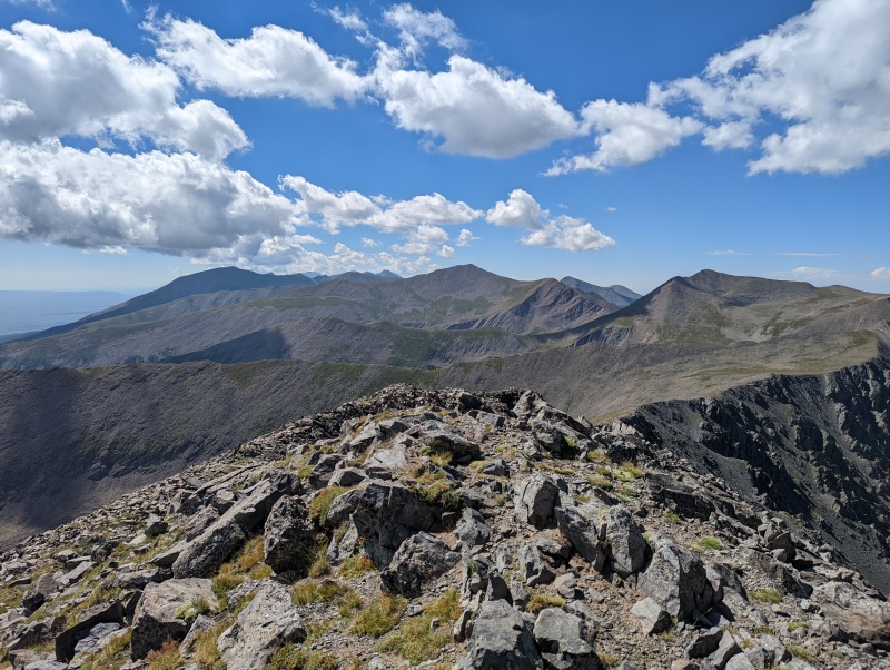
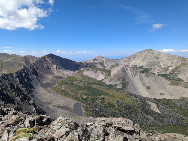
Looking south from the summit of Eagle Peak. Electric Peak is near the center, with Lakes Peak to the right.
Looking west from the summit of Eagle Peak. Cottonwood Peak is the tall one on the right, and Thirsty Peak is on the left.
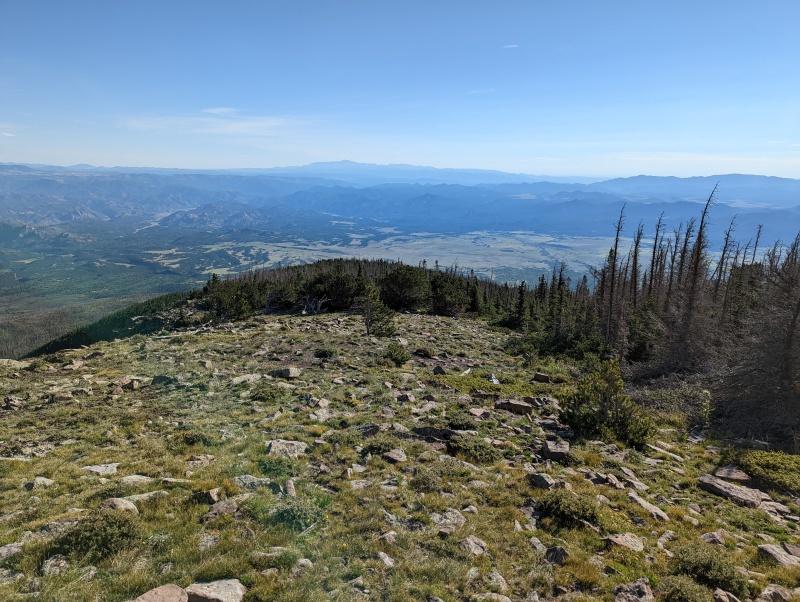
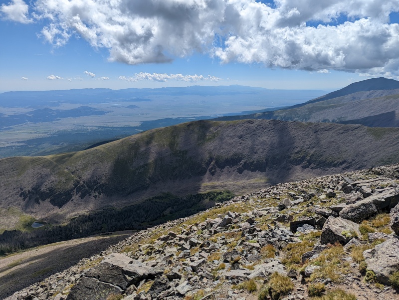
View toward Westcliffe from the summit of Eagle Peak
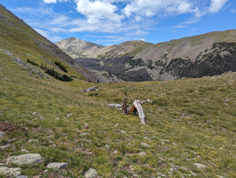
Looking west toward Cottonwood Peak from the north ridge of Eagle Peak
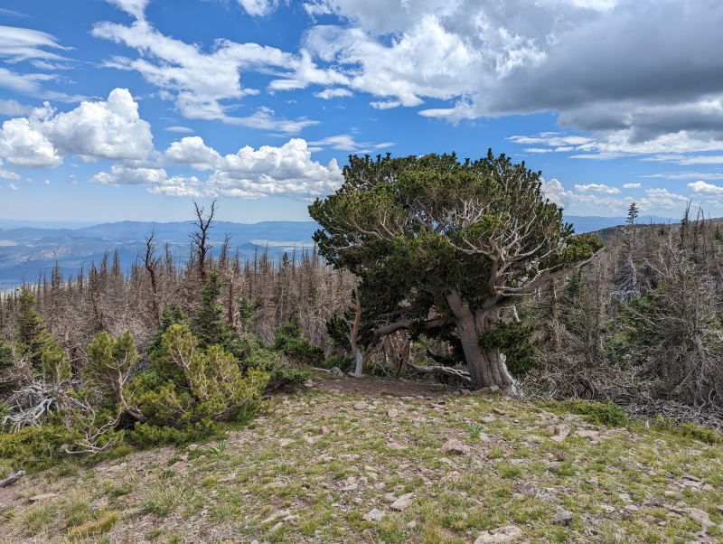
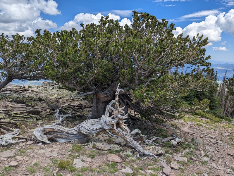
This ancient tree required closer inspection
The trunk is very thick for such a short tree
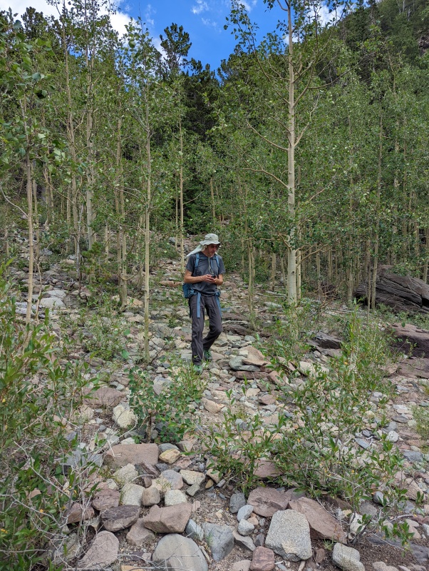
On our descent, we continued on the trail below where we'd joined it this morning
We were curious where the trail would take us, and the occasional cairn made it easy to follow
The trail took us right to the north side of Rainbow Lake! Had we known about the trail this morning, we could have saved ourselves a lot of work.
Recording the trail's starting location (lat: 38.25301; long: -105.70884; UTM 437979.79 Easting and 4234125.15 Northing [UTM Zone 13S])
For the easy way to Eagle Peak, start at the designated campsite on the east side of FR 198, just NW of Rainbow Lake.
Follow a road from the campsite toward Rainbow Lake
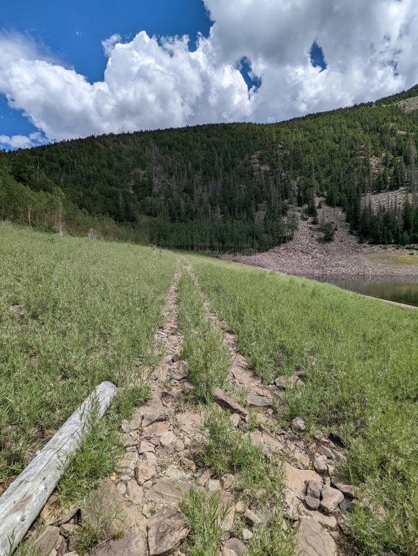
This road heads across the grass just north of Rainbow Lake (far right)
The road fizzles out as it nears the start of the trail in the young aspens to your left (north)
If you don't see the trail, go to the coordinates given in Image #16. You should see a cairn-marked trail heading northeast into the aspens. The trail becomes easier to follow as it climbs onto the north ridge of Eagle Peak. Enjoy!
Thumbnails for uploaded photos (click to open slideshow):
The Sangre has some really uh... awesome? roads. Even San Juan roads typically don't suck as much as Sangre destroyers. I think with exception of Molas Pass and Music Pass I've hiked every other 13er road in the place because they're so slow, damaging, and unfun to drive.
Caution: The information contained in this report may not be accurate and should not be the only resource used in preparation for your climb. Failure to have the necessary experience, physical conditioning, supplies or equipment can result in injury or death. 14ers.com and the author(s) of this report provide no warranties, either express or implied, that the information provided is accurate or reliable. By using the information provided, you agree to indemnify and hold harmless 14ers.com and the report author(s) with respect to any claims and demands against them, including any attorney fees and expenses. Please read the 14ers.com Safety and Disclaimer pages for more information.
Please respect private property: 14ers.com supports the rights of private landowners to determine how and by whom their land will be used. In Colorado, it is your responsibility to determine if land is private and to obtain the appropriate permission before entering the property.


")
")
")
")
")
")
")
")
")
")
")
")
")
")
")
")
")
")
")


