Download Agreement, Release, and Acknowledgement of Risk:
You (the person requesting this file download) fully understand mountain climbing ("Activity") involves risks and dangers of serious bodily injury, including permanent disability, paralysis, and death ("Risks") and you fully accept and assume all such risks and all responsibility for losses, costs, and damages you incur as a result of your participation in this Activity.
You acknowledge that information in the file you have chosen to download may not be accurate and may contain errors. You agree to assume all risks when using this information and agree to release and discharge 14ers.com, 14ers Inc. and the author(s) of such information (collectively, the "Released Parties").
You hereby discharge the Released Parties from all damages, actions, claims and liabilities of any nature, specifically including, but not limited to, damages, actions, claims and liabilities arising from or related to the negligence of the Released Parties. You further agree to indemnify, hold harmless and defend 14ers.com, 14ers Inc. and each of the other Released Parties from and against any loss, damage, liability and expense, including costs and attorney fees, incurred by 14ers.com, 14ers Inc. or any of the other Released Parties as a result of you using information provided on the 14ers.com or 14ers Inc. websites.
You have read this agreement, fully understand its terms and intend it to be a complete and unconditional release of all liability to the greatest extent allowed by law and agree that if any portion of this agreement is held to be invalid the balance, notwithstanding, shall continue in full force and effect.
By clicking "OK" you agree to these terms. If you DO NOT agree, click "Cancel"...
I thought I'd finished the 13ers in the Huerfano River area of the Sangre de Cristo Mountains with a climb of Huerfanito on 6/17/2021. Then John Kirk's LIDAR project identified Unnamed (UN) 13557 (formerly 13555) as a separate peak. The LIDAR project also demoted UN 13660A to a false summit of UN 13656, located about 0.4 mile SE of UN 13660A on the ridge to Ellingwood Point. This meant that I needed to climb UN 13656 to (re)complete Colorado's bicentennial (200 highest) mountains.
Friday, August 12, 2022. Randy and I left Colorado Springs in the late afternoon and drove past Gardner and Redwing to the Zapata/Huerfano trailhead, where we had no trouble finding a campsite. After setting up our tent, we scoped out the start of the Huerfano Trail for tomorrow's climb of UN 13557. (Note: Caltopo calls this trail the Raspberry Trail.)
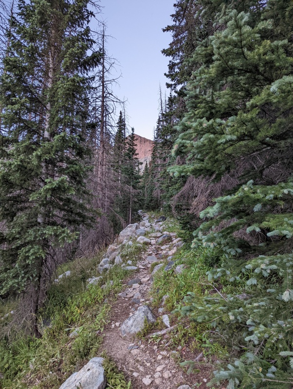
Saturday, August 13, 2022. The Huerfano Trail was easy to follow, but the first few hundred feet of elevation gain included a lot of deadfall as the trail climbed east above the Huerfano River. The trail leveled out as it climbed onto a broad ridge, and at about 11,150' we left the trail and bushwhacked south through the trees toward UN 13557. The bushwhacking was not difficult.
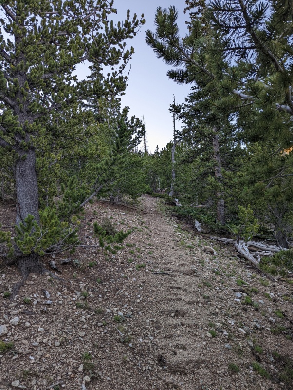
Looking up the trail as it began to top out on the broad ridge north of UN 13557 (All photos by Randy Mack)
Looking east as we climbed south toward UN 13557
Looking west toward California Peak from the same location as the previous photo
We're about to exit the trees
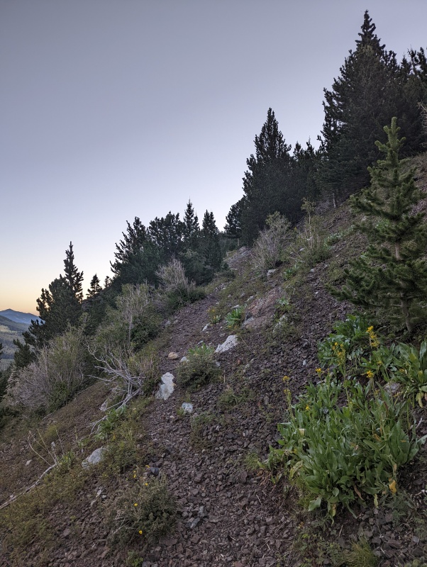
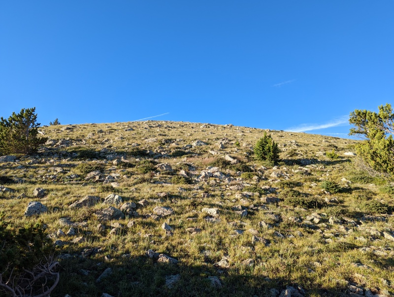
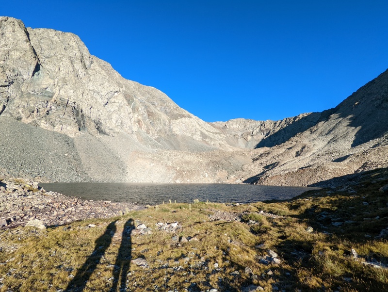
The trees abruptly gave way to tundra and rocks.
Looking down UN 13557's broad north ridge toward the Huerfano Trail
The tundra was gentle, and UN 13557 would make a good snow climb. Just don't forget your gaiters!
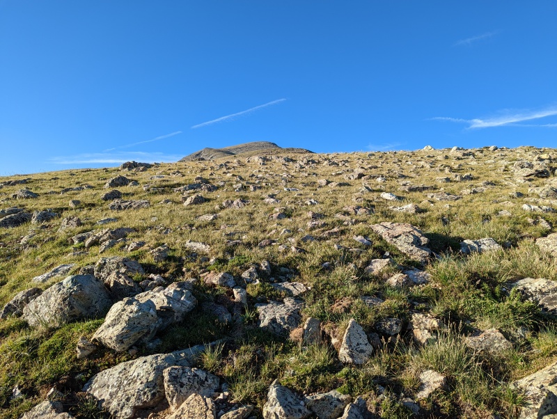
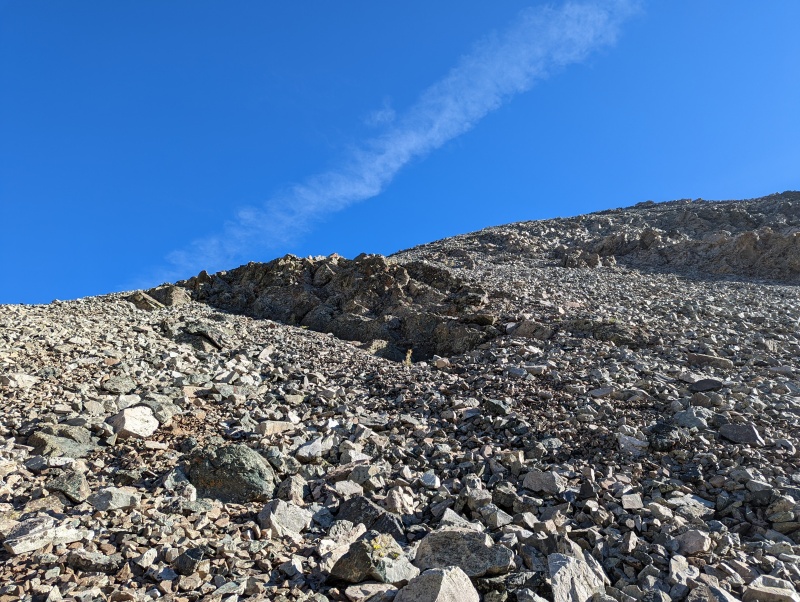
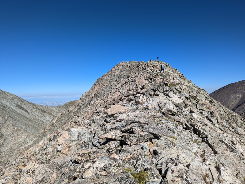
UN 13557's summit block is getting closer
It was a steady, gentle climb to the summit of UN 13557.
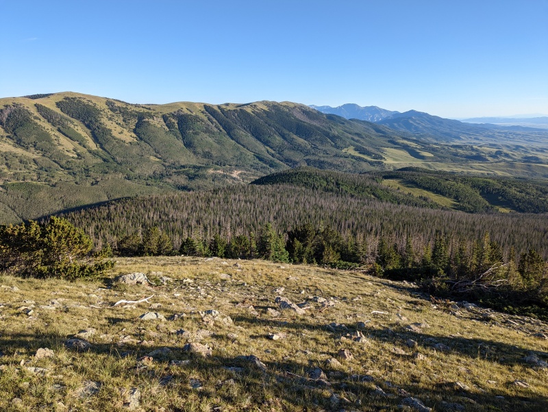
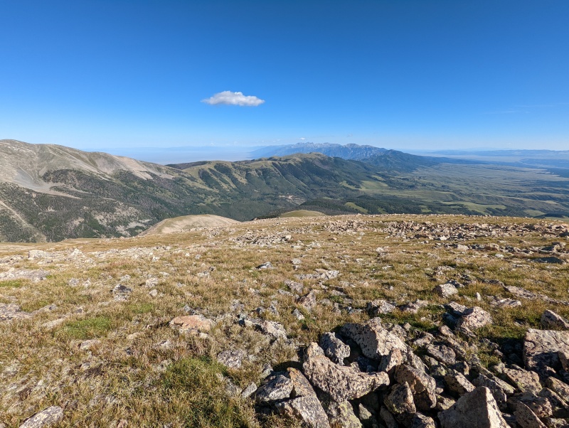
Looking west from the summit of UN 13557 toward California Peak
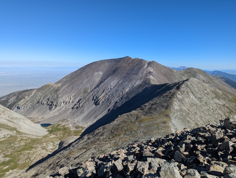
Looking south at Mt. Lindsey and Huerfano Peak from the summit of UN 13557; with Blanca and Ellingwood visible at far right
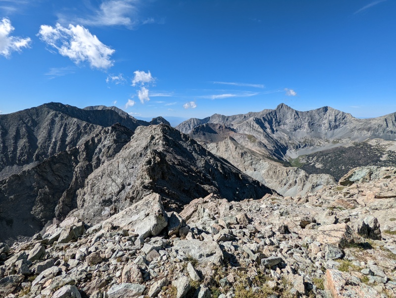
A closer look at the rugged ridge from UN 13557 to Huerfano Peak
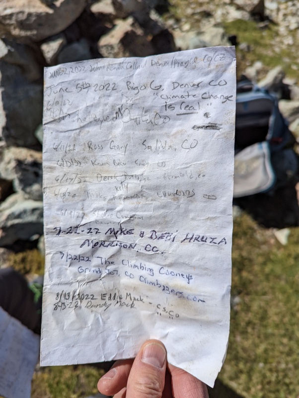
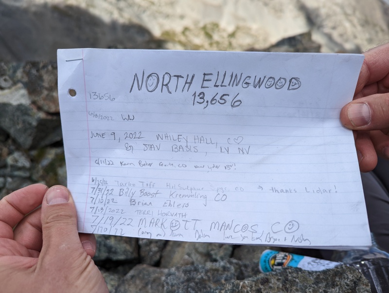
The UN 13557 summit register had 18 signatures from June - August 2022, and about the same number for 2012 - 2021.
UN 13557 has become quite popular in 2022 after LIDAR data showed it was a separate peak
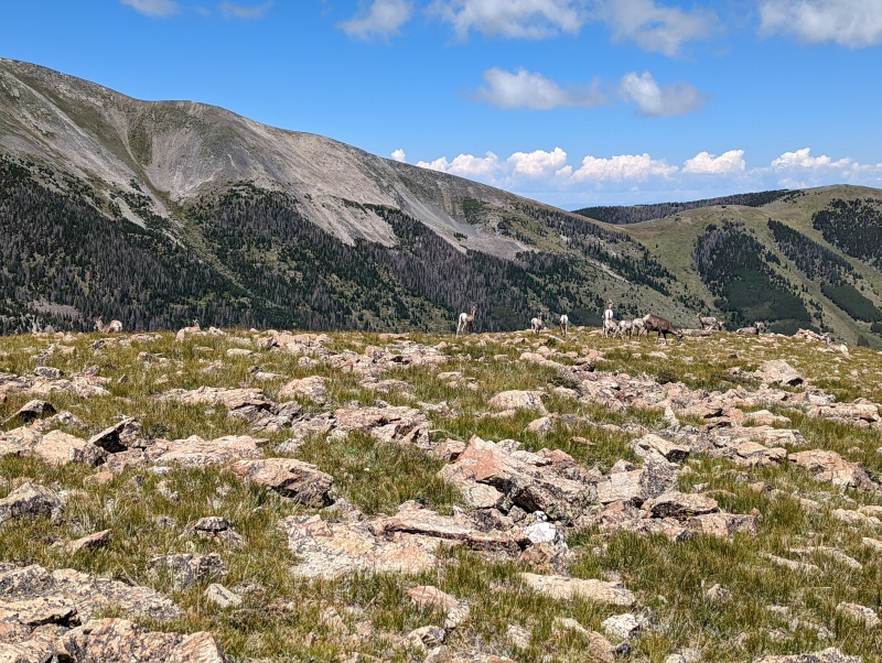
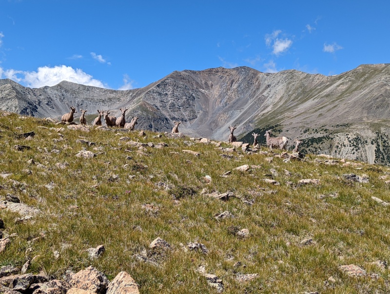
We saw this herd as we descended...
...and they just watched as we passed by
We continued down UN 13557's north ridge, intersected the Huerfano Trail, and returned to our campsite.
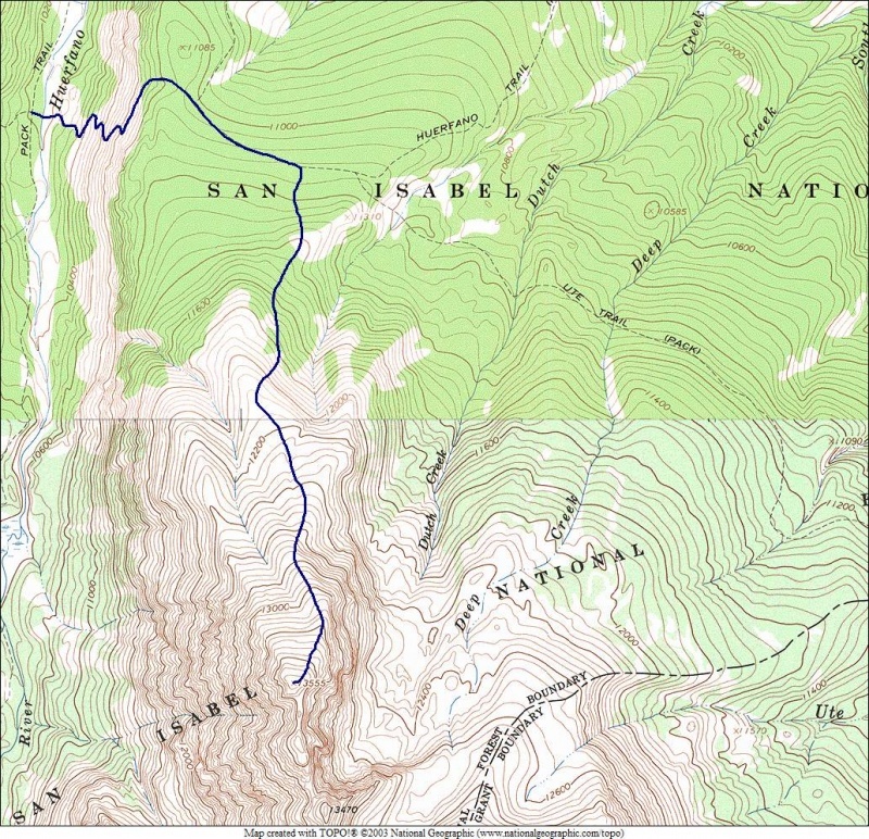
Our route today was essentially the same as Jay's, so I took the liberty of "borrowing" his map
Sunday, August 14, 2022. Randy and I climbed UN 13577 and UN 13660A on 9/15/2016 from the Lily Lake trailhead. Today, we would follow the same route to those summits, except we'd continue south and southeast along the ridge from UN 13660A to the summit of UN 13656.
The sometimes-rocky trail to Lily Lake
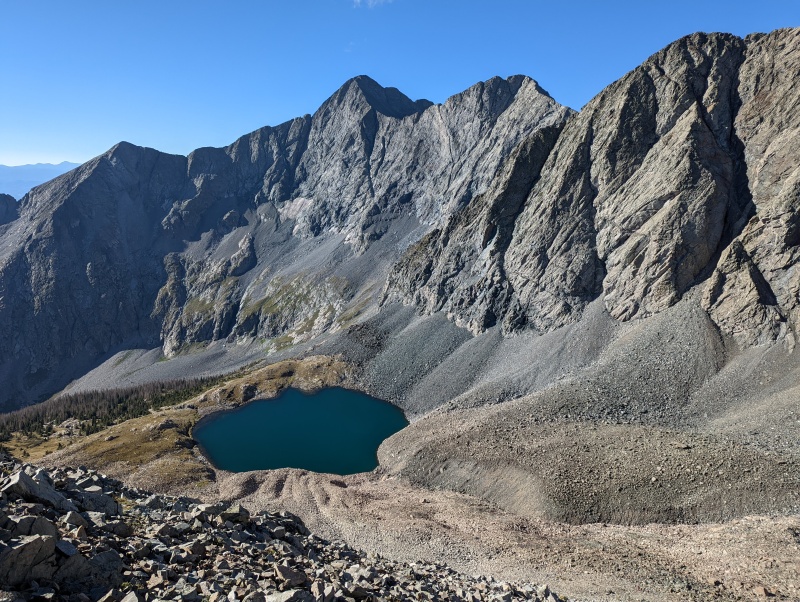
Looking west from the outlet of Lily Lake; with UN 13577 to the right and UN 13660A/13656 to the left
From Lily Lake, we headed west to a rib before scrambling south to the east ridge of UN 13577 on surprisingly stable rock. Once on the ridge, we headed WNW to the summit of UN 13577. The summit register was too wet to sign.
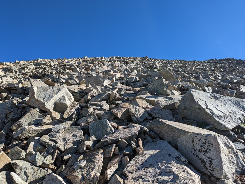
We scrambled over rocks of all sizes toward the east ridge of UN 13577
Looking back at Blanca Peak and Ellingwood Point above Lily Lake
The slope eased as we neared the east ridge of UN 13577
Once on the ridge, it was not far to UN 13577's summit. Two climbers we met today (Brian and Megan) are almost there
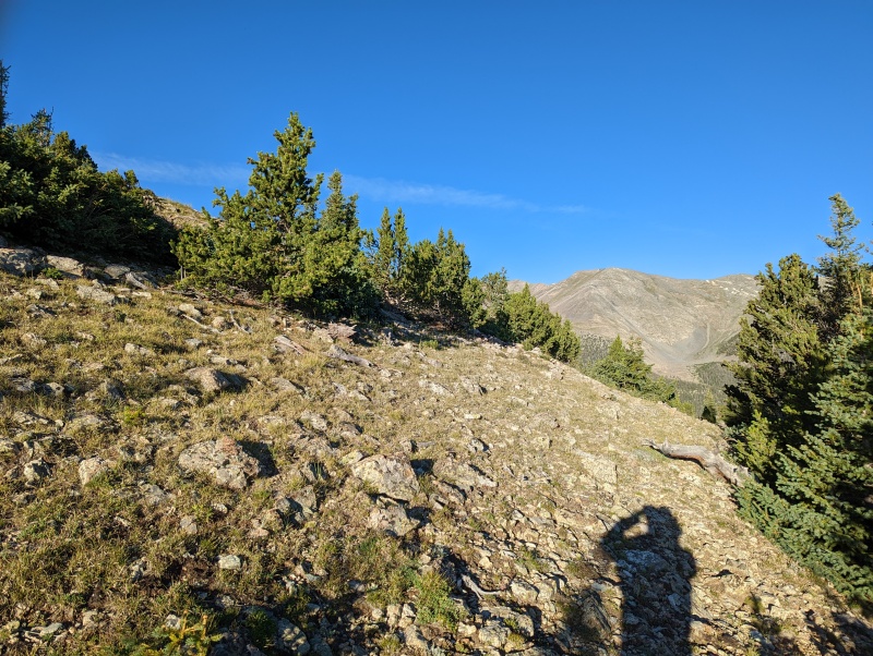
Looking WSW toward UN 13660A (right) from the summit of UN13577. The new LIDAR-based summit is 0.4 mile SE (left) of UN 13660A
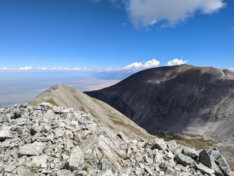
Looking north toward California Peak from UN 13577's summit
Brian and Megan continued toward California Peak, and a group of about nine that we'd seen at Lily Lake arrived on UN 13577 just as we began the traverse to UN 13660A.
Blanca Peak, Ellingwood Point, and Lily Lake from UN 13577
The traverse from UN 13577 to UN 13660A went quickly and without incident. We were a bit surprised to find a summit register on UN 13660A, given that it is now just a false summit of UN 13656.
View north from the summit of UN 13660A
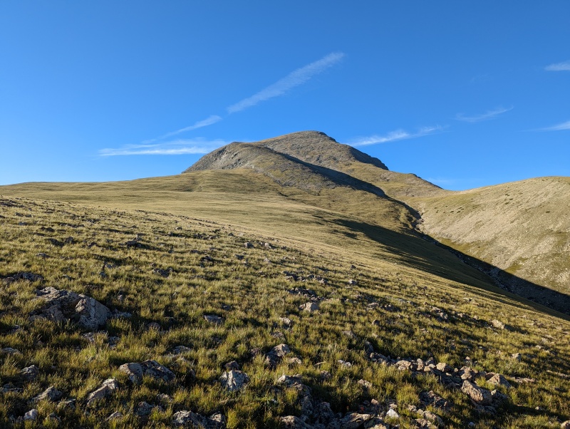
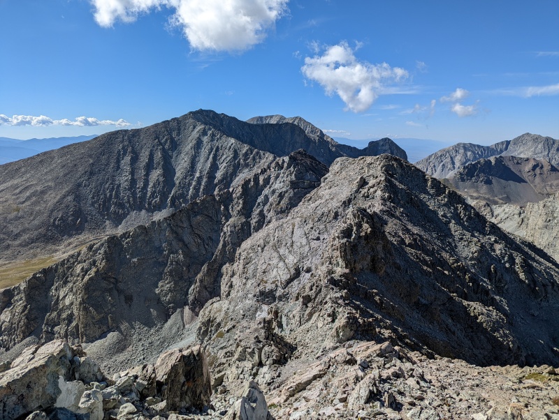
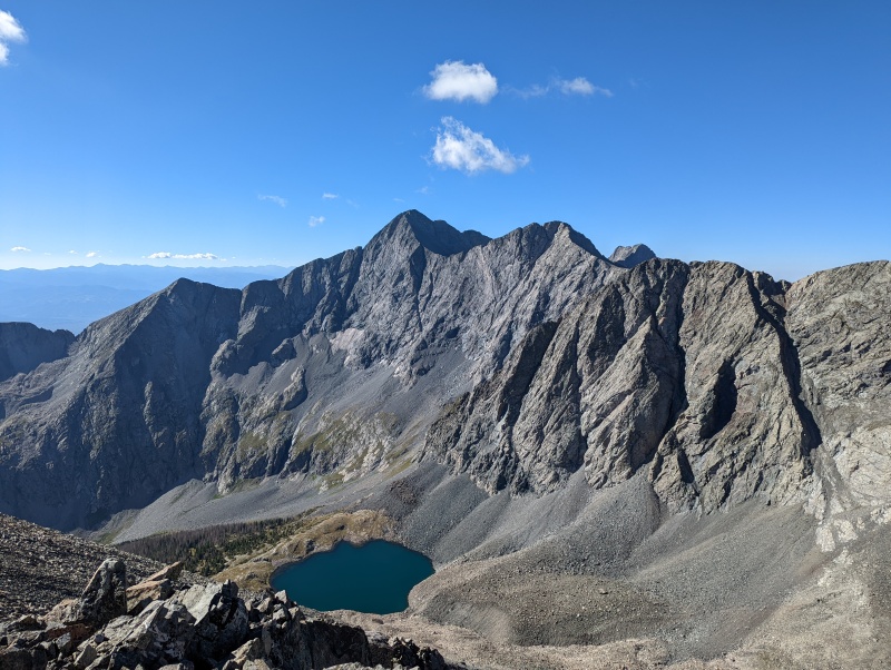
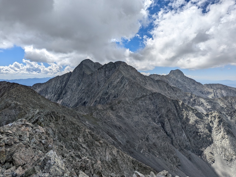
The view SE toward UN 13656, Ellingwood Point, and Blanca Peak from UN 13660A's summit
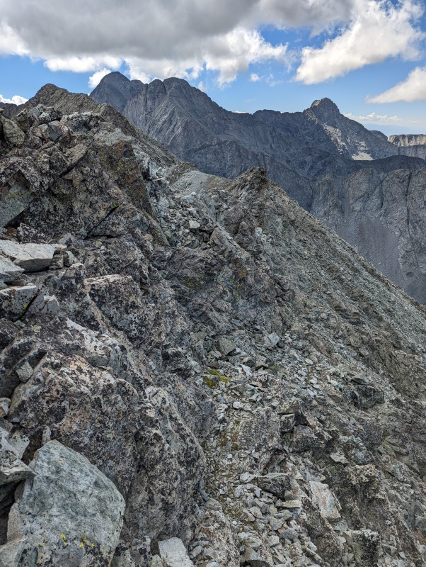
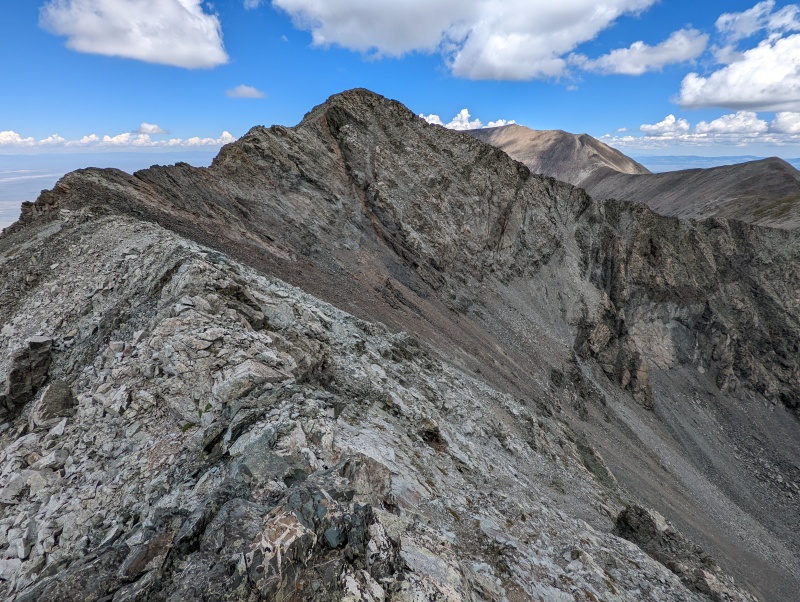
After signing the summit register, we continued on toward today's primary objective: UN 13656. In our opinion, the ridge never exceeded Class 2+ or Class 3, depending on your choice of route. In some places, an obvious path is developing.
There were a few places where we dropped a little bit below the ridge to the west
Some of the rock along the ridge was a bit loose but didn't feel particularly exposed
Some of the ridge was an easy walk
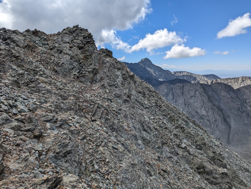
Almost to the summit of UN 13656
It didn't take long for the usual suspects to show up on UN 13656, which someone informally named "North Ellingwood"
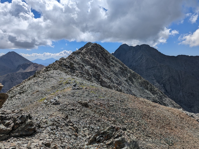
Looking toward Ellingwood Point from the summit of UN 13656
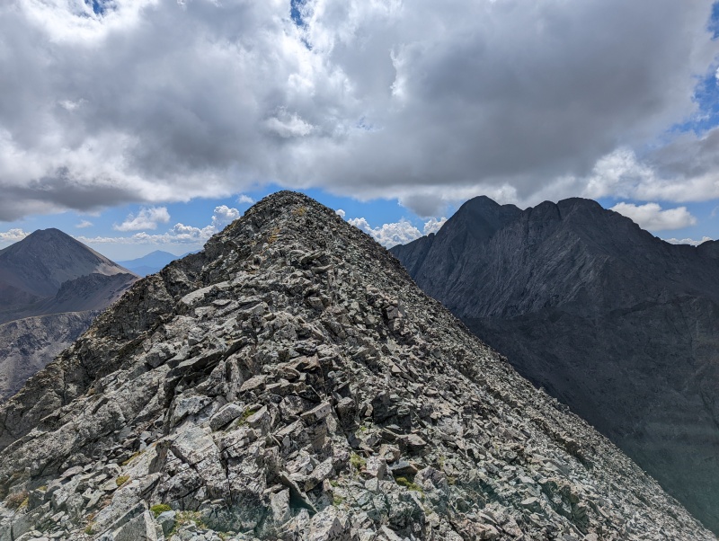
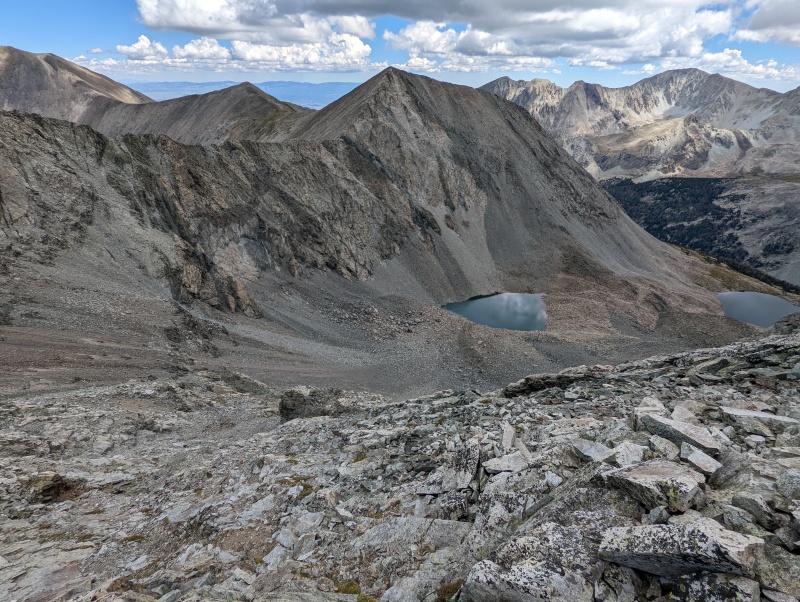
After a short break on UN 13656's summit, we headed back toward UN 13660A.(center)
Our descent route toward Lily Lake began near the light orangish rock at the far left of the photo above.
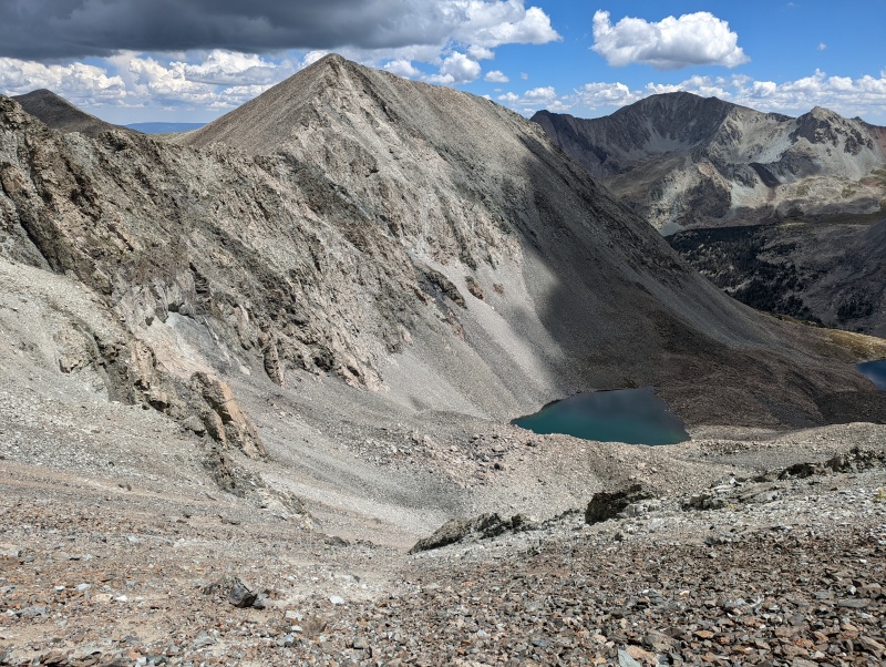
Looking east at an unnamed lake at 12,620' (left) and Lily Lake (right) from the UN 13660A - UN 13656 ridge
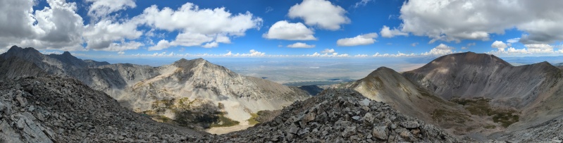
Panorama
We descended directly toward the basin. This would have been a terrible ascent route due to the loose rock/scree
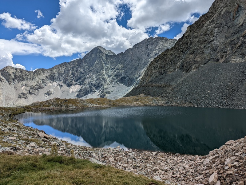
Lily Lake
Once we reached the trail at Lily Lake, we put on the cruise control back to the trailhead.
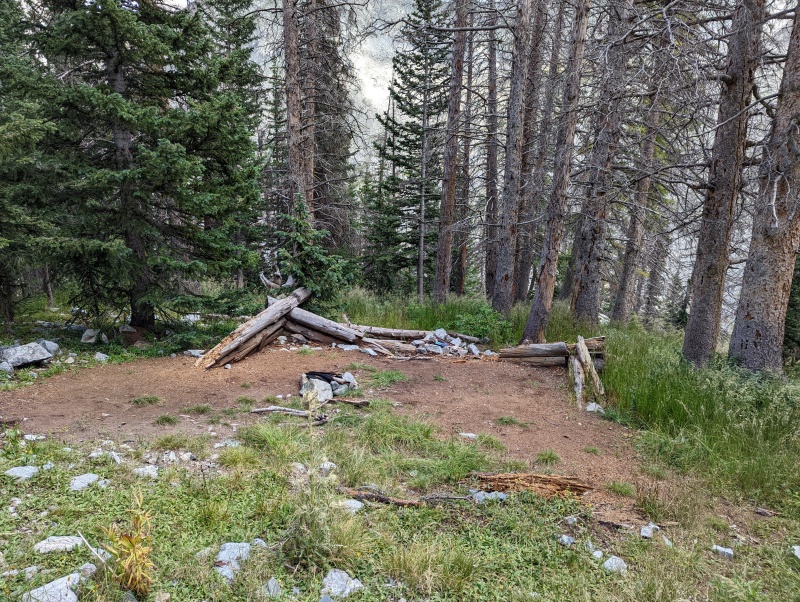
A collapsed cabin we saw as we returned to the Lily Lake trailhead
This is a scenic area, but it felt good to (once again) finish climbs of the ranked 13ers here. On to the next adventure!
Thumbnails for uploaded photos (click to open slideshow):
Did the small band of cliffs about 1/2 way down the face of 13,660 give you any trouble on the way down? I'm looking to ascend up California and come down that way next weekend.
Thanks for the info, @Mtnman200! Looks like a pleasant slog through a couple of miles of step, loose rock from the ridge to the lake, but I'm betting it beats reclimbing all the way back to 13,577. I'll definitely be looking to come down that, not up :)
Thank you for the TR and useful pics!
I too need to revisit this area due to LiDAR....
Was not a fan of the line I took up to the ridge for 13577 (last time). Sounds like your line was probably better. Do you have a track or image of your route that I could peruse?
Caution: The information contained in this report may not be accurate and should not be the only resource used in preparation for your climb. Failure to have the necessary experience, physical conditioning, supplies or equipment can result in injury or death. 14ers.com and the author(s) of this report provide no warranties, either express or implied, that the information provided is accurate or reliable. By using the information provided, you agree to indemnify and hold harmless 14ers.com and the report author(s) with respect to any claims and demands against them, including any attorney fees and expenses. Please read the 14ers.com Safety and Disclaimer pages for more information.
Please respect private property: 14ers.com supports the rights of private landowners to determine how and by whom their land will be used. In Colorado, it is your responsibility to determine if land is private and to obtain the appropriate permission before entering the property.


")
")
")
")
")
")
")
")
")
")
")
")
")
")
")
")
")
")
")
")
")
")
")
")
")
")
")
")
")
")
")
")
")
")
")
")
")
")