| Report Type | Full |
| Peak(s) |
Mt. Owen - 13,064 feet Ruby Peak 12641 Purple Peak 12753 |
| Date Posted | 08/19/2022 |
| Modified | 07/26/2024 |
| Date Climbed | 07/16/2022 |
| Author | JQDivide |
| Additional Members | FoodieHiker |
| Peaks above Lake Irwin |
|---|
|
Ruby Peak, Mount Owen and Purple Peak 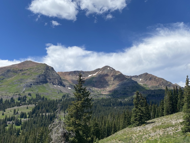
We tried to hike this route a couple years ago only to be met with a gate across the road. Seems private property owners and the government are in a stand still about access issues in regard to road use. The access now is by going up over Scarp Ridge. Other people have gone by skirting the private property to the west, but that probably really doesn’t work unless you take the ridge. 
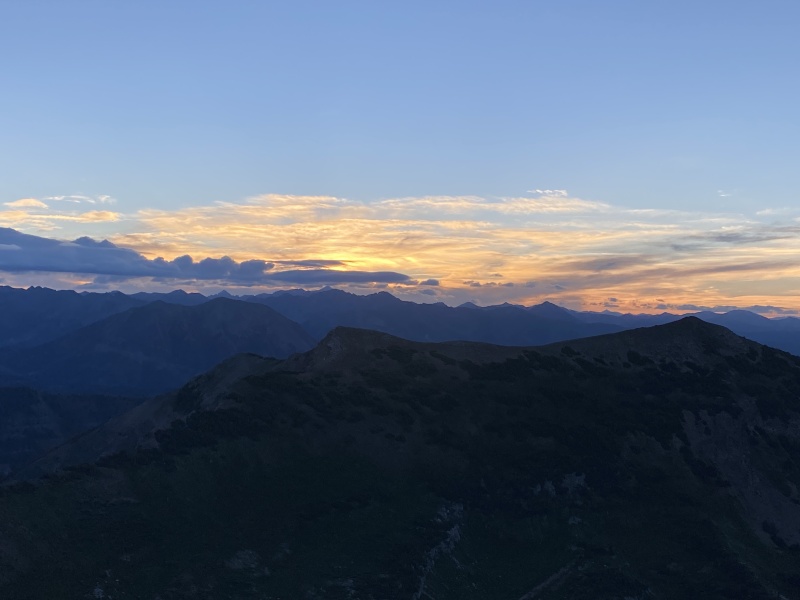
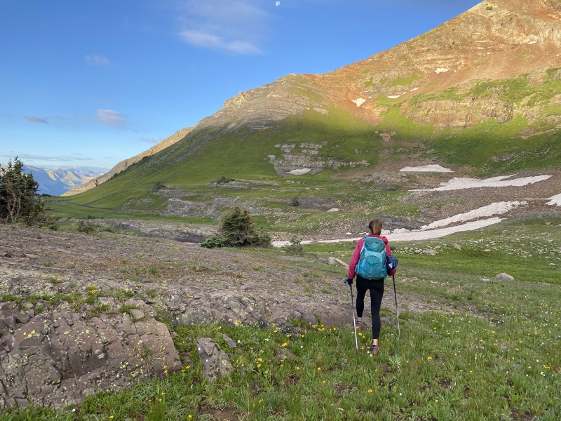
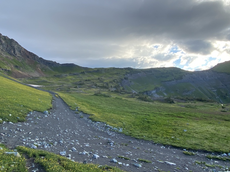
Photos: Scarp Ridge to Robinson Basin 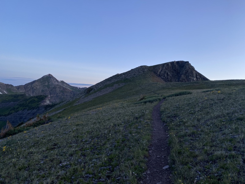
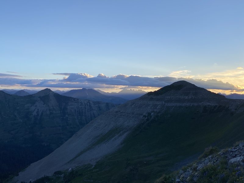
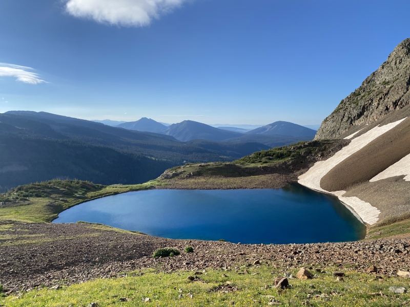
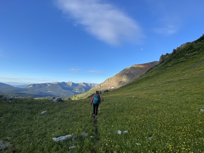
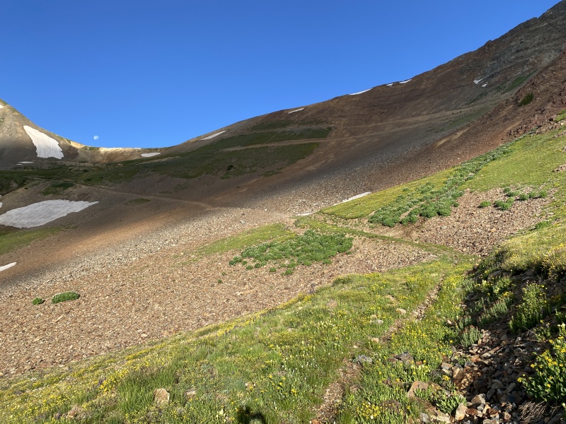
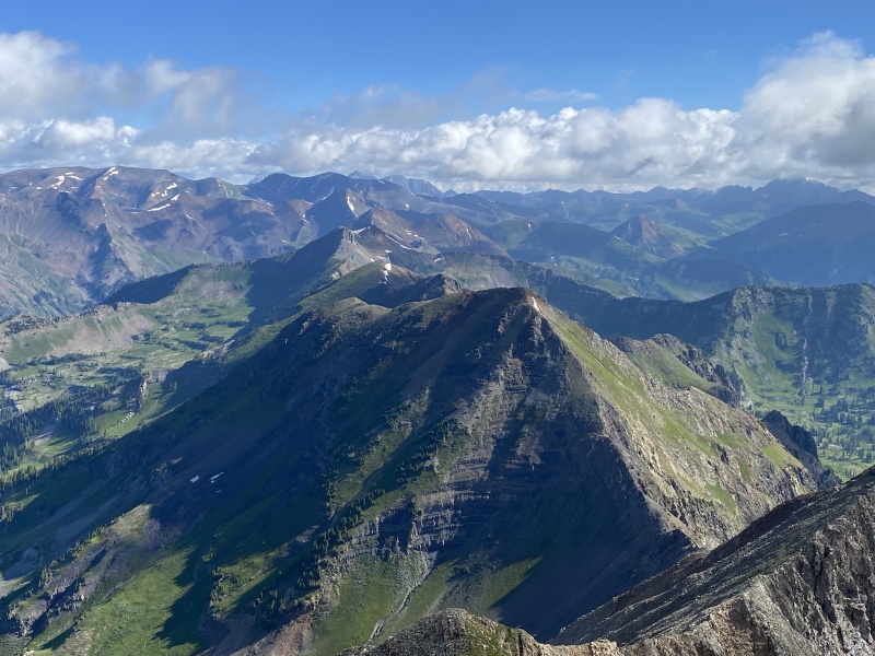
Park along the road just below the old lodge building above Lake Irwin. Walk up the road and around the lodge property and head toward the ridge. About 15 to 20 minutes in, you’ll come to flat-ish rocky slab. Go left toward Scarp Ridge. Going right will take you toward Emmons. Late spring, early summer this area is full of Glacier Lilies. It’s about 2 miles to Scarp Ridge and 1,500 feet of gain. At the top, you have good views of the Oh Be Joyful area and the peaks of Ruby Range. Go left and follow the ridge down toward Purple Peak. At the low spot, we went too low, followed a game trail. It’s a loose rocky mess. Stay high and pass this part to enter the northwest corner of Robinson Basin. Drop down and cut across the slabs and grass and head toward Ruby Peak. 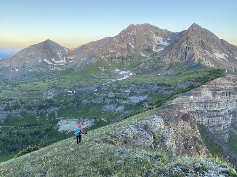
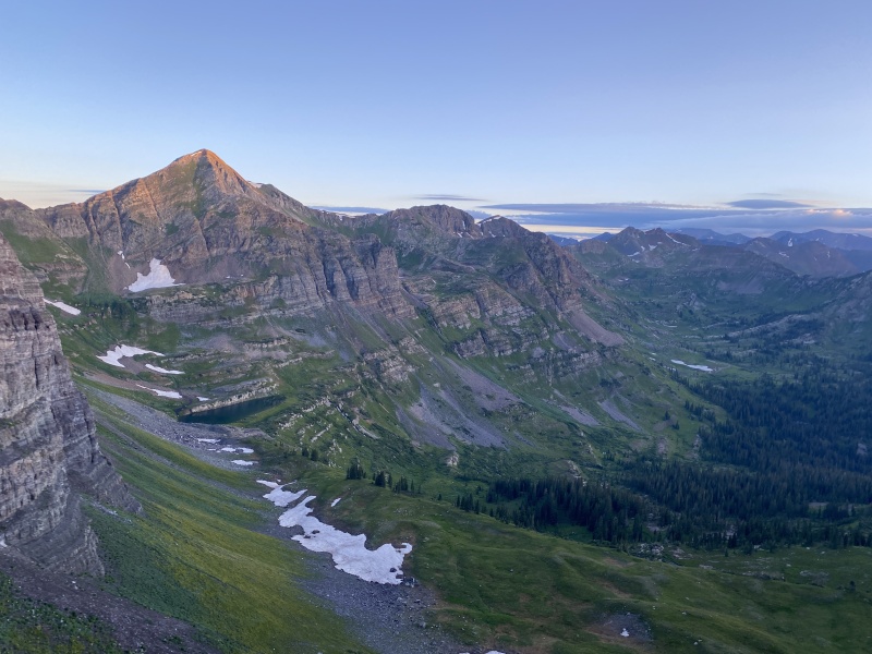
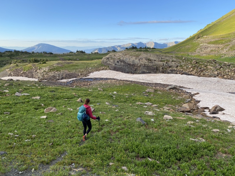
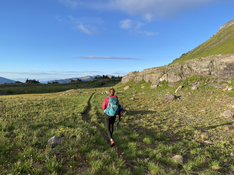
You’ll see a mining road heading that way. Follow that, or the trail to its left. You’ll eventually get on a trail that will take you to the old mining road (about 3.4 miles in) that leads to the saddle between Ruby and Owen. Follow the road up to the saddle, at about 4.5 miles. We decided to go for Owen and Purple first, just in case weather came in early and we had to bail. It would be easier to come back to grab Ruby as a solo than to grab Purple. Photos: Robinson Basin to Saddle 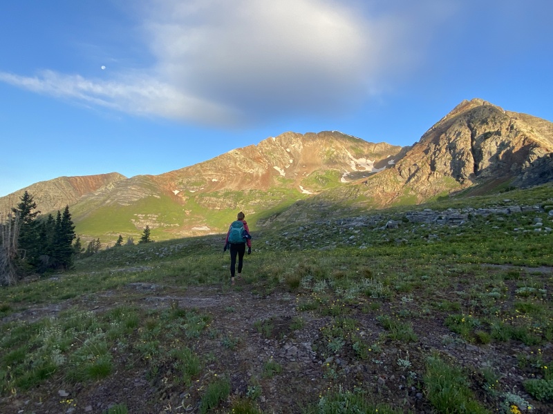
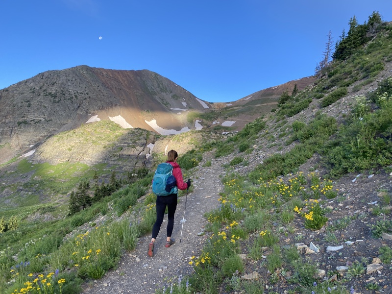

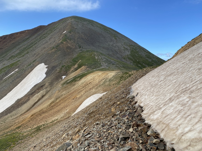
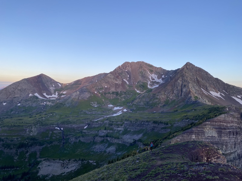
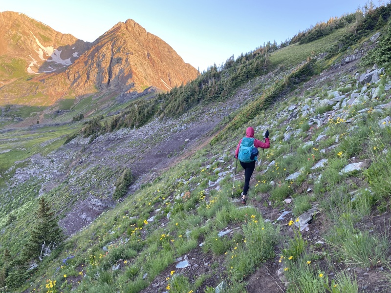
There is a trail for the most part up and over Owen. The trail isn’t great, typical 13er stuff. But there were a few spots that we used hands, I’d say Class 2+ or really easy Class 3. The bump you see going up Owen is not the summit, it’s just a shoulder. Was a bit more than 5 miles to reach the summit and about 3,000 feet of total gain on the day. Took 4:25 hr/min. Photos: Owen 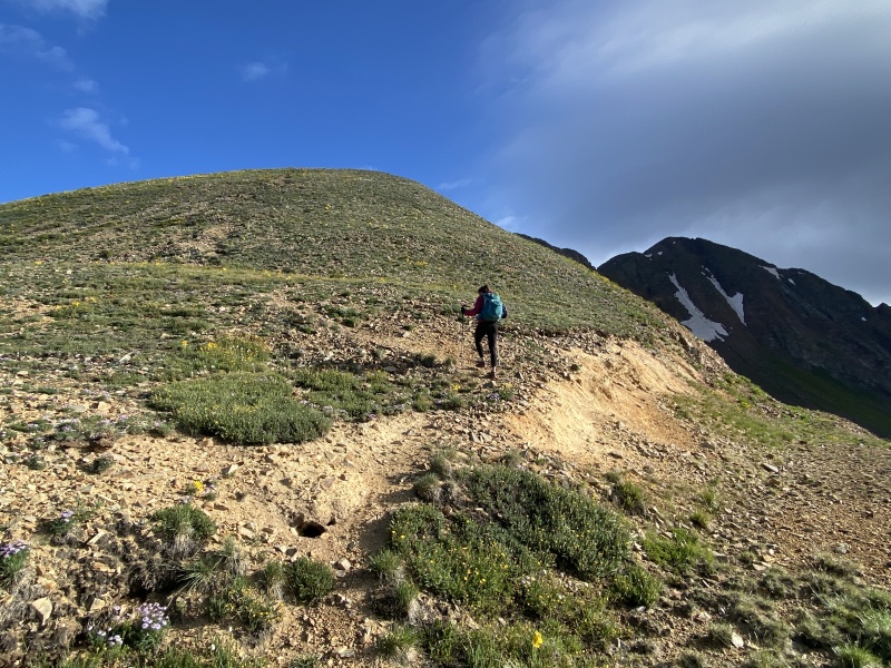
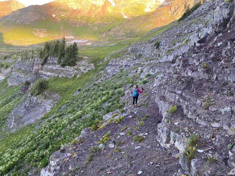
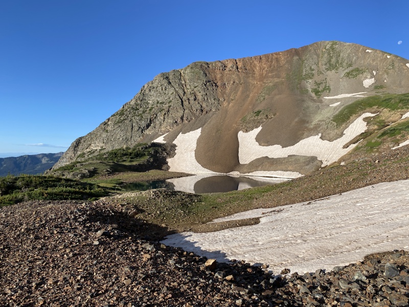
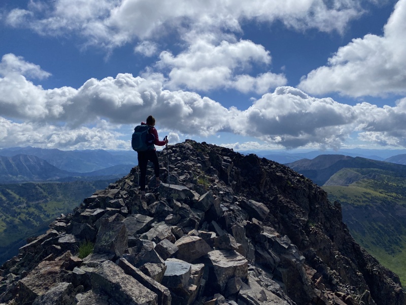
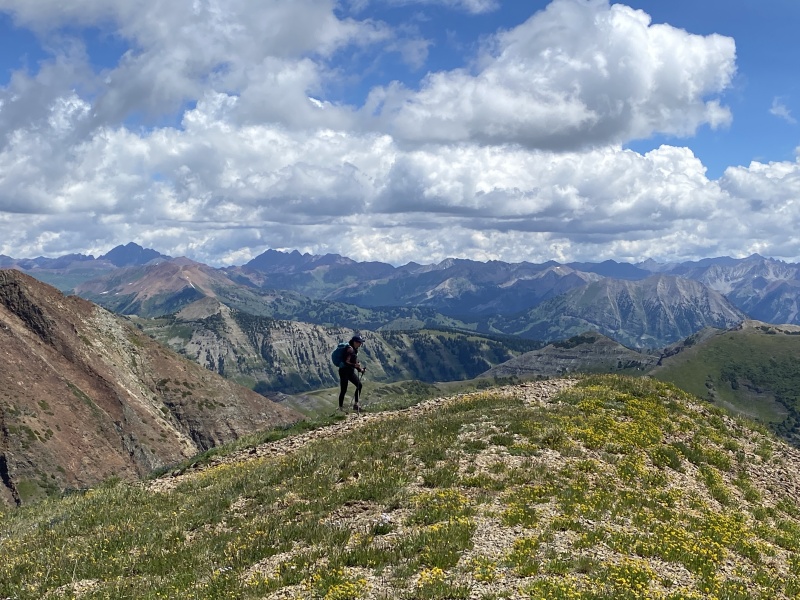
The roughest part of the route is Owen’s northern ridge. Lots of loose dirt, some steep. Was harder going back up. But, I did fall twice. I slipped on grass. Fell, got up. Took a step and fell again. I’m graceful like that. The ridge between Owen and Purple was rocky. Some dinner plates. Some trail. Took about 35-40 minutes from summit to summit, and less than half a mile. We didn’t stay long, and headed back toward Owen. Took about 45 minutes to get back to Owen. We went up one short section that was really loose dirt, that wasn’t fun. I’m guessing we were probably just to the right by a few feet of where we came down. Photos: Owen to Purple
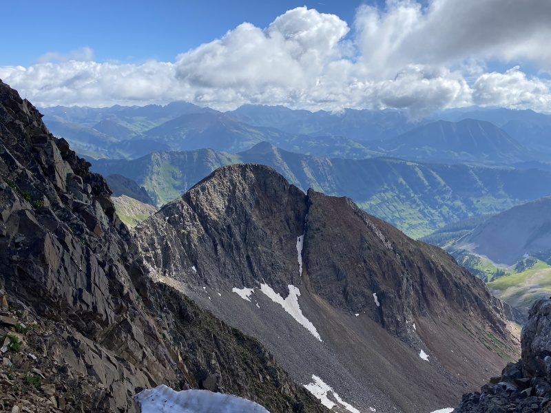
Up and over, and 25 minutes later we were at the Ruby-Owen saddle. We found a bit of a wind block on the trail and had lunch. We spoke to three young ladies that were on the way up and were going to do a loop with Owen and Purple back to Scarp Ridge. The trespassed on the road coming up and didn’t want to chance it again. Only one thing, Purple’s east ridge back to Scarp DOES NOT GO. Well, if you like Class 5 and have a rope it does. They didn’t. (There is a TR on here about that.) Photos: Purple to Owen and back to the saddle 
After we ate, we stood up and worked our stiff muscles and headed up Ruby. Not much of a trail. It’s in pieces and looks more like a goat trail. It took less than 20 minutes. Snapped a few photos and headed down. 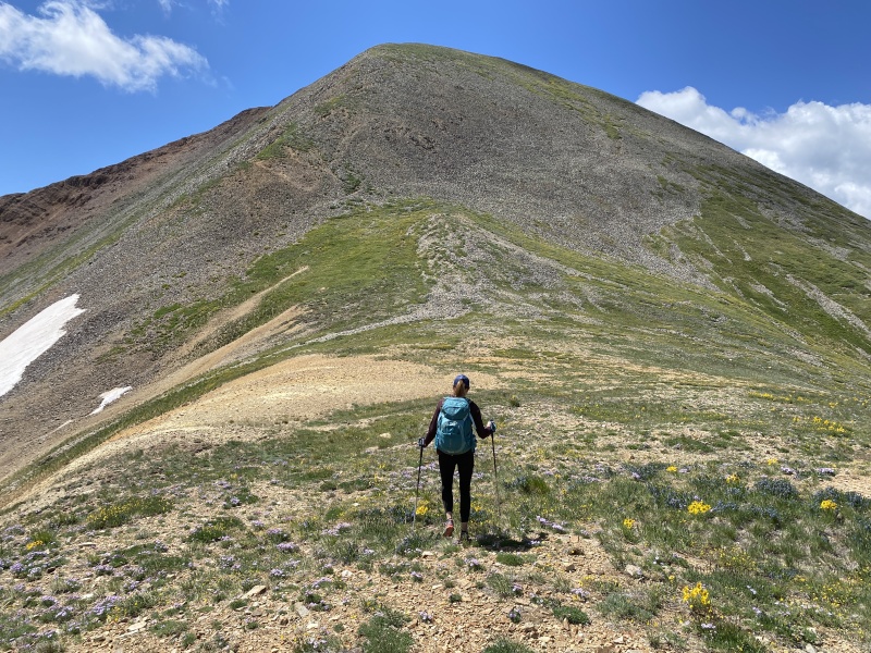
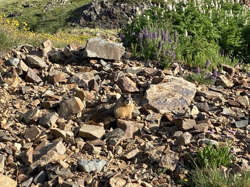
For the most part, this entire route is pretty straight forward. So why not screw that up to make a short cut. We decided instead of going back up to Scarp Ridge, we would cut straight across the basin and save 700-800 feet of gain, all while staying off of private property. We had checked out this idea when we did Peeler and Garfield a couple years ago. It would go, you just had to bounce around all the slabby small cliffs. Well, this idea sucked. We kept getting cliffed out. Then hike a couple hundred yards to your left. Cliff. Work around it. Another cliff. Another 100 yards. Cliff. Work around. If you had the time, and a better idea of the location of the rocks, this could work well. It was hot. I was tired. I was frustrated. And we were not making much progress. Those young ladies hiked the road up. Hmmm… We made it back to the Suburban and cleaned up. Drank some Palomas (grapefruit margaritas, that’s our new thing this summer). We drove to CB and had more margs at Bonez as we waited to meet up with our friends Brent and Michelle for dinner, but that didn’t happen. They were up in Poverty Gulch. But we found them after, in time for some drinks and ninja camping. 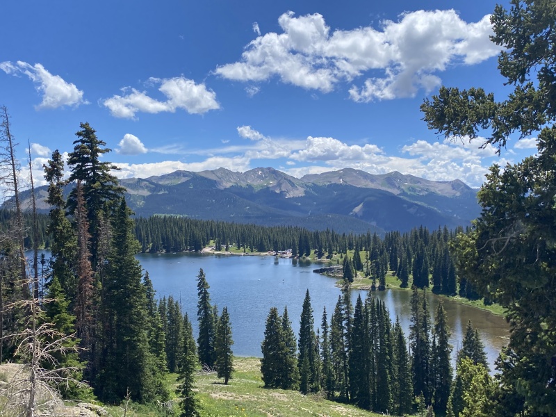
We hiked the 401 Trail from the Judd Falls TH the next morning. What a nice leisurely walk. Perfect for a ‘day-after’ hike. We only went a couple miles, but it was great. Flowers. Aspens. Views. Peaks. After that, we went downtown to the Farmer’s Market. Lots of great vendors. These are peaks 28, 29 & 30 on our Crested Butte peak list we are working on. Thumbnails for uploaded photos (click to open slideshow): ")
")
")
")
")
")
")
")
")
")
")
")
")
")
")
")
")
")
")
")
")
")
")
")
")
")
")
")
")
")
")
")
")
")
")
")
")
")
")
")
")
")
")
")
")
")
")
")
|
| Comments or Questions | |||
|---|---|---|---|
|
Caution: The information contained in this report may not be accurate and should not be the only resource used in preparation for your climb. Failure to have the necessary experience, physical conditioning, supplies or equipment can result in injury or death. 14ers.com and the author(s) of this report provide no warranties, either express or implied, that the information provided is accurate or reliable. By using the information provided, you agree to indemnify and hold harmless 14ers.com and the report author(s) with respect to any claims and demands against them, including any attorney fees and expenses. Please read the 14ers.com Safety and Disclaimer pages for more information.
Please respect private property: 14ers.com supports the rights of private landowners to determine how and by whom their land will be used. In Colorado, it is your responsibility to determine if land is private and to obtain the appropriate permission before entering the property.