| Report Type | Full |
| Peak(s) |
Longs Peak - 14,259 feet Pagoda Mountain - 13,488 feet Isolation Peak - 13,114 feet Paiute Peak - 13,094 feet Apache Peak - 13,450 feet North Arapaho Peak - 13,513 feet South Arapaho Peak - 13,408 feet |
| Date Posted | 08/16/2022 |
| Date Climbed | 08/11/2022 |
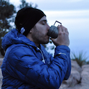
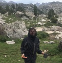
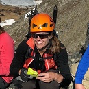
| Author | blazintoes |
| LA Freeway |
|---|
|
I love the smell of skunk weed in the morning. Today August 10th is the last day the sun will set at 8pm and as the flowers point east prematurely waiting for the sunrise I ask them, “are you waiting, me too?” Traipsing along the CDT with the magnificent wildflowers I realize that I’m part of a bigger system which is the natural world. A little pika scampers around then stops and stares with a mouthful of skunk weed because she knows what’s good and says, “uh, excuse me bipedal monster, you’re standing on my house.” I step aside and up ahead at last glowing in the morning light is my patronus; a tawny brawny mountain deer. It’s going to be a good day if I can just get off of this L.A. freeway without gettin' killed or caught. 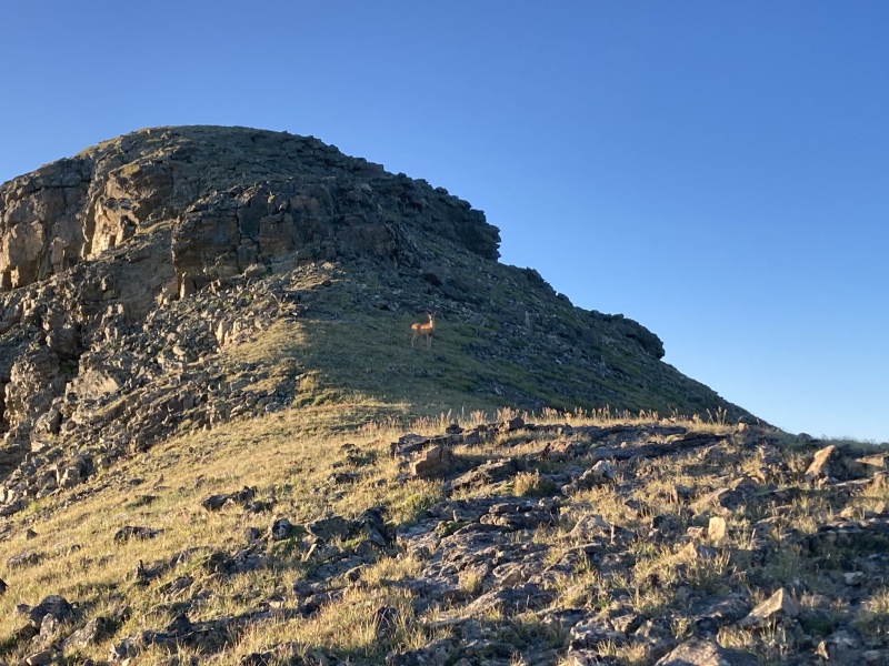
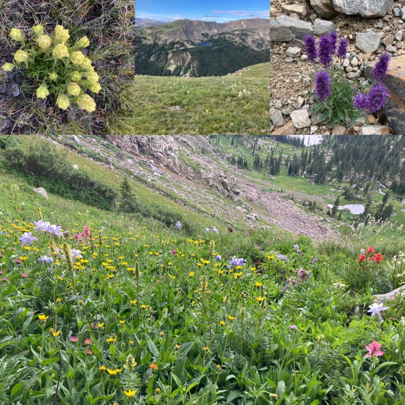
"LA Freeway" is a complete ridge traverse from Long's Peak to S. Arapaho Peak along the CDT and I became interested in this adventure when I read the following blog post from the current FKT record holder Kyle Richardson: August 4, 2018 "The LA Freeway was first envisioned by Carl Pfiffner back in the 1950s. He had the idea of traversing from Longs Peak (14,259ft) to the Arapahos (13,501ft) along the Continental Divide, linking the tallest point in Rocky Mountain National Park to the tallest point in the Indian Peaks. In 2002, Buzz Burrell became the first person complete Carl Pfiffner's original idea of linking Longs Peak to the Arapahos in a massive 2 day effort. After completion, Buzz dubbed the route the "LA Freeway" and laid down the foundation for this iconic line. Sticking strictly to the Divide and tagging every peak along the way (listed at the bottom), Buzz was able to fulfill Pfiffners original vision. It's also worth noting that Gerry Roach helped push the creative bounds of this route by extending the traverse from Milner to Berthoud Pass, this is known as the Pfiffner Traverse. The LA Freeway has been something I've wanted to try and tackle ever since I moved to Boulder and saw the line for the first time. Driving down Highway 36 into Boulder, the LAF dominates the skyline. It is such a logical and aesthetic line that really inspires me. It wasn't until this summer that I felt like I was really ready to give it a shot. Below is a recap of my day along the LA Freeway." My report. With a marginal weather forecast I packed up and wanted to see how far I could get despite Mr. G’s warnings to respect the weather. I have schemed and dreamed about attempting LAF for three years, have the time, the gear, am physically and mentally fit and have staged the caches. Time to go. 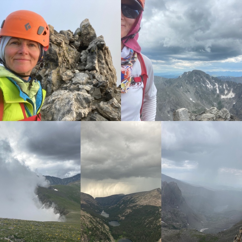
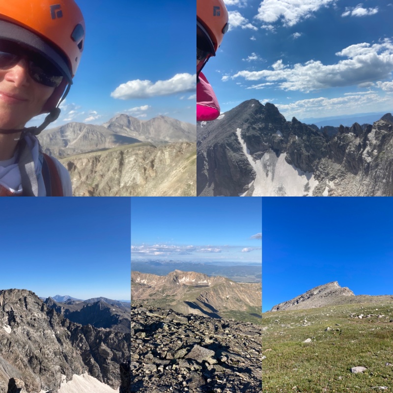
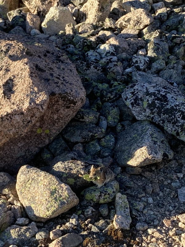
7/23/22 Up wet Cables and down dry Pagoda via the west ridge bypass was excellent. As I descended Pagoda a mild weather blip had me worried that I was going to get caught in rain while soloing slabs. The rain held off until Chiefs Head and I had to take shelter in my Brooks Mountaineering bivy sac. Phew. Time wasted away but I was dry so I quickly got up Chiefs Head then over to Alice and got caught in another storm but this one lasted longer. After it passed I finally got up Alice but it was now 4:15pm and I wanted to be there by noon. Next up were Tanima and The Cleaver by 6:20pm. Once down Cleaver and onto Isolation it dumped. This was terrible timing because it's late and there was no safe place to bivy as water poured down the mountain. At sunset it finally stopped raining. I cleaned up and climbed Isolation's west gully vs. the awesome looking north ridge because everything was wet and I thought the gully would be better. At first it was easy scrambling then thick fog rolled in and I could see about 10 inches in front of my face via headlamp. I scrambled fine then got stuck on a slick wet committing slab and this was the second scare of the day. I finally committed to a move that was definitely leg breaking territory and made it. Another Phew! The long scrambling ridge to Isolation after 10pm when I can't see and my feet are soaked was slow going. Stepping on rocks with wet feet was like walking on ice and speaking of ice, it was cold enough that there was verglas. I decided to bivy for the night when I found a dry spot near what appeared as an overhanging tower no where near the summit. I tossed around until 2am and heard a terrifying rockfall nearby and thankfully nothing smashed me. 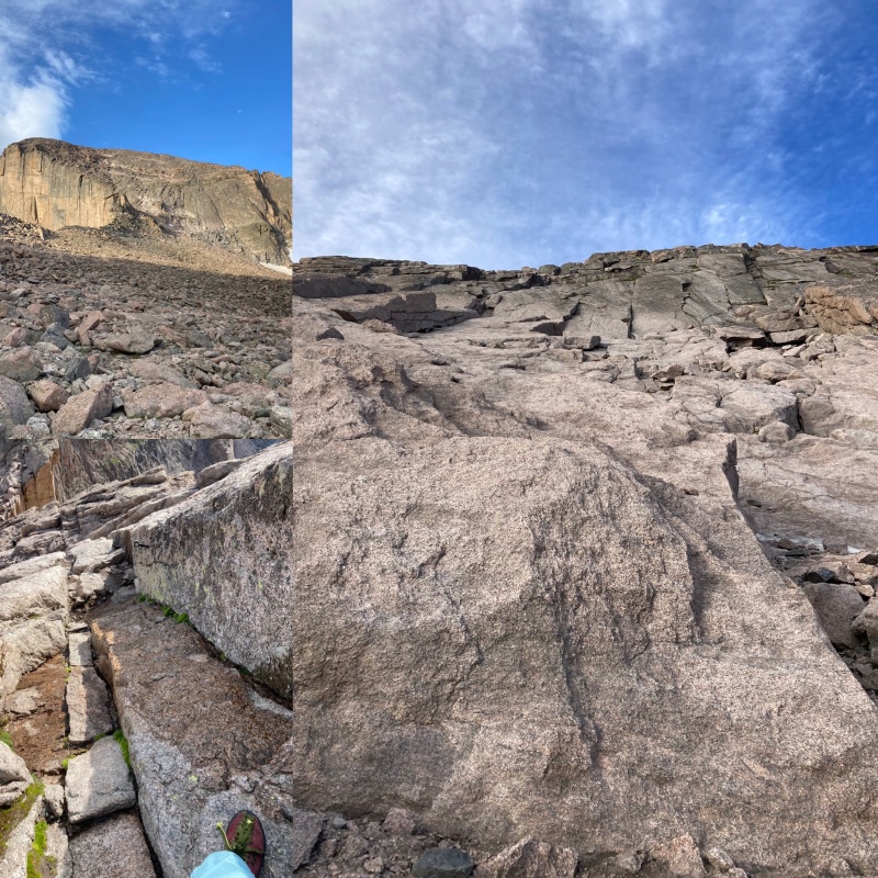
Day 2. I fitfully rested until 5am shivvering all night then started up the ridge which was a little slippery when wet but my shoes dried. I watched the sunrise on Isolation and it took a long time to warm up but I felt good. The ridge down and up Ouzel took a while and I summitted by 8am then Ogalala and made it to my cached gear on Ooh La La and finally got more water and snacks. I cached a couple days prior after climbing Hiamovi, a worthy technical peak. 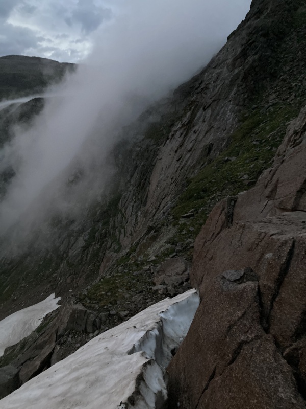
I got the Points and Buchanan when clouds started building again over Paiute. Why would I attempt this with a marginal forecast? Sunday’s forecast was predicted to be worse than Saturday and my experience was the exact opposite. That’s why. I had warm stable sunny skies all day Sunday and was able to get all the way to Sawtooth in a solid push but then it dumped again. I sat on Sawtooth’s summit in my bivy for 2 hours while it poured rain. I was a little wet and cold but stopped shivvering. With mild hypothermia I decided to hike down Buchannan Pass and then up over to Mitchell Lakes via Beaver Creek trail where I had another cache just in case. This would've added 8 miles and I’d have to repeat the process the next day to continue the LA Freeway because FKT’s must also list bail outs. When I got to Coney Lake TH it rained on me the entire way and with rain gear on I was soaked head to toe because of heavy vegetation, creek crossings, rocks, mud, marsh and killer mosquitoes. Nearing sunset again I decided to hitch a ride with a Jeep at the TH and he took me back to my car at Longs. Big fat bummer. Fail. 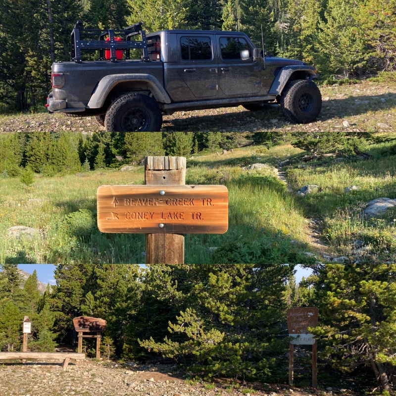
I had two good solid solo days even with major weather delays but it's important to have a dry day for the finish because it's the most technical. I drove home to clean up and check the weather so a couple days later... 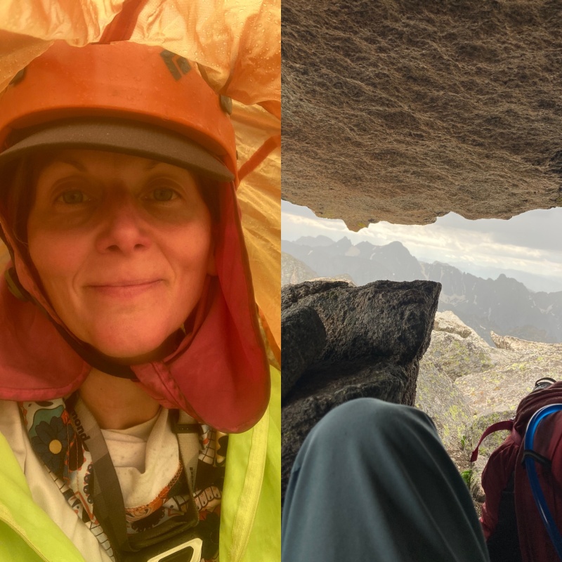
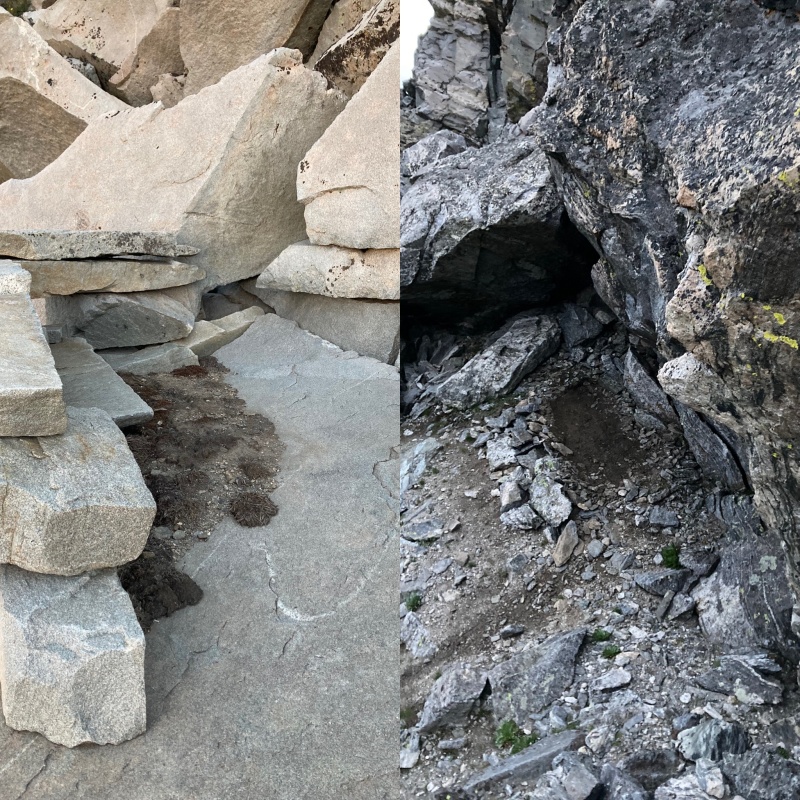
Day 3. Warmed up and totally dry I left my car at the 4th of July TH and me and my bike were dropped off at Brainard’s Mitchell Lakes. I started up Audubon to Beaver Creek and back up Buchannan Pass to continue the traverse from Sawtooth to Paiute and what a surprise it was. This added 9 miles and ~3,000 vertical. After scrambling along the ridge I chose slabs to a chimney on the east ridge. Once finished with Paiute it dumped rain again for 2 hours after a weather prediction for zero percent chance of rain. Whatever. I hid in a rock cave. The rock was wet and this killed my chances to continue. I decided to climb up Audubon and hike back down to my cache at Mitchell Lakes. 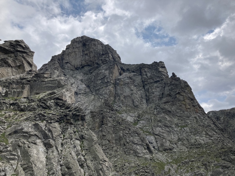
Day 4 The following morning I hiked back up Audubon and over to Paiute to continue the traverse. This added 8 miles and another ~3,000 vertical. Finally on to Toll I chose the north ridge and found the piton up the 5.4 corner. The rocks were bomber and Toll was so far my favorite peak of the traverse. I made quick time to Pawnee and then Shoshoni that had a surprise finish. WYSINotWYG. 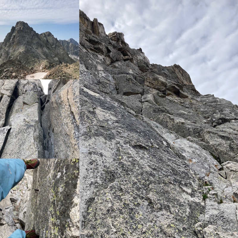
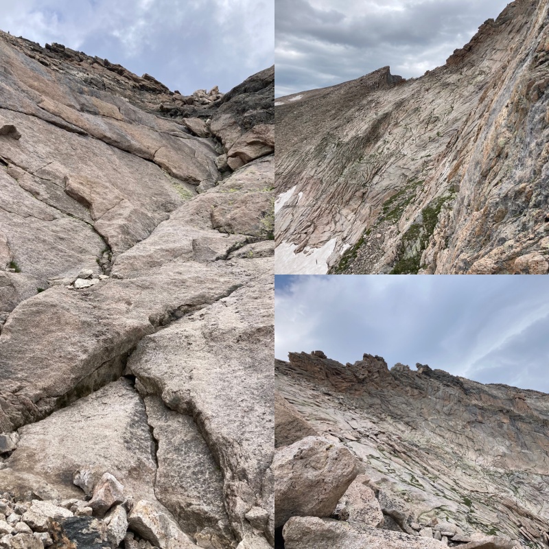
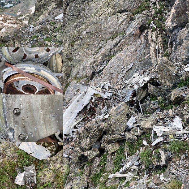
The Chessman traverse was mostly bypassed and the first time I was scared for the day was on the ramps up the King. Class 3 my butt. Once I got to Apache virga started misting down on Navajo and I wasted no time scrambling there. I had one slip on the downward slabs and took my time bypassing Dickers Peck. I got on Navajo's west gully and climbed the class 4 chimney. Coming down off Navajo was time consuming along the never ending scree field down and up Arikaree; my least favorite peak probably because I opted out of the ridge crest because of time. The rain held off and I followed Deshawa's never ending narrow ridge traipsing across the airplane wreckage and chose the class 3 notch instead of the gully to prevent tetanus in case some wreckage sliced my skin. The climb up Deshawa was super fun and committing along the east ramp. 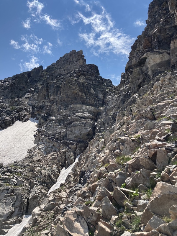
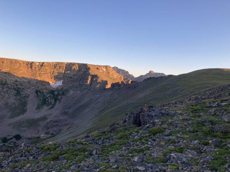
Another time consuming never ending tower(s) solo along the ridge to North Arapaho was killing time and I chose a class 3 ramp east to quickly gain the summit ridge. The sun set when I summitted and it's been several years since I've done the South to North Arapaho traverse but in spring with snow and I don't remember much. I started down the ridge to South via headlamp and tagged a rock with my toe then slipped head first into a boulder and whacked my helmet hard enough to smash my headlamp into pieces. I took a bungee cord and wrapped it around my head to use my phone's flashlight to find a safe place to bivy because there was no way I was going to figure out the finish via cel phone flashlight. Finally on day 5 attempt 7am I was done. That which does not kill you makes you stronger, right? I didn’t log bail outs so my mileage and stats for the 5 day push along the LA Freeway minus the extras was 39.7 miles, 23:03:46 hours moving time and 20,707 vertical feet. I did this self supported and solo with most peaks site unseen from Pagoda to Paiute, a new route on Toll, Pawnee to the Kasparov and Navajo to North Arapaho and technically this counted as a female FKT but I was not satisfied. If you live, you will fail. If you act, you will make mistakes. Nobody is perfect, circumstances change. It does not take long to live a life, you turn around and poof — it’s over. Two days later with a predicted perfect forecast the following week I knew I had to repeat the LAF FKT and this time in good style. August 9, 2022. Cable's was busy with 5 people roped up so I chose a route left of Cable's that I'll call the grey lichen route that was less slab and more of a finger crack. I blitzed by the party of 5 quickly and summitted Long's by 0814 and had the entire summit solo. Weird. From Long's I found a quicker way toward Pagoda and ran into two scramblers doing the Long's Grand Slam and helped them down the tricky bits. From Pagoda I got greedy and wanted to research the 5.7 route but there was no way I could climb down the first tower free. I found and old piton rap ring and looked for a way down it's base via a spicy chimney that took me to the base of the west ridge. I scrambled up to the second tower then dropped down the north face and down-climbed an off-width crack with a perfect knee jam then continued along slab westward. Even though it ate up time, this was a surprising and enjoyable route down Pagoda versus the demoralizing west ridge bypass. Chiefs Head went quickly as did the hike over and up Alice's hourglass then it is a long way to Isolation via Tanima and The Cleaver. I chose the west gully again to see what I missed last time via headlamp. Time dwindled as I hiked up Ouzel, Ogalalla, Ooh La La and I knew there was a tricky tower section between the Points. I cached water and food at Buchannan pass the day prior but I chose to bivy after Ooh La La because of the ridge towers. 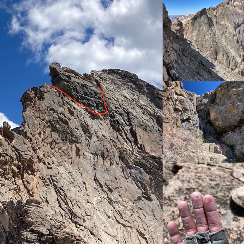
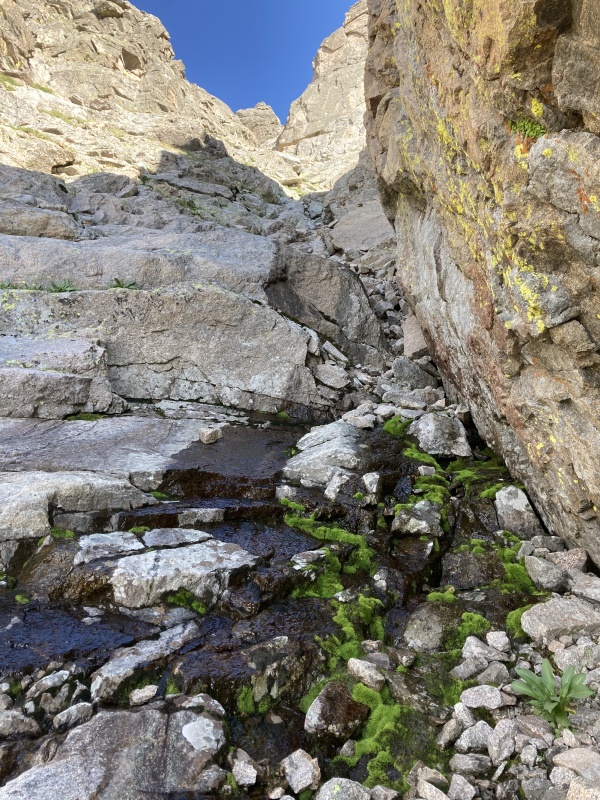
August 10th. I moved slowly and took a long time to warm up. I finally got to my cache and was excited to have a Red Bull and mushroom jerky. I wasn't looking forward to Paiute and I call it Mount Pollute because it is pure choss and I don’t know the Kyle Richardson east sidewalk sneak. Maybe someday he’ll show me? The only part that is enjoyable is the finish up the 3rd class scoop to a fun 4th class chimney. Also Paiute is the only mountain along the entire traverse where I was breaking off holds and had to exhaustively check every hand and foot placement. On to Toll now I found a good water source via a melting snow pool and decided to go up the 4th class gully vs. the super fun north face because I was carrying 6 liters of water now and could drop my pack at the saddle then out-n-back quickly without pack weight. 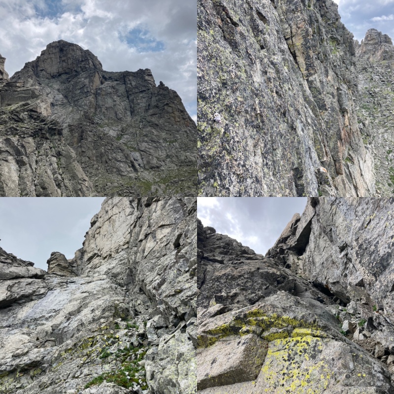
The hike up and over Pawnee, the pass and Shoshoni was a breeze and I wanted to be hiking the Kasparov by 4pm. This stretch went much quicker as did the climb over to and up Navajo. I dropped down to the Arikaree basin and filled up 2L of water again in case I was benighted along the hardest stretch of the traverse from Deshawa-South Arapaho. I decided to go straight up Arikaree's northeast face and found an awesome hand crack that was much more enjoyable then skirting around it's southeast super choss flank. It was getting late and I was feeling overwhelmed at the 3 final peaks. The route to Deshawa although intuitive is involved (at least there is some entertainment with the airplane wreckage) but I nailed it as the sun set. Bummer. I descended Deshawa and made another bivy because there is one tower along the ridge to North Arapaho that I know I won't do via headlamp or full moonlight as I had even though I should keep moving. The successful strategy I’ve learned isn’t go ballistic and see how fast at my age and adaptive athlete status. I’ve learned to never red line in the mountains. Instead I climb in control and summit with tons of energy that is vitally important while alpine climbing. As the cliche goes, the summit is only halfway so its best not arrive exhausted. You can slap the chains at the top of a hard sport climb but there’s no slapping the chains in alpinism. Lead on-sight in good strong style, safely. This is what one's ability is. 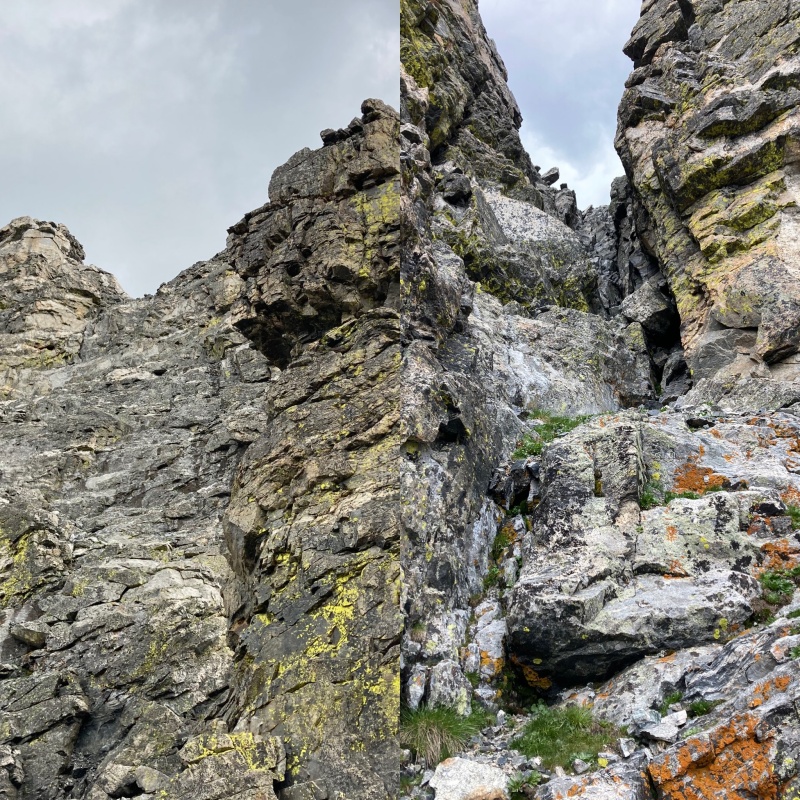
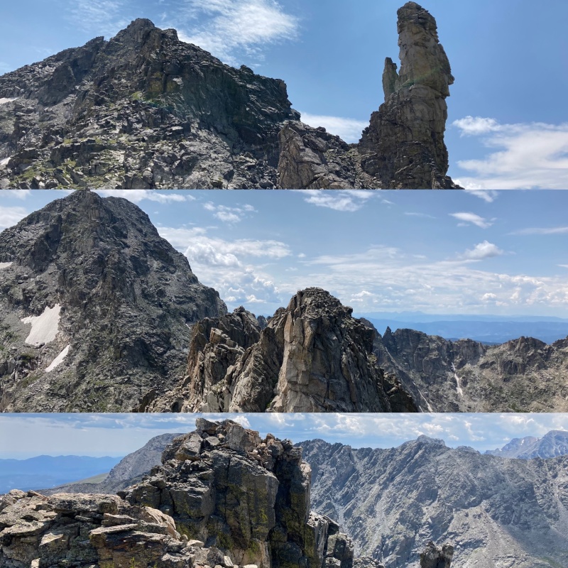
August 11th Moving slowly again my body finally warmed up as I approached the whackado tower mid ridge to North Arapaho. The first time I climbed it's northwest side but today I chose the southeast side because it was warm, sunny and the wind was coming from the west. Brrr. The southeast side is committing face climbing but there are good holds, just slabby feet. This tower must have a name? Whackado Tower. There I named it. 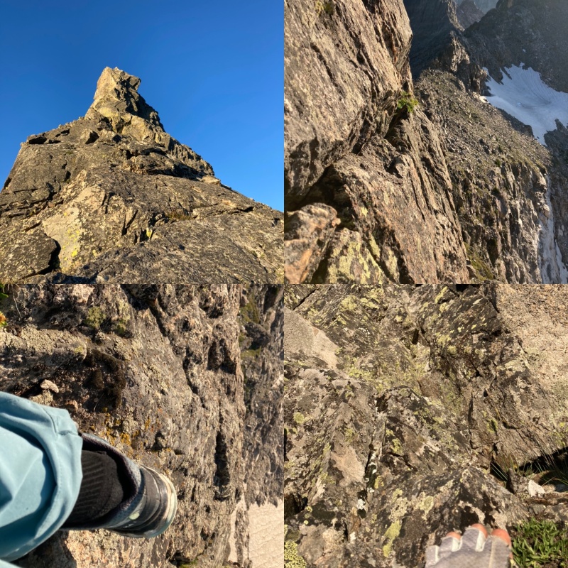
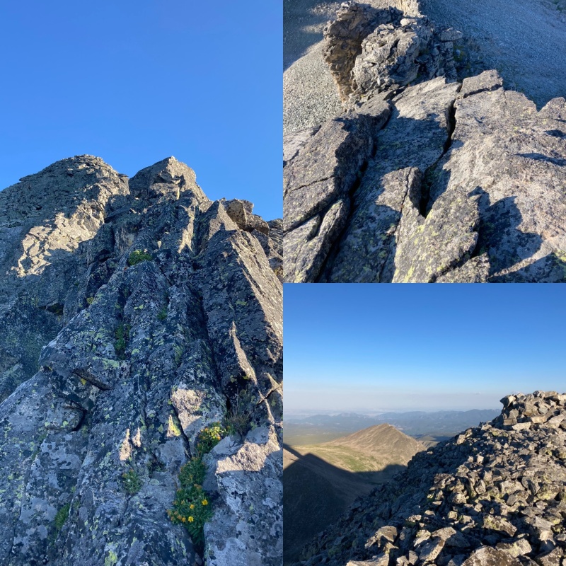
I found a south gully up to North's finishing ridge and enjoyed the summit for 3 minutes then followed the well traveled route to South Arapaho. On the way down to 4th of July TH I took my time and stopped and chatted with a few people and the first one ironically named Marc with all the newbie accouterments when I asked, “are you on a dog leash too?” as I pointed to his InReach device dangling from his pack. My Marc is my biggest fan and if I’m true to my genuine desires I have full support. The rule is to send messages every hour on the hour while solo and occasionally I get encouraging messages along the way. After being in my head for 2 days I can finally relax with Bluetooth headphones and the first song that popped up was Kelly Clarkson’s ‘My Life Would Suck Without You’ and I got a little emotional realizing how privileged I am considering where I was 6 years ago. I was hit by a car while riding my bike home from work and it took a long time to get where I am today. I've planned and dreamed of the LA Freeway for 3 years and haven't had the right amount of physical or mental fitness to do this until now. I had to learn how to walk and climb again with a fused back so sometimes rock sheltered bivy's are a little rough but today finally, in good style, I completed this mission most of it site unseen (the first time with marginal weather) as a self-supported solo female. 
Long ago I learned I couldn’t live without climbing mountains and stopped questioning why. Some search for meaning in their life, not me, climbing is the only thing that makes me feel alive. There doesn’t need to be a reason. The summit is just a step and the only secret I have is to just keep going. 
Part of a poem that quells my terminal uniqueness. Joy and woe are woven fine, 
GPS stats round 2: 37.91 miles 22h 44m moving time 2d 7h 20m total time 20,454 vert Splits August 9th Long's TH 0353 Long's summit 0814 Pagoda 0953 Chiefs Head 1206 Alice 1356 Tanima 1509 Isolation 1735 Ouzel 1848 Ogalalla1931 Ooh La La 2013 Bivy before the Points 2118 August 10th Point 12,228 0612 Buchannan 0653 Cache 0714 Sawtooth 0757 Algonquin 0921 Paiute 1150 Toll 1317 Pawnee 1354 Shoshoni 1506 Apache 1700 Navajo 1750 Arikaree 1909 Deshawa 2038 Bivy August 11th North Arapaho 0746 South Arapaho 0835 4th of July TH 1113 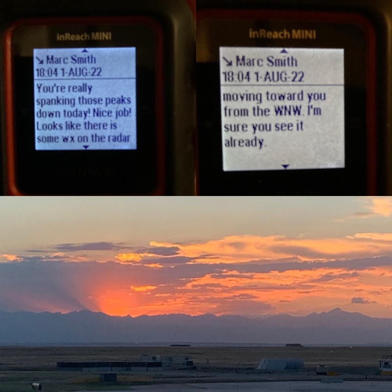
Thumbnails for uploaded photos (click to open slideshow): ")
")
")
")
")
")
")
")
")
")
")
")
")
")
")
")
")
")
")
")
")
")
")
")
")
")
")
")
")
")
")
")
")
|
| Comments or Questions | |||||||||||||||||||||||||||||||||||||||
|---|---|---|---|---|---|---|---|---|---|---|---|---|---|---|---|---|---|---|---|---|---|---|---|---|---|---|---|---|---|---|---|---|---|---|---|---|---|---|---|
|
Caution: The information contained in this report may not be accurate and should not be the only resource used in preparation for your climb. Failure to have the necessary experience, physical conditioning, supplies or equipment can result in injury or death. 14ers.com and the author(s) of this report provide no warranties, either express or implied, that the information provided is accurate or reliable. By using the information provided, you agree to indemnify and hold harmless 14ers.com and the report author(s) with respect to any claims and demands against them, including any attorney fees and expenses. Please read the 14ers.com Safety and Disclaimer pages for more information.
Please respect private property: 14ers.com supports the rights of private landowners to determine how and by whom their land will be used. In Colorado, it is your responsibility to determine if land is private and to obtain the appropriate permission before entering the property.