Download Agreement, Release, and Acknowledgement of Risk:
You (the person requesting this file download) fully understand mountain climbing ("Activity") involves risks and dangers of serious bodily injury, including permanent disability, paralysis, and death ("Risks") and you fully accept and assume all such risks and all responsibility for losses, costs, and damages you incur as a result of your participation in this Activity.
You acknowledge that information in the file you have chosen to download may not be accurate and may contain errors. You agree to assume all risks when using this information and agree to release and discharge 14ers.com, 14ers Inc. and the author(s) of such information (collectively, the "Released Parties").
You hereby discharge the Released Parties from all damages, actions, claims and liabilities of any nature, specifically including, but not limited to, damages, actions, claims and liabilities arising from or related to the negligence of the Released Parties. You further agree to indemnify, hold harmless and defend 14ers.com, 14ers Inc. and each of the other Released Parties from and against any loss, damage, liability and expense, including costs and attorney fees, incurred by 14ers.com, 14ers Inc. or any of the other Released Parties as a result of you using information provided on the 14ers.com or 14ers Inc. websites.
You have read this agreement, fully understand its terms and intend it to be a complete and unconditional release of all liability to the greatest extent allowed by law and agree that if any portion of this agreement is held to be invalid the balance, notwithstanding, shall continue in full force and effect.
By clicking "OK" you agree to these terms. If you DO NOT agree, click "Cancel"...
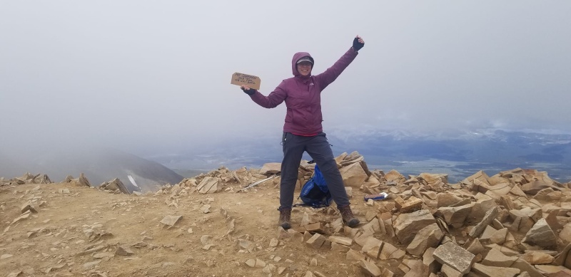
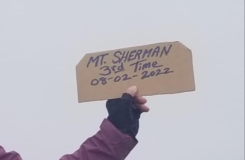
My third trip up Mt. Sherman was on Tuesday, August 2, 2022. My plan was to add a nearby 13er or two, but the wind was so strong it was hard to move. I almost lost my eyeglasses, hat, and trekking poles. What started as a calm, beautiful blue day quickly turned gray, misty, and windy. Another hiker (former Marine) estimated it at about 70 MPH. I'm glad it didn't rain.
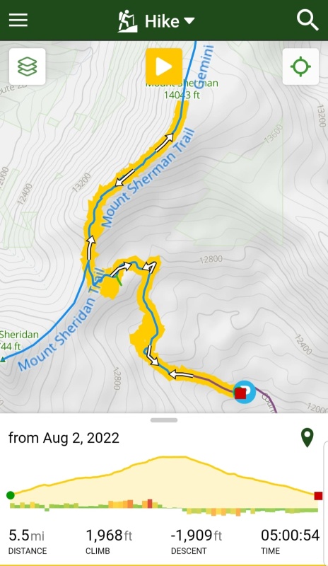
DATE: Tuesday, August 2, 2022
TRAILHEAD: Fourmile Creek
ROUNDTRIP MILES: 5.3
START AND END TIMES: 8:01 AM, 12:40 PM (4 hours moving time)
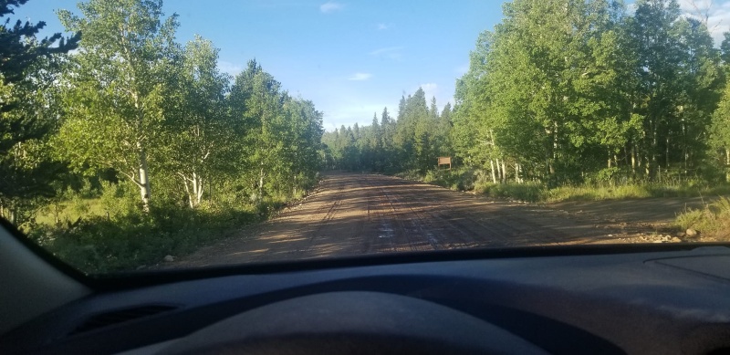
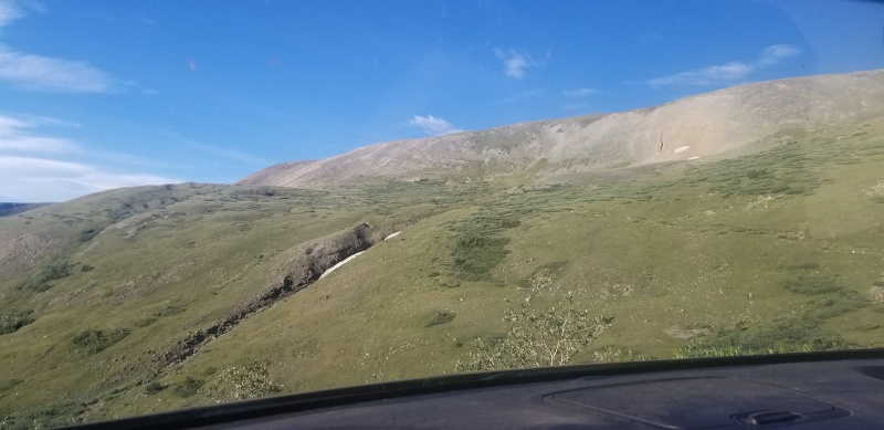
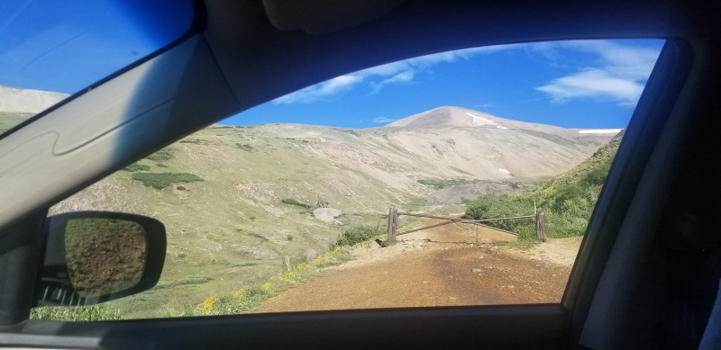
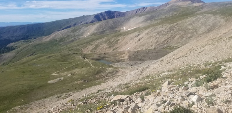
The better part of a rugged road.A view south from my dashboard.Can't get a much closer parking spot. Most people parked courteously.
I arrived at the trailhead at 7:40, ate breakfast and changed from clogs into boots. I didn't make a point to see when I began hiking, but my Trail Forks app says it was at 8:01 AM. As I started I looked at the sky and thought, "What a beautiful day for a summit!"
I did a little meandering, because I took a wrong turn. I'm not sure how I could do that when I had been up there twice before. It wasn't hard to get back on the correct trail.
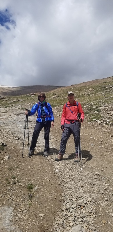
I met another woman hiking solo about a third of the way up and we hiked together to the summit and back to our cars.
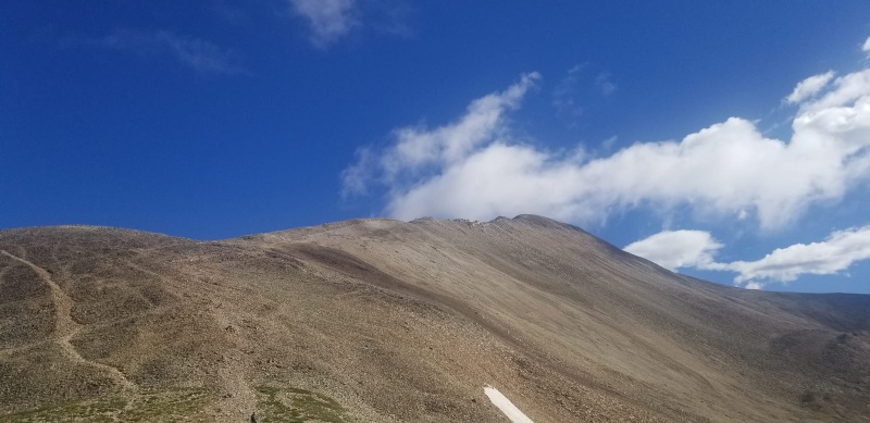
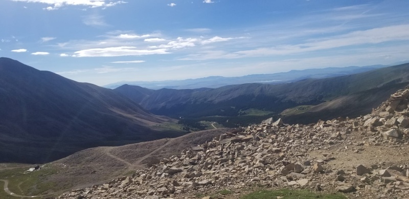
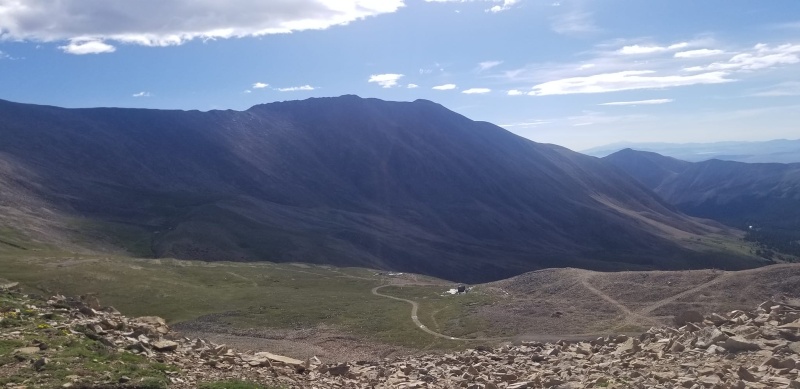
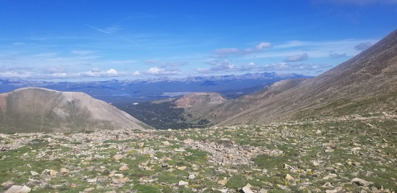
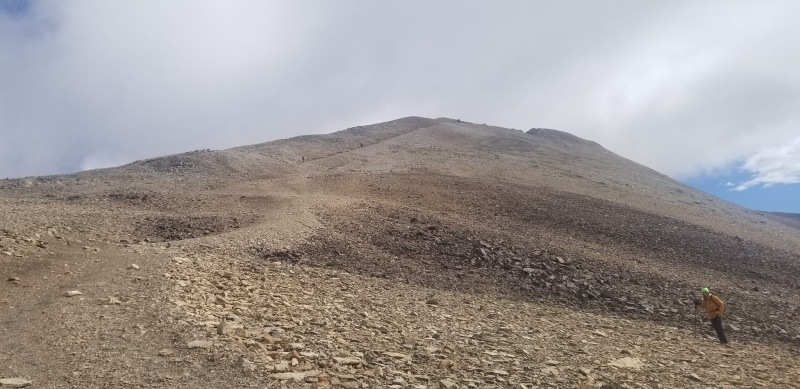
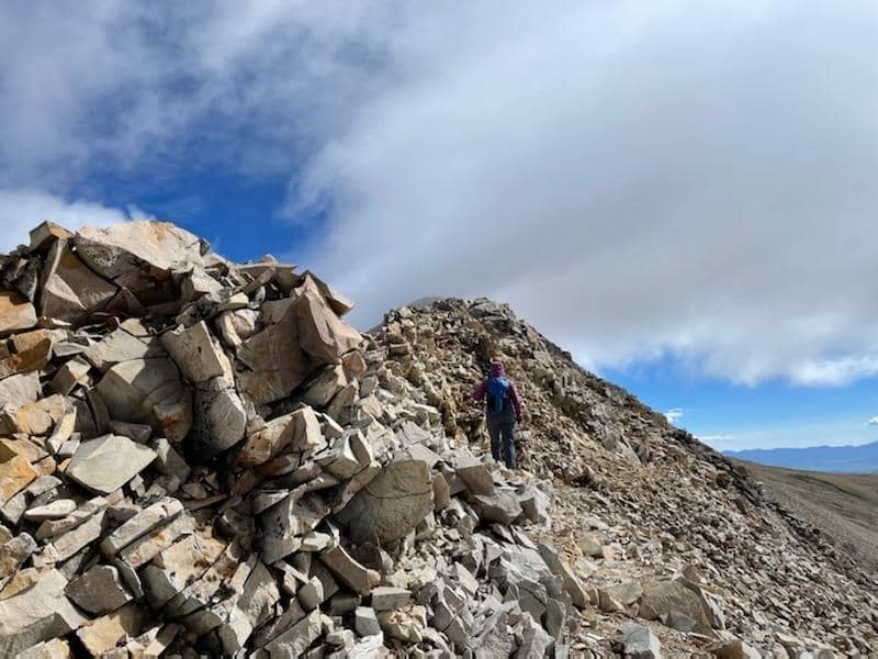
A look back at the trail, shortly after the mine ruins, still early in the hike.Looking up from the saddle, the sky was still mostly blue and beautiful.From the saddle looking east.The clouds were beginning to turn gray. Looking east.Looking over the west side.I got a picture of my hiking partner re-connecting from the less windy, eastern trail we opted for on this windy day, to the more direct trail up the ridge.My newfound partner snapped a picture of me ascending the east side of the ridge.
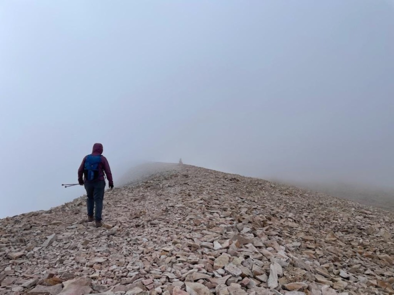
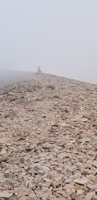
The views were great below the summit, once on top it was gray and misty. I am hiking in the wind. I think it came mostly from the west.
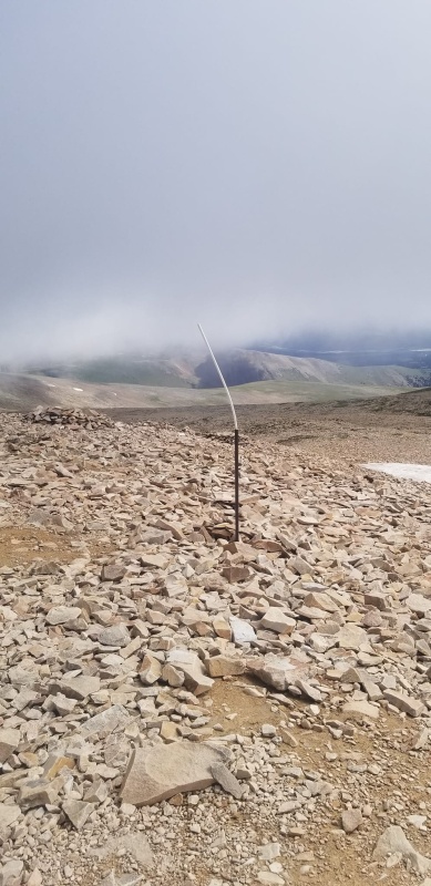
We spot a marker through the mist. The summit is beyond this.I think this pole on the summit is new. Last time I was there in 2021 there were a couple of registration tubes anchored to boulders. There is no geological survey marker on Mt. Sherman.My best summit photo, looking west, I am facing east.I packed home my sign and two others that I found on the summit.
Several people passed us on their way down while we headed up. There were about a dozen people on the summit when we were there, but others were still on their way. It wasn't hundreds of people, as I remember on a Saturday in August, 2021.
We are almost back to our cars in this picture, taken by a hiker we met on the top.My Trail Forks Recording.
Thumbnails for uploaded photos (click to open slideshow):
Something about Mt. Sherman causes "bad" weather there frequently in my experience. I have been up there 4 times, all in summer, and 3 of the 4 times there were high winds.
Great write up we are going to do this Monday weather permitting it.
Caution: The information contained in this report may not be accurate and should not be the only resource used in preparation for your climb. Failure to have the necessary experience, physical conditioning, supplies or equipment can result in injury or death. 14ers.com and the author(s) of this report provide no warranties, either express or implied, that the information provided is accurate or reliable. By using the information provided, you agree to indemnify and hold harmless 14ers.com and the report author(s) with respect to any claims and demands against them, including any attorney fees and expenses. Please read the 14ers.com Safety and Disclaimer pages for more information.
Please respect private property: 14ers.com supports the rights of private landowners to determine how and by whom their land will be used. In Colorado, it is your responsibility to determine if land is private and to obtain the appropriate permission before entering the property.
")
")
")
")
")
")
")
")
")
")
")
")
")
")
")
")
")
")
")


