| Report Type | Full |
| Peak(s) |
South Lookout Peak - 13,420 feet |
| Date Posted | 07/14/2022 |
| Date Climbed | 06/28/2022 |
| Author | supranihilest |
| Additional Members | whileyh |
| Spice Lookout Peak | |||||||||||||||
|---|---|---|---|---|---|---|---|---|---|---|---|---|---|---|---|
|
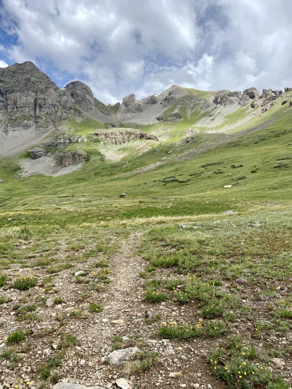
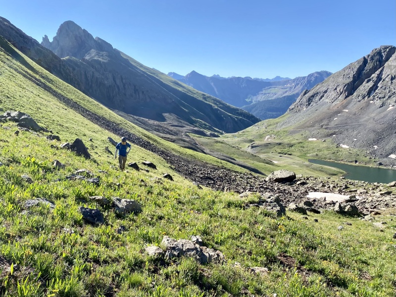
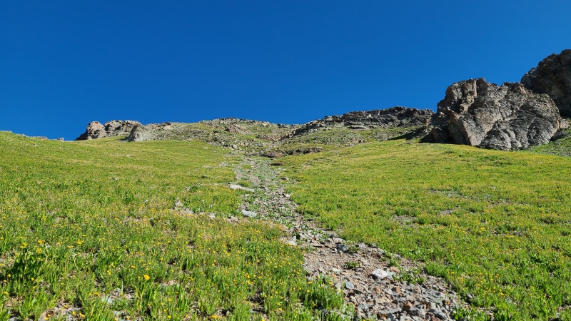
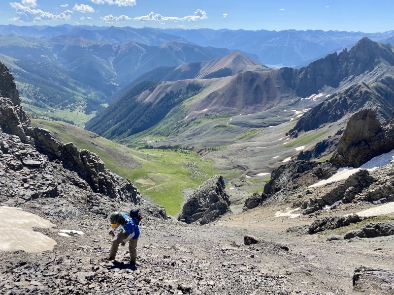
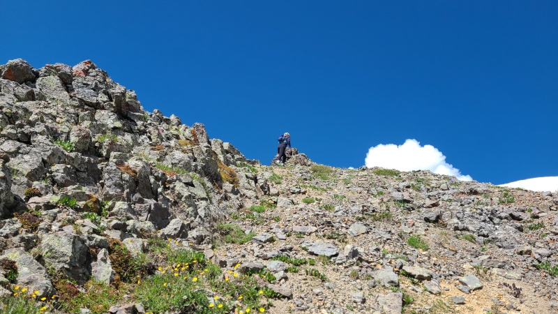
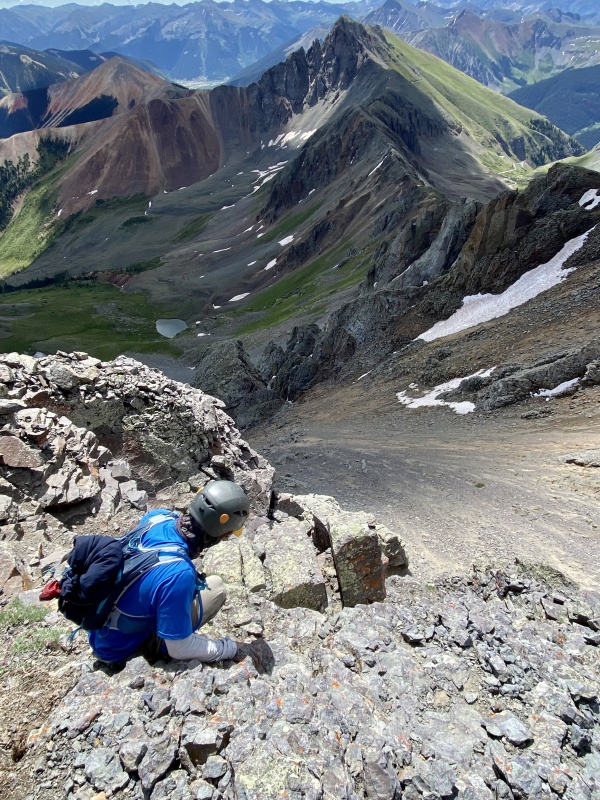
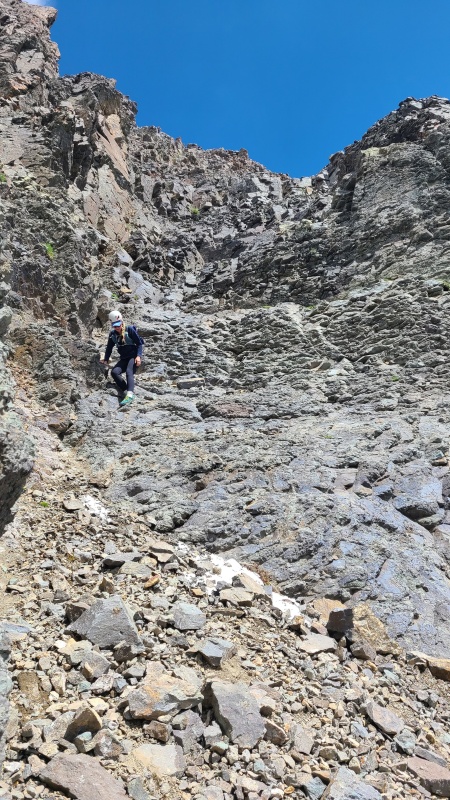
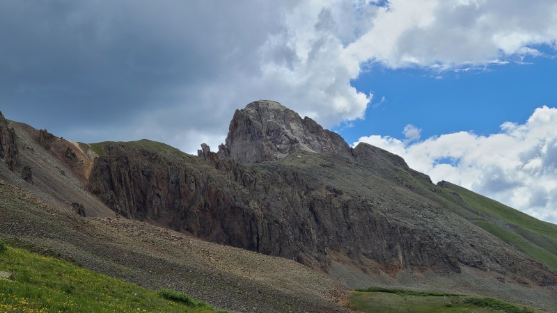
South Lookout Peak is a tough and reclusive mountain northwest of Silverton. It guards its summit well, with most approaches being little more than a losing staring contest with a huge, intimidating mass of pinnacles, spires, and blocks. Only from the south via Clear Lake does South Lookout give likely passage, and even then the approach is short and steep and the summit guarded by formidable, exposed scrambling on poor rock. Its higher, easier, and more well-known big sister peak, Lookout Peak, sits due north across Ophir Pass. Access to South Lookout from Ophir Pass is possible, but I've never heard of anyone climbing the peak from there. Perhaps as a snow climb up its east face, something I intend to try at some point. I didn't have the luxury of that this year so Whiley and I did it dry. While I thought the peak was spooky and difficult, it was also kind of fun in a way. Type II fun, really. We also took a slight variation to the other routes thus far described in trip reports, which we thought worked well and wanted to describe. The morning of our climb we drove up Clear Lake Road/San Juan County Road 12/Forest Service Road 815, which goes all the way to Clear Lake. It's an easy to moderate 4WD road with tight switchbacks. Most of the switchbacks could be camped at if one desired. From Clear Lake South Lookout Peak is under a mile away and about 1,400 feet of gain, but the peak is no gimme. We started hiking first on easy tundra towards the obvious point that is South Lookout's south summit at the corner of the basin. The terrain steepened, what looked like grass was actually half scree, and we had one short, chossy cliff band to work through, but there were absolutely no difficulties at all to the south summit. If only this could have been the true summit! 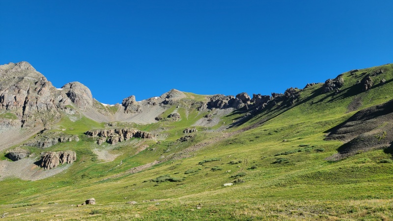
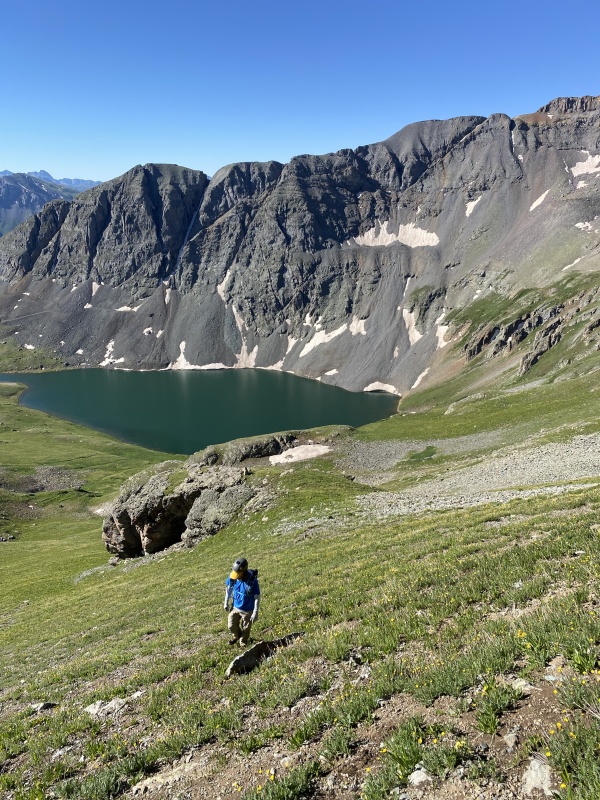
We didn't ascend directly to the south summit, instead reaching the connecting ridge with "V 5" first. From there the view of South lookout is sobering after such easy terrain. 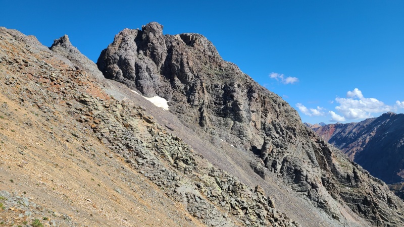
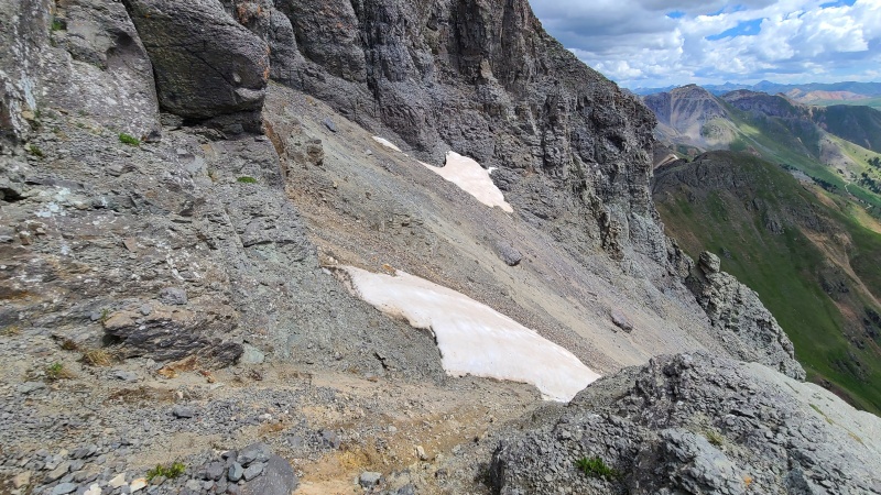
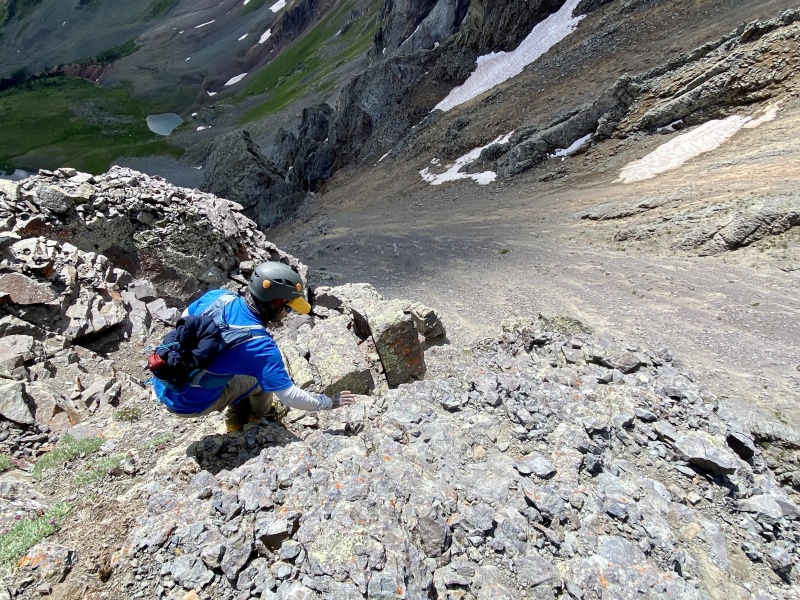
We continued to the south summit at which point the grass ended abruptly and shifted to scree overlaying hardpan. We crossed the first gully of hardpan to a shallow rib, then another steeper gully to the base of the summit massif. The second gully was a fair bit steeper than the first and most of the scree had been washed away leaving more hardpan. I took advantage of the wet dirt around the two snow patches, and also put on microspikes to grind little steps into the hardpan for Whiley, since she hadn't brought her spikes. The hardpan was steep and tractionless enough to be nerve-wracking otherwise. 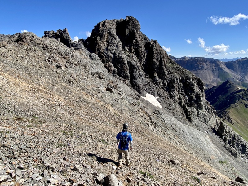
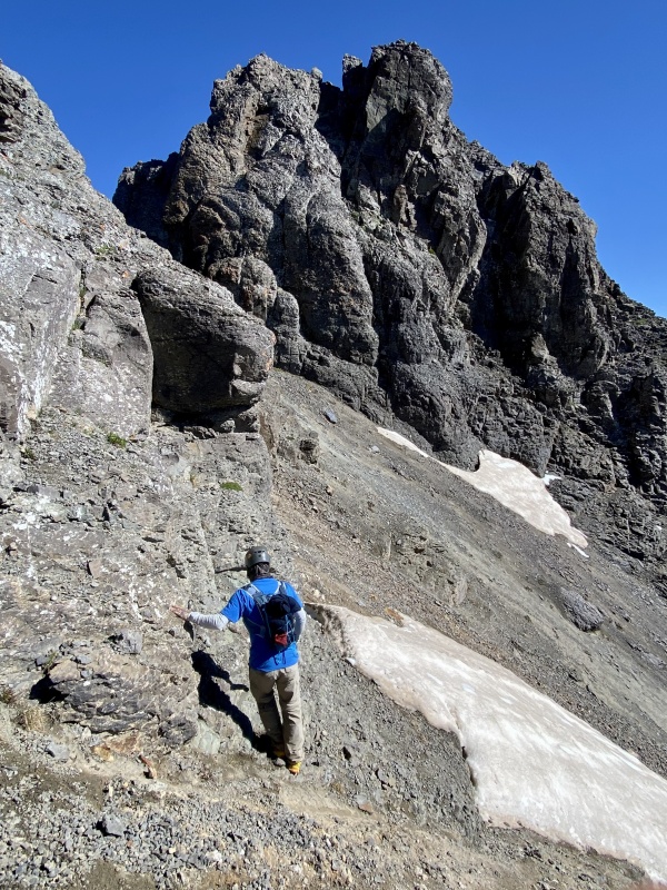
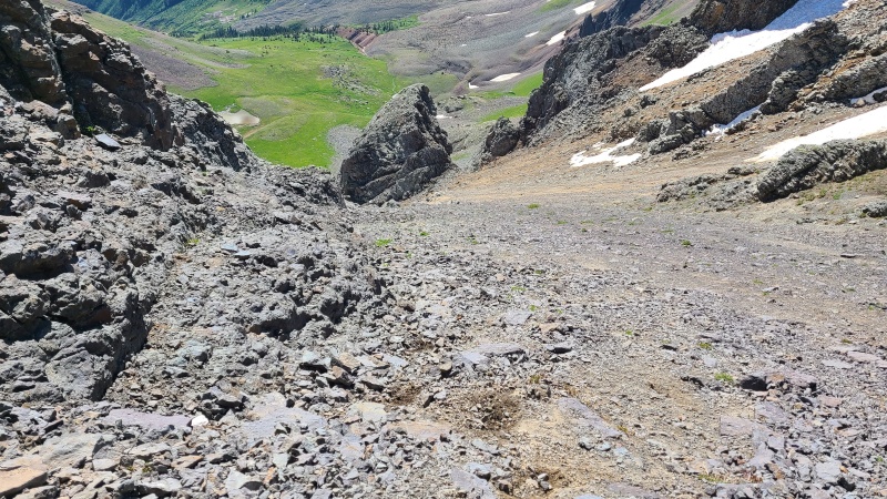
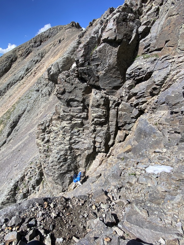
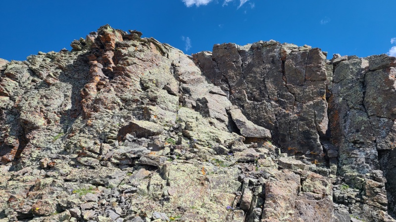
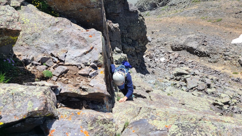
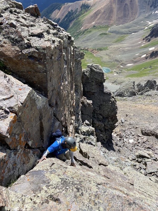
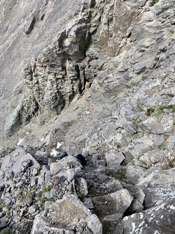
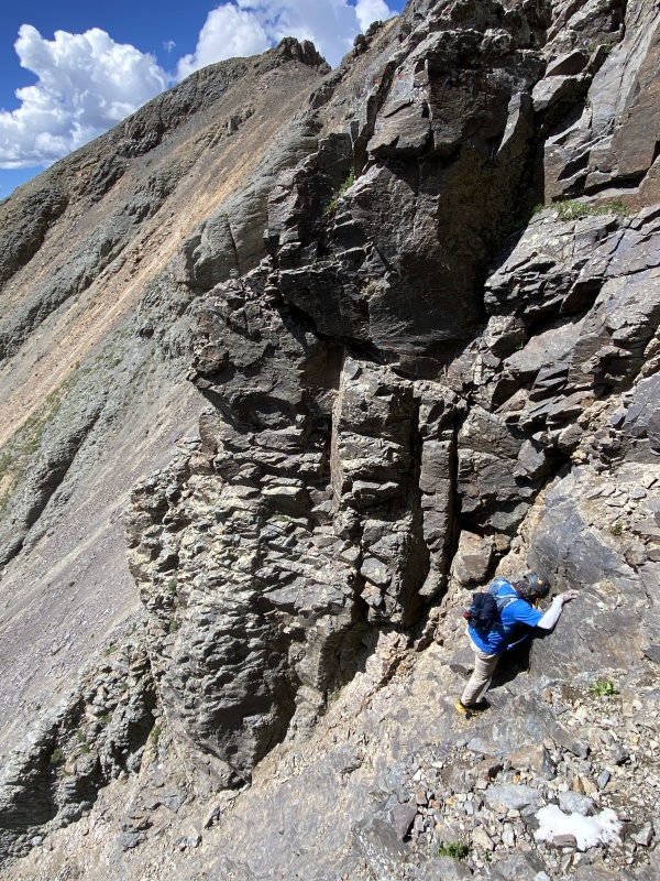
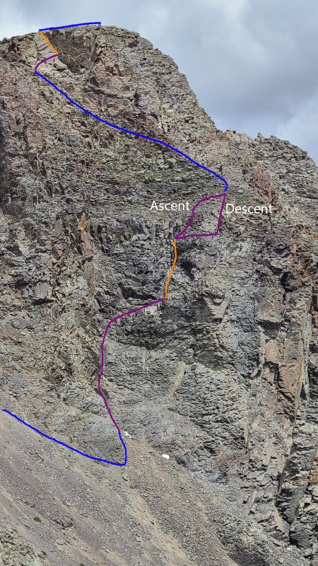
When we reached the far side of the second gully we went downhill 75-100 feet and rounded the corner about 50 feet above the short tower in the photo above. This took us into a third gully below what would be the meat of our climb. At this point our climb diverged from Furthermore's. He went to climber's right around this section on a narrow ledge system which looked very exposed. We went more directly up. The scramble could be handled a number of different ways, but we began by going climber's left up a chossy red gully for about 25 feet until it narrowed enough that we could climb up more solid black rock. The black rock also could have been ascended directly but it was downsloping, smooth, and covered in a thick layer of dirt which didn't inspire confidence. We scraped off as much dirt as we could with each move. Whiley ascended first onto the black rock then made a Class 3 traverse to the right on poor, dirt-covered rock to a ledge where we could stop and go hands free for a moment. This ledge is visible in several photos below, both from below and above; it's higher up than it looks when viewing from below. 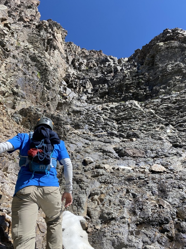
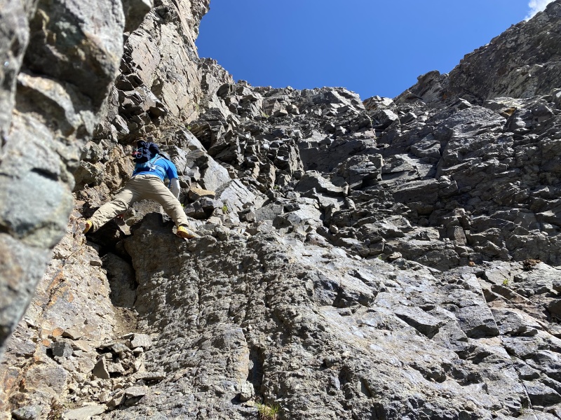
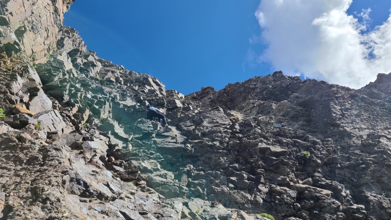
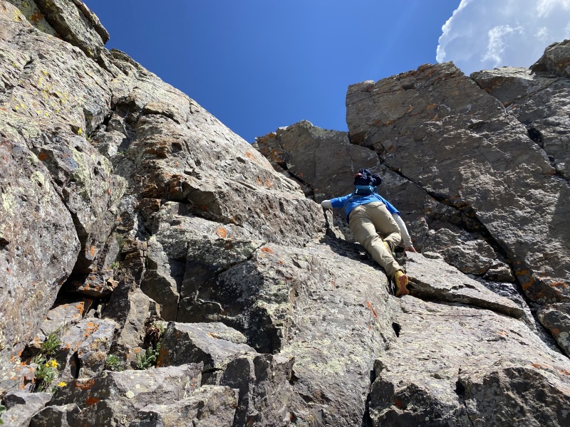
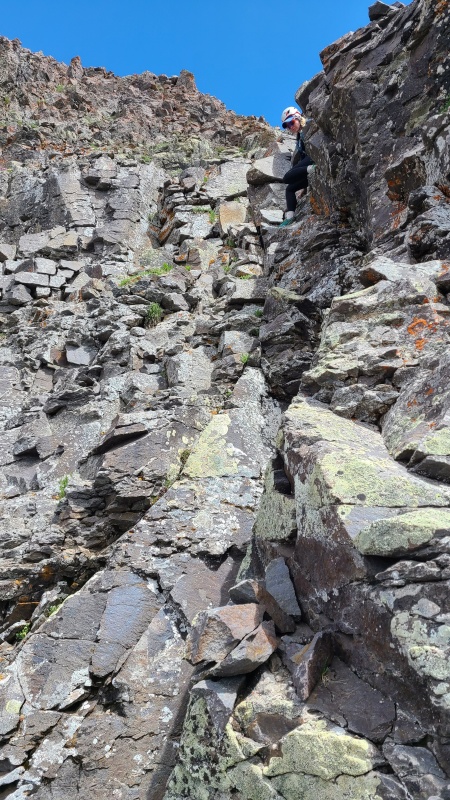
From this ledge we really only saw one option: go directly up the remaining headwall in an open book chimney, which was just slightly under vertical. Fortunately rock quality improved here, relatively speaking, and the scrambling felt more secure though it was harder. There were good holds but sometimes they were narrow and required stacking hands and feet. The chimney required a delicate but fun sequence which I took first this time. A few body lengths of Class 4 dancing up the chimney led to another section of crappy, dirt-covered, down sloping black rock like that we found below. We switched again with Whiley heading up first. Though this was only Class 3 it was highly exposed and we got to the top without being sure how we'd get back down - too loose and down sloping to even butt-scoot. We knew there was at least one other way down, via a horrendous, chossy red gully far to our left (which we did not take a photo of, but is seen in photo #6 in Marmot72's trip report) so we'd figure it out as we descended. 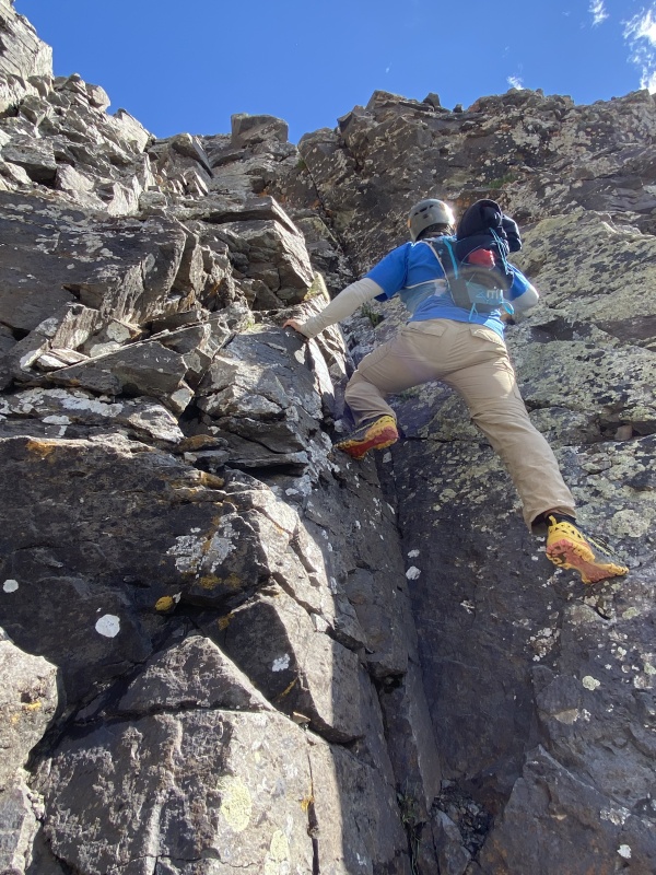
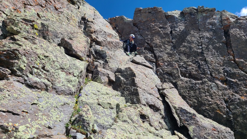
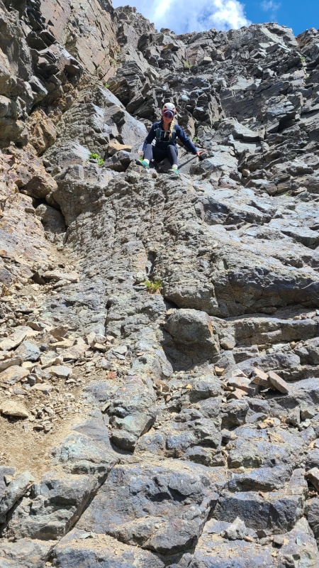
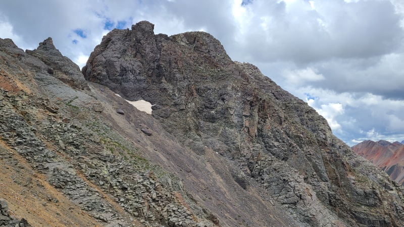
Once atop the Class 3 section, which was only 6-10 feet, the scrambling immediately abated and we found ourselves on Class 2 terrain. There was even some grass! We were on top of a rib at this point, which we mostly were able to hike up to the summit block. There was some very minor Class 2+, and to our joy no hardpan at all! 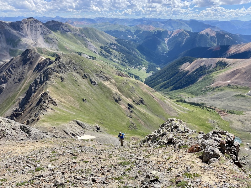
We climbed up the rib for 100-150 feet or so at which point we had a clear picture of how to get up the summit block. There might have been multiple ways up but an obvious corner looked easiest and is what others have reported in their trip reports. The rock here also looked - and proved - to be excellent quality. Exposure on the summit block was far more manageable than the sections below. There's a short section of Class 3 at the bottom on broken rock and ledges before the best course of action seemed to be climbing the cracks in the corner. The upper portion was Class 4, and while it was a little slabby and I did a smearing move or two the fine rock and abundant, secure holds made the block feel easy, certainly easier than the lower scramble. It only took us a couple of minutes to get up to our hard-earned summit and was by far the most fun part of the peak. 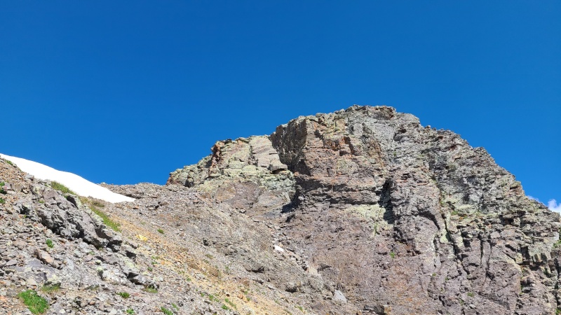


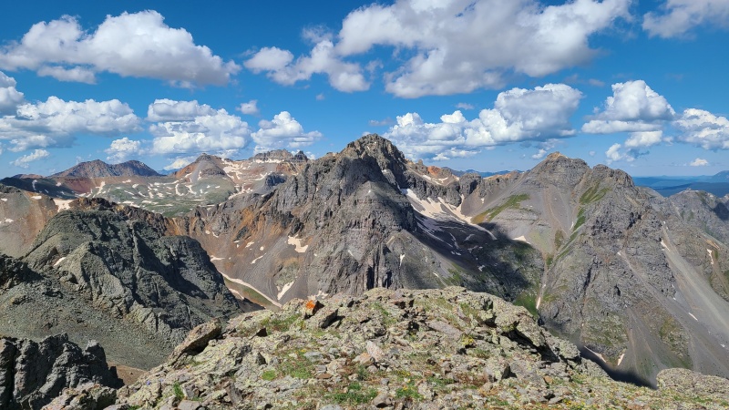
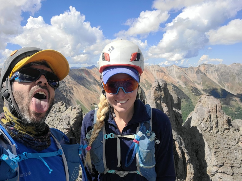
We spent only a minute or two on top marveling at the incredible towers that make up the north summit and thanking our lucky stars that they weren't the true summit. They'd undoubtedly be a considerable technical climb and not something we wanted to deal with. Our gawking complete we decided to get off this pile - the faster the better. The down climb off the summit block was again the easy part, and we carefully hiked down the rib to where we'd climbed up before. 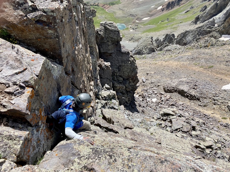
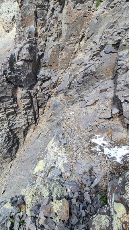
At this point we scouted the exact route we ascended, now with the benefit of calmer minds. The Class 3 section on top of the chimney was still garbage. I attempted to butt-scoot it and just barely got my feet dangling over the edge before I got too scared to continue. With nothing to hold onto except dirt and gravel, a slanted edge over 100-plus feet of exposure, and a bad feeling, I backed off. We knew this was likely to be the crux, even if it wasn't the most technically difficult - it was just super sketchy and with fatal consequences. The red gully (now to our right) didn't seem pleasant either so I spent a couple of minutes poking around the immediate area, finding a great way down just to the left. It was still a butt-scoot, but instead of a butt-scoot to the edge of a sheer wall I was able to get down to a small cleft among several broken blocks (which were bomber!), down climb several feet to a ledge, then traverse to descender's right around a tiny outcrop which led to the bottom of the sketchy stuff and the top of the chimney. All in all the ledge traverse was probably 10 feet long and exposed, but the rock was good, level, and clean. 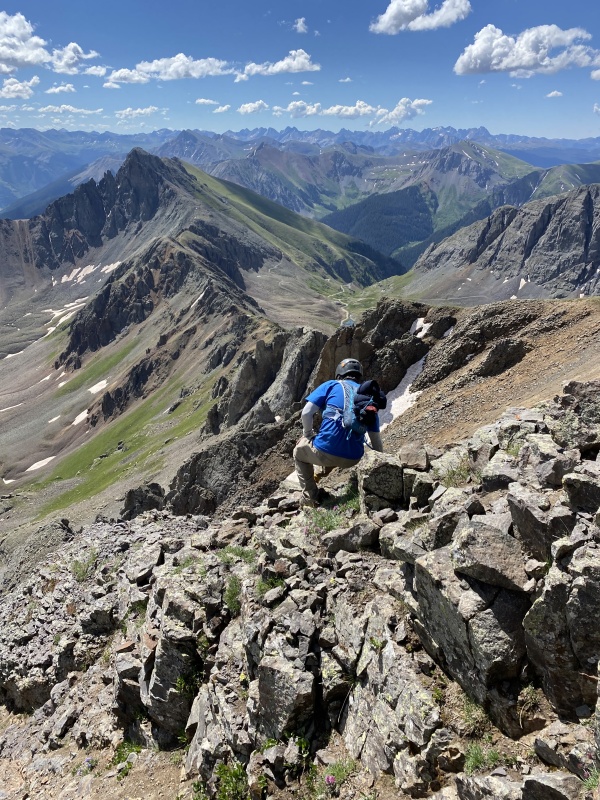
The down climb of the chimney was actually easier on the way down, feeling more like Class 3 than Class 4. On the other hand, the final ledge traverse and down climb were harder than on the way up. We butt-scooted the heck out of it where we could, and down climbed facing in where we couldn't, owing to not being able to safely down climb the sloping trash facing out. 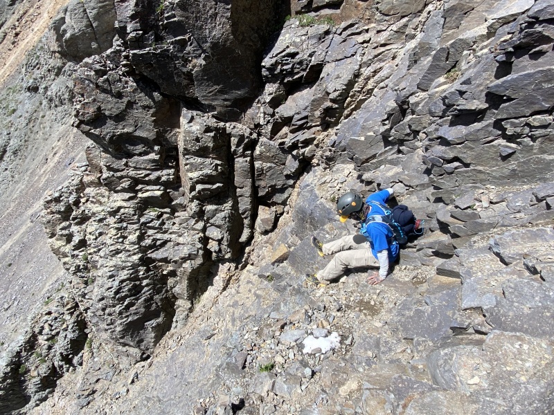
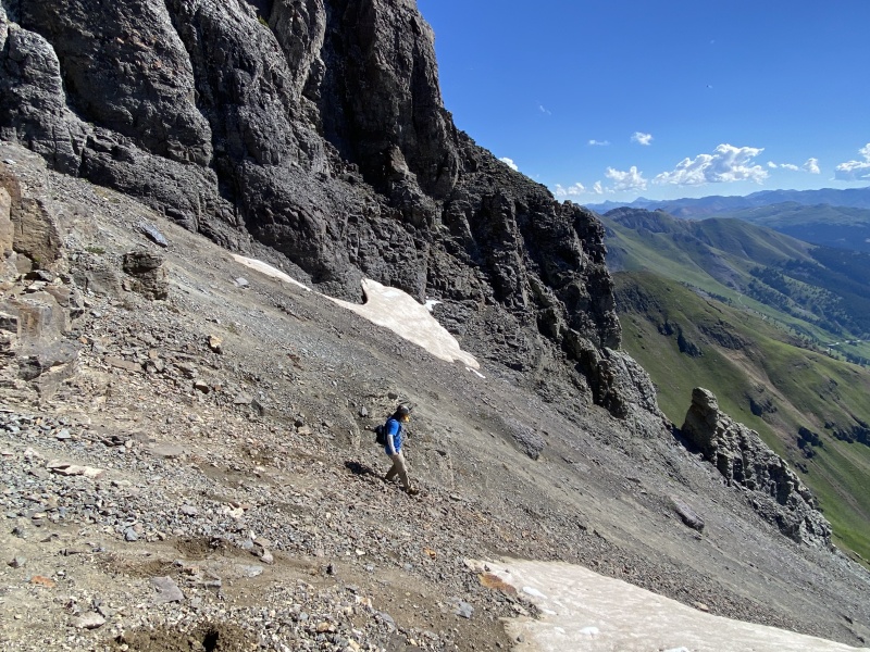
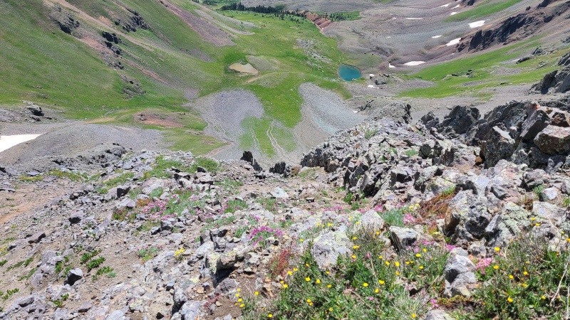
We breathed a sigh of relief when we reached the talus in the gully. Though South Lookout was fun it was sketchy and kept us on edge for the past hour and a half or so - quite a lot of time to only climb up and down 200-300 feet! We beat feet back to the south summit and partway down the ridge with "V 5" to get a few pictures as clouds built overhead. It's a good thing this peak was a short one. 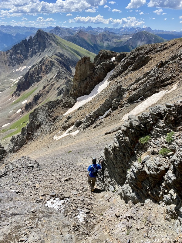

Descending the grass/scree slope back to Clear Lake was quick, and it sprinkled a little as we descended and drove back to Kendall campground where I'd left my van. What a peak! We knew it'd be an interesting one, and in typical San Miguel fashion it sure was! We were glad to have it done, knowing it was one of the biggest remaining challenges we had left on our thirteener list. I worked for the rest of the afternoon while Whiley scouted the John Cappis 50k course for the upcoming weekend. Another great San Juan scramble - check! 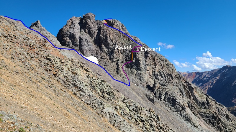
StatisticsClimbers: Ben Feinstein (myself), Whiley H. Total distance: 2.1 miles
Splits:
GPX users: Though I cleaned up my GPX track significantly do NOT expect to be able to follow it inch-by-inch. This route is too steep, scrambly, and exact to blindly follow a track. Thumbnails for uploaded photos (click to open slideshow): ")
")
")
")
")
")
")
")
")
")
")
")
")
")
")
")
")
")
")
")
")
")
")
")
")
")
")
")
")
")
")
")
")
")
")
")
")
")
")
")
")
")
")
")
")
")
")
|
| Comments or Questions | |||||||||||||||||||||
|---|---|---|---|---|---|---|---|---|---|---|---|---|---|---|---|---|---|---|---|---|---|
|
Caution: The information contained in this report may not be accurate and should not be the only resource used in preparation for your climb. Failure to have the necessary experience, physical conditioning, supplies or equipment can result in injury or death. 14ers.com and the author(s) of this report provide no warranties, either express or implied, that the information provided is accurate or reliable. By using the information provided, you agree to indemnify and hold harmless 14ers.com and the report author(s) with respect to any claims and demands against them, including any attorney fees and expenses. Please read the 14ers.com Safety and Disclaimer pages for more information.
Please respect private property: 14ers.com supports the rights of private landowners to determine how and by whom their land will be used. In Colorado, it is your responsibility to determine if land is private and to obtain the appropriate permission before entering the property.