To break up the long drive from Denver to Silverton on Friday, July 27, I had made a slight detour to tag bicentennial peak UN 13,712 by the most expedient means I knew of: going over fourteener Shavano. That jaunt ate up about 4 1/2 hours and I found myself driving up to Clear Lake in the dark and not getting into the sleeping bag until after 10 pm. I was surprised to find several vehicles up around the lake, and a party with a campfire. With lousy sleep the night before, an alpine start was not in the works and I slept in until 4:30 or so, awakened by the same low voice of one of the campers who had made it difficult for me to fall asleep to begin with.
Despite their early rising, my neighbors were not climbers. As I prepared my gear, another two vehicles pulled up, and photographers with tripods moved toward the lake. Iwalked away from the lake, contouring around a pile of rubble to start up the steep slope to a low point in the ridge from S Lookout to V5. Gaining this ridge involved the tedium and effort typical of the San Juans, as it consisted of the familiar loose scree. Once atop the ridge, I was rewarded with gorgeous views across the basin, southwest to where the rising sun painted the vivid peaks of the Vermillion group in gold and pink splendor, to the severe blue granite of V2’s north face swathed in shadow, directly west to the ragged head of Ulysses S Grant peak, and northwest across a hostile ridge to the main event of today, South Lookout Peak.
Turning back to the matter at hand, and turning my face into the dawn, I made my way toward the V5 summit. I quickly had to abandon the ridge crest in favor of the western side to avoid a fearsome tower. After bypassing it and regaining the upper slope, I found myself confronted by a morass of crumbling dark rock. The whole northern half of the summit is a blackened, decaying tooth.
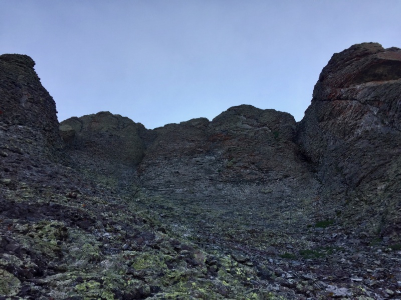
The prudent course would likely have been to continue south and so find the easy way I descended, but I made a furtive scamper upward, up class three detritus, and finally to the summit.
The views here over to Ice Lakes basin and the peaks of the Vermillion Group were more astonishing than from the earlier view from the ridge.
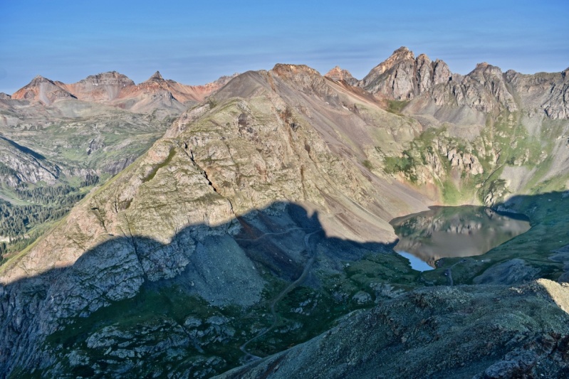
After consuming both a snack and the incredible views, I scouted and readily found the easier path down from the south side of the summit and looked down to the Clear Lake road. It was not that far down and I mused that it would likely be most expedient to descend to the road and take it back into the basin, then up the south face of South Lookout. For some stubborn, stupid reason, I persisted in traversing beneath the summit block and back to the ridge. The way ahead looked promising until about two-thirds of the way, where it looked dubious.
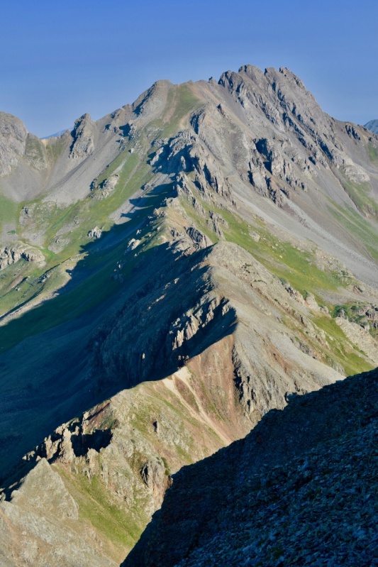
Doubt turned to certainty: I found a confusing maze of rubble and towers. Perhaps if I descended to the base of the first spire, I could wind my way through and upwards, but if it turned out poor, I would have to regain my current perch up more of the San Juan’s finest junk. Descending west into the basin was no good here: a giant rock pile sprawled beneath the ridge. Forget this ridge: do V5 from the road and S Lookout from the inviting slopes beyond Clear Lake!
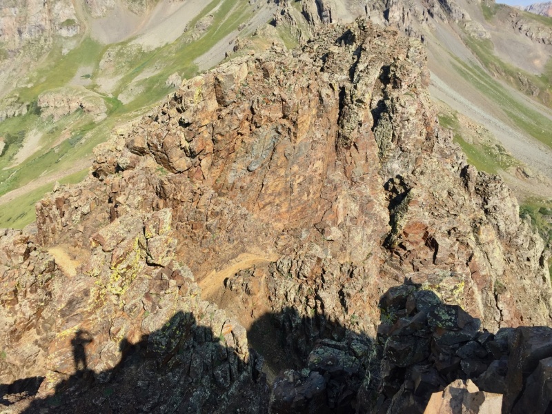
I peered down an exit gully and beyond into Paradise Basin. The slopes looked better on that side. Without further ado, I negotiated my way down the class 3 gully.
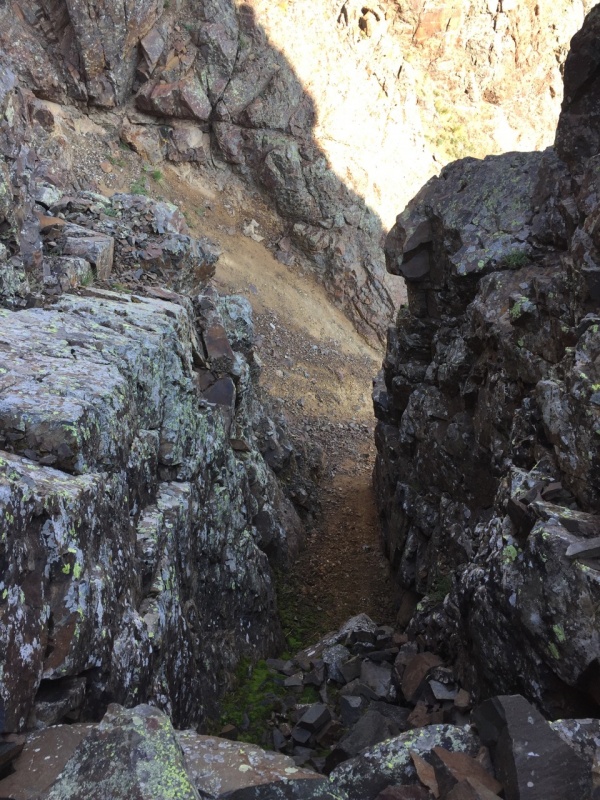
I found trouble in Paradise. The tantalizing grass lay hundreds of feet below, while I side-hilled a mess of hardpan and scree. Persevering, I finally regained the ridge on the far side of this convoluted cluster of towers, relieved to find gentler slopes and some grass to mix up the rock.
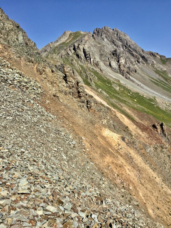
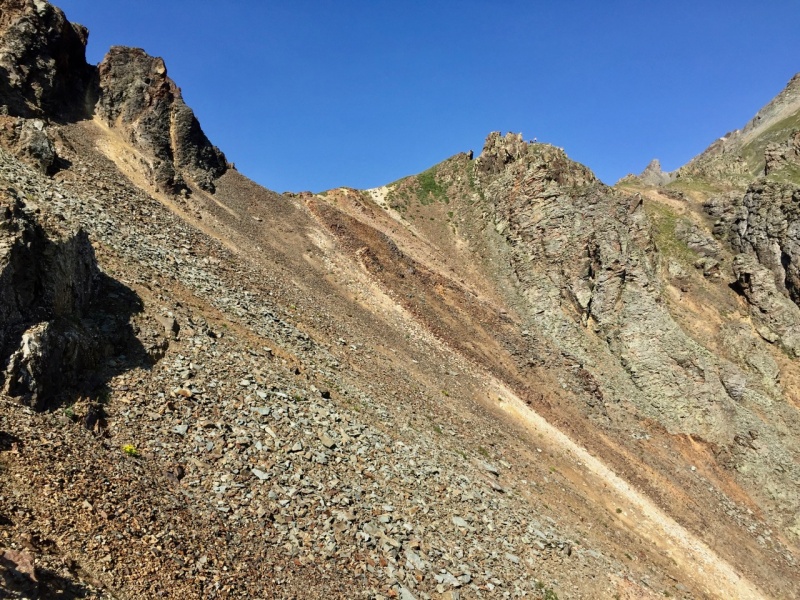
Glad to be off the hell above paradise, I hastened upward along the ridge and soon found a rock buttress, opting for the brief scramble to the top of it instead of the slight descent around it to grassy slopes beyond. Above this feature, the slope became benign and grassy.
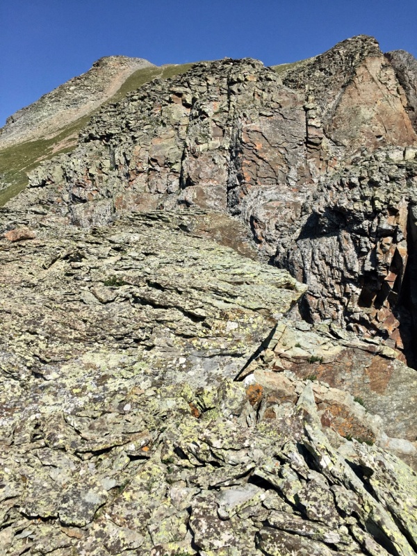
The upmost grassy slopes allowed a quick ascent over a rounded top to then confront the false summit. From Ben and Kyle’s trip, I knew that the route over this thing lay in navigating gullies and ledges on the lower right side, rather than taking on higher, steeper left side. Unfortunately, I didn't take a picture of the approach to this false summit, but Ben's second picture in the following report shows it: 2016/09/14/another-labor-day-south-silverton-west-13ers/
I stayed high on the ridge to the base of the false summit, then descended along it (half to two-thirds of the way in Ben's picture), until I found a shallow gully affording access. That led to a maze of ledges. I ziggged and zagged, keeping to the path of least resistance. If you find yourself on anything above class 3 here, then you've missed an easier way.

My scrambling took me up to a sling, beyond which was an easy downclimb into a grungy gully. This gully is so grungy that naming it the Pearl Jam Gully would still not do it justice. I went up the gully. Another way would be to traverse class three ledges to the right that are made difficult by their angle in some places and the abundance of debris in others. A cairn lies that way, unseen on my ascent but readily espied on my descent of the summit.
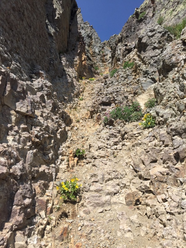
Going up the gully wasn’t bad until its end beneath a slightly overhung rock pile. I gingerly got atop this section and then back onto the ridge crest. The distance from here to the true summit block is not far, but, as with the false summit, it’s better to stay on top until the rock, rather than angle toward it, because the slopes are made of such loose, shifting material.
The way up the summit block is a fun class four slab. While technically more difficult than the false summit, it goes much easier both up and down because of the solidity of the rock. In the picture below, this feature is left of center, and faces right.
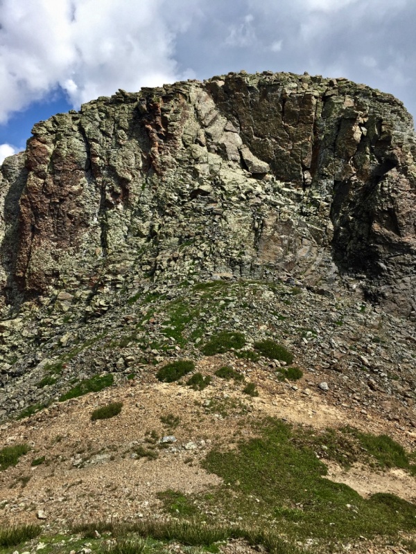
The views from the summit are worthy of the “Lookout” moniker: in all directions, dramatic, colorful ridges and craggy peaks greet the eye.
It was only a bit after ten but the western and northern skies darkened swiftly while I took in the views and some sustenance. After the down-climb of the slab, I spotted the earlier-mentioned cairn down the slope and followed it, finding myself on the maze of ledges to the east of the grungy gully. It began sleeting, and the mix of rubble and wet atop the awkward slant made me reconsider and back track and up to the top of the grunge gully. Trying to get into the gully from the top felt equally precarious, so I traversed some ledges immediate to it and then found a way down into it. Finding myself back by the sling, I retraced my ascent route. Breathing a big sigh of relief to be off the sleet-slickened rock, I hustled down the benign southern slopes a few minutes ahead of the the thunder, down to the shore of Clear Lake, and back to the car. The jeep group had given way to a Toyota Landcruiser club, and they marveled to see my Rav4 up here.
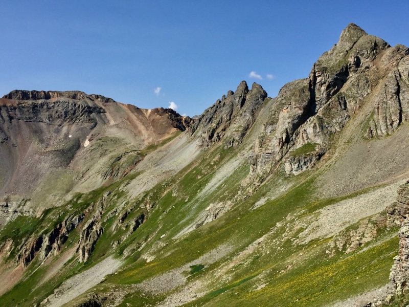
Having orphaned V2 when I climbed V4 and US Grant from island lake some years back, I had hoped to perhaps traverse to it, but another trip to Island Lake will have to suffice. For the curious, here's a look across to the high saddle to V2 from the upper slopes of S Lookout.
After visiting with the Landcruiser people a bit, I un-staked my tent, collapsed the poles and simply stuffed it in the back of the car to drive back down the road and over to the other side of S Mineral Creek, by Rolling Mountain, for day two.