| Report Type | Full |
| Peak(s) |
Capitol Peak - 14,138 feet |
| Date Posted | 09/25/2021 |
| Modified | 10/03/2021 |
| Date Climbed | 09/18/2021 |
| Author | arianna2 |
| Capitol-our finishing touch |
|---|
|
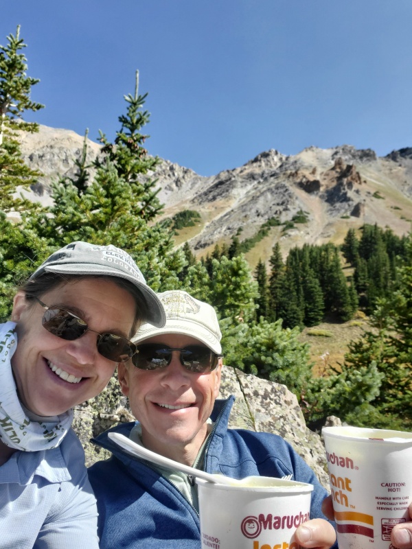
Suddenly there was the heart wrenching sound of loose gravel grinding together and clanking down into the pit of nothingness. He instantaneously loses his balance and falls off. As he was falling off, he was able to grab and hold on to a ledge. I grabbed and grabbed but couldn't get a hold of his arm. I looked down into miles of air below us which kept bouncing around. I didn't have on sticky shoes so I slipped and the ledge crumbled and we felt our bodies twisting and falling to our certain death. At once my eyes snapped open and I breathed a sigh of relief as I realized this was just another bad dream. This is a little bit of an embellishment of what was going on in my mind for a several weeks as we prepared for this our final and 59th peak, but not much. I have not had so much angst about any of the other 14ers as I did this one. Why? I ask myself. I love rock climbing, exposure doesn't bother me too much, I love hard and physically challenging hikes, and there is always risk of injury. I guess the preparation makes you think differently about this peak. I wouldn't say it is over-hyped, maybe it is for the 20 year old class V climber every weekend, but in general I think the hype does help the prep but the prep feeds the hype. I am bummed that I had to worry so much about this mountain but without that worry, we might not have prepared enough I guess. It is a balance. Just maybe don't watch You Tube videos of bouncy nauseating GoPro footage if that doesn't help you, or don't worry if you don't have sticky shoes, and definitely don't be reading 14er disasters-Victims of the Game while you are preparing (that wasn't intentional). If you are trying to decide if this is a good peak for you, I would echo what several good reports and threads have already said. You should have experience with and be ok with extreme exposure, route finding when a mistake might kill you, and good mental focus. But don't let that freak you out, it can be fun and a safe trip. There are several good reports to study ahead of time and I might try to cite them at the end. There were a few things we felt would have been helpful to know more so I will try to focus on that in this report. I am not a tech guru so my drawings on pictures probably aren't the best but hopefully they will help someone. I think I will try breaking it up into sections so I might have pictures from on the way up or on the way down. Here goes; The Hike to Camp 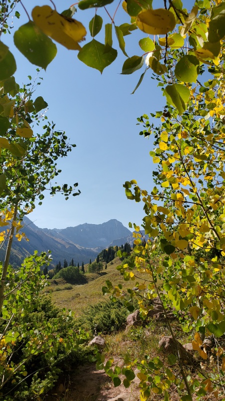

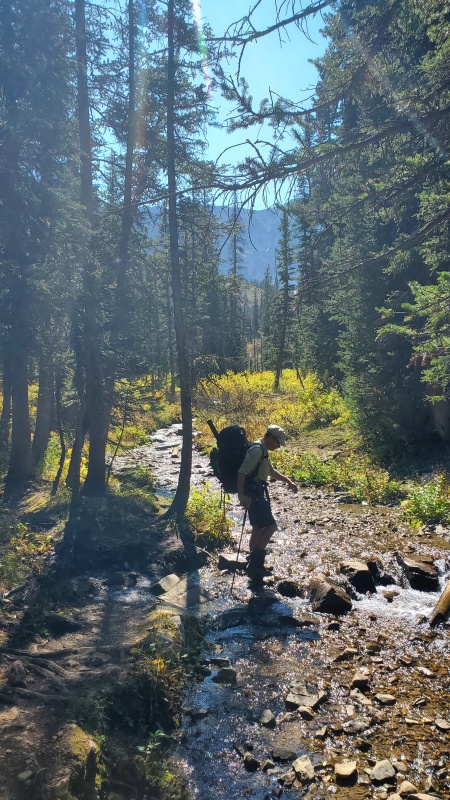
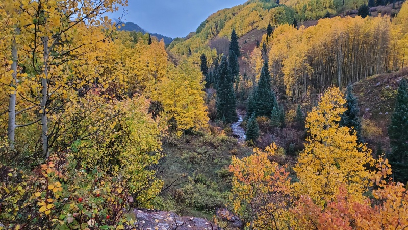
I think quite a few people do the whole thing in a day but even if you are physically and mentally fit to do so...why not take the time to enjoy the peak and the surroundings. I would always recommend breaking this one up. Also, as for timing of when to do this peak. A lot of people say do it in September after Labor Day, there will be a lot less people. Well, wow, I wouldn't want to see how busy it is in July because it was still busy in September. We would have loved to do a weekday but it wasn't in the cards this year. That would probably be ideal. I have to say though, even though there were a lot of people, we all worked together pretty well on the mountain. Having other people helps you with safety and route finding. We saw a group go the wrong way before K2. We had three groups ask us which way to go. We heard groups asking themselves which way to go. It might be safest to do this when others are around although rockfall is more of a concern (but everyone stopped for others and seemed respectful) as well as the potential to go the wrong way since you might follow someone. One thing is for sure, you can't always trust that another group knows what they are doing. Be aware. Anyway, back to the hike to camp... It took us about 2 hours 45 minutes both on the way up as well as the way down for this 6 mile 2300ish foot climb with 30 -33 lb packs. There are 8 formal camp sites. 1-3 are first and somewhat closer together in the trees. Where we settled was Camp 4 as it is a little more on its own and has a great view from a rock outcropping nearby. Perfect for meals and watching the sunset. If you have more energy or these are full then you have to climb a little higher to camp 5-8. Camp 6 has the best view but a little more open to wind. 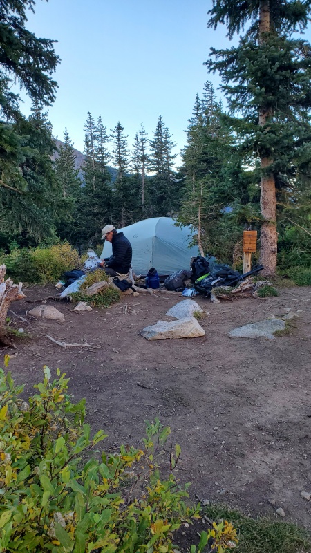

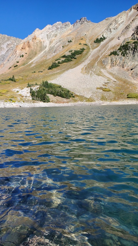
The lake is absolutely beautiful and fun to fish. 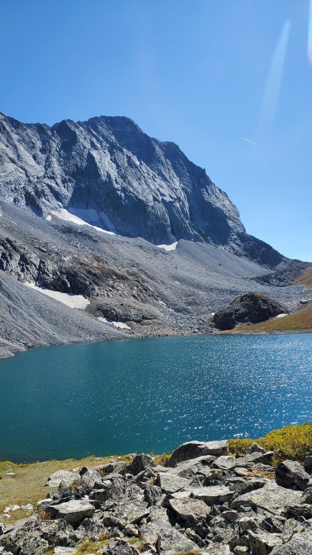
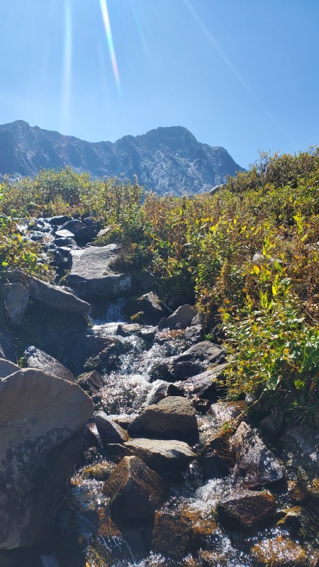
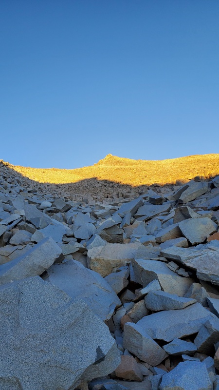
the saddle, looks pretty easy. Enjoy looking at that nice and easy trail up the saddle, that is the only easy part of the whole adventure. We had a great forecast with mostly sun for the next day. There weren't many people there. However, we just kept questioning our start time. Some reports said it was hard to figure out where to go from the saddle in the dark so thought maybe we shouldn't start as early as we usually do. We settled on setting the alarm for 415 but when we heard people already going by the tent area at 350 we decided to get up and get going. Always takes us an hour so we started up to the saddle a little after 5. Surprising to us that there were several groups already close to the top of the saddle by then. Saddle to K2 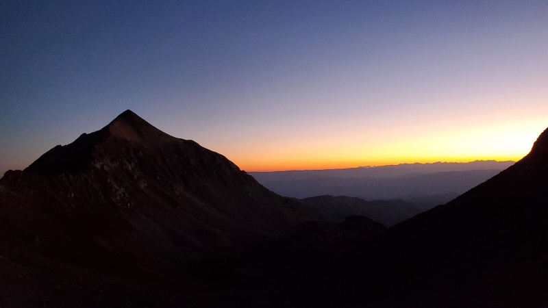
There are a few things worth mentioning here that hopefully will help. Doing this first part in the dark is doable but it is disorienting in a way. The trail on the back side of the saddle has obvious switchbacks down to a gully that you must cross. You have options. There are cairns down further in the gully that some people were picking their way down to and on our way back we saw people struggling high up in the gully. Here is what we found to be the easiest course. Below is what you see when you come down the switchbacks. Except of course that it may be pitch black and it looks like an impassable rock wall so it makes you think you have to go down or up the gully. You can of course but there is an easy ledge or crack in that rock that makes it pretty easy to climb up. 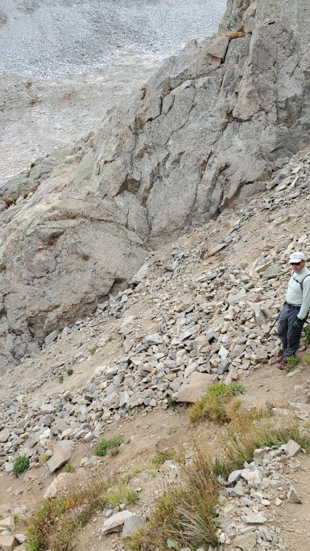
The picture on the right shows the switchbacks coming down to the gully. We crossed when there were no longer any obvious switchbacks and it was a dirt slide down further. The picture on the left shows where we crossed the gully easily, and climbed the wall on the other side using the crack you can see. That led us to a trail on the other side. 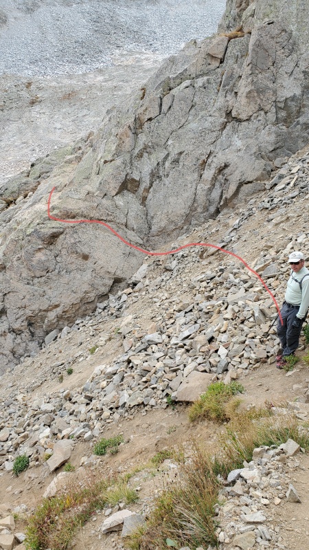

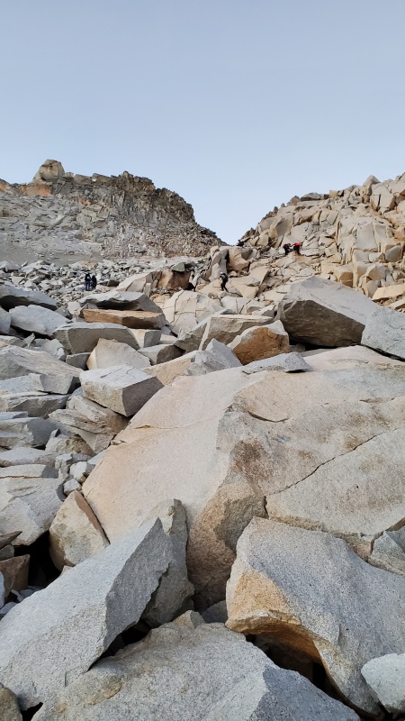
The next section in the dark is a lot of rock hopping and minimal trail but not too hard to figure out. However, I was somewhat stunned how it looked on our way back in the daylight. 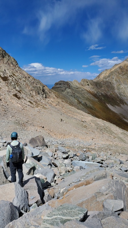
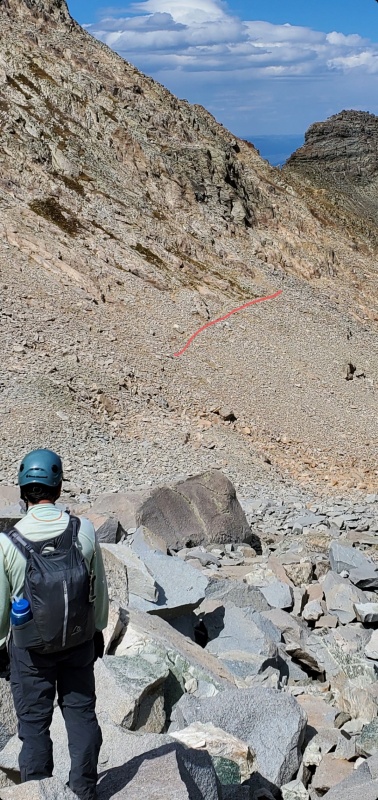
Ok. Plenty of talus hoping left. Bigger rocks more to the right. The orange rock is nice to hike on. 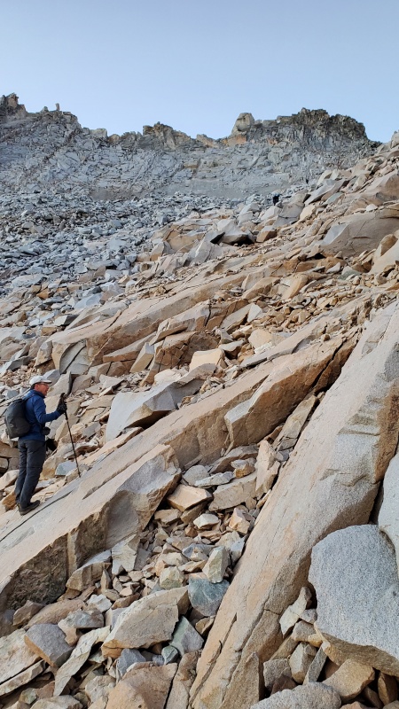
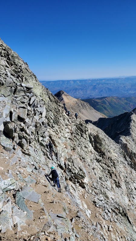
K2 A bit of route finding needed for K2. As you get closer to it, it's features are a little more like a wide pile of rocks. You do go more to the right then up and towards the left. Then from the top you go down the back side towards the right. Like the picture in the route description. Note all the hikers coming down K2. Pick your most comfortable steps and is helpful to have someone guide if needed as you downclimb. 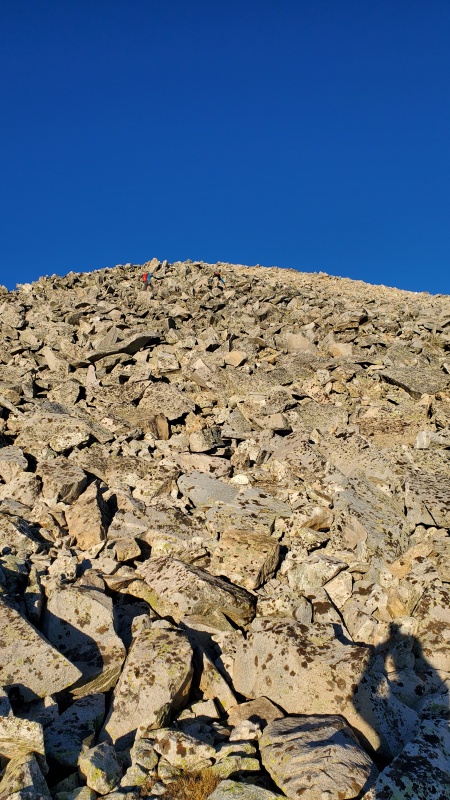
much easier than going around. 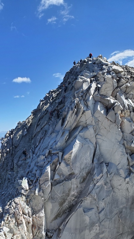
It is a rock face on this (Capitol's) side. 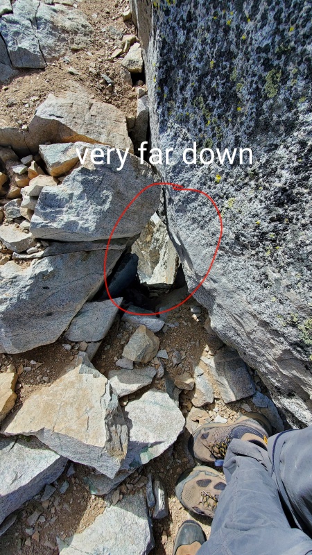
check out this rock formation that is easy to miss. And be careful what rock you lean up against. Got there around 740, so about 2.5 hours from camp. Ok, from the top of K2, pick out some important areas to remember for your route finding later. In the picture below, the bottom line is a rock tower that you should remember to climb after the mini knife edge on the way up, and after the main knife edge on the way back. The middle circle is around the area where the notch above the steep gully is. After crossing this notch you move left, leaving the ridge, and start the ascending traverse. The upper circle is what we thought was the crux of the route. Note the two humps and the notch that you are heading for. 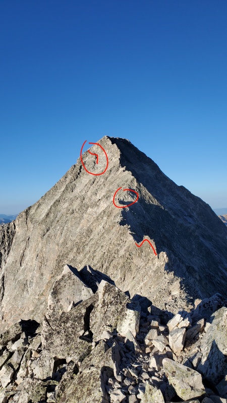
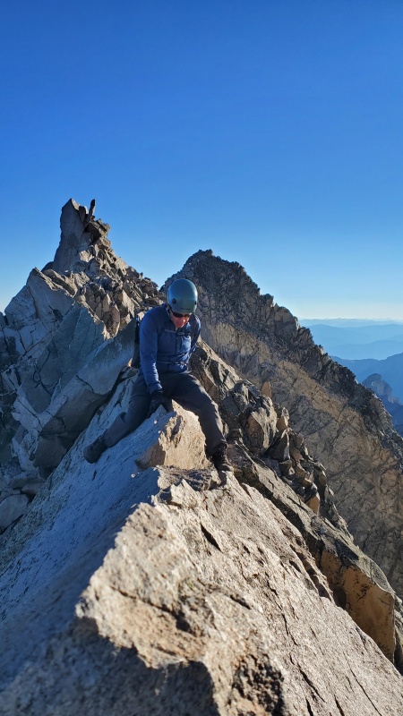
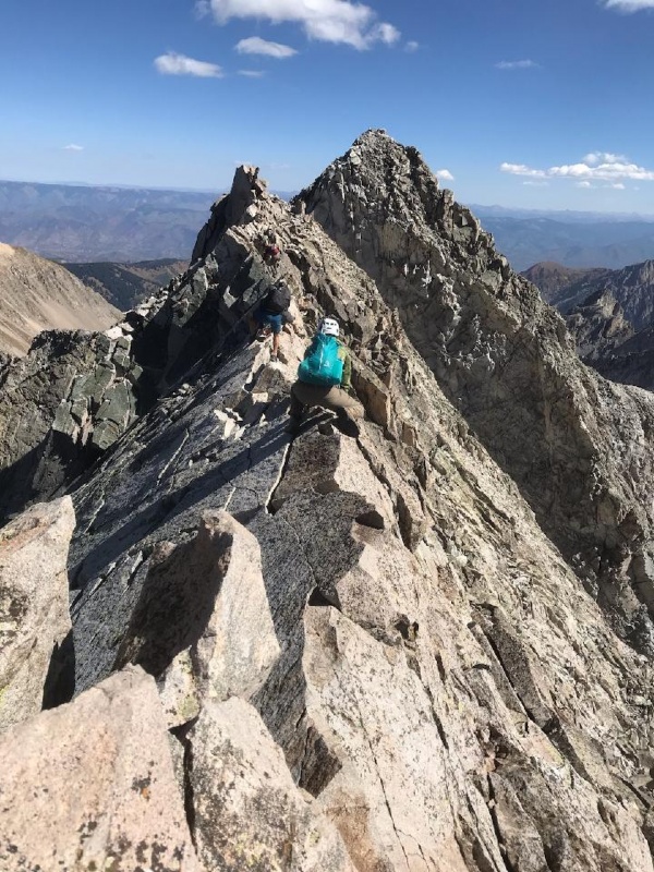
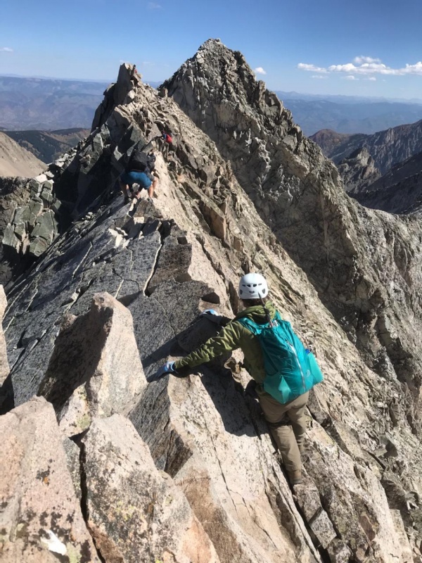
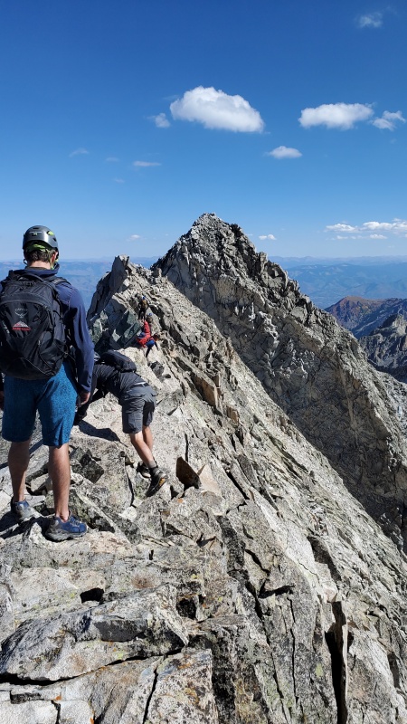
Knife edge Exposure from here on out is dramatic. However, if you are like us, you get hyper focused on your next step and next hand and foot hold. I didn't really pay much attention to the exposure. We did joke about the country song Boot Scootin Boogie calling it the Butt Scootin Boogie (you gotta google it if you haven't heard the song). Plenty to hold on to that was solid. Plenty of foot and hand holds. You can scoot, spider crawl, walk...whatever you are most comfortable with. Because of the exposure and risk I didn't make some of the moves I normally would have if there was a ledge a few feet down or something. Three points of contact at all times from here on out. On the way back from the face, I could not wait to get back to the knife edge. At least it was solid and you knew where to go. 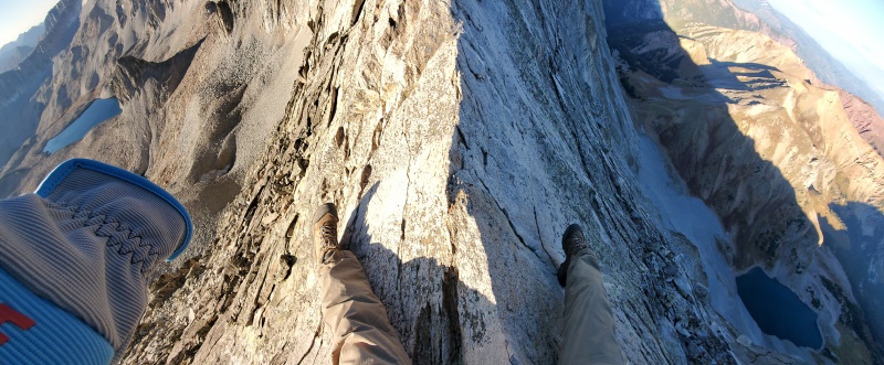
on his hips waiting up front. Wish I was that comfortable. 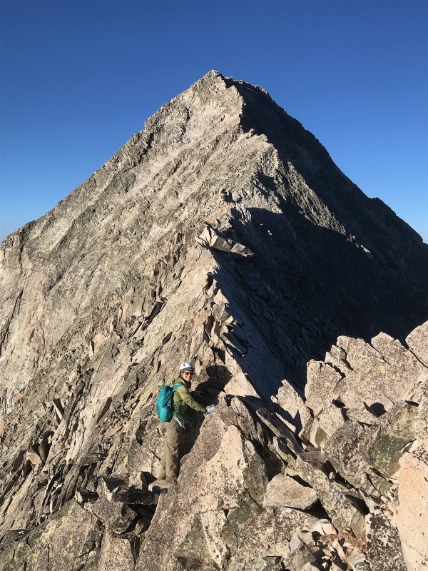
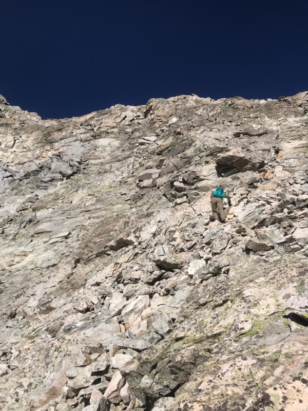
East Face Once you get done with the mini knife edge, then the knife edge, then some ridge climbing, you finally get to that notch with a steep dirt gully mentioned in the route description. Here you move more to the left and I would suggest going up some. There are cairns all over the place so pick a line and generally go up and head towards that rock edge and notch I will show in a picture. Generally, the higher you go, there is less rubble and unstable rock but more class 3-4 moves. I always seemed to favor that over the looser stuff but it is a mix one way or another...unless you climb the ridge proper. 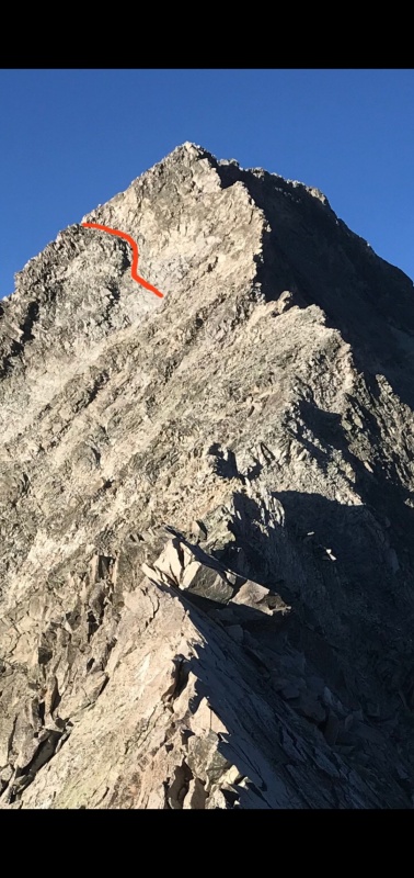
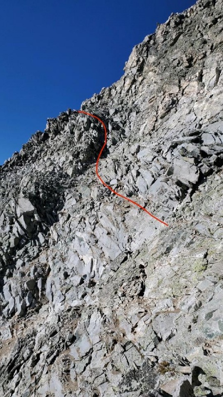
When you are there you can see yellow rock just above that steel gray rock. Below that gray rock is a pretty good ledge to cross over 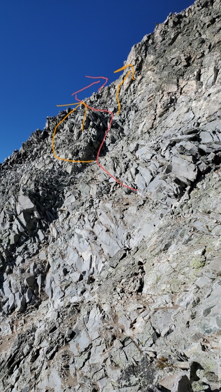
Once at that notch you climb the ridge all the way to the summit. You stay high up on top of the ridge the whole way. 
We made good time to the summit, around a hour and forty minutes but the downclimb took a lot longer. We are always slower at down climbing than others. I almost always find it more challenging in route finding as well. Things look different. It is important to try to remember some landmarks and where you came up. Once again you can stay higher up on the face and do harder moves. The cairns looked really tempting to stay high. But, we decided to go the way we came so we had to go down a little ways first before traversing. Just don't go too low. You basically go slightly down and across like how you came up but there just isn't something as easy to watch for in the distance (like that notch) to know where you are on the face. We did use our GPS app track (strava and gpx trax) to make sure we were on the same general line going back as we were going up. 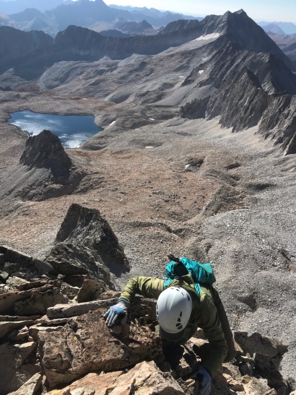
We got back to K2 at 1230. We had to wait for climbers three times on the way down plus 20 minutes on the summit so from our prep and from our experience, it is good to plan on 4 hours from K2 back to K2. This was a hard mental game for us. Four hours of having to care about every step and hand hold and to think about what could happen if you misstep really takes a toll. Believe me, I got after Craig if I heard even a pebble move. Seriously, what do you do when you have dreamt about that sound and the certain fall that happens afterwards. Up to this peak, I hiked 58 mountains with this man, I wasn't going to lose him now. I wasn't in the least bit comfortable until we were back on K2. Finally felt like taking a break and eating something and excitedly ponder what he had just done. A few more pictures and thoughts 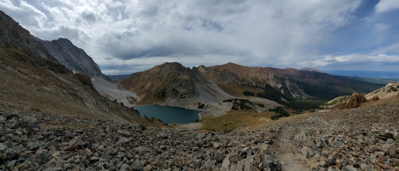
other camps are. 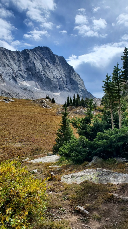
the time probably shaved an hour off this time. But some started at 4 too. So I would plan on this taking 8 to 10 hours in general. Then you can add at least another 4 hours if you want to do it all in one day. 
We started this journey together 12 years ago. We went from thinking there were only one or two of the Elks that we would ever do to completing all of them and liking them the most. We know a lot of people have completed the 58 peak list but we feel extra special since we did them all together. We only got turned back on Quandary and that was because we tried to do it in the winter. That is amazing weather and health and everything else. We are truly blessed by God and give Him all the glory. A few resources we found helpful for this climb: https://www.14ers.com/php14ers/tripreport.php?trip=21052 https://www.14ers.com/php14ers/tripreport.php?trip=20655 https://www.14ers.com/php14ers/tripreport.php?trip=20463 https://www.14ers.com/php14ers/tripreport.php?trip=15551 https://www.14ers.com/php14ers/tripreport.php?trip=20907 Thank you so much to Bill Middlebrook and this website because we couldn't have done all these peaks without it. Addendum 10/2/21 Amazing the difference in 2 weeks. Beautiful but much colder. We went up the ditch trail again to the lake and then came back the standard old way just to see the difference. 2 weeks ago coming back on the ditch trail with packs after having climbed capitol was pretty tiring when you have to go up and down several times. Coming back the old way is something to consider. It really pretty and it is all downhill until the very end. Yeah. You have to go up 400 ft but it is all at once and only took 10 or 15 minutes. 

Thumbnails for uploaded photos (click to open slideshow): ")
")
")
")
")
")
")
")
")
")
")
")
")
")
")
")
")
")
")
")
")
")
")
")
")
")
")
")
")
")
")
")
")
")
")
")
")
")
")
")
")
")
")
")
")
")
")
|
| Comments or Questions | ||||||||||||||||||
|---|---|---|---|---|---|---|---|---|---|---|---|---|---|---|---|---|---|---|
|
Caution: The information contained in this report may not be accurate and should not be the only resource used in preparation for your climb. Failure to have the necessary experience, physical conditioning, supplies or equipment can result in injury or death. 14ers.com and the author(s) of this report provide no warranties, either express or implied, that the information provided is accurate or reliable. By using the information provided, you agree to indemnify and hold harmless 14ers.com and the report author(s) with respect to any claims and demands against them, including any attorney fees and expenses. Please read the 14ers.com Safety and Disclaimer pages for more information.
Please respect private property: 14ers.com supports the rights of private landowners to determine how and by whom their land will be used. In Colorado, it is your responsibility to determine if land is private and to obtain the appropriate permission before entering the property.


