Download Agreement, Release, and Acknowledgement of Risk:
You (the person requesting this file download) fully understand mountain climbing ("Activity") involves risks and dangers of serious bodily injury, including permanent disability, paralysis, and death ("Risks") and you fully accept and assume all such risks and all responsibility for losses, costs, and damages you incur as a result of your participation in this Activity.
You acknowledge that information in the file you have chosen to download may not be accurate and may contain errors. You agree to assume all risks when using this information and agree to release and discharge 14ers.com, 14ers Inc. and the author(s) of such information (collectively, the "Released Parties").
You hereby discharge the Released Parties from all damages, actions, claims and liabilities of any nature, specifically including, but not limited to, damages, actions, claims and liabilities arising from or related to the negligence of the Released Parties. You further agree to indemnify, hold harmless and defend 14ers.com, 14ers Inc. and each of the other Released Parties from and against any loss, damage, liability and expense, including costs and attorney fees, incurred by 14ers.com, 14ers Inc. or any of the other Released Parties as a result of you using information provided on the 14ers.com or 14ers Inc. websites.
You have read this agreement, fully understand its terms and intend it to be a complete and unconditional release of all liability to the greatest extent allowed by law and agree that if any portion of this agreement is held to be invalid the balance, notwithstanding, shall continue in full force and effect.
By clicking "OK" you agree to these terms. If you DO NOT agree, click "Cancel"...
On Tuesday, Sept. 14 I was crazy enough to attempt to climb Capitol and Snowmass in one single day. I made it to the top of Capitol but fell a little shot of Snowmass. Here are some details of my journey, which ended at Snowmass Lake after about 15.7 miles and a ton of elevation gain (Stava says 9,200ft of gain but I'm not sure that's accurate):
After making my way to Moon Lake (a 7-mile adventure in it's own right) via the Maroon-Snowmass TH and then the West Snowmass trail followed by a bush-whack that followed West Snowmass Creek, I ascended to the Cap-Daly saddle to climb the Northeast Ridge direct route to Capitol (best decision of the day!). I was able to follow the ridge properly all the way to the K2-Cap saddle, then once across the knife edge I continued to follow the ridge to the summit. The ridge-direct is an exposed route but it offers really fun climbing (I encountered nothing over class 4) and the rock is pretty solid. It ended up being about 2.5 miles to Capitol from Moon Lake and 9.5 miles total from the TH.
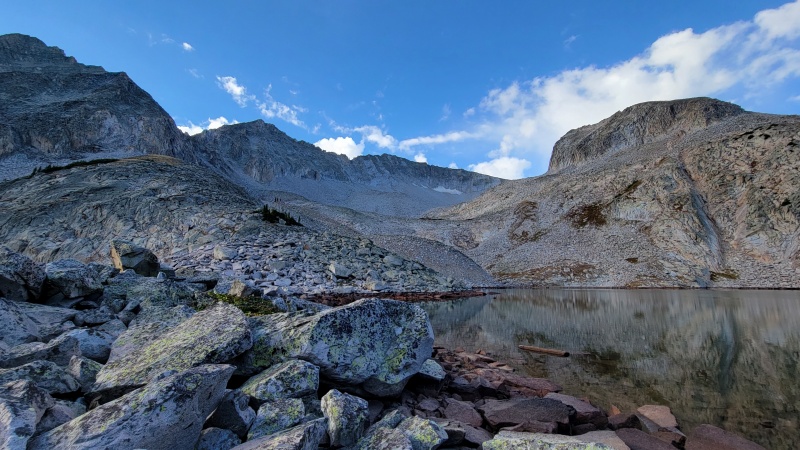
Moon LakeLooking back to Daly during my climb of the ridge from the Daly-Cap saddle
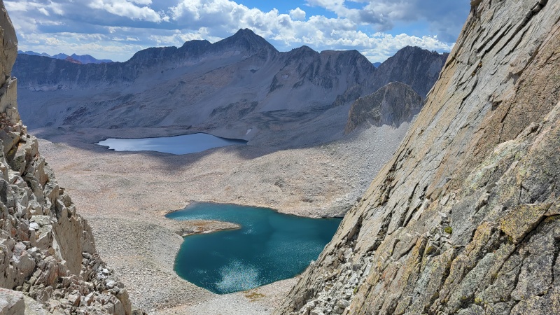
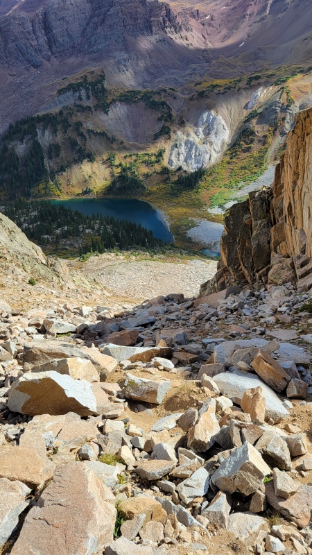
From the summit I followed the ridge back across the knife edge, skirted around K2 and made my way to the Wandering Dutchman Couloir on the ridge between K2 and Clark Peak. This is where the day was truly beginning as I carefully descended this steep and somewhat loose passage into the Pierre Lakes Basin. Once in the basin, it was a giant game of boulder hopping for what felt like forever as I passed three lakes and over a few rolling hills to reach my next objective -- Heckert Pass, which allowed access into the Snowmass basin and onto the standard East Slopes route up Snowmass.
Looking down into the Pierre Lakes Basin as I was descending the Wandering Dutchman Couloir.Wandering Dutchman (the notch in the ridge) from Pierre Lakes Basin
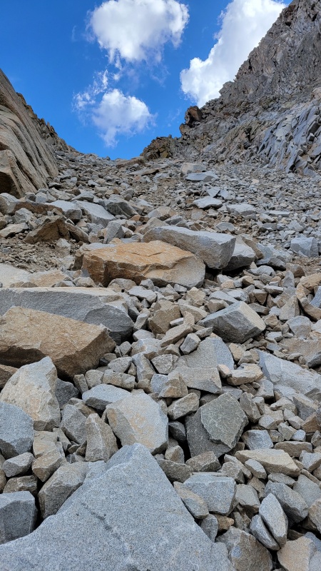
THIS PASS WAS AWFUL. As steep as can be and probably the loosest terrain I've ever ascended. I was sketched out the entire time, but I was so far into the route that I was committed to making it over the pass. Heckert was relatively short but it took so much out of me. The ground moved every step. Just an absolute mess of a place that should probably only be climbed with snow. I have plenty of experience in the CO mountains but that climb might rank as the most terrible!!! Once at the top of Heckert I was 13.5 miles and 10.5 hours (4.5 hours to cover 4 miles from the top of Capitol) into this slow moving, utterly strenuous excursion.
Climbing Heckert Pass. Steep and very, very loose.Looking down the Snowmass Lake side of Heckert. Much nicer.
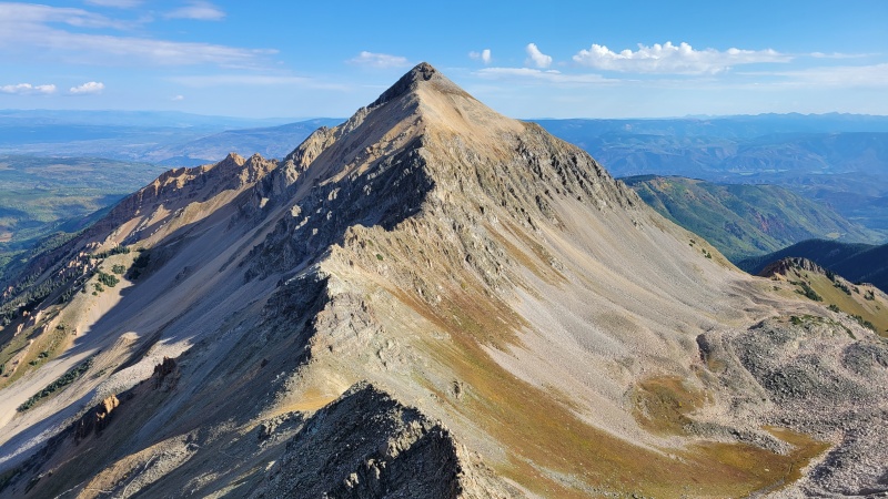
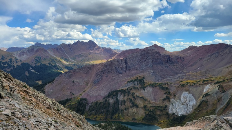
From the top of Heckert, the view was spectacular, however, as Snowmass Lake and the surrounding mountains popped with beauty. I still had plenty of work to do to get to Snowmass and I was exhausted, but knew I had to at least try to make it up the second peak of the day after coming so far. Plus the weather was good (I had a few sprinkles of rain throughout the day but nothing worrisome) and I still had some daylight. So I made my down the other side of Heckert (so much easier than the other side but still steep) and started a sort of ascending traverse toward Snowmass and eventually intersected the standard route. I got to about 12,800ft, sat down and saw how far I still had to go, realized how bad my feet hurt after hours and hours and hours of traveling on rock, and I said I was done.
View from the top of Heckert Pass
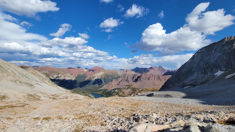
I had not much left in the tank after 11.5 hours on this route and knew I still needed to at least descend to Snowmass Lake to sleep (some super talented athletes have completed this entire hike (car-to-car) in 1 day, but I brought a sleeping system as I knew I'd need to camp). So I told myself it was OK not to summit Snowmass and that I'd had a crazy successful day and made my way down to the nearest campsite I could find. A crisp, frosty night under the stars was a great end to a pretty intense adventure that I'm not sure I'd ever repeat......probably not.
View from where I turned around going up Snowmass. Not a bad place to end the hike.
A 9+ mile hike back to the trailhead the next morning provided me an opportunity to reflect on what I’d accomplished. These mountains always motivate me to push myself, even after climbing all 58 14ers and doing numerous different routes. I love finding new adventures and this state has endless opportunities for new adventures, and even when things don't go exactly as planned, a day or two in the mountains is usually a great time. I also was proud of myself for being able to not finish this incredibly difficult combo hike and still be happy with my trip.
My GPS Tracks on Google Maps (made from a .GPX file upload):
Beautiful photos and awesome attempt of this long linkup Nick!
Caution: The information contained in this report may not be accurate and should not be the only resource used in preparation for your climb. Failure to have the necessary experience, physical conditioning, supplies or equipment can result in injury or death. 14ers.com and the author(s) of this report provide no warranties, either express or implied, that the information provided is accurate or reliable. By using the information provided, you agree to indemnify and hold harmless 14ers.com and the report author(s) with respect to any claims and demands against them, including any attorney fees and expenses. Please read the 14ers.com Safety and Disclaimer pages for more information.
Please respect private property: 14ers.com supports the rights of private landowners to determine how and by whom their land will be used. In Colorado, it is your responsibility to determine if land is private and to obtain the appropriate permission before entering the property.

")
")
")
")
")
")
")
")
")
")
")
")
")
")


