Download Agreement, Release, and Acknowledgement of Risk:
You (the person requesting this file download) fully understand mountain climbing ("Activity") involves risks and dangers of serious bodily injury, including permanent disability, paralysis, and death ("Risks") and you fully accept and assume all such risks and all responsibility for losses, costs, and damages you incur as a result of your participation in this Activity.
You acknowledge that information in the file you have chosen to download may not be accurate and may contain errors. You agree to assume all risks when using this information and agree to release and discharge 14ers.com, 14ers Inc. and the author(s) of such information (collectively, the "Released Parties").
You hereby discharge the Released Parties from all damages, actions, claims and liabilities of any nature, specifically including, but not limited to, damages, actions, claims and liabilities arising from or related to the negligence of the Released Parties. You further agree to indemnify, hold harmless and defend 14ers.com, 14ers Inc. and each of the other Released Parties from and against any loss, damage, liability and expense, including costs and attorney fees, incurred by 14ers.com, 14ers Inc. or any of the other Released Parties as a result of you using information provided on the 14ers.com or 14ers Inc. websites.
You have read this agreement, fully understand its terms and intend it to be a complete and unconditional release of all liability to the greatest extent allowed by law and agree that if any portion of this agreement is held to be invalid the balance, notwithstanding, shall continue in full force and effect.
By clicking "OK" you agree to these terms. If you DO NOT agree, click "Cancel"...
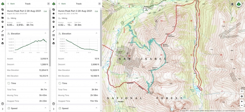
Huron Peak: North Ridge via Lulu Gulch Ascent, Standard Route Descent 12.2 Miles - 4,007' - 11 hr 26 min* Saturday 28-August-2021
*take this with a gain of salt. I had issues with Gaia GPS tracking and think the distance is overestimated. Roach says something more on the order of 9.30 miles and 4,036' of gain.
Location
Elevation (ft)
Distance (mi)
Split (mi)
Time
Time (HH:MM)
Split (HH:MM)
Winfield Start
10,240
0.0
0.0
04:25 28-Aug-2021
00:00
00:00
Pt 13,462
13,462
4.8
4.8
08:19 28-Aug-2021
03:54
03:54
Browns Peak
13,523
5.6
0.8
09:29 28-Aug-2021
05:04
01:09
Huron Peak
14,003
6.2
0.6
11:31 28-Aug-2021
07:06
02:02
Winfield End
10,240
12.2
6.0
15:51 28-Aug-2021
11:26
04:20
Introduction Welp, in the last month or so I've now had two separate outings where I guided friends up their first 14er! Maybe I should start a guide service!
Or perhaps not after reviewing the details of this trip report...
I took a friend up their first 14er here but it was perhaps a bit too ambitious for a first 14er outing. Now of course it's not like we ran into any injuries or got near the threat of an SAR call or anything. And it's not like I took my friend up the Barr Trail or took them to Chicago Basin.
It was just a long day. Longer than it would have been up Bierstadt, Quandary, Sherman, or the other staple "first 14ers."
(We still got it done safely and successfully though, which is the important part!)
Initial Attempt/Prep I first met my friend (/co-worker) Laura on a work trip to my company's office in Aberdeen, Scotland (her home) shortly before she moved to my company's Paso Robles, California office (where I was working at the time) for a new position. I moved back to Colorado in 2018, and in 2020, after I started getting into this whole "alpine hiking" thing she expressed interest in summiting a 14er!
Come summer 2021 it appeared we might be able to make this work out. She expressed a lot of interest in making it happen. She made a number of gear purchases out in California and conducted a number of training hikes out in California's Central Coast Region (not at altitude of course, but what can you do?)
It then appeared she might be able to make a 3-day stopover in Denver in late August 2021 on the way to a business trip in Anchorage, Alaska. With that our date was set.
Now for a first 14er outing I had to think what would work. I had thoughts of the "standard" first 14er outings that I previously mentioned (or the kind of outing I had taken friends up only a couple weeks prior.) But I believed Laura to be capable to try something a little more special, particularly given the fact that she had been training for such an outing prior to the hike. I ultimately would underestimate the effects of altitude; this will become apparent later in this report (but still, we got it done).
I had heard good things about Huron Peak and specifically the Lulu Gulch Route as a nice non-standard route up to Huron that was pretty, uncrowded, and ultimately somewhat equivalent in length and gain compared to the standard route (when starting from the 2WD "trailhead" anyway). I conveyed the, perhaps relatively large, gain and RT mileage to Laura, who was still gung-ho to give it a try.
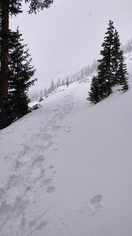
It's worth mentioning also that I had also previously attempted Lulu Gulch. On Saturday, 21-November-2020 I happened to be a part of a large group the forums here managed to put together to head up Huron via Lulu Gulch. Unfortunately on this outing I hadn't quite nailed my winter gear down and had to turn around near at the "avalanche prone" part of the route for overly cold/numb feet. No one summited that day for what that's worth...
Right before my "turn around" point on Lulu Gulch Route in November 2021. About 11,600'.
My friend Laura arrived into DIA Thursday the 26th, both to ensure she would be able to more comfortably prepare for an "alpine start" the following day, and to give at least one extra day to "acclimate to altitude.""
The next day I took the opportunity to show the sights and scenes of the greater Denver Metro Area, and we did a quick warmup/acclimation hike up North Table Mountain in Golden.
Altitude wasn't a problem here for the short ~500' of gain! It was quite hot though!
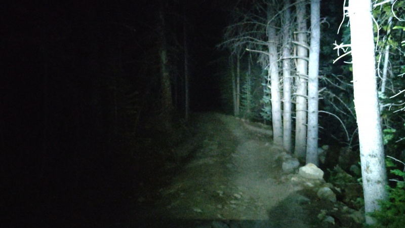
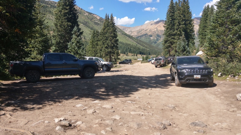
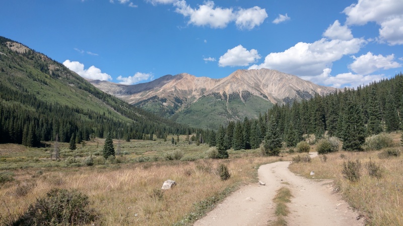
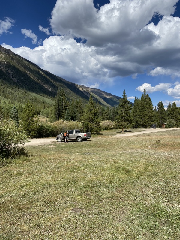
Hike Start to the Middle Mountain Switchbacks We set out from my place in Arvada to the trailhead around 1:30 AM on Saturday. Driving county road 390 to Winfield wasn't an issue in my RWD 2002 F-150, it was bumpy and rough in spots, but it was quite surprising to us just the shear number of people we had seen camping along the road. We arrived at the "Winfield" parking lot, the place with the restrooms and such, and set out on foot. My vehicle likely could have made it further along the road and closer to the Lulu Gulch 4WD road split-off fine, but it was not something we opted for (it was only 0.2-0.3 miles anyway).
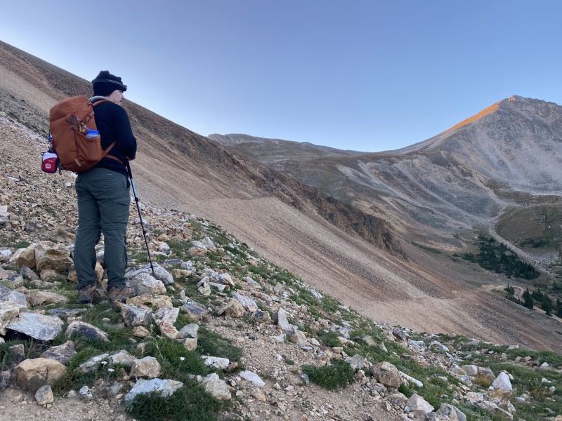
Starting out on the Lulu Gulch 4WD road before 5:00 AM.
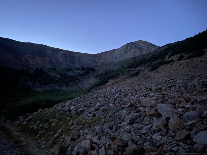
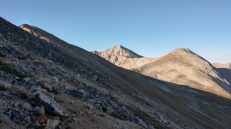
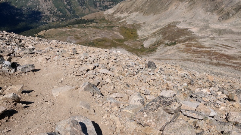
We continued on the Lulu Gulch 4WD road without issue before arriving at "Lulu Gulch Proper," the place I had previously turned around at (around 11,600' in Nov 2020), around sunrise.
Starting to see daylight hit Browns Peak.Looking North and seeing the backside of La Plata and such around sunrise.
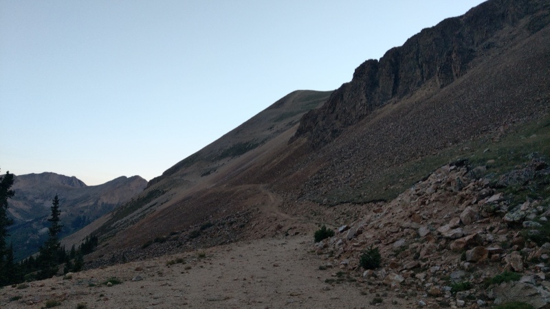
We then had something of a decision point. Once you get to Lulu Gulch on the 4WD road, the route opts for heading straight for Browns Peak via a somewhat steep 30°-40° tundra/talus slope. Although if you wanted to, you could optionally continue up the 4WD road where it switchbacks up to Middle Mountain B.
Bagging Middle Mountain wasn't necessarily my goal for the day but it seemed like heading up those 4WD switchbacks would ultimately be an easier way to get up to where we needed to be (particularly for a first timer) even if it meant a little bit more distance for us. I presented the options to Laura and we opted for the 4WD switchbacks.
"4WD switchbacks" perhaps ending up being a little bit misleading as we started climbing them. Laura got a little spooked out at times for how narrow the "road/trail" ended up being in spots and how steep the slopes we were switching back up ended up being. I mean these scree and tundra slopes we were switching back up were also on the order of 30°-45°.
As weird as it may sound, even given the altitude issues we would run into later, it was these switchbacks that were the worst part for Laura, but we still got through them. It's also perhaps something of "experience" as I know I've had to sidestep straight up such steep tundra/scree slopes before without the luxury of any switchbacks (Lackawana comes to mind, still not any fun :-/).
The start of the "4WD Switchbacks" up to Middle Mountain.Stopping on the "4WD Switchbacks" as the sun starts to hit Browns Peak.Another pic of sun starting to hit Browns Peak from the switchbacks.Yeah the "4WD Switchbacks" got pretty narrow and steep in spots. I'm pretty sure you probably can't call this a 4WD road anymore?
Pt 13,462 We reached the top of the switchbacks to find a fairly well established trail to follow. Unfortunately the further we followed this trail the more I realized that it actually bypassed the summit of Middle Mountain. Maybe by 100-200' of vertical, but by the time we had passed it I wasn't really wanting to add any more gain than necessary for my first timer friend and we ended up at something of a saddle between Middle Mountain and Pt 13,462.
We now had another decision point. We could bypass Pt 13,462 by going off trail straight for Browns Peak on relatively shallow or even somewhat flat tundra, or we could continue on the trail we had found up to 13,462. I was honestly leaning for bypassing 13,462 but when presented the options Laura preferred to stay on trail even if it meant gaining that other 13er summit, so that's what we did.
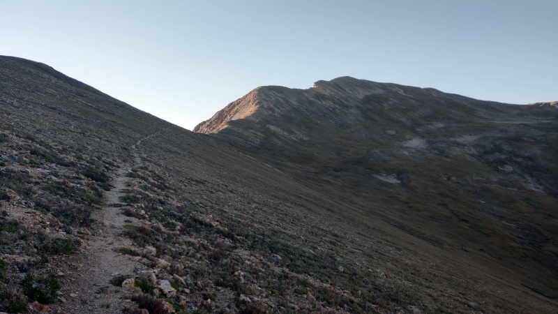
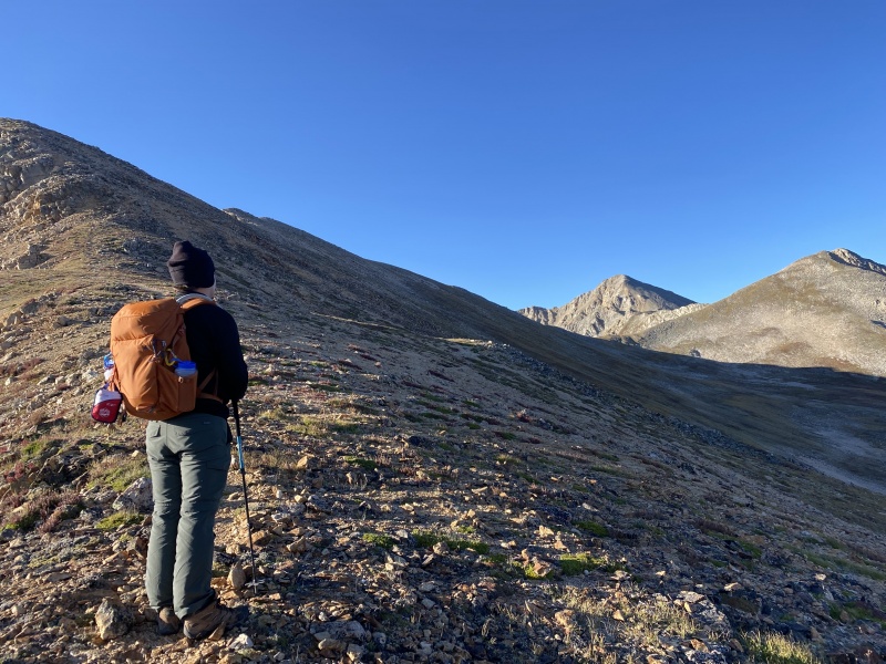
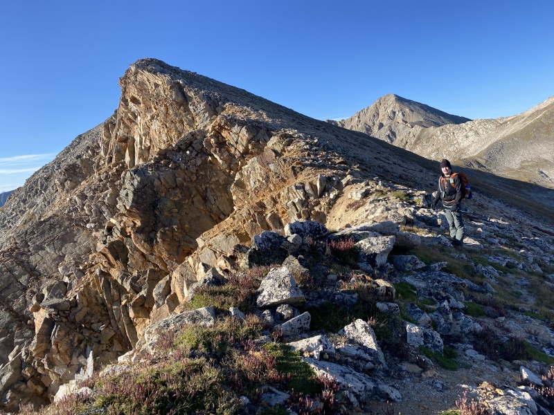
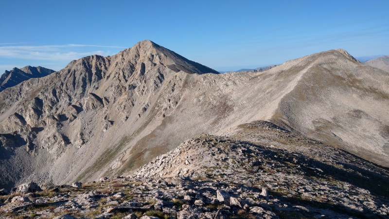
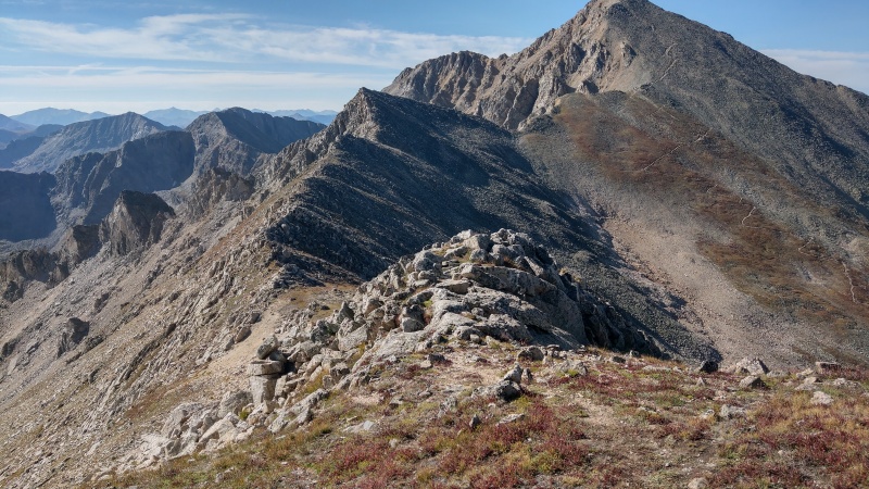
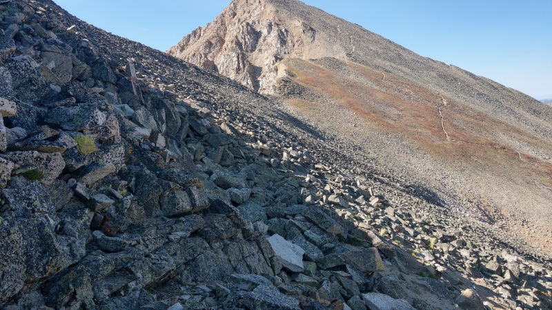
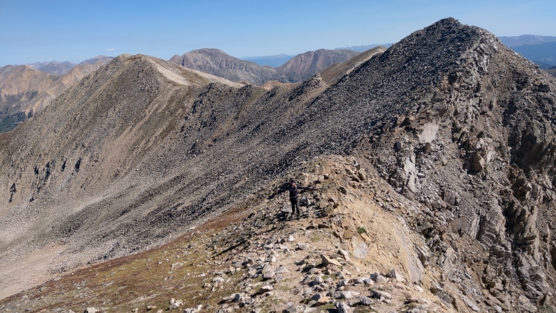
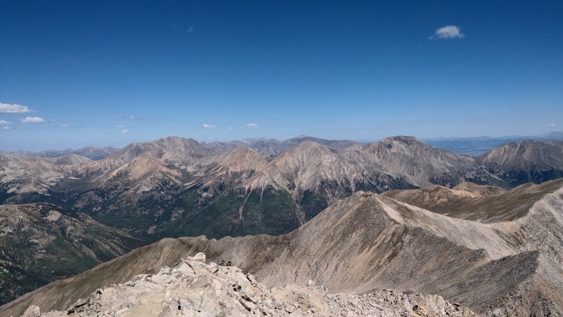
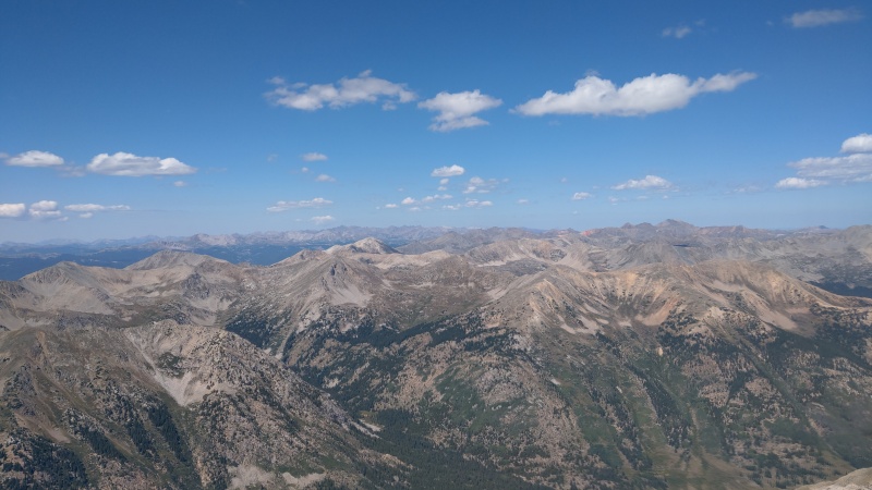
Following the trail from the top of the switchbacks along the side of Middle Mountain.Contemplating options on the "saddle" between Middle Mountain and 13,462.Heading south on the slopes up to 13,462. Can definitely see Huron here!Some steep gullies and exposure appear on the way to 13,462 summit!Aforementioned steep gullies.Laura making her way up to the 13,462 summit, looking North.Me checking the register at 13,462 summit. It was damp, I didn't sign it.Looking at Browns and Huron Peak from 13,462.
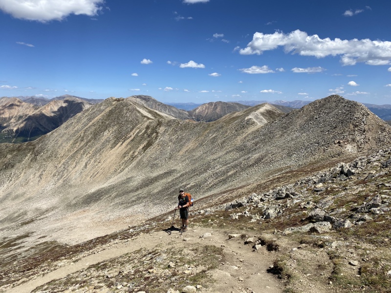
Browns Peak The transit from Pt 13,462 to Unranked Browns Peak was surprisingly easily, especially considering how things looked from a distance. It was mostly tundra save for a short rock-hoppy bit before we reached the saddle.
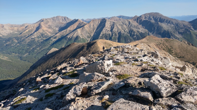
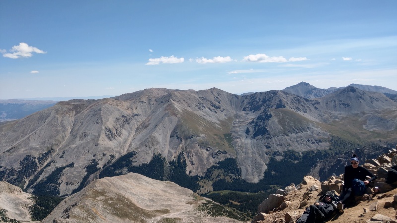
Laura heading down a short rocky bit before the saddle between 13,462 and Browns.Looking back at Pt 13,462 from Browns Peak summit.Looking back on the final bit of the route to Huron Peak from Browns Peak (Huron Standard Route also visible).
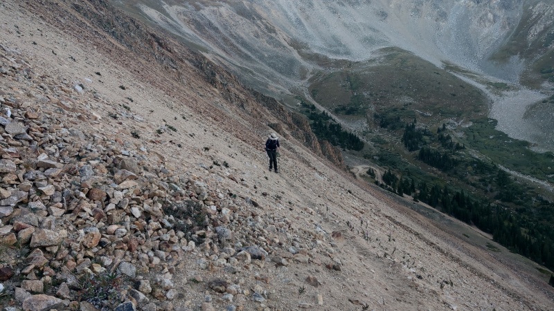
Huron Peak The final bit is where the suck kinda started.
For a first 14er outing I had kinda forgot that "Class 2" had something of a difficulty curve compared to Class 1, and the "rock hopping" we had to do from Browns Peak to meet up with Huron's standard route to summit Laura wasn't very fond of. The nature of this last ridge was also a bit unexpected on my part. Still she felt a lot better "rock hopping" than she did hiking up those earlier scree-ish switchbacks, but it was still a bit tedious compared to most hiking she was used to.
We stayed right (west) of the rocky ridge like the route description said and eventually met up with the standard route.
We also happened to run into my friend Syndi around here who was attempting Huron as #57/58 this weekend via the same route (not unexpected based on prior communication). She had done Stewart and San Luis with me the previous weekend. She eclipsed our pace this day though. She and two other people were the only ones we had seen on the Lulu Gulch route all day.
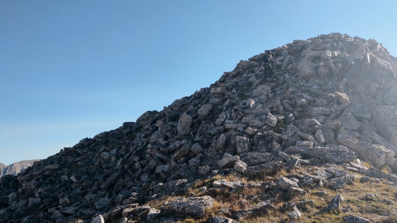
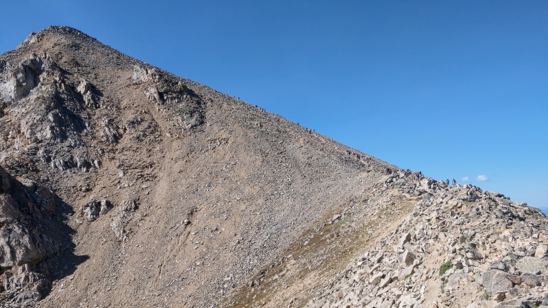
Looking closer at the ridge between Browns Peak and Huron.Rock hopping on the way to meet up with Huron's Standard Route.Did it! Finally at a well established trail! Huron's Standard route!Looking at the crowds heading up the last bit of Huron's Standard Route.
Finally on a well established (and somewhat crowded ) trail, we made our final push to the summit.
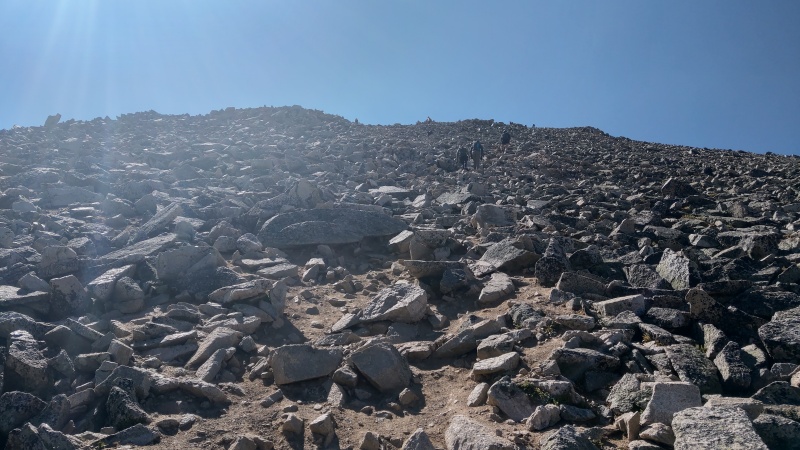
And it was here, maybe 300' from the summit, that Laura really started to struggle.
All the previous issues were relatively minor, but here she really started to struggle to catch her breath at altitude.
Then at 200' from the summit her ability to catch here breath triggered something of a mild panic attack, which only made breathing worse. This quickly subsided but at this point I told her to sit down, and set a timer for 10 minutes on my phone. I checked if she had any more serious symptoms of altitude sickness, and she said she had none other than being out-of-breath. I told her we would sit here and rest until at least my 10 minute timer elapsed, and also checked if we needed to turn around and head to lower altitude now but we were still doing OK.
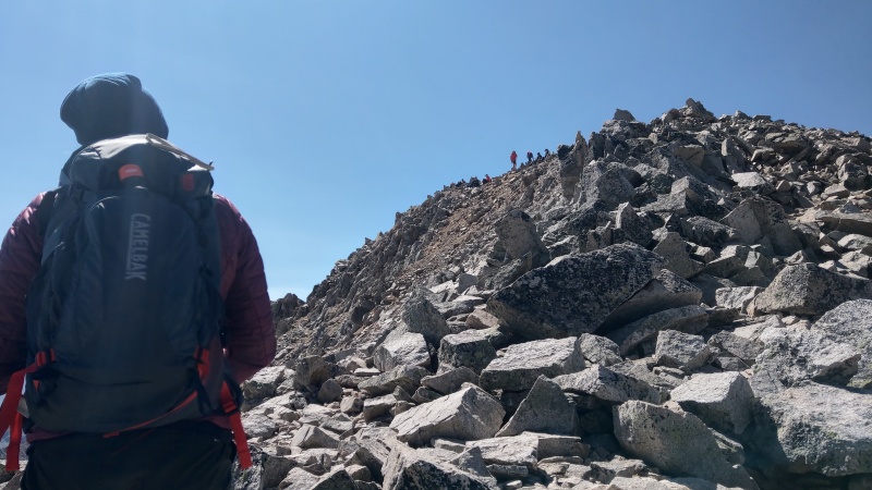
After a 10 minute rest we took an appropriately slow pace. I told her, "take ten steps up, then rest" and that's what we did... Checking as well if we needed to turn around at any point. I had aspirin if she needed it but she never experienced a headache or other altitude sickness symptoms. She was just out-of-breathe and then closer to the summit (after a few "10 step" instances) she did start to feel a bit of nausea.
It was slow going for a little bit, but Laura and I managed to make it to the summit around 11:30.
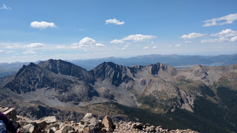
The final couple hundred feet to Huron's summit.Almost there!Summit! I also made sure there was no ambiguity regarding the sign elevation datums.Looking North from Huron Summit. (La Plata and more)Looking East from Huron Summit . (BelOxMo Group)Looking South from Huron Summit. (Three Apostles)Looking West from Huron Summit. (The Elks and more)
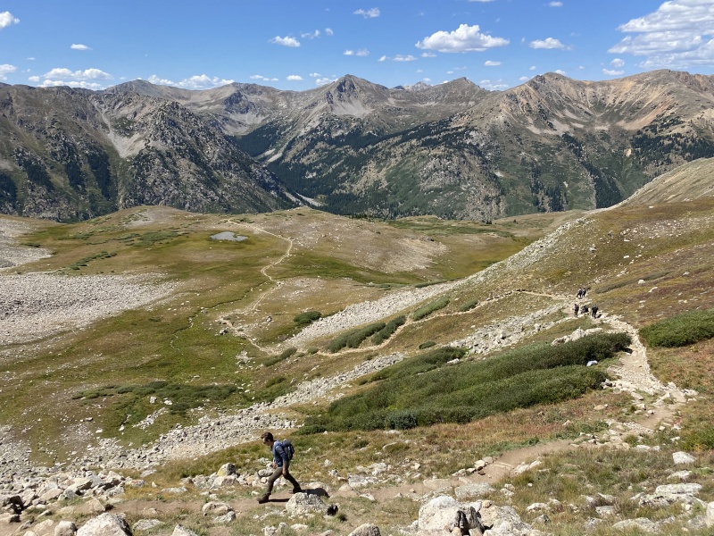
The Descent At this point we started our descent via the standard route, which is something we planned from the start since it seemed like it might be easier even with the long walk on the road back to Winfield.
This was pretty long, and while Laura has less altitude issues on the way down she still had some boughts of nausea and, the further we went on, some exhaustion to deal with.
After the fact we later concluded that the exhaustion was mostly to blame on lack of food intake. Though packing some sandwiches we had not consumed any of them yet (not even on the summit). This was something I had experienced myself both on Princeton in January 2021 and Humboldt in March 2021. The Humboldt outing in particular was the most tired I remember myself ever having been, for whatever reason... (not enough food I suspect?) Part of the problem was that the nausea Laura was experiencing really killed any appetite. I believe in order to rectify that we would have to at the very least stopped and taken a rest for 10-20 minutes, eat some food, then remain for an additional 10-20 minutes to ensure the food could be kept down. But that's simply not something we took the time to do. We at least had no issues with water. Between the 3L Laura took up and the 4L I took up we were both adequately hydrated and neither of us ran out.
Either way, we made it back to Winfield shortly before 4:00 PM, and then after eating some food and drinking some Gatorade (and maybe a beer or two) we both felt fully restored.
Starting to make our way down from Huron Peak summit.Heading down the standard route. Looking back towards the ridge that we traversed from Browns Peak.Looking down at a flat bit on the standard route.The "South Winfield" Trailhead. Still a long walk on the road to go for us.Looking North walking the "4WD" road back to Winfield.
Back at Winfield! And my F-150!
Conclusion How much is too much? I could have, and probably should have, chosen an easier "first 14er outing" for my friend here but we still got it done safely and successfully. So much so that Laura even suggested she'd be willing to another 14er next time she's in Colorado! (ideally an easier one)
In any event I celebrate every outing in which we're all able to get home safely but still make an effort to review any "lessons learned" to make future outings more fun, safer, and more successful.
And for weather info like in my other reports (from my Kestrel); though almost identical to my report from the previous week (San Luis):
Almost no smoke to speak of
Temperature in the high 30s to low 50s throughout the hike
Wind Speeds in the low teens MPH at worst
Wind chill at worst in the 30s
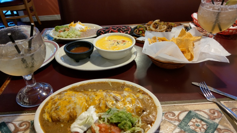
After a long drive back to Denver Laura and I refueled with a substantial amount of Mexican food at one of my favorite restaurants in Golden: El Dorado.
Calling @headsizeburrito! I hope you approve.
GPX As mentioned in my other reports I record my track via my phone's Gaia GPS app (and FitBit Versa, though that's inaccurate).
Unfortunately I ran into some issues this hike. I ended up having to restart my phone maybe 5 minutes into my hike and also Gaia for some reason stopped my track shortly after descending Huron Peak summit. So the end result is I actually have 3 tracks for this outing, which is messy, but I don't really feel the need to share any of them for such an easy to follow route anyway... They can be provided upon request.
Gaia being messy and likely overestimating distance.
Thumbnails for uploaded photos (click to open slideshow):
Congratulations to you both for the successful trek. I'm glad I took the standard route.
Caution: The information contained in this report may not be accurate and should not be the only resource used in preparation for your climb. Failure to have the necessary experience, physical conditioning, supplies or equipment can result in injury or death. 14ers.com and the author(s) of this report provide no warranties, either express or implied, that the information provided is accurate or reliable. By using the information provided, you agree to indemnify and hold harmless 14ers.com and the report author(s) with respect to any claims and demands against them, including any attorney fees and expenses. Please read the 14ers.com Safety and Disclaimer pages for more information.
Please respect private property: 14ers.com supports the rights of private landowners to determine how and by whom their land will be used. In Colorado, it is your responsibility to determine if land is private and to obtain the appropriate permission before entering the property.


")
")
")
")
")
")
")
")
")
")
")
")
")
")
")
")
")
")
")
")
")
")
")
")
")
")
")
")
")
")
")
")
")
")
")
")
")
")
")


