Download Agreement, Release, and Acknowledgement of Risk:
You (the person requesting this file download) fully understand mountain climbing ("Activity") involves risks and dangers of serious bodily injury, including permanent disability, paralysis, and death ("Risks") and you fully accept and assume all such risks and all responsibility for losses, costs, and damages you incur as a result of your participation in this Activity.
You acknowledge that information in the file you have chosen to download may not be accurate and may contain errors. You agree to assume all risks when using this information and agree to release and discharge 14ers.com, 14ers Inc. and the author(s) of such information (collectively, the "Released Parties").
You hereby discharge the Released Parties from all damages, actions, claims and liabilities of any nature, specifically including, but not limited to, damages, actions, claims and liabilities arising from or related to the negligence of the Released Parties. You further agree to indemnify, hold harmless and defend 14ers.com, 14ers Inc. and each of the other Released Parties from and against any loss, damage, liability and expense, including costs and attorney fees, incurred by 14ers.com, 14ers Inc. or any of the other Released Parties as a result of you using information provided on the 14ers.com or 14ers Inc. websites.
You have read this agreement, fully understand its terms and intend it to be a complete and unconditional release of all liability to the greatest extent allowed by law and agree that if any portion of this agreement is held to be invalid the balance, notwithstanding, shall continue in full force and effect.
By clicking "OK" you agree to these terms. If you DO NOT agree, click "Cancel"...
This is my first trip report. Previously, I didn't think I had anything of substance to add to the knowledge of climbing the easier class 1 and 2 peaks I have completed so far; however, the Mount Harvard - Columbia Traverse is a different animal. While I have read reports of this difficult route from experienced Colorado adventurers I have yet to see one from the perspective of a flatlander with damaged knees and 60 years under his or her belt. I hope this report will provide information to help these hikers decide whether this route is for them.
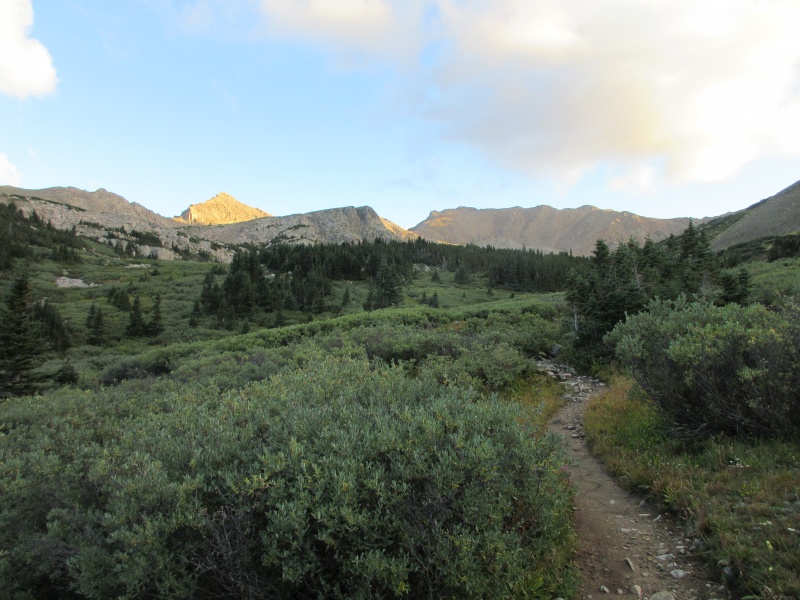
I arrived at the North Cottonwood Creek trailhead at about 4:45 AM on August 27th with the intention of doing Mt. Harvard only, though I had studied the traverse route. I had been in Colorado since Monday evening and had hiked Mt. Princeton on Tuesday, and Mt. Yale on Wednesday. Tuesday was tough due to my lack of acclimation, but Yale was easier on Wednesday, and by Friday I pretty much had my hiking legs and was feeling really good going up the Mt. Harvard trail. Throughout much of the forested section of the trail I wasn't able to see much with just my headlamp, but I did enjoy the stream crossings, especially the large one at the bridge within the first quarter of a mile or so of the hike. By the time I reached the intersection with the west slopes Columbia trail there was plenty of light outside to shut off my headlamp. Not long thereafter, the trail turned to the east toward Mt. Columbia and I saw a couple of occupied campsites to my left.
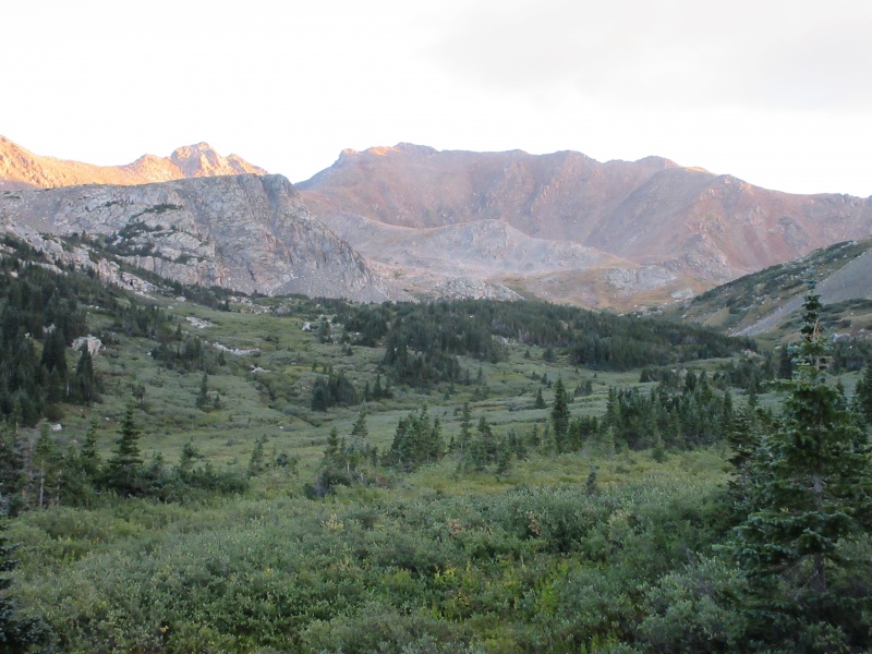
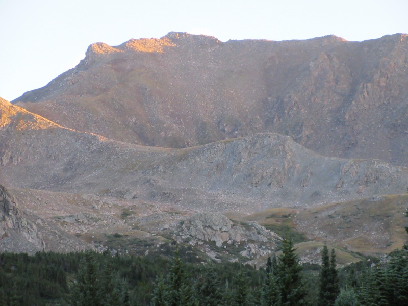
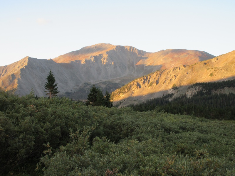
I proceeded onward as the trail curved back to the north and it is here that the beauty of Horn Fork Basin comes into its own. I took a few photos along the way and stopped at what appeared to be a higher plateau in the basin to really take in the views.
The Northern BasinSun-kissed Mt. HarvardLooking back at Mt. Yale in the distance.Further up in the basin.The northern end of the basin with the shoulder before Mt. Harvard in view.
I arrived at the base of the shoulder in front of Harvard with approximately 2700 feet of elevation gain completed. Up to this point, the gain had been well distributed throughout the trail so the hike had been relatively easy. I was quite impressed with the rock trail that was created by CFI to go over the shoulder and made my way up it with relatively little effort as well, considering how steep it appeared from below. I crossed the slope leading to the south ridge and then, finally, some steep, strenuous climbing began.
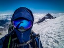
The ascent to Mt. Harvard was slow, steep, and tedious with numerous switchbacks. Near the bottom I would count out 350 to 450 steps before stopping for a breather, but as I climbed higher the numbers went down to 100 to 200 steps. However, it wasn't that long before I was at the bottom of the rock leading to the summit. A fun scramble ensued up the rock and I was at the top at approximately 9:45 AM. There was a lovely sign in a metal box that I used in the pics but it was dated August 5th. I am not big on signs but my wife likes me to use them so our relatives know where I am when they look at the pics.
Ascending to the south ridge.
Mt. Harvard summit pic.
The basin in all its glory with Bear Lake in the center.
Once on the summit I ate some grub and drank some water. I was feeling really good, had plenty of time, and the weather was great so I decided to continue along the traverse to Columbia. Plus, the other three people, who arrived at the summit after me, were heading that way so I thought that would make this solo outing less intimidating. I forgot to restart my hike on my watch when I left the summit but I presume I left somewhere around 10:30 to 10:45 AM. Descending from Harvard to the saddle between it and Columbia was fairly routine with some loose scree and rock, but otherwise it was very manageable.
Some rock along the ridge descending from Mt. Harvard.
Horn Fork Basin from the saddle with Mt. Yale just left of center.
Once one begins the descent off of point 13,516, the intensity of the hike increases substantially. A couple of other hikers and I worked together on route finding and we made a couple of tiny blunders which made the traverse more difficult. A route finding mistake on this side of the ridge seems to increase the effort exponentially. After descending point 13,516 the hike is an upwards climb through what I would call small ridges of boulders of maybe 100 to 300 feet each and it is quite exhausting, at least for me. After a while, these talus fields start to wear on the joints and one's mental fortitude. Determination and pushing through the exhaustion, as well as carrying enough water and energy snacks are key to completing this section. For what it's worth, I would advise picking the quickest way up to the ledge that is located between the talus below and Columbia's ridge above. Once you reach that ledge you still have lots of small talus ridges to cross but it looks more manageable than crossing too far on the talus and then going up to the ledge, which is what I did. Also and again from my perspective, it is easier to climb the talus to reach the ledge than to pick out a "cleaner" spot. The hikers in front of me initially chose a spot that looked clear of boulders but it was extremely loose scree and a slip from halfway up the slope would have been quite ugly and dangerous. We eventually all chose the path of the boulders even though they were much better in the loose stuff than I was.
We were aiming for the grassy area in the bottom middle of this pic. This turned out to be a mistake as there was a big hidden valley of talus right before it. The pics of this area in this report and on 14ers.com do not reveal some of the pitfalls in these areas.
Loose ugly area up ahead with Columbia towering in the distance. We avoided this area by cutting back slightly to the ledge on some talus.
Looking back toward Harvard with the "rabbit" rock formation in the upper left of the photo.
At this point in the hike exhaustion was becoming a liability and it was affecting my concentration. I found myself making mistakes with foot and trekking pole placement leading to some off balance moves and occasionally placing a trekking pole in a hole. I doubled down on my determination and slowed down enough to make sure I could eliminate those mistakes. I knew there was time and I didn't need to hurry and possibly break an arm or an ankle. I also stopped taking photos and kept my mind on the task at hand. Eventually, I climbed out of the sea of talus at 2:18 PM, and made a right turn to climb up to the saddle between the higher ridge and Mt. Columbia.
The hike from the saddle was a steep, loose climb up the mountain ridge to the boulders at the top and the winds were quite strong at this point. The final climb through the boulders is actually a welcome relief because you know you have almost completed the traverse. I arrived at the summit at 3:18 PM and discovered the views from Columbia are spectacular as well, from the surrounding mountains to the precipitous drop down into the basin.
At the summit of Mt. Columbia.
A view down into the basin, with Mt. Yale in the upper left, during the descent of Mt. Columbia.
I spent a few minutes eating a granola bar and drinking some water before descending the six miles back to the trailhead along the West Slopes route for Columbia. While there is some loose stuff at the beginning of the descent it wasn't too bad and once I reached the newly built trail further down the mountain I was moving pretty fast. However, the day had taken its toll and I was using my trekking poles to help support my weight and ease the pain in my knees as I went down the steps of the excellent trail. Once I reached the intersection of the West Slopes trail and the Mt. Harvard trail it was clear sailing. I arrived back at the trailhead at approximately 7:10 PM. Subtracting the time I spent on the summits, my hiking time was about 13 hours 10 minutes.
All in all this is a magnificent trail with amazing views, but the challenge is intense. The traverse isn't very technical, but the miles of talus and scree are simply exhausting. If you are physically capable, preparation and having the right mindset are key to completing the traverse. Just remember that once you reach the saddle and descend the ridge off point 13,516 there are no easy ways out. Every path from this point on is a slog.
My GPS Tracks on Google Maps (made from a .GPX file upload):
And as a fellow "flatlander" I appreciate your perspective of a "flatlander." There is a quantum of difference between a once or twice a year climber who lives at 1,000 feet of elevation or less, and those who are lucky and blessed to live at altitude and get out with great frequency. Way to get it done, Ed.
Even those of us old geezers who live here and get out regularly appreciate these reports. Helps us visualize routes and pitfalls for our upcoming hikes! Excellent work Ed.
Ed, great report and amazing pics. Great beta on the condition of the trail and some of the challenges. I did the "Loveland Double" and it was equally exhausting and time consuming. This is one I may eye in the future. Like you said, key is planning and giving yourself time. Appreciate the great report. Thanks. Congrats!
Ritzn1, I have looked at that west ridge route to Torreys but haven't fit it into a trip yet. It is definitely a commitment with that much elevation gain. Thanks for your comments.
For the excellent write up. Very helpful even for this young hiker who lives in CO (although with damaged knees!)
Caution: The information contained in this report may not be accurate and should not be the only resource used in preparation for your climb. Failure to have the necessary experience, physical conditioning, supplies or equipment can result in injury or death. 14ers.com and the author(s) of this report provide no warranties, either express or implied, that the information provided is accurate or reliable. By using the information provided, you agree to indemnify and hold harmless 14ers.com and the report author(s) with respect to any claims and demands against them, including any attorney fees and expenses. Please read the 14ers.com Safety and Disclaimer pages for more information.
Please respect private property: 14ers.com supports the rights of private landowners to determine how and by whom their land will be used. In Colorado, it is your responsibility to determine if land is private and to obtain the appropriate permission before entering the property.


")
")
")
")
")
")
")
")
")
")
")
")
")
")
")
")
")