Download Agreement, Release, and Acknowledgement of Risk:
You (the person requesting this file download) fully understand mountain climbing ("Activity") involves risks and dangers of serious bodily injury, including permanent disability, paralysis, and death ("Risks") and you fully accept and assume all such risks and all responsibility for losses, costs, and damages you incur as a result of your participation in this Activity.
You acknowledge that information in the file you have chosen to download may not be accurate and may contain errors. You agree to assume all risks when using this information and agree to release and discharge 14ers.com, 14ers Inc. and the author(s) of such information (collectively, the "Released Parties").
You hereby discharge the Released Parties from all damages, actions, claims and liabilities of any nature, specifically including, but not limited to, damages, actions, claims and liabilities arising from or related to the negligence of the Released Parties. You further agree to indemnify, hold harmless and defend 14ers.com, 14ers Inc. and each of the other Released Parties from and against any loss, damage, liability and expense, including costs and attorney fees, incurred by 14ers.com, 14ers Inc. or any of the other Released Parties as a result of you using information provided on the 14ers.com or 14ers Inc. websites.
You have read this agreement, fully understand its terms and intend it to be a complete and unconditional release of all liability to the greatest extent allowed by law and agree that if any portion of this agreement is held to be invalid the balance, notwithstanding, shall continue in full force and effect.
By clicking "OK" you agree to these terms. If you DO NOT agree, click "Cancel"...
Stewart Creek Loop: San Luis Peak - Baldy Alto - Stewart Peak 16.0 Miles - 5,325' - 10 hr 13 min Saturday 21-August-2021
The Patron Saint San Luis (King Louis IX of France) The Pioneer William Mathews Stewart II*
The namesakes for these two high peaks in the La Garita Wilderness (* honestly the "Stewart" mention comes solely from Wikipedia which I've had trouble verifying)
Location
Elevation (ft)
Distance (mi)
Split (mi)
Time
Time (HH:MM)
Split (HH:MM)
Stewart Creek Trailhead Start
10,493
0.0
0.0
04:16 21-Aug-2021
00:00
00:00
San Luis Peak
14,014
6.6
6.6
07:58 21-Aug-2021
03:42
03:42
Baldy Alto
13,698
8.1
1.5
09:32 21-Aug-2021
05:16
01:34
Stewart Peak
13,983
9.7
1.6
11:09 21-Aug-2021
06:53
01:37
Nutras Creek Trailhead
11,055
13.9
4.1
13:45 21-Aug-2021
09:29
02:36
Stewart Creek Trailhead End
10,493
16.0
2.1
14:29 21-Aug-2021
10:13
00:44
Introduction The goal I've given myself is to focus on the Centennial 13ers before focusing on the 14ers themselves, or at least take opportunities to hit Cent 13ers that happen to be nearby other 14ers. With that in mind I was toying around with the idea of hitting San Luis Peak and Stewart Peak together (and grab Baldy Alto in-between) back in July but had no takers for partners. Then Sydni, a friend who I had tagged a couple peaks with previously, was looking to knock out San Luis Peak in August (one of the 3 14ers she had left!) and we managed to work out a plan for this outing.
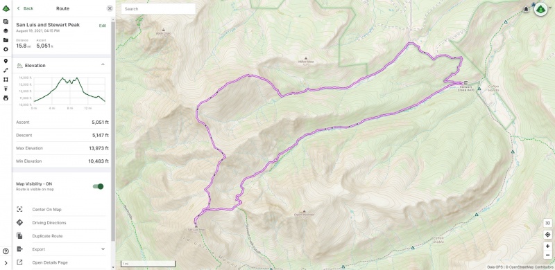
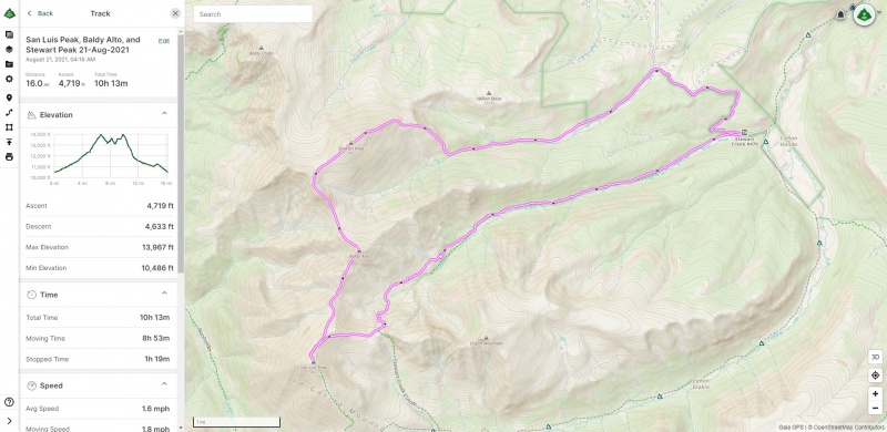
Looking at the routes online here, in Roach's guides, and in Trip Reports such an outing was looking to be a pretty big day. In particular we took a look at this Trip Report from user "geojed," who also threw in Bi-Cent Organ Mountain (we opted not for Organ). We weren't sure if the weather would initially cooperate for such a large day, but if it didn't then we would focus solely on hitting San Luis Peak out-and-back from the standard route (Northeast Ridge). For the larger loop should we commit to it we also decided upon a more conventional approach; after traversing from San Luis Peak over Baldy Alto to Stewart Peak we'd simply take the East Ridge route back to the Nutras Creek Trailhead and walk the road back to our Stewart Creek Trailhead starting point. Tracing this all out in Gaia ahead of time it looked like this:
Pre-planning the route in Gaia. I more or less manually traced this over other GPXs though I imagine if I knew more about editing GPX files I could have built this more elegantly.
So that was that. With our plan in mind we set out from Denver Friday afternoon for Stewart Creek Trailhead, and at the time weather was looking good enough to try for this larger loop.
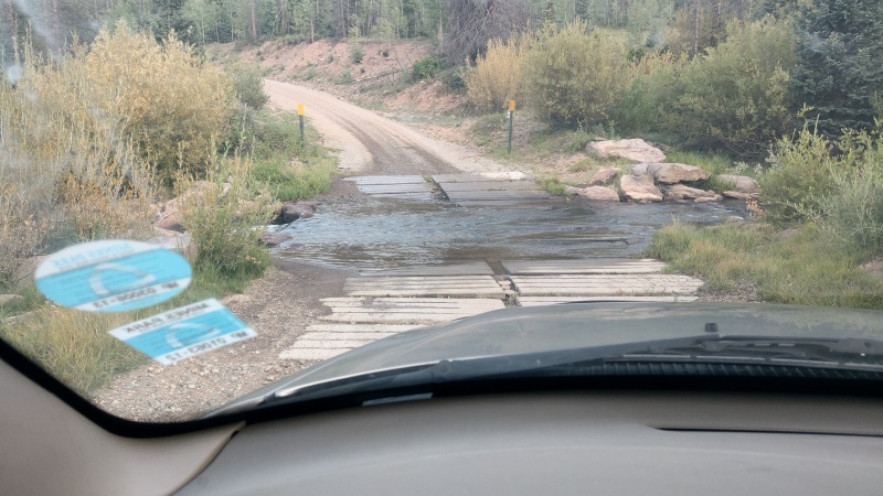
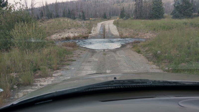
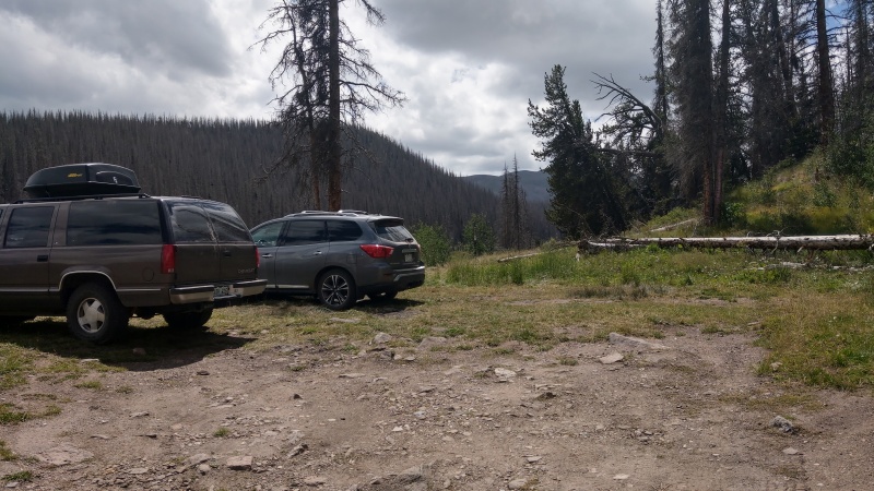
Stewart Creek Trailhead Traffic on the drive was surprisingly light, and what was also surprising was just how easy it was to get to the trailhead itself. The road was in pretty good shape. It was rough in spots as expected but no problem I would say for most 2WD vehicles (my RWD 2002 F-150 included). The thing that might be problematic, as detailed in the Trailhead Info page, are the two creek crossings:
First creek crossing early on: Pauline Creek.Second creek crossing: Nutras Creek.
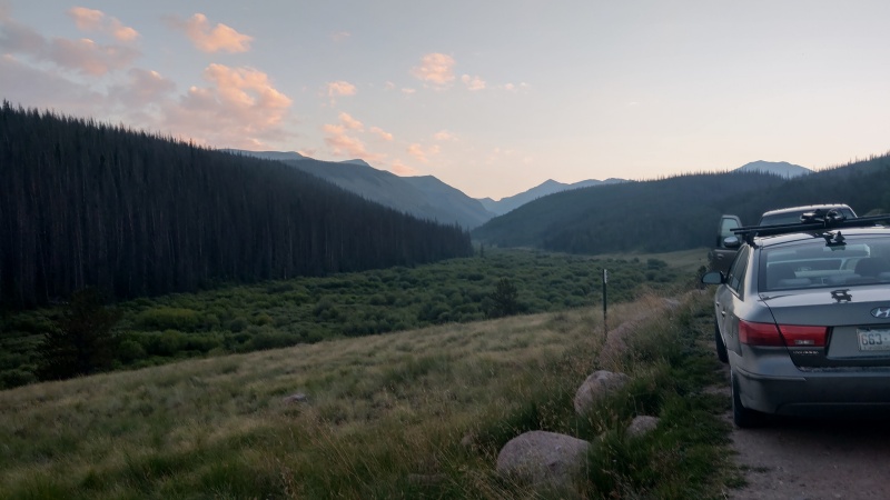
These obviously could be a problem for low clearance vehicles, particularly in periods of high flow. Nevertheless when we arrived at the trailhead we did note there was a Hyundai sedan there that made it fine (we also happened to catch it crossing Nutras creek on the way out without issue). We arrived shortly before 8:00 PM. Sydni opted to setup her tent, and though I had brought my tent as well I was lazy and opted to scrunch up in my crew cab's back seat.
Arrival at Stewart Creek Trailhead, looking West.
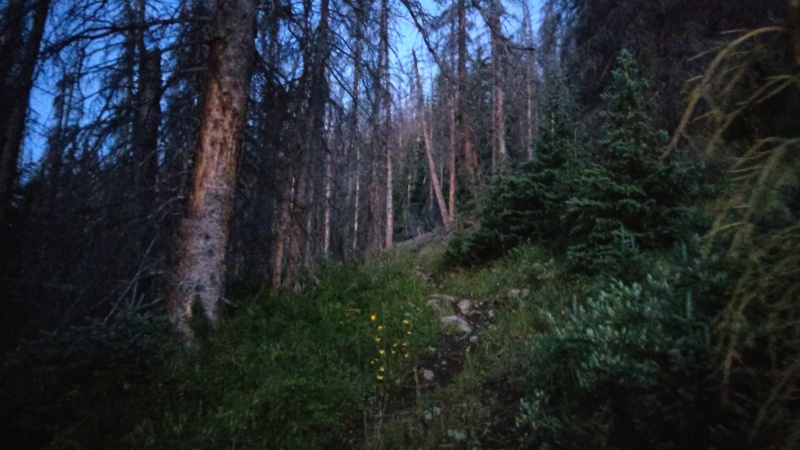
San Luis Peak We woke around 3:30 AM, got ready, and set out on the trail at 4:16 AM. This was fairly uneventful. The trail is very easy to follow even in the dark. It was a full moon but by this time in the morning the moon was already blocked by the peaks to the west of us so it might as well have been a moonless night. We thought we heard a moose or other large animal hop into the creek beside us at one point, but other than that didn't encounter any animals for sure until after sunrise.
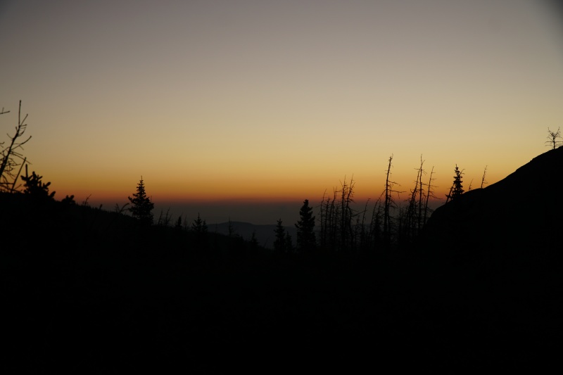
Blurry trail appearing as the sun gets closer to rising.The prominent peak here is something of a false summit. San Luis itself is just barely visible behind it here.Smokey Sunrise.
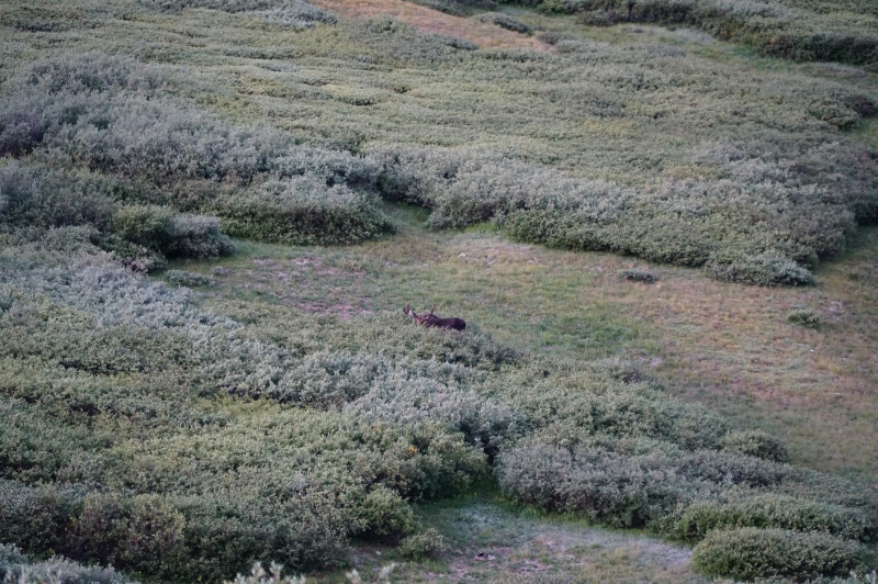
As we approached the willow-y bit of the trail right before it started up the switchbacks we ran into a moose chomping on some willows. We kept our distance of course. He saw us but didn't seem to mind.
Hi moose! Please eat all the willows you like!Good morning La Garita Wilderness! Starting to switchback up to the saddle between San Luis and Organ.
There really isn't much to say about the rest of this route up to San Luis. It's well established Class 1 trail all the way, thanks much to CFI as the route description mentions. We hit the summit right before 8:00 AM where we ran into a group of 3 who reached summit shortly before we did. We also happened to see a couple groups making their way up the South Ridge route.
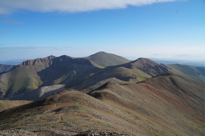
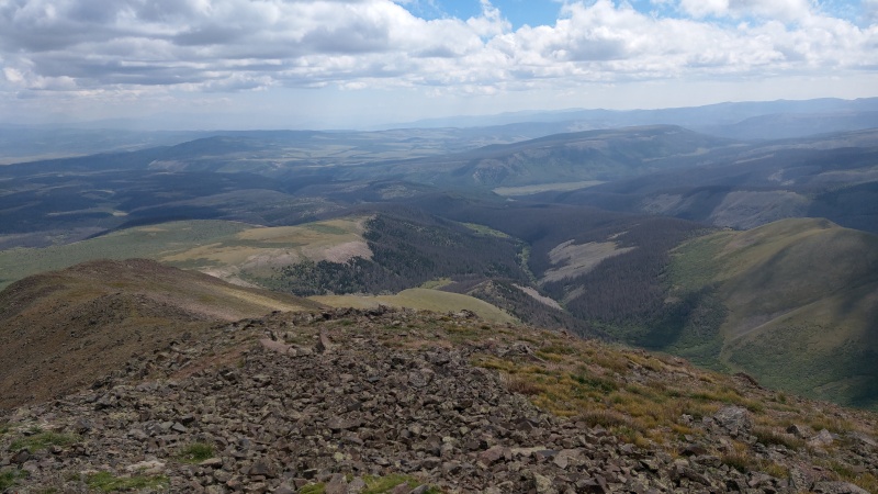
Saddle between San Luis and Organ.Continuing on the last bit of trail up to San Luis, looking back to Baldy Alto and Stewart Peak.San Luis Peak summit looking Northwest-ishSan Luis Peak summit monument.Phoenix Peak and more of the La Garita Wilderness south of San Luis Peak summit.
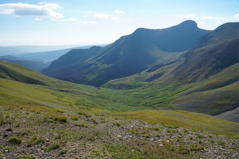
Baldy Alto San Luis summit achieved, we took a moment to re-evaluate our plan. There were some clouds in the distance for sure, but nothing that really spooked us. With cell coverage we checked updates to weather forecasts and radar. We could see on radar rain hitting Uncompaghre in the distance (and well, with our own eyes we could see this from the summit too). However those clouds were heading in a northeasterly direction according to the radar, not toward us. Feeling comfortable we decided to continue on with the larger loop.
Baldy Alto and Stewart Peak from San Luis summit.
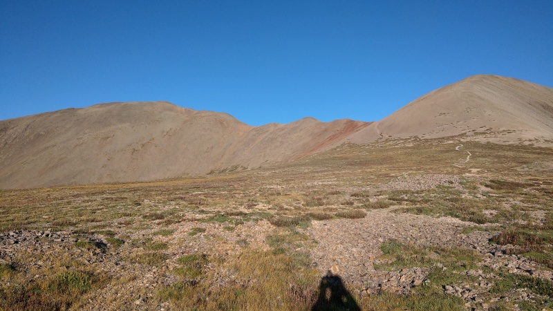
Connecting San Luis to Baldy Alto is pretty straightforward. We backtracked a bit on the main trail then cut off the trail and over the ridge about the same spot the GPX track from geojed did. Even if you didn't have a GPX track it intuitively seemed like the best place to do it. From there we descended the saddle connecting to Baldy Alto. For pretty much the remainder of the day we opted to not gain any more elevation than we needed to (i.e. opting to side skirt some of the "bumps" on the way to Baldy Alto.)
Getting closer to Baldy Alto.Some talus to wade through on the way to Baldy Alto.
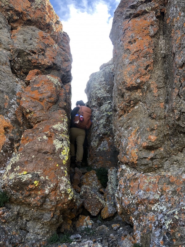
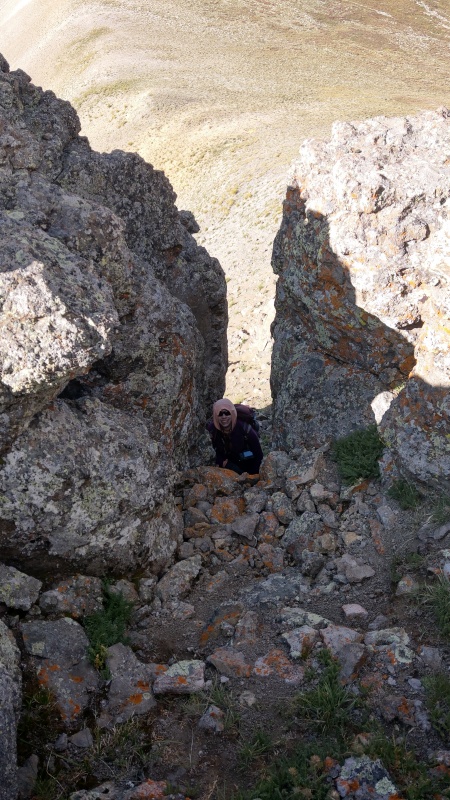
Hitting the low point in the saddle we then started gaining elevation again and ran into a rocky bit through which you can do some climbing or scrambling. This is totally optional and is easily bypassed. We opted heading up a very short little chimney, maybe Class 3+. It wasn't the best display of my climbing skills, which are a bit novice at best... I rushed the moves and didn't really take the time to set proper footholds so my feet slipped a bit. I made it up fine but should have taken more time even if it was only a short (<10') section. Sydni crawled up it much more elegantly than me.
Me heading up the very short little chimney.Chimney from above.
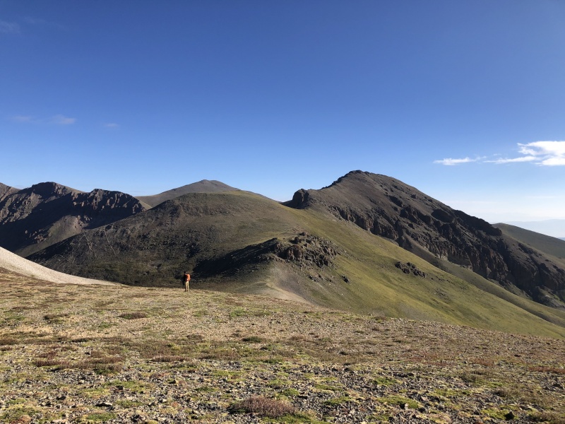
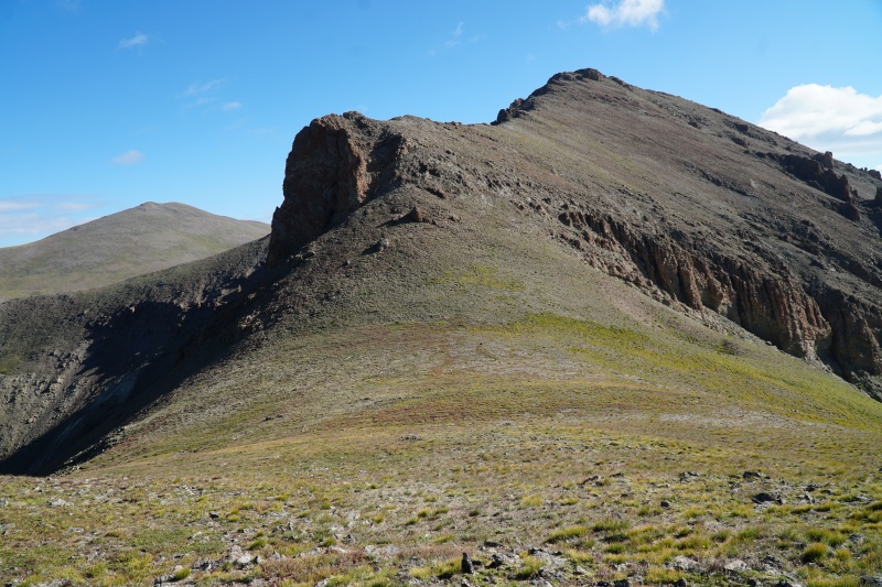
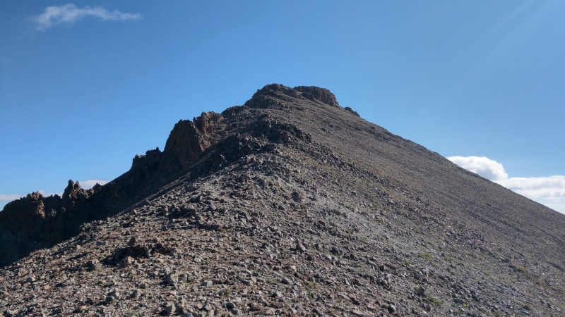
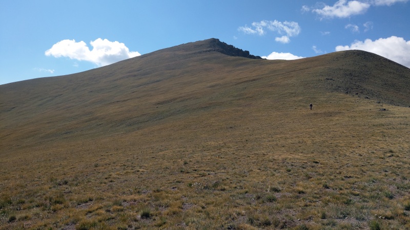
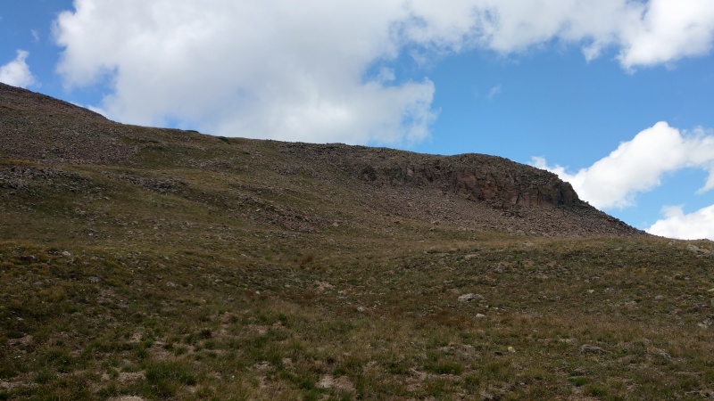
From there we could see the final push we'd need to do up to Baldy Alto. From a distance it looked a bit steep and sketchier than it would ultimately end up being (as is often the case looking at routes from a distance). We cut around the right (south) side of the large cliff we could see. There's a ridge from this cliff up to Baldy's summit which we side stepped for a bit before we finally gained it and made our push up.
Looking back down into Stewart Creek after our very short scramble. Organ Mountain visible.The final push to Baldy Alto.Side-stepping the south side of the final ridge.Ridge gained, summit visible.
We reached summit right around 9:30 AM. Those clouds in the distance we had seen earlier on San Luis? There were some more of them and they were closer than before. We used our available cell coverage to check weather and radar again. We knew those clouds might start to be a problem in 3 hours or so but we felt confident we'd be able to get over to Stewart Peak within that window so forged ahead for our third and final peak of the day.
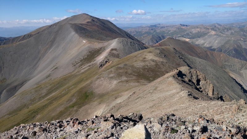
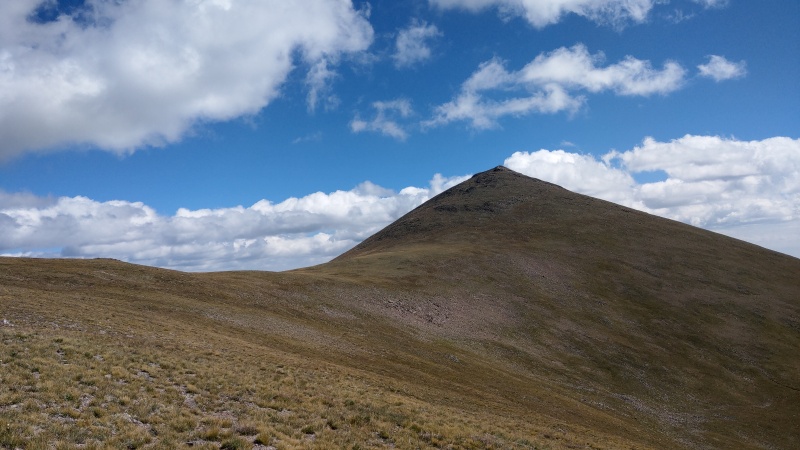
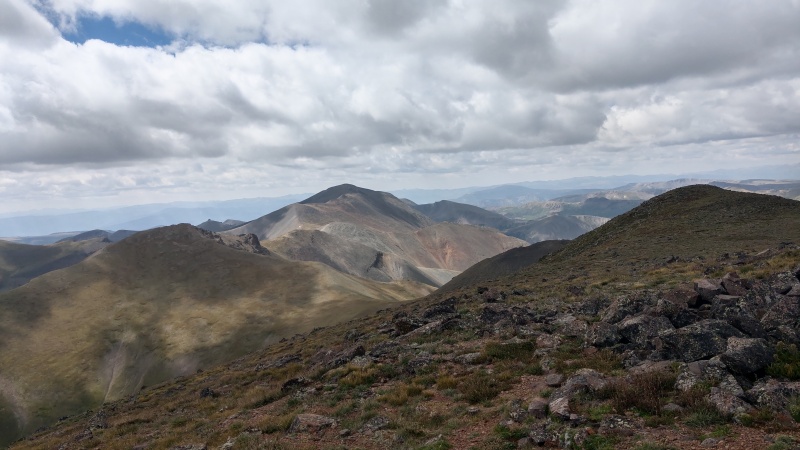
Looking back at San Luis from Baldy Alto summit.View east from Baldy Alto summit.Stewart Peak from Baldy Alto summit.
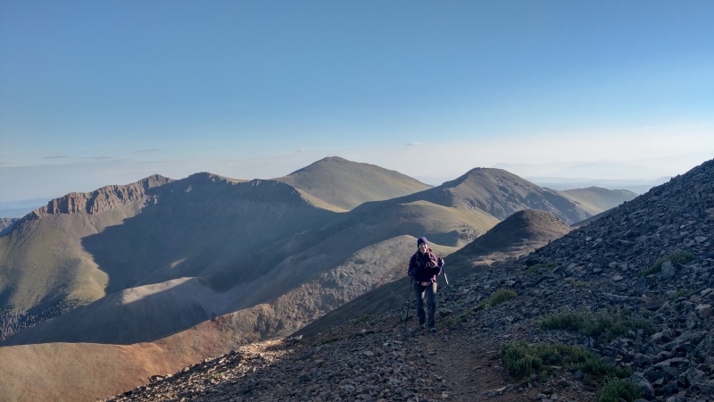
Stewart Peak Descending to the saddle between Baldy Alto and Stewart Peak was also simple enough, mostly tundra and nothing too terribly steep (less than 25° at most).
Looking back on the descent from Baldy Alto.
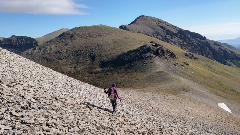
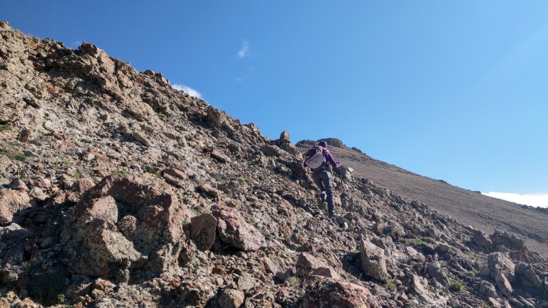
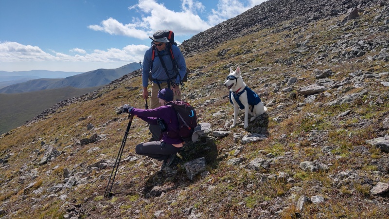
The idea now is to head up some steep tundra to gain a ridge running N-S east of Stewart peak. The steep tundra eventually gives way to talus and boulders but the rock hoping wasn't too painful. Again we skirted more to the side because we could see heading all the way up to the top of the ridge would give us some unnecessary gain. Shortly after reaching this section we ran into a fellow hiker and his dog who was doing something of the same loop for the day but in the opposite direction.
Pup selfie and looking back a little on the rocking hoping bit.
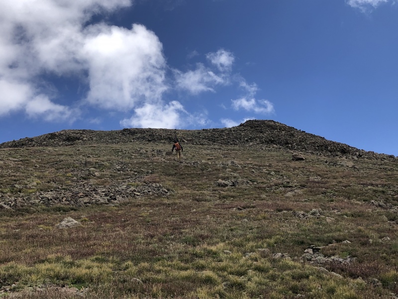
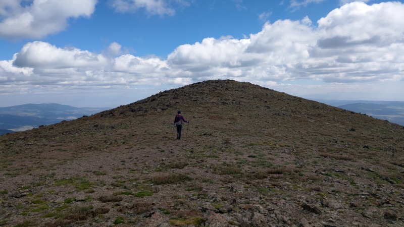
From here you simply head east up Stewart's relatively gentle tundra to gain the summit.
Turning east to head up Stewart's summit.
Stewart's last push up relatively gentle tundra.There are some false summit on the way up Stewart but the last one isn't too bad.
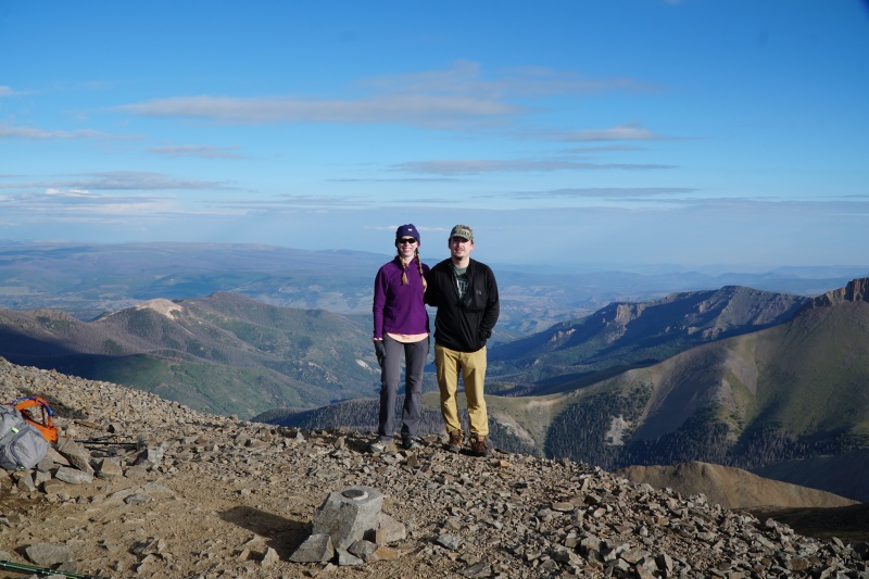
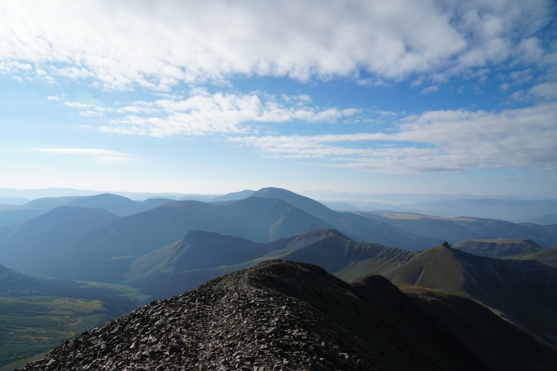
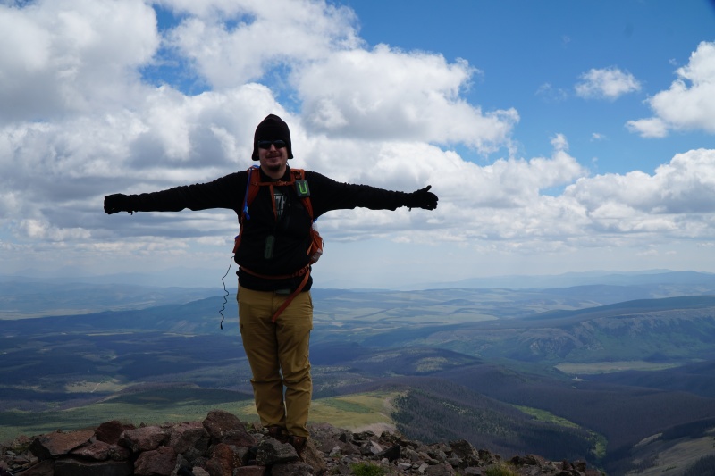
We reached the summit shortly after 11:00 AM and definitely could see more clouds than before and some starting to get darker. We took a quick break then began our descent a little more hurriedly.
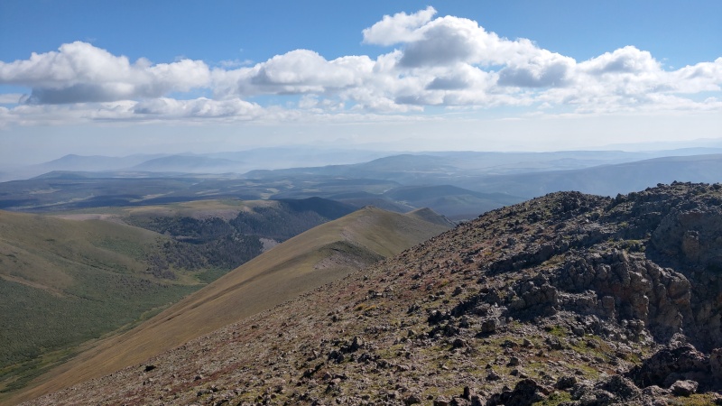
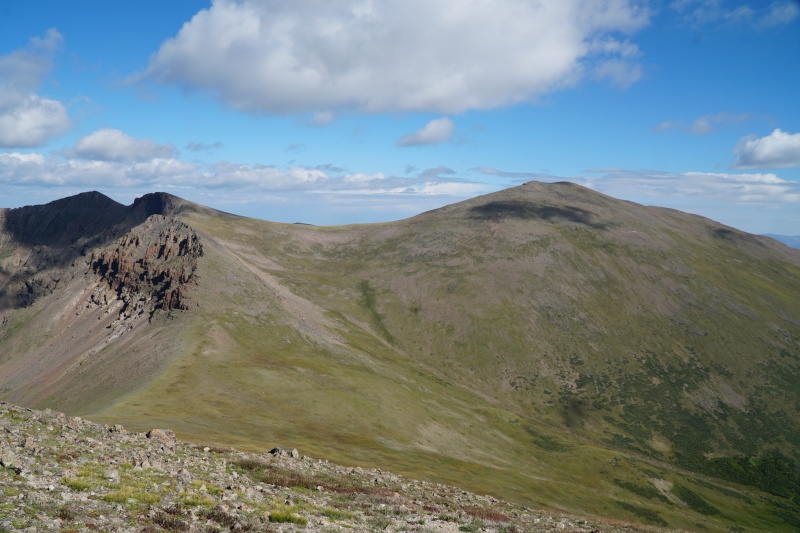
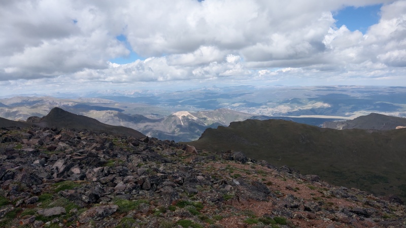
Stewart Peak summit. Ignore my charging cable just hanging there...Looking back at San Luis and Baldy Alto from Stewart Summit.Other San Juans west of us including Uncompaghre and WetterhornLooking east from Stewart summit. You can actually see the Stewart Creek Trailhead from here but just barely (probably not visible in the photo).
Descent From here on we were just following the Stewart Peak East Ridge route for the descent which proceeded without issue. We stuck to the ridge for as long as we could. It was rocky most of the way but never too steep. There were many places where it seemed like the ridge might suddenly cliff out but this only actually happened where the ridge "ends" in something of a clearing. I went all the way to the "cliff out" and had to turn around but Sydni cut down the ridge a bit earlier (actually where the route GPX went anyway) so just keep that in mind if you're descending this way.
Looking back at where the ridge "cliffs out." Follow the ridge almost all the way but not all the way to here. Pay attention to the GPX track if you can.
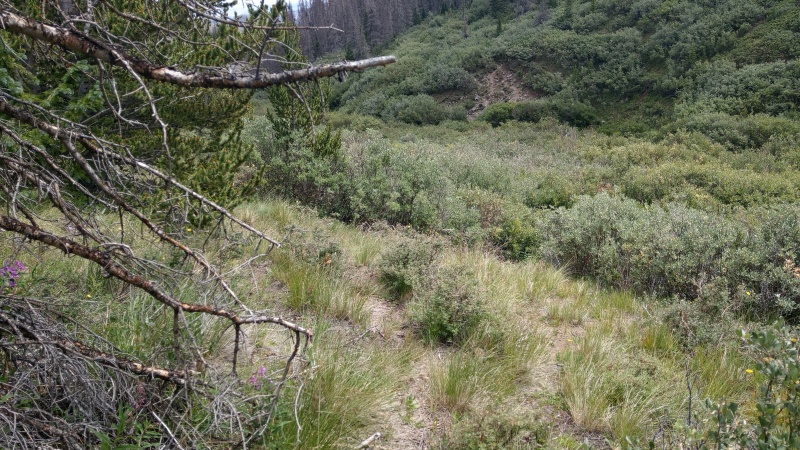
At this point the route takes a turn south and heads towards Nutras Creek. This section is a bit tricky as you're heading down some steep tundra slopes that become a thin forest (I wish I had more pictures of the forest, but there are some of those in the route description). Some parts of this slope approach 40°. Though luckily if you stick to the route you don't have any willows to really worry about. Once you're pretty much at the creek a thin trail should appear heading east.
Hmmm, ok can't quite see it in this picture, but this is where we picked up the faint trail heading alongside Nutras Creek.
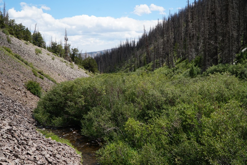
The trail at this point is pretty thin but get's a lot less thin and easier to follow later on. Be aware there is a good amount of deadfall you have to work on bypassing. There is also an unfun section of rock fall right into the creek which is hard to get by, especially if you've lost the trail.
Steep rockfall into Nutras Creek and some.
We reached Nutras Creek trailhead and the road around 1:45 PM. Walking the road back wasn't that fun as you gain maybe 100' or so before dropping down to Stewart Creek, but at least there's no problems route finding! We reached Stewart Creek Trailhead a short while later at 2:29 PM.
Nutras Creek Trailhead.
Conclusion A long day, but a good day. The clouds started to spook us later on, particularly when we reached Stewart Peak, but we didn't encounter any rain or graupel, and we saw no lightning strikes from any of the clouds.
This seemed like an easy and straightforward route, with maybe the worst part being the steep descent into Nutras Creek and the difficulties in following the trail from there onward, but that might just be nitpicking at this point
Weather was great too. As measured with my Kestrel:
Temperature started in the high 30s in the morning, was in the mid 40s at altitude early in the day, low 50s later. Back below treeline temps were in the high 60s and low 70s.
There wasn't too much wind but when there was it was usually less than 10 mph. Worst of the wind was in the saddle in-between Baldy Alto and Stewart Peak where it was in the low 20 mph range.
Wind chill was at worst in the mid 20s but usually in the mid to high 30s.
Interestingly we had good views and minimal smoke to the west of us. There was a lot more smoke and less visibility east.
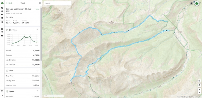
GPS Tracking I discussed this a bit in my last Trip Report, but it's interesting to me how much different methods of tracking can differ from one another in terms of distance and gain. The GPX included and presented below here comes from Sydni's Suunto watch which appeared to be more accurate than any method I was able to employ. Note that the gain of 5,325' came from what her app said, which differs from what Gaia tries to calculate when you load in the GPX.
The "offical" Suunto track.
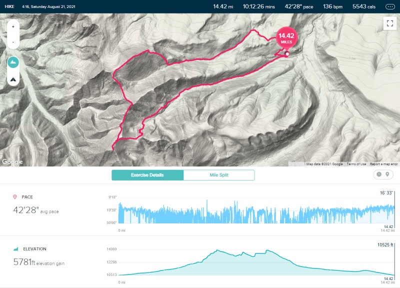
Out of curiosity I'm displaying my Gaia Phone GPS track and Fitbit track below, though I'm likely not going to include these in every report I do. I just think it's worth noting how different (or likely inaccurate) different methods can be.
Worth noting my Gaia phone track also for some reason stopped recording on the road back to Stewart Creek Trailhead, so one can't quite do an apples to apples comparison (though I think it's clear both appear less accurate compared to the Suunto track).
My Gaia Phone GPS track. Ends prematurely; potentially overestimates distance.FitBit track underestimating distance. But at least the gain isn't as far off as it was in my last report.
My GPS Tracks on Google Maps (made from a .GPX file upload):
Thanks for posting such a detailed report. I need to get back to the La Garitas for Organ and another romp up San Luis. 25 years ago it was my favorite range because nobody was there but probably a little more crowded now. Very sad the trees all died.
@blazintoes
Wish it was our dog! The cool looking pup belonged to the hiker we ran into. He and the pup were actually making a multi-day trip out of it backpacking.
@JChitwood
Yeah all the dead trees were somewhat disheartening. Also a bit scary. Someone gets careless with a campfire there and it's not going to be pretty. Luckliy it still wasn't too terribly crowded. There were people there but it wasn't that bad.
One of these days I'll have to come back for Organ too. An interesting looking mountain.
Great Looking Dog and Pathfinder! 8/24/2021 6:28pm
Pleasure meeting you two. I just got back from the 4-day loop and you guys were the only people I saw the entire time. Incredible weekend to be out. Where in the world did you find Class 3+ on Stewart? Nice trip report, BTW.
For the scramble bit, if you're heading from San Luis to Baldy Alto, shortly after you get to the lowest part between the two on a saddle, there's a small rock outcrop on the way up to Baldy Alto around 13,200'.
37.99931, -106.925852?
Edit: most visible on the picture with the caption "Some talus to wade through on the way to Baldy Alto"
Caution: The information contained in this report may not be accurate and should not be the only resource used in preparation for your climb. Failure to have the necessary experience, physical conditioning, supplies or equipment can result in injury or death. 14ers.com and the author(s) of this report provide no warranties, either express or implied, that the information provided is accurate or reliable. By using the information provided, you agree to indemnify and hold harmless 14ers.com and the report author(s) with respect to any claims and demands against them, including any attorney fees and expenses. Please read the 14ers.com Safety and Disclaimer pages for more information.
Please respect private property: 14ers.com supports the rights of private landowners to determine how and by whom their land will be used. In Colorado, it is your responsibility to determine if land is private and to obtain the appropriate permission before entering the property.


")
")
")
")
")
")
")
")
")
")
")
")
")
")
")
")
")
")
")
")
")
")
")
")
")
")
")
")
")
")
")
")
")
")
")
")
")
")
")
")
")
")