Download Agreement, Release, and Acknowledgement of Risk:
You (the person requesting this file download) fully understand mountain climbing ("Activity") involves risks and dangers of serious bodily injury, including permanent disability, paralysis, and death ("Risks") and you fully accept and assume all such risks and all responsibility for losses, costs, and damages you incur as a result of your participation in this Activity.
You acknowledge that information in the file you have chosen to download may not be accurate and may contain errors. You agree to assume all risks when using this information and agree to release and discharge 14ers.com, 14ers Inc. and the author(s) of such information (collectively, the "Released Parties").
You hereby discharge the Released Parties from all damages, actions, claims and liabilities of any nature, specifically including, but not limited to, damages, actions, claims and liabilities arising from or related to the negligence of the Released Parties. You further agree to indemnify, hold harmless and defend 14ers.com, 14ers Inc. and each of the other Released Parties from and against any loss, damage, liability and expense, including costs and attorney fees, incurred by 14ers.com, 14ers Inc. or any of the other Released Parties as a result of you using information provided on the 14ers.com or 14ers Inc. websites.
You have read this agreement, fully understand its terms and intend it to be a complete and unconditional release of all liability to the greatest extent allowed by law and agree that if any portion of this agreement is held to be invalid the balance, notwithstanding, shall continue in full force and effect.
By clicking "OK" you agree to these terms. If you DO NOT agree, click "Cancel"...
General William Tecumseh Sherman The Constellation Gemini Preacher John Lewis Dyer
The namesakes for this trio of peaks surrounding Iowa Gulch just outside of Leadville.
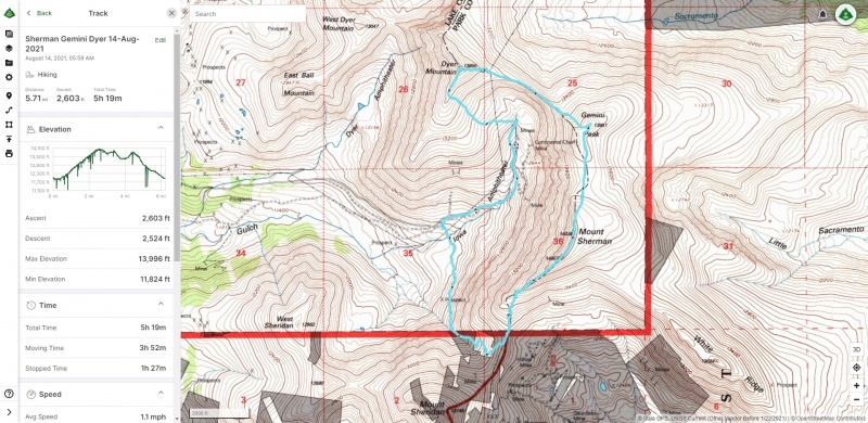
Location
Elevation (ft)
Distance (mi)
Split (mi)
Time
Split (HH:MM)
Trailhead Start
12,000
0.00
0.00
05:59 14-Aug-2021
00:00
Mount Sherman
14,036
2.36
2.36
09:21 14-Aug-2021
03:22
Gemini Peak
13,951
3.08
0.72
09:56 14-Aug-2021
00:35
Dyer Mountain
13,855
4.04
0.96
10:34 14-Aug-2021
00:38
Trailhead End
12,000
5.71
1.67
11:18 14-Aug-2021
00:44
Introduction Oh hey look you're reading my first ever Trip Report! On a first 14er! Ok well not the first 14er for myself... but it was for the two poor souls I managed to drag along with me on this outing!
I only started hiking Colorado's highest peaks starting in summer 2020, despite having spent the vast majority of my life in Colorado. I had always enjoyed hiking though, and was a part of a small casual hiking group that some friends put together on the book of faces. So sure enough after I hit a few peaks here in Colorado I began to threaten this group that I'd drag them up a 14er one of these days. Well, that day came in August 2021!
Sensing the hesitation from the group at mere mention of the intimidating word "14er," I thought that I better suggest something "easy" for this outing, and for me this would be Mt. Sherman. Problem was, I had already done Mt. Sherman! Labor Day weekend 2020 I did a quick jaunt up Mt. Sherman from Iowa Gulch and it ended up being one of my favorite hikes. That I'm sure some might find surprising because I know many describe Mt. Sherman as somewhat underwhelming, but two things made that hike stand out for me:
It was my first true sunrise summit
A full moon meant I actually was able to hike the route without even using a headlamp
Having that in mind, and also knowing that the Iowa Gulch route is a bit less crowded than the standard route (at least until they meet up with each other), I figured why not take my casual hiking group up here again? So then it was settled. I made a FB event for the group and started planning.
But further on I couldn't help but think about how to make this a bit more interesting. I knew there were plenty of other peaks within close proximity that were worth summiting in their own right (I had in fact summited Sheridan as well on that first Sherman outing in 2020). Hey, Centennial Dyer Mountain is right there too! How about hit Sherman then grab Dyer on the way back down? Maybe even hit Gemini on the way? Turn it into a big Iowa Gulch loop?
I noted that though Roach had route descriptions for all these peaks in his 14ers and 13ers books he didn't detail an Iowa Gulch loop that hit all three. However, there was this helpful Trip Report from user Chelsea who did this loop in 2020 and it seemed to confirm to me that doing the full loop didn't really add too much in the way of distance and gain compared to just doing Mt. Sherman out-and-back. So I thought "well let's do it then and make this first 14er outing for the group a tad more interesting!" This would later turn out to be maybe a bit ill advised...
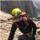
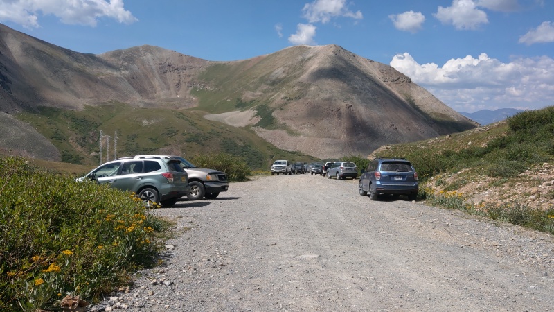
Mount Sherman Checking weather, smoke, and availability we managed to be able to commit to August 14th, and sure enough we were there and ready to go at the Iowa Gulch trailhead just before 6:00 AM. From the group only my friend Marc and his girlfriend Lizi were able to join and luckily the trailhead wasn't too busy with only 2-3 other vehicles.
Smiling start
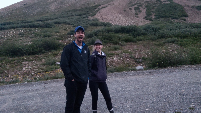
Right as we were starting we ran into two other hikers who had recently moved to Colorado from Texas and as it so happened they also were attempting Sherman as their first 14er (Emma and Lila). They were a bit unclear where the trail started and I certainly couldn't blame them because it is a little tricky. Using the GPX track and my own prior knowledge we all set out together down that short 4WD road spur off CR-2, left underneath the telephone poles, then out across Iowa Gulch.
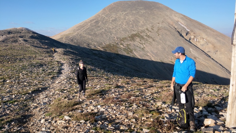
We were all doing fine to start with but started to slow down a bit going up the talus-y trail. I made a point to make sure we set the right pace for everyone, especially since it was most people's first real hike at altitude, and because I knew even from a short outing up Boreas Mountain a few weeks ago I pushed myself too hard and too fast and nearly vomited less than a mile in (yuck). I wanted to avoid that if possible...
Catching our breath and looking back at the trailhead with our new friends from Texas.
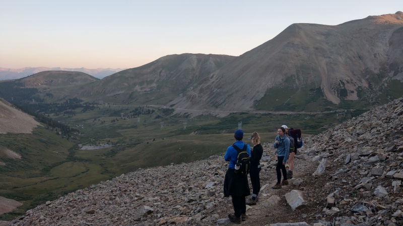
The trail became a bit steeper in spots and had some unfun sections of loose dirt and scree that I remembered all too well from the last time I had ascended Sherman. I had brought two pairs of micro-spikes for myself and my companions but I only ended up using them for the worst section of loose dirt trail approaching the switchbacks up to the Sherman-Sheridan saddle. That certainly wasn't a problem for a chill mountain goat that we ran into on the way though.
Where are your micro-spikes?
It was around this time that Lizi started to really struggle. We really slowed our pace down as she was getting some bad boughts of nausea. Wasn't sure if it was exertion, altitude, or a combination of both but I remembered the feeling vividly from my aforementioned Boreas Mountain hike. She wasn't experiencing a headache or other altitude sickness symptoms though.
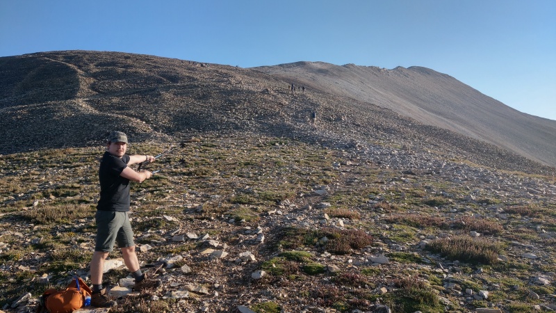
We managed to power through it and met up with the standard route at the Sherman-Sheridan saddle. Taking plenty of breaks, not going too fast, and drinking plenty of water.
At the saddle, making progress!Me saying "Just a bit further! It's right there!"
The route was a bit more crowded at this point but not too bad. We just continued to power through it, taking an appropriately slow pace. We ran into our Texas friends again who had gone on ahead just below 14,000 and chatted a bit before making our final push.
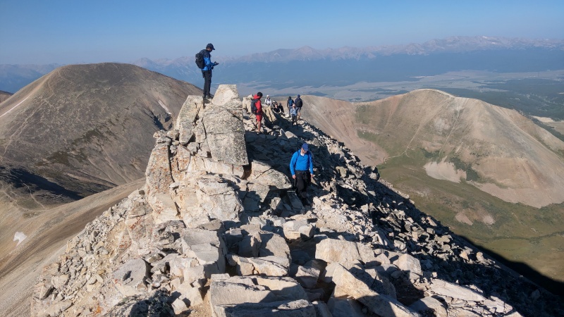
I forgot how narrow this ridge got...The homestretch, we're already above 14,000! Also that boxer had a REALLY long tongue.
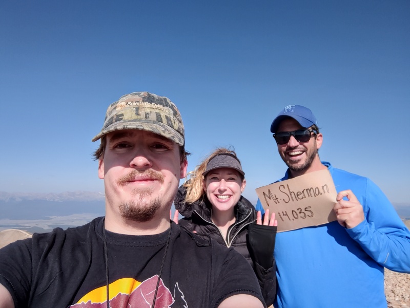
Around 9:20 AM Marc and Lizi hit their first 14er summit.
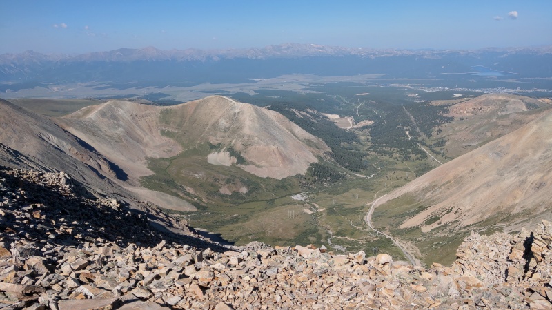
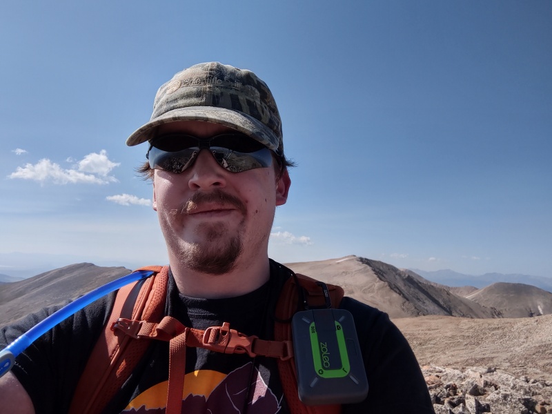
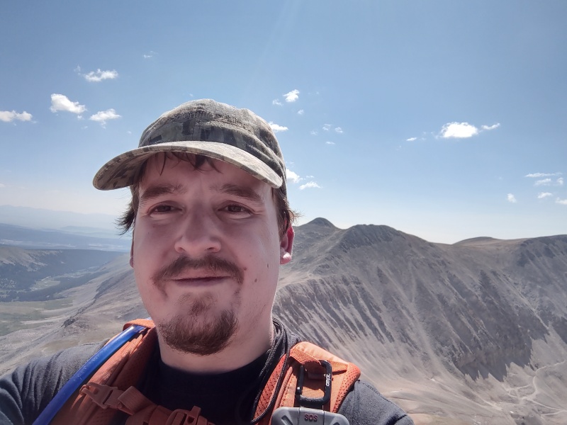
Yes, I am "representin the dot com" with my free shirt. Thanks Bill!Summit looking west. I like how you can see the trailhead so clearly from Sherman's summit. It really gives you perspective on "This is what 2000' vertical looks like"
We did it! Though at this point it was clear adding more distance or gain wasn't going to work out well for Lizi. I still wanted to grab the other peaks while I was here though (ugh, I guess I am a peakbagger.) We talked it over a bit and both Marc and Lizi felt comfortable returning to the trailhead the same way we came without me, and I felt confident hitting the other two peaks solo. We'd meet back at the trailhead. There were plenty of people all over these mountains that day too.
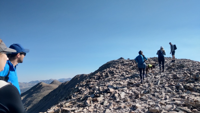
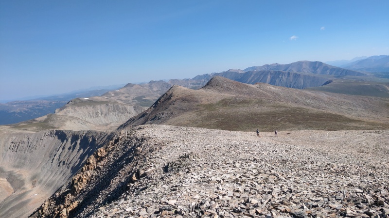
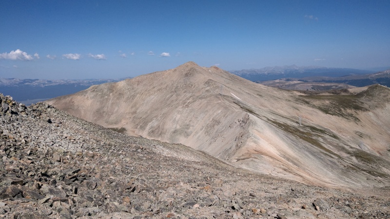
Gemini Peak So we parted our ways and I started out to Gemini Peak only a short distance away. It was a mix of talus and tundra as you'd expect that got surprisingly steep right at Gemini's northeastern summit (still no more than class 2). I summited roughly a half hour after I had left Sherman, though if you don't hit the "twins" lower summit too does it count? Eh, it's unranked anyway...
On to GeminiGemini summit. Looking back to the crowds on Sherman.Gemini Peak Summit.
I checked in with my Zoleo at the summit (and sent a message to Marc and Lizi as well) and then began working my way to Dyer Mountain.
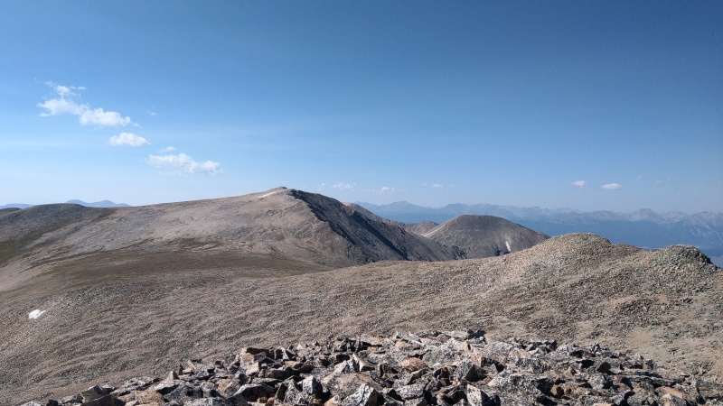
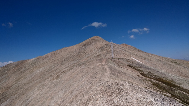
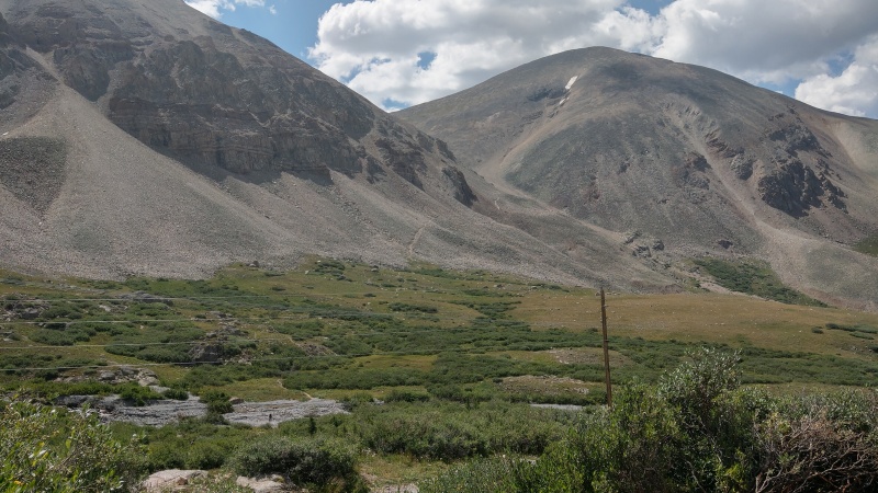
Dyer Mountain This was pretty straightforward. The ridge between the two isn't nearly as daunting as it looks from a distance. There isn't really too much exposure (unless you look for it).
I crossed under the high voltage power lines coming out of Iowa Gulch, made a final push up the class 2 talus, and summited Dyer around 10:30 AM. I had been really pushing myself to do a fast pace to race against some clouds that had been forming, but even when I hit the summit of Dyer there were not that many around and none of them looked threatening.
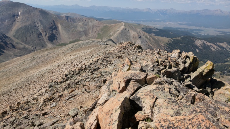
From the low point between Gemini's two peaks looking to Dyer.The last push up Dyer.Dyer Mountain Summit. Looking back at Gemini and Sherman.Dyer Mountain Summit.
On the summit I checked in again and then started my way down back into Iowa Gulch. I noted the GPX from the Trip Report I downloaded went pretty much straight down from here, but I noted on the slope angle map that if I just followed the ridge a bit more south I could then cut east onto some shallower slopes.
Heading down Dyer's south ridge was pretty easy.
This seemed like a reasonable plan as I couldn't see anything of an "official" trail that the GPX seemed to be following (I really try to whenever possible stick to a trail when there is one.)
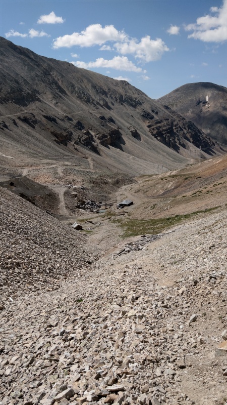
Ultimately I did work my way back to the GPX track later on to avoid some really steep looking stuff right above the mines. Shortly after meeting back up with the track something of a trail seemed to appear.
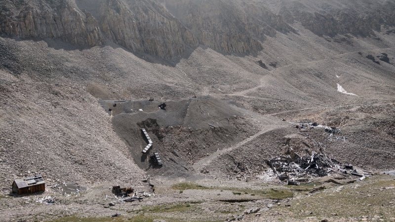
A trail appearing shortly after meeting back up with the GPX track.I don't think these mines are quite operational...
From all the abandoned mines of course it's easy to follow the remnants of the old road back to the trailhead.
I arrived at the trailhead at 11:18 AM, met up with my friends as they made it down OK too, and we then departed.
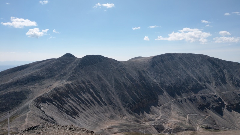
Iowa Gulch Trailhead a bit busier upon return.Looking back at the Sherman Iowa Gulch route in the daylight. Hi Sheridan!
Conclusion Overall a really good day. It was a bit rough for my friends as their first 14er, but they powered through it and got it done successfully and safely.
The weather was great too:
Smoke/visibility was a lot better compared to the previous week.
Temperature at altitude was in the mid 40s to low 50s
Wind was minimal and when it was there there wasn't a gust that touched 20 mph
Wind chill was at worst in the mid 30s
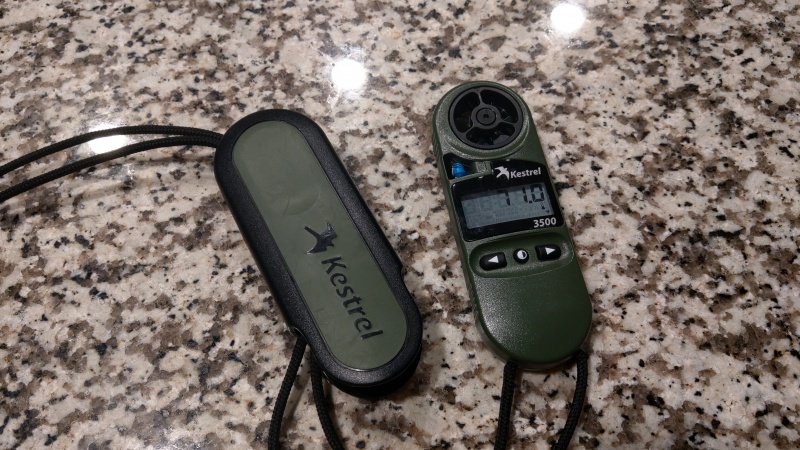
How do I know what the weather was like with such specificity? Well with my Kestrel Weather Meter of course!
A completely superfluous gear purchase for 14ers? Yes. Still fun to have on a 14er? Definitely!
It may be a while before I take my friends and the others in the group up another 14er or 13er. But we still enjoyed this little outing.
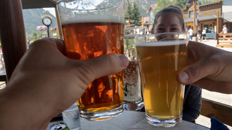
Celebratory beers (and cider) in Frisco
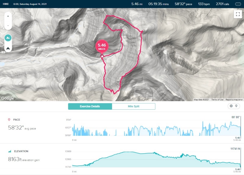
Observation: GPS and Satellite Messenger Tracking I record tracks using Gaia GPS on my phone on these hikes because it has seemed to be the most accurate to me, at least with the gear I have anyway. Before I had Gaia GPS I used my Fitibit Versa but that always seemed wildly inaccurate (even though it should use my phone GPS just like Gaia?)
Interestingly though both seemed more consistent with each other than usual this time around. And both also seemed to underestimate distance and gain compared the Trip Report by Chelsea. Take that as you will. I know a lot of this depends on how you have the tracking configured too.
Gaia GPS: The weird elevation spikes have always puzzled me.Fitbit reading a bit less in terms of distance... Yeah just ignore the elevation gain here. Yikes.
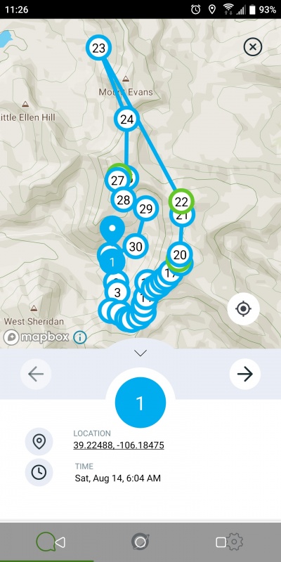
One other thing of note. I recall discussions in the forums about satellite messengers with follow me features (i.e. Garmin) having issues on occasion with sending inaccurate locations.
Personally I have really enjoyed my Zoleo Satellite Messenger as an alternative to Garmin and Spot and have had no issues with it. I was also very appreciative when Zoleo recently added their own automatic location sharing feature. I tested it out a couple times prior to this hike and it seemed to work great, though this time out I noted that there were two location shares that were WAY off.
I was sharing location every 12 minutes and two of the shares that occurred when I was on the ridge between Gemini and Dyer placed me a few miles north near Mt. Evans. I guess every satellite messenger can be susceptible to these sorts of things then? Zoleo measures GPS independently of my phone. Puzzling.
Does this mean I can add Mt. Evans to my checklist too?
My GPS Tracks on Google Maps (made from a .GPX file upload):
Awesome first write up Carl! It's apparent you put some time into this. Great words and pics. I wonder if Lizi was just struggling with the altitude? From a breathing stand-point.
I always hated those power lines. Too bad you never got the chance to see the Hilltop Mine building up there before it fell over. Keep em' coming man!
Congratulations, Carl! I wish I had seen this report earlier!
I was up there yesterday, with an initial goal of hitting three peaks: Sheridan, Sherman (2nd time) and Gemini. I got the first two and decided not to go for Gemini. How far is it from Sherman to Gemini? I will probably always kick myself for letting the wind, sprinkles, and dark clouds scare me back down, especially since it didn't amount to much.
"I measured Gemini about 0.72 mi away from Sherman (one way)."
Thanks.
Caution: The information contained in this report may not be accurate and should not be the only resource used in preparation for your climb. Failure to have the necessary experience, physical conditioning, supplies or equipment can result in injury or death. 14ers.com and the author(s) of this report provide no warranties, either express or implied, that the information provided is accurate or reliable. By using the information provided, you agree to indemnify and hold harmless 14ers.com and the report author(s) with respect to any claims and demands against them, including any attorney fees and expenses. Please read the 14ers.com Safety and Disclaimer pages for more information.
Please respect private property: 14ers.com supports the rights of private landowners to determine how and by whom their land will be used. In Colorado, it is your responsibility to determine if land is private and to obtain the appropriate permission before entering the property.
")
")
")
")
")
")
")
")
")
")
")
")
")
")
")
")
")
")
")
")
")
")
")
")
")
")