Download Agreement, Release, and Acknowledgement of Risk:
You (the person requesting this file download) fully understand mountain climbing ("Activity") involves risks and dangers of serious bodily injury, including permanent disability, paralysis, and death ("Risks") and you fully accept and assume all such risks and all responsibility for losses, costs, and damages you incur as a result of your participation in this Activity.
You acknowledge that information in the file you have chosen to download may not be accurate and may contain errors. You agree to assume all risks when using this information and agree to release and discharge 14ers.com, 14ers Inc. and the author(s) of such information (collectively, the "Released Parties").
You hereby discharge the Released Parties from all damages, actions, claims and liabilities of any nature, specifically including, but not limited to, damages, actions, claims and liabilities arising from or related to the negligence of the Released Parties. You further agree to indemnify, hold harmless and defend 14ers.com, 14ers Inc. and each of the other Released Parties from and against any loss, damage, liability and expense, including costs and attorney fees, incurred by 14ers.com, 14ers Inc. or any of the other Released Parties as a result of you using information provided on the 14ers.com or 14ers Inc. websites.
You have read this agreement, fully understand its terms and intend it to be a complete and unconditional release of all liability to the greatest extent allowed by law and agree that if any portion of this agreement is held to be invalid the balance, notwithstanding, shall continue in full force and effect.
By clicking "OK" you agree to these terms. If you DO NOT agree, click "Cancel"...
SnowmassS-Ridge (the express route)and Siberia Peak
This was my second time climbing the S-Ridge on Snowmass Mountain and my 100th overall 14er summit. I first did the S-Ridge two years ago when I was working on completing the 14er list and have been wanting to go back ever since. It was definitely one of my favorite Colorado 14er routes along with Kit Carsons North Ridge, the Southwest Ridge of Little Bear Peak and the "Point fest" to San Luis. The S-Ridge route is fairly quick and a great alternative to backpacking the standard East Slopes.
Day of Climb: Sunday July 18th, 2021
Trailhead: Lead King Basin
Peaks: Snowmass Mountain and Siberia Peak
Mileage and Elevation Gain: 11.28 miles and 6207 feet of gain
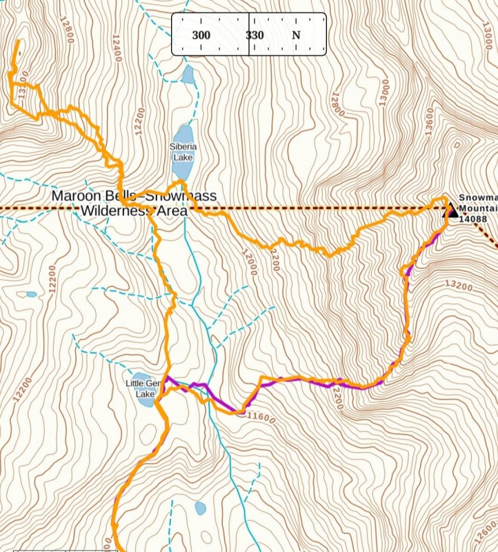
Orange was our route for this report. Purple was my route 2 years ago.
We arrived late at the Lead King Basin trailhead the night before our climb. There were only a couple other cars in the lot and a tent or 2 set up. It's clear that the rough 6 mile 4WD road from Marble keeps this 14er trailhead from becoming overly crowded like so many others. I had picked up my 2 climbing partners along the way after their valiant effort to get a RAV4 up this road failed. So, with 5 of us packed into my RAM 1500 we made the trailhead without difficulty taking the upper road.
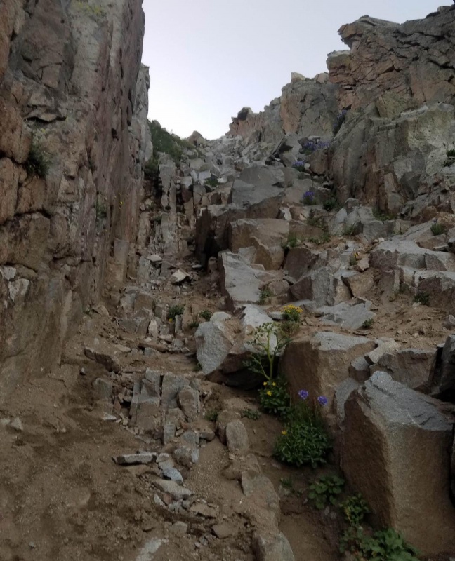
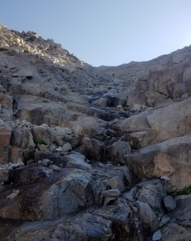
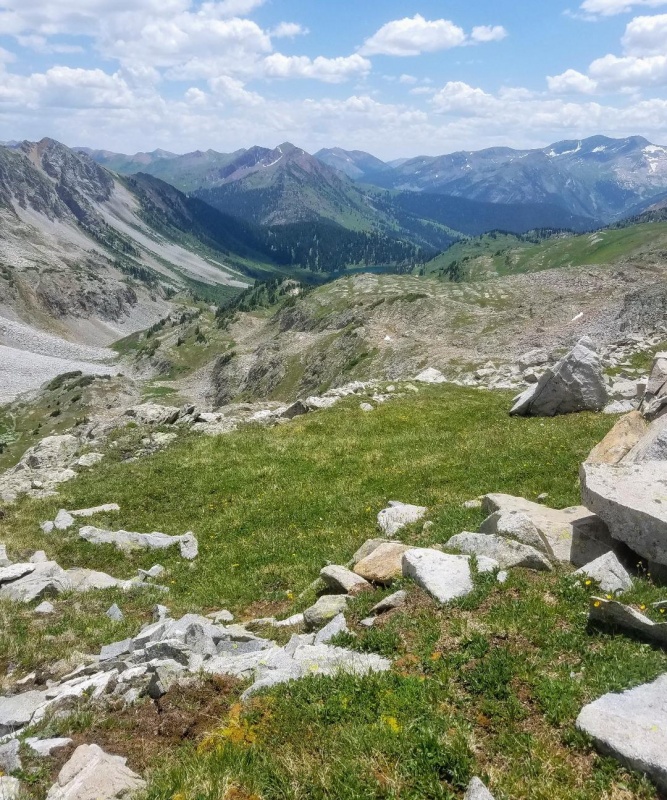
We were up around 3 the next morning and hiking by 3:35. A fast pace was immediately set with the aim of reaching the ridge by sunrise. We quickly found ourselves getting very wet in the dark from chest high wildflowers hanging over the trail as it had been a heavy dew night. We also had to fight our way through several thick willow patches that soaked us as well. Still, we made good time and knew we'd dry out with the sun. Once at Little Gem Lake we left the nice trail and headed down a grassy ravine towards the S-Ridge. At the bottom we crossed a creek and took a gully up through a small cliff band. From here it was then just a short talus hop to the gullies that would take us to the S-Ridge.
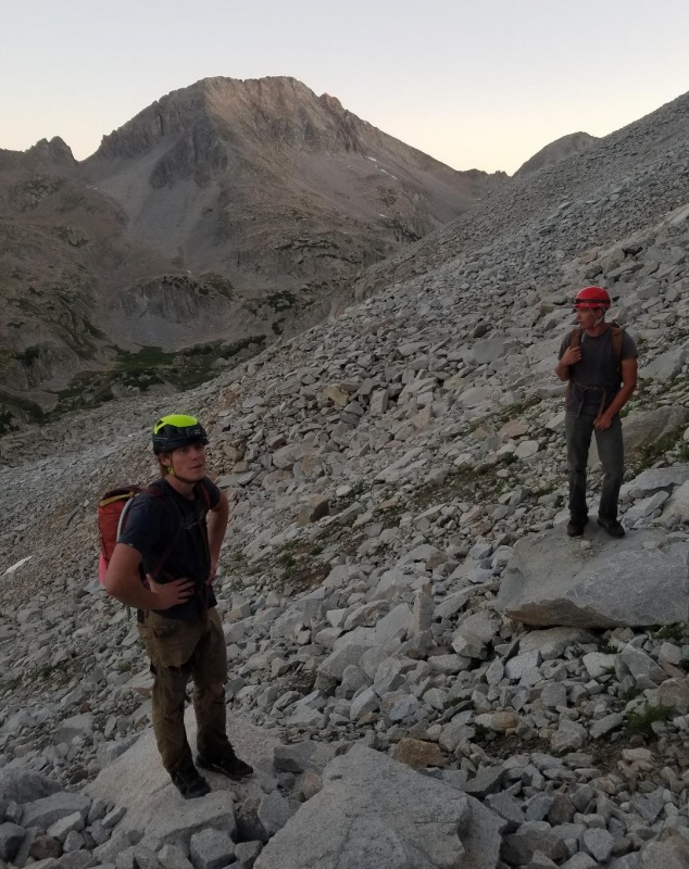
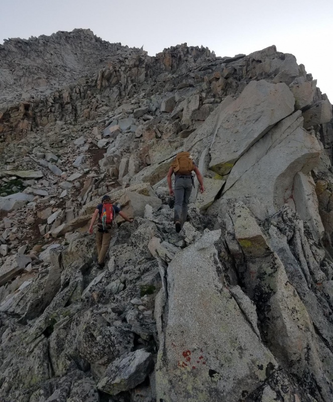
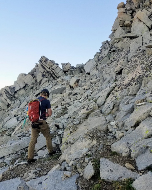
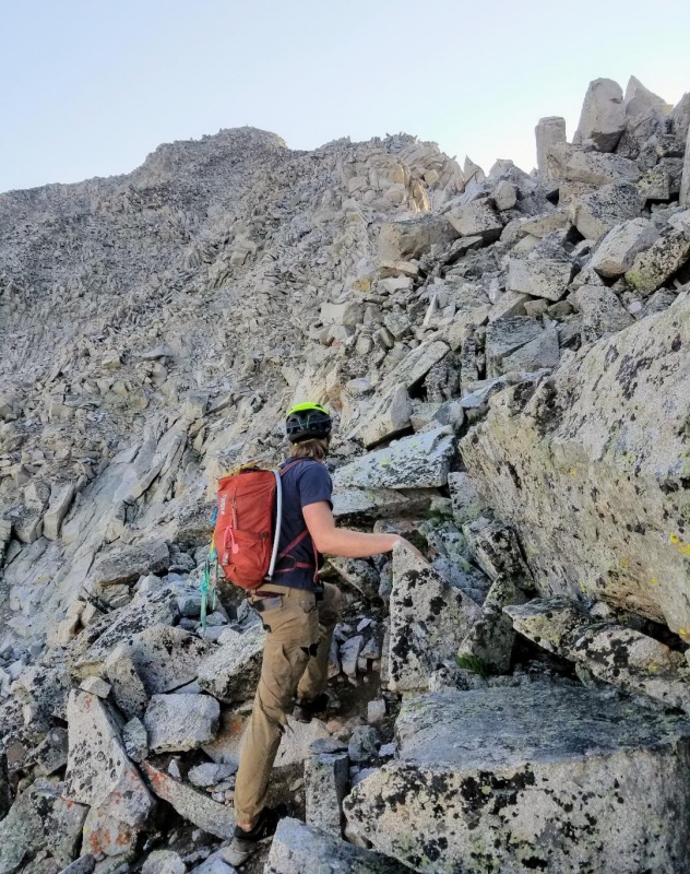
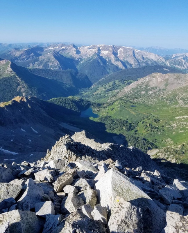
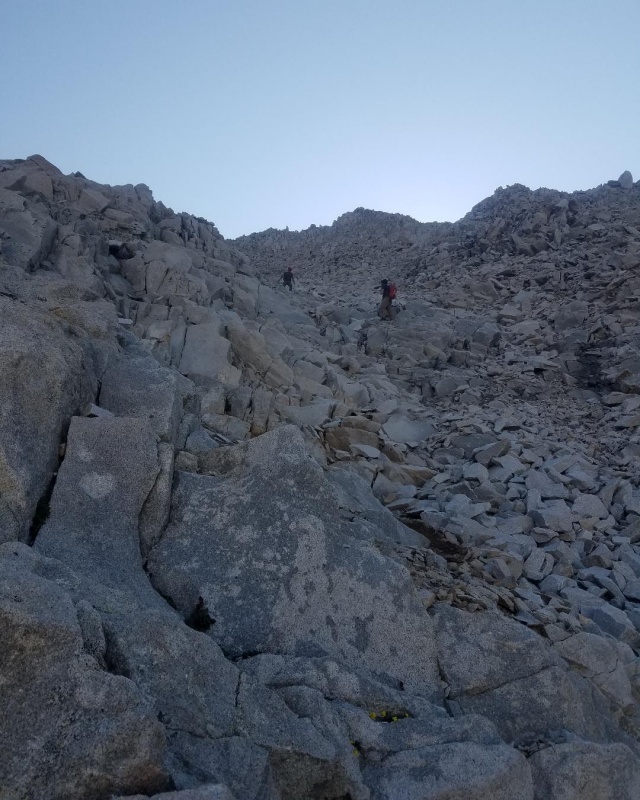
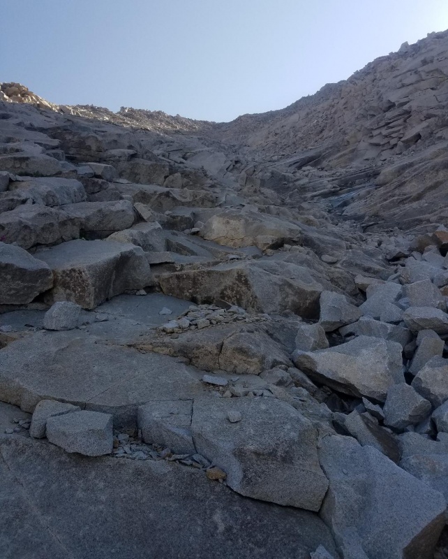
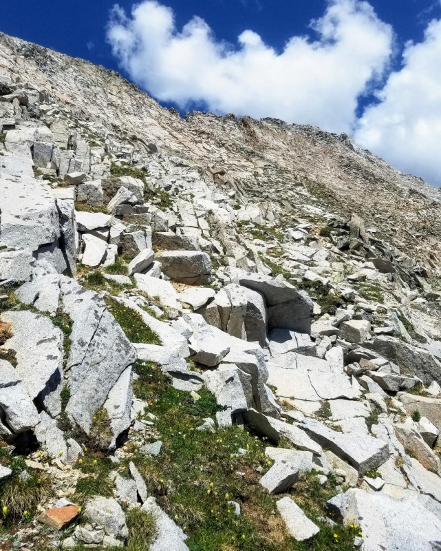
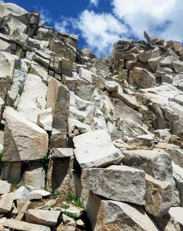
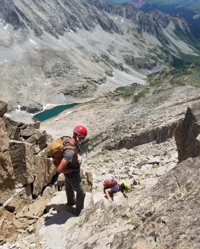
We hit the base of these ridge access gullies at 5:55 in the morning with first light. We were excited for the real fun that was about to begin. There are a couple class 2 gullies to choose from here that will reach the ridge, or there is a class 3 rock climb that will do the trick as well.
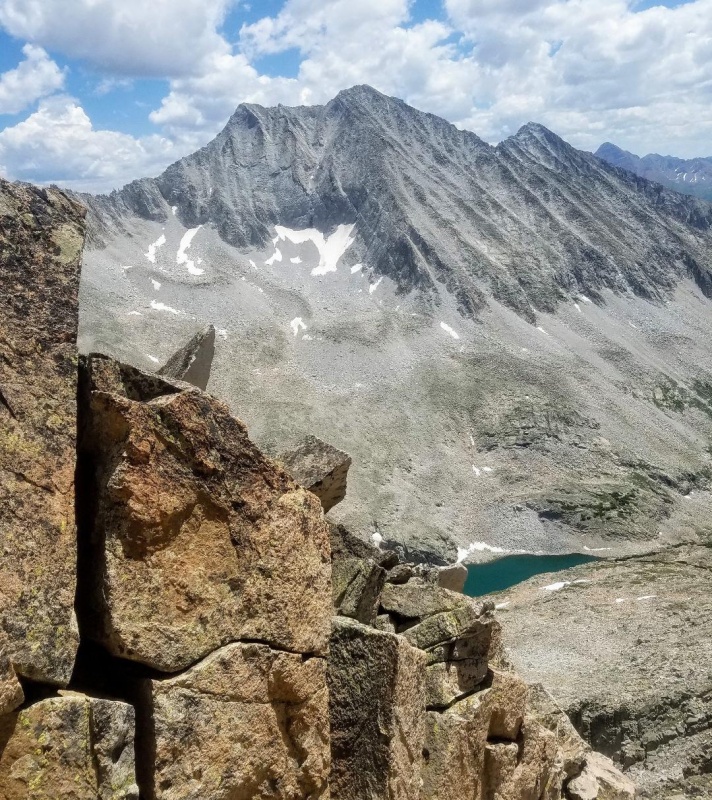
Contemplating which gully to take. Siberia Peak(our afternoon objective) is in the background.I took the middle gully in this picture. It looks short, but it is longish and steep.Caleb went a more adventurous class 3 route to the right.
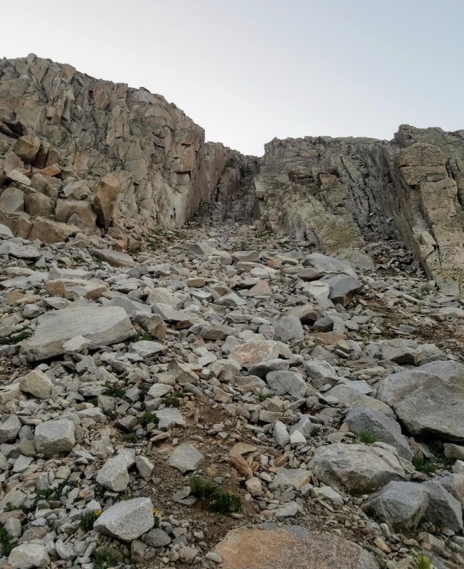
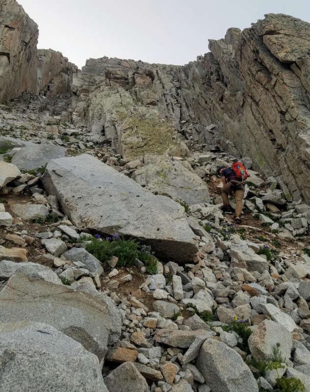
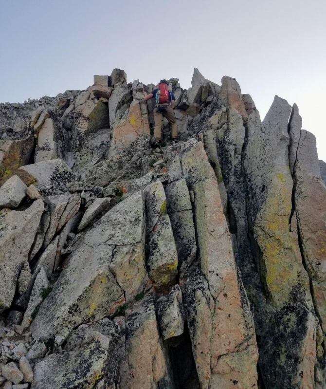
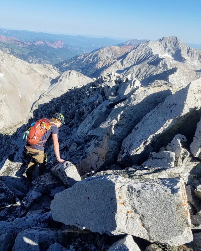
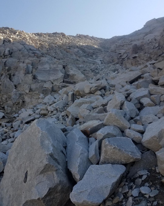
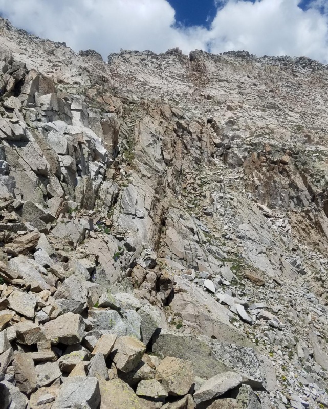
The gully I chose was steep, but not too much trouble and much longer than it looked. Still, it didn't take long to reach the beginning of the S-Ridge. All and all the gully worked out fine, but I would reccomend the class 3 climbing route my buddy took. I went this way my first time climbing the S-Ridge and thought it was more enjoyable.
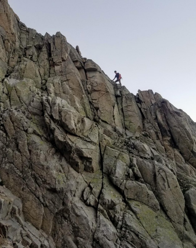
My buddy high above my gully on the class 3 route to the ridge.There was a well worn path up the left side of my gully.Looking down gully to show the steepness.Top of the gully.Beginning of the S-ridge.
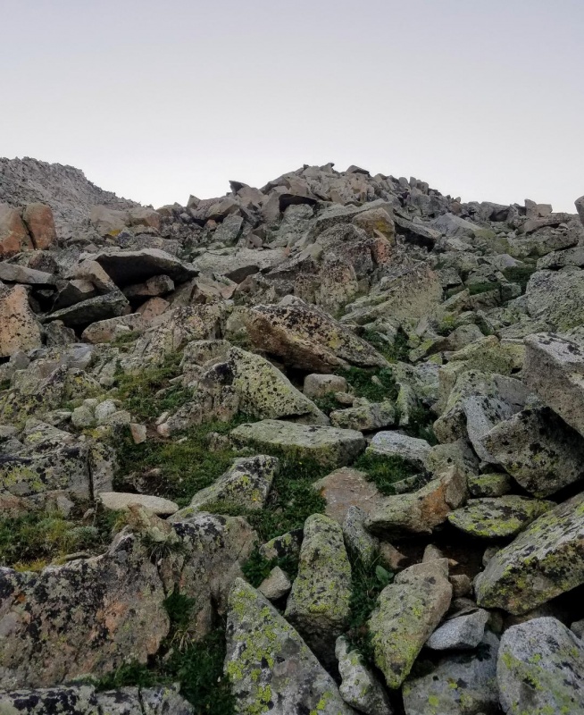
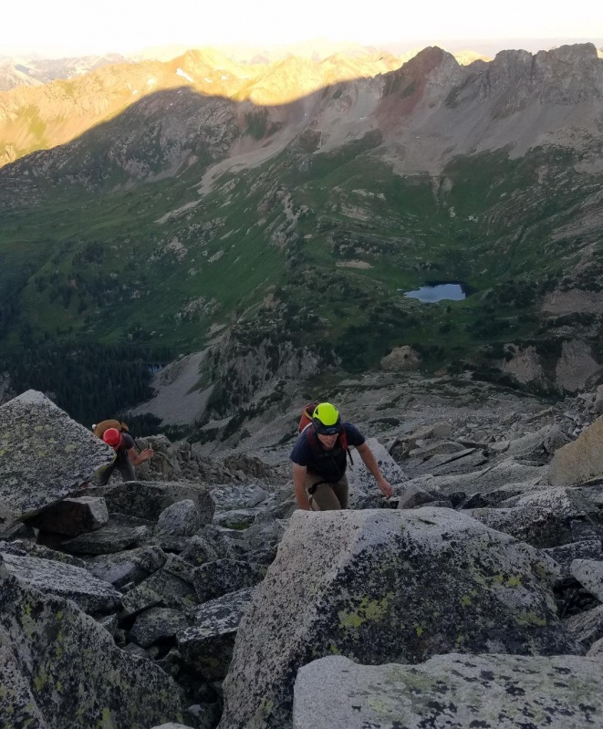
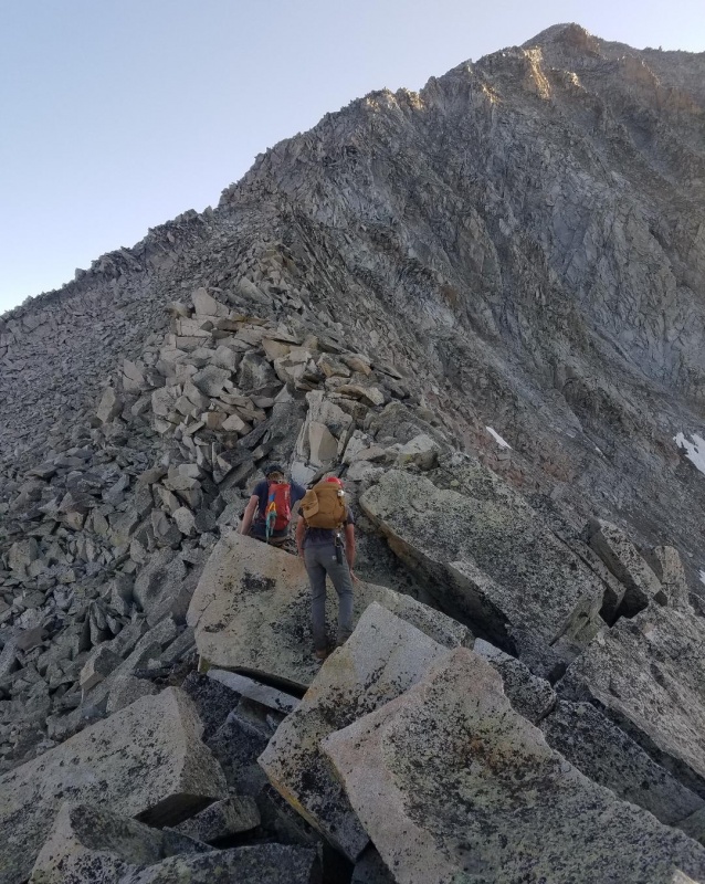
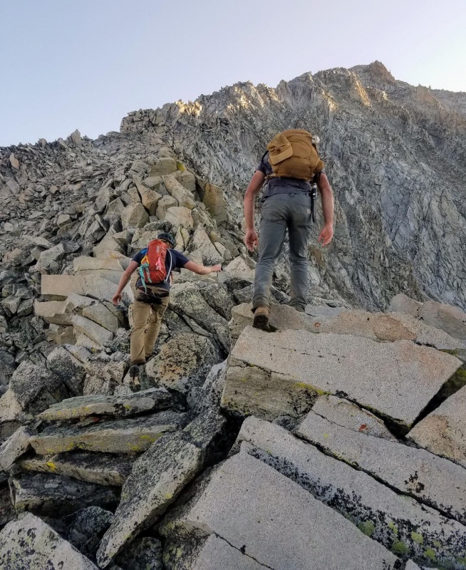
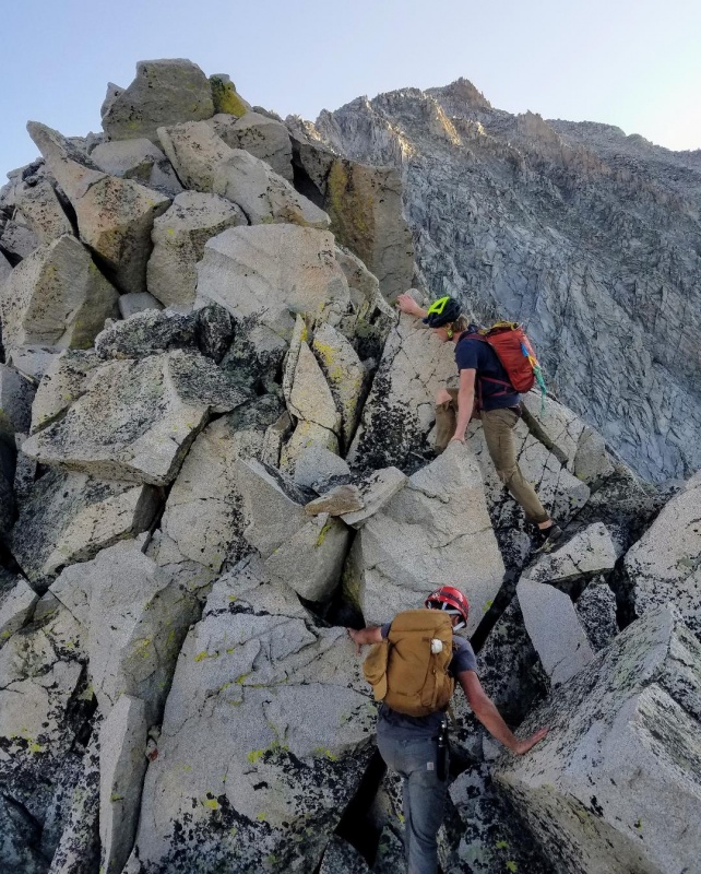
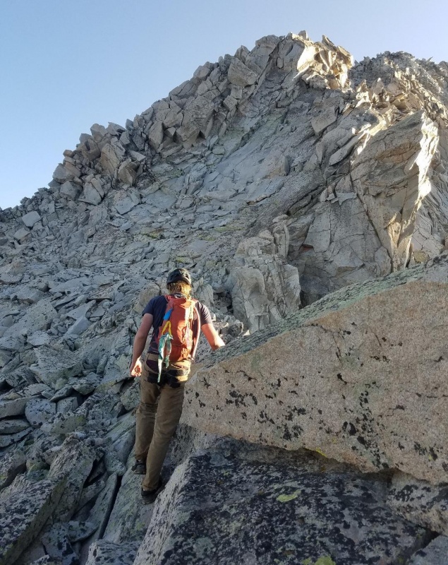
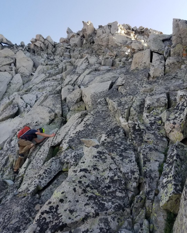
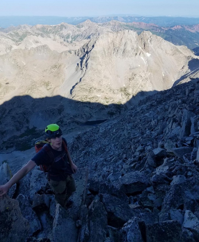
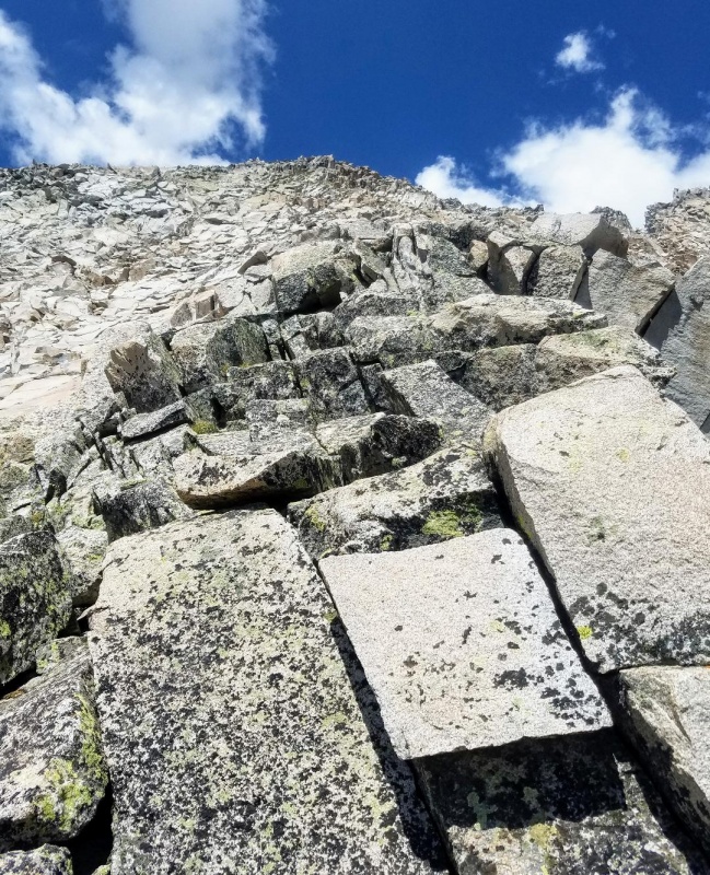
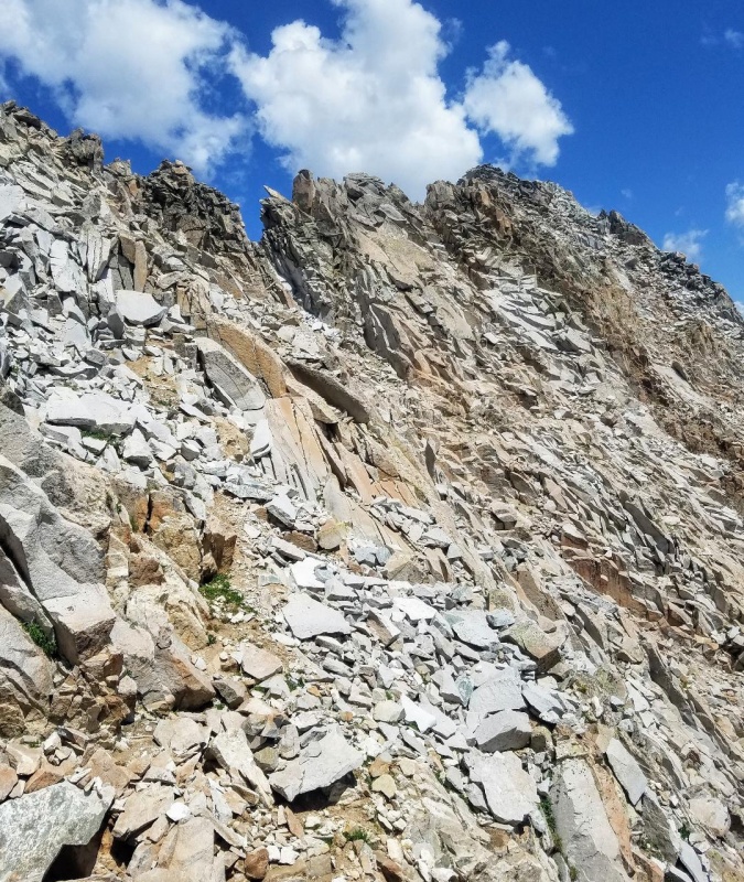
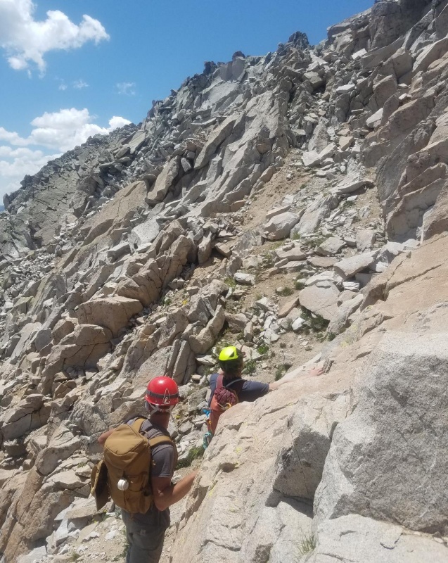
Once on the ridge we were able to move quickly on this lower section over large boulders and an occasional class 3 scramble. It always seemed better to stay on the ridge proper, or close to it, for the best rock and a more enjoyable climbing experience which we did our best to do. There was no shortage of fun scrambling in this section and I felt like the exposure was usually minimal.
Making our way up the lower section of the ridge.Class 3 climb here.Looking down the ridge at Little Gem LakeAnother fun section.
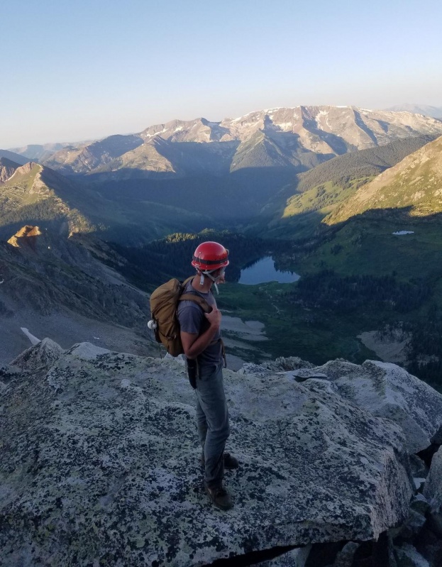
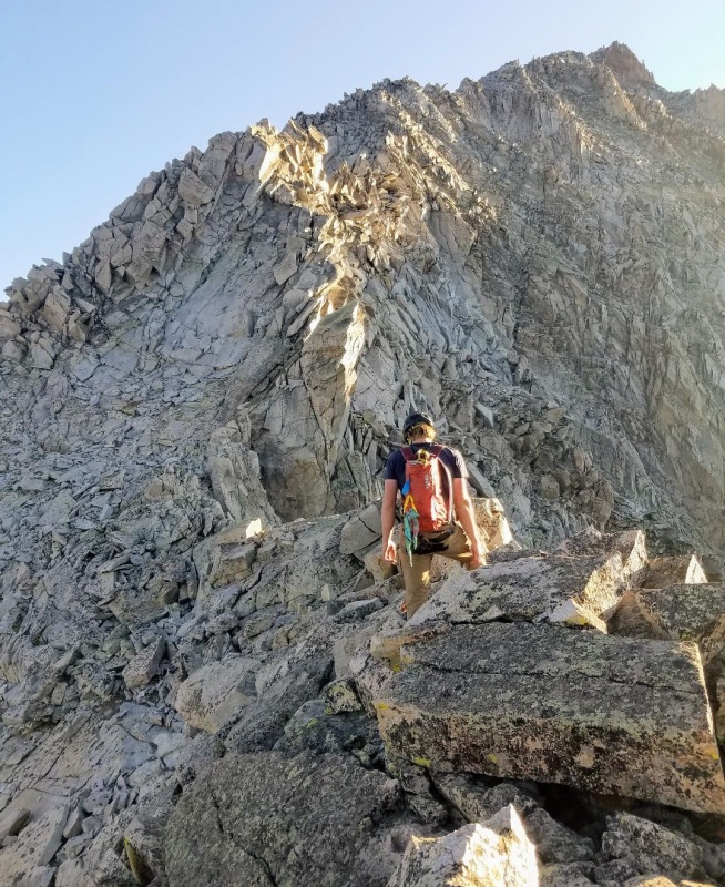
After a lot of fun climbing we eventually came to a mellow section as we transitioned to the upper ridge. There is a bit of a catwalk here as the ridge jogged to the left and then back to the right. We took what was really are first rest here and enjoyed the views as we prepared for harder climbing to come.
Looking down at Geneva Lake.Still a long ways to go as we break at this mellow section.Easy stuff here as we approach the upper ridge.
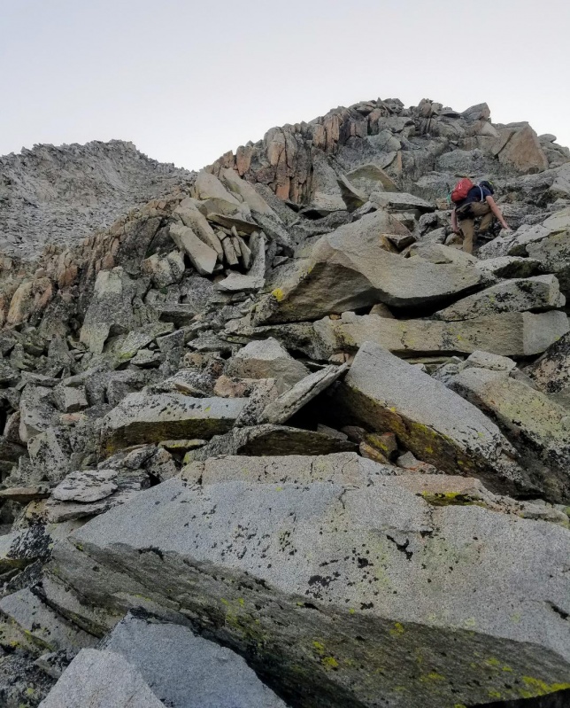
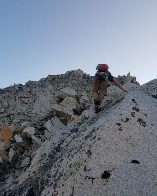
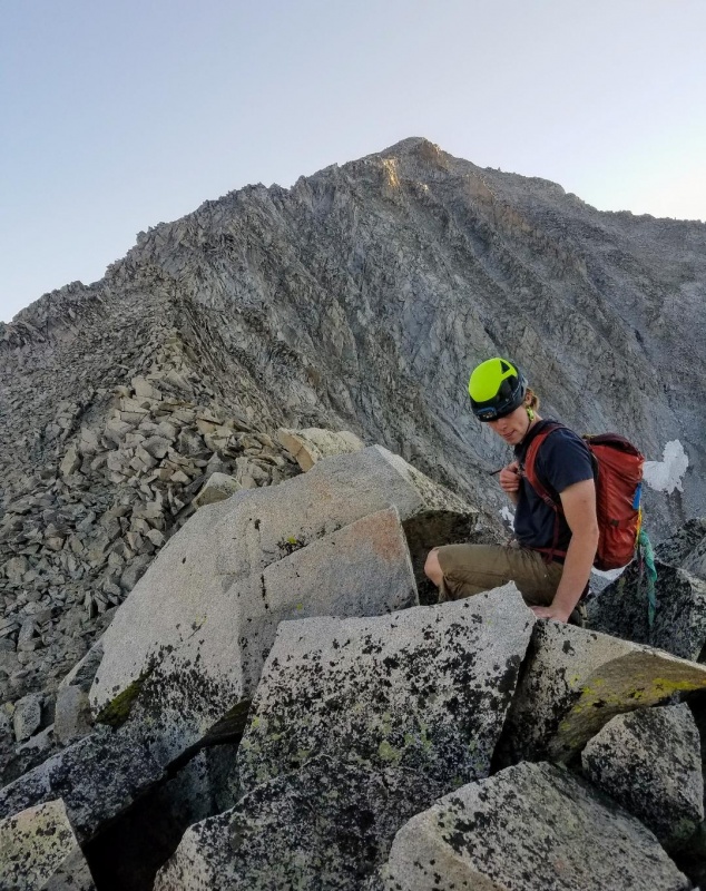
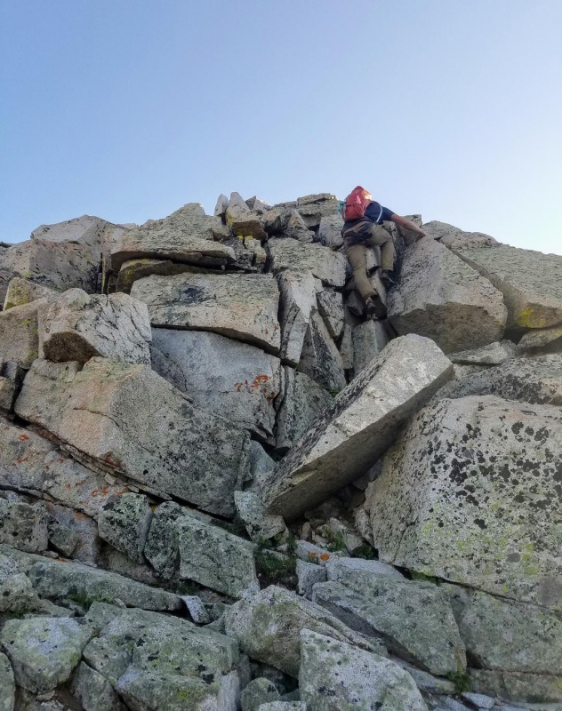
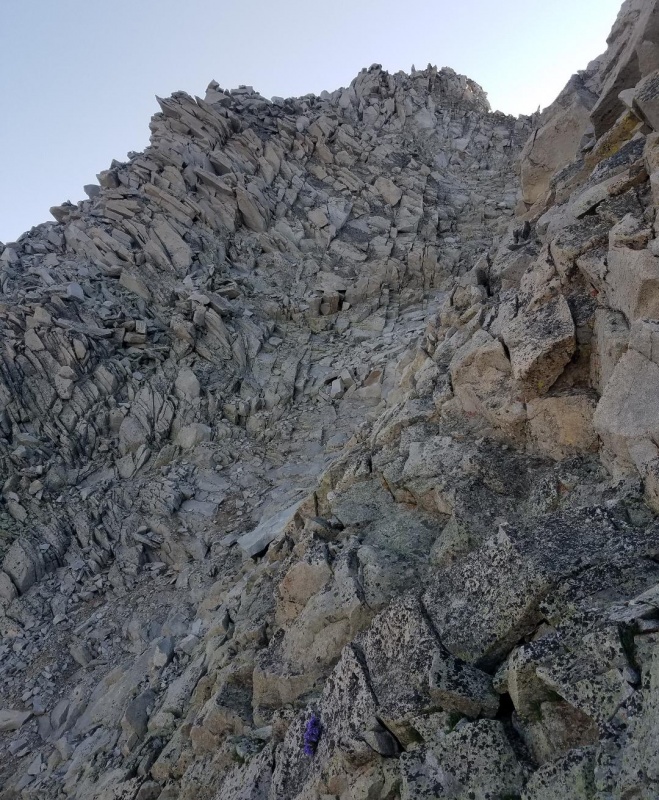
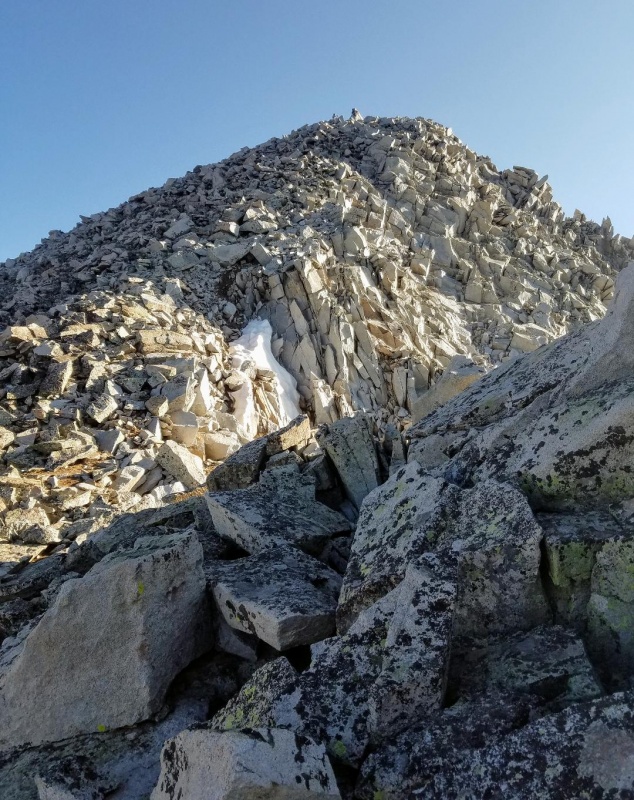
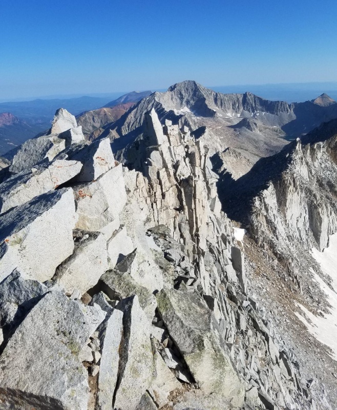
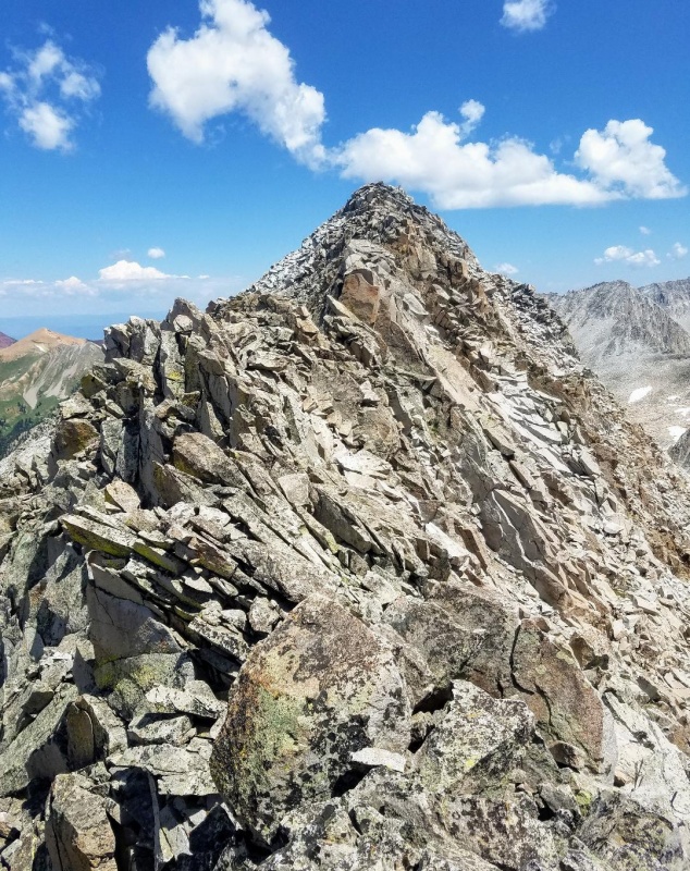
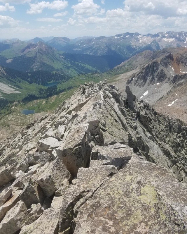
Now on the upper section the climbing intensifies again with some more great class 3 climbing. The rock quality on the ridge proper for these was always excellent with looser stuff to the left. The class 3 was pretty much sustained in this section right to the crux and the exposure was never too extreme.
A good overall view showing the rest of the ridge.Back to scrambling.Nice class 3 climb here.And another.Approaching the crux with the summit finally looking much closer.
At the crux, we chose to go around it by climbing through a notch to our left. I did the crux 2 years prior on my first ascent of the S-ridge and there is a nice airy class 4 move if you choose that route. The notch workaround was easy and fast so that was good for us. After going through the notch we climbed a steep gully and then took a short class 3 section to get us back to the ridge proper.
The Crux is right center and notch workaround is on the left.Going through the notch.Gully climb on the other side of the notch leading back to the ridge proper.Steep but easy climbing up the gully.Nice class 3 climb back to the ridge crest.The summit is looking very close now.Looking down at our next target, Siberia Peak.
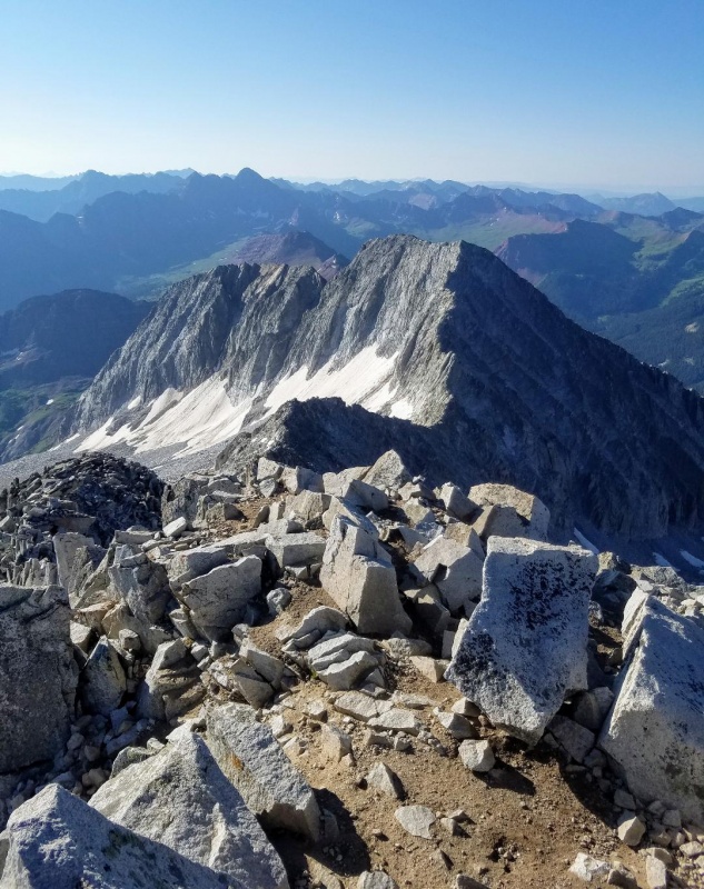
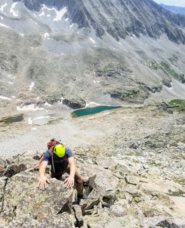
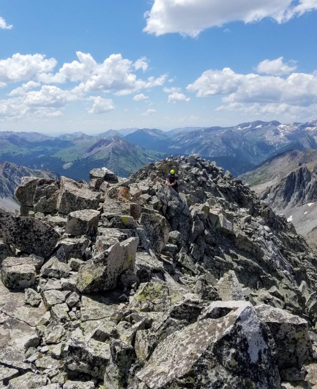
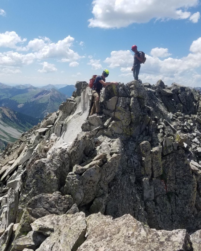
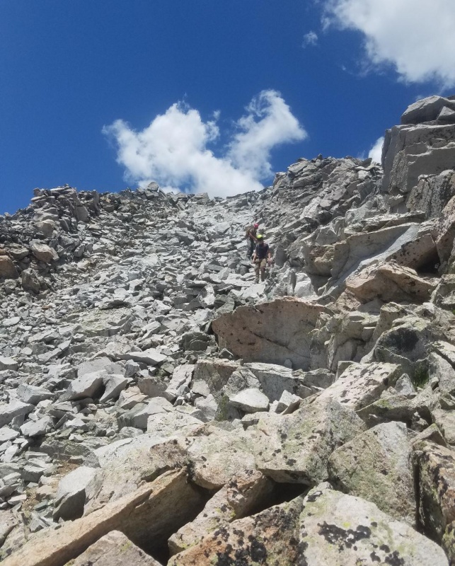
After the crux section the summit wasn't far and there was mostly only class 2 climbing left. The hard stuff was done and enjoyed the easy finish.
Final pitch to the summit.The summit is just ahead.
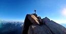
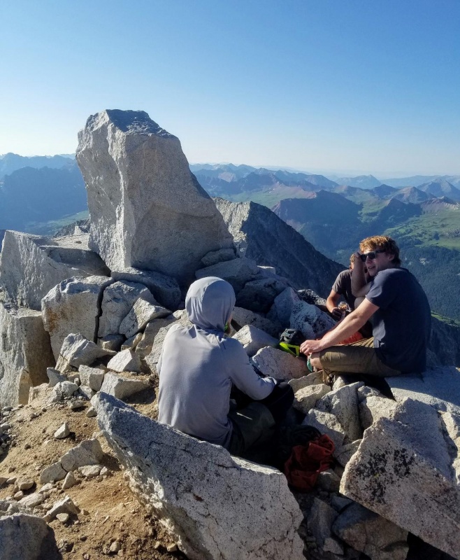
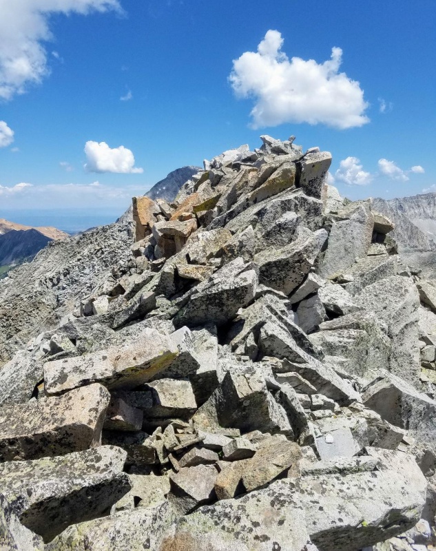
It was great to summit Snowmass Mountain again and taking two friends up made it even better. It took us a speedy 4 hours and 25 minutes from trailhead to summit. We weren't flying up this thing though, so I think summiting in under 4 hour is possible. If you're not into camping, this route sure beats the 22 mile standard route by a long shot. We lucked out with warm weather and no winds, so we stayed on the summit for about 30 minutes or so enjoying the incredible views. Surprisingly, a couple guys joined us from the standard route and then 2 more climbers came up from the west slopes.
Enjoying the windless summit.From the summit looking at Capitol Peak.Snowmass Lake and a melted out standard east slopes route.Hagerman PeakLooking back down the S-Ridge.
I could've easily stayed up there much longer, but I was itching to get to my primary goal for which was Siberia Peak. Surprisingly, List of John's shows Siberia as the 3rd least climbed ranked 13er. This intrigued me being right next to Snowmass and hardly climbed. It also looked like a fun peak and had been on my to do list for a couple years now. So, we ended our nice summit break and started down the West Slopes of Snowmass Mountain which would take us to Siberia Lake and Siberia Peak.
Starting our descent off Snowmass Mountain.
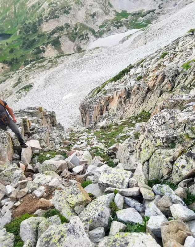
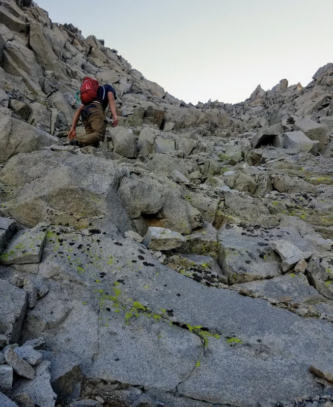
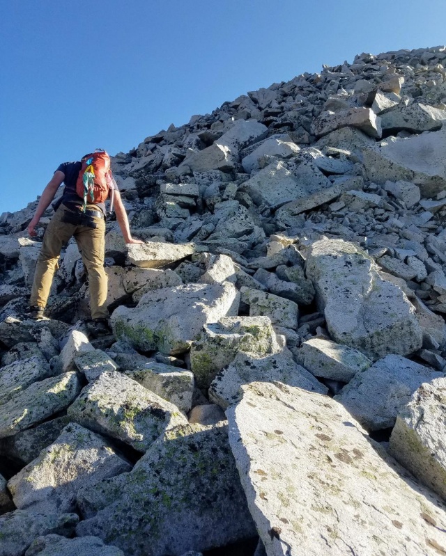
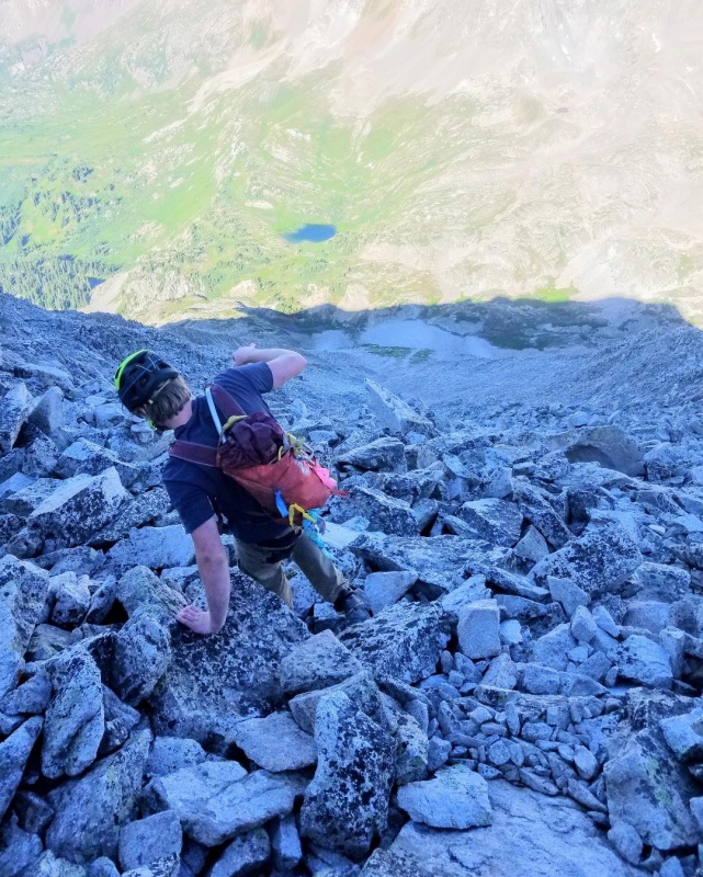
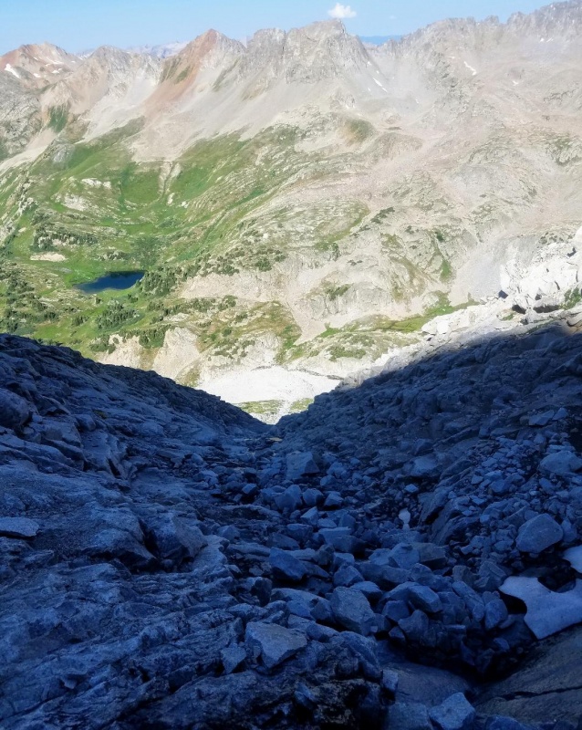
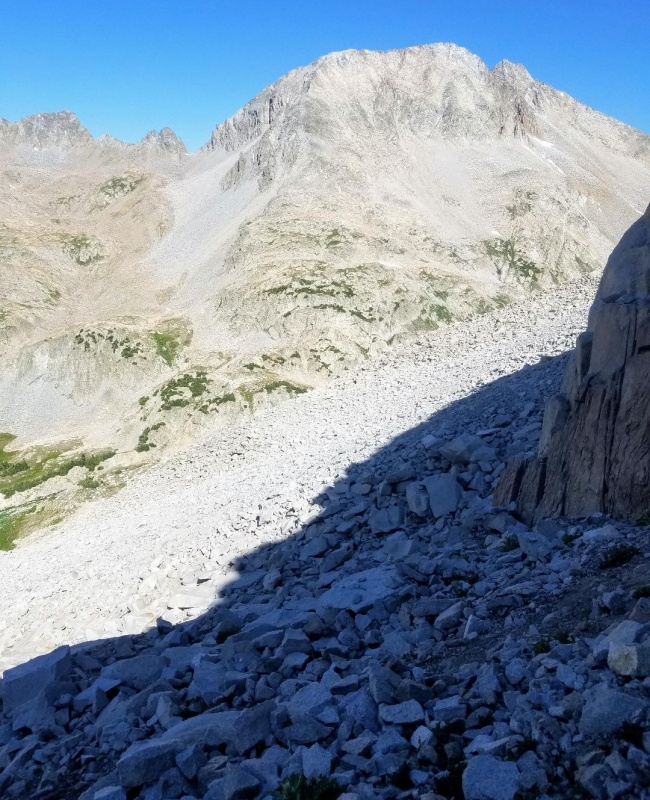
Initially, the West Slopes were very steep as we descended large boulders to enter the gully. This quickly gave way to smaller loose stuff with a more mellow angle. The 3 of us descended with spacing across the wide gully to avoid knocking rocks onto each other and we found well worn paths to follow. I don't believe this route is as loose as I've heard people say as we had no issues with rockfall and loose scree was not that bad. I think if you're careless though, rockfall it could be a problem in some spots.
Very steep in the beginning.The route starts to mellow here although still steep.Looking back up at my buddies.A bit lowerAnother look up.Slabby rock as we near the bottom of the gully.
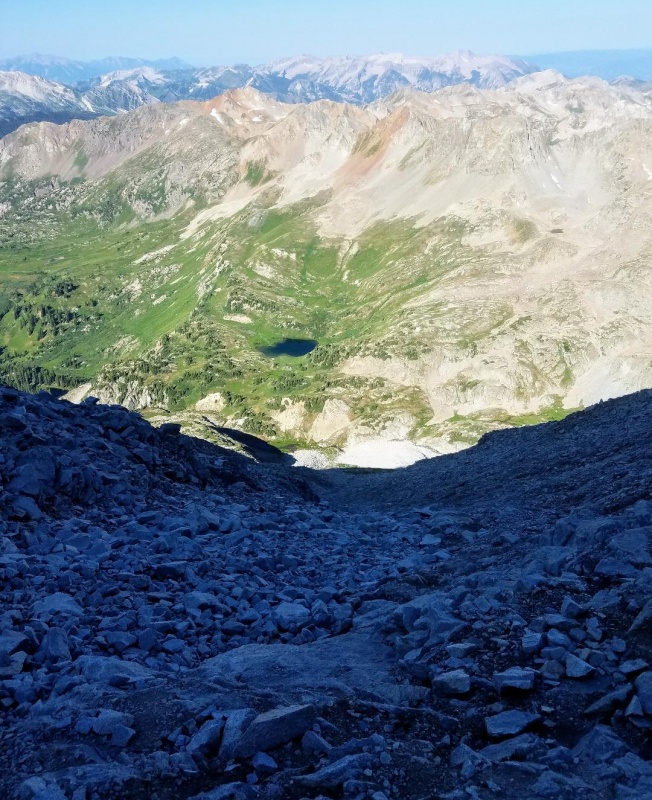
We reached the bottom of the gully in about 45 minutes and turned to our right to descend some steep, grassy terraces. We then deviated from the West slopes route here and starting angling towards Siberia Lake.
The end of the gully.Siberia Peak and a long sidehilling talus hop to get there.
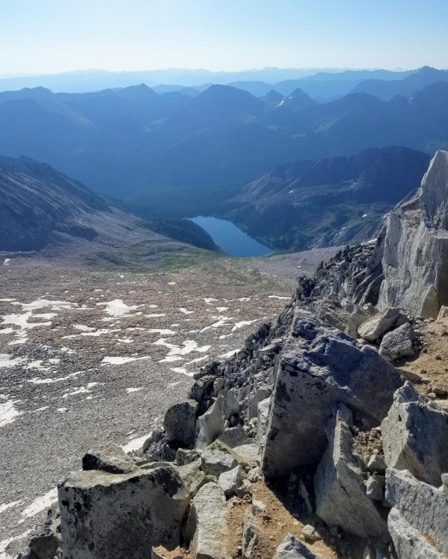
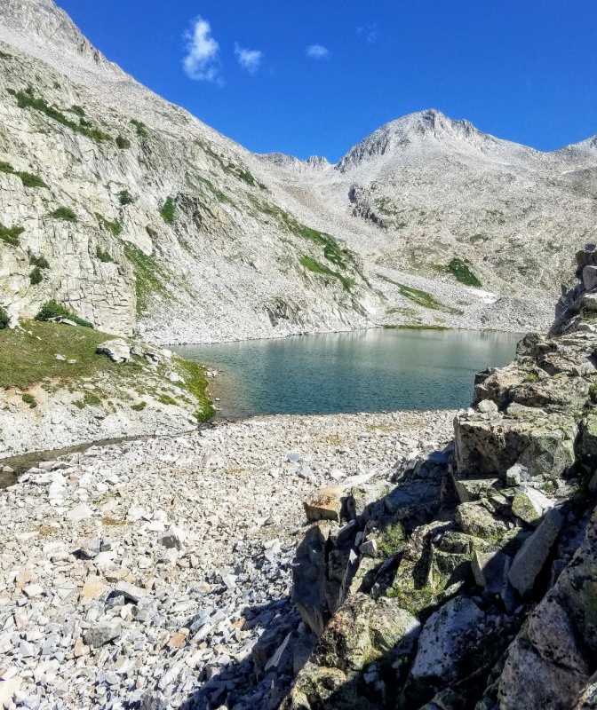
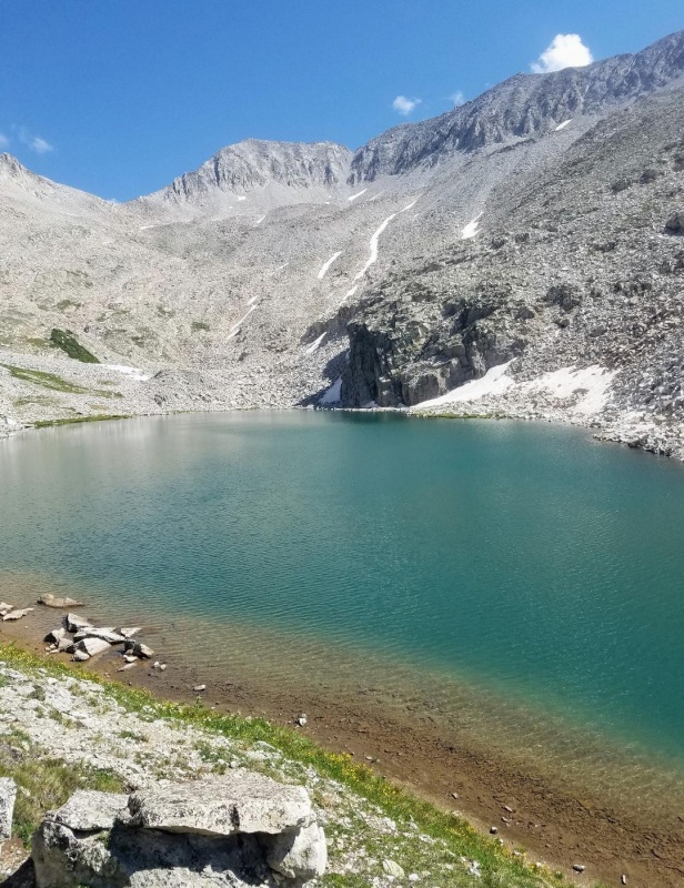
The route over to Siberia was a forever talus hop that took longer than the descent down the West slopes of Snowmass. All easy though, just very tedious. Siberia Lake was beautiful upon arrival and teeming with trout. Saw some bear tracks as well in a snowbank.
East face of Siberia PeakSiberia LakeSiberia Lake
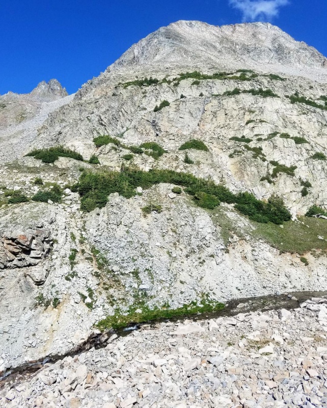
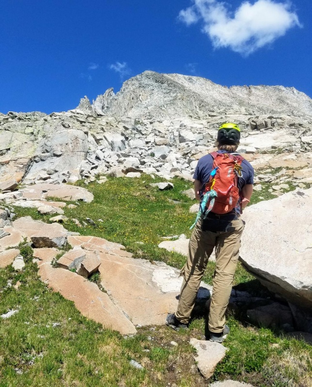
We had a nice break at Siberia Lake and then started the long ascent up Siberia Peak. We needed about 1500 feet of elevation gain to reach the summit. The climbing was easy at first as we worked our way up several grass terraces and then got a better view of possible routes to the summit. The initial plan had been to climb the southeast ridge which looked mellow. It now looked like it would be better to take a direct line to the south ridge (or upper ridge) as there appeared to be many possible climbing options on the east face.
Looking back at Siberia Lake as we start our ascent.Contemplating different route options.
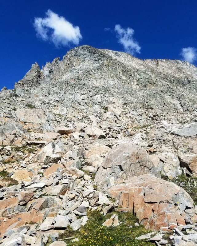
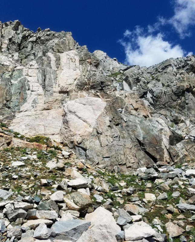
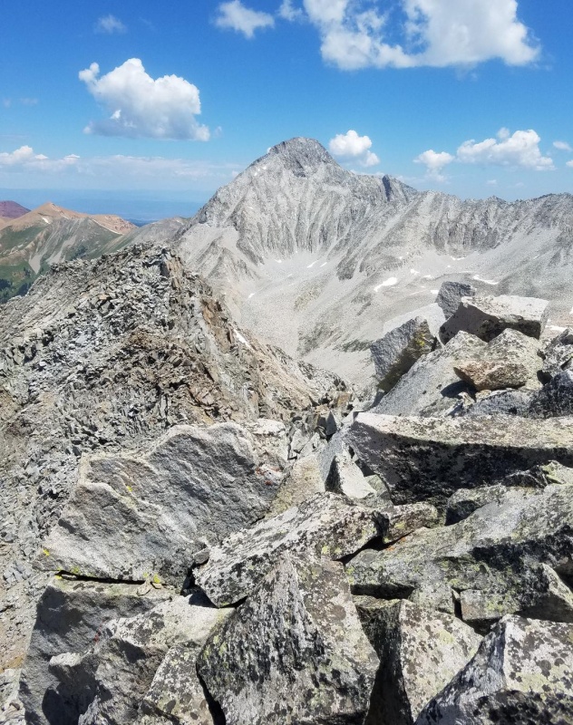
After the last grass terrace we began climbing directly towards the summit over steep talus. Eventually, we hit an enjoyable, sustained class 4 rock rib which cut straight to the ridge. Once on the south ridge we could see the summit and it did not look far. Unfortunately, we soon realized there was a lot of complicated class 3 terrain to cover before reaching the summit, and it was not going to be a quick jaunt as we had expected.
Southeast ridge of Siberia.A short class 3 section here as we leave the last grass terrace.We started angling straight towards the summit here following this grassy line.A look at the south ridge with it's many notches and spires.Class 4 rock rib we took.Almost to the south ridge.South ridgeLooking towards the summit after gaining the south ridge.
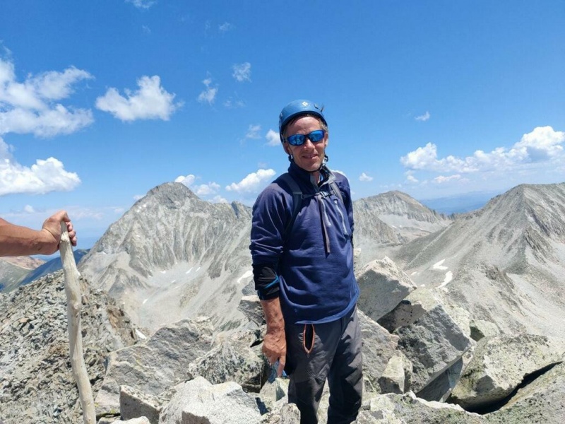
The main obstacles on the south ridge were a series of notches which slowed us down greatly. Mostly, they weren't too difficult to maneuver through though except the largest notch close to the summit. We opted to drop down off the ridge to climbers right to get around this one. We regained the ridge shortly after and made the summit with an easy scramble to finish. The south ridge had been much tougher than expected, but the rock quality was good and there was plenty of class 3 fun.
Looking back on the South ridge.Looking south across the big notch as my buddies start their downclimb to join me.Tough section here to get back to the ridge.Last bit of scrambling before the summitSummit view of Capitol PeakYay!
The summit was tiny and the views of Capitol and Snowmass were amazing. I was happy to reach this summit I'd been wanting for quite some time now. It was worth the effort and a really good peak that I would highly reccomend. Probably one of my favorite 13ers now so far. We signed the register and then departed after a short stay. It was still a long ways back to the trailhead and an even longer drive back to Fort Collins.
Our descent started down the way we came along the south ridge and back through all the notches. We decided not to take the class 4 line we had ascended as that was not appealing, and instead, we took the easier southeast ridge. This ridge was not without it's difficulties though and at one point we entered and descended a gully to get around a tough spot.
Starting descent.South RidgeDownclimbing to get back around the difficult notch.Returning to upper ridge.Starting down the southeast ridge.
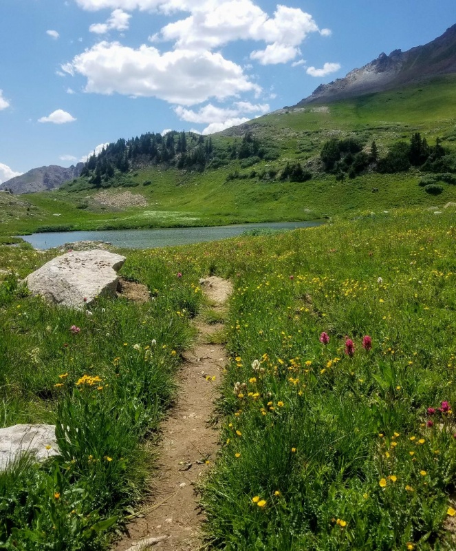
The descent down the southeast ridge went quickly, and it was so nice to reach the grass terraces on the lower slopes. We then continued south and eventually connected back with the standard Snowmass West Slopes trail and knew it would be all down hill from here. We soon passed Little Gem Lake and then Geneva Lake. The wildflowers, waterfalls and mushrooms were all beautiful as we made our way back to my truck at The Lead King Basin trailhead.
Short gully section parallel to southeast ridge that allowed us to easily get around a few difficulties on ridge proper.Back to the grass terraces.Wildflowers.Little Gem Lake.
My GPS Tracks on Google Maps (made from a .GPX file upload):
Excellent report! Those pictures make the S Ridge look miserable. Although, that gully does look kind of exciting.
That notch in the ridge on Siberia was a surprise when I was up there. I remember coming up to it and saying, "Whoa!"
Nice work!!!
One of my favorite routes. The photos show the quality of the route quite well.
I have done both gullies and the ridge between them for the start and agree with your conclusion that the rock between the gullies is the best access to the ridge.
That sounds like my kind of terrain. I've previously already thought that the S-ridge sounds like a lot more fun for whenever I will do Snowmass; combining it with Siberia seems like a lovely option. Now I just need to find a way to get to that trailhead...
Thanks Trotter! Siberia really is a fun peak. I'm surprised more don't climb it.
PaulVee - Thanks!
Kiefer - Thanks! The S- Ridge is the opposite of miserable. I think most would enjoy it. Yeah, that notch was something and stopped us dead in our tracks. Luckily, the workaround wasn't too sketchy.
Wolfgang - You would definitely enjoy this route. The scrambling is fantastic! You can get any vehicle to Crystal which is only 2 miles from the trailhead and the mill is a must see.
Piling on to say thanks - not a ton of info online about the "S", and this puts me at ease to tackle it this weekend. cheers!
Caution: The information contained in this report may not be accurate and should not be the only resource used in preparation for your climb. Failure to have the necessary experience, physical conditioning, supplies or equipment can result in injury or death. 14ers.com and the author(s) of this report provide no warranties, either express or implied, that the information provided is accurate or reliable. By using the information provided, you agree to indemnify and hold harmless 14ers.com and the report author(s) with respect to any claims and demands against them, including any attorney fees and expenses. Please read the 14ers.com Safety and Disclaimer pages for more information.
Please respect private property: 14ers.com supports the rights of private landowners to determine how and by whom their land will be used. In Colorado, it is your responsibility to determine if land is private and to obtain the appropriate permission before entering the property.


")
")
")
")
")
")
")
")
")
")
")
")
")
")
")
")
")
")
")
")
")
")
")
")
")
")
")
")
")
")
")
")
")
")
")
")
")
")
")
")
")
")
")
")
")
")
")
")
")
")
")
")
")
")
")
")
")
")
")
")
")
")
")
")
")
")
")
")
")
")
")
")
")
")
")