Download Agreement, Release, and Acknowledgement of Risk:
You (the person requesting this file download) fully understand mountain climbing ("Activity") involves risks and dangers of serious bodily injury, including permanent disability, paralysis, and death ("Risks") and you fully accept and assume all such risks and all responsibility for losses, costs, and damages you incur as a result of your participation in this Activity.
You acknowledge that information in the file you have chosen to download may not be accurate and may contain errors. You agree to assume all risks when using this information and agree to release and discharge 14ers.com, 14ers Inc. and the author(s) of such information (collectively, the "Released Parties").
You hereby discharge the Released Parties from all damages, actions, claims and liabilities of any nature, specifically including, but not limited to, damages, actions, claims and liabilities arising from or related to the negligence of the Released Parties. You further agree to indemnify, hold harmless and defend 14ers.com, 14ers Inc. and each of the other Released Parties from and against any loss, damage, liability and expense, including costs and attorney fees, incurred by 14ers.com, 14ers Inc. or any of the other Released Parties as a result of you using information provided on the 14ers.com or 14ers Inc. websites.
You have read this agreement, fully understand its terms and intend it to be a complete and unconditional release of all liability to the greatest extent allowed by law and agree that if any portion of this agreement is held to be invalid the balance, notwithstanding, shall continue in full force and effect.
By clicking "OK" you agree to these terms. If you DO NOT agree, click "Cancel"...
Wrapping Up the Elk Range: Snowmass, North Maroon, and Pyramid in under a week
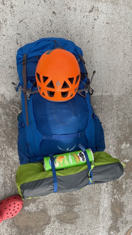
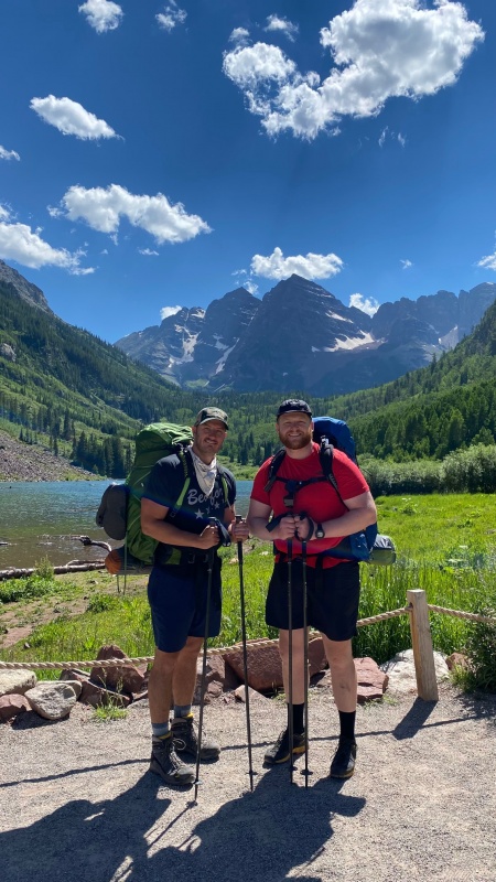
Six days, 43 miles, and 16,150' of elevation was all that was standing between me and finishing the Elk Range 14ers and being one (major) step closer to finishing all 58. With a couple of good friends who were willing to repeat peaks with me, I laid out an ambitious itinerary and packed the truck.
The plan was to first hit Snowmass with Collin, who had previously done Snowmass via the West slope but was interested in getting the "full" Snowmass experience on the standard route complete with a proper snow climb. Then I would return to Avon for a 3-day rest, after which I would rendezvous with Chris (Stiffler_From_Denver) and head to Aspen for back-to-back attempts on North Maroon and Pyramid.
This is going to be a longer one, so here are my key takeaways for those of you looking for the short and sweet:
Get you some friends who are willing to repeat tough mountains with you! The importance of good company and strong morale cannot be overstated.
We logged 9 miles to get to Snowmass lake (24 round trip total, as opposed to the listed 22)... That's a long way in hard-soled Mountaineering boots and with a heavy overnight pack. Count the ounces on this one, or do it as a long day trip. Yes, it was still worth bringing mountain boots, crampons, and an axe.
The 800' above Snowmass Lake is not to be taken lightly. Way more prone to rockfall than it looks. Consider putting on your helmet here even though it seems too early.
The direct snow climb variation on Snowmass, while steep at the end, can save a lot of time and effort in the right conditions.
The shuttle system to Maroon Lake actually wasn't too bad... until I had to pay my $100+ bill for parking at the Highlands garage! (that one blindsided me)
Consider following the goats on Pyramid -- They might know the route better than you do (scroll down to read about Tim).
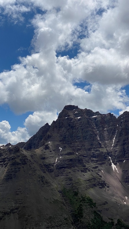
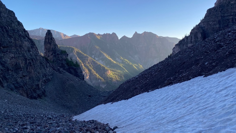
SNOWMASS
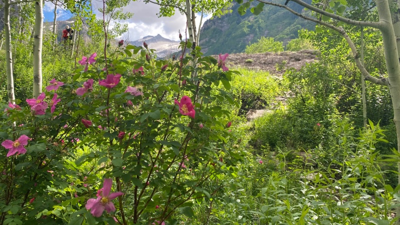
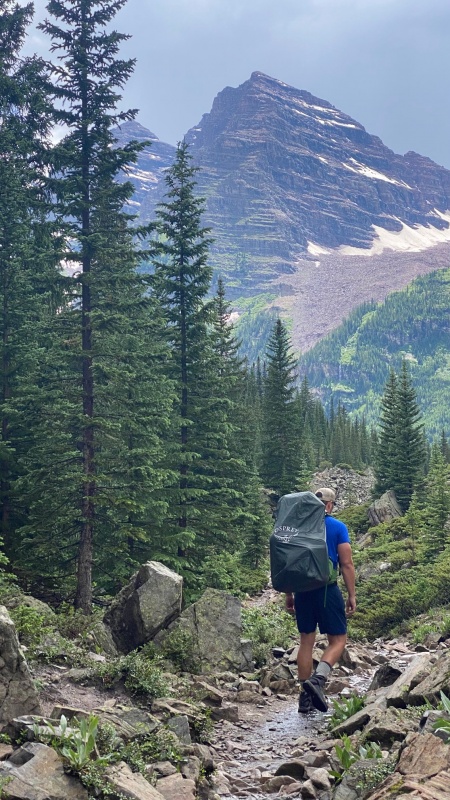
The approach to Snowmass Lake was easygoing and uneventful, albeit a bit longer than we were anticipating. The abundant wildflowers kept us company, and after 2 hours and 45 minutes we were at the log jam. Thankfully, the water was low and the logs were (relatively) stable and crossing was easy with the assistance of trekking poles and carefully planned steps. I was surprised by how seemingly flat the trail was up to this point (about the 6 mile mark).
After grinding out 3 more miles over the course of another hour and 15 minutes, we arrived at the lake exactly 4 hours after leaving the parking lot.
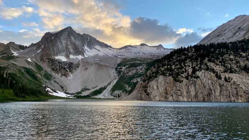
The first view of Snowmass, about 4 miles in.Crossing the infamous log jam... Trekking poles and cat feet recommended.Snowmass Lake at sunset
With a pessimistic forecast, we were up at 3 and on the trail by 3:30. Route finding through the willows along the lake can be an absolute bear. We opted to stay low and use the lake's shore as a navigation handrail. There is a faint trail that follows the shore. It's easy to lose, but it does go all the way to the talus pile on the opposite side of the lake. In hindsight, it would have been easier to take the high trail above the willows. This bushwhacking side quest in the dark cost us about a half hour.
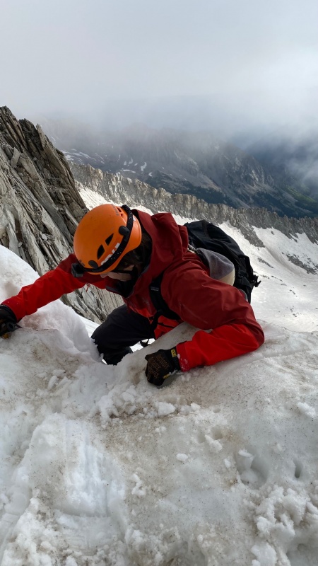
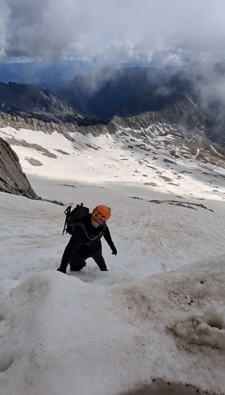
We started up the steep headwall while it was still pitch dark. Because of this, we found ourselves slightly off route (to lookers left), despite closely following a gps track. The rock here is absolutely rotten and the pitch proved to be just as steep as it looks from the lake. We found ourselves bear crawling on ball-bearing scree while weaving between kitchen table sized rocks that were teetering. The heavy rain from the day before had caused the ground to become saturated, which did not help the rockfall hazard...
I am always extremely careful trying to prevent rockfall, but despite my caution, I stepped up next to (not on, just next to) a seemingly stable rock that was about the size of a couch cushion...The dirt underneath the rock gave way and the rock decided to go with it. I shouted "ROCK!" and the rock missed Collin, who was thankfully staggered about 10 feet below me and to my left. It was still pitch dark, so we could see sparks fly off the bottom of the rock as it collided with other rocks. It came to rest after tumbling about 20 feet. I'm ashamed to admit that I caused such a large rock to fall, but it serves as a humble reminder that a) we should have been wearing our helmets by this point already, b) we were doing the right thing by climbing closely together and staggered, and c) sometimes the rocks just decide to move despite your best efforts.
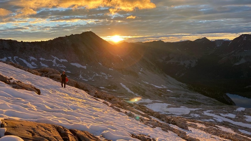
Sunrise above the lake (this is about where we donned the crampons)
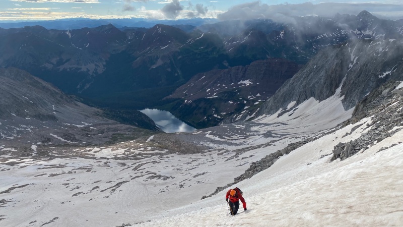
The snowfields above the lake were sparse, but at about 12,500 we were able to put on crampons and string together some consistent snow climbing. Wanting to avoid as much of the rotten rock on the ridge as possible, we chose to aim for the notch in the ridge just below the summit. There was not a hard freeze the night before, and with some added water content due to the rain, the snow was a bit soft for my liking. In a perfect world, I'd like the snow to be really firm before sunrise, and then the sun warms it into corn with a few inches of boot penetration by the time we descend... this wasn't the case for our ascent on Snowmass. The snow felt a bit rotten, but it was still supportable and we weren't concerned about wet slides, so we pressed on.
Things get progressively steeper as you head toward the notch. Standard route splits off to climber's left just below Collin in this photo.
The climbing toward the notch was fantastic above 13,000. The cooler air of the higher altitude combined with the welcomed cloud cover gave us perfect snow climbing conditions-- Much better than it was 500' below. Collin had some crampon complications (I lent him an old pair of strap-on crampons that weren't cooperating with his boots), but we slowly made our way up to the notch.
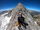
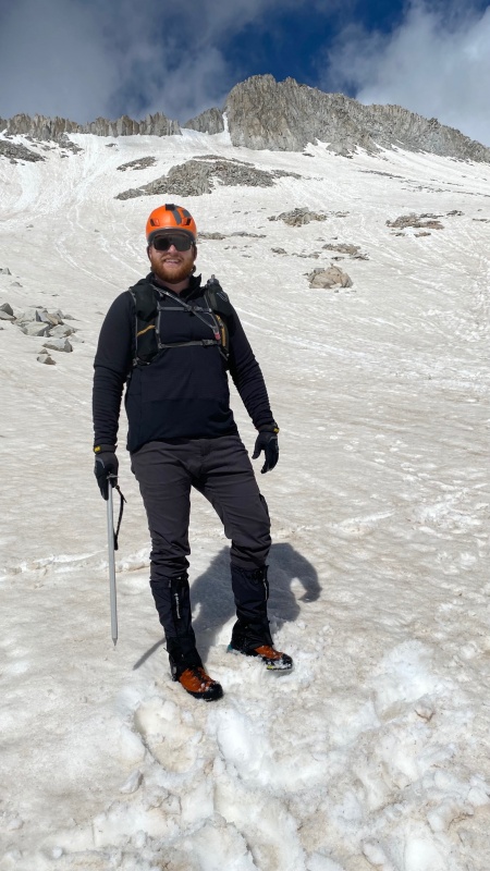
I was able to kick steps right up to the cornice that guards the summit ridge. The majority of the climbing is in the 45 degree range, until it gets gradually steeper to 60-ish degrees, and finally finishes with a couple of moves on the cornice, which was pretty much vertical (for about 5 or 6 feet) on the day we climbed it. With stable snow and good footing, this made for an awkward but fun mantle move onto the top of the cornice. We gained the ridge at 7:30 am -- exactly 4 hours from the lake.
Headed toward the notch (right)Just below the final move to gain the ridge. It's steeper than it looks here.
Looking down from atop the cornice which guards the ridgeThere's a bit of an awkward mantle move to get on top of the cornice. The last 6 feet or so was damn near vertical on this day.On the summit ridge. The direct approach via the notch shaves a considerable amount of time off the ridge.Last few moves before the summit. A little exposure here.
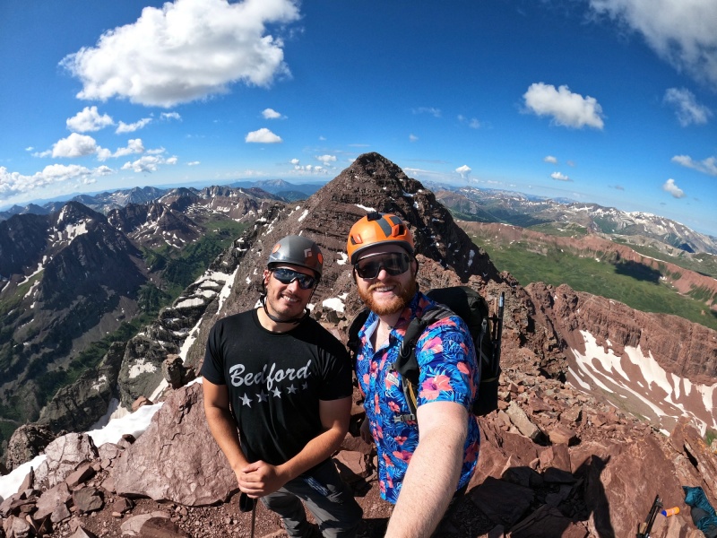
Summit!
After 25 minutes of careful scrambling, the clouds parted and we were on the summit by 8 am.
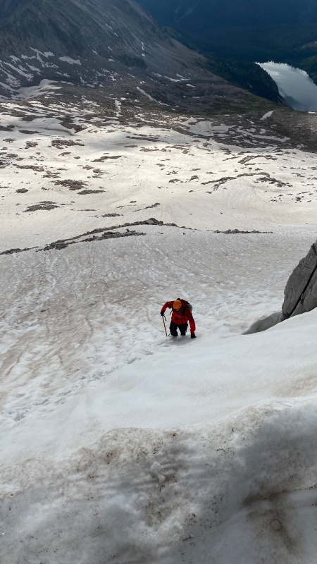
We chose to descend the same route, despite how awkward the downclimb on the cornice would be. The best way to do this is to get a good hand hold with your axe and descend the cornice facing in. From there, we cut down and over about 150' and enjoyed incredible intermittent glissading for about 1,200'.
Eyeing my glissade line. It's easiest to descend the cornice facing in.All smiles after a long glissade! Still more to go below this bench.Returning to Snowmass Lake with The Bells in the background.
With sore feet and huge smiles, we returned to Avon where I would spend some time with my wife and in-laws while resting for a few days.
Thanks again, Collin, for being willing to repeat a tough peak with me despite me trying to kill you with rockfall and lending you less-than-ideal crampons.
Garmin Stats: Distance: 24 mi Elevation Gain: 6,765 ft. Moving Time: 12:30:25
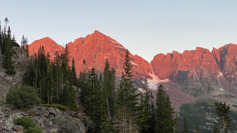
NORTH MAROON
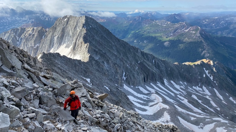
After a couple days of rest, it was time to head back to Aspen, this time with Chris (Stiffler_From_Denver). Chris finished the 14ers a couple years ago but was making good on a promise to accompany me on North Maroon (his company on Pyramid was still up for debate). It also gave him a chance to test a few new pieces of ultralight gear in preparation for his thru hike of the Colorado Trail, which will take place in 2022.
A quick note on parking: The parking permit system has proven to be a nuisance for many people over the last couple years. A necessary measure for sure, but an inconvenient one nevertheless. I had failed multiple times to secure a 60 hour parking pass, so I acquiesced and bought two shuttle tickets for 3 pm on a Monday. What they don't make very clear, is that parking in the Highlands parking area is hourly, at the same (or close to the same) rate they charge during the ski season! I believe it was in the ballpark of $35 per calendar day. This resulted in returning from our 48 hour trip (which unfortunately spanned 3 calendar days) to a parking total that was in excess of $100. We learned later that you can park in the Ajax (or maybe Snowmass?) lot for around $12, but then you have to take multiple busses just to get to the Maroon Lake Shuttle, adding several extra hours. Yikes!
I have a hunch that this parking debacle will lead to more climbers looking to knock out many (or all) of these peaks in one trip, so hopefully this will give some insight as to what it was like to tackle North Maroon and Pyramid back-to-back.
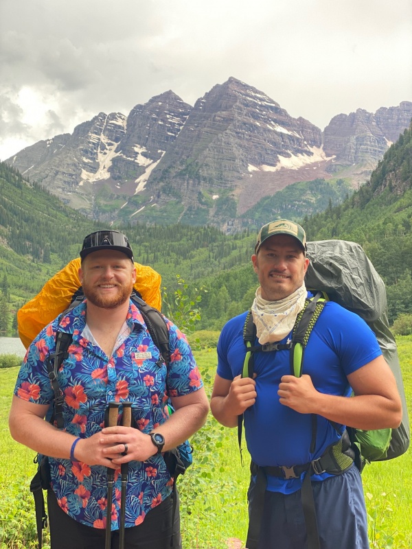
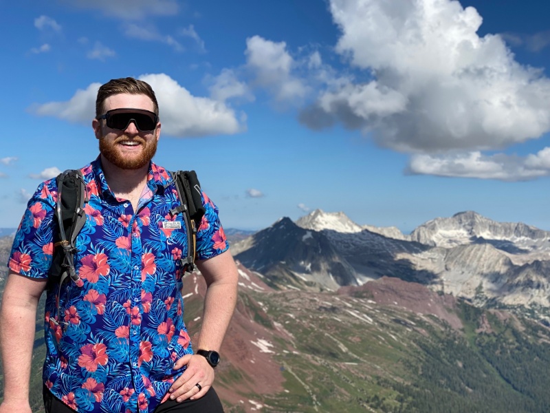
Hard to have a bad time in a HawiianPacking only what really matters...The Bells never cease to amaze
We arrived a bit early, and the bus folks were kind enough to let us get on an earlier bus. They run every 15 minutes.
After leaving Maroon Lake around 2:45 pm, we had made it to the Crater Lake by 3:45 pm and found our home for the next two nights at camp site 3.
One benefit of the shuttle system is that once the shuttle stops running for the day around 5:00 pm, the tourists and day-trippers return to Aspen and the valley becomes much more quiet. We had all of Crater Lake to ourselves the first night, which is a rare experience. As we were enjoying dinner by the lake, a storm blew in and we retired to our tents around 6:30 pm. It rained buckets until about 2 am.
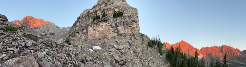
We were on the trail by 4:30 am, on our way up North Maroon. I brought less than a liter of water for the first segment, as it is steep and there are several opportunities to filter water before the boulder field (the best of which is the big stream crossing in Minnehaha Gulch, about a mile or so in).
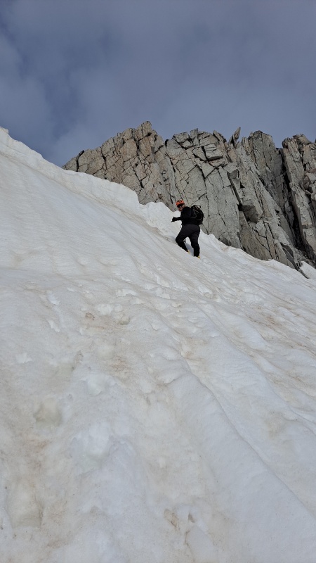
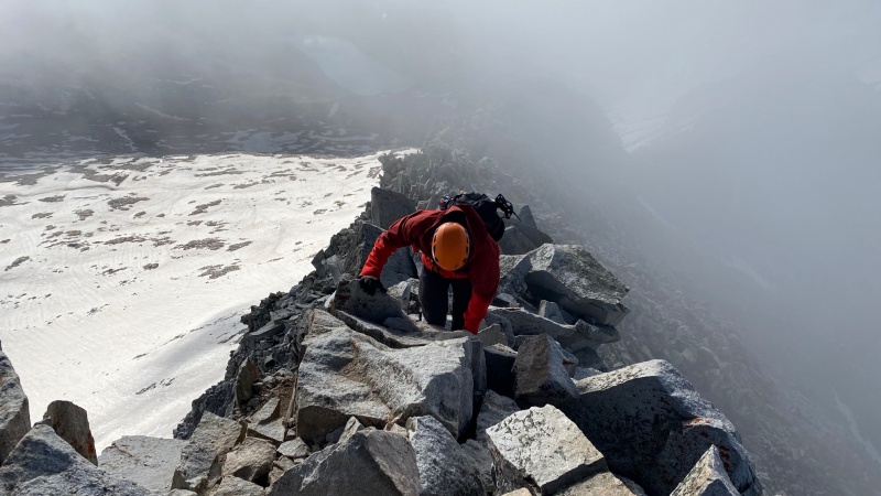
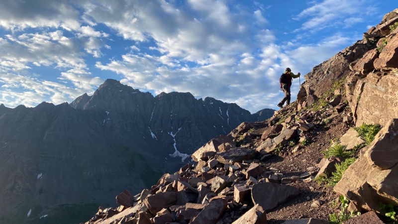
After the boulder field, we stopped for our first break to enjoy the morning sun on one of the first ledges at around 6:30 am. From there, the route finding was fairly straightforward, but there was some added pucker factor due to the rain the night before. The gullies are steep and exposed and you ascend by zig-zagging your way up ledges with downward sloping dirt and intermittent patches of grass -- made even spicier when you throw some moisture in the mix.
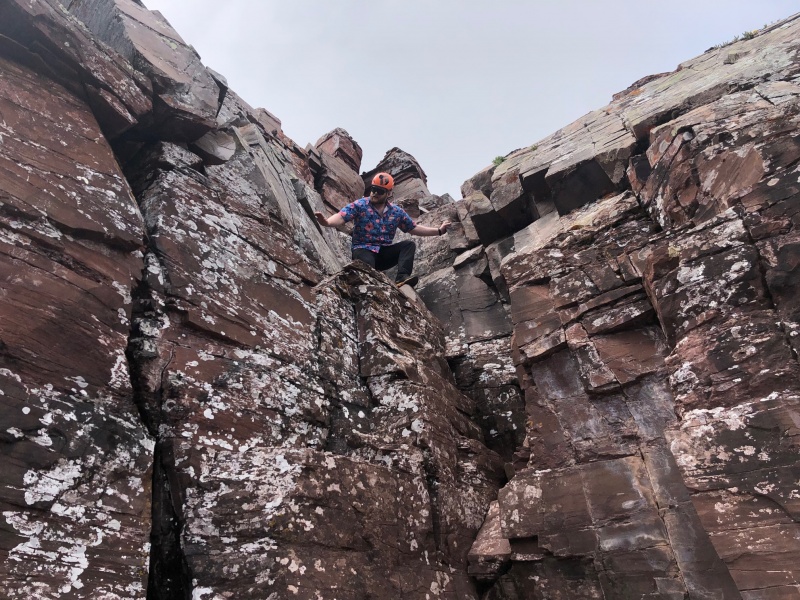
By 7:30 am, we were at the top of the first gulley, and by 8:50 am, we had reached the base of the chimney move. I found this section to be a bit overhyped, but my more vertically challenged friends might disagree. It's a pretty easy few moves for confident climbers with long limbs, and it's well protected so there is very little exposure to worry about for this section.
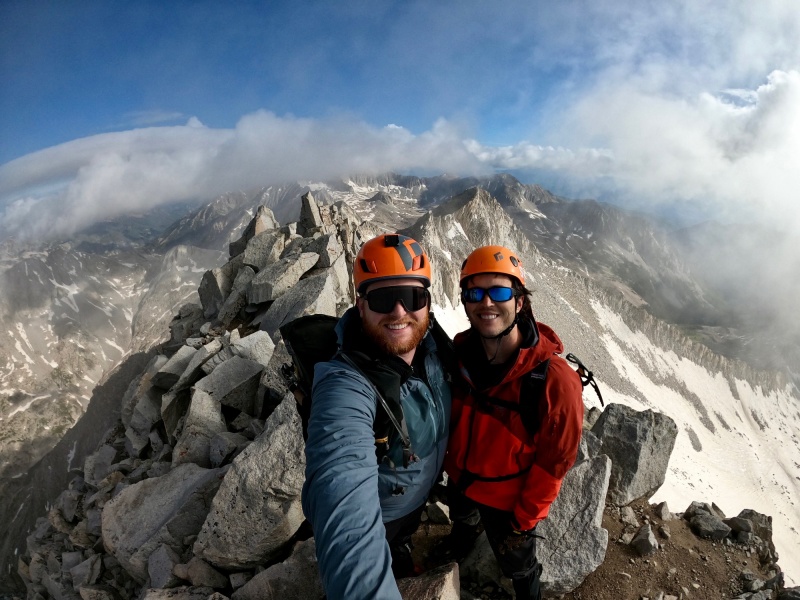
After another 35 minutes of scrambling, we were on the summit by around 9:30 -- exactly 5 hours from leaving camp site 3.
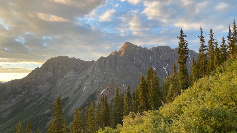
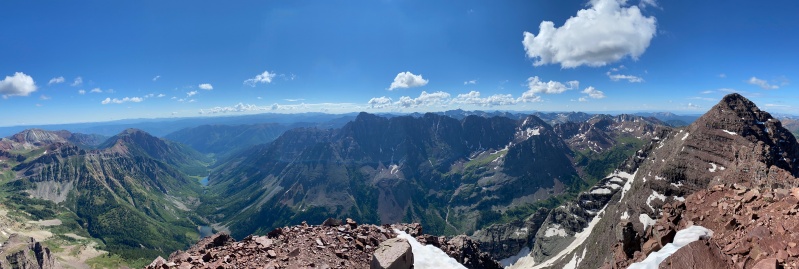
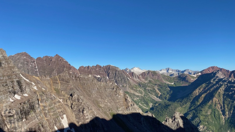
Sunrise on Pyramid, seen from just below the boulder field on N MaroonLeaving the boulder field and entering the first of many ledgesSummit view with Maroon Lake and Crater Lake on the left, Pyramid in the middle, and Maroon on the right.
Snowmass and Capitol in the backgroundHad the summit all to ourselves!Descending the chimney move... Probably easiest to turn and downclimb facing in, unlike what I'm doing here.Blackhawk hovering above Pyramid
The Blackhawk Rescue While we were descending the first gulley, clouds started to move in and we heard what we thought was thunder overhead. Turns out, it was actually a Blackhawk helicopter circling the summit of Pyramid Peak across the valley, which we were planning on climbing the next day. It was an eerie feeling, no doubt.
"I wonder if they're training," I said to Chris with an upward inflection, hoping he'd agree with me.
"Yeah, let's go with that," he replied somberly. The Blackhawk made a half dozen more big circles before hovering for several minutes and then finally taking off with what looked to be a person at the end of a long line.
Note: As I was writing this trip report, our fellow 14ers.com member, HikesInGeologicTime, published an incredibly well-written and thoughtful report about their 50' fall and subsequent Blackhawk rescue on Pyramid peak. Unbeknownst to us, Chris and I had been witnessing HikesInGeologicTime's rescue on Pyramid. You can read Geo's report here. Geo: if you're reading this, I'm so glad you survived your fall and made it out (mostly) okay. Your tenacity is inspiring and we'll all be cheering on as you heal up and push to finish the 14ers soon!
Later that evening while we were cooking dinner, after a long period of silence, I piped up and said, "So are you joining me on Pyramid tomorrow?" somewhat jokingly. After battling his own demons with Pyramid due to a nearly identical experience the first time he climbed N Maroon (Blackhawk and all), as well as a failed attempt, he had professed many times that Pyramid is one peak he'd never repeat. Needless to say, he was understandably reluctant to join on Pyramid. After all, that wasn't part of the deal.
"I'll go with you as far as the green gulley," he agreed. That's a good friend.
Not to spoil the ending, but Chris ended up accompanying me the entire way up Pyramid, despite having to overcome some pretty legit mental hurdles. Not many walk the walk like he does. I'm lucky to call him a friend.
PYRAMID
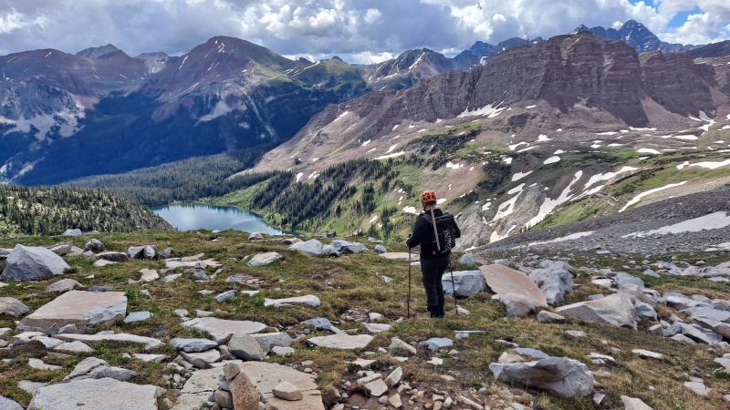
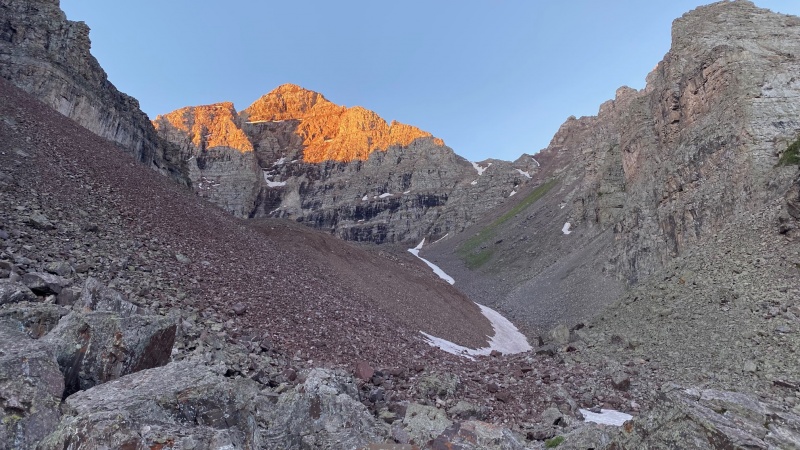
Spirits were high on the morning of our Pyramid attempt. After a good night of rest, we headed up -- heavily caffeinated and ticking off the miles with good conversation. The turnoff for Pyramid is extremely easy to miss, even for the experienced route finder. There are two entrances and both will take you to the right place -- I'd recommend dropping a waypoint during the day at your preferred entrance.
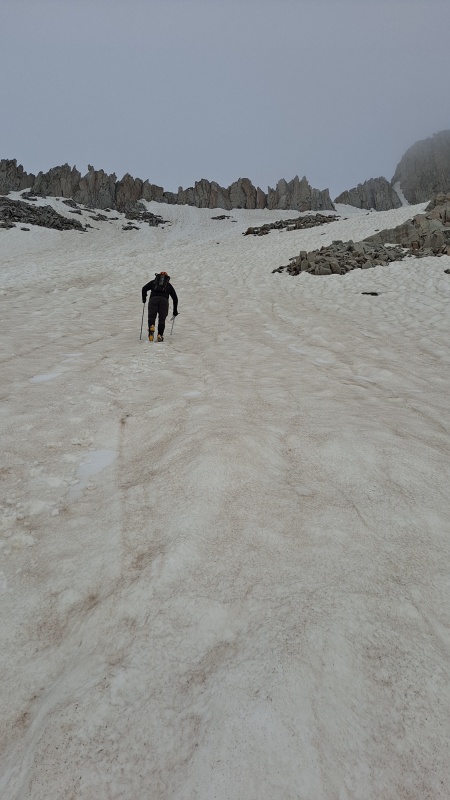
We left camp again at about 4:30 am and we found ourselves at the base of the Amphitheater at about 5:50. There are two massive cairns that greet you into the amphitheater and it feels like something out of Lord of the Rings. I chose to ascend the thin ribbon of snow with microspikes, which proved to be a more efficient method.
Alpenglow on the Bells. Feeling like I'm living inside a John Fielder image...At the entrance to the amphitheater -- Pyramid on the left, Bells on the right.
Looking up the amphitheater... It's longer than it looks (giggity)Looking back own the amphitheater. I preferred to ascend on the snow. Spikes were helpful.At the top of the gulley with Pyramid (out of frame) the Bells, Snowmass, and Capitol in view. One of my all time favorite 14er views...
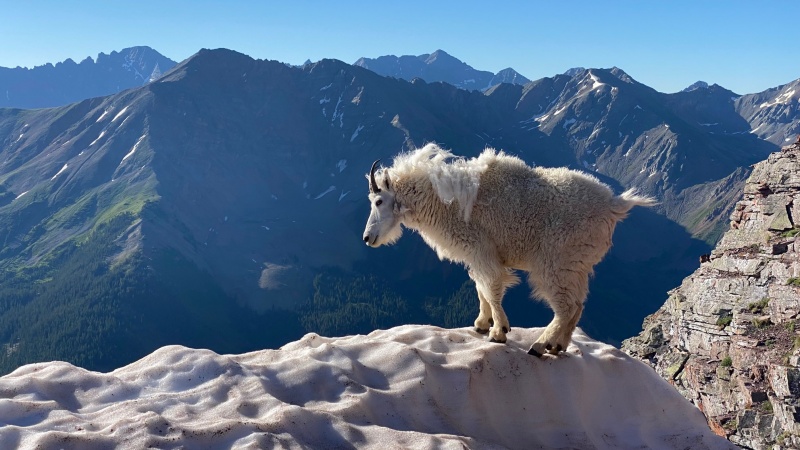
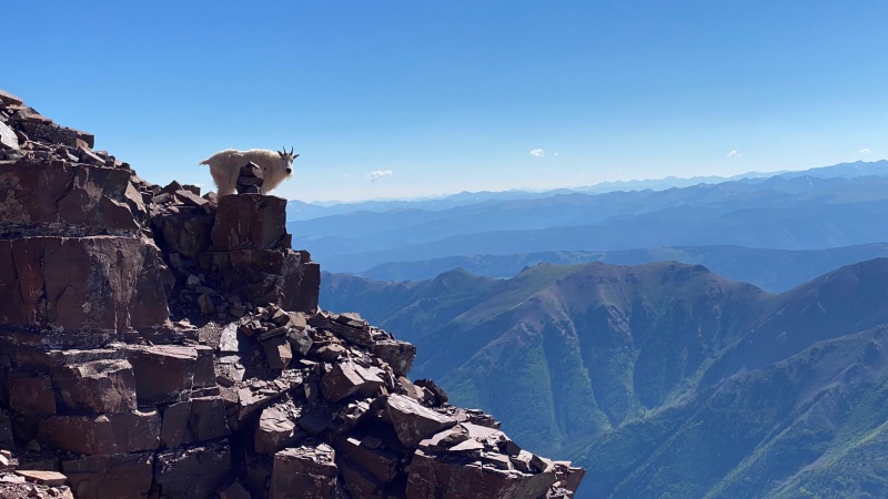
It took us about an hour to cross the amphitheater and about another hour to ascend the nasty 1,000' gulley. At 7:45 am, we found ourselves atop the gulley and we were ready for the real fun to begin. That's when we met our mountain goat friend, Tim...
Everybody meet Tim.
Our Goat Friend, Tim
We crested the ridge to find a mountain goat guarding the ridge, and acting like he was waiting for us. We decided to name him "Tim" after realizing his way of carrying himself was reminiscent Tim the Enchanter from Monty Python's Holy Grail. My encounters with mountain goats have been too many to count, but this experience was unlike any other.
When we resumed our climb, Tim pushed his way past us and decided he was going to be the leader of our group. He would walk up ahead 50 yards or so, and then stop and wait for us, looking back to make sure we were still behind him. It was no different than when I hike with my dog Samson, who likes to explore up ahead, but will never lose sight of the group. When we would find ourselves slightly off route and unable to find a cairn, we would just have to look around to find Tim peeking around a corner... right next to a cairn. After several instances of this, it became laughable.
This happened for well over 1,000'...Tim guided us all the way up the green gulley, through the crux, and to about 100' below the summit, where he scampered out to the edge of a cliff and decided he was going to take a nap on his badass perch. Chris and I summited at 9:30 am -- Exactly 5 hours after leaving camp site 3. We enjoyed nearly an hour on the perfectly still summit, which we had all to ourselves.
On our descent, we met back up with Tim, where he roused from his nap and resumed his guiding services for the 1,000' back down the ridge and we bid him farewell.
One could explain this experience by citing animals' propensity to follow the path of least resistance or "natural lines of drift." Tim could have also been walking with us in hopes of scoring some of our nice, salty urine. Certainly could be! Or, one could see this as an encounter with something more divine. I choose to believe the latter.
Tim making sure we didn't miss this cairn...
The triumphant return!
Garmin Stats (Pyramid and North Maroon combo): Distance: 19 mi Elevation Gain: 9,382' Moving Time: 12:07:27
Thumbnails for uploaded photos (click to open slideshow):
It was a great week indeed. No rocks from Tim, but the rest of his family did seem to enjoy kicking rocks down on us. Nice catching up with you yesterday!
Photos, goats, and shirt! We had a couple of goats on Pyramid's summit keeping us company as well. Probably pretty typical now, but still very special.
Caution: The information contained in this report may not be accurate and should not be the only resource used in preparation for your climb. Failure to have the necessary experience, physical conditioning, supplies or equipment can result in injury or death. 14ers.com and the author(s) of this report provide no warranties, either express or implied, that the information provided is accurate or reliable. By using the information provided, you agree to indemnify and hold harmless 14ers.com and the report author(s) with respect to any claims and demands against them, including any attorney fees and expenses. Please read the 14ers.com Safety and Disclaimer pages for more information.
Please respect private property: 14ers.com supports the rights of private landowners to determine how and by whom their land will be used. In Colorado, it is your responsibility to determine if land is private and to obtain the appropriate permission before entering the property.

")
")
")
")
")
")
")
")
")
")
")
")
")
")
")
")
")
")
")
")
")
")
")
")
")
")
")
")
")
")
")
")
")
")
")
")
")
")
")
")
")
")
")
")